Shield Inside Sign Signs In Arizona
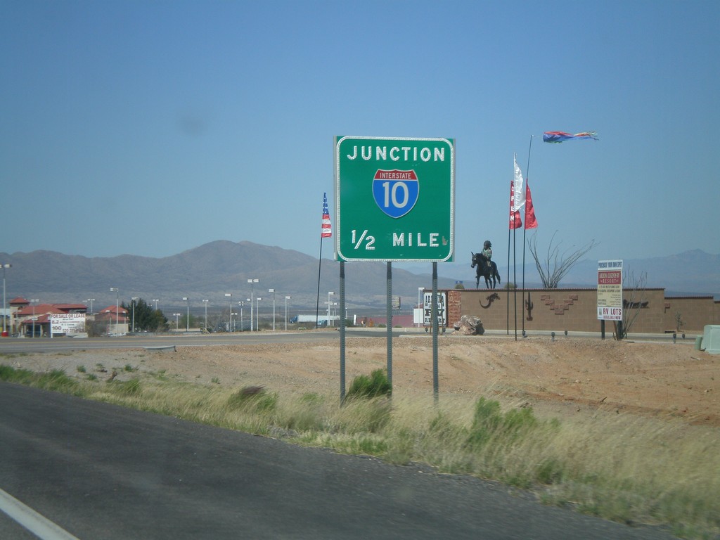
AZ-90 North Approaching I-10
AZ-90 north approaching I-10.
Taken 03-22-2009

 Benson
Cochise County
Arizona
United States
Benson
Cochise County
Arizona
United States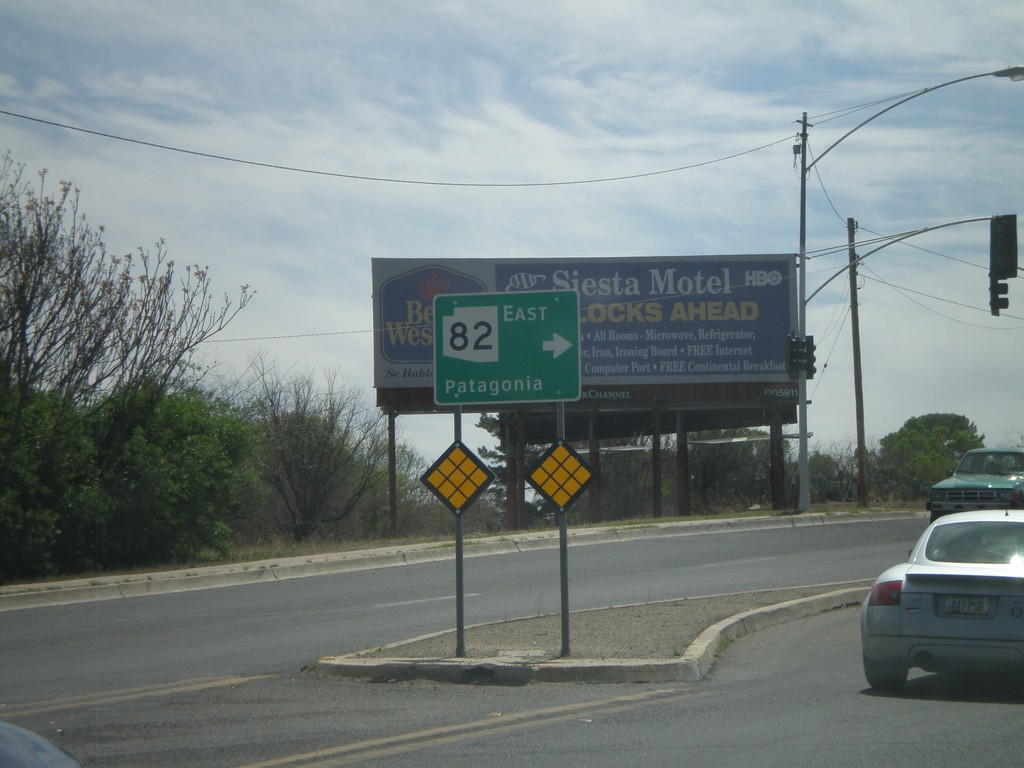
BL-19 South at AZ-82
BL-19 south at AZ-82 east to Patagonia.
Taken 03-22-2009

 Nogales
Santa Cruz County
Arizona
United States
Nogales
Santa Cruz County
Arizona
United States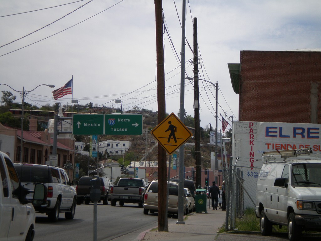
BL-19 South at I-19 and Border Crossing
BL-19 south at I-19 north to Tucson. Continue on BL-19 south for the border crossing into Mexico. This is the beginning of I-19.
Taken 03-22-2009
 Nogales
Santa Cruz County
Arizona
United States
Nogales
Santa Cruz County
Arizona
United States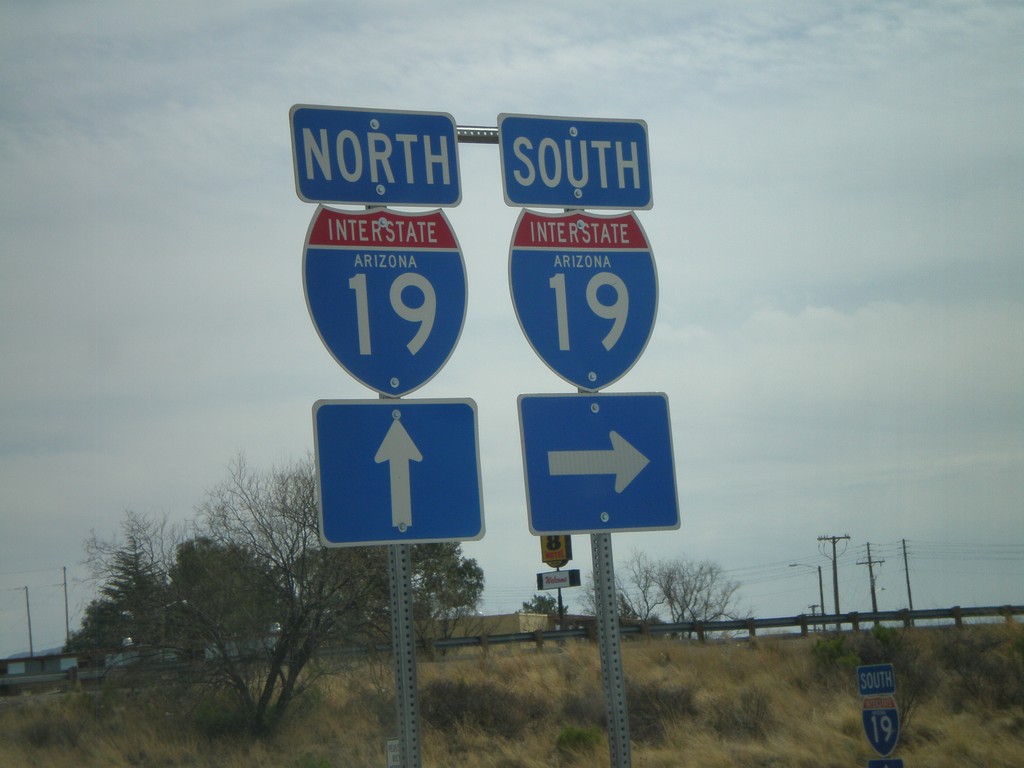
AZ-189 North at I-19
AZ-189 north at I-19 onramp.
Taken 03-22-2009
 Nogales
Santa Cruz County
Arizona
United States
Nogales
Santa Cruz County
Arizona
United States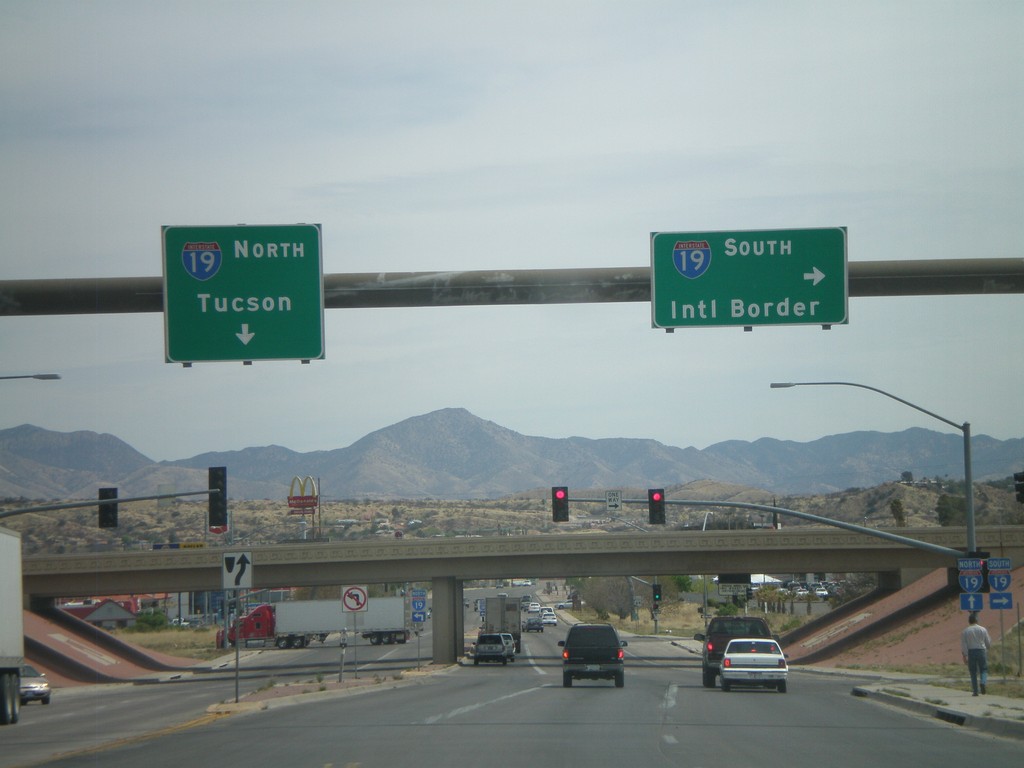
AZ-189 North Approaching I-19
AZ-189 north approaching I-19. Use I-19 south for the International Border. Use I-19 north for Tucson.
Taken 03-22-2009
Nogales
Santa Cruz County
Arizona
United States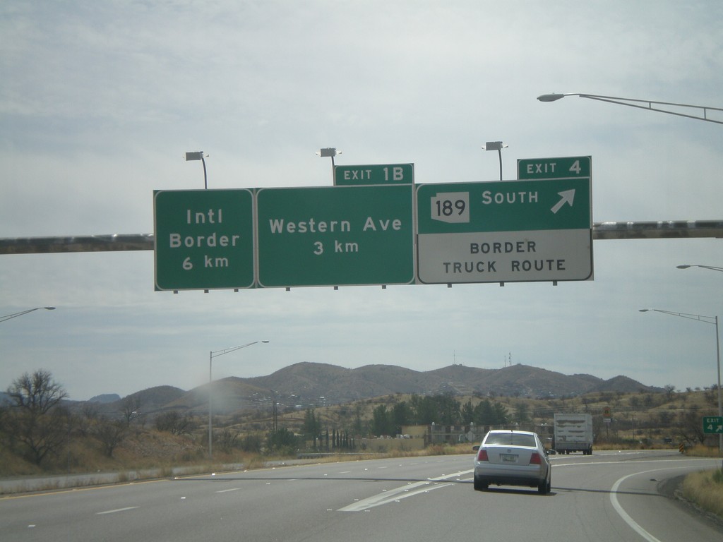
I-19 South - Exit 4 and Exit 1B
I-19 south at Exit 4 - AZ-189 South/Border Truck Route. Approaching Exit 1B - Western Ave. The international border with Mexico is 6 km to the south via I-19.
Taken 03-22-2009
Nogales
Santa Cruz County
Arizona
United States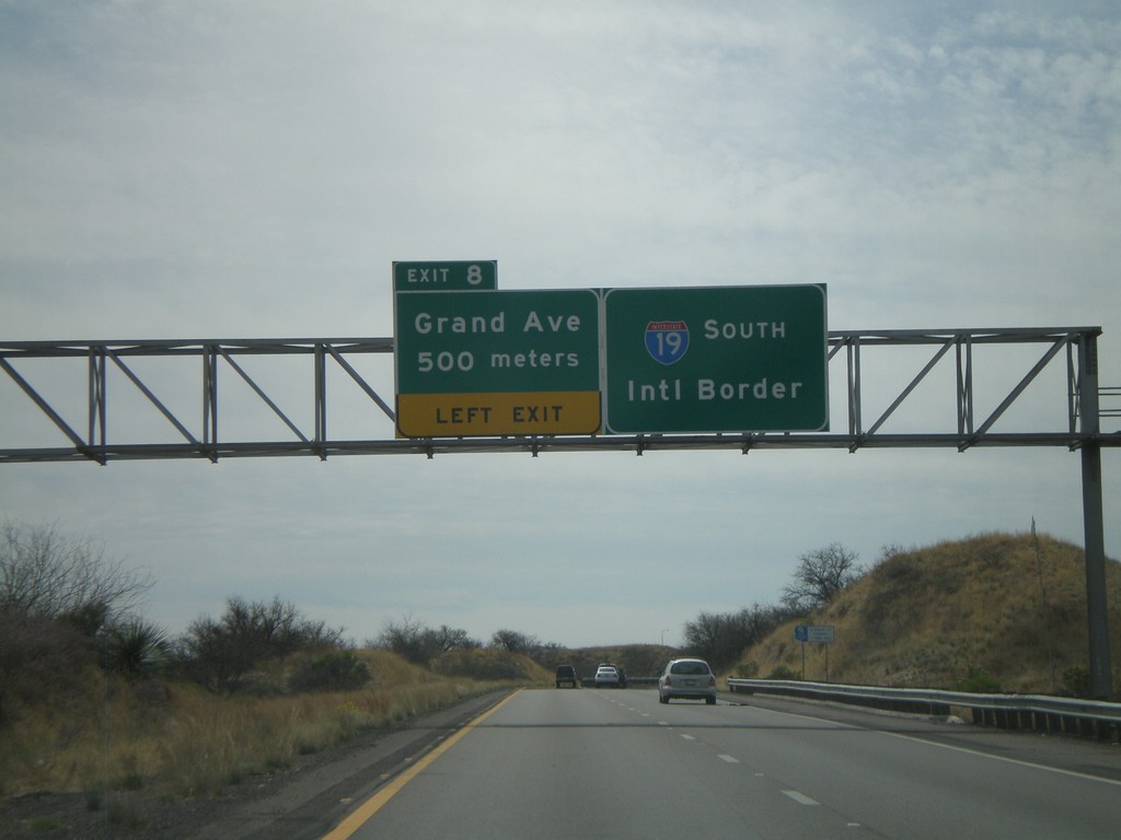
I-19 South - Exit 8
I-19 south approaching Exit 8 - Grand Ave. I-19 continues south towards the International Border with Mexico. Grand Ave. is the Nogales business loop.
Taken 03-22-2009
Nogales
Santa Cruz County
Arizona
United States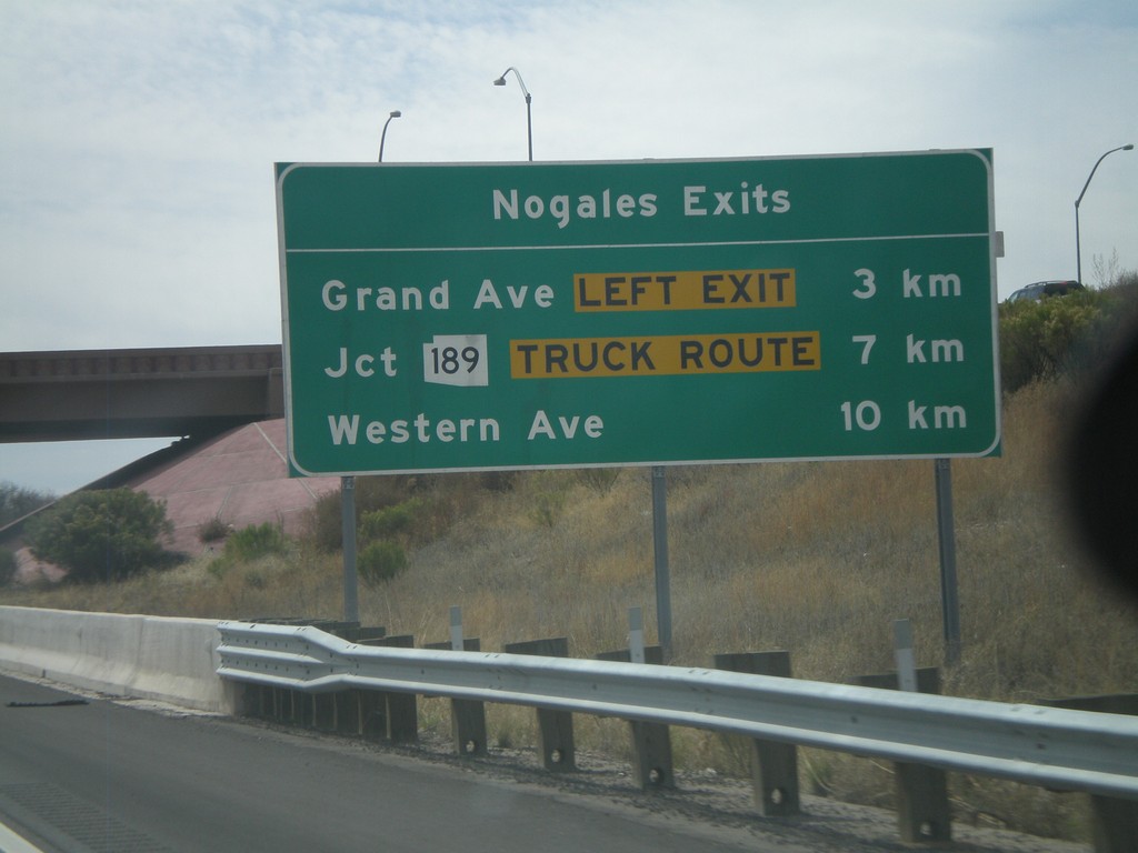
I-19 South - Nogales Exits
Nogales Exits on I-19 south. Distance to Grand Ave., AZ-189, and Western Ave.
Taken 03-22-2009
Nogales
Santa Cruz County
Arizona
United States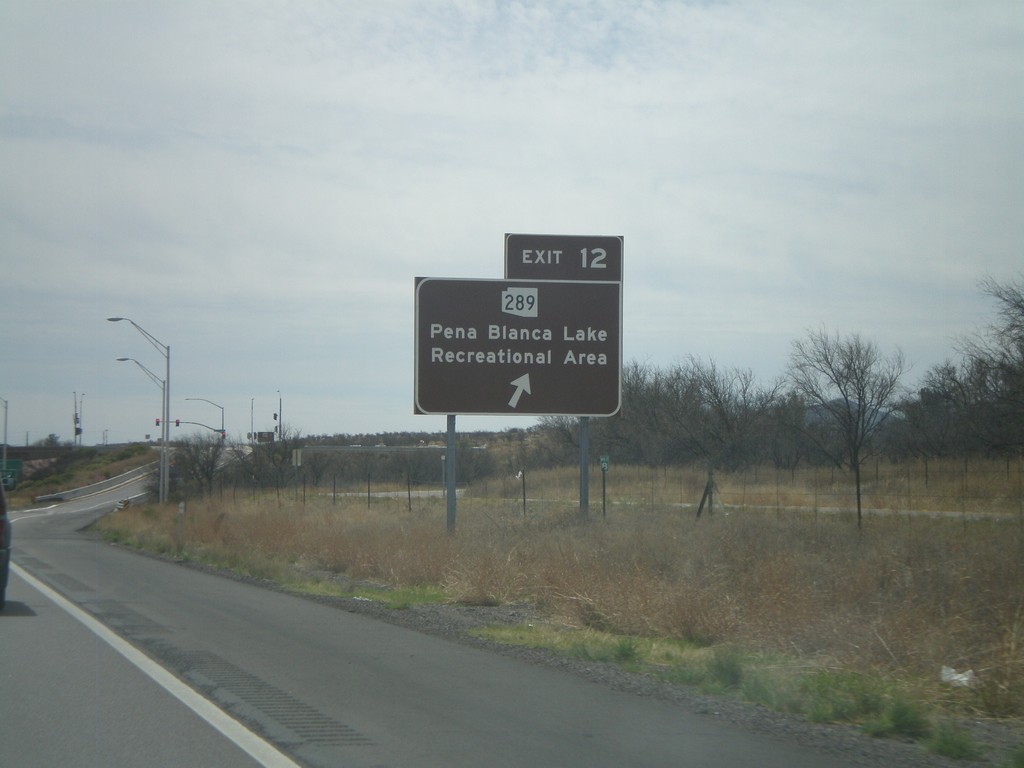
I-19 South - Exit 12
I-19 south at Exit 12 - AZ-289/Pena Blanca Lake Recreational Area. The sign is colored brown.
Taken 03-22-2009
 Rio Rico
Santa Cruz County
Arizona
United States
Rio Rico
Santa Cruz County
Arizona
United States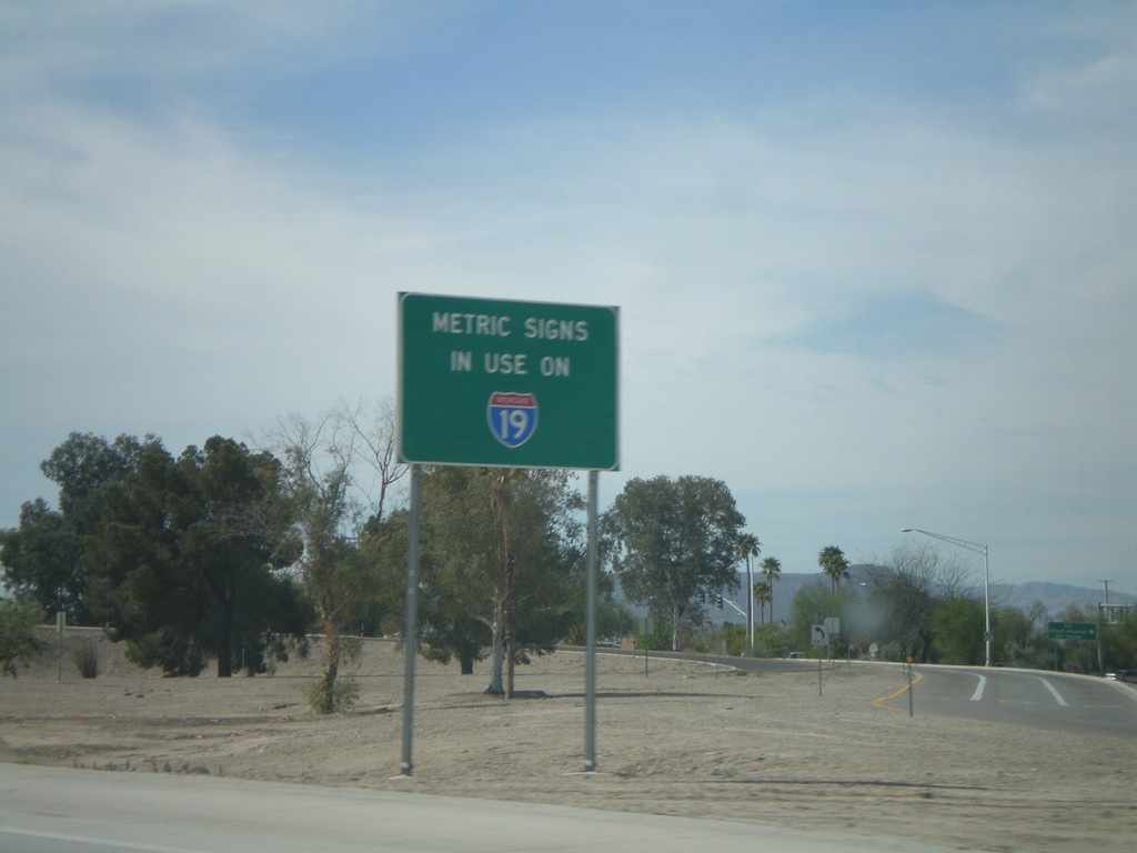
Metric Signs In Use on I-19 South
Metric Signs in Use on I-19 South. All distance markers and interchanges marked in kilometers or meters. Mileposts are signed in kilometers. There are mileposts signed as miles that are parallel to the road (signed 90 degrees to the standard signs).
Taken 03-22-2009
Tucson
Pima County
Arizona
United States