Shield Inside Sign Signs In Arizona
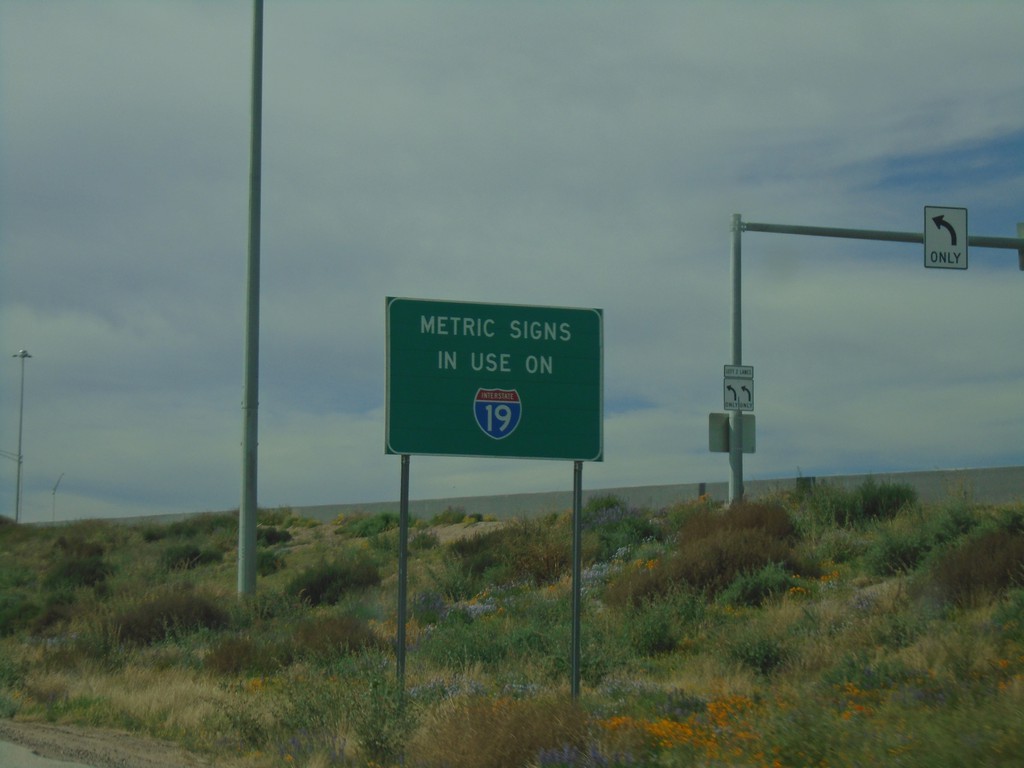
Metric Signs In Use on I-19 South
Metric Signs in Use on I-19 South. All distance markers and interchanges marked in kilometers or meters. Mileposts are signed in kilometers. There are mileposts signed as miles that are parallel to the road (signed 90 degrees to the standard signs).
Taken 03-23-2019
 Tucson
Pima County
Arizona
United States
Tucson
Pima County
Arizona
United States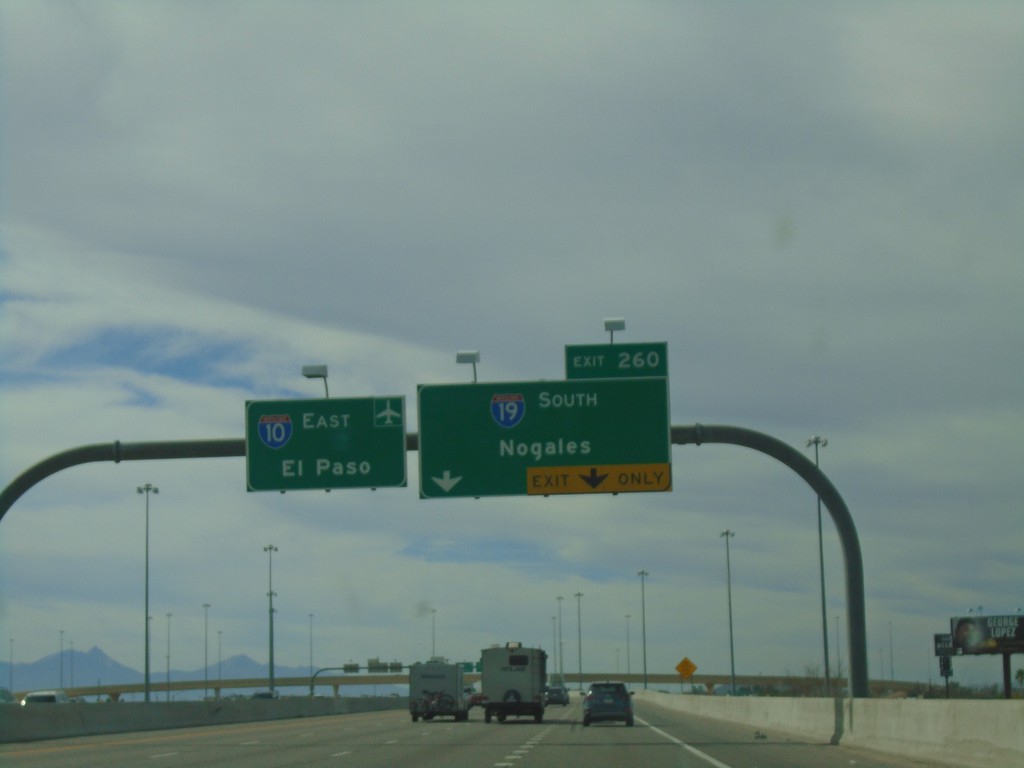
I-10 East Approaching Exit 260
I-10 east approaching Exit 260 - I-19 South/Nogales. I-10 continues east towards the Tucson Airport and El Paso (Texas).
Taken 03-23-2019
 Tucson
Pima County
Arizona
United States
Tucson
Pima County
Arizona
United States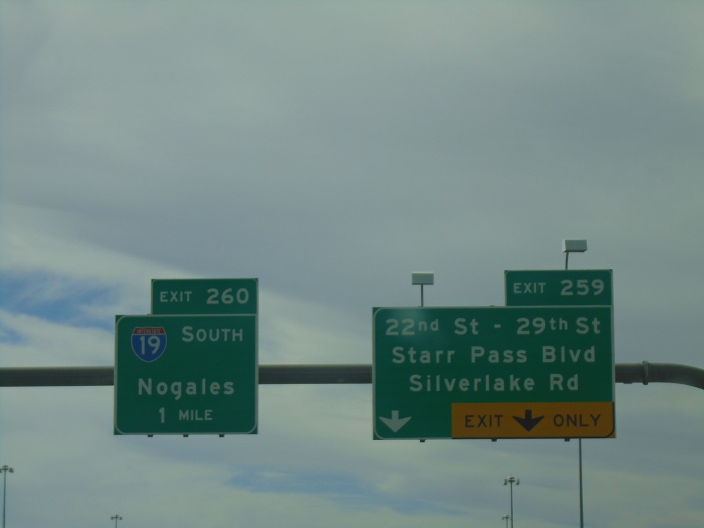
I-10 East - Exits 259 and 260
I-10 east at Exit 259 - 22nd St - 29th St/Starr Pass Blvd/Silverlake Road. Approaching Exit 260 - I-19 South/Nogales.
Taken 03-23-2019
Tucson
Pima County
Arizona
United States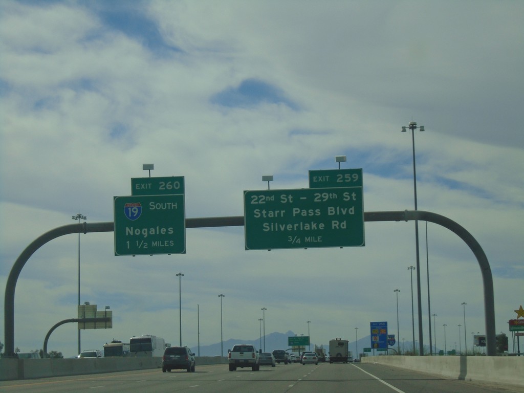
I-10 East Approaching Exits 259 and 260
I-10 east approaching Exit 259 - 22nd St - 29th St./Starr Pass Blvd/Silverlake Road. Approaching Exit 260 - I-19 South/Nogales.
Taken 03-23-2019
Tucson
Pima County
Arizona
United States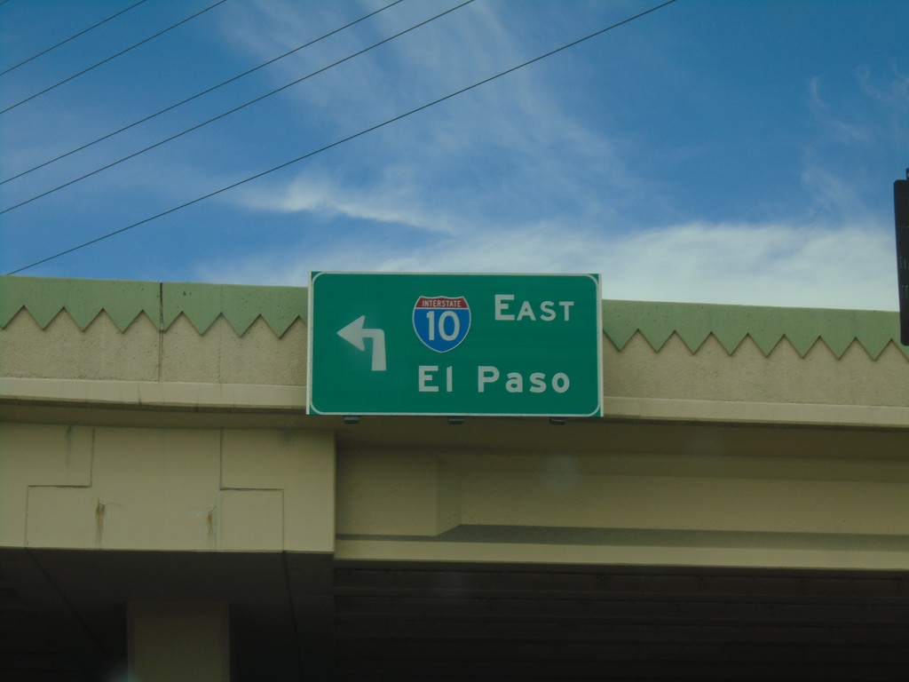
Speedway Blvd. West at I-10
Speedway Blvd. West at I-10 East to El Paso (Texas).
Taken 03-23-2019
Tucson
Pima County
Arizona
United States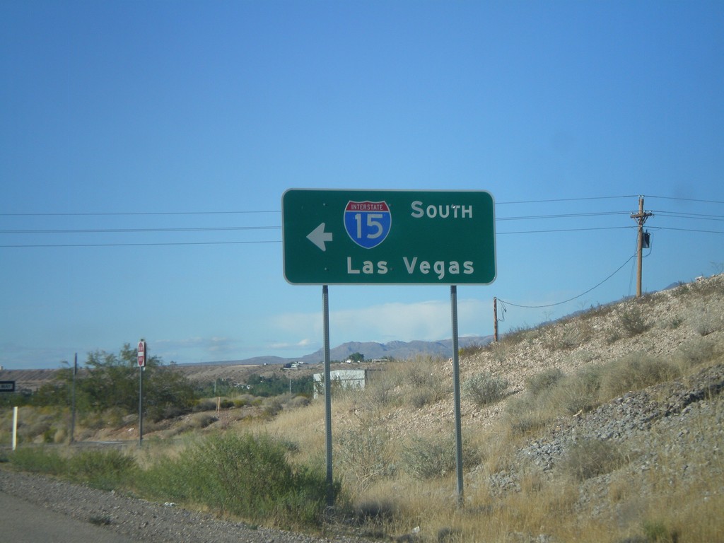
County Road 91 North at I-15 South
County Road 91 North at I-15 South to Las Vegas (Exit 8).
Taken 10-09-2011
 Beaver Dam
Mohave County
Arizona
United States
Beaver Dam
Mohave County
Arizona
United States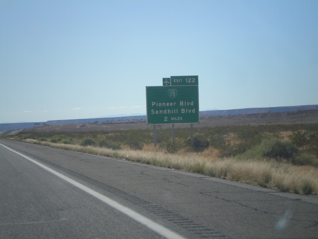
I-15 South Approaching Exit 122
I-15 south approaching Exit 122 (Nevada) - BL-15/Pioneer Blvd/Sandhill Blvd. BL-15 is not signed on the actual interchange within Nevada.
Taken 10-09-2011
 Littlefield
Mohave County
Arizona
United States
Littlefield
Mohave County
Arizona
United States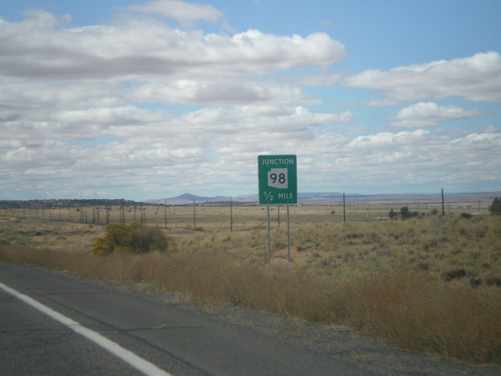
US-160 West Approaching AZ-98
US-160 west approaching AZ-98.
Taken 10-08-2011

 Shonto
Navajo County
Arizona
United States
Shonto
Navajo County
Arizona
United States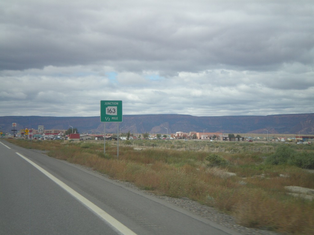
US-160 West Approachign US-163
US-160 west approaching US-163. US-163 is incorrectly marked here as AZ-163.
Taken 10-08-2011
 Kayenta
Navajo County
Arizona
United States
Kayenta
Navajo County
Arizona
United States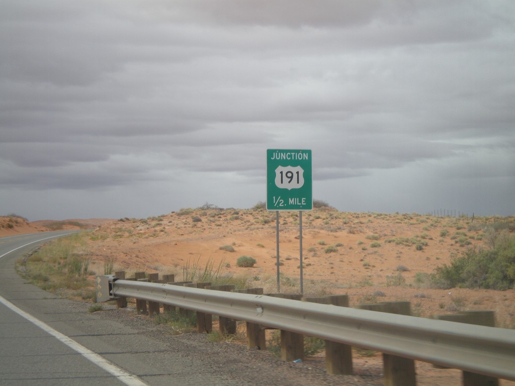
US-160 West/US-191 South Approaching US-191 South
US-160 West/US-191 South approaching US-191 South.
Taken 10-08-2011
 Teec Nos Pos
Apache County
Arizona
United States
Teec Nos Pos
Apache County
Arizona
United States