Shield Inside Sign Signs In Idaho
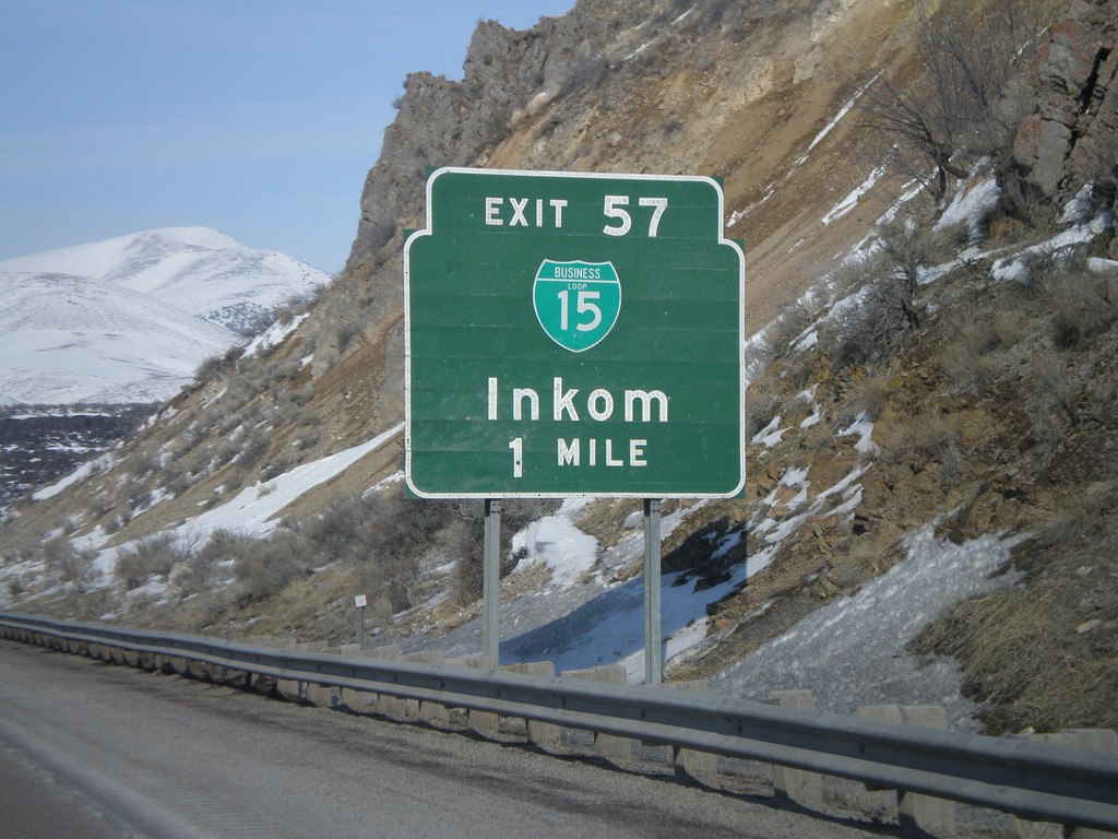
I-15 North - Exit 57
I-15 north approaching Exit 57 - BL-15/Inkom.
Taken 02-17-2008


 McCammon
Bannock County
Idaho
United States
McCammon
Bannock County
Idaho
United States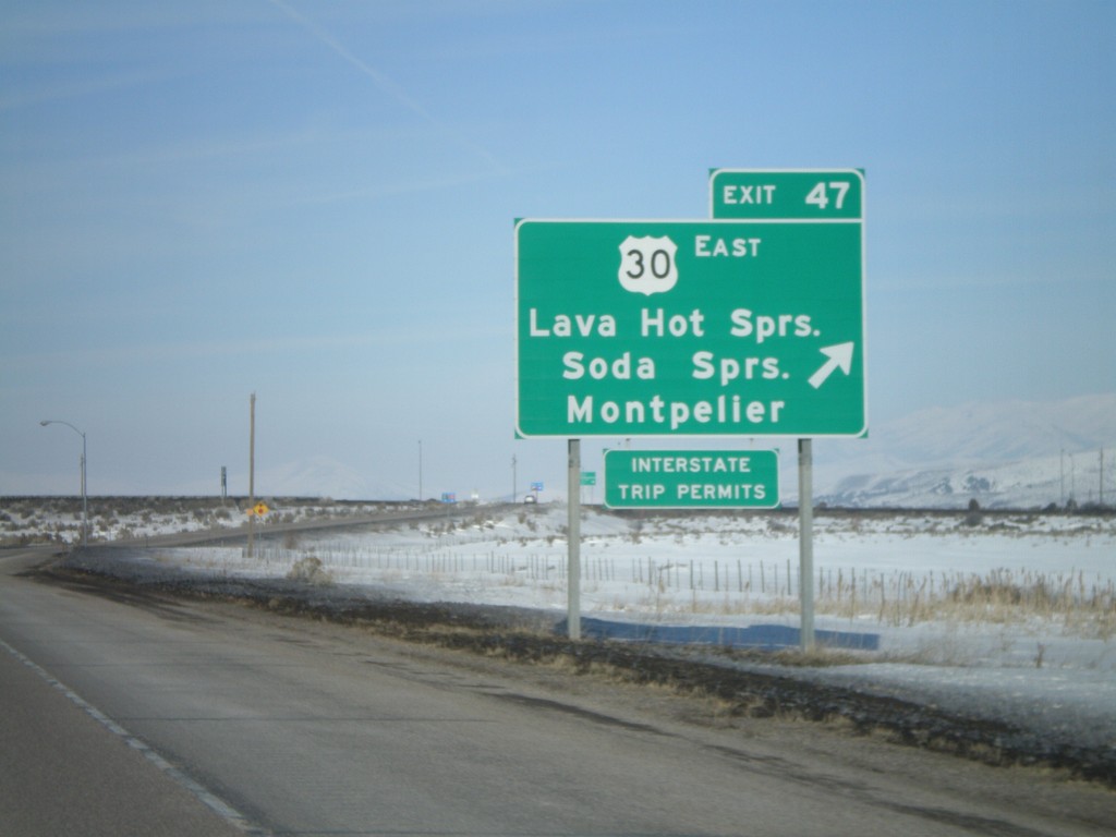
I-15 North - Exit 47
I-15 north at Exit 47 - US-30 East/Lava Hot Springs/Soda Springs/Montpelier. US-30 west joins I-15 north to Pocatello.
Taken 02-17-2008
McCammon
Bannock County
Idaho
United States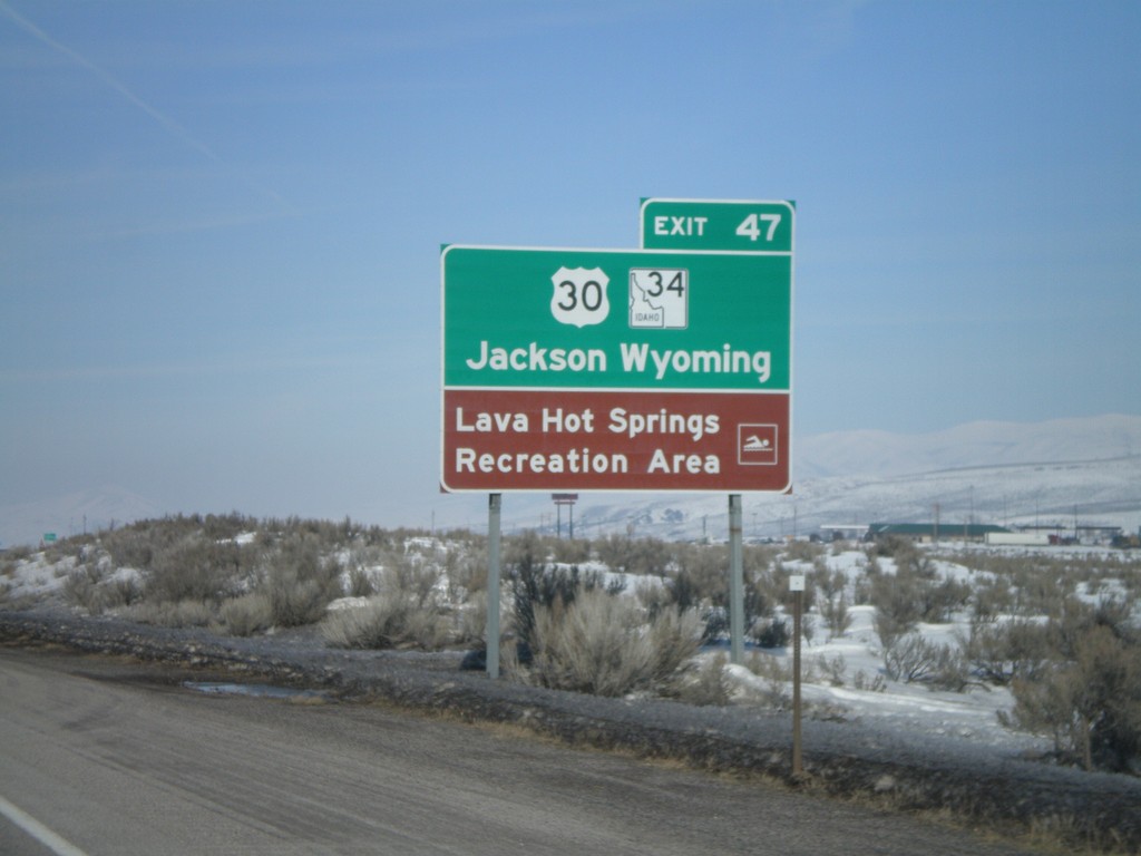
I-15 North - Use US-30/ID-34 for Jackson,WY
I-15 north approaching Exit 47. Use US-30 East and ID-34 North for Jackson, Wyoming. Access to Lava Hot Springs Rec. Area.
Taken 02-17-2008
 McCammon
Bannock County
Idaho
United States
McCammon
Bannock County
Idaho
United States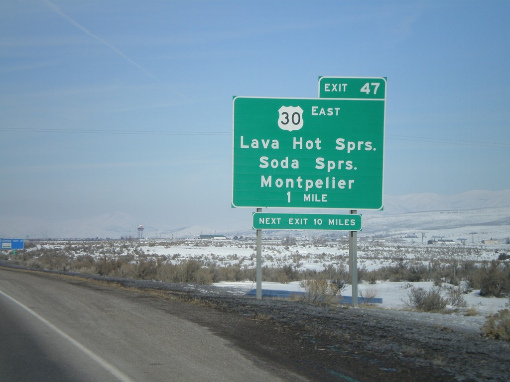
I-15 North - Exit 47
I-15 north approaching Exit 47 - US-30 East/Lava Hot Springs/Soda Springs/Montpelier
Taken 02-17-2008
McCammon
Bannock County
Idaho
United States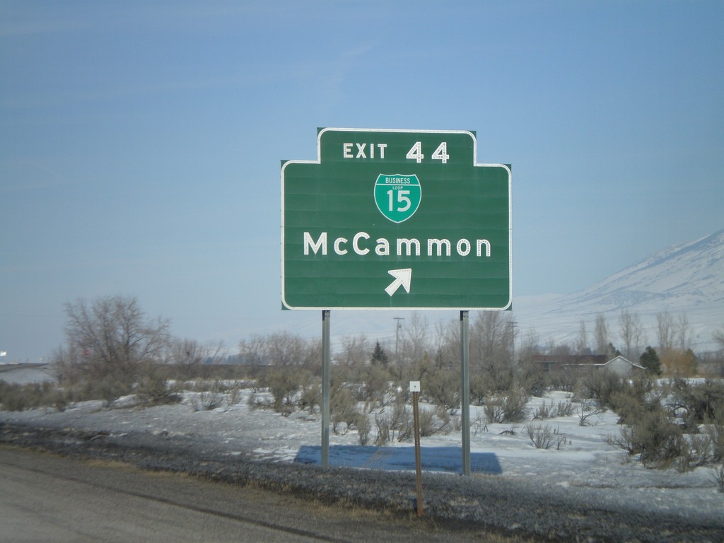
I-15 North - Exit 44
I-15 north at Exit 44 - BL-15/McCammon
Taken 02-17-2008
McCammon
Bannock County
Idaho
United States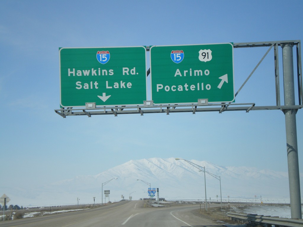
US-91 North At I-15
US-91 north approaching I-15. US-91 north joins I-15 here. I-15/US-91 north to Arimo and Pocatello. Continue over overpass for I-15 South to Salt Lake and Hawkins Road.
Taken 02-17-2008
Downey
Bannock County
Idaho
United States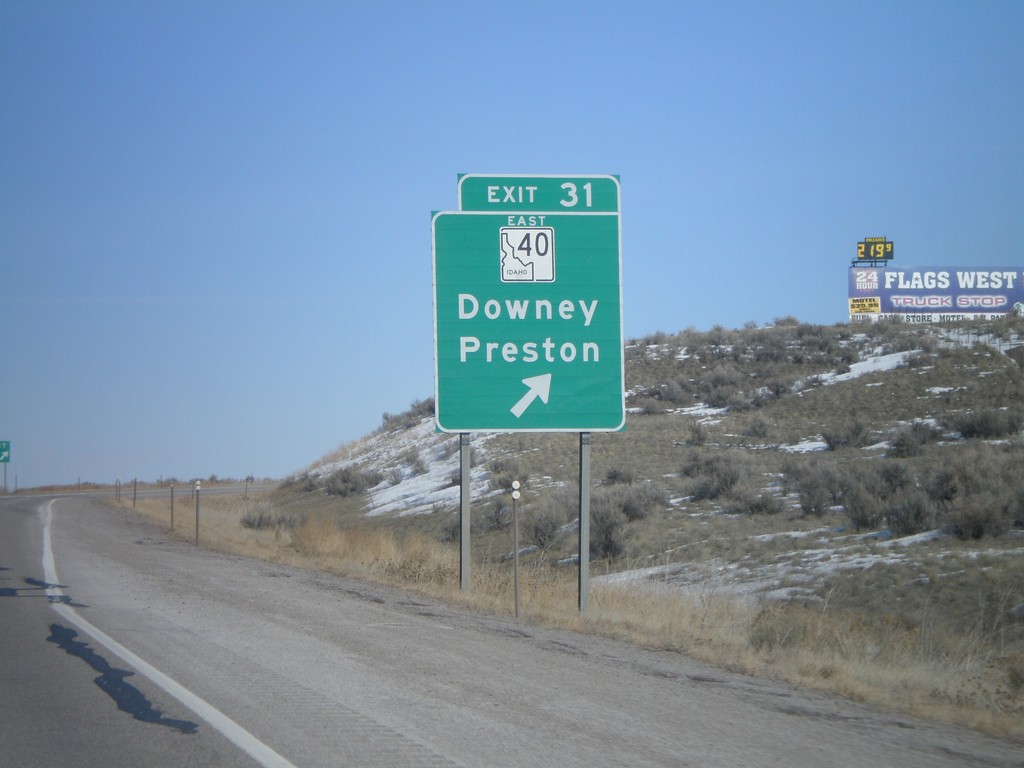
I-15 North - Exit 31
I-15 north at Exit 31 - ID-40 East/Downey/Preston.
Taken 02-17-2008
 Downey
Bannock County
Idaho
United States
Downey
Bannock County
Idaho
United States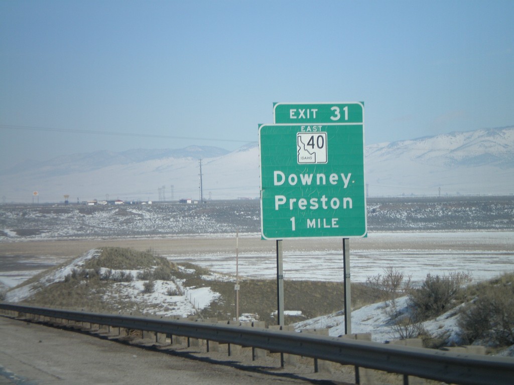
I-15 North - Exit 31
I-15 north approaching Exit 31 - ID-40 East/Downey/Preston.
Taken 02-17-2008
Downey
Bannock County
Idaho
United States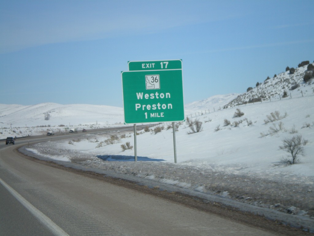
I-15 North - Exit 17
I-15 north approaching Exit 17 - ID-36/Weston/Preston.
Taken 02-17-2008
 Malad City
Oneida County
Idaho
United States
Malad City
Oneida County
Idaho
United States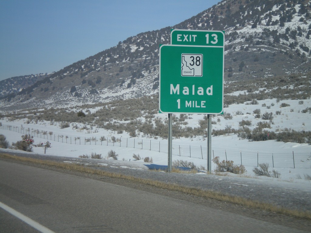
I-15 North - Exit 13
I-15 north approaching Exit 13 - ID-38/Malad
Taken 02-17-2008
 Malad City
Oneida County
Idaho
United States
Malad City
Oneida County
Idaho
United States