Shield Inside Sign Signs In Idaho
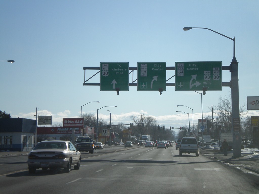
US-93 South Approaching ID-74 To US-30
US-93 south approaching ID-74 overhead. Use Blue Lakes South for US-30 East. Use US-93 south for US-30 west.
Taken 01-16-2008


 Twin Falls
 County
Idaho
United States
Twin Falls
Twin Falls County
Idaho
United States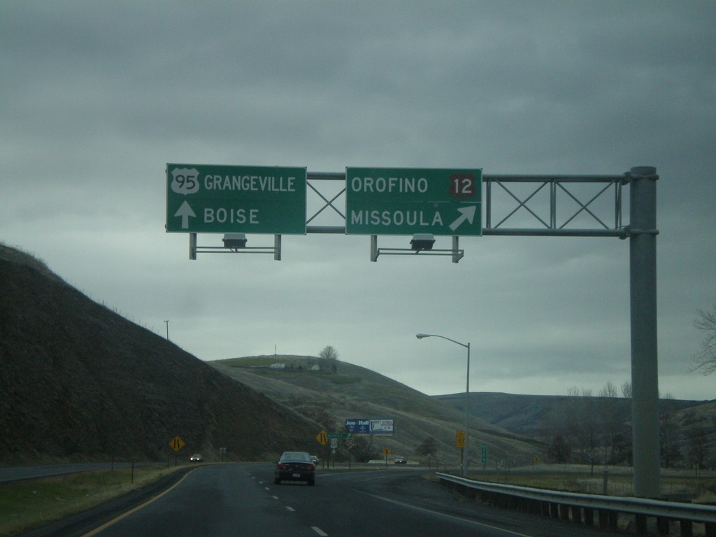
US-12 East/US-95 South Overhead
US-95 South/US-12 East at US-12/US-95 split. US-12 east follows the Clearwater River to Orofino and Lewiston. US-95 south to Grangeville and Boise.
Taken 12-26-2007

 North Lapwai
Nez Perce County
Idaho
United States
North Lapwai
Nez Perce County
Idaho
United States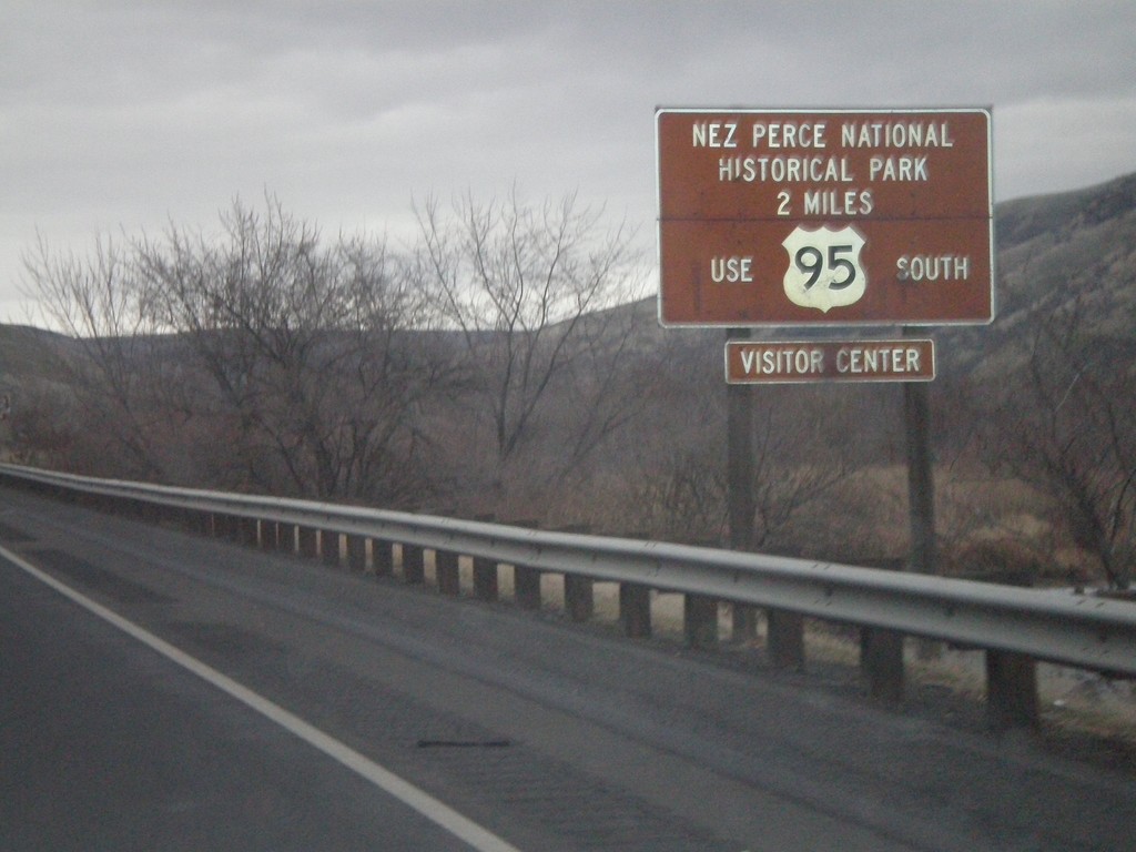
US-12 East/US-95 South - Nez Perce National Historical Park
US-95 South/US-12 East approaching the US-12/US-95 Split. Use US-95 south for the Nez Perce National Historic Park.
Taken 12-26-2007
Lewiston
Nez Perce County
Idaho
United States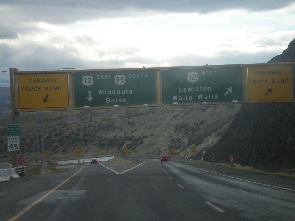
US-95 South at US-12
US-95 south at US-12 at the bottom of the Lewiston Hill. The welcome to Lewiston sign is right above the speed limit sign on the left side of the photo. Lewiston is the lowest city in Idaho - 738 feet. There are Runaway Truck Ramps on either side of the photo.
Taken 12-26-2007
Lewiston
Nez Perce County
Idaho
United States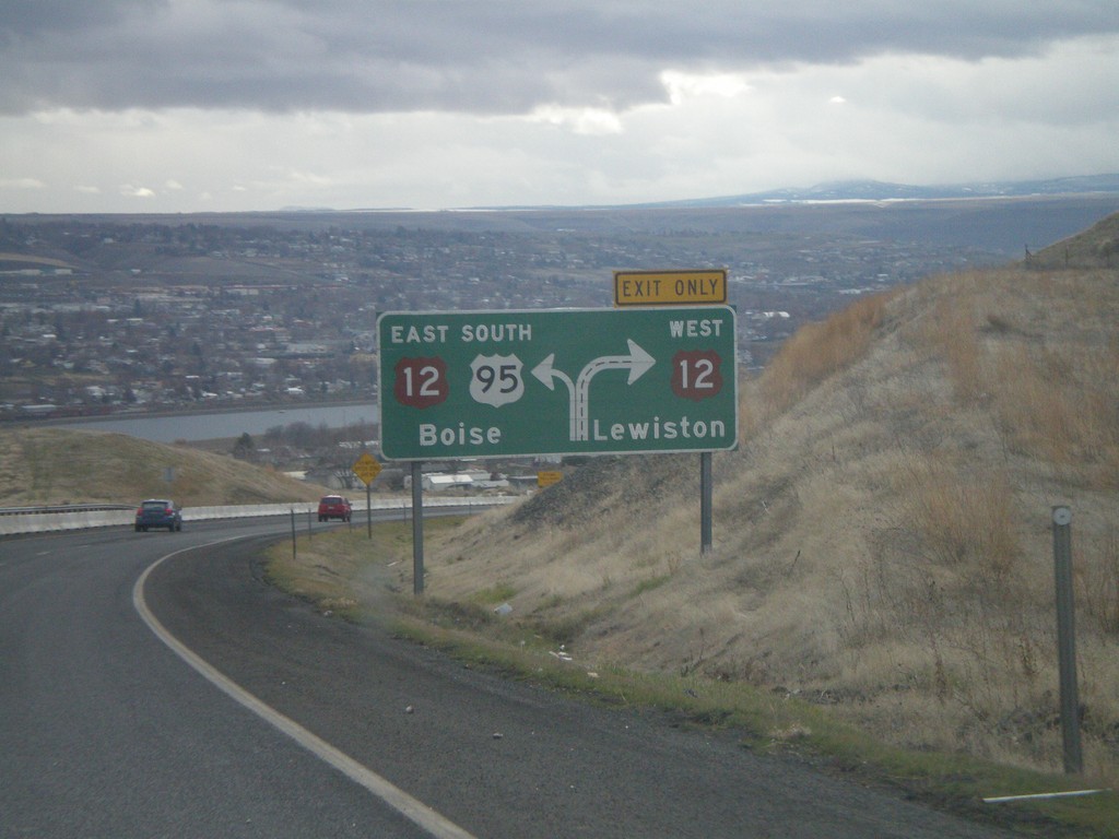
US-95 South Approaching US-12
Route diagram for US-95/US-12 junction on US-95 south. View of the Clearwater Valley and the city of Lewiston. The river in the background is the Clearwater River.
Taken 12-26-2007
Lewiston
Nez Perce County
Idaho
United States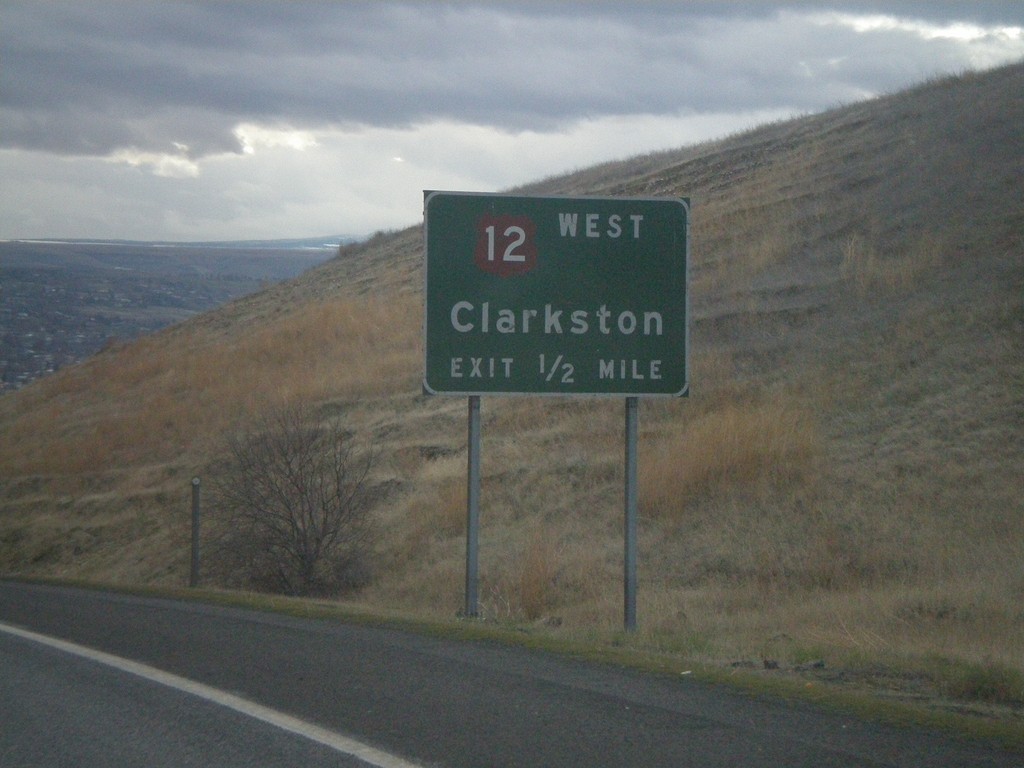
US-95 South Approaching US-12
US-95 south approaching US-12 west to Clarkston (Washington).
Taken 12-26-2007
Lewiston
Nez Perce County
Idaho
United States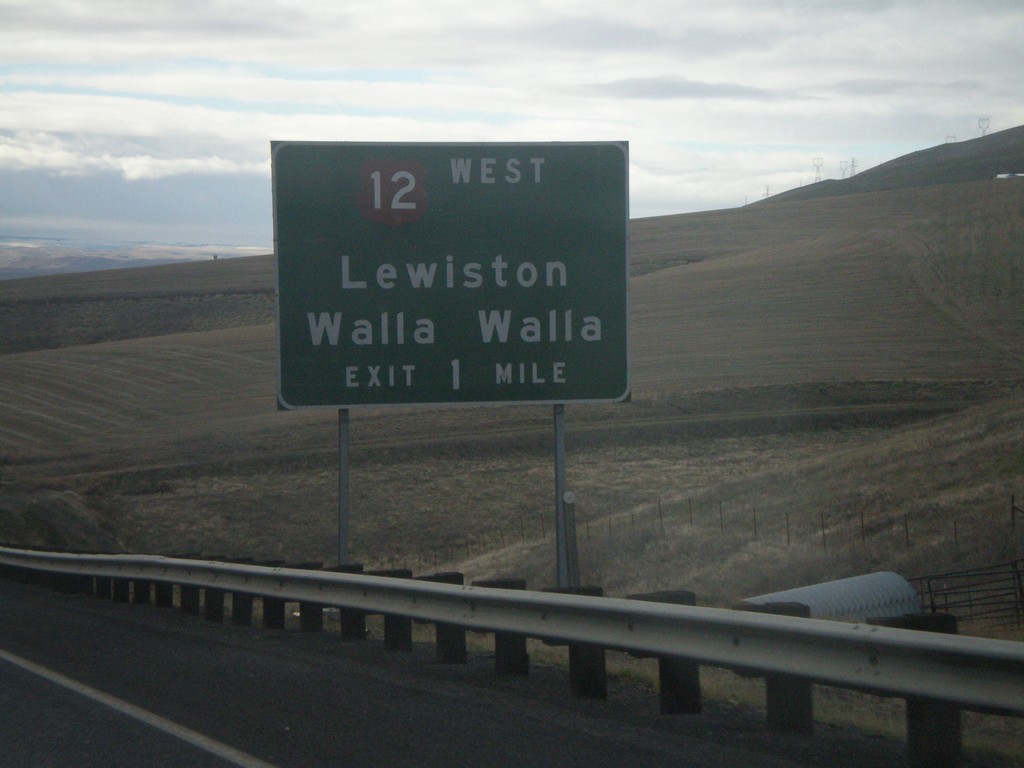
US-95 South Approaching US-12
US-95 south on the Lewiston Hill approaching US-12 west to Lewiston/Walla Walla.
Taken 12-26-2007
Lewiston
Nez Perce County
Idaho
United States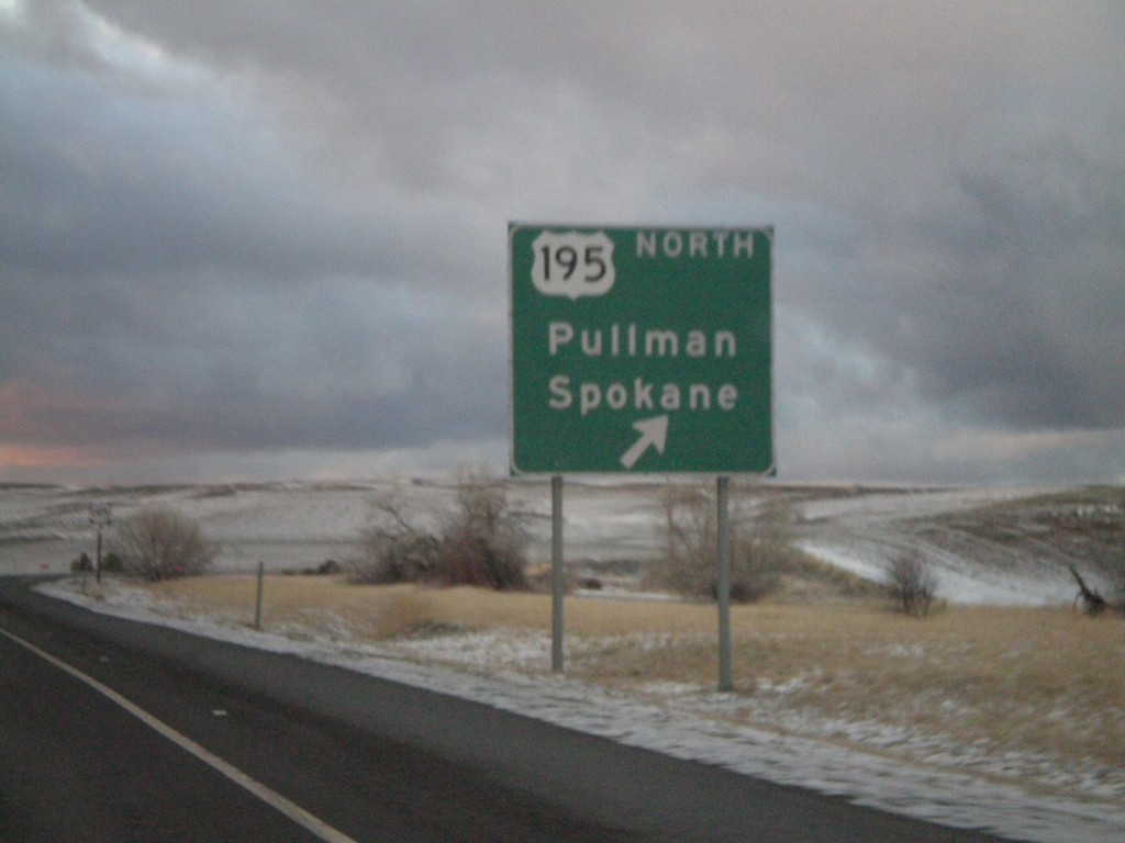
US-95 North At US-195
US-95 north approaching US-195 to Pullman and Spokane. US-195 leaves Idaho less than a mile of this junction.
Taken 12-24-2007
 Genesee
Nez Perce County
Idaho
United States
Genesee
Nez Perce County
Idaho
United States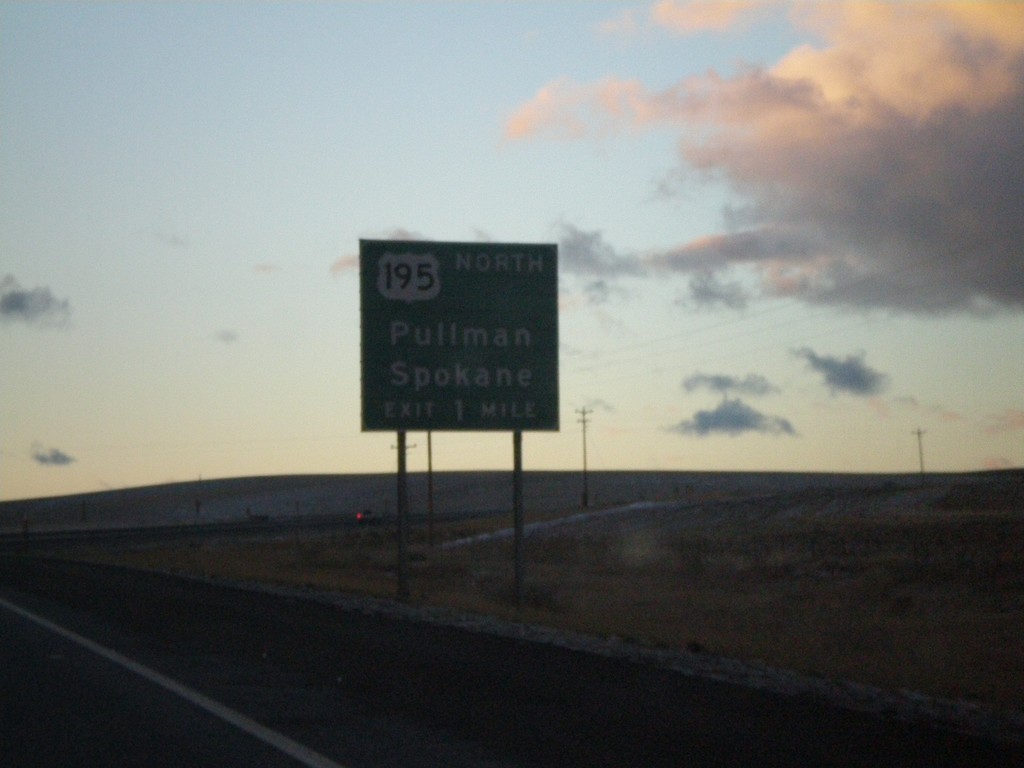
US-95 North Approaching US-195
US-95 north approaching US-195 north to Pullman and Spokane.
Taken 12-24-2007
Genesee
Nez Perce County
Idaho
United States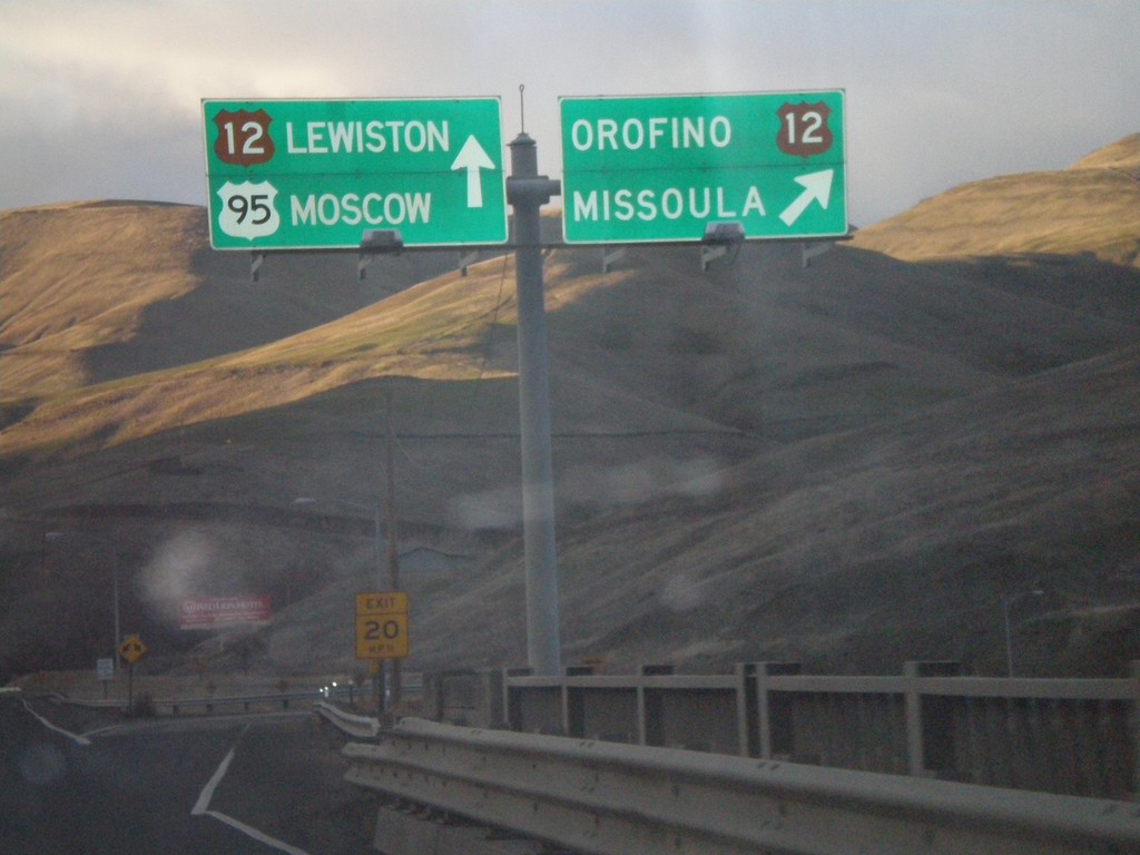
US-95 North at US-12 Junction
US-95 north at US-12 to Orofino and Missoula. US-12 follows US-95 north to Lewiston.
Taken 12-24-2007
Lewiston
Nez Perce County
Idaho
United States