County Boundary Signs In Missouri
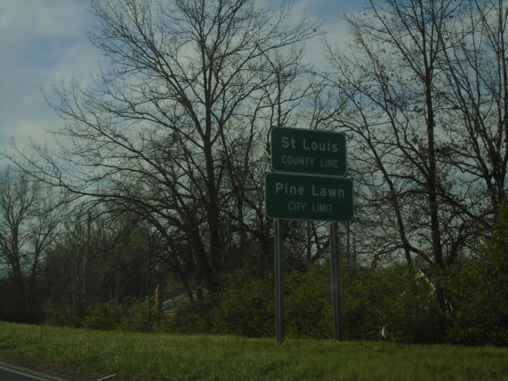
I-70 West - Saint Louis County Line
Saint Louis County Line/Pine Lawn City Limit on I-70 West.
Taken 03-29-2026
 Jennings
St. Louis County
Missouri
United States
Jennings
St. Louis County
Missouri
United States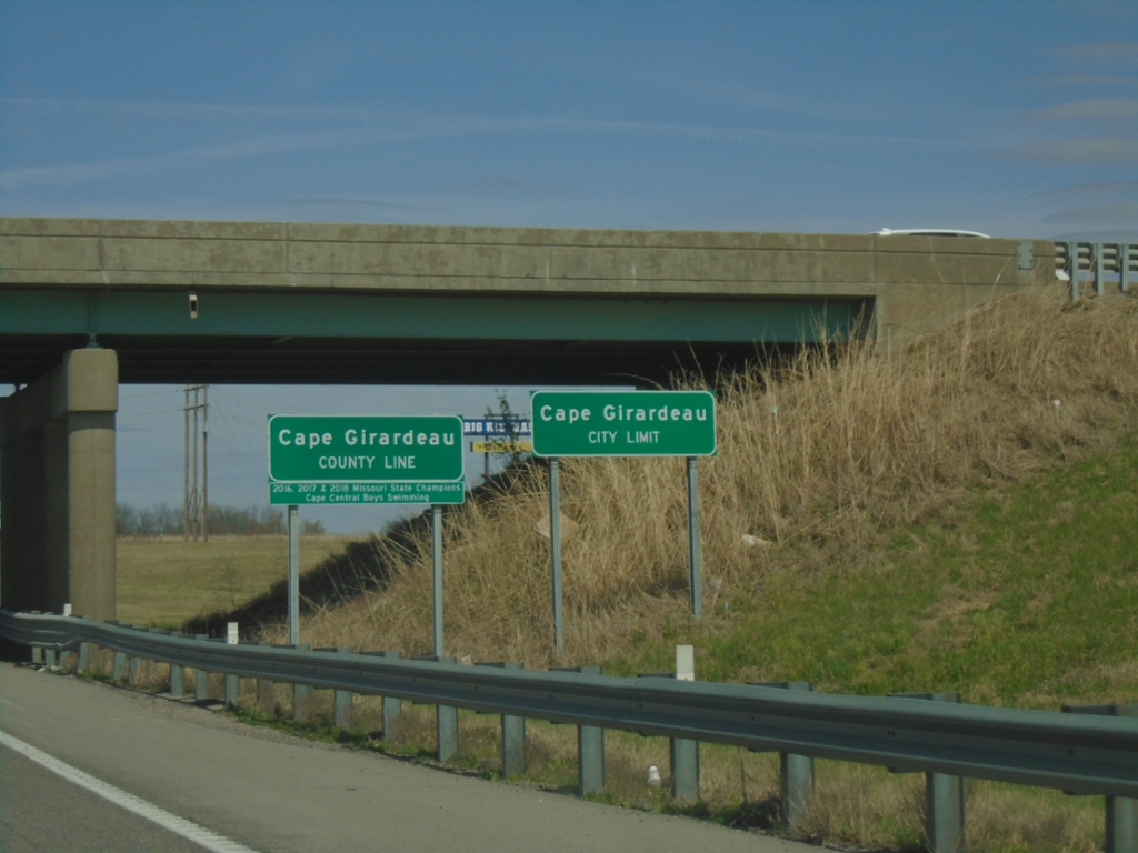
I-55 North - Cape Girardeau County
Cape Girardeau County / Cape Girardeau City Limit on I-55 North.
Taken 03-29-2026

 Scott City
Cape Girardeau County
Missouri
United States
Scott City
Cape Girardeau County
Missouri
United States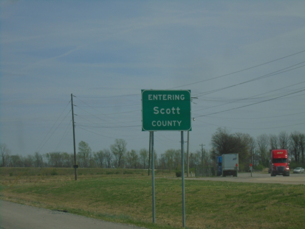
US-60 East - Scott County
Entering Scott County on US-60 East.
Taken 03-29-2026
 Sikeston
Scott County
Missouri
United States
Sikeston
Scott County
Missouri
United States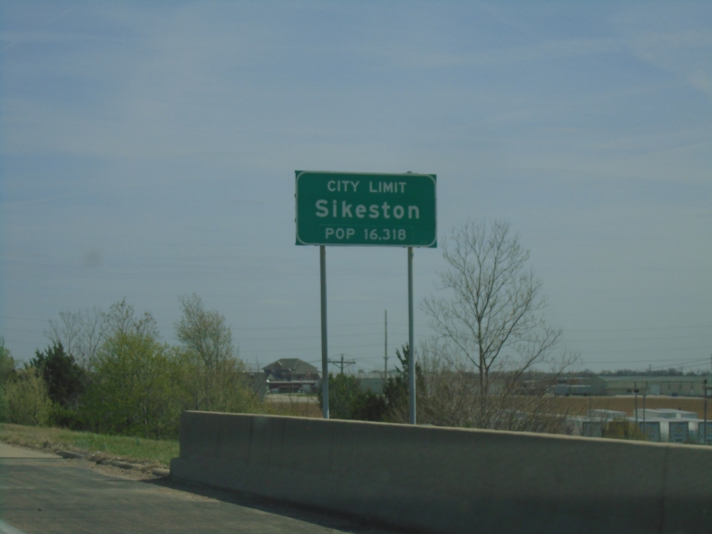
US-60 East - Sikeston
Sikeston City Limit on US-60 East.
Taken 03-29-2026
Sikeston
Scott County
Missouri
United States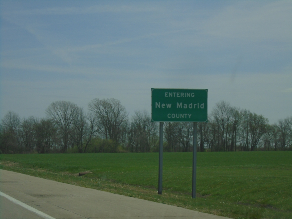
US-60 East - New Madrid County
Entering New Madrid County on US-60 East.
Taken 03-29-2026
Morehouse
New Madrid County
Missouri
United States
US-60 East - Stoddard County
Entering Stoddard County on US-60 East at the Saint Francis River bridge.
Taken 03-29-2026
Dudley
Stoddard County
Missouri
United States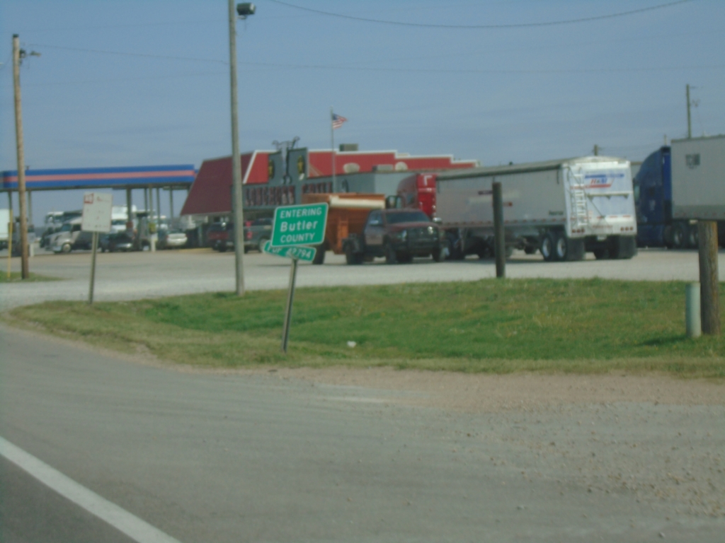
US-67 North - Butler County
Entering Butler County at the Arkansas/Missouri State Line on US-67 North.
Taken 03-29-2026
 Neelyville
Butler County
Missouri
United States
Neelyville
Butler County
Missouri
United States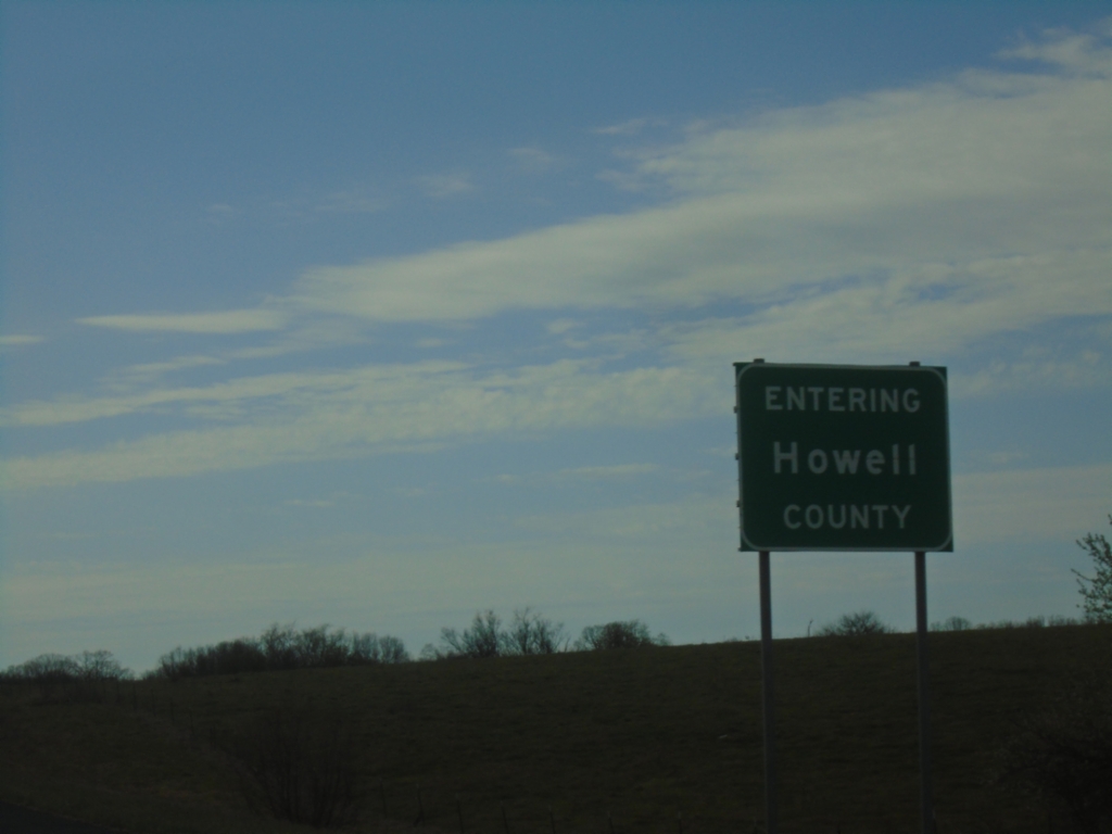
US-60 West - Howell County
Entering Howell County on US-60 west.
Taken 03-27-2026
Mountain View
Howell County
Missouri
United States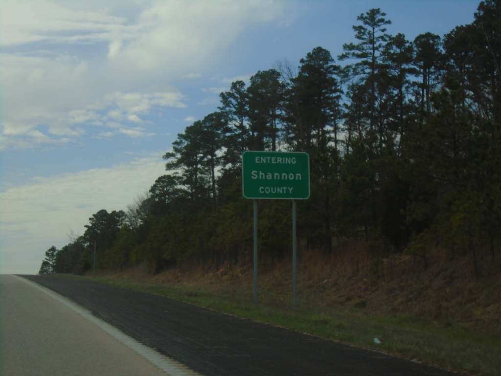
US-60 West - Shannon County
Entering Shannon County on US-60 West.
Taken 03-27-2026
Winona
Shannon County
Missouri
United States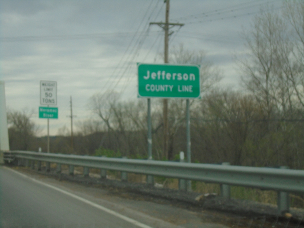
MO-21 South - Jefferson County Line
Jefferson County Line on MO-21 south at the Meramec River bridge.
Taken 03-27-2026
 Rock Township
Jefferson County
Missouri
United States
Rock Township
Jefferson County
Missouri
United States