Navajo County, Arizona
Localities: Cibecue | Heber-Overgaard | Holbrook | Kayenta | Shonto | Show Low | Sun Valley
Cibecue
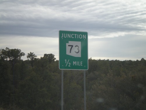
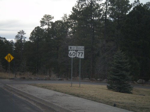
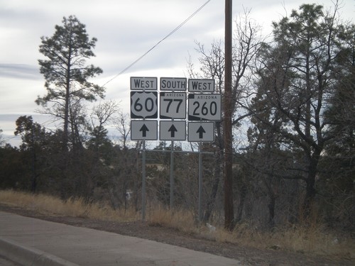
US-60 West/AZ-77 South Approaching AZ-73
US-60 west/AZ-77 south approaching AZ-73.
Heber-Overgaard
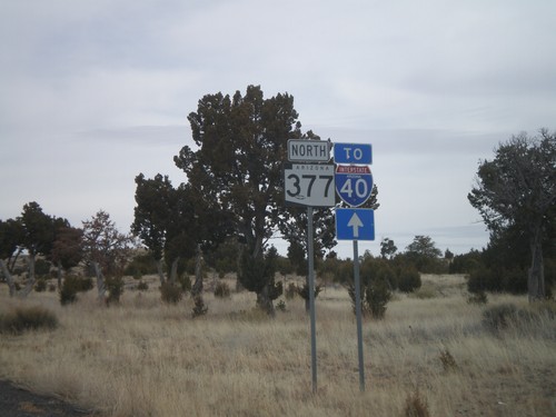
AZ-377 North To I-40
AZ-377 north to I-40. Many of the shields along AZ-277 and AZ-377 north between Heber and Holbrook have a To I-40 shield in addition to the state highway shield.
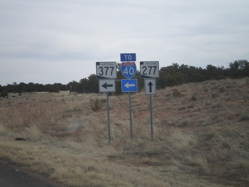
AZ-277 North at AZ-377 (To I-40)
AZ-277 north at AZ-377 (To I-40)
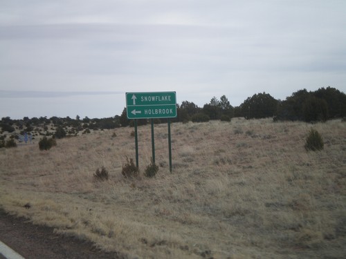
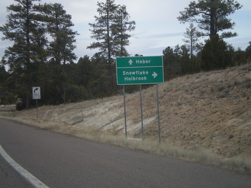
AZ-277 North at AZ-377
AZ-277 north at AZ-377. Use AZ-277 for Snowflake; use AZ-377 for Holbrook.
AZ-277 East Approaching AZ-377
AZ-277 east approaching AZ-377 north.
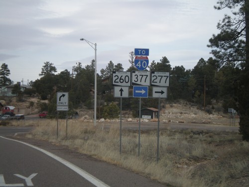
AZ-260 West at AZ-277
AZ-260 west at AZ-277 north (To AZ-377 and I-40).
AZ-260 West at AZ-277
AZ-260 west at AZ-277. Use AZ-277 north for Snowflake and Holbrook. Continue west on AZ-260 for Heber.
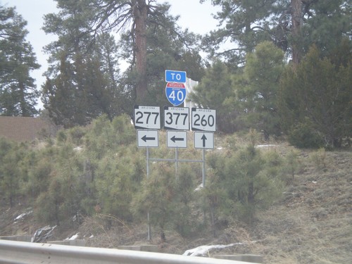
AZ-260 East at AZ-277 North
AZ-260 east at AZ-277 north. Use AZ-277 north for AZ-377 and I-40.
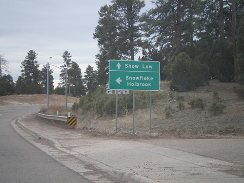
AZ-260 West at AZ-277 North
AZ-260 east at AZ-277 north to Snowflake and Holbrook. Continue east on AZ-260 for Show Low.
AZ-260 East Approaching AZ-277
AZ-260 east approaching AZ-277.
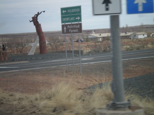
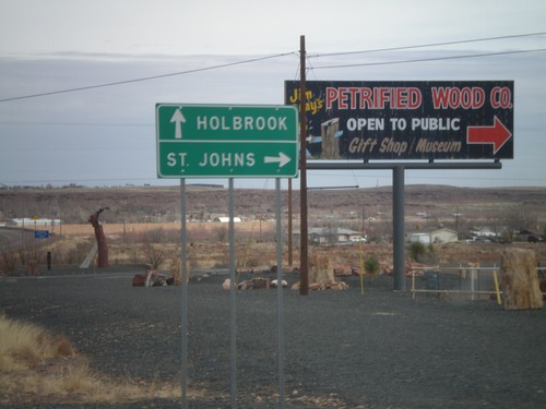
Holbrook
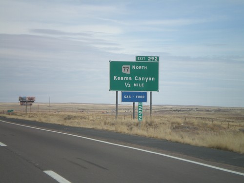
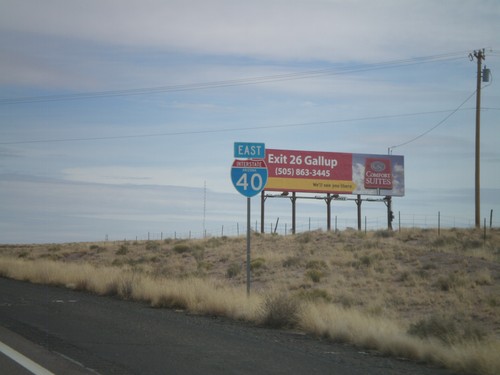
I-40 East - Exit 292
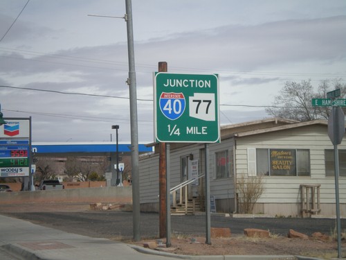
I-40 east at Exit 292 - AZ-77 North/Keams Canyon. AZ-77 north leaves I-40 here, and heads north onto the Hopi Indian Reservation.
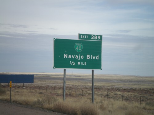
I-40 East - Exit 289
I-40 east approaching Exit 289 - BL-40/Navajo Blvd.
I-40 East Shield
I-40 East, Arizona, shield in Holbrook.
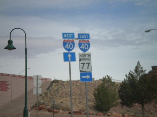
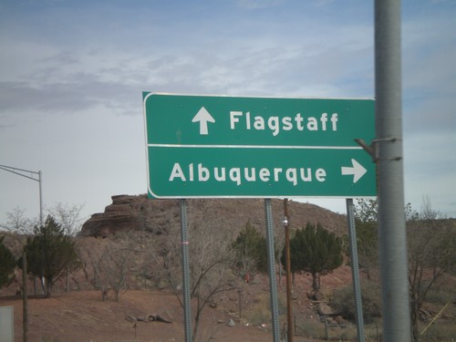
BL-40 East/AZ-77 North at I-40
BL-40 East/AZ-77 North at I-40 freeway entrance. Use I-40 west for Flagstaff; use I-40 east for Albuquerque. AZ-77 joins I-40 east through Holbrook.
BL-40 East/AZ-77 North at I-40
BL-40 East/AZ-77 North at I-40 freeway entrance. Use I-40 west for Flagstaff; use I-40 east for Albuquerque. AZ-77 joins I-40 east through Holbrook.
BL-40 East/AZ-77 North Approaching I-40
BL-40 East/AZ-77 North approaching I-40. AZ-77 joins I-40 east through Holbrook.
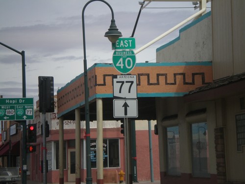
AZ-77 North/BL-40 East Approaching I-40
AZ-77 North/BL-40 East approaching I-40. AZ-77 north joins I-40 east to the east side of Holbrook.
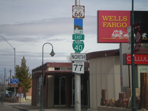
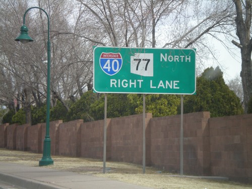
BL-40 East/AZ-77 North - Arizona Scenic Byway
BL-40 east/AZ-77 north in Holbrook. BL-40 in Holbrook follows the historic route of US-66 and is signed as an Arizona Scenic Byway.
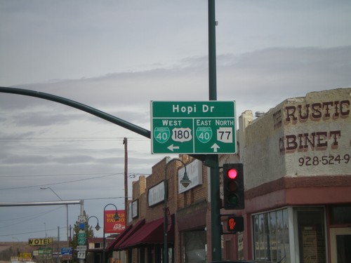
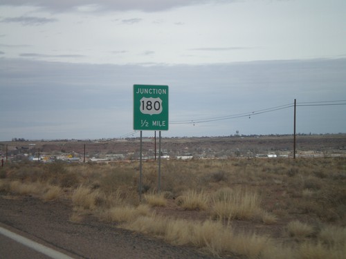
US-180 West/AZ-77 North at BL-40
US-180 West/AZ-77 North at BL-40. Continue straight for BL-40 East/AZ-77 North (Navajo Blvd.). Turn left for BL-40 West/US-180 West (Hopi Drive).
AZ-77 North/US-180 West at BL-40
AZ-77 North/US-180 West at BL-40 in downtown Holbrook. Continue straight on Navajo Blvd. for AZ-77 North/BL-40 East. Turn left on Hopi Drive for US-180 West/BL-40 west.
AZ-77 North/US-180 West Approaching BL-40
AZ-77 north/US-180 west approaching BL-40 in Holbrook.
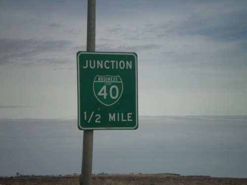
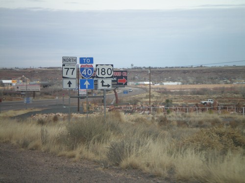
AZ-77 North To I-40
AZ-77 north to I-40 (and US-180 west which is not signed) in Holbrook.
South Apache Dr. at AZ-77 and US-180
S. Apache Dr. at AZ-77 and US-180. Use AZ-77 south for Snowflake; use AZ-77 north/US-180 west for Holbrook; use US-180 east for Petrified Forest.
AZ-77 North at US-180
AZ-77 north at US-180. Use US-180 east for St. Johns; use US-180 west/AZ-77 north for Holbrook.
AZ-77 North at US-180
AZ-77 north at US-180. Turn right for US-180 east; continue north on AZ-77 for US-180 east to I-40.
AZ-77 North Approaching US-180
AZ-77 North approaching US-180. US-180 joins AZ-77 into Holbrook.
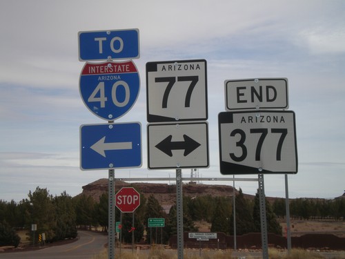
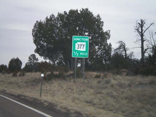
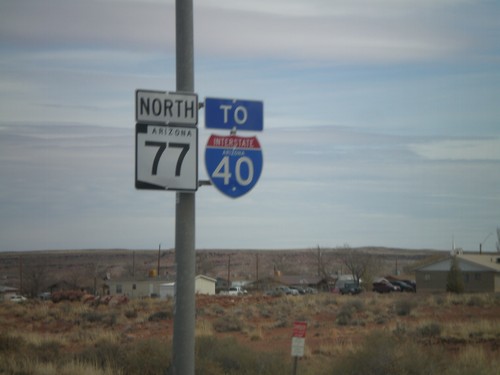
End AZ-377 at AZ-77
End AZ-377 at AZ-77. Use AZ-77 north for I-40.
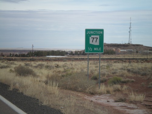
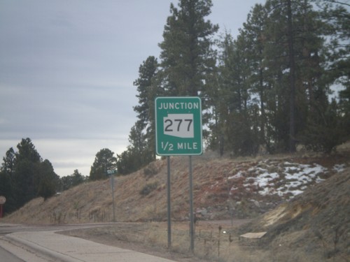
AZ-377 North Approaching AZ-77
AZ-377 north approaching AZ-77.
Kayenta
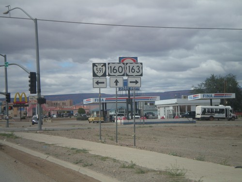
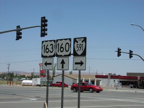
US-160 West at US-163 and Navajo IR-591
US-160 West at US-163 and Navajo IR-591. Turn right for US-163 east; turn left for Navajo IR-591.
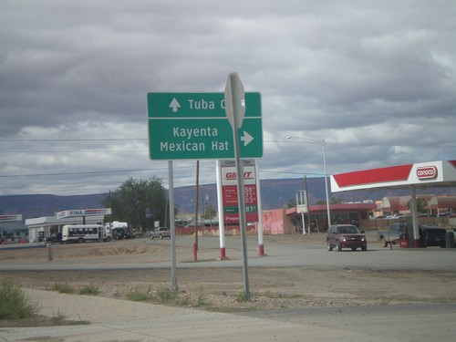
US-160 West at US-163
US-160 West at US-163 in Kayenta. Use US-163 north for Kayenta and Mexican Hat. Use US-160 west for Tuba City. This is the western end of US-163.
US-160 West Approachign US-163
US-160 west approaching US-163. US-163 is incorrectly marked here as AZ-163.
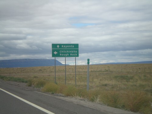
US-160 West at Navajo IR-59
US-160 West at Navajo IR-59 south to Chilchinbito and Round Rock. Continue west on US-160 for Kayenta.
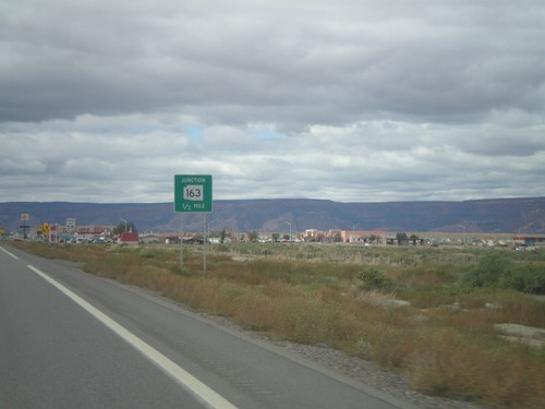
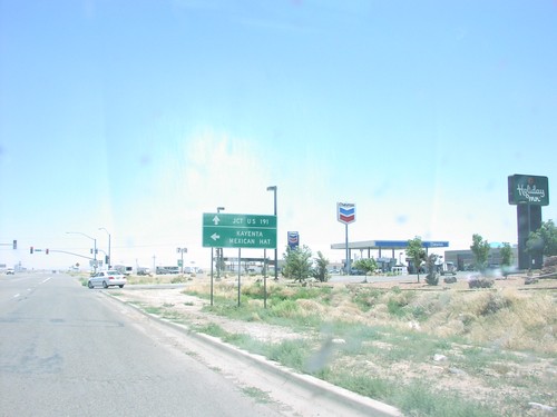
US-160 East at US-163
US-160 east approaching US-163 to Mexican Hat and Kayenta. Continue east on US-160 for US-191.
US-160 East Approaching US-163
US-160 east approaching US-163.
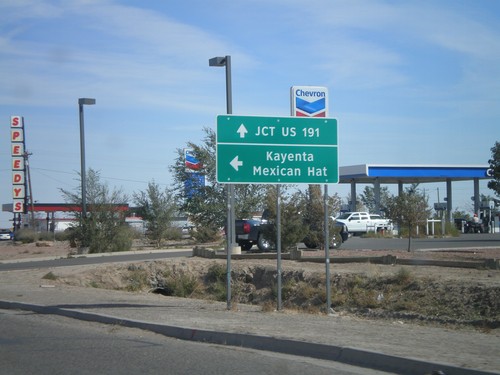
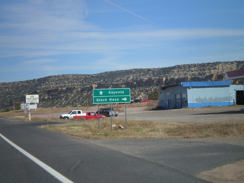
US-160 East at US-163
US-160 east approaching US-163 to Mexican Hat, in Kayenta.
US-160 East at US-163/BIA-591
US-160 east at US-163/BIA-591 junction in Kayenta.
Shonto
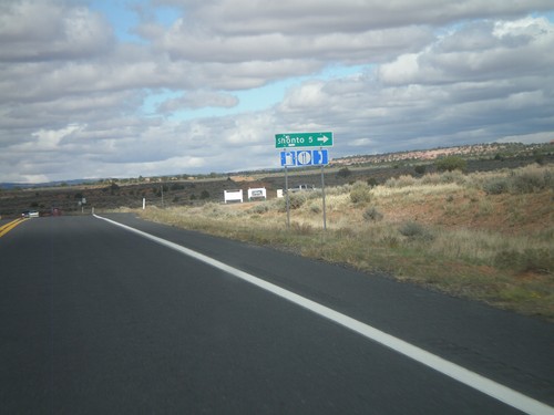
AZ-98 North at Shonto Jct.
AZ-98 North at Shonto Jct. Food, gas, and phone access available in Shonto.
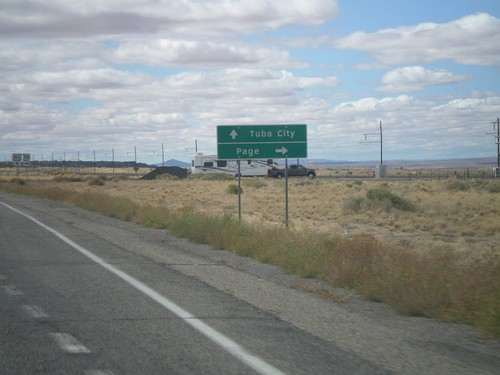
US-160 West at AZ-98
US-160 west at AZ-98 north to Page. Continue west on US-160 to Tuba City.
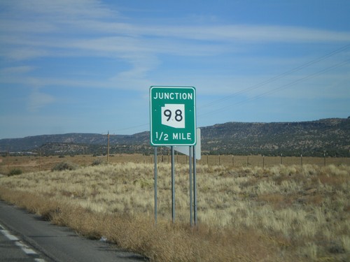
US-160 West Approaching AZ-98
US-160 west approaching AZ-98.
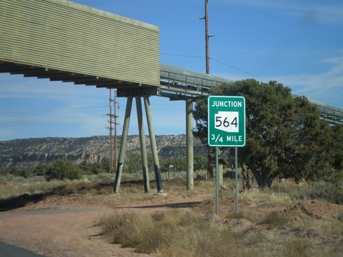
US-160 East at AZ-564
US-160 east at AZ-564.
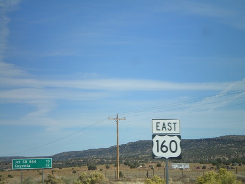
US-160 East Approaching AZ-564
US-160 east approaching AZ-564.
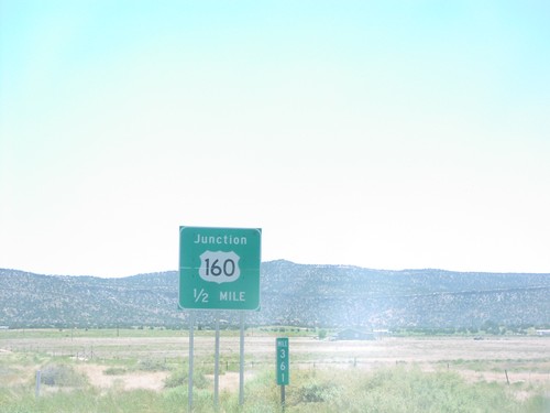
US-160 East - Shield and Distance Marker
Distance marker on US-160 east of AZ-98. Distance given to Jct. SR-564 and Kayenta. US-160 shield in foreground.
US-160 East Approaching AZ-98
US-160 east approaching AZ-98.
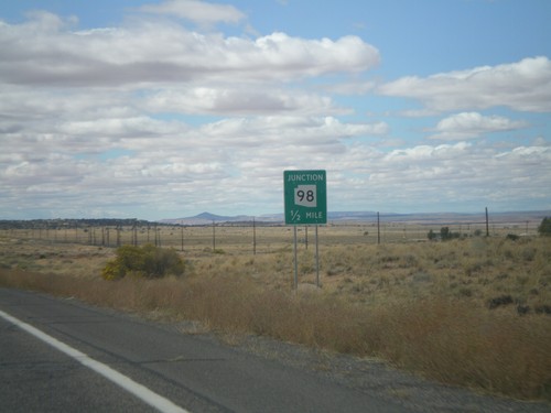
End AZ-98 East at US-160
End AZ-98 east at US-160 to Kayenta and Tuba City. Taken in Navajo County.
End AZ98 East at US-160
End AZ-98 east at US-160 junction in Navajo County.
Show Low
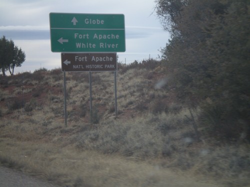
US-60 West/AZ-77 South at AZ-73
US-60 West/AZ-77 South at AZ-73 east to Fort Apache, White River, and Fort Apache National Historic Park. Continue west on US-60 for Globe.
US-60 West/AZ-77 South
US-60 West/AZ-77 South leaving Show Low.
US-60 West/AZ-77 South/AZ-260 West at AZ-260
US-60 West/AZ-260 West/AZ-77 South at AZ-260. Turn right to continue on AZ-260. Continue straight for US-60 West/AZ-77 South.
US-60/AZ-77/AZ-260 West at AZ-260
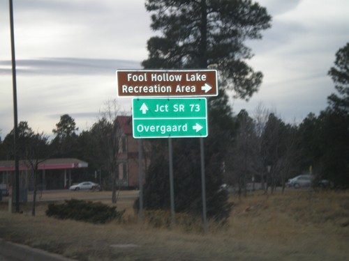
US-60/AZ-77/AZ-260 west at AZ-260 west to Overgaard and Fool Hollow Lake Recreation Area. US-60 West/AZ-77 South continues to AZ-73 Jct. AZ-260 west leaves US-60/AZ-77 here.
US-60 West/AZ-77 South/AZ-260 West at AZ-260
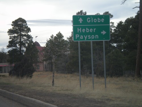
US-60 West/AZ-77 South/AZ-260 West at AZ-260. Use AZ-260 west for Heber and Payson. Continue on US-60 West/AZ-77 South for Globe.
US-60 West/AZ-260 West/AZ-77 South
US-60 West/AZ-260 West/AZ-77 South in Show Low.
US-60 West/AZ-77 South at AZ-260
US-60 West/AZ-77 South at AZ-260. Turn left for AZ-260 west; continue straight for US-60 West/AZ-77 South/AZ-260 West.
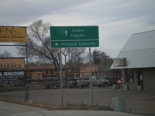
US-60 West/AZ-77 South at AZ-260
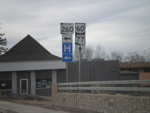
US-60 West/AZ-77 South at AZ-260. Use AZ-260 west for Pinetop/Lakeside. AZ-260 joins US-60 West/AZ-77 South through Show Low. Use US-60 West/AZ-77 South/AZ-260 West for Payson and Globe.
US-60 West/AZ-77 South Approaching AZ-260
US-60 West/AZ-77 South approaching AZ-260 in Show Low.
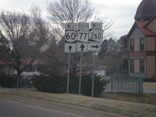
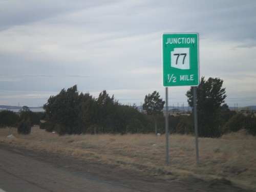
US-60 West at AZ-77
US-60 west at AZ-77. Turn right for AZ-77 north. Continue straight for US-60 west and AZ-77 south. AZ-77 joins US-60 west to Globe.
US-60 West Approaching AZ-77
US-60 west approaching AZ-77. Use AZ-77 north for Holbrook. Continue west on US-60 and AZ-77 south for Show Low.
US-60 West Approaching AZ-77
US-60 west approaching AZ-77.
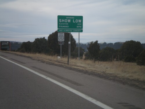
US-60 West - Entering Show Low
Entering Show Low on US-60 west. Elevation 6,331, founded in 1870.
Sun Valley
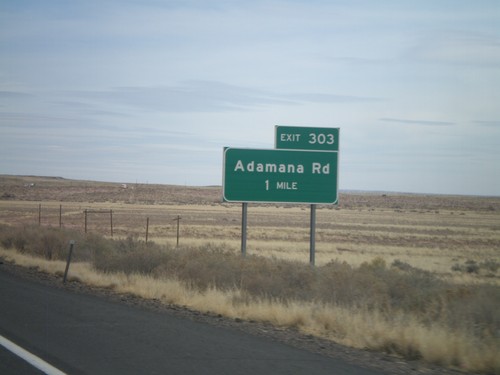
I-40 East - Exit 303
I-40 east at Exit 303 - Adamana Road.
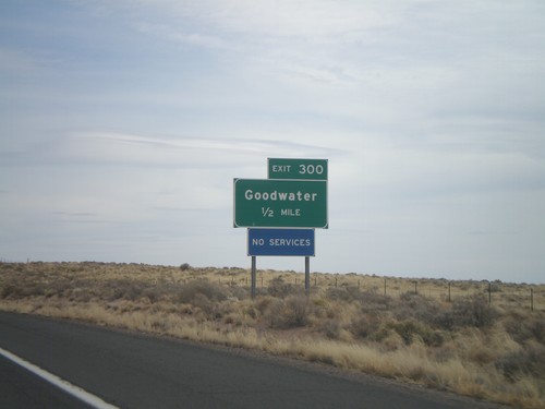
I-40 East Approaching Exit 300
I-40 east approaching Exit 300 - Goodwater.
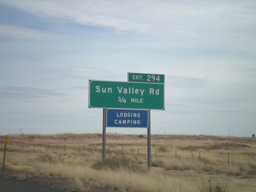
I-40 East Approaching Exit 294
I-40 east approaching Exit 294 - Sun Valley Road.