Cleburne County, Arkansas
Localities: Concord | Drasco | Greers Ferry | Higden
No Place Associated
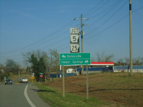
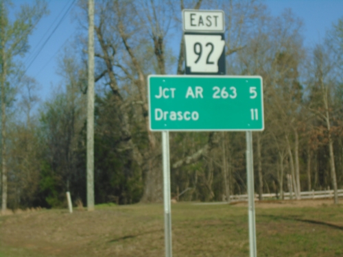
AR-92 East at AR-5/AR-25
AR-92 East at AR-5/AR-25 in Drasco. Use AR-5 North/AR-25 East to Batesville; AR-5 South/AR-25 West to Heber Springs.
Concord
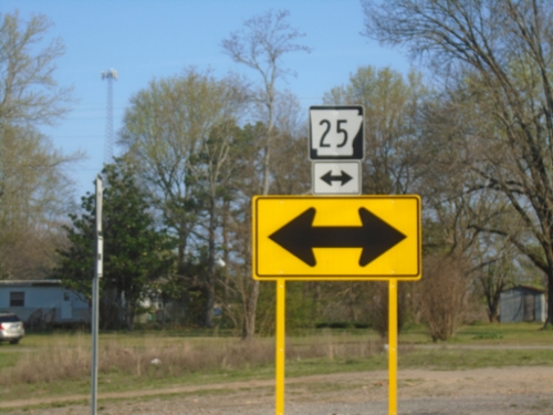
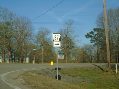
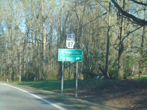
AR-87 North at AR-25
AR-87 North at AR-25 in Concord.
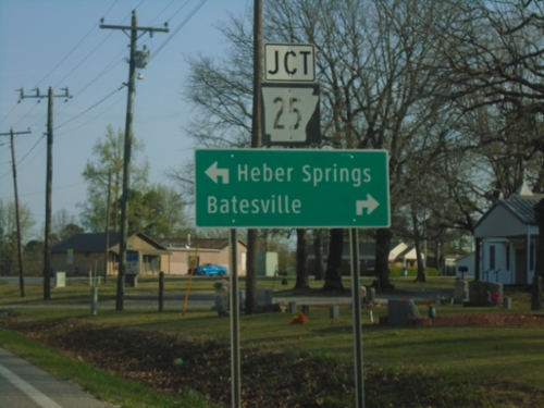
AR-87 North at AR-25
AR-87 North at AR-25 in Concord. Use AR-25 North to Batesville; AR-25 South to Heber Springs.
AR-25 North at AR-87
AR-25 North at AR-87 in Concord.
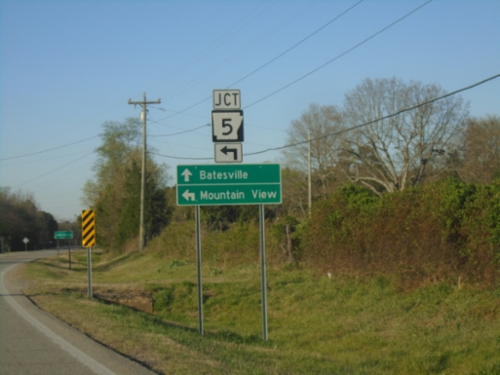
AR-25 North Approaching AR-87
AR-25 North approaching AR-87 in Concord. Use AR-87 South to Floral; continue on AR-25 North to Batesville.
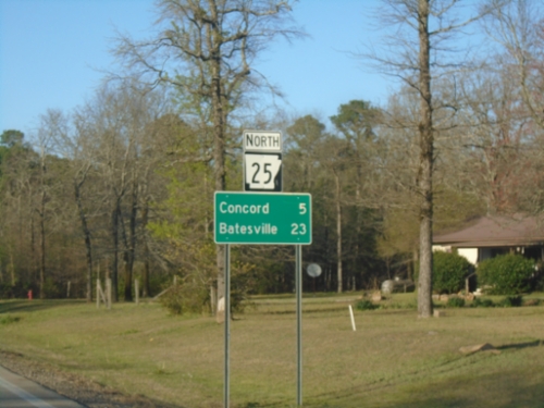
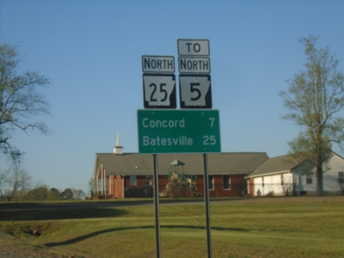
AR-25 North - Distance Marker
Distance marker on AR-25 North. Distance to Concord and Batesville.
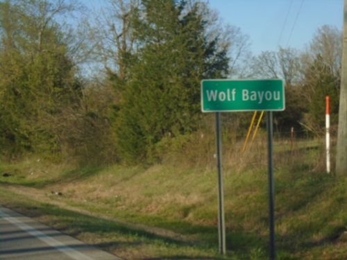
AR-25 North - Wolf Bayou
Entering Wolf Bayou on AR-25 North.
Drasco
AR-5/AR-25 North at AR-5/AR-25 Split
AR-5/AR-25 North at AR-5/AR-25 Split in Wolf Bayou. Use AR-5 North to Mountain View; AR-25 North to Batesville.
AR-25 North/To AR-5 - Distance Marker
Distance Marker on AR-25 North/To AR-5. Distance to Concord and Batesville.
Greers Ferry
AR-92 East - Distance Marker
Distance marker on AR-92 East. Distance to Jct. AR-263 and Drasco.
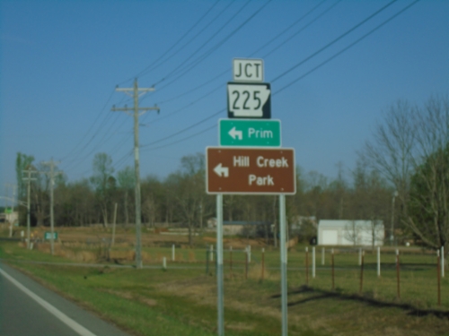
AR-92 East at AR-225
AR-92 East at AR-225 in Cleburne County. Use AR-225 North to Prim and Hill Creek Park.
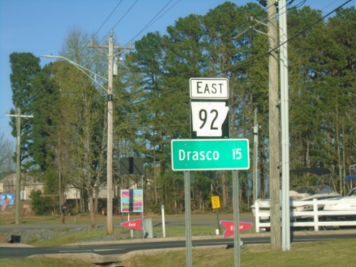
AR-92 East - Distance Marker
Distance marker on AR-92 East. Distance to Drasco.
Higden
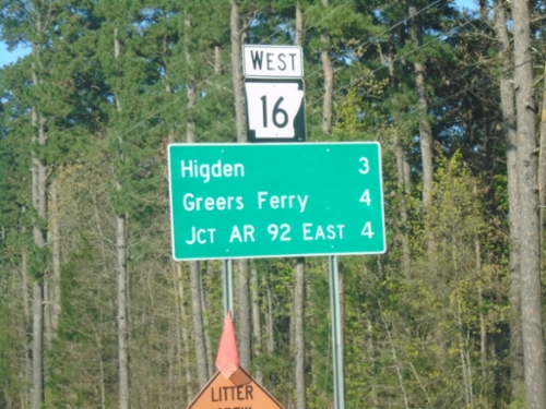
AR-16 West - Distance Marker
Distance marker on AR-16 West. Distance to Higden, Greers Ferry, and Jct. AR-92 East.
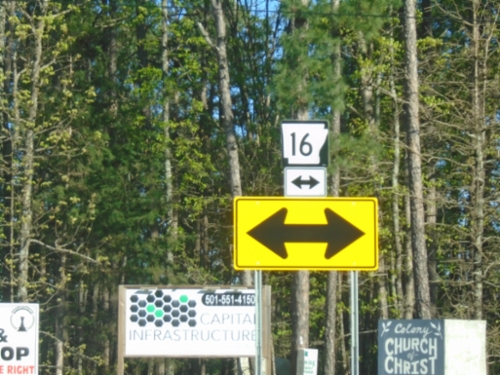
AR-92 East at AR-16
AR-92 East at AR-16 in Cleburne County.
AR-92 East at AR-16
AR-92 East at AR-16 in Cleburne County. Use AR-16 South to AR-25 Junction; use AR-16 North/AR-92 East to Greers Ferry.