Conway County, Arkansas
Localities: Atkins | Center Ridge | Hill Creek | Morrilton | Plumerville | Springfield
No Place Associated
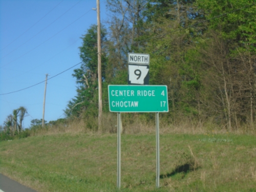
AR-9 North - Distance Marker
Distance marker on AR-9 North. Distance to Center Ridge and Choctaw.
Atkins
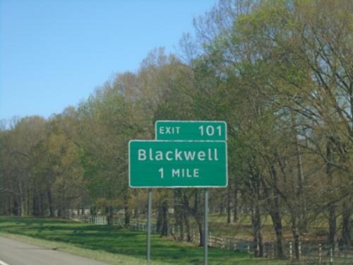
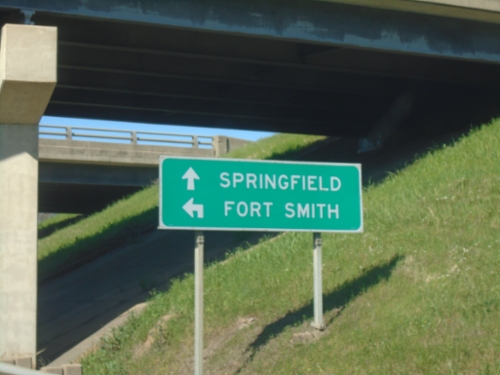
I-40 East - Exit 101
I-40 east approaching Exit 101 - Blackwell
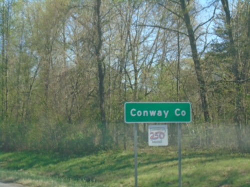
I-40 East - Conway County
Entering Conway County on I-40 East.
Center Ridge
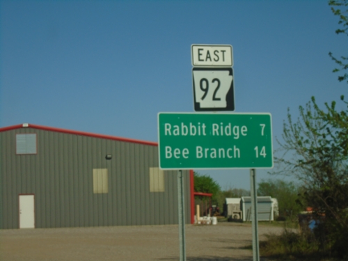
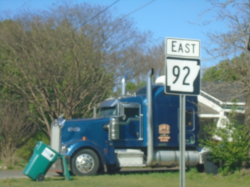
AR-92 East - Distance Marker
Distance marker on AR-92 east. Distance to Rabbit Ridge and Bee Branch.
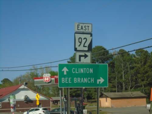
AR-9 North/AR-92 East at AR-9/AR-92 Split
AR-9 North/AR-92 East at AR-9/AR-92 Split in Center Ridge. Use AR-92 East to Bee Branch; AR-9 North to Clinton.
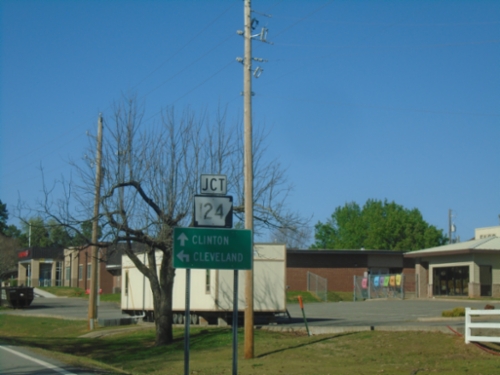
AR-9 North at AR-124
AR-9 North at AR-124 West to Cleveland. Continue north on AR-9 to Clinton.
Hill Creek
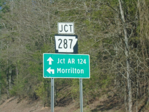
AR-92 East at AR-287
AR-92 East at AR-287 in Hill Creek. Turn left on AR-287 West to Morrilton; continue on AR-92 to AR-124 Junction.
Morrilton
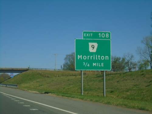
I-40 East - Exit 108
I-40 east approaching Exit 108 - AR-9/Morrilton
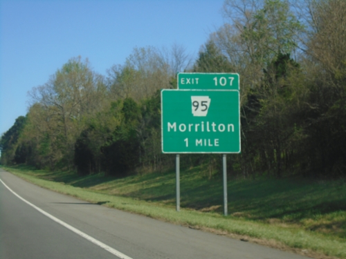
I-40 East - Exit 107
I-40 east approaching Exit 107 - AR-95/Morrilton.
Plumerville
AR-92 East - Plumerville
AR-92 East in Plumerville
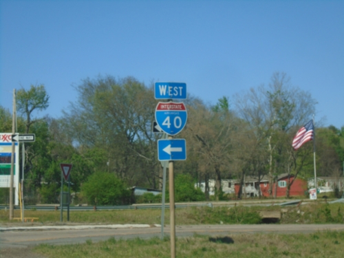
AR-92 North at I-40 West
AR-92 North at I-40 West in Plumerville.
AR-92 North at I-40 West
AR-92 North at I-40 West to Fort Smith. Continue north on AR-92 to Springfield.
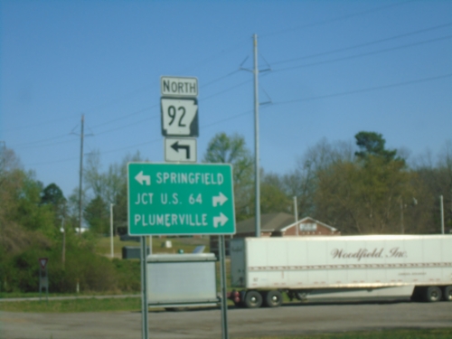
I-40 East - Exit 112 Offramp
I-40 East - Exit 112 Offramp at AR-92. Turn left for AR-92 North to Springfield. Turn right for AR-92 south to US-64 and Plumerville.
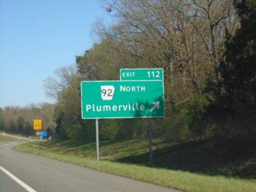
I-40 East - Exit 112
I-40 east at Exit 112 - AR-92/Plumerville.
Springfield
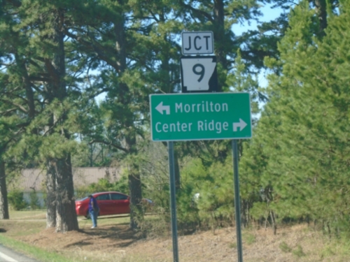
AR-92 East at AR-9
AR-92 East at AR-9. Use AR-9 South to Morrilton; AR-9 North/(AR-92) East to Center Ridge
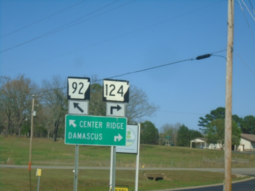
End AR-124 at AR-92
End AR-124 at AR-92 in Springfield.
AR-92 East at AR-124
AR-92 East at AR-124 in Springfield. Use AR-92 east to Center Ridge; AR-124 to Damascus.