Central Kootenay, British Columbia
Localities: Castlegar | Creston | Kingsgate | Kitchener | Nelson | New Denver | Riondel | Robson | Salmo | Slocan Park | South Slocan | Three Forks | Yahk
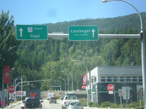
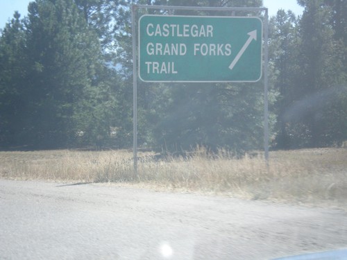
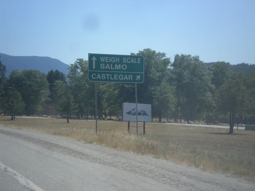
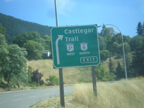
Castlegar
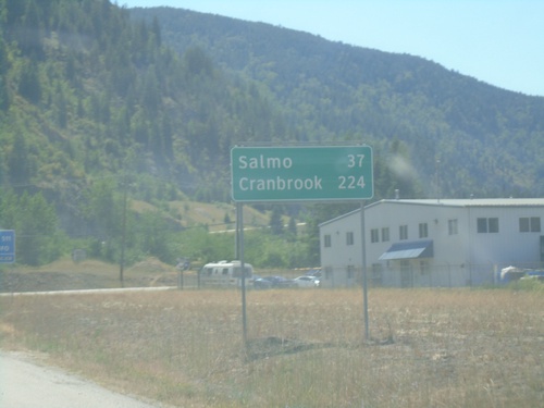
BC-3 East - Distance Marker
Distance marker on BC-3 east. Distance to Salmo and Cranbrook.
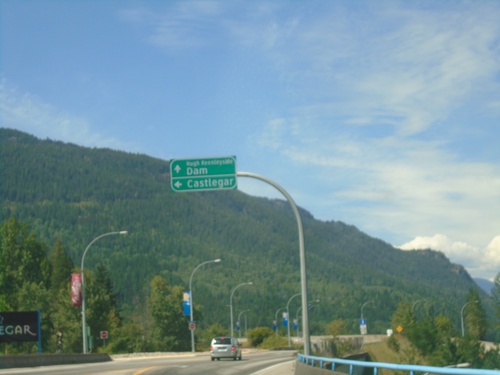
Robson Road at Columbia Ave - Castlegar
Robson Road at Columbia Ave at the end of the Columbia River Bridge. Turn left for (Columbia Ave.) to Castlegar. Continue straight for Hugh Keenleyside Dam. The Hugh Keenleyside Dam is on the Columbia River creating the Arrow Lakes.
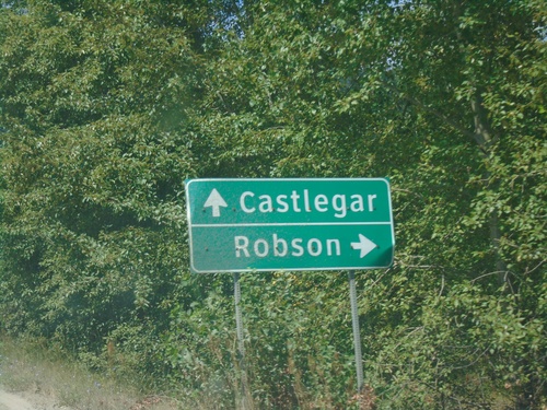
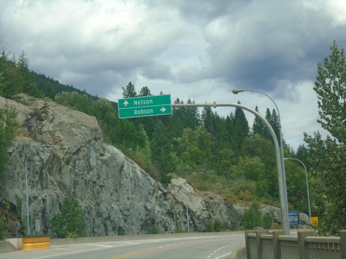
Robson Access Road East at Broadwater Road
Robson Access Road East at Broadwater Road. Turn right for Robson; continue straight for Castlegar.
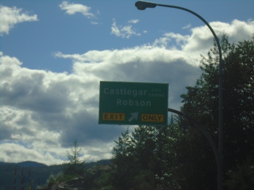
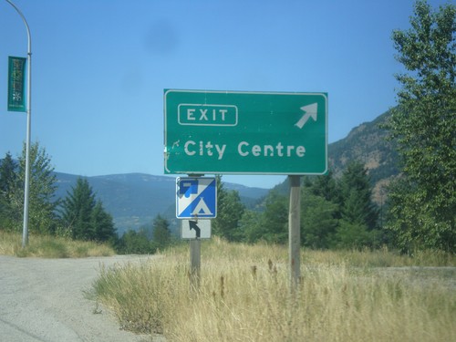
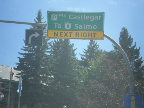
BC-3A West - Robson Interchange
BC-3A West at Castlegar City Centre/Robson interchange.
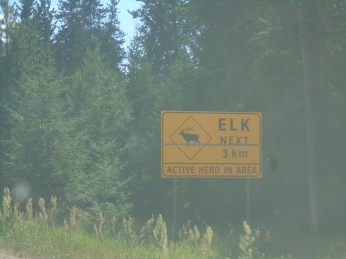
BC-3A West - Elk Next 3km
BC-3A West - Elk Next 3km - Active Herd In Area.
BC-3A West - South Slocan
BC-3A West in South Slocan
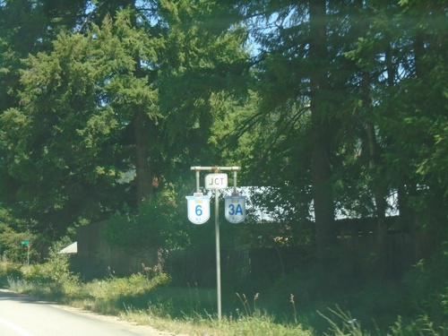
BC-3A East Approaching BC-6
BC-3A East approaching BC-6 in South Slocan. BC-6 South joins BC-3A eastbound to Nelson.
Robson Access Road East at BC-3A
Robson Access Road East at BC-3A in Castlegar.
BC-3A East - Robson Interchange
BC-3A East at Robson interchange. Continue east on BC-3A for Nelson.
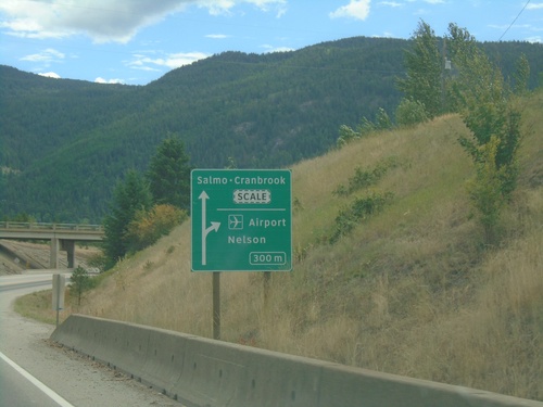
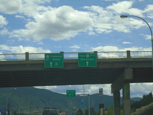
BC-3 East at BC-3A Interchange
BC-3 East at BC-3A interchange in Castlegar. Use BC-3A for Airport and Nelson. Continue east on BC-3 for Cranbrook and Salmo.
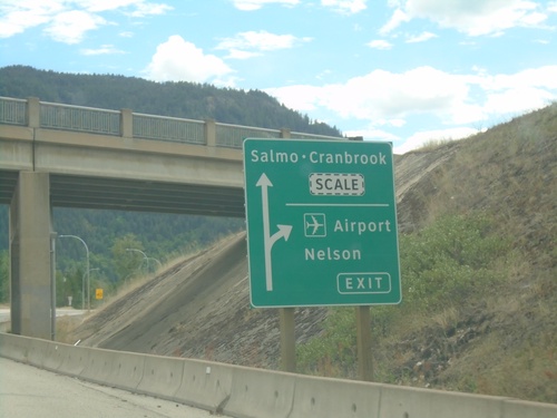
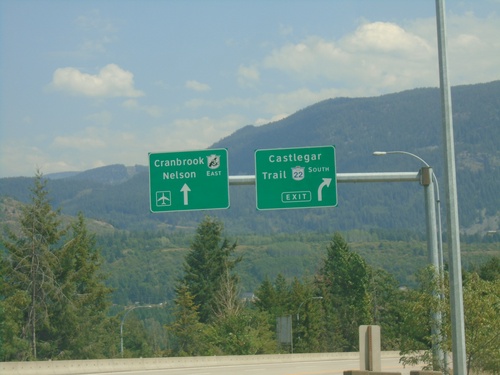
BC-3 East Approaching BC-3A Interchange
BC-3 East approaching BC-3A interchange. Exit for (BC-3A)/Airport/Nelson. Continue on BC-3 for Salmo-Cranbrook.
BC-22 South at BC-3 East
BC-22 South at BC-3 East to Cranbrook and Nelson.
Begin BC-22 South at BC-3 East
Begin BC-22 South at BC-3 East. Use left lane for BC-3 East/Cranbrook/Nelson. Continue south for BC-22/Trail/USA Border.
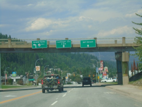
End BC-22 North at BC-3 West
End BC-22 North at BC-3 West in Castlegar. Use BC-3 West to Grand Forks. Use middle lanes for Castlegar City Centre (via Columbia Ave.). Use right lane for 18th St.
BC-3 East Offramp at BC-22
BC-3 East Offramp at BC-22 (Columbia Ave.) in Castlegar. Turn left for BC-22 south to Trail; right for (Castlegar) City Centre.
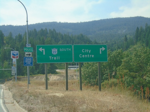
BC-3 East Approaching BC-22 - Castlegar
BC-3 East Approaching BC-22 in Castlegar. Exit for BC-22 South/Castlegar/Trail. Continue on BC-3 East for Cranbrook and Nelson.
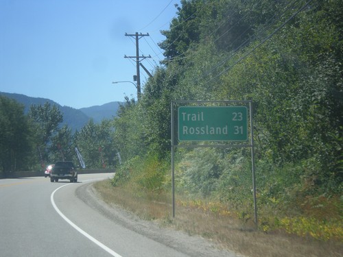
BC-22 South - Distance Marker
Distance marker on BC-22 south. Distance to Trail and Rossland.
BC-3 West - BC-22 Offramp at 6th Ave.
BC-3 West - BC-22 Offramp at 6th Ave. in Castlegar. Continue ahead for BC-22 south/Trail and Castlegar City Centre.
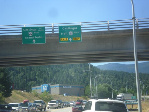
BC-3 West at BC-22 South Interchange
BC-3 West at BC-22 South/Trail interchange.
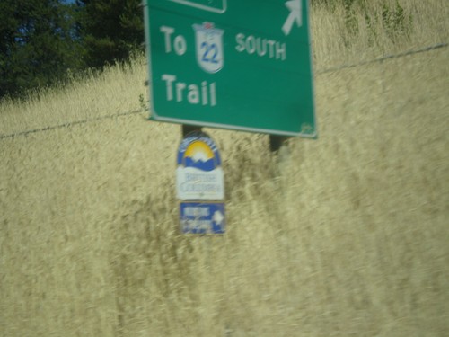
End BC-3A West at BC-3
End BC-3A West at BC-3. Use BC-3 West for Castlegar, Grand Forks, and Trail.
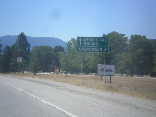
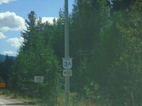
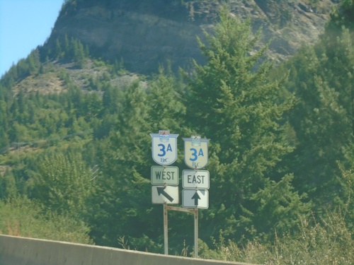
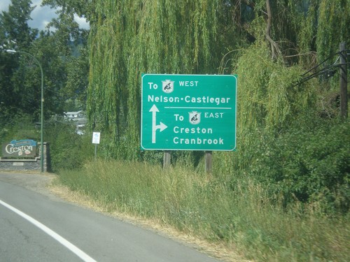
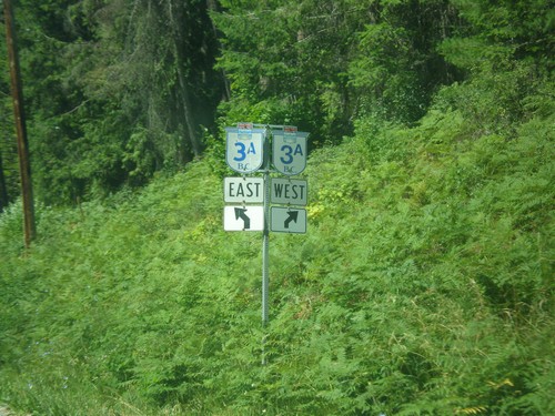
BC-3A West approaching BC-3
BC-3A West approaching BC-3. Use right lane for BC-3 West/Castlegar. Use left lane for BC-3 East/Weigh Station/Salmo.
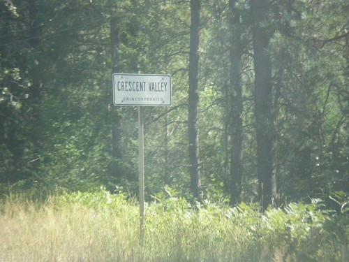
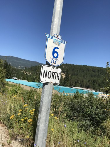
BC-6 South - Entering Crescent Valley
BC-6 South - Entering Crescent Valley (Unincorporated).
BC-3 West - Castlegar City Centre
BC-3 west at Castlegar City Centre interchange.
BC-3 West at BC-22 South - Castlegar
BC-3 West at BC-22 South in Castlegar. Use BC-22 south for Castlegar and Trail. Continue west on BC-3 for Castlegar City Centre and Grand Forks.
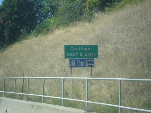
BC-3 West - Castlegar - Next 2 Exits
Castlegar - Next 2 Exits on BC-3 West
End BC-3A West at BC-3
End BC-3A West at BC-3. Use BC-3 West for Castlegar, Grand Forks, and Trail.
BC-3A West approaching BC-3
BC-3A West approaching BC-3. Use right lane for BC-3 West/Castlegar. Use left lane for BC-3 East/Weigh Station/Salmo.
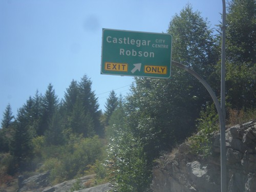
BC-3A West - Robson Interchange
BC-3A West at Castlegar City Centre/Robson interchange.
BC-3A East at BC-6
BC-3A East at BC-6. BC-6 south joins BC-3A east to Nelson.
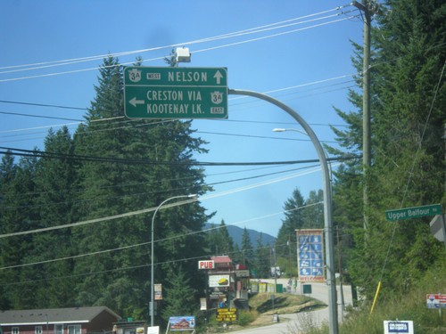
BC-3A West/BC-6 North Split
BC-3A West/BC-6 North split in South Slocan. Turn right for BC-6 north to Slocan, New Denver, and Nakusp.
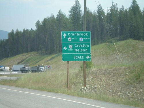
Creston
BC-3 East at BC-3A - Creston
BC-3 East at BC-3A in Creston. Turn right to continue east on BC-3.
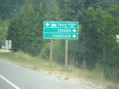
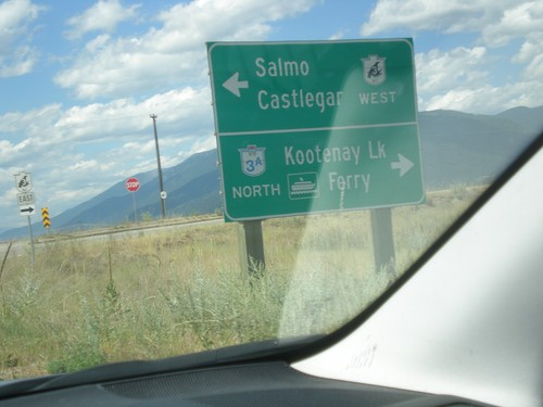
BC-3 East at BC-3A North
BC-3 East at BC-3A North in Creston. Turn left for BC-3A North to Kootenay Lake Ferry; turn right for BC-3 East to Creston and Cranbrook. BC-3A is an alternate route to BC-3 and follows Kootenay Lake and the Kootenay River west before re-joining BC-3 in Castlegar.
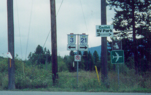
End BC-21 North at BC-3 (To BC-3A)
End BC-21 North at BC-3 (To BC-3A) in Creston. Turn left for BC-3 West to Salmo and Castlegar. Turn right for (BC-3 East), BC-3A North/Kootenay Lake Ferry.
BC-21 North at Erickson Road
BC-21 North at Erickson Road. Turn right for Erickson Road east and BC-3 east. Continue north on BC-21 for BC-3 west.
BC-21 North Approaching Erickson Road
BC-21 North approaching Erickson Road in Creston. Use Erickson Road west for BC-3 East/Creston/Cranbrook. Continue north on BC-21 for BC-3 East to Nelson and Castlegar.
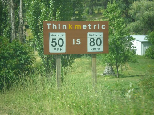
BC-21 North - Think Metric
Think Metric sign on BC-21 north, just past the Rykerts Port of Entry. 50 MPH = 80 km/h.
16th Ave. South at Erickson St. - Creston
16th Ave. South at Erickson St. in Creston. Turn right for BC-21; left for BC-3 (no Crowsnest symbol on the BC-3 shield).
Kingsgate
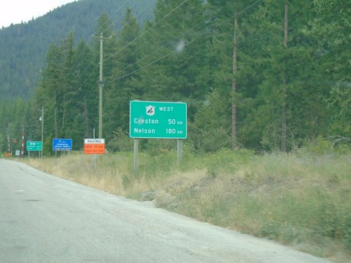
BC-95 North - Distance Marker For BC-3 West
Distance Marker For BC-3 West (Crowsnest Highway) on BC-95 north. Distance to Nelson and Creston. Many of the border crossings near the Crowsnest Highway have signs showing distance along the Crowsnest Highway.
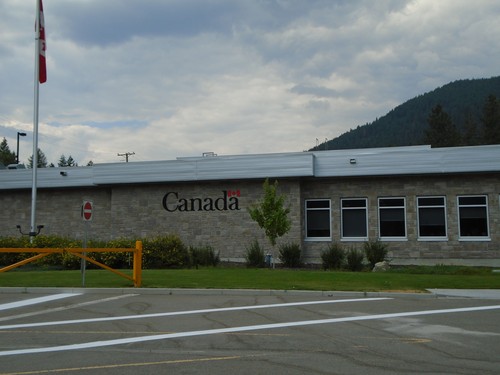
BC-95 North - Port of Kingsgate
Canada Border Services Agency Port of Kingsgate office on BC-95 north.
Kitchener
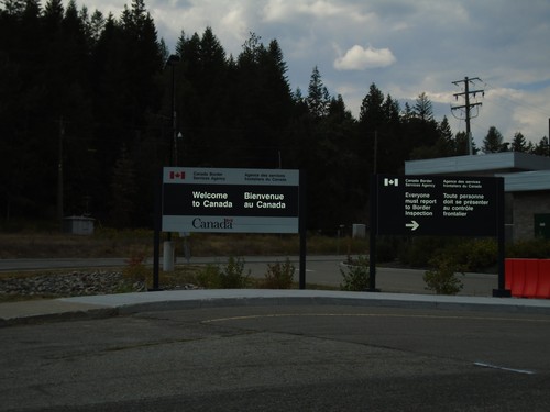
BC-95 North - Welcome To Canada
Welcome To Canada on BC-95 north. Approaching border inspection at Port of Kingsgate.
Kingsport, BC Customs Station
Customs Canada at End of US-95 North
US-Canada Border - Eastport, ID/Kingsgate, BC
The international bounday between United States and Canada at the Easport,ID/Kingsgate, BC border crossing. The picture is taken right on the international boundary. You can see a swath of trees cut down at the border itself, and you can see that same swath as a notch at the top of the ridge in the background. United States is to the left - Canada to the right.
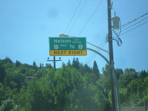
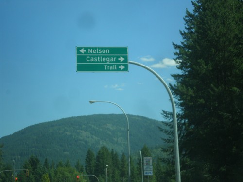
Nelson
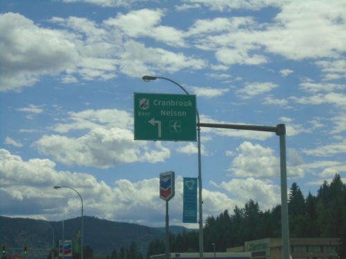
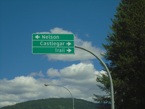
BC-3A West at BC-6 - Nelson
BC-3A West at BC-6 junction in Nelson. Exit right for BC-3A West/BC-6 North/Trail Castlegar.
BC-3A West Approaching BC-6
BC-3A West approaching BC-6 To BC-3/Salmo in Nelson.
BC-3A - Downtown Nelson
BC-3A (Ward St.) at Vernon St. in Nelson. Turn right on Vernon St. for BC-3A West/Castlegar and To BC-6/Salmo.
BC-3A/To BC-6 - Nelson St. Approaching Anderson St. in Nelson
BC-3A West/To BC-6/Nelson City Centre Next Right on Nelson St. approaching Anderson St. in Nelson.
End BC-31 South at BC-3A
End BC-31 South at BC-3A in Balfour. Turn left for BC-3A East to Creston via Kootenay Lake (Ferry). Continue straight for BC-3A West to Nelson.
End BC-31 South at BC-3A - Balfour
End BC-31 South at BC-3A in Balfour,
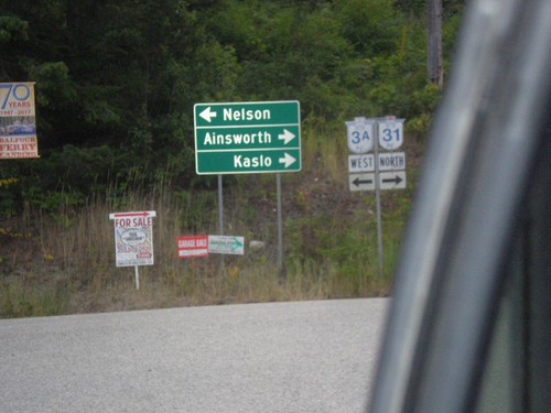
BC-3A West at BC-31
BC-3A West at BC-31 in Balfour, leaving the Kootenay Lake Ferry. Turn right for BC-31 north to Ainsworth and Kaslo. Turn left for BC-3A west to Nelson.
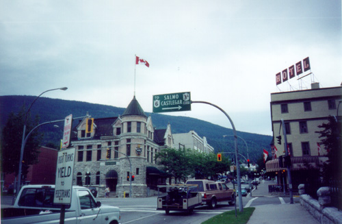
BC-3A - Downtown Nelson
BC-3A/To BC-6/Salmo/Castlegar Overhead
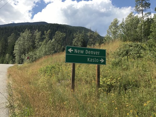
New Denver
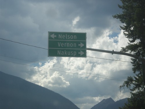
End BC-31A at BC-6
End BC-31A at BC-6 in New Denver. Use BC-6 north for Nakusp and Vernon; BC-6 south for Nelson.
End BC-31A West at BC-6 - New Denver
End BC-31A West at BC-6 in New Denver.
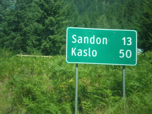
BC-31A East - Distance Marker
Distance Marker on BC-31A East. Distance to Sandon and Kaslo.
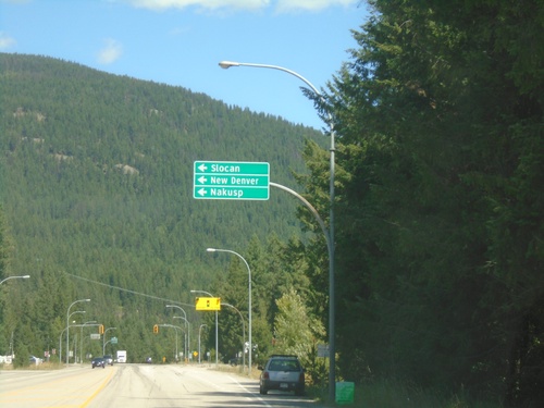
BC-6 North at BC-31A East
BC-6 North at BC-31A East in New Denver.
BC-6 North at BC-31A - New Denver
BC-6 North at BC-31A in New Denver. Use BC-6 north for Nakusp. Use BC-31A East to Sandon and Kaslo.
BC-6 South at BC-3
BC-6 South At BC-3 Junction.
Riondel
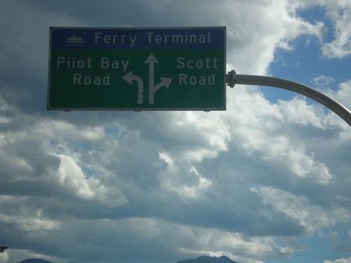
BC-3A West - Kootenay Lake Ferry
BC-3A West approaching Kootenay Lake Ferry. Use left lane for Pilot Bay Road; right lane for Scott Road. Continue in middle lane for the Kootenay Lake Ferry.
Robson
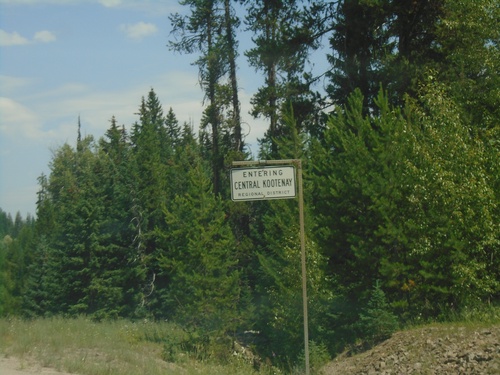
BC-3 East - Central Kootenay Regional District
Entering Central Kootenay Regional District on BC-3 east.
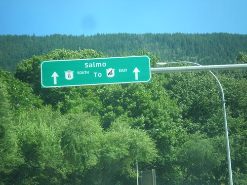
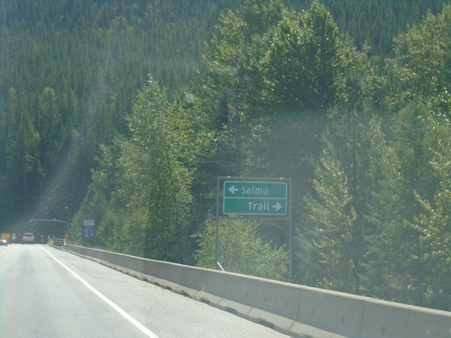
Salmo
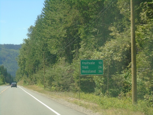
BC-3B West - Distance Marker
Distance marker on BC-3B West. Distance to Fruitvale, Trail, and Rossland.
BC-3B West - Central Kootenay Regional District
BC-3B West in Central Kootenay Regional District
BC-3 East Approaching BC-3B
BC-3 East approaching BC-3B in Central Kootenay Regional District. Turn left for BC-3 East to Salmo; right for BC-3B West to Trail.
Slocan Park
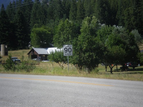
BC-6 North - Speed Limit
Speed Limit 90 km/h on BC-6 North.
South Slocan
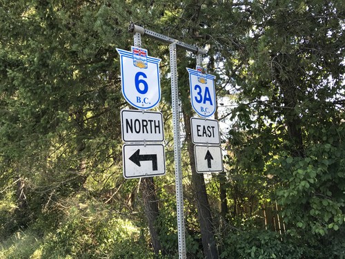
BC-6 South at BC-3A Junction
BC-6 South at BC-3A. Turn right for BC-3A west to Castlegar and Trail; turn left for BC-3A east and BC-6 south to Nelson. BC-6 south joins BC-3A east to Nelson.
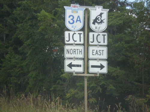
BC-3A East at BC-6 - South Slocan
BC-3A East at BC-6 in South Slocan. Turn left for BC-6 north to Slocan, New Denver, and Nakusp.
BC-6 South at BC-3A Junction
BC-6 South at BC-3A. Turn right for BC-3A west to Castlegar and Trail; turn left for BC-3A east and BC-6 south to Nelson. BC-6 south joins BC-3A east to Nelson.
BC-6 North - Crescent Valley
BC-6 North in Crescent Valley.
Three Forks
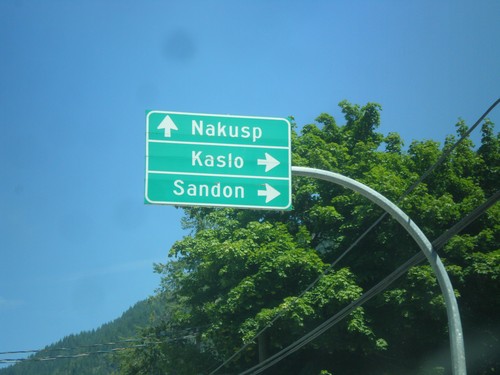
Sandon Road at BC-31A
Sandon Road at BC-31A. Use BC-31A east to Kaslo; west to New Denver.
Yahk
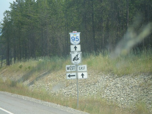
BC-95 North at BC-3
BC-95 north at BC-3 (Crowsnest Highway) west to Creston and Nelson, east to Cranbrook.
BC-95 North at BC-3
BC-95 north approaching BC-3 (Crowsnest Highway).