Mono County, California
Localities: Benton | Benton Hot Springs | Bishop | Bridgeport | Chalfant | Chalfant Valley | Coleville | Dyer | Lee Vining | Mammoth Lakes | Mina | Mono City | Oasis | Sonora Junction | South Landing
Benton
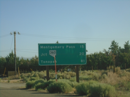
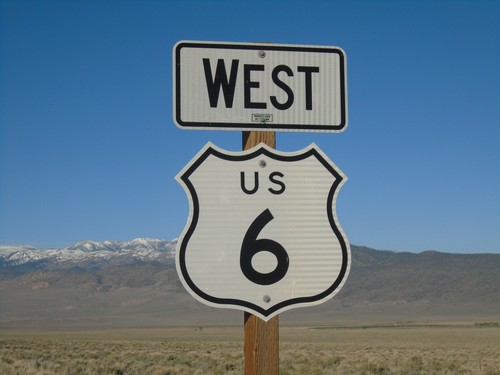
US-6 East - Distance Marker
Distance marker on US-6 east. Distance to Montgomery Pass (NV), Jct NV-360, Tonopah (NV).
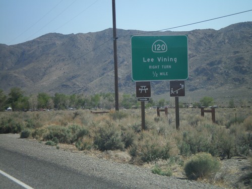
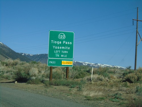
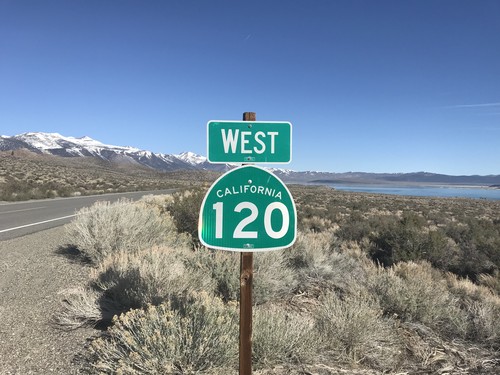
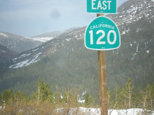
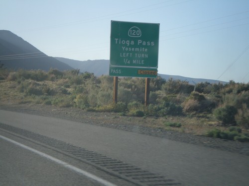
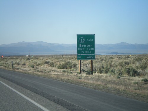
US-6 East at CA-120
US-6 East at CA-120 West in Benton.
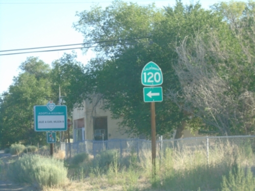
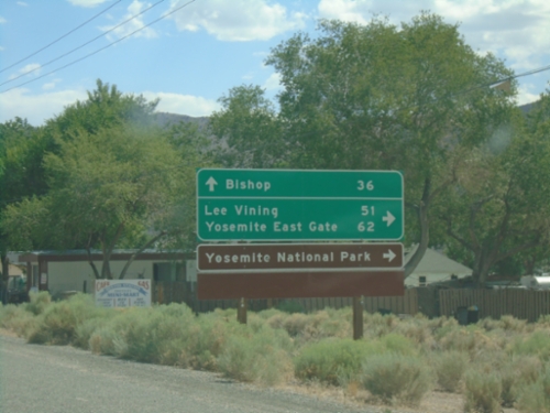
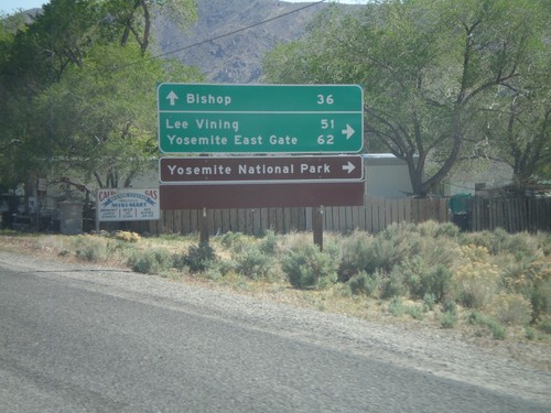
US-6 East Approaching CA-120
US-6 East approaching CA-120 west to Lee Vining, Yosemite East Gate and Yosemite National Park. Continue east on US-6 to Tonopah (Nevada).
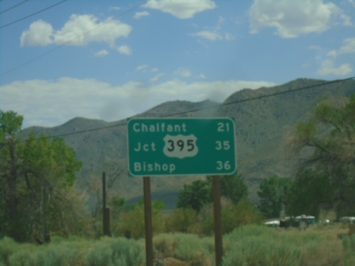
US-6 West - Distance Marker
Distance marker on US-6. Distance to Chaflant, Jct. US-395, and Bishop.
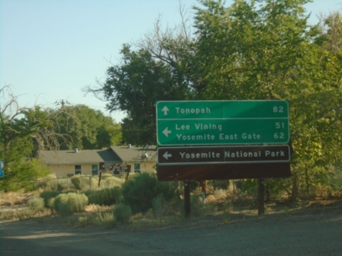
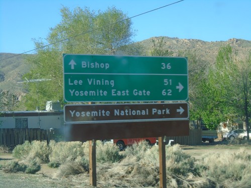
US-6 West at CA-120 West
US-6 West at CA-120 West. Use CA-120 west for Lee Vining, Yosemite East Gate, and Yosemite National Park. Continue west on US-6 for Bishop.

US-6 West Approaching CA-120
US-6 west approaching CA-120 west to Lee Vining.
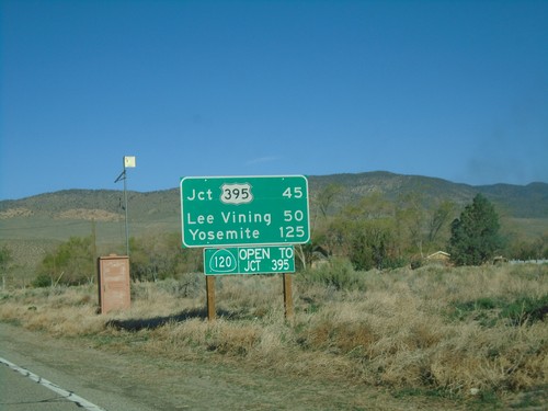
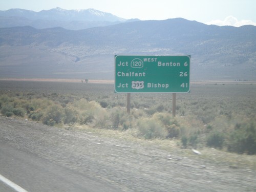
CA-120 West - Distance Marker
Distance marker on CA-120 west. Distance to US-395, Lee Vining, and Yosemite. CA-120 is open to US-395. This stretch of CA-120 is closed during the winter months.
US-6 West at CA-120 West
US-6 West at CA-120 West. Use CA-120 west for Lee Vining, Yosemite East Gate, and Yosemite National Park. Continue west on US-6 for Bishop.
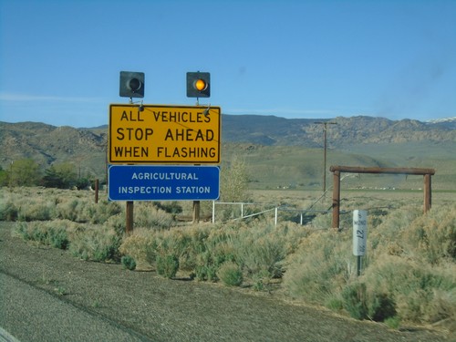
US-6 West - California State Agricultural Inspection
US-6 west approaching the California State Agricultural Inspection Station at Benton. All traffic must stop for inspection.
US-6 West - Mono County
US-6 west in Mono County.
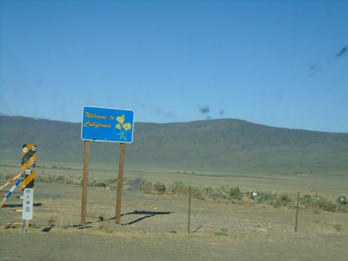
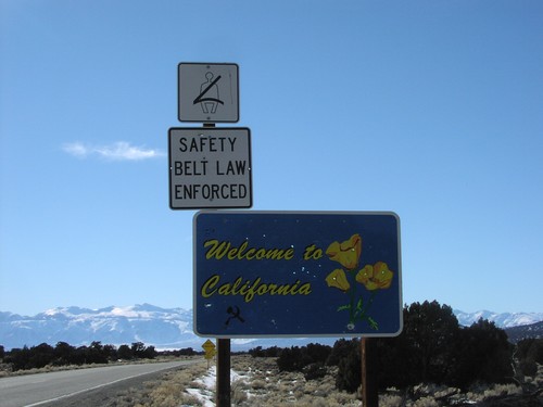
US-6 West - Welcome to California
Welcome to California on US-6 west. Taken at the Nevada-California state line. The cattle guard marks the actual state line.
End CA-120 East at US-6
End CA-120 east at US-6. Use US-6 west for Bishop; US-6 east for Tonopah (Nevada).
US-6 West at CA-120 West
US-6 West at CA-120 West. Use CA-120 west for Lee Vining, Yosemite East Gate, and Yosemite National Park. Continue west on US-6 for Bishop.
US-6 West Approaching CA-120
US-6 west approaching CA-120 west to Lee Vining.
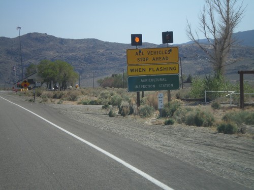
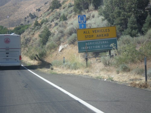
US-6 West - California State Agricultural Inspection
US-6 west approaching the California State Agricultural Inspection Station at Benton. All traffic must stop for inspection. I was waved through on this day.
US-6 West - Distance Marker
Distance marker on US-6 west. Distance to Jct. CA-120 West/Benton, Chalfant, and Jct. US-395/Bishop. This is the first distance marker on US-6 inside of California.
US-6 West - Welcome to California
Welcome to California on US-6 west. Taken at the Nevada-California state line. The cattle guard marks the actual state line.
Benton Hot Springs
CA-120 West at Benton Crossing Road
CA-120 West at Benton Crossing Road in Mono County. Turn left for Benton Cross Road south to Crowley Lake and US-395; continue straight for CA-120 West to Tioga Pass and US-395.
Bishop
US-6 East Approaching CA-120
US-6 East approaching CA-120 East to Lee Vining.
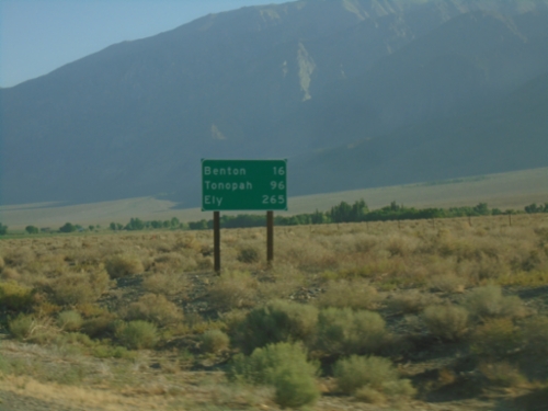
US-6 East - Distance Marker
Distance marker on US-6 east. Distance to Benton, Tonopah (NV), and Ely (NV).
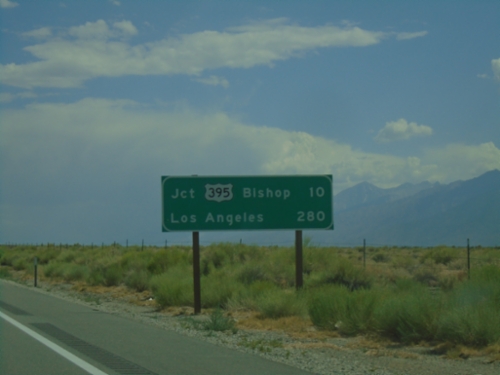
US-6 West - Distance Marker
Distance marker on US-6 west. Distances to Jct. US-395 - Bishop, and Los Angeles.
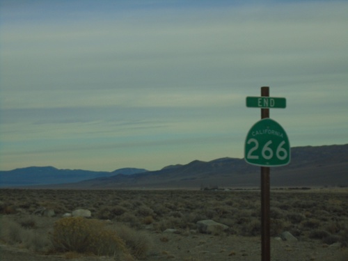
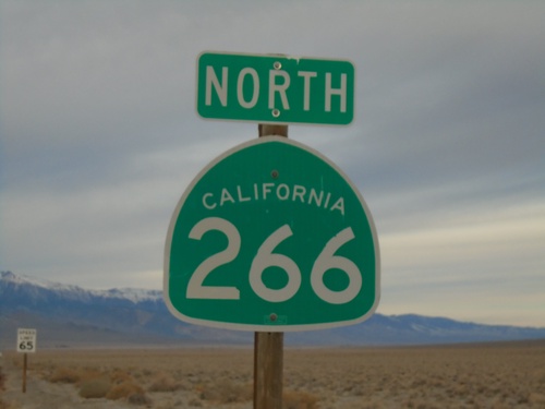
End CA-266 North
End CA-266 north at the California-Nevada State Line. CA-266 continues into Nevada as NV-264.
CA-120 West - Distance Marker
Distance marker on CA-120 west. Distance to Jct. US-395, Lee Vining, and Yosemite.
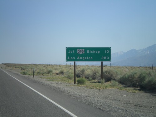
US-6 West - Distance Marker
Distance marker on US-6 west. Distances to Jct. US-395 - Bishop, and Los Angeles.
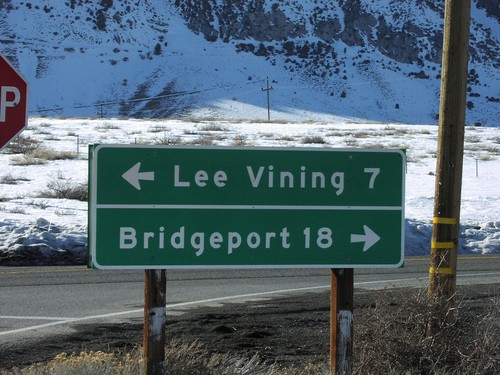
Bridgeport
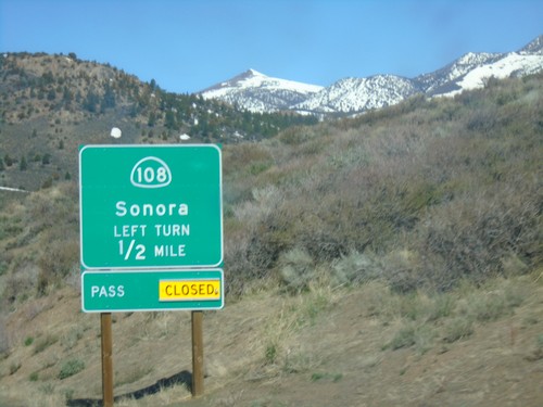
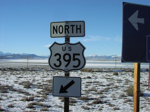
US-395 North Approaching CA-108
US-395 North approaching CA-108/Sonora. Sonora Pass was closed when this picture was taken.
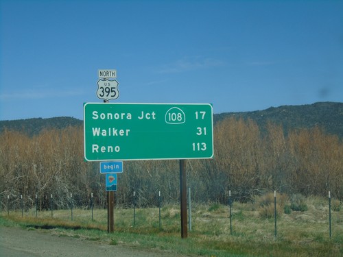
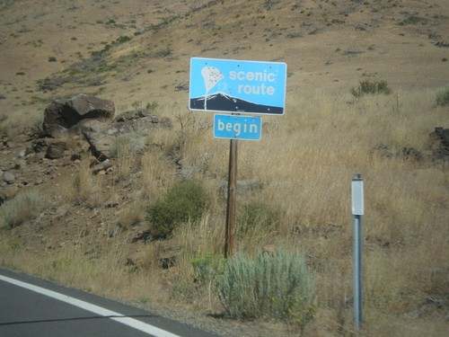
US-395 North - Distance Marker
Distance marker on US-395 north. Distance to Sonora Jct. - CA-108, Walker, and Reno (Nevada). Begin scenic route.
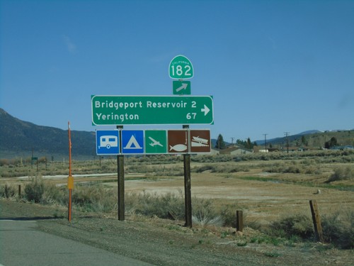
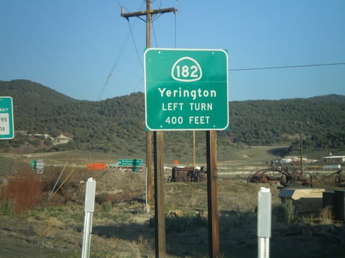
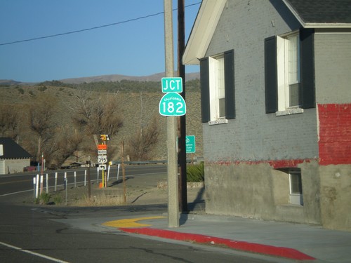
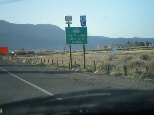
US-395 North at CA-182
US-395 north at CA-182 in Bridgeport. Turn right for Bridgeport Reservoir and Yerington (Nevada).
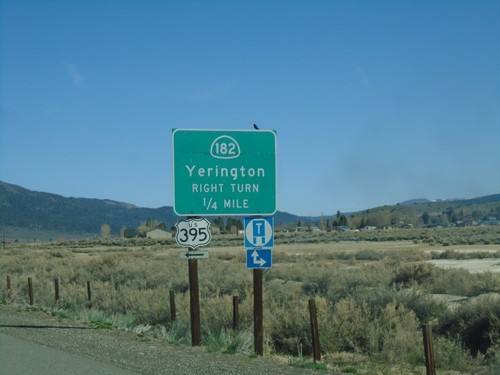
US-395 North Approaching CA-182
US-395 north approaching CA-182 north to Yerrington (Nevada). Turn left to continue north on US-395.
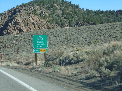
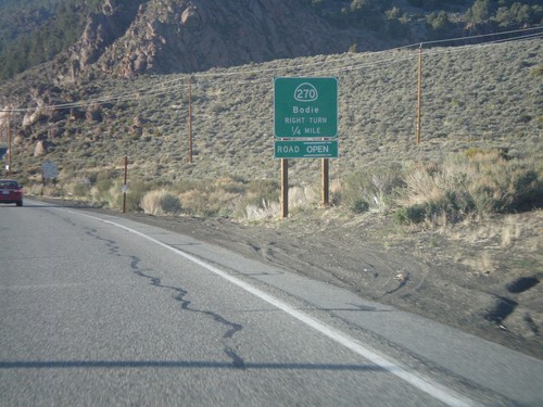
US-395 South Approaching CA-270
US-395 South Approaching CA-270 east to Bodie. CA-270 east was closed at the time this photo was taken.
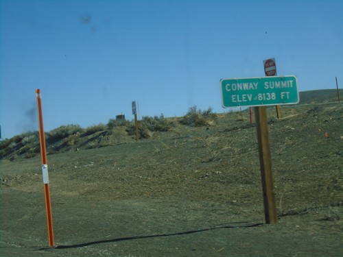
US-395 North - Conway Summit
Conway Summit - Elevation 8138 Feet on US-395 north. Conway Summit is the highest point on US-395.
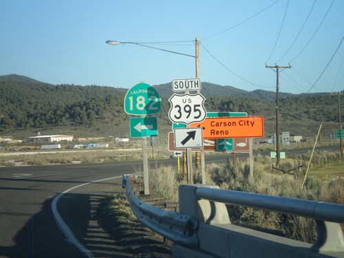
US-395 South at CA-182
US-395 south at CA-182 in Bridgeport. When this picture was taken, US-395 was closed in the evenings north of Bridgeport, so northbound US-395 traffic had to use CA-182 to reach Reno and Carson City, hence the orange directional signs.
US-395 South Approaching CA-182
US-395 south approaching CA-182 north to Yerrington (Nevada).
US-395 South Approaching CA-182
US-395 South approaching CA-182 in Bridgeport.
US-395 North Approaching CA-182
US-395 north approaching CA-182 north to Yerrington (Nevada). Turn left to continue north on US-395.
US-395 South Approaching CA-270
US-395 South Approaching CA-270 east to Bodie.
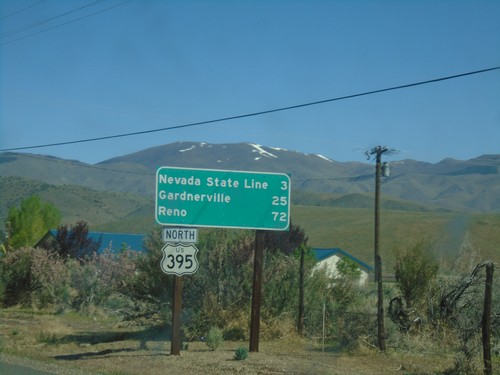
Chalfant
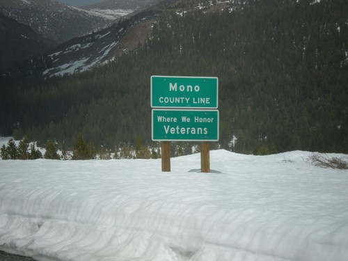
US-6 East - Mono County
Mono County Line on US-6 East.
Chalfant Valley
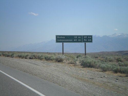
US-6 West - Distance Marker
Distance marker on US-6 west. Distance to Bishop and Independence. This is an older style distance marker which lists distances in miles and kilometers. These dual unit signs are scattered around California, although they tend to be older with button copy lettering.
Coleville
US-395 North - Distance Marker
Distance marker to Nevada State Line, Carson City, and Reno on US-395 north.
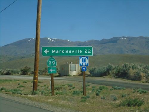
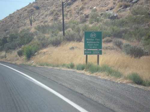
US-395 North at CA-89
US-395 North at CA-89 North. Turn left on CA-89 for Markleeville.
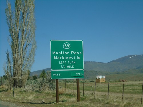
US-395 North Approaching CA-89
US-395 North approaching CA-89 to Markleeville and Monitor Pass. Monitor Pass was open when this picture was taken.
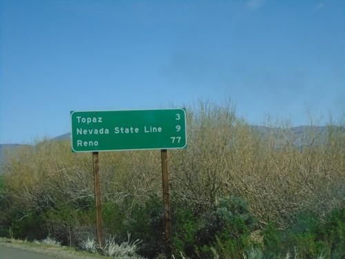
US-395 North - Distance Marker
Distance marker on US-395 north. Distance to Topaz, Nevada State Line, and Reno (Nevada).
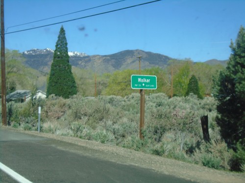
US-395 North - Walker
Entering Walker on US-395 north.
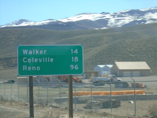
US-395 North - Distance Marker
Distance maker on US-395 north. Distance to Walker, Coleville, and Reno (Nevada).
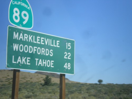
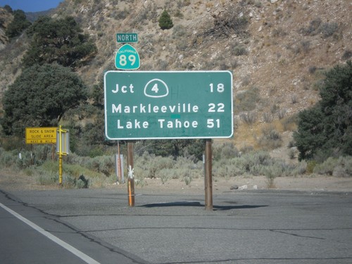
CA-89 North - Distance Marker
Distance marker on CA-89 north. Distance to Markleeville, Woodfords, and Lake Tahoe.
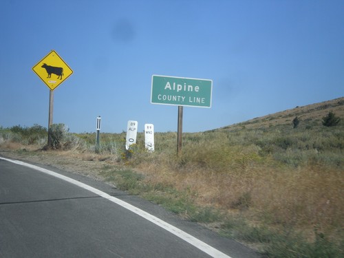
CA-89 North - Alpine County Line
Alpine County Line on CA-89 north. Open range.
CA-89 North - Begin Scenic Route
Begin Scenic Route on CA-89 north.
CA-89 North - Distance Marker
First distance marker on CA-89 north. Distance to CA-4 Jct., Markleeville, and Lake Tahoe.
US-395 South - Sierra Pass Information
Sierra pass closure information on US-395 south. Information for Sonora Pass (CA-108) and Tioga Pass (CA-120). At the time this photo was taken both passes were open.
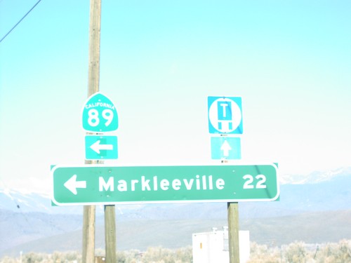
US-395 North at CA-89 North
US-395 south at CA-89 north to Markleeville. This is the southern end of CA-89.
US-395 South at CA-89
US-395 south at CA-89 North to Markleeville and Monitor Pass. Monitor Pass was open when this was taken. This is the southern end of CA-89.
US-395 South - California Agricultural Inspection Station
US-395 South approaching California Agricultural Inspection - Topaz Border Station. All southbound traffic must stop for inspection.
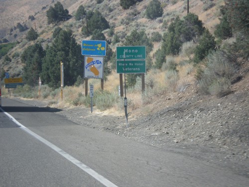
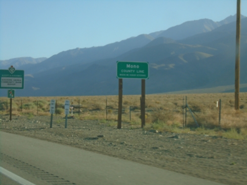
US-395 South - Welcome To California
Welcome to California / Mono County Line on US-395 south.
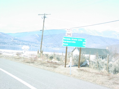
US-395 North - Distance Marker
Distance marker to Nevada, Carson City, and Reno on US-395 north in Topaz.
US-395 North at CA-89 North
Distance marker to Markleeville on US-395 north at CA-89 junction in Topaz. This is the southern end of CA-89.
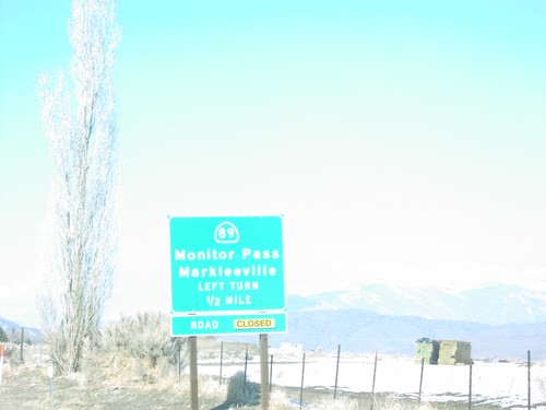
US-395 South at CA-89
US-395 north at CA-89 junction to Markleeville and Monitor Pass in Topaz. Monitor Pass is closed when this was taken.
Dyer
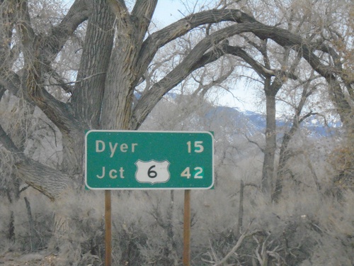
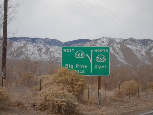
CA-266 North - Distance Marker
Distance marker on CA-266 north. Distance to Dyer (Nevada) and US-6 junction.
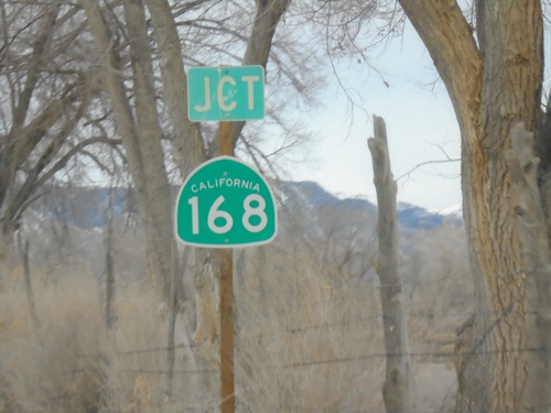
CA-266 North Approaching CA-168
CA-266 North approaching CA-168 in Mono County.
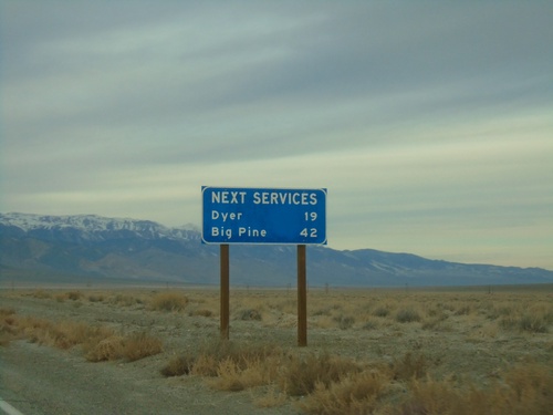
CA-266 North - Next Services
Distance to next services on CA-266 north. Dyer (Nevada) - 19 Miles. Big Pine (via CA-168) - 42 Miles.
CA-266 North - Mono County
CA-266 north in Mono County. Speed Limit 65 MPH.
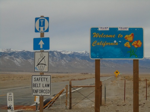
Welcome To California - CA-266 North
Welcome To California on CA-266 North. Taken at the Nevada-California State line. The mile marker for NV-266 is in the foreground. The state line is at the cattle guard.
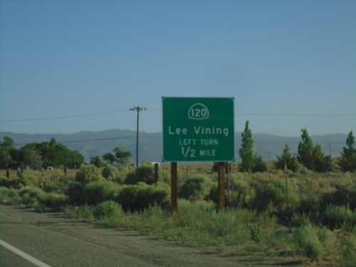
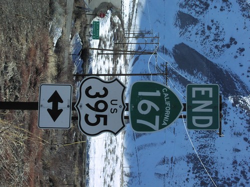
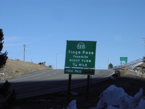
Lee Vining
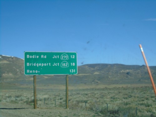
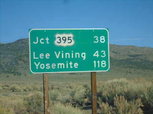
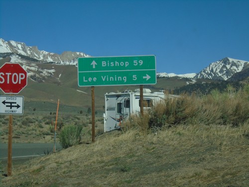
US-395 North - Distance Marker
Distance marker on US-395 north. Distance to Bodie Road - Jct. CA-270, Bridgeport - Jct. CA-182, and Reno (Nevada).
US-395 North Approaching CA-120
US-395 north approaching CA-120 east to Tioga Pass and Yosemite. Tioga Pass is closed when this picture was taken.
CA-120 West at US-395 North
CA-120 West at US-395 North in Mono County. Turn left (across the divided highway) for US-395 south to Bishop; left for US-395 north to Lee Vining. CA-120 west joins US-395 north to Lee Vining.
CA-120 West at US-395
CA-120 West at US-395 junction. Turn right for US-395 North/CA-120 West. CA-120 west joins US-395 north to Lee Vining.
CA-120 West at US-395
CA-120 West at US-395 in Mono County. Turn left for US-395 south to Bishop; left for US-395 north/(CA-120 west) to Lee Vining. CA-120 west joins US-395 north to Lee Vining.
CA-120 West - Mono County
CA-120 west in Mono County. Mono Lake is in the background of the photo.
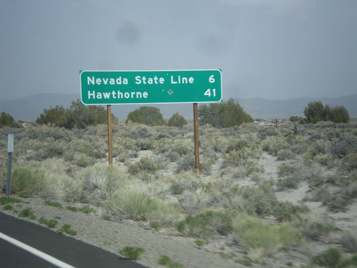
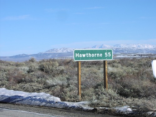
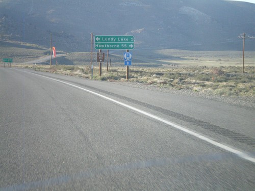
CA-167 East - Distance Marker
Distance marker on CA-167 east. Distance to Nevada State Line and Hawthorne (Nevada).
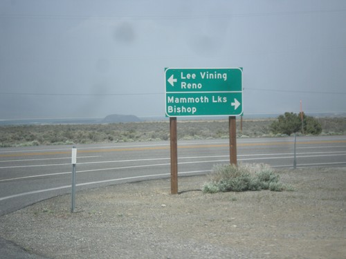
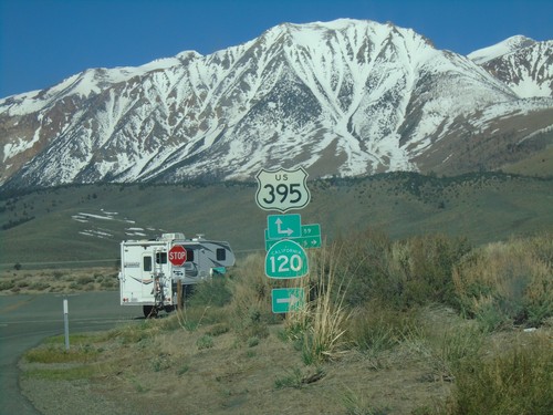
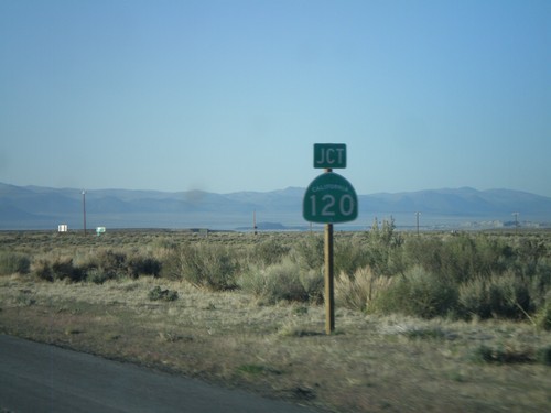
CA-120 East at US-395
CA-120 east at US-395. Turn right for US-395 south to Bishop and Mammoth Lakes. Turn left for US-395 north to Lee Vining and Reno. Turn right to continue east on CA-120.
CA-120 East at US-395
CA-120 east at US-395. Turn right for US-395 north to Lee Vining; left for US-395 south to Bishop. Turn right on US-395 to continue east on CA-120.
CA-120 East - Mono County Line
Mono County Line on CA-120 east at Tioga Pass.
CA-120 East - Tioga Pass
First CA-120 shield after leaving Yosemite National Park at Tioga Pass.
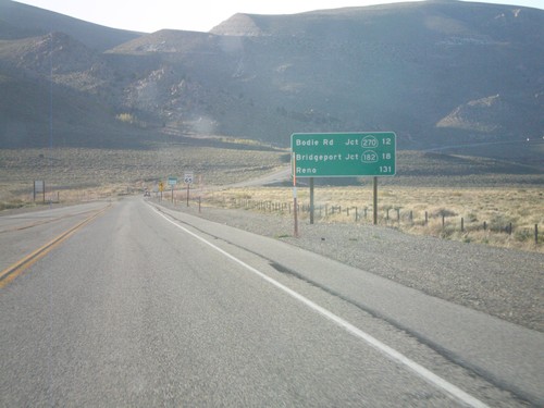
US-395 North - Distance Marker
Distance marker on US-395 north. Distance to Bodie Road - Jct. CA-270, Bridgeport - Jct. CA-182, and Reno (Nevada).
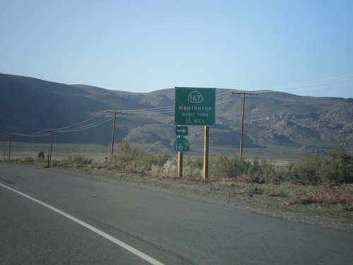
US-395 North Approaching CA-167
US-395 north approaching CA-167 east to Hawthorne (Nevada).
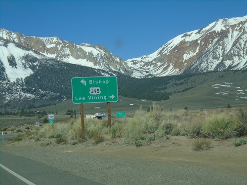
US-395 North Approaching CA-120
US-395 north approaching CA-120 east to Tioga Pass and Yosemite. Tioga Pass was opened the day after this picture was taken.
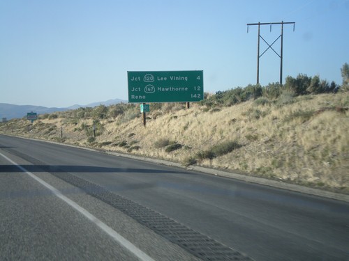
US-395 North - Distance Marker
Distance marker on US-395 north. Distance to Jct. CA-120 in Lee Vining, Jct. CA-160 to Hawthorne, and Reno.
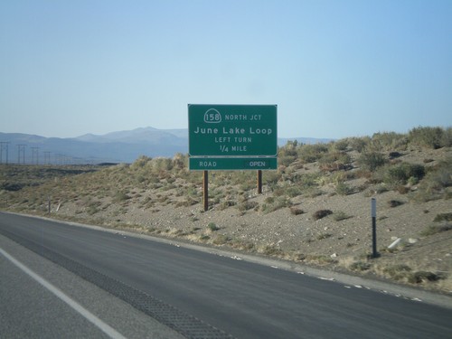
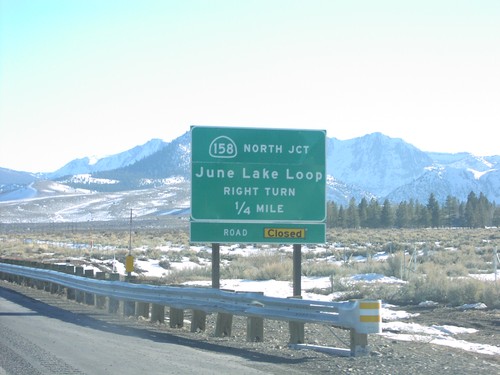
US-395 North Approaching CA-158
US-395 North Approaching CA-158 - June Lake Loop (north end).
US-395 North At CA-120 East
US-395 north at CA-120 east. CA-120 west joins US-395 north to Lee Vining.
US-395 North Approaching CA-120 East
US-395 North Approaching CA-120 East to Benton. CA-120 west joins US-395 north to Lee Vining.
Distance Marker On CA-167 East
Distance marker to Hawthorne (NV) just east of US-395 junction
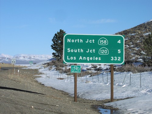
Distance Marker on US-395 South
Distance marker to CA-158 (June Lake)/CA-203 (Mammoth Lakes)/Los Angeles, just south of CA-120 east
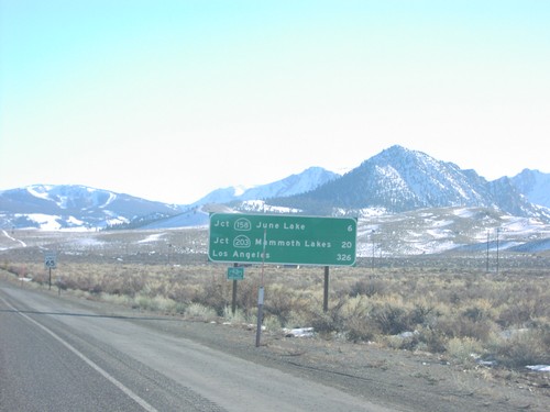
Distance Marker on US-395 South
Distance marker to CA-158 (North), CA-120 East, and Los Angeles, just south of CA-120 West
End CA-167 West at US-395
Western end of CA-167 at US-395 to Lee Vining and Bridgeport
End CA-167 West at US-395
End CA-167 at US-395
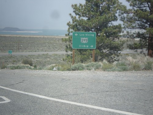
US-395 South CA-120 West
US-395 south at CA-120 west to Tioga Pass/Yosemite
US-395 South CA-158 Jct.
CA-158 junction (north) to June Lake
Mammoth Lakes
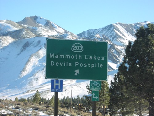
US-395 South at CA-203
CA-203/Devils Postpile/Mammoth Lakes exit on US-395 south
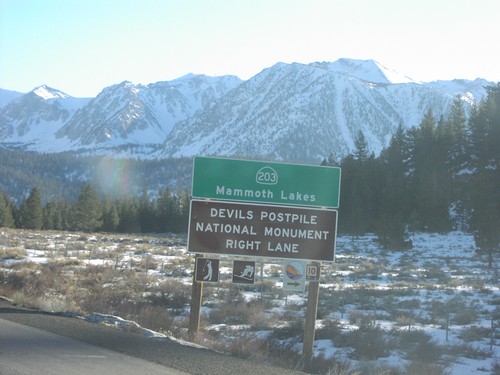
US-395 South at CA-203
CA-203 to Mammoth Lakes and Devils Postpile National Monument, right lane
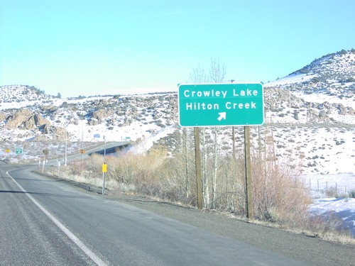
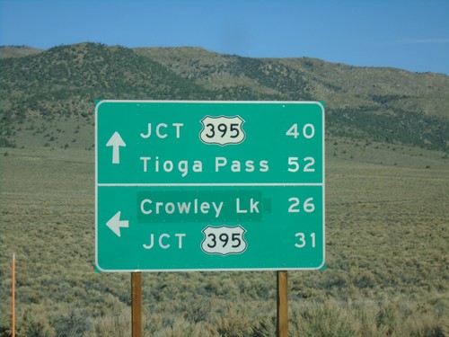
US-395 South at Crowley Lake
Crowley Lake/Hilton Creek exit on US-395 south
Mina
CA-167 West at NV/CA Stateline
First SR-167 assurance marker after Nevada border
Welcome To California - CA-167 West
Welcome to California at Nevada border
Mono City
US-395 North at CA-167
US-395 north at CA-167 east to Hawthorne (Nevada). Turn left for Lundy Lake.
Oasis
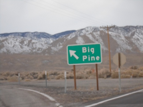
CA-266 North at CA-168 West
CA-266 North at CA-168 West to Big Pine. The White Mountains are in the background.
CA-266 North Approaching CA-168
CA-266 North approaching CA-168 in Mono County. Use CA-168 West to Big Pine; continue north on CA-266 for Dyer (Nevada).
Sonora Junction
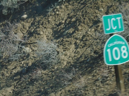
US-395 North Approaching CA-108
US-395 North approaching CA-108 - Mono County.
South Landing
US-395 Entrance at Crowley Lake
US-395 freeway entrance at Crowley Lake IC