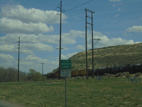
Bannock County, Idaho
Localities: Arimo | Chubbuck | Downey | Lava Hot Springs | McCammon | Pocatello | Red Rock Junction | Swanlake | Virginia
Arimo
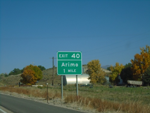
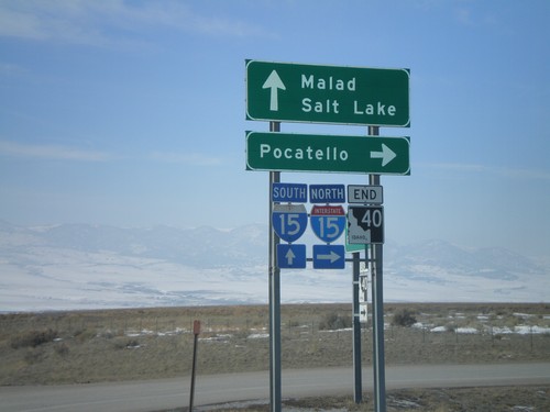
I-15 North - Exit 40
I-15 north approaching Exit 40 - Arimo.
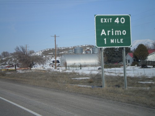
I-15 North - Exit 40
I-15 north approaching Exit 40 - Arimo.
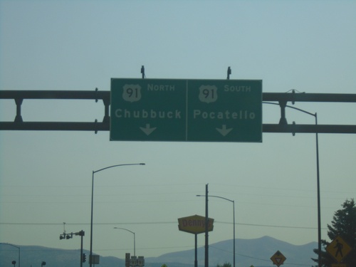
Chubbuck
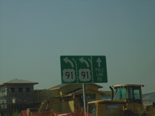
US-91 South at Pole Line Road
US-91 South at Pole Line Road. Merge left to continue south on US-91.
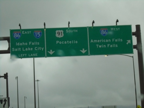
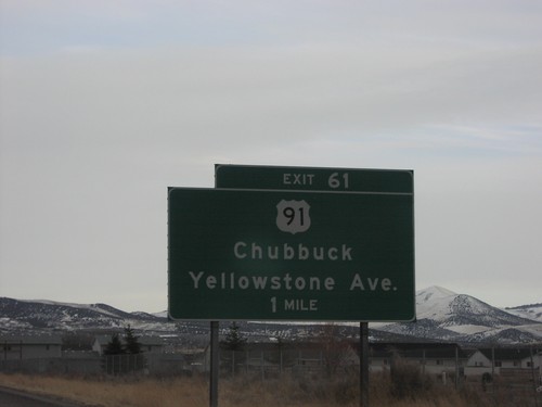
US-91 South at I-86
US-91 south at I-86 (Exit 61). Merge right for I-86 West to American Falls and Twin Falls. Use I-86 East/To I-15 for Idaho Falls and Salt Lake City (Utah). Continue south on US-91 for Pocatello.
Northgate Parkway West at I-15 South
Northgate Parkway West at I-15 South to Salt Lake City (Utah).
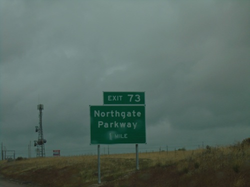
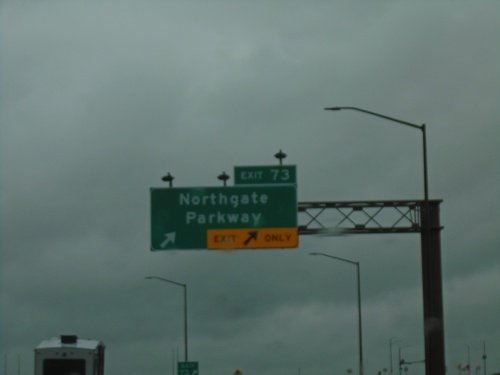
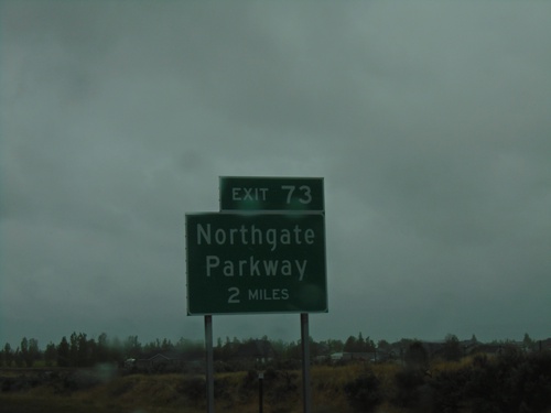
I-15 North - Exit 73
I-15 north approaching Exit 73 - Northgate Parkway.
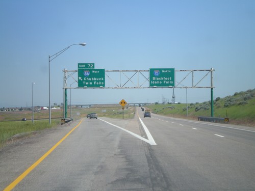
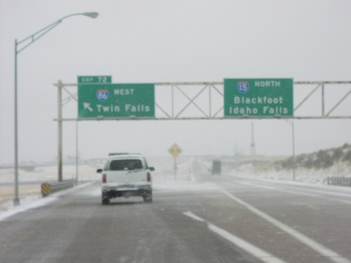
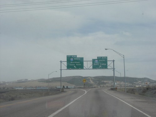
I-15 South - Exit 72
I-15 south approaching Exit 72 - I-86 West/Chubbuck/Twin Falls. Continue south on I-15 for Pocatello and Salt Lake (Utah).
I-15 South - Exit 72
I-15 south approaching Exit 72 - I-86 West Junction.
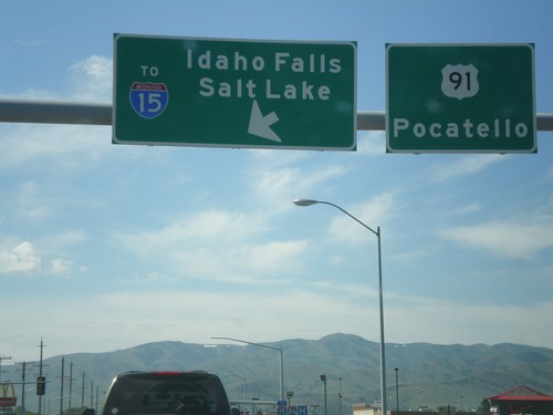
US-91 South at I-86 East (To I-15)
US-91 south at I-86 (Exit 61) onramp. Turn left on I-86 for Idaho Falls, and Salt Lake City via I-15.
US-91 South at I-86 East (To I-15)
US-91 south at I-86 (Exit 61) onramp. Turn left on I-86 for Idaho Falls, and Salt Lake City via I-15.
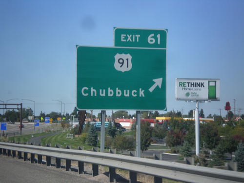
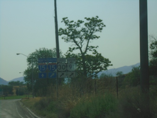
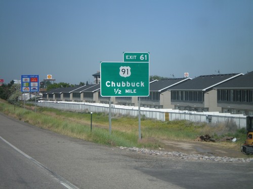
I-86 West - Exit 61
I-86 west at Exit 61 - US-91/Chubbuck.
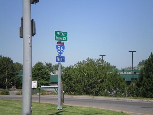
I-86 West - Freeway Entrance
I-86 west onramp at Exit 61. The Freeway Entrance type sign assembly is not common in Idaho.
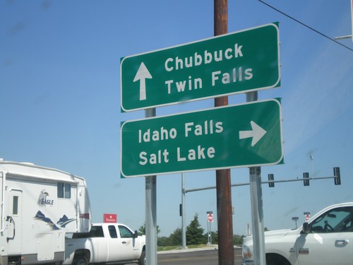
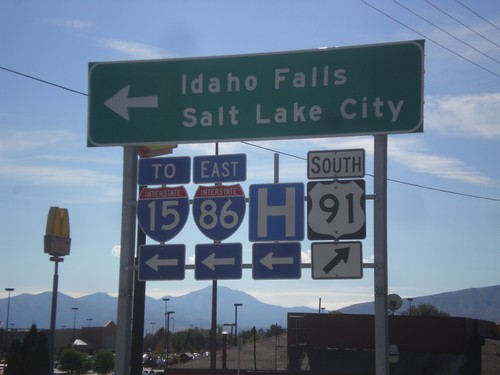
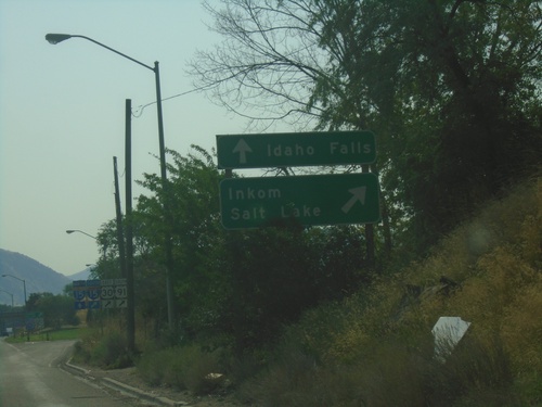
US-91 North at I-86
US-91 north at I-86 (Exit 61) onramp. Turn right on I-86 for Idaho Falls and Salt Lake. Continue over overpass for I-86 west to Twin Falls. US-91 continues north to Chubbuck.
US-91 South at I-86 East (To I-15)
US-91 south at I-86 east (To I-15). Use I-86 east for Idaho Falls and Salt Lake. Continue south on US-91 for Pocatello. I-86 east ends at I-15 just east of here.
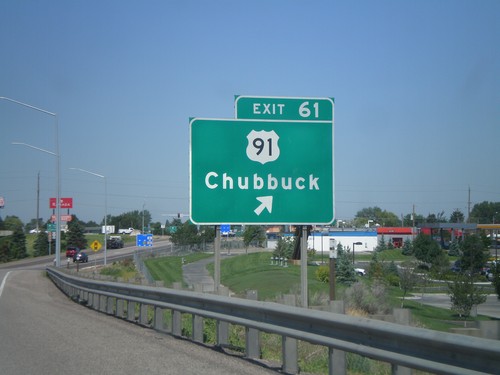
I-86 West - Exit 61
I-86 west at Exit 61 - US-91/Chubbuck.
I-86 East - Pocatello Exits Use I-15 South
Use I-15 south for Pocatello Exits on I-86 east.
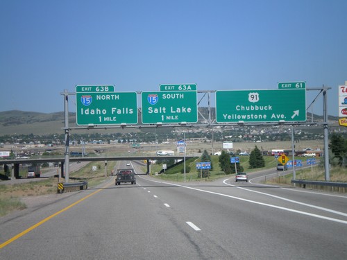
I-86 East Exit 61/Exit 63
I-86 east at Exit 61, US-91/Chubbuck/Yellowstone Ave., approaching Exit 63AB - I-15/Idaho Falls/Blackfoot/Salt Lake, 1 mile.
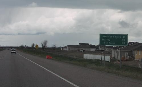
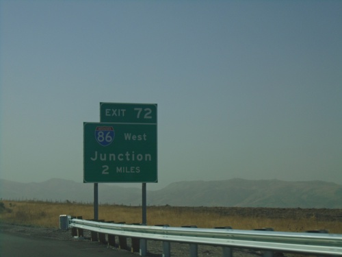
I-86 West - Distance Marker
Distance marker on I-86 west. Distance to American Falls, Burley, and Twin Falls.
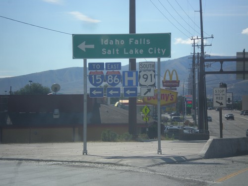
US-91 South Approaching I-86
US-91 south approaching I-86. Use I-86 east for I-15.
US-91 South at I-86
US-91 south at I-86 west to American Falls and Twin Falls. Continue south on US-91 for Pocatello.
Downey
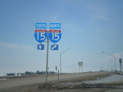
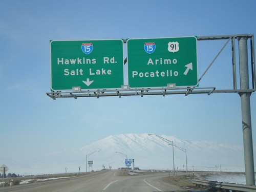
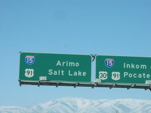
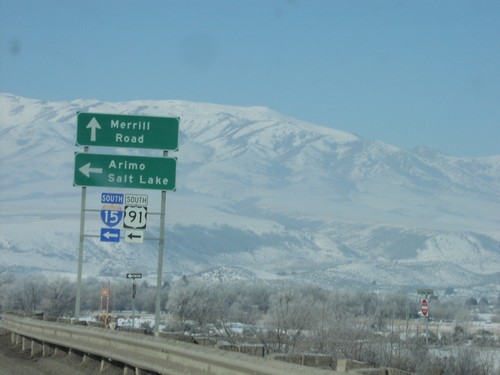
US-91 North At I-15
US-91 north approaching I-15. I-15/US-91 north to Arimo and Pocatello. Continue over overpass for I-15 South to Salt Lake (Utah) and Hawkins Road. US-91 north joins I-15 north to Pocatello.
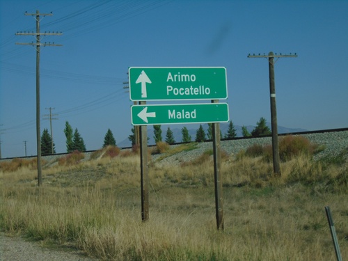
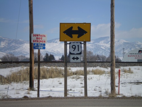
US-91 North at ID-40 West
US-91 north at ID-40 west to Malad. Continue north on US-91 for Arimo and Pocatello.
US-91 North Approaching ID-40 West
US-91 North approaching ID-40 West. Continue north on US-91 for I-15 North; use ID-40 west for I-15 south.
US-91 North at Oxford Highway
US-91 North at Oxford Highway in Bannock County. The intersection is located at Red Rock Pass which was the site of an ancient dam on prehistoric Lake Bonneville. The erosion of this dam created the catastrophic Bonneville Floods which affected much of the Snake River plain of Idaho.
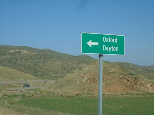
US-91 North Approaching Oxford Highway
US-91 North approaching Oxford Highway south to Oxford and Dayton.
US-91 North at I-15 Ramp
US-91 north at I-15 onramp. Merge right for I-15 north - continue straight for I-15 south.
US-91 North At I-15
US-91 north approaching I-15. US-91 north joins I-15 here. I-15/US-91 north to Arimo and Pocatello. Continue over overpass for I-15 South to Salt Lake and Hawkins Road.
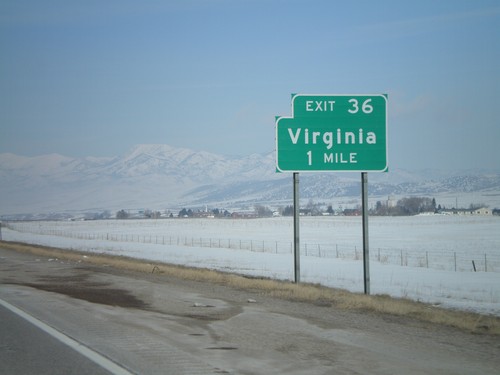
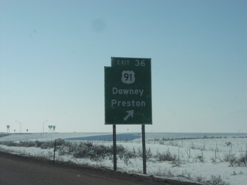
I-15 North - Exit 36
I-15 north approaching Exit 36 - Virginia.
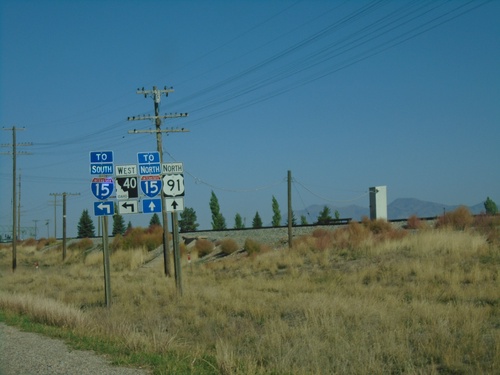
End ID-40 West at I-15
End ID-40 west at I-15 - north to Pocatello, south to Malad and Salt Lake.
Jct. I-15 on ID-40 West
ID-40 west approaching I-15.
US-91 North at ID-40 West
US-91 north at ID-40 west. Use ID-40 west for I-15 south. Use US-91 north for I-15 north.
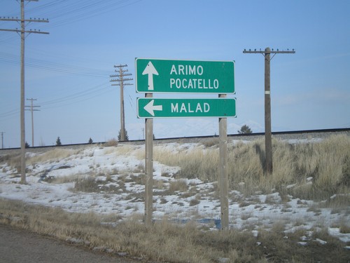
US-91 North at ID-40 West to Malad
US-91 north to Arimo and Pocatello at ID-40 west to Malad.
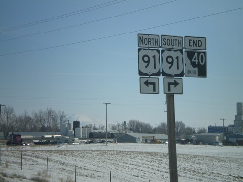
End ID-40 East at US-91
End ID-40 east at US-91.
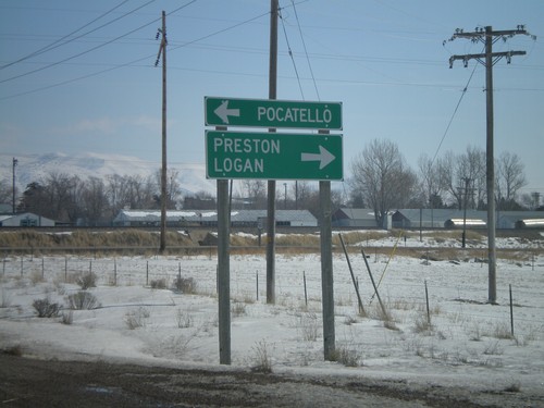
End ID-40 East at US-91
End ID-40 east at US-91 north to Pocatello - and US-91 south to Preston and Logan (Utah)
End ID-40 at US-91
End ID-40 east at US-91.
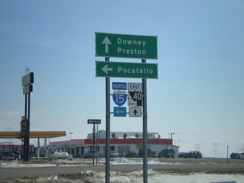
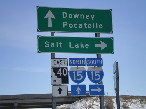
ID-40 East at I-15 North
ID-40 east to Downey and Preston at I-15 north to Pocatello.
Begin ID-40 East at I-15
Begin ID-40 east at I-15 south to Salt Lake.
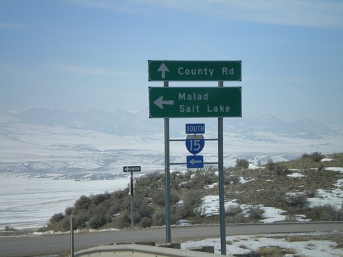
End ID-40 West at I-15 South
End ID-40 west at I-15 south to Malad and Salt Lake.
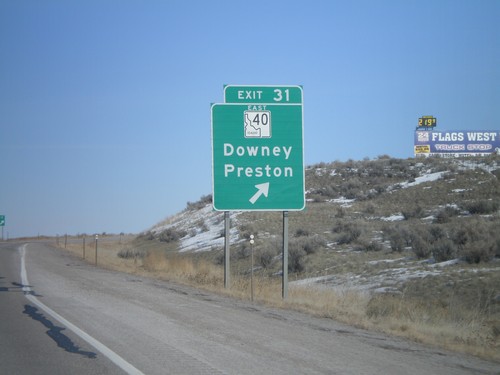
I-15 North - Exit 31
I-15 north at Exit 31 - ID-40 East/Downey/Preston.

I-15 North - Exit 31
I-15 north approaching Exit 31 - ID-40 East/Downey/Preston.
Lava Hot Springs
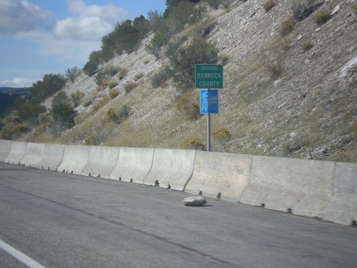
US-30 West - Bannock County
Entering Bannock County on US-30 west.
McCammon
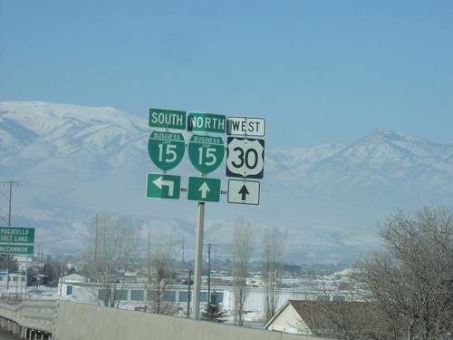
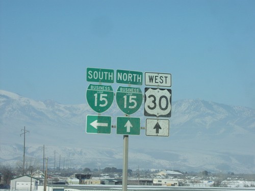
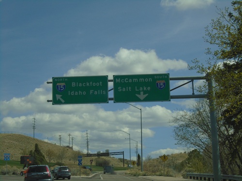
I-15 North - Exit 47
I-15 north at Exit 47 - US-30 East/Lava Hot Springs/Soda Springs/Montpelier. US-30 west joins I-15 and US-91 north to Pocatello.
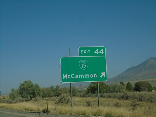
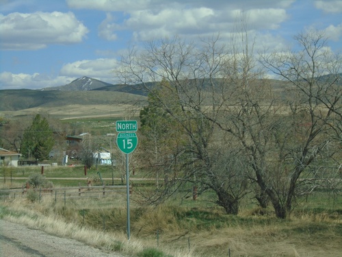
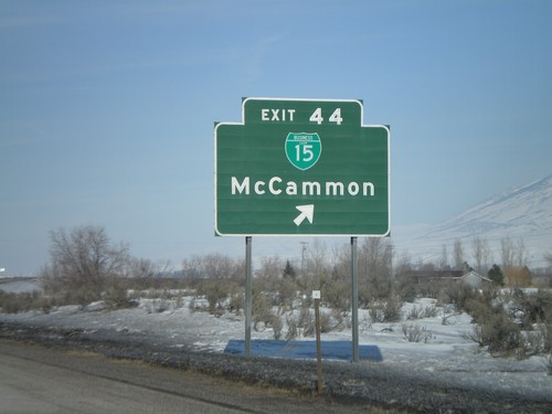
I-15 North - Exit 44
I-15 north at Exit 44 - BL-15/McCammon
BL-15 North at Old US-91
BL-15 North at Old US-91 in Bannock County. Turn left on Old US-91 to continue north on BL-15 to McCammon and Lava Hot Springs.
BL-15 North - Distance Marker
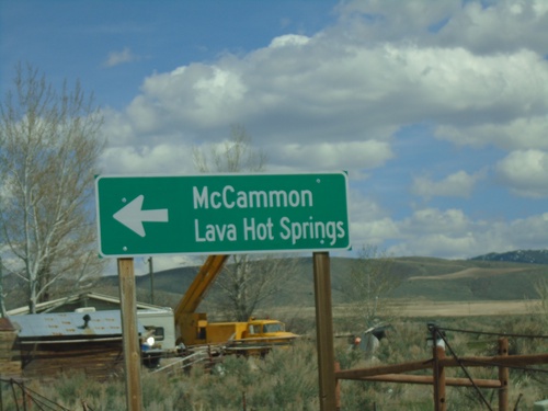
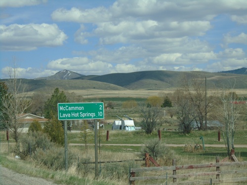
Distance marker on BL-15 north. Distance to McCammon and Lava Hot Springs (via US-30).
BL-15 North - Bannock County
BL-15 (McCammon) North in Bannock County.
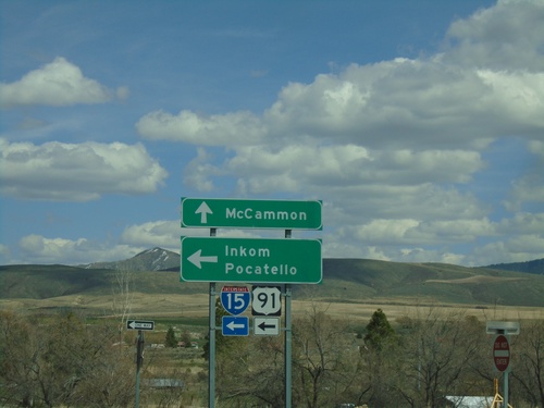
Jensen Road/BL-15 North at I-15/US-91 North (Exit 44)
Jensen Road/BL-15 North at I-15/US-91 North (Exit 44) in McCammon. Use I-15/US-91 North to Inkom and Salt Lake. Continue north on BL-15 for McCammon.
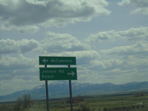
I-15/US-91 Exit 44 Onramp
I-15/US-91 Exit 44 offramp at BL-15/Jensen Road. Turn left for BL-15 North to McCammon; right for Jenson Road to Robin.
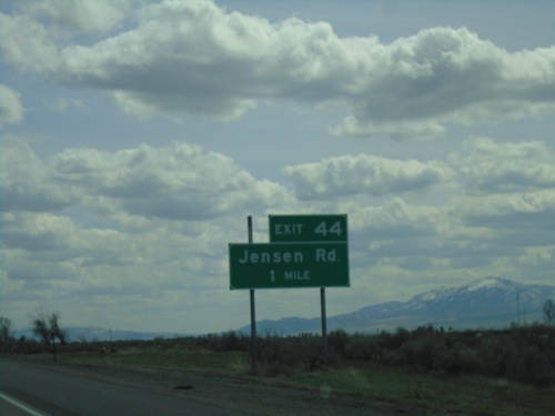
I-15 South - Exit 44
I-15 south approaching Exit 44 - Jensen Road.
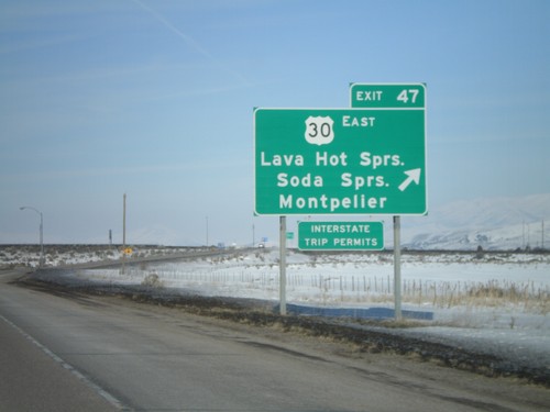
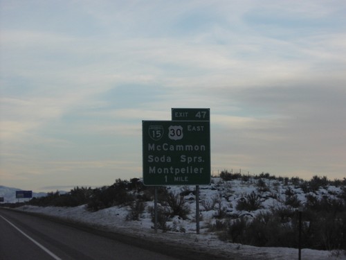
I-15 South - Exit 47
I-15 south at Exit 47 - US-30/McCammon/Soda Springs/Montpelier. US-30 eastbound leaves I-15 southbound here. This is the northern end of the McCammon business loop.
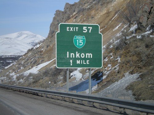
I-15 North - Exit 57
I-15 north approaching Exit 57 - BL-15/Inkom.
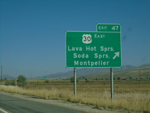
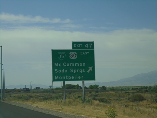
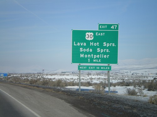
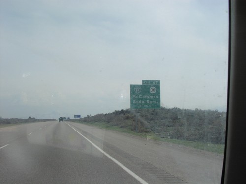
I-15 North - Exit 47
I-15 north at Exit 47 - US-30 East/Lava Hot Springs/Soda Springs/Montpelier. US-30 west joins I-15 north to Pocatello.
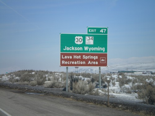
I-15 North - Use US-30/ID-34 for Jackson,WY
I-15 north approaching Exit 47. Use US-30 East and ID-34 North for Jackson, Wyoming. Access to Lava Hot Springs Rec. Area.
I-15 North - Exit 47
I-15 north approaching Exit 47 - US-30 East/Lava Hot Springs/Soda Springs/Montpelier
I-15 North - Exit 44
I-15 north at Exit 44 - BL-15/McCammon
I-15 South Exit 47
I-15 south at Exit 47, US-30 to Soda Springs
US-30 West Approaching I-15/US-91
US-30 west approaching I-15/US-91 junction in McCammon.
US-30 West at BL-15 South
BL-15 shields on US-30 west approaching BL-15 junction in McCammon.
US-30 West at BL-15 South
BL-15 shields at US-30 west at BL-15 junction in McCammon.
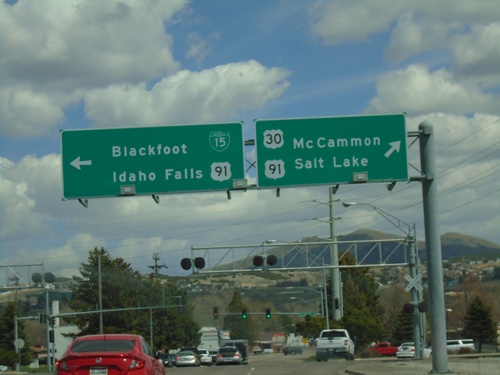
US-30 West at I-15/US-91
I-15/US-91 south to Arimo and Salt Lake, and I-15/US-91 North/US-30 West to Inkom and Pocatello.
US-30 West at I-15/US-91 South
I-15/US-91 south to Arimo and Salt Lake on US-30 west, McCammon.
I-15 South Exit 47
BL-15/US-30/McCammon/Soda Springs Exit 47 on I-15 South
I-15/US-91 Exit 44 Onramp
I-15/US-91 freeway entrance at Exit 44 - Jensen Road (southbound) and BL-15/McCammon (northbound).
Pocatello
I-15 North at I-86 West
I-15 North at I-86 West to Twin Falls. Continue north on I-15 to Idaho Falls.
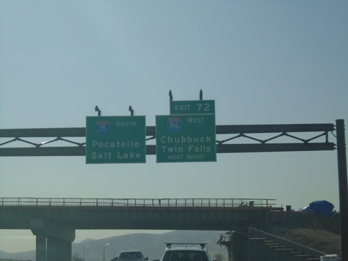
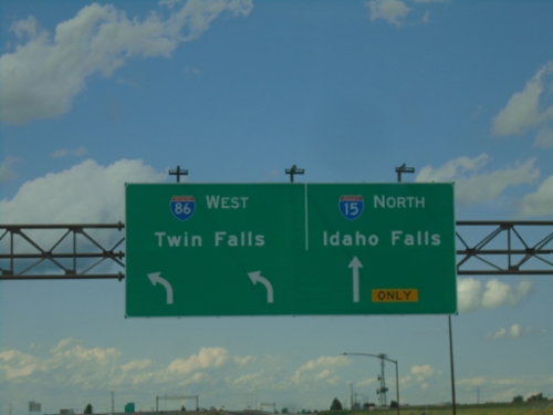
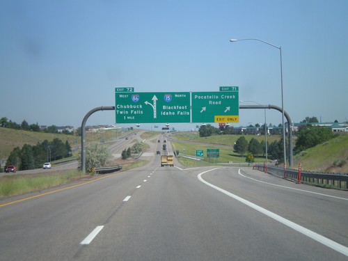
I-15 North at Exit 72
I-15 north at Exit 72 - I-86 West/Twin Falls. Continue north on I-15 to Idaho Falls.
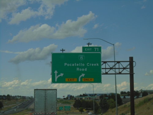
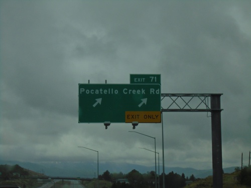
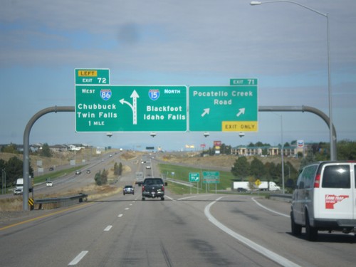
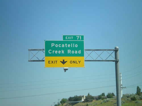
I-15 North - Exits 71
I-15 north at Exit 71 - BL-15/Pocatello Creek Road.
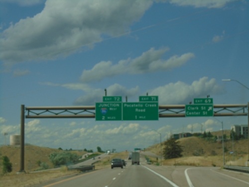
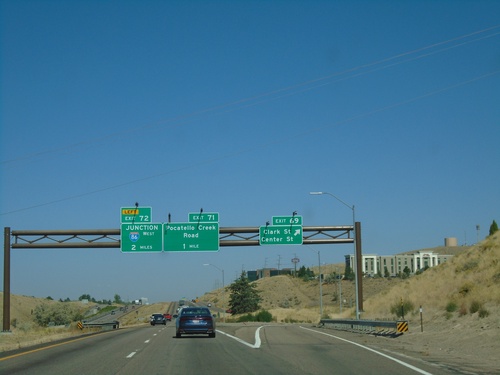
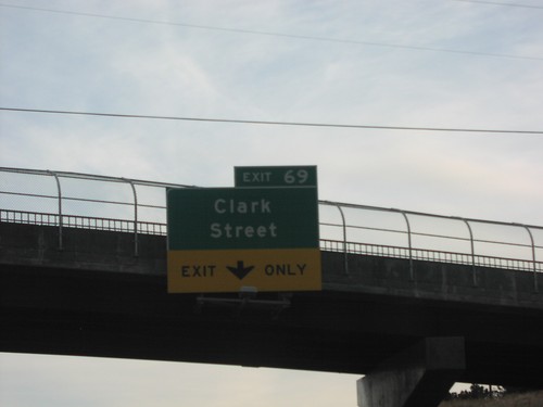
I-15 North - Exits 69, 71, and 72
I-15 north at Exit 69 - Clark St./Center St. Approaching Exit 71 - Pocatello Creek Road, and Exit 72 - Junction I-86 West.
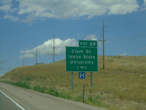
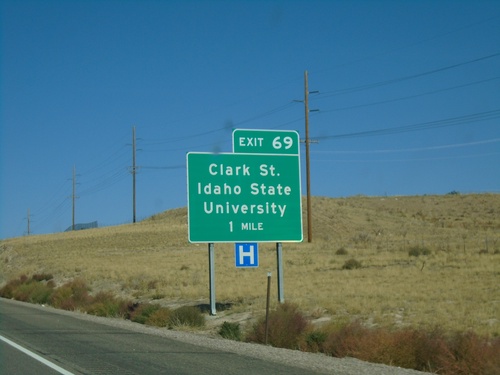
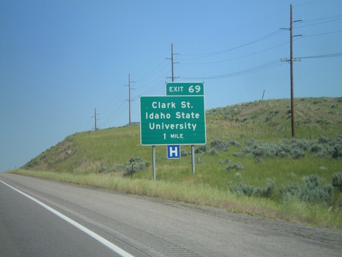
I-15 North - Exit 69
I-15 north approaching Exit 69 - Clark St./Idaho State University.
BL-15 South (S 5th Ave) at I-15 North
BL-15 South (S 5th Ave) at I-15 North in Pocatello.
BL-15 South (S 5th Ave) at I-15 North
BL-15 South (S 5th Ave) at I-15 North in Pocatello. Use I-15 north to Blackfoot and Idaho Falls. This is the southern end of the Pocatello business loop.
S 5th Ave. South Approaching I-15 North
S 5th Ave. South (BL-15) approaching I-15 North to Blackfoot and Idaho Falls.
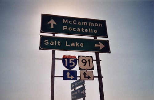
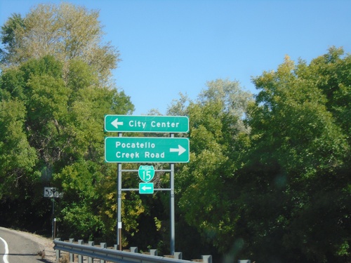
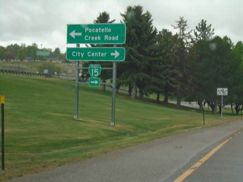
S 5th Ave North at I-15 South
S 5th Ave North at I-15 South in Pocatello. Turn left for I-15/US-91 South/US-30 East to Inkom and Salt Lake. Continue straight for BL-15/US-91 North/US-30 West to (Pocatello) City Center.
US-91/US-30/BL-15 South at I-1
US-91/US-30/BL-15 south at I-15/US-30/US-91 to McCammon and Salt Lake (UT). US-91 joins I-15 south to Virginia. US-30 joins I-15 south to McCammon. Continue under freeway for I-15 north.
US-91/US-30/BL-15 South at I-15
US-91/US-30/BL-15 South at I-15 in Pocatello. Merge right for I-15/US-91 South/US-30 East. Continue under freeway for I-15 North.
US-91/US-30/BL-15 South at I-15
US-91/US-30/BL-15 south at I-15/US-30/US-91 south to Inkom and Salt Lake (UT). Use I-15 north to Idaho Falls. US-91 joins I-15 south to Virginia. US-30 joins I-15 south to McCammon.
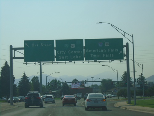
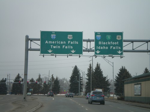
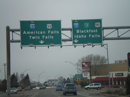
BL-15/US-91 South at US-30
BL-15/US-91 South at US-30 in Pocatello. Turn right for US-30 West/To I-86/Twin Falls/American Falls. Continue straight for US-30 East/US-91 South/BL-15 South/(Pocatello) City Center/Salt Lake. Turn left for Oak St.
US-91/BL-15 South Approaching US-30
US-91/BL-15 South (Yellowstone Ave.) approaching US-30 (Oak St.) in Pocatello. Use US-30 west for I-86, American Falls, and Twin Falls. Continue south for BL-15/US-91/US-30 East to (Pocatello) City Center and Salt Lake (UT). US-30 east joins BL-15/US-91 southbound.
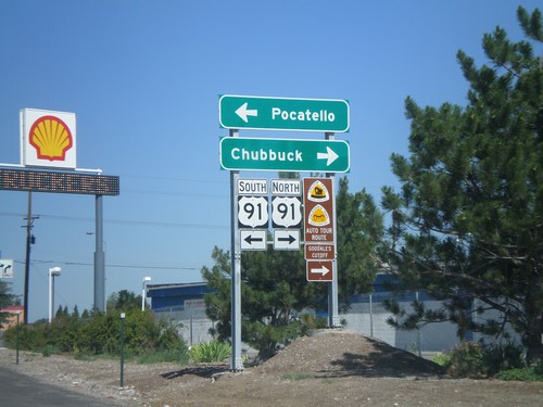
US-91 South at BL-15 - Pocatello
US-91 South (Yellowstone Ave.) at BL-15 (Alameda Road). Turn left on BL-15 North to Salt Lake City; continue straight on BL-15 South/US-91 South to (Pocatello) City Center.
US-91 South Approaching BL-15
US-91 South (Yellowstone Ave.) approaching BL-15 (Alameda Road.). BL-15 South joins US-91 southbound.
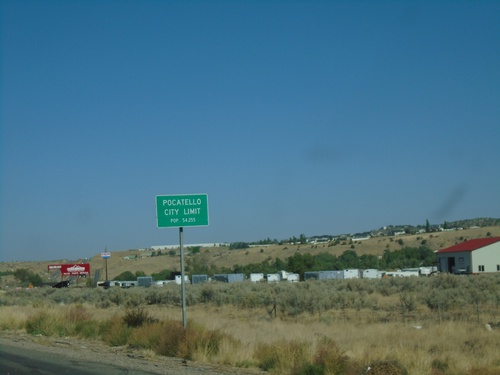
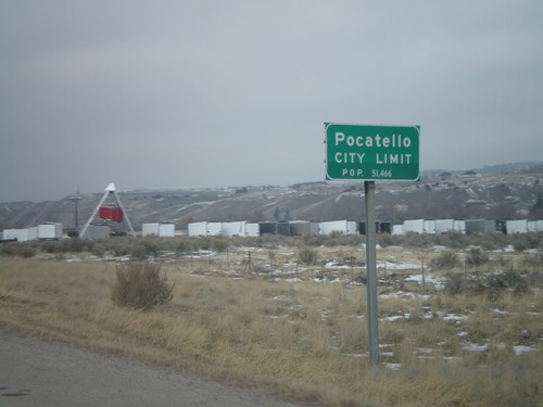
US-91 South - Pocatello
Entering Pocatello on US-91 South. Pocatello is the 6th largest city in Idaho (2020 Census) and is the county seat of Bannock County.
I-86 East Exit 61 Offramp at US-91
I-86 East Exit 61 offramp at US-91 in Chubbuck.
I-86 East - Exit 61 Offramp at US-91
I-86 East - Exit 61 Offramp at US-91. Use US-91 North to Chubbuck; US-91 South to Pocatello.
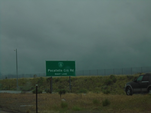
Pocatello Creek Road at I-15 North
Pocatello Creek Road at I-15 North. This type of sign assembly with the Freeway Entrance sign mounted on the shield is not very common in Idaho.
Pocatello Creek Road West at I-15
Pocatello Creek Road west at I-15. Use I-15 North for I-86, Twin Falls and Idaho Falls. Continue straight on Pocatello Creek Road for I-15 South and BL-15 to City Center.
I-15 North Exit 71 Offramp
I-15 North Exit 71 Offramp at BL-15/Pocatello Creek Road. Turn right for Pocatello Creek Road; left for I-15 and City Center.
I-15 North - Exits 69, 71, and 72
I-15 north at Exit 69 - Clark St/Center St. Approaching Exit 71 - Pocatello Creek Road, and Exit 72 - Junction I-86 West.
I-15 North - Exit 69
I-15 north approaching Exit 69 - Clark St./Idaho State University.
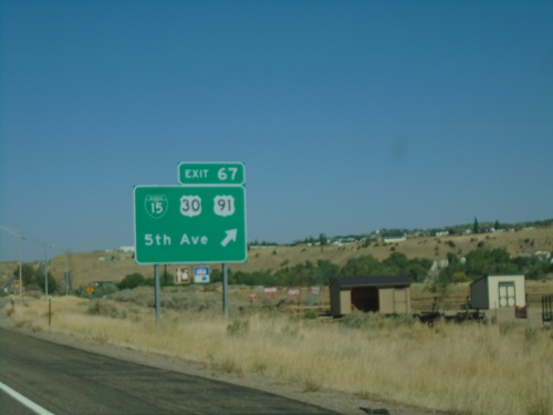
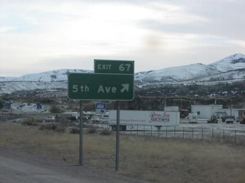
I-15 North - Exit 67
I-15 north at Exit 67 - BL-15/US-30/US-91/5th Ave. US-91 and US-30 leave I-15 northbound. This is the southern end of the Pocatello business loop.
I-15 North - Pocatello City Limit
Entering Pocatello on I-15 north. Pocatello is the 6rd largest city in Idaho according to the 2020 Census.
E Center St. at I-15
E Center St. at I-15 in Pocatello. Use I-15 south for McCammon and Salt Lake (Utah). Use I-15 north for Blackfoot and Idaho Falls.
E Center St. at I-15 - Pocatello
E Center St. at I-15 in Pocatello. Merge right for I-15 South.
E Center St. Approaching I-15
E Center St. approaching I-15 (Exit 69) in Pocatello. Use right lane for I-15 South.
BL-15 South/US-91 South/US-30 East - Pocatello
BL-15 South/US-91 South/US-30 East (N 4th Ave) in Pocatello
US-30 East (Oak St.) at BL-15/US-91
US-30 East (Oak St.) at BL-15/US-91 (Yellowstone Ave.) Turn right for BL-15/US-91 South/US-30 East/McCammon/Salt Lake (Utah). Turn left for BL-15/US-91 North/Blackfoot/Idaho Falls.
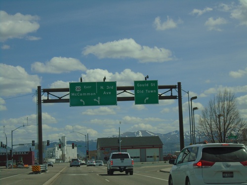
US-30 East (Garrett Way) at Gould St. and N 3rd
US-30 East (Garrett Way) at Gould St. and N 3rd Ave. in Pocatello. Turn right for Gould St./Old Town; straight for N 3rd Ave. Turn left to continue east on US-30 to McCammon.
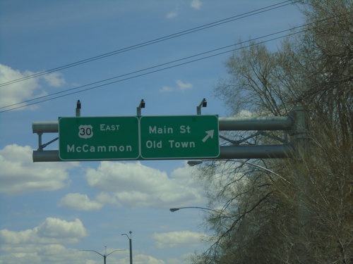
US-30 East at Main St.
US-30 East (Garrett Way) at Main St./Old Town (Pocatello). Continue on US-30 East to McCammon.
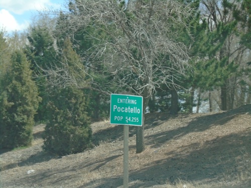
US-30 East - Pocatello
Entering Pocatello on US-30 East. Pocatello is the 5th largest city in Idaho according to the 2017 census estimate. Pocatello is also home to Idaho State University.
US-30 East - Bannock County
Entering Bannock County on US-30 east.
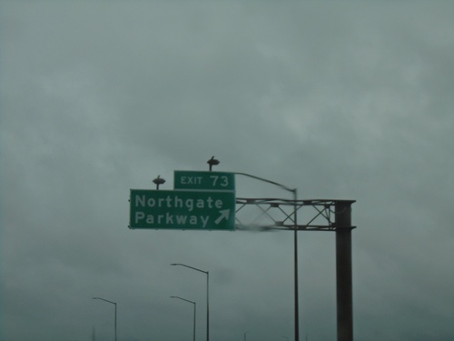
I-15 North - Exit 73
I-15 north at Exit 73 - Northgate Parkway.
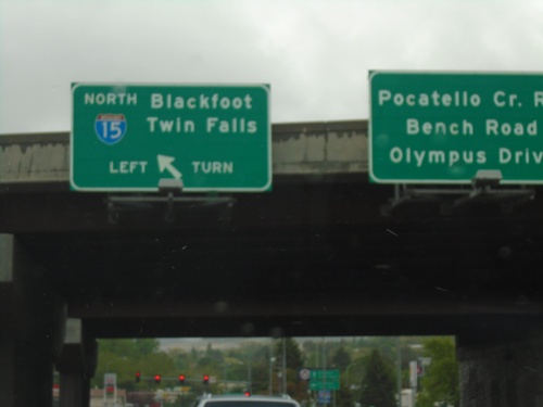
End BL-15 North at I-15 (Exit 71)
End BL-15 North at I-15 (Exit 71) in Pocatello. Use I-15 north for Blackfoot and Twin Falls. Continue straight for Pocatello Creek Road, Bench Road, and Olympus Drive.
I-15 South - Exit 71 Offramp
I-15 South - Exit 71 offramp at Pocatello Creek Road. Turn right for (Pocatello Creek Road) to (Pocatello) City Center and BL-15. Turn left for Pocatello Creek Road.
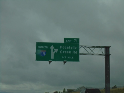
I-15 South - Exit 71
I-15 south at Exit 71 - Pocatello Creek Road
I-15 South - Exit 71
I-15 south approaching Exit 71 - Pocatello Creek Road.
I-15 South Approaching Exit 71
I-15 south approaching Exit 71 - BL-15/Pocatello Creek Road.
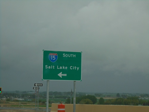
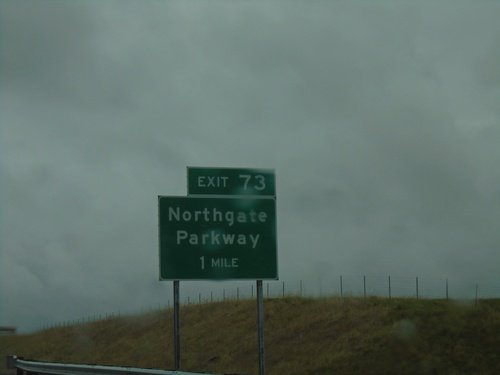
I-15 South - Exit 73
I-15 south at Exit 73 - Northgate Parkway
I-15 South - Exit 73
I-15 south approaching Exit 73 - Northgate Parkway.
I-15 South - Exit 73
I-15 south approaching Exit 73 - Northgate Parkway. This interchange opened in the fall of 2019.
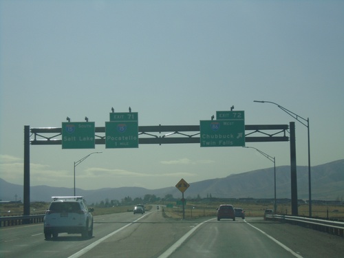
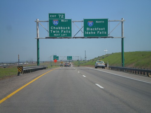
I-15 South - Exit 72 and 71
I-15 south at Exit 72 - I-86 West/Twin Falls/Chubbuck. Approaching Exit 71 - BL-15/Pocatello. Continue south on I-15 for Salt Lake. The BL-15 shield on Exit 71 is incorrectly labeled as I-15.
I-86 West - Exit 61 Offramp at US-91
I-86 west at Exit 61 offramp, US-91 jct. Use US-91 north for Chubbuck. Use US-91 south for Pocatello.
I-15 North - Exits 71 and 72
I-15 north at Exit 71 - Pocatello Creek Road. Approaching Exit 72 - I-86 West/Chubbuck/Twin Falls. Continue north on I-15 for Idaho Falls and Blackfoot.
I-86 West - Exit 61 Offramp at US-91
I-86 west at Exit 61 offramp, US-91 jct. Use US-91 north for Chubbuck. Use US-91 south for Pocatello. US-91 north is part of the Oregon/California Trail - Goodale Cutoff.
I-86 West - Exit 61
I-86 West approaching Exit 61 - US-91/Chubbuck. This is the first exit westbound on I-86.
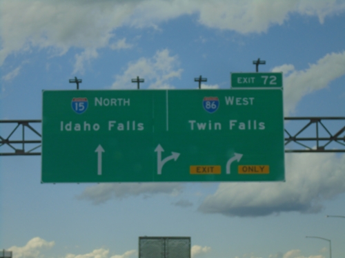
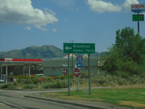
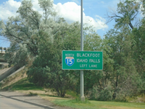
I-15 North at Exit 72
I-15 north at Exit 72 - I-86 West/Twin Falls/Chubbuck. Continue north on I-15 for Blackfoot and Idaho Falls. This is the last exit on I-15 north in the Pocatello area.
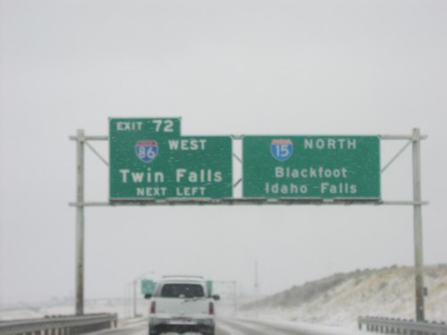
I-15 North - Exit 72
Approaching Exit 72 - I-86 west to Twin Falls and Chubbuck on I-15 north. Continue north on I-15 for Blackfoot and Idaho Falls.
I-15 North - Exits 71 and 72
I-15 north at Exit 71 - Pocatello Creek Road. Approaching Exit 72 - I-86 West/Chubbuck/Twin Falls.
I-15 North Approaching Exit 71
I-15 north approaching Exit 71 - Pocatello Creek Road.

I-15 North - Exits 69, 71, and 72
I-15 north at Exit 69 - Clark St. Approaching Exit 71 - Pocatello Creek Road, and Exit 72 - Junction I-86 West.
I-15 North - Exit 69
I-15 north approaching Exit 69 - Clark St./Idaho State University.
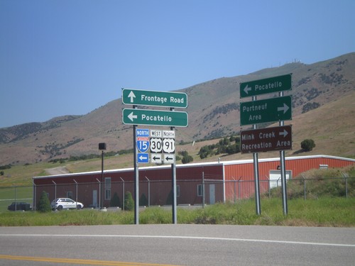
Frontage Road North at I-15 North
Frontage Road north at I-15/US-30/US-91 (Exit 67) north. Use I-15 north for Pocatello. Use Frontage Road north for Pocatello. Use Frontage Road south for Portneuf Area and Mink Creek Recreation Area.
US-30 West/To I-86
US-30 West/To I-86 on Garrett Way.
US-30 West - Oak St./Garrett Way Jct.
US-30 west (Oak St.) at Garrett Way to American Falls and Twin Falls.
US-30 West To I-86 - Oak St.
US-30 West/To I-86 on Oak St. West.
US-91/US-30/BL-15 North at US-30 West
US-91 N./US-30 W./BL-15 N. at US-91/US-30 split. Continue on 5th Ave. for BL-15/US-91/To I-15/Blackfoot/Idaho Falls. Turn left on Oak St. for US-30/To I-86/American Falls/Twin Falls.
US-91/US-30/BL-15 North at US-30 West
US-91 North/US-30 West/BL-15 North approaching US-91/US-30 split. Continue on 5th Ave. for BL-15/US-91/To I-15/Blackfoot/Idaho Falls. Turn left on Oak St. for US-30/To I-86/American Falls/Twin Falls.
BL-15/US-30/US-91 Shields - Pocatello
BL-15/US-30/US-91 shields on S. 5th Ave. north.
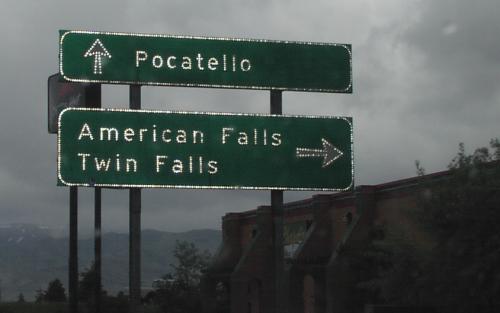
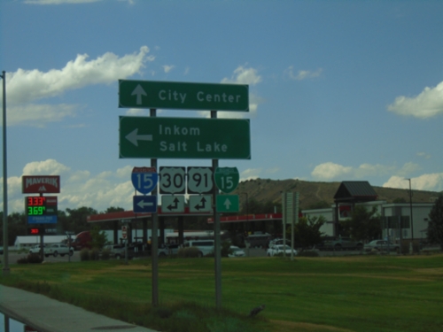
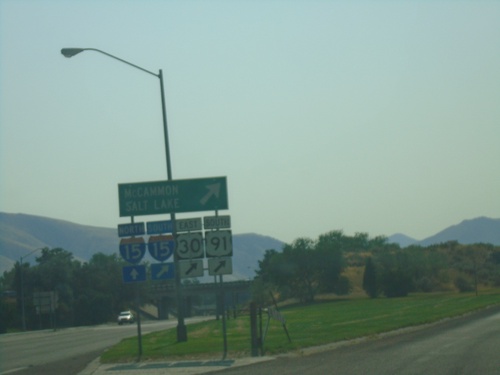
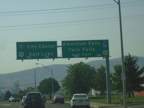
US-91/US-30/BL-15 North at I-15 South
US-91/US-30/BL-15 north at I-15/US-30/US-91 south to Inkom and Salt Lake. US-91 joins I-15 south to Virginia. US-30 joins I-15 south to McCammon.
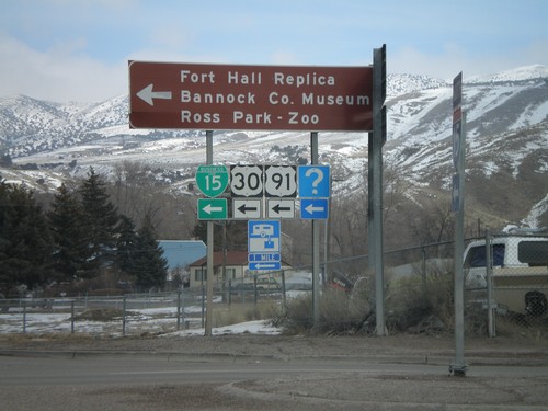
I-15 North at US-91/US-30/BL-15
I-15 offramp at US-91/US-30/BL-15. US-91 and US-30 leave I-15 here. Turn left for Fort Hall Replica, Bannock County Museum, and Ross Park - Zoo.
I-15 North - Pocatello City Limit
Entering Pocatello on I-15 north. Pocatello is the 3rd largest city in Idaho followed by Boise and Nampa.
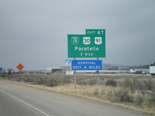
I-15 North - Exit 67
I-15 north approaching Exit 67 - BL-15/US-30/US-91/Pocatello.
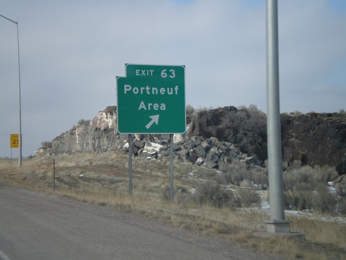
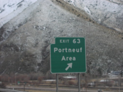
I-15 North - Exit 63
I-15 north at Exit 63 - Portneuf Area.
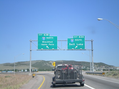
End I-86 East at Exits63AB at I-15
End I-86 at I-15 Exit 63A - I-15 South/Salt Lake, Exit 63B - I-15 North/Blackfoot/Idaho Falls.
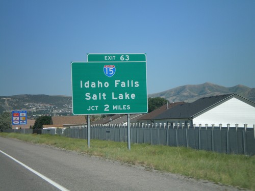
I-86 East Exit 63 - I-15 Jct.
I-86 east approaching I-15/Idaho Falls/Salt Lake, 2 miles.
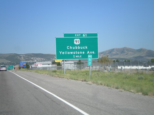
I-86 East Exit 61
I-86 east approaching Exit 61, US-91/Chubbuck/Yellowstone Ave., 1 mile.
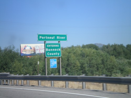
I-86 East - Entering Bannock County
I-86 east at Bannock county line at the Portneuf River.
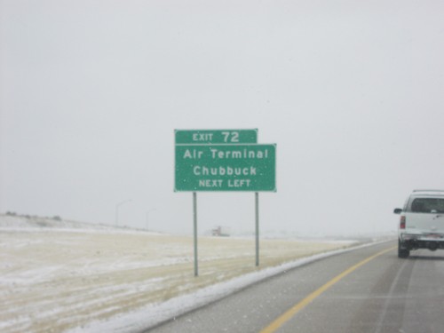
I-15 North approaching Exit 72
Use Exit 72, I-86 west, to Air Terminal and Chubbuck on I-15 north
I-15 North at Exit 72 at I-86 West
I-15 north at I-86 west to Twin Falls
I-15 North at Exit 72, I-86 West
I-86 west to Twin Falls next left on I-15 north
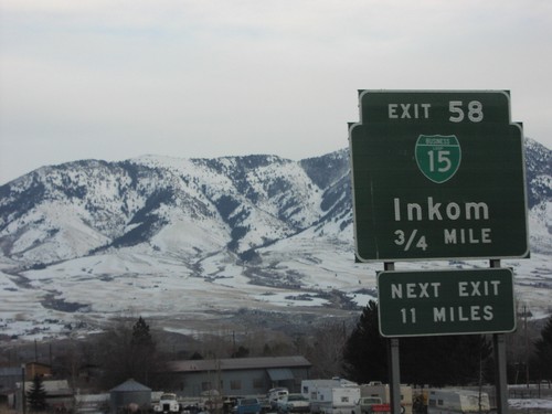
I-15 South Exit 58
I-15 south at Exit 58, BL-15/Inkom
I-15 South Exit 63
I-15 south at Exit 63, Portneuf Area
I-15 South Exit 67
I-15 south at Exit 67, 5th St.
I-15 South Exit 69
I-15 south at Exit 69, Clark St.
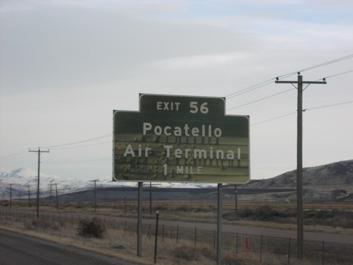
I-86 East Exit 56
I-86 east at Exit 56, Pocatello Air Terminal
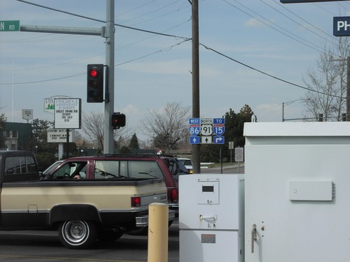
I-86 East Exit 61
I-86 east at Exit 61, US-91/Yellowstone Ave
End I-86 East at I-15 - Exit 63AB
End I-86 at I-15 Junction
I-86 East Exit 63
I-86 Approaching I-15 To Idaho Falls and Salt Lake
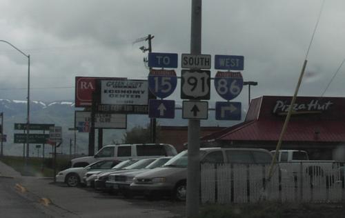
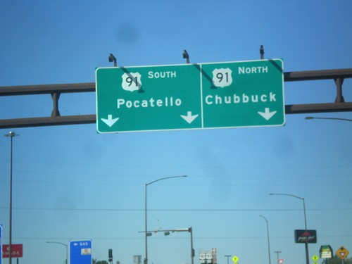
US-91 North at I-86
I-15/I-86/US-91 Shields on Yellowstone Ave. North
Red Rock Junction
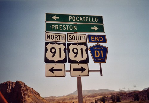
End CR-D1 at US-91
End Bannock County CR-D1 at US-91. Taken at Red Rock Pass.
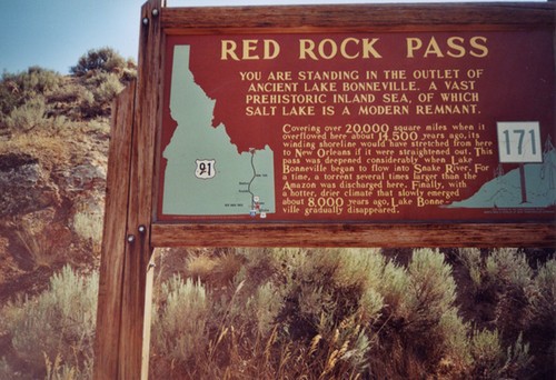
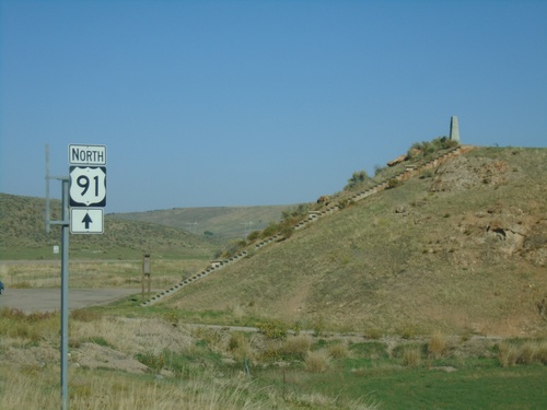
US-91 - Red Rock Pass Historical Marker
Historical Marker on Red Rock Pass, US-91 South. All highways in Idaho have these historical markers. To see all of them check out the Idaho State Historical Marker Guide. Red Rock Pass is where ancient Lake Bonneville - an inland sea, which covered most of the great basin, overflowed into the Snake Plain. Evidence of this great flood is everywhere along the Snake and Columbia Rivers in the Pacific Northwest. This pass marks the divide between the Great Basin and the Snake/Columbia River drainages.
Swanlake
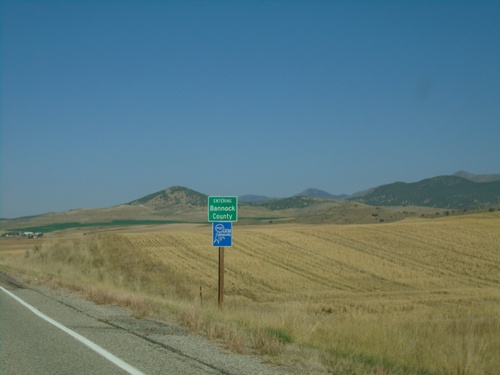
US-91 North - Bannock County
Entering Bannock County on US-91 north.
Virginia
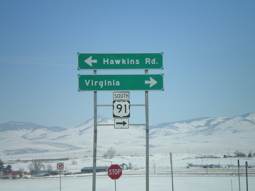
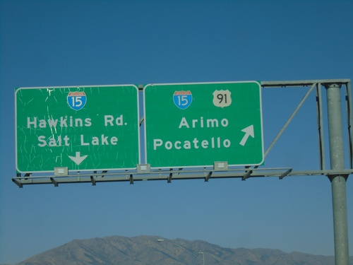
I-15 North Offramp at US-91
I-15 north offramp at US-91 to Virginia. Turn left for Hawkins Road. US-91 joins I-15 north here to Pocatello.
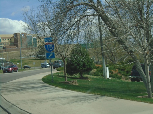
I-15 South Exit 36
I-15 south at Exit 36, US-91/Downey/Preston.