Bear Lake County, Idaho
Localities: Fish Haven | Geneva | Montpelier | Ovid | Paris | Saint Charles | Soda Springs
Fish Haven
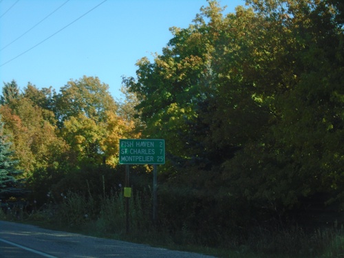
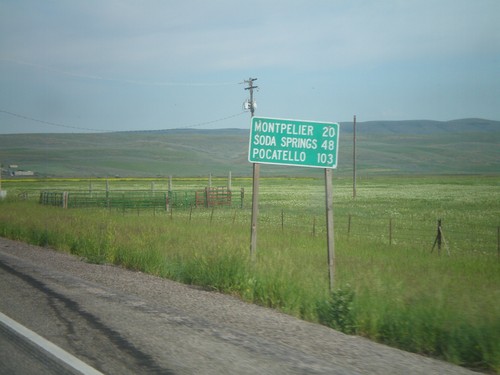
US-89 North - Distance Marker
Distance marker on US-89 north. Distance to Fish Haven, St. Charles, and Montpelier.
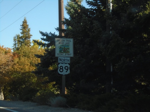
US-89 North - Oregon Trail - Bear Lake Scenic Byway
Oregon Trail - Bear Lake Scenic Byway on US-89 North
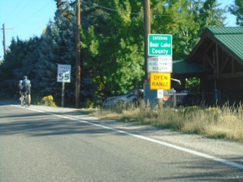
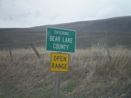
US-89 North - Bear Lake County
Entering Bear Lake County on US-89 North.
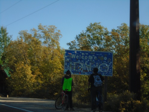
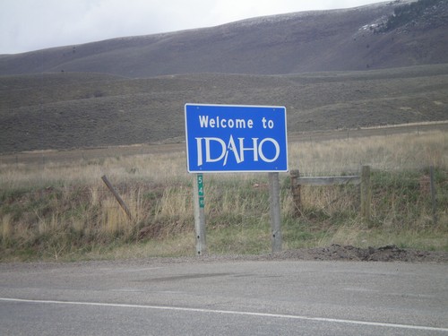
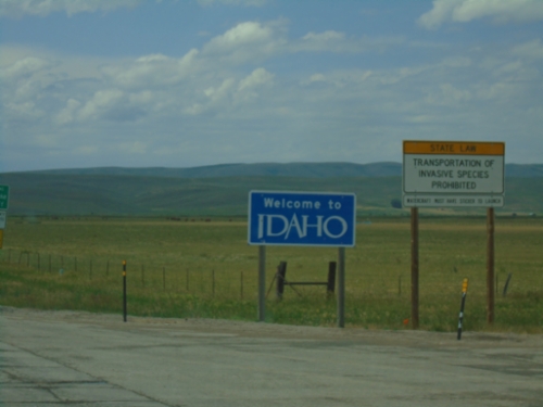
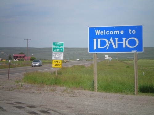
US-89 North - Welcome To Idaho
Welcome to Idaho on US-89 North.
Geneva
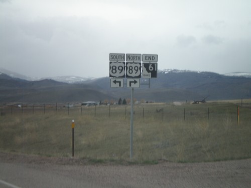
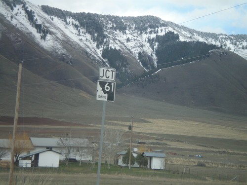
End ID-61 at US-89
End ID-61 north at US-89. ID-61 is the shortest state highway in Idaho.
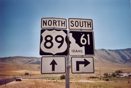
ID-61 North Approaching US-89
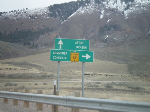
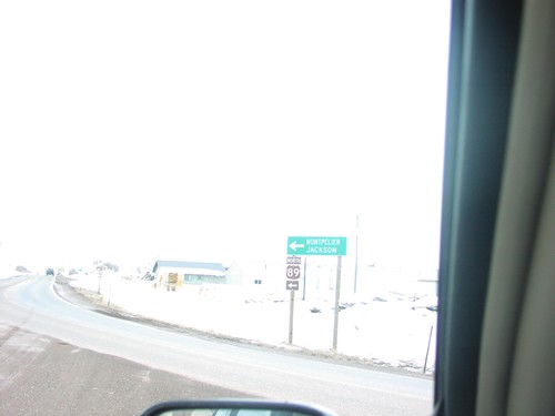
ID-61 north approaching US-89. Use US-89 north for Afton and Jackson (both in Wyoming). Use US-89 south for Montpelier. This type of direction sign is typically used at freeway ramps.
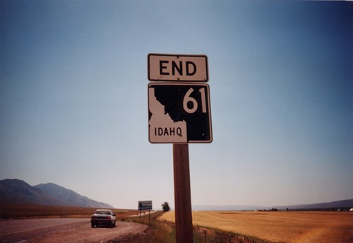
End ID-61 North at US-89
End ID-61 north at US-89
ID-61 North Approaching US-89
ID-61 north approaching US-89
ID-61 North - Entering Bear Lake County
Entering Bear Lake County on ID-61 north at the Idaho-Wyoming state line.
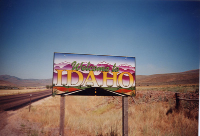
ID-61 North - Welcome To Idaho
Welcome to Idaho on ID-61 north. The Wyoming milemarker for WY-89 is attached to the sign.
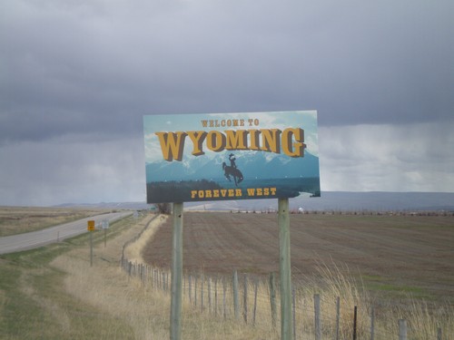
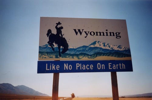
WY-89 South - Welcome To Wyoming
Welcome To Wyoming On WY-89 South. This is the new style of welcome sign in Wyoming. Taken on the Wyoming-Idaho border.
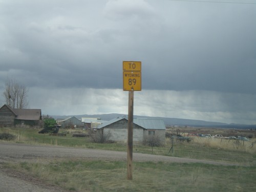
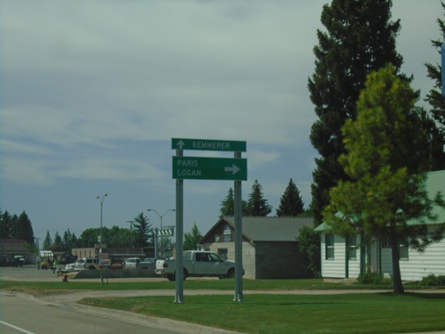
To WY-89 on ID-61 South
To WY-89 on ID-61 south. ID-61 becomes WY-89 at the Idaho-Wyoming State Line.
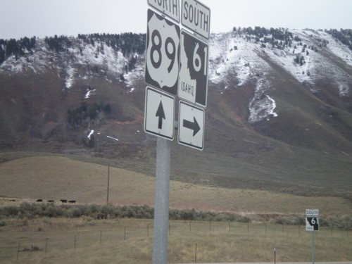
US-89 North at ID-61
US-89 north at ID-61
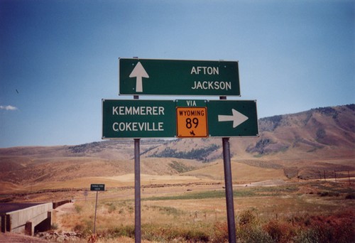
US-89 North Approaching ID-61
US-89 north approaching ID-61 (To WY-89). Use ID-61 south for WY-89, Cokeville, and Kemmerer. Continue north on US-89 for Afton and Jackson. All destinations are in Wyoming. The only instance that I have encountered where state highway shield from another state is posted in Idaho, is at this intersection.
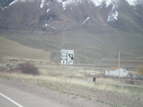
US-89 North Approaching ID-61
US-89 north approaching ID-61.
US-89 North Approaching ID-61
US-89 north approaching ID-61
End ID-61 at the Wyoming Border
End ID-61 at the Wyoming Border. Highway continues as WY-89. The Wyoming Welcome Sign is in the distance.
ID-61 North - Welcome To Idaho
Welcome to Idaho on ID-61 North at the Idaho/Wyoming Border.
US-89 North at ID-61 South
ID-61 Junction on US-89 North. ID-61 south is the shortest state highway in Idaho.
US-89 North at ID-61(To WY-89).
US-89 North at ID-61 To WY-89 Junction. ID-61 is the shortest state route in Idaho ( 0.74 miles long). ID-61 is essentially a spur of WY-89 to connect up with US-89 which heads back into Wyoming.
WY-89 South - Welcome To Wyoming
Welcome To Wyoming On WY-89 South. This is an older style of welcome sign in Wyoming. The newer signs have a picture of Devils Tower.
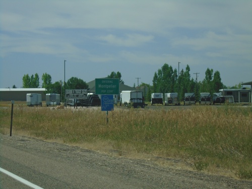
Montpelier
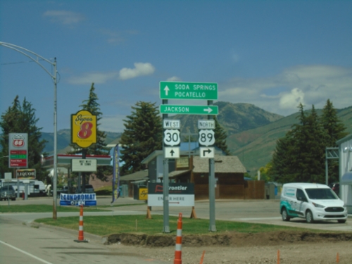
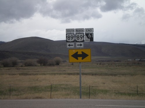
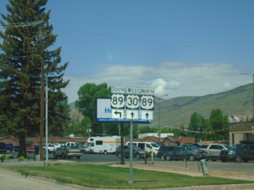
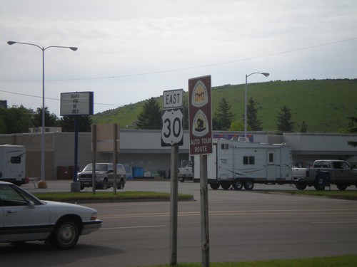
US-89 North/US-30 West at US-89 North
US-89 north/US-30 west at US-89 north to Jackson (WY). Continue west on US-30 for Soda Springs and Pocatello.
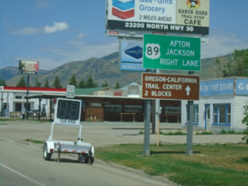
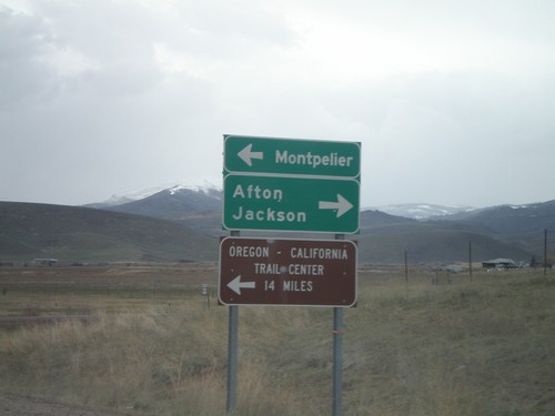
US-30 West/US-89 North - Montpelier
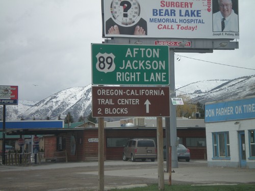
US-30 West/US-89 North approaching US-30/US-89 split in Montpelier. Use US-89 north for Afton (WY) and Jackson (WY). Continue straight for the Oregon-California Trail Center.
US-30 West/US-89 North - Montpelier
US-30 West/US-89 North - part of the Oregon Trail - Bear Lake Scenic Byway. Taken in Montpelier.
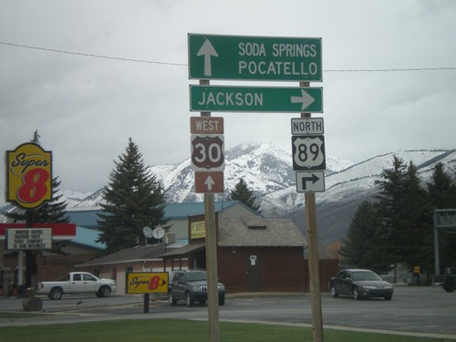
US-30 West at US-89
US-30 West at US-89 in Montpelier. Turn left for US-89 south at (Montpelier) City Center. Continue straight for US-30 West/US-89 North.
US-30 West at US-89
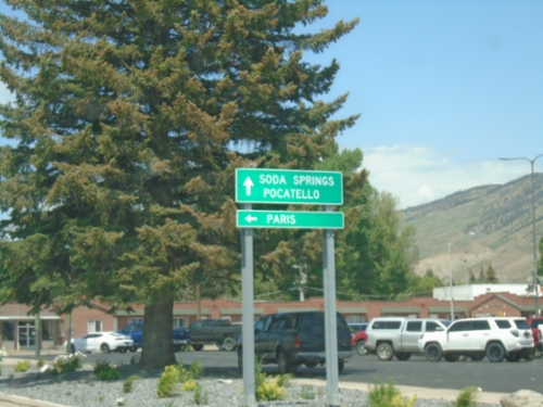
US-30 west at US-89. Turn left for US-89 south to Paris. Continue ahead for US-30 West towards Soda Springs and Pocatello, and US-89 north.
US-30 West at US-89
US-30 west at US-89 in Montpelier. US-89 joins US-30 through Montpelier.
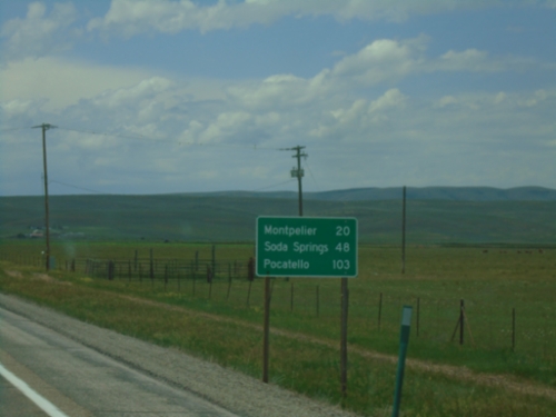
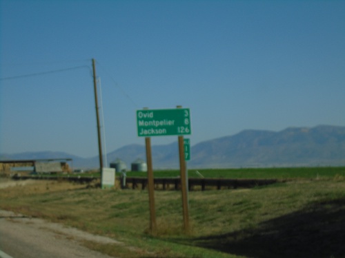
US-30 West - Distance Marker
First distance marker on US-30 west in Idaho. Distance to Montpelier, Soda Springs, and Pocatello.
Welcome To Idaho - US-30 West
Welcome to Idaho on US-30 west. Entering Bear Lake County. Taken at the Wyoming-Idaho Border.
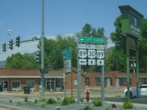
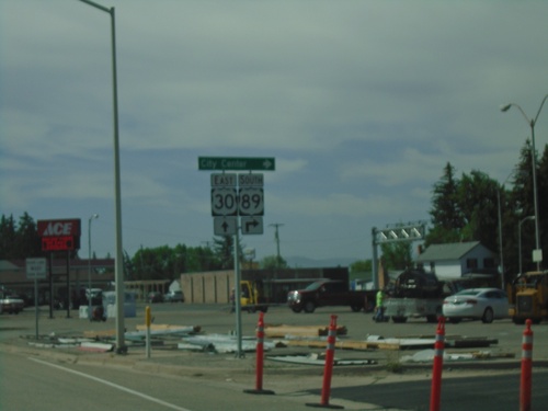
US-89 North at US-30 - Montpelier
US-89 north at US-30 in Montpelier. Use US-30 East for Border and Kemmerer (WY). Use US-30 West to Pocatello and US-89 North to Jackson (WY). US-89 north joins US-30 west through Montpelier.
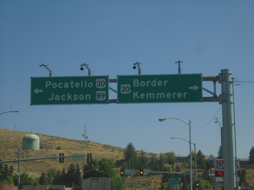
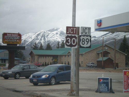
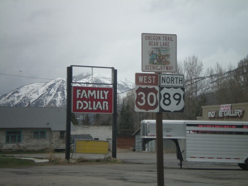
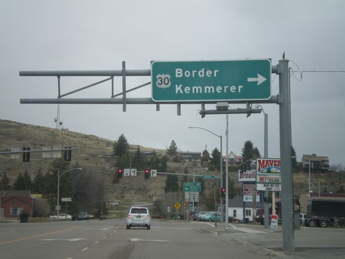
US-30 East Approaching WY-89
US-30 East approaching WY-89 at Border Junction. WY-89 south joins US-30 east to Sage Junction. While the upcoming junction is in Wyoming, this picture is in Idaho. Milemarker 455 of US-30 in Idaho is in the background.
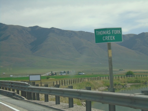
US-30 East - Thomas Fork Creek
US-30 east at Thomas Fork Creek
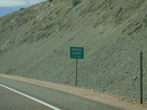
US-30 East - Border Summit
US-30 east at Border Summit - Elevation 6358 Feet.
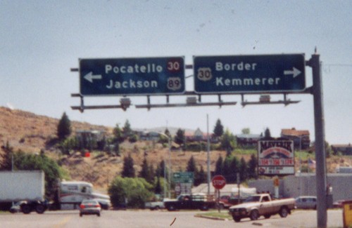
US-30 East - Distance Marker
Distance marker on US-30 east. Distance to Border, Cokeville, and Kemmerer. All three destinations are in Wyoming.
US-30 East/US-89 South at US-30/US-89 Split
US-30 East/US-89 South at US-30/US-89 split in Montpelier. Turn left for US-89 south to (Montpelier) City Center.
US-30 East/US-89 South at US-30/US-89 Split
US-30 East/US-89 South at US-30/US-89 split in Montpelier. Turn right on US-89 south for Paris and Logan (Utah). Continue east on US-30 for Kemmerer (Wyoming).
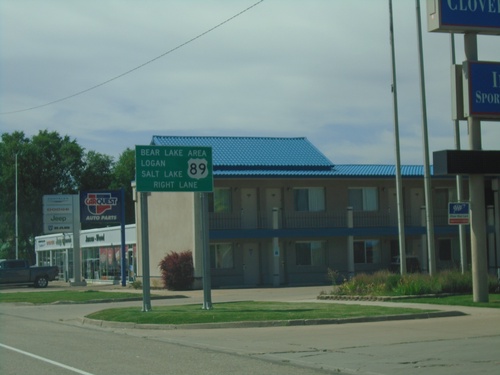
US-30 East/US-89 South approaching US-89
US-30 East/US-89 South approaching US-89/US-30 split in Montpelier. Use US-89 south for Bear Lake Area, Logan (UT), and Salt Lake (UT).
US-30 East at US-89 South - Montpelier
US-30 East at US-89 South in Montpelier. US-89 south joins US-30 east for a few blocks through Montpelier.
US-30 East at US-89 - Montpelier
US-30 East at US-89 in Montpelier. US-89 south joins US-30 east for a few blocks through Montpelier.
US-30 East - Montpelier
Entering Montpelier on US-30 west.
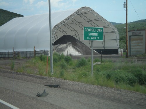
US-30 West - Georgetown Summit
US-30 west at Gorgetown Summit - Elevation 6,283 Feet. Idaho Transportation Maintenance Yard in the background.
US-30 East - Oregon Trail/California Trail
US-30 east in Montpelier, with California and Oregon Trail Auto Tour Route signs.
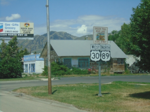
US-30 West at US-89
US-30 west at US-89. Turn left for US-89 south to Paris. Continue ahead for US-30 West towards Soda Springs and Pocatello, and US-89 north.
US-30 West at US-89
US-30 west at US-89 in Montpelier. US-89 joins US-30 through Montpelier. The Oregon Trail-Bear Lake Scenic Byway joins US-30 here, from US-89 south. That is why the US-89 south and US-30 west shields are brown.
US-30 West - Distance Marker
First distance marker on US-30 west in Idaho. Distance to Montpelier, Soda Springs, and Pocatello.
Welcome To Idaho - US-30 West
Welcome to Idaho on US-30 west. Entering Bear Lake County. Taken at the Wyoming-Idaho Border.
US-89 North/US-30 West at US-89 North
US-89 north/US-30 west at US-89 north to Jackson. Continue west on US-30 for Soda Springs and Pocatello.
US-30 West/US-89 North Approaching US-89
US-30 West/US-89 North approaching US-89 north in Montpelier.
US-30/US-89 - Approaching US-89
US-30 West/US-89 North approaching US-89 north split. Use right lane for US-89 north to Afton and Jackson (both in Wyoming).
US-30/US-89 - Oregon Trail Bear Lake Scenic Byway
US-30 West/US-89 North - Oregon Trail Bear Lake Scenic Byway in Montpelier.
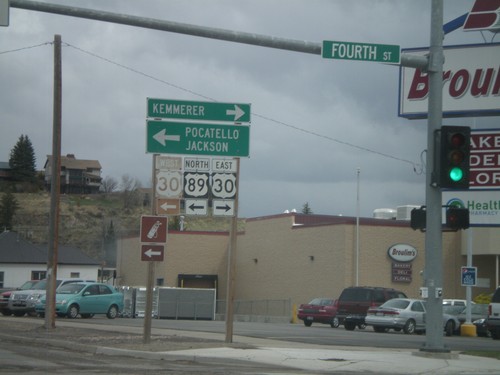
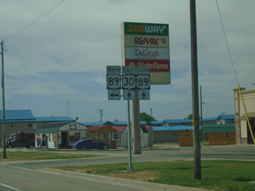
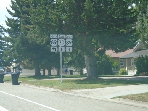
US-89 North at US-30
US-89 north at US-30 in Montpelier. Use US-30 east for Kemmerer (Wyoming), and US-30 west/US-89 north for Pocatello and Jackson (Wyoming). US-30 and US-89 north join briefly through Montpelier.
US-89 North at US-30
US-89 north at US-30 in Montpelier. Use US-30 East for Border and Kemmerer. The left half of this sign is missing.
US-89 North at US-30
US-89 North at US-30 East to Border and Kemmerer (WY) and west to Pocatello and Jackson (WY). US-89 follows US-30 west briefly through Montpelier.
Ovid
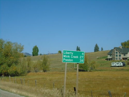
ID-36 West - Distance Marker
Distance marker on ID-36 west. Distance to Liberty, Mink Creek, and Preston.
US-89 North at ID-36
US-89 North at ID-36 in Bear Lake County. Turn left for ID-36 west.
US-89 North at ID-36
US-89 North at ID-36. Merge right to continue north on US-89 towards Montpelier and Jackson (Wyoming). Use ID-36 West for Preston.
US-89 North Approaching ID-36
US-89 North approaching ID-36 West in Bear Lake County.
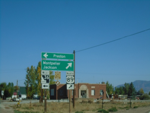
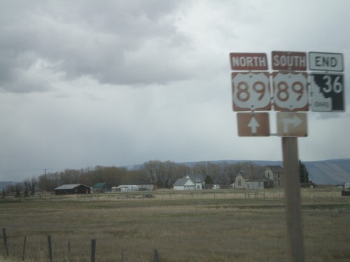
End ID-36 East at US-89
End ID-36 at US-89 Junction. Use US-89 north for Montpelier and Jackson.
End ID-36 East at US-89
End ID-36 east at US-89. US-89 is part of the Oregon Trail - Bear Lake Scenic Byway
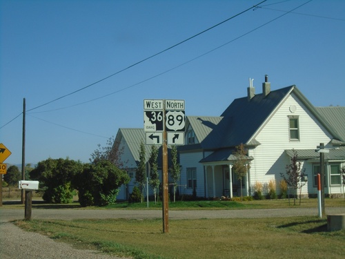
End ID-36 at US-89
End ID-36 at US-89. Use US-89 south for Paris. US-89 north for Montpelier and Jackson.
End ID-36 east at US-89
End ID-36 east at US-89
ID-36 East Approaching US-89
ID-36 east approaching US-89. US-89 is part of the Oregon Trail-Bear Lake Scenic Byway.
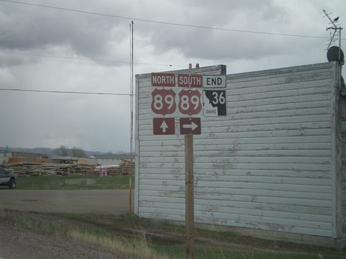
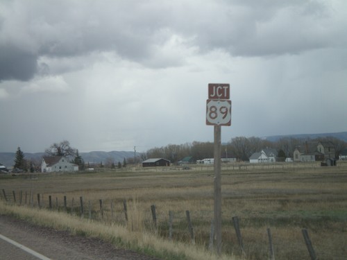
End ID-36 at US-89
End ID-36 at US-89 Junction, north of Paris
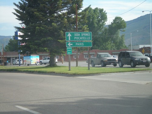
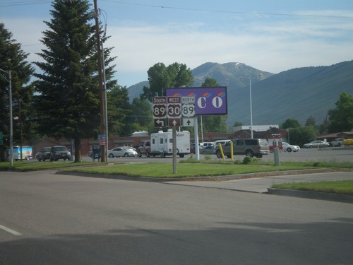
Paris
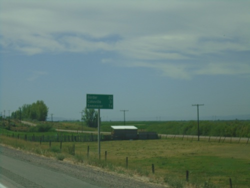
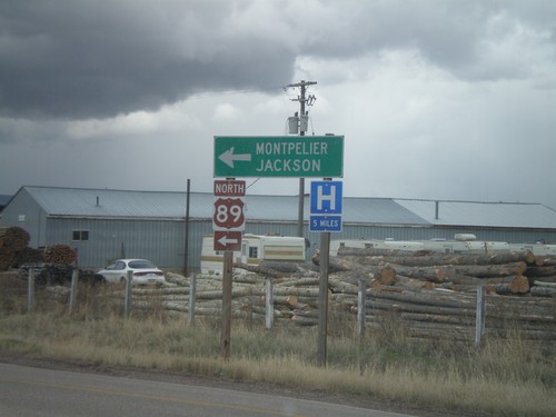
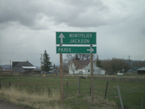
US-89 North - Distance Marker
Distance marker on US-89 north. Distance to Ovid, Montpelier, and Jackson (Wyoming).
Saint Charles
US-89 North - Distance Marker
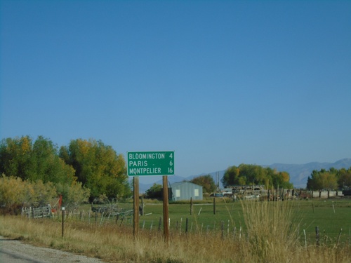
Distance marker US-89 North. Distance to Bloomington, Paris, and Montpelier.
Soda Springs
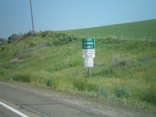
US-30 West - Entering Caribou County
Entering Caribou County on US-30 west.