Canyon County, Idaho
Localities: Apple Valley | Caldwell | Greenleaf | Melba | Middleton | Nampa | Notus | Parma | Star | Walters Ferry | Wilder
Apple Valley
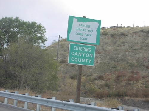
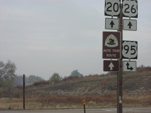
US-20/US-26 East - Oregon Thanks You
Oregon Thanks You. Come Back Soon. Entering Canyon County (Idaho) on US-20/US-26 east at the Oregon/Idaho line.
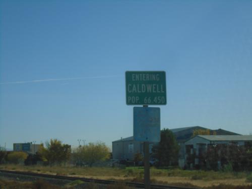
Caldwell
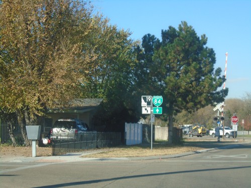
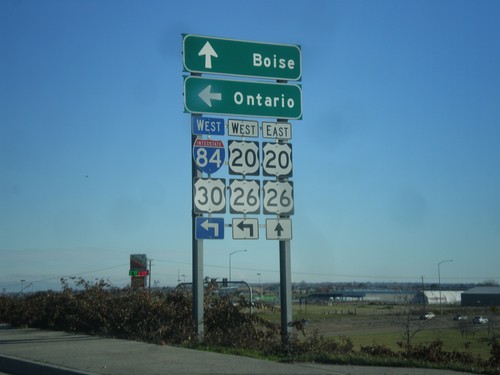
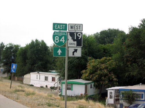
ID-19 West at I-84 Onramp
End BL-84 West at I-84/US-30/(US-20/US-26) in Caldwell. Use I-84/US-30 east for Nampa and Boise; I-84/US-30 west for Ontario (Oregon).
End BL-84 West at I-84/US-30
End BL-84 West at I-84/US-30 in Caldwell.
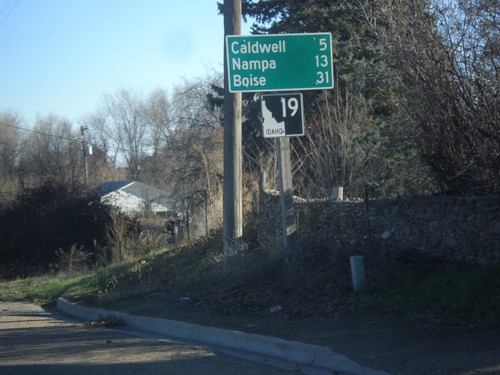
ID-19 East - Caldwell
Entering Caldwell on ID-19 east. Caldwell is the county seat of Canyon County, and is the 5th largest city in Idaho (2020 Census).
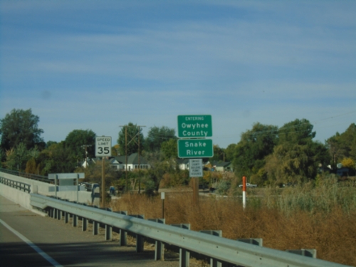
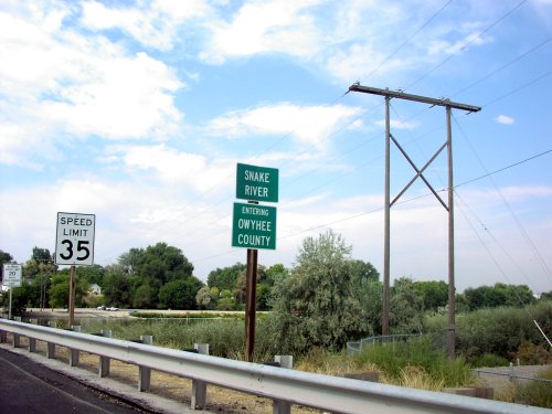
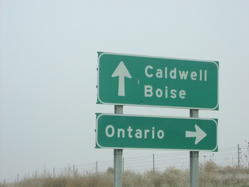
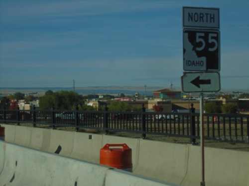
ID-55 South - Entering Owyhee County
ID-55 south - Entering Owyhee County/Snake River.
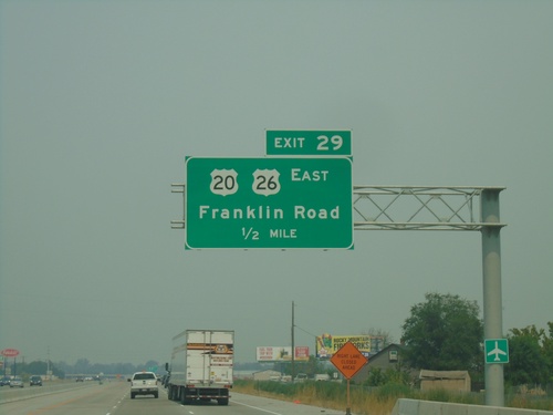
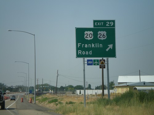
I-84 West - Exit 29
I-84 west approaching Exit 29 - US-20/US-26 East/Franklin Road.
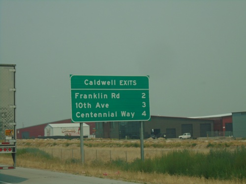
I-84 West - Caldwell Exits
Caldwell exits on I-84 west: Franklin Road, 10th Ave., Centennial Way
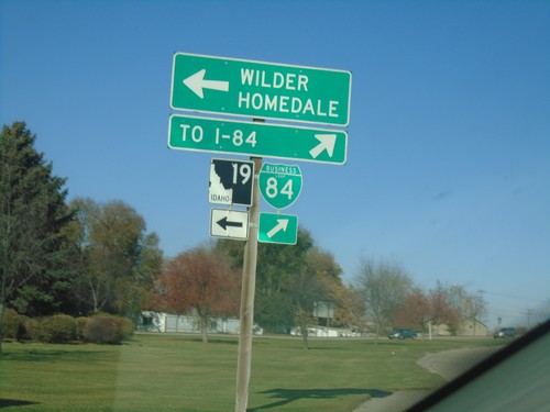
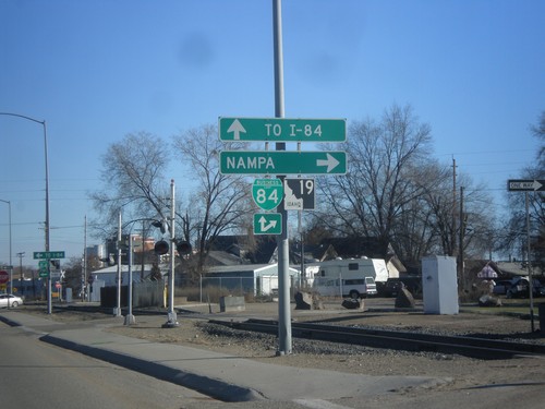
BL-84 West at ID-19 - Caldwell
BL-84 West at ID-19 in Caldwell. Turn left for ID-19 West to Wilder and Homedale. Turn right to continue on BL-84 West to I-84.
BL-84 West Approaching ID-19 - Caldwell
BL-84 West (Blaine St.) Approaching ID-19 in Caldwell
BL-84 West (Blaine St.) at CR-K2 (S 10th Ave.)
BL-84 West (Blaine St.) at CR-K2 (S 10th Ave.) in Caldwell.
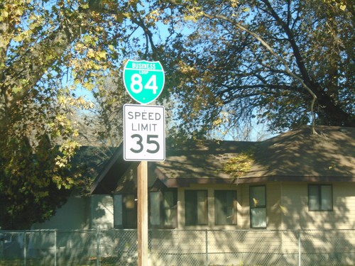
BL-84 - Caldwell
BL-84 West in Caldwell on Blaine St. Speed Limit 35 MPH.
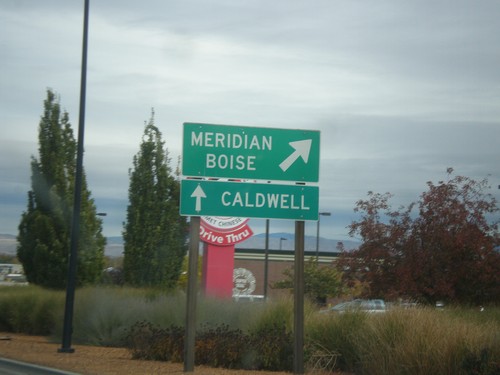
US-20/US-26 West at I-84 East - Caldwell
US-20/US-26 West at I-84 East in Caldwell. Turn left for US-20/US-26 West to Nampa and Boise. Continue west on Franklin Road to Caldwell.
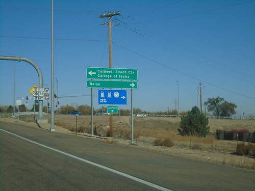
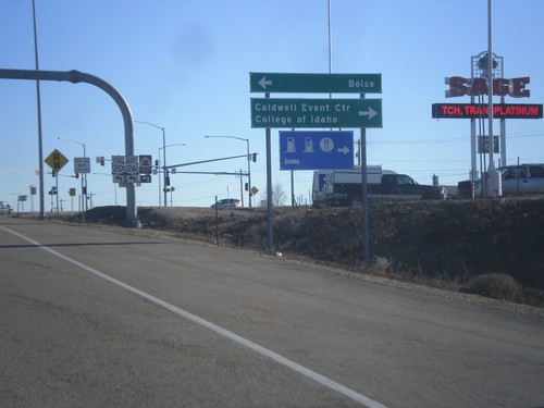
I-84 West Offramp at US-20/US-26 East
I-84 West (Exit 29) offramp at US-20/US-26 East in Caldwell. Turn right for US-20/US-26 East to Boise; left for Franklin Road West to Caldwell Event Center and College of Idaho.
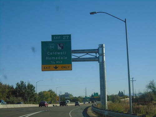
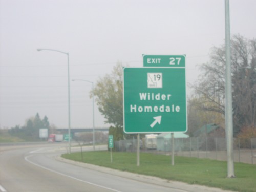
I-84 East - Exit 27
I-84 East approaching Exit 27 - BL-84/ID-19/Caldwell/Homedale.
I-84 West - Exit 27
I-84 west approaching Exit 27 - ID-19/Grenleaf/Wilder/Homedale.
End ID-44 West at I-84 Onramp at Exit 25
End of ID-44 at I-84/US-30 junction to Caldwell and Boise.
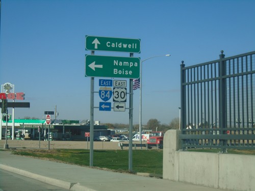
US-20/US-26 East at I-84 West
US-20/US-26 East at I-84 West in Caldwell. Use I-84/US-30/US-20/US-26 West for Ontario (Oregon). Continue east for US-20/US-26 to Boise.
I-84 East at US-20/US-26 - Exit 29 Offramp
I-84 East (Exit 29) offramp at US-20/US-26 (Franklin Road). US-20/US-26 leaves I-84 here, and turns east into Boise. Turn left for US-20/US-26 to Boise. Turn right for Franklin Road to College of Idaho and Caldwell Event Center.
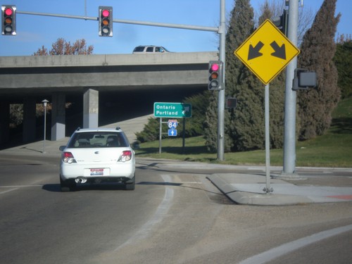
10th St. East at I-84 East
10th St. East at I-84 East to Ontario, and Portland. This is one of the few instances of Portland used as a control city on I-84.
10th St. East at I-84 East
10th St. East at I-84 East (Exit 28). Turn right on I-84 for Nampa and Boise. Continue east on 10th St. for I-84 East to Ontario (Oregon).
ID-19 East at BL-84
ID-19 east at BL-84 in Caldwell. Merge right for BL-84 (Cleveland Blvd.) east to Nampa. Continue straight for BL-84 West/ID-19 East for I-84.
ID-19 East Approaching BL-84
ID-19 East Approaching BL-84 (Cleveland Blvd.) in Caldwell.
ID-19 East Approaching BL-84
ID-19 east approaching BL-84 in Caldwell.
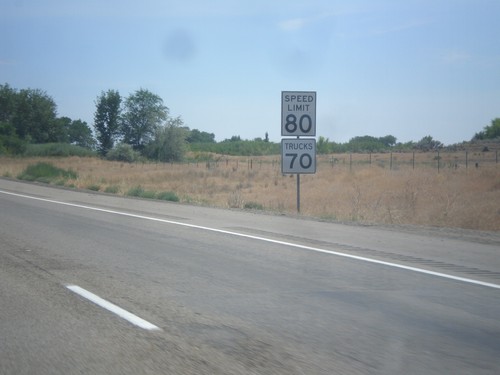
I-84 East - Speed Limit 80
Speed Limit 80 MPH on I-84 east. Truck speed limit 70 MPH. The speed limit in Idaho was raised in July 2014. Utah, Texas, and Wyoming also have speed limits this high.
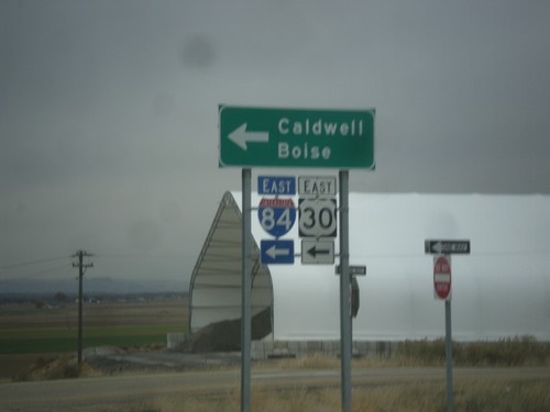
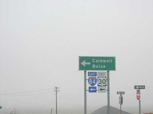
US-20/US-26 East Approaching I-84/US-30
US-20/US-26 east approaching I-84/US-30 onramp.
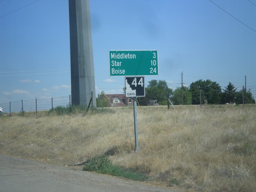
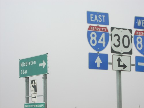
ID-44 East - Distance Marker
Distance marker on ID-44 east. Distance to Middleton, Star, and Boise.
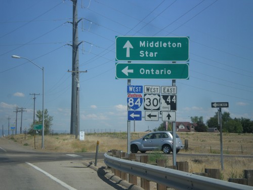
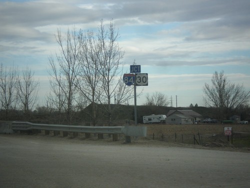
Begin ID-44 East at I-84/US-30
Beginning of ID-44 east at I-84/US-30 West onramp (Exit 25). Turn left on I-84/US-30 West for Ontario. Continue straight for ID-44 east to Middleton and Star.
I-84 East (Exit 25) at ID-44
I-84 East (Exit 25) at ID-44 junction. Turn left for ID-44 east to Middleton. Continue ahead for the onramp for I-84/US-30 towards Caldwell and Boise.
I-84 West - Exit 29
I-84/US-30 west at Exit 29 - US-20/US-26/Franklin Road. US-20/US-26 join I-84 west through Caldwell.
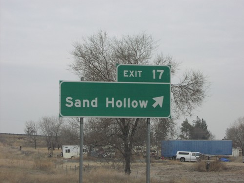
I-84 West Exit 17
I-84 west at Exit 17, Sand Hollow.
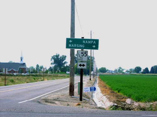
Farmway Road South at ID-55
Farmway Road at ID-55. ID-55 shield is all white instead of solid black for the upper right portion.
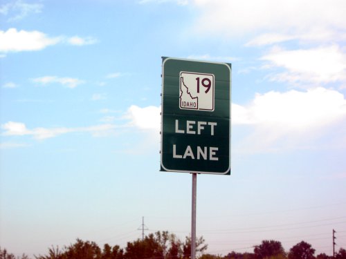
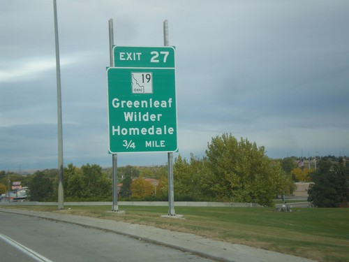
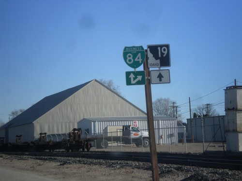
I-84 West Exit 27 Offramp - Use Left Lane for ID-19
I-84 west Exit 27 offramp at ID-19. Use left lane for ID-19 west.
ID-19 West - Distance Marker
Distance marker on ID-19 west/BL-84 east to Nampa, Wilder, and Homedale.
ID-19 West at I-84 Onramp
BL-84/ID-19 west at I-84 (Exit 27) onramp to Boise. Continue west on BL-84/ID-19 to Homedale and Wilder.
ID-19 West/BL-84 East - Caldwell
ID-19 West/BL-84 East in just west of I-84.
ID-19 West/BL-84 East Split
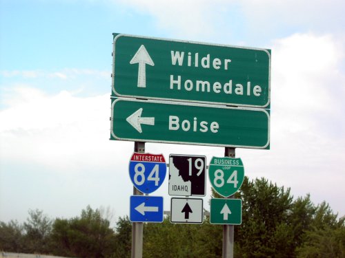
ID-19 west/BL-84 east at ID-19/BL-84 split. ID-19 west goes to Greenleaf, Wilder, and Homedale. BL-84 east goes to Nampa.
ID-19 West/ID-84 East Split
ID-19 west/BL-84 east at ID-19/BL-84 split.
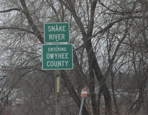
ID-55 South - Owyhee County Line
ID-55 south at Snake River/Owyhee county line.
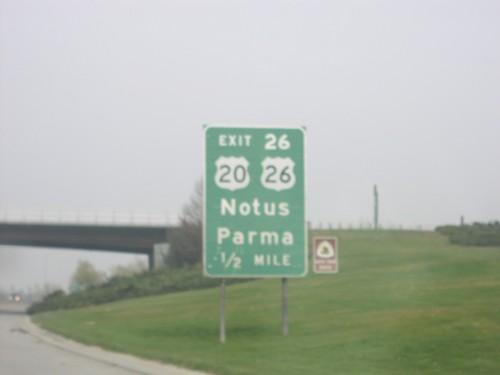
I-84 West Exit 26
I-84 west at US-20/US-26 west to Notus and Parma
I-84 West Exit 26
I-84 west at US-20/US-26 junction to Notus and Parma
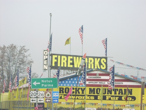
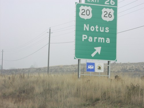
I-84 West Exit 26 Offramp at US-20/US-26
US-20/US-26 west to Notus and Parma (and fireworks stand)
I-84 West Exit 27
I-84 west at ID-19 junction to Caldwell and Homedale
End ID-44 West at I-84 Exit 25 Onramp
ID-44 west at I-84/US-30 west to Ontario (OR), and east to Caldwell and Boise.
End ID-44 West at I-84 Onramp at Exit 25
End of ID-44 at I-84/US-30 junction to Caldwell and Boise.
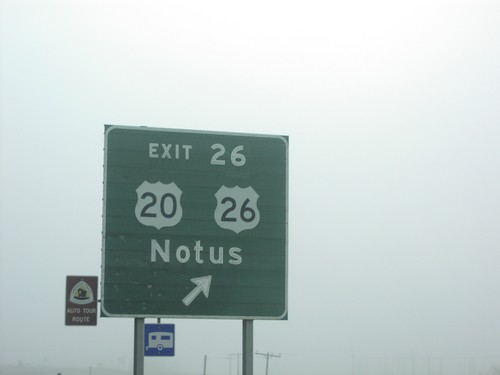
I-84 East Exit 26
I-84 east at Exit 26 - US-20/US-26/Notus junction in Caldwell. US-20/US-26 join I-84 east through Caldwell.
ID-44 West at ID-84/US-30 Onramp at Exit 25
I-84 west freeway entrance at western end of ID-44
Greenleaf
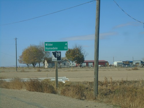
ID-19 West - Distance Marker
Distance marker on ID-19 west. Distance to Wilder and Homedale.
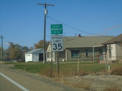
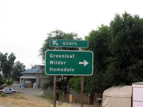
ID-19 West - Greenleaf
Entering Greenleaf on ID-19 west. Speed Limit 35 MPH.
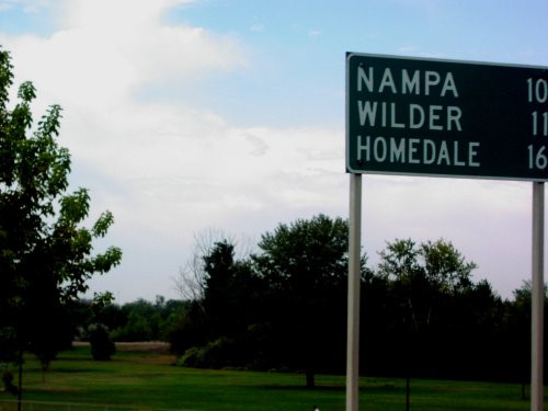
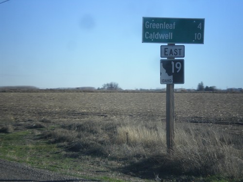
ID-19 East - Distance Marker
Distance marker on ID-19 east. Distance to Caldwell, Nampa, and Boise.
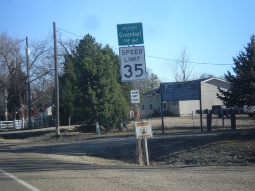
ID-19 East - Greenleaf
Entering Greenleaf, Population 862 on ID-19 east.
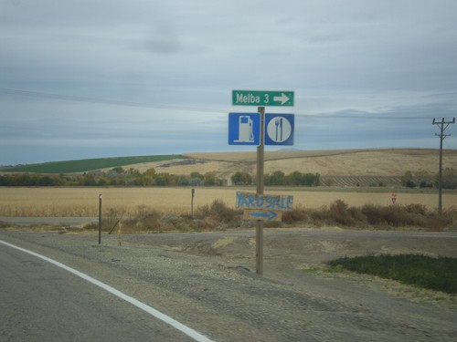
Melba
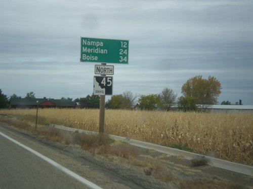
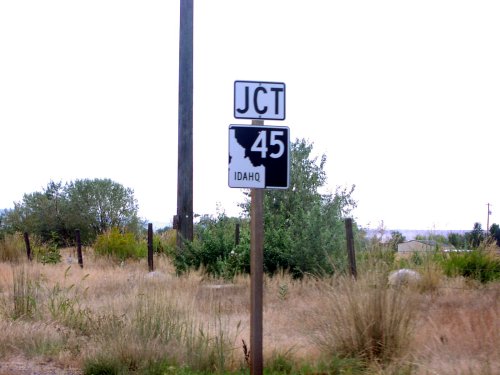
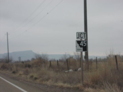
ID-45 North - Distance Marker
Distance maker on ID-45 north. Distance to Nampa, Meridian, and Boise.
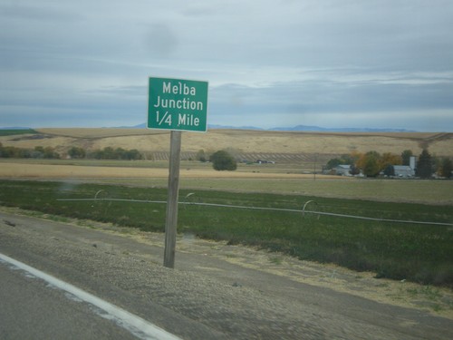
ID-45 North - Melba Junction
ID-45 north at Melba Road east to Melba.
ID-45 North - Melba Junction
ID-45 north approaching Melba Road.
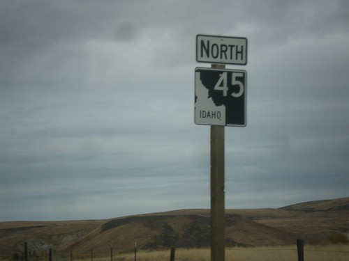
ID-45 North - Canyon County
ID-45 north in Canyon County.
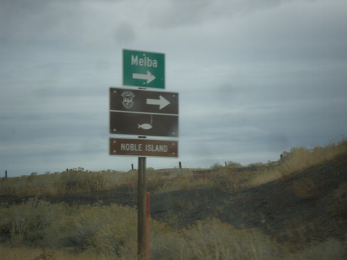
ID-45 North - Melba
ID-45 North at Ferry Road junction to Melba. Also turn right for Noble Island fishing access.
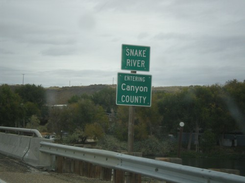
ID-45 North - Canyon County / Snake River
Entering Canyon County on ID-45 north at the Snake River bridge.
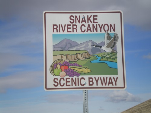
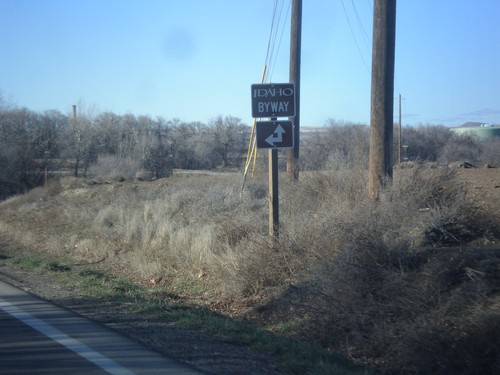
Snake River Canyon Scenic Byway
Snake River Canyon Scenic Byway on Map Rock Road West, at ID-45 junction.
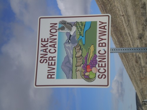
Snake River Canyon Scenic Byway
Snake River Canyon Scenic Byway on Map Rock Road West, at ID-45 junction.
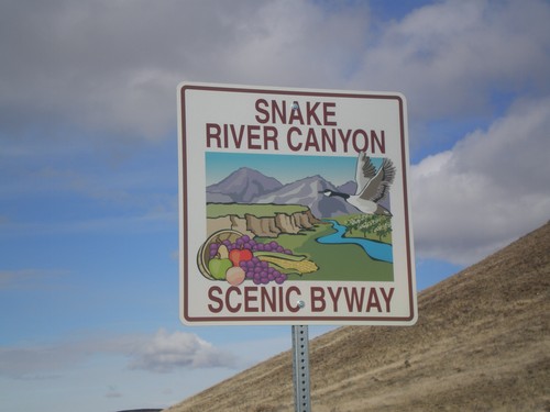
Snake River Canyon Scenic Byway
Snake River Canyon Scenic Byway on Map Rock Road West, at ID-45 junction.
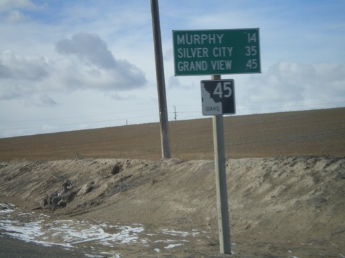
ID-45 South - Distance Marker
Distance marker on ID-45 south to Murphy, Silver City, and Grand View.
Middleton
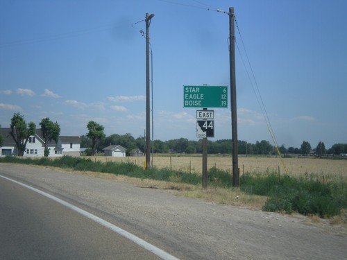
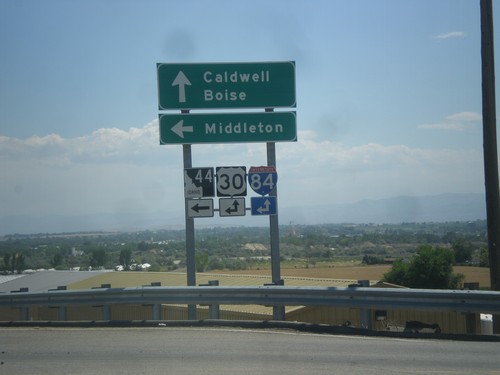
ID-44 East - Distance Marker
Distance marker on ID-44 east. Distance to Star, Eagle, and Boise.
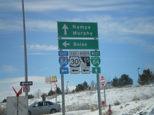
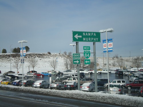
Nampa
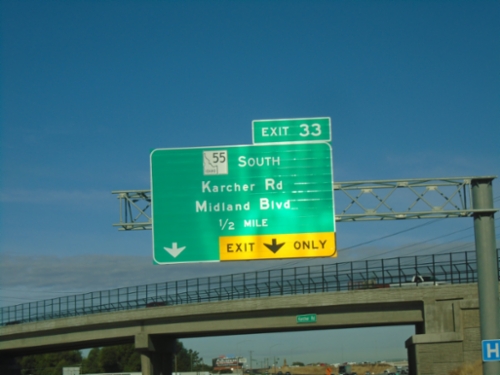
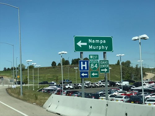
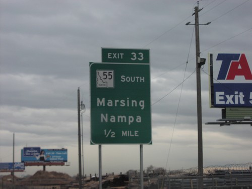
Karcher Road West Approaching I-84 East/ID-55 North
Karcher Road West approaching I-84 East/ID-55 North (Exit 33) to Boise. Continue west on ID-55 for Marsing.
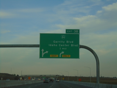
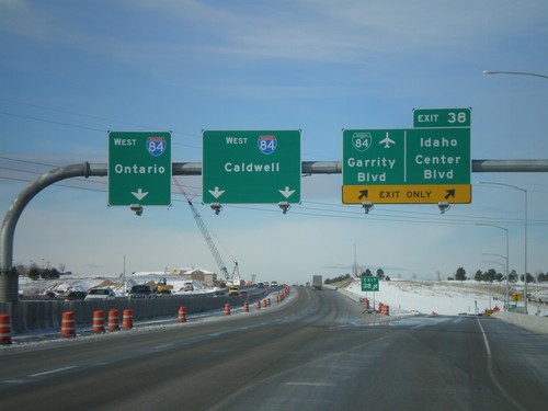
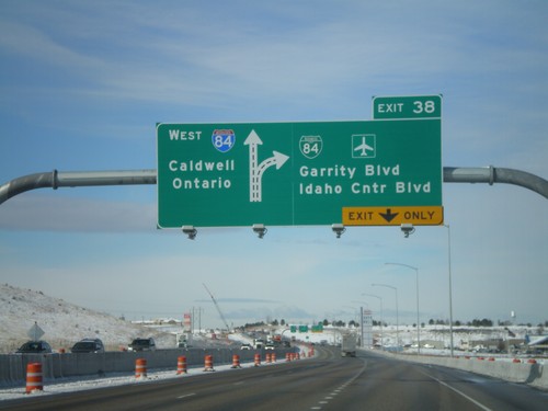
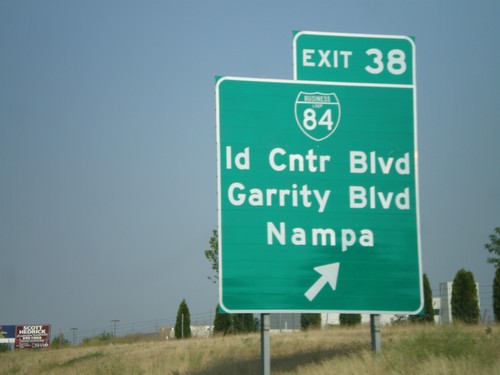
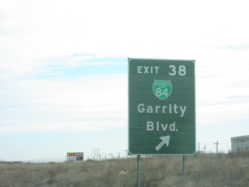
I-84 West - Exit 38
I-84/US-30 west at Exit 38 - BL-84/Garrity Blvd./Idaho Center Blvd.
Karcher Road West at I-84/US-30 East/ID-55 North
Karcher Road West at I-84/US-30 East/ID-55 North (Exit 33) to Boise.
Karcher Road West at I-84/US-30 East
Karcher Road West at I-84/US-30 East/ID-55 North (Exit 33). Turn left for ID-55 North.
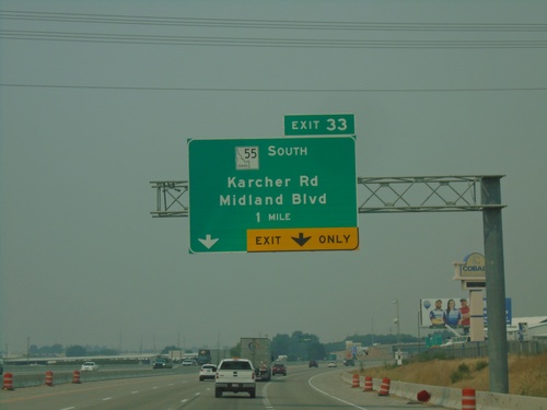
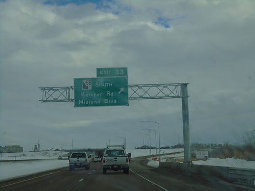
I-84 West - Exit 33
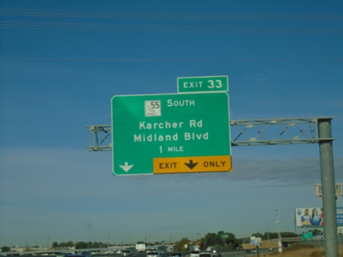
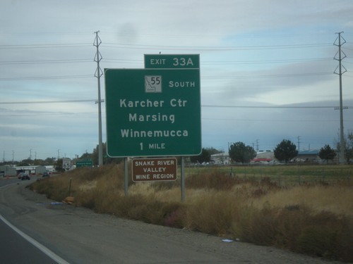
I-84 west approaching Exit 33 - ID-55 South/Karcher Road/Midland Blvd. ID-55 south leaves I-84/US-30 westbound.
I-84 West - Exit 33
I-84 west approaching Exit 33 - ID-55 South/Karcher Road/Midland Blvd. ID-55 south leaves I-84 westbound.
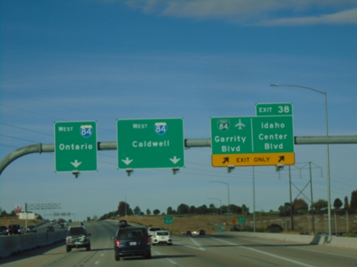
I-84 West - Exit 38
I-84 west at Exit 38 - BL-84/Garrity Blvd./Idaho Center Blvd. I-84 heads west towards Caldwell and Ontario (Oregon).
I-84 West - Exit 33
I-84 west approaching Exit 33 - ID-55 South/Karcher Road/Midland Blvd. ID-55 south leaves I-84 westbound.
I-84 East - Exit 33
I-84 east at Exit 33 - ID-55 South/Karcher Road/Midland Blvd.
I-84/US-30 East/ID-55 North - Nampa
I-84/US-30 East/ID-55 North in Nampa
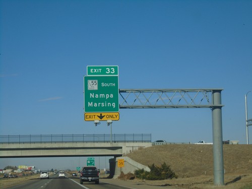
I-84 West - Exit 33
I-84 west at Exit 33 - ID-55 South/Nampa/Marsing. ID-55 leaves I-84 westbound here. This interchange has recently been reconfigured westbound, removing the 33A ramp, and renumbering the interchange to 33.
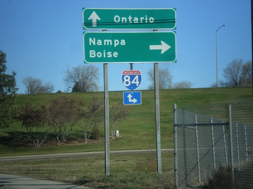
End BL-84 East at I-84/US-30/ID-55
End BL-84 East at I-84/US-30/ID-55 in Nampa. Merge right for I-84/US-30 East and ID-55 north to Meridian and Boise; continue under freeway for I-84/US-30 West and ID-55 south to Caldwell.
BL-84 East Approaching I-84/US-30/ID-55
BL-84 East approaching I-84/US-30/ID-55 (Exit 38) in Nampa. This is the east end of the Nampa business loop.
BL-84 East - Franklin Road
BL-84 East at Franklin Road junction. Merge right to continue east on BL-84. East of Franklin Road, BL-84 follows Garrity Blvd.
BL-84 East - Nampa
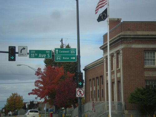
BL-84 East along 11th Ave. North in downtown Nampa
End ID-45 North at BL-84
End ID-45 North at BL-84 in Nampa. Turn right on 11th Ave. South for BL-84 east to Boise. Continue straight on 2nd St. South for BL-84 west to Caldwell.
ID-45 North (12th Ave S) at 2nd St. South
ID-45 North (12th Ave S) at 2nd St. South in downtown Nampa. Turn left to continue north on ID-45 and for BL-84.
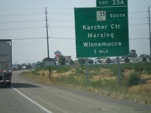
I-84 West - Exit 33A
I-84 west approaching Exit 33A - ID-55 South/Karcher Center/Marsing/Winnemucca. ID-55 south leaves I-84 westbound.
I-84 West - Exit 38 Offramp
I-84 west Exit 38 offramp. Turn left for BL-84 towards Nampa and Murphy. Turn right for the Idaho Center, an event complex.
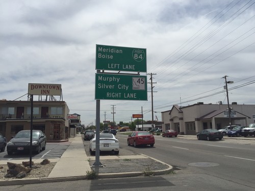
BL-84 East (3rd St.) at ID-45
BL-84 East (3rd St.) at ID-45 in Nampa. Continue straight for ID-45 south to Murphy and Silver City. Turn left on 11th Ave. to continue east on BL-84 to Meridian and Boise.
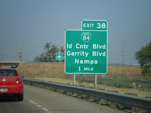
I-84 East - Exit 38
I-84 east at Exit 38 - BL-84/Garrity Blvd/Idaho Center Blvd. Use I-84 east for Meridian and Boise. This is the eastern end of the Nampa/Caldwell business loop.
I-84 East - Exit 38
I-84 east approaching Exit 38 - BL-84/Idaho Center Blvd./Garrity Blvd.
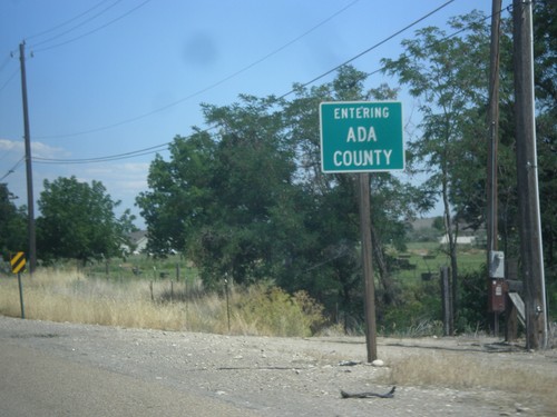
US-20/US-26 East - Ada County
Entering Ada County on US-20/US-26 east.
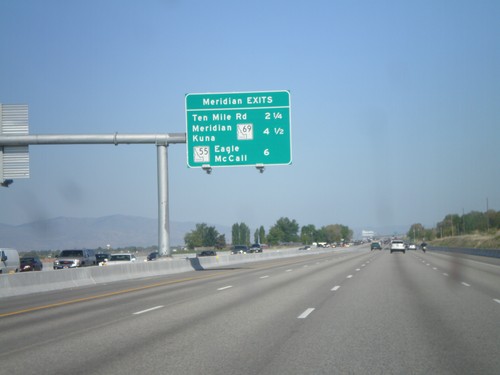
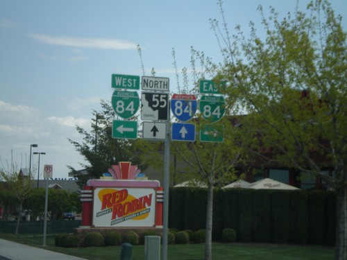
I-84 East - Meridian Exits
Meridian exits on I-84 east. Approaching Ten Mile Road, ID-69, and ID-55 junction.
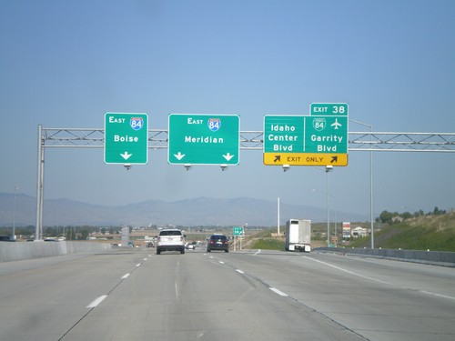
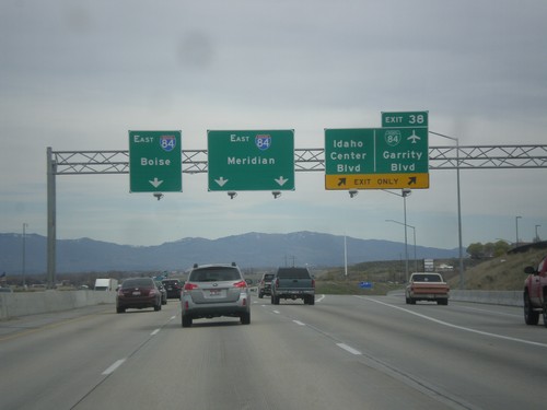
I-84 East - Exit 38
I-84 east at Exit 38 - BL-84/Garrity Blvd/Idaho Center Blvd. Use I-84 east for Meridian and Boies. This is the eastern end of the Nampa/Caldwell business loop. This interchange was recently rebuilt as part of the widening of I-84 between Nampa and Boise.
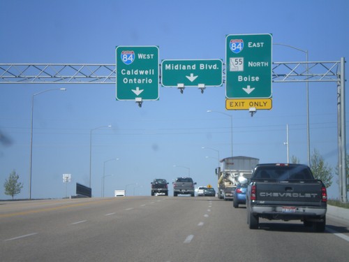
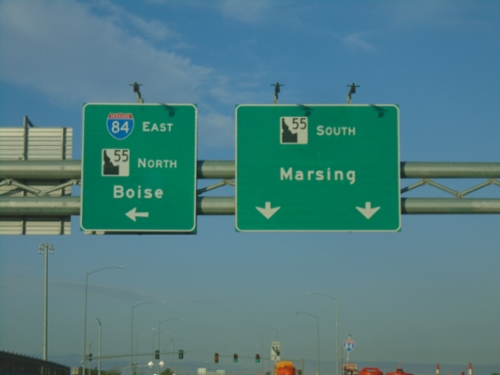
ID-55 South at I-84/US-30
ID-55 south at I-84/US-30 junction (Exit 33). Turn right for I-84/US-30 East/ID-55 south to Boise. Turn left for I-84/US-30 west to Caldwell and Ontario (Oregon). Continue ahead for Midland Blvd. ID-55 joins I-84 east to Meridian.
BL-84 West at ID-45
BL-84 West (11th Ave. South) at ID-45. Turn right on 2nd St. South to continue west on BL-84 towards Caldwell and Marsing. Continue ahead on 11th Ave. South for ID-45 south towards Murphy.
Begin BL-84 West at I-84 Exit 38 Onramp
Begin BL-84 West (Garrity Blvd.) at I-84/US-30/ID-55 onramp at Exit 38. Use I-84/US-30 East/ID-55 north for Boise. Continue on BL-84 west for Nampa and Murphy.
I-84 West - Exit 38 Offramp
I-84 west Exit 38 offramp. Turn left for BL-84 towards Nampa and Murphy. Turn right for the Idaho Center, an event complex.
I-84 West - Exit 38
I-84 west at Exit 38 - BL-84/Garrity Blvd./Idaho Center Blvd. I-84 heads west towards Caldwell and Ontario (Oregon). Oddly, there are two different control cities for two different sets of lanes. Through Nampa, all through traffic is urged to use the left lanes, so it does not make since why Ontario bound traffic use the left most lane.
I-84 West - Exit 38
I-84/US-30 west at Exit 38 - BL-84/Garrity Blvd./Idaho Center Blvd. Westbound I-84 traffic continues towards Caldwell and Ontario (OR).
ID-55 North at BL-84
ID-55 north at BL-84 (Nampa-Caldwell Blvd.). Continue north on ID-55 for I-84.
I-84 East - Meridian Exits
Meridian exits on I-84 east. Approaching ID-69, and ID-55 junction.
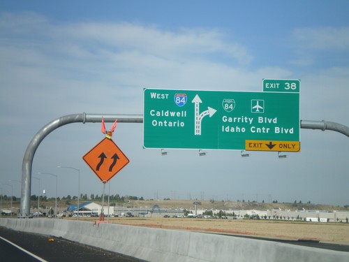
I-84 West - Exit 38
I-84/US-30 west at Exit 38 - BL-84/Garrity Blvd./Idaho Center Blvd. Westbound I-84 traffic continues towards Caldwell and Ontario (OR).
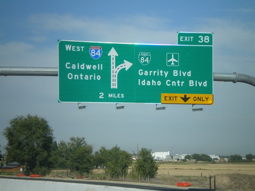
I-84 West Approaching Exit 38
I-84/US-30 west approaching Exit 38 - BL-84/Garrity Blvd./Idaho Center Blvd. Westbound I-84 traffic continues towards Caldwell and Ontario (OR). This is a new sign as part of the I-84 widening between Meridian and Nampa.
I-84 West - Exit 33A
I-84 west approaching Exit 33A - ID-55 South/Karcher Center/Marsing/Winnemucca. ID-55 south leaves I-84 westbound.
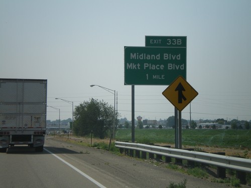
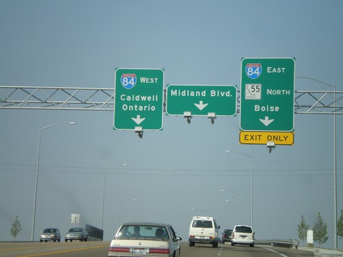
I-84 West - Exit 33B
I-84 west approaching Exit 338 - Midland Blvd./Market Place Blvd.
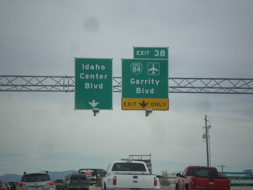
I-84 East Exit 38
I-84 east at Exit 38 - BL-84/Idaho Center Blvd./Garrity Blvd./Murphy
I-84 East Approaching Exit 38
I-84 east approaching Exit 38 - BL-84/Idaho Center Blvd./Garrity Blvd./Nampa
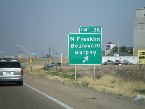
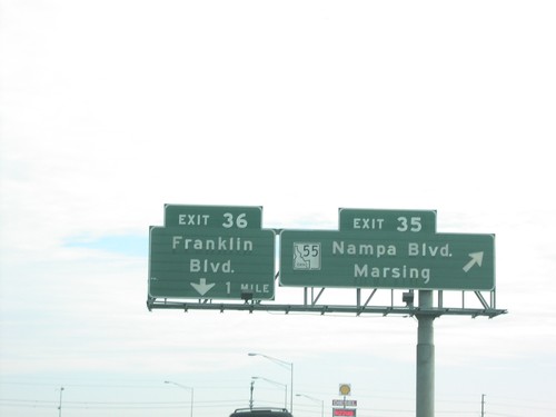
I-84 East Exit 36
I-84 east at Exit 36 - N. Franklin Blvd./Murphy. The exit text was changed in 2007 from Franklin Blvd.
ID-55 North at I-84
ID-55 east at I-84. Take I-84 west to Caldwell and Ontario. I-84 east towards Boise. ID-55 joins I-84 east to Meridian. This is a new interchange, completed in 2007. Before this, all ID-55 traffic was routed through downtown Nampa to get to the interstate.
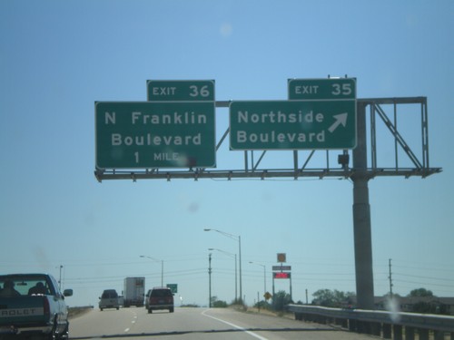
I-84 East - Exit 35 Approaching Exit 36
I-84 east at Exit 35 - Northside Blvd. Approaching Exit 36 - N Franklin Blvd.
I-84 West - Exit 36 Approaching Exit 35
I-84 west at Exit 36 - N. Franklin Blvd. Approaching Exit 35 - Northside Blvd.
I-84 East Exit 33
I-84 east at newly opened Exit 33, ID-55 South/Nampa/Marsing.

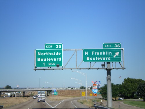
I-84 East Exit 35
I-84 East at Exit 35 - ID-55/Nampa Blvd./Marsing. The ID-55 interchange has since been relocated to Exit 33. The current interchange is signed as Northside Blvd.
I-84 East Exit 38
I-84 east at Exit 38 - BL-84/Garrity Blvd. This is the eastern end of the Nampa/Caldwell business loop.
I-84 East Exits 35 and Exit 36
I-84 east at Exit 35 - ID-55/Nampa Blvd./Marsing and Exit 36 - Franklin Blvd. ID-55 has since been relocated to Exit 33. The new exit text for Exit 35 is Northside Blvd. Exit 36 is now Franklin Blvd./Murphy
Notus
US-20/US-26 West Leaving Notus
Distance marker on US-20/US-26 west leaving Notus. Distance to Parma, Notus (Oregon), and Bend (Oregon). This is the first instance of Bend as a control city on US-20/US-26 Westbound.
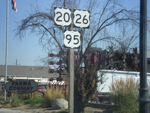
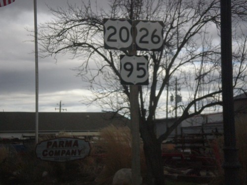
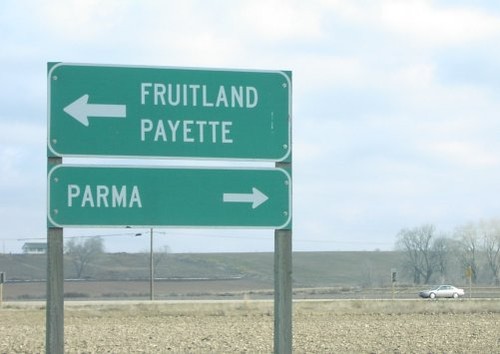
Parma
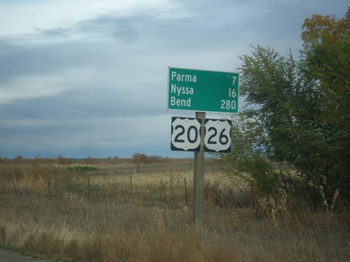
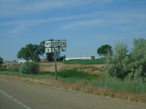
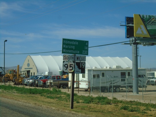
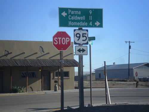
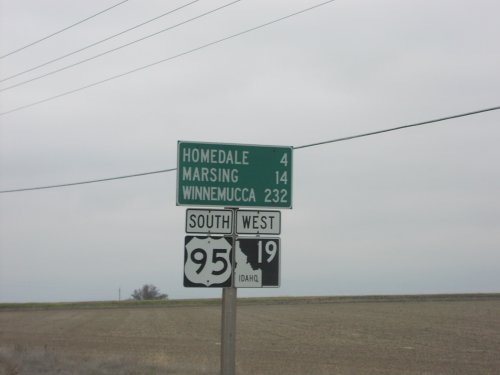
US-95 South - Distance Marker
Distance marker on US-95 south. Distance to Wilder, Homedale, and Winnemucca (Nevada).
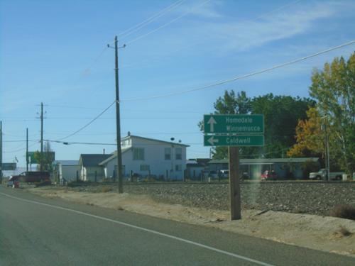
US-95 South at US-20/US-26
US-95 South at US-20/US-26 in Canyon County. Turn right for US-20/US-26 west to Nyssa (Oregon). Continue on US-95 South/US-20 East/US-26 East to Parma and Winnemucca (Nevada).
US-95 South at US-20/US-26
US-95 South at US-20/US-26 junction. US-20/US-26 joins US-95 south through Parma.
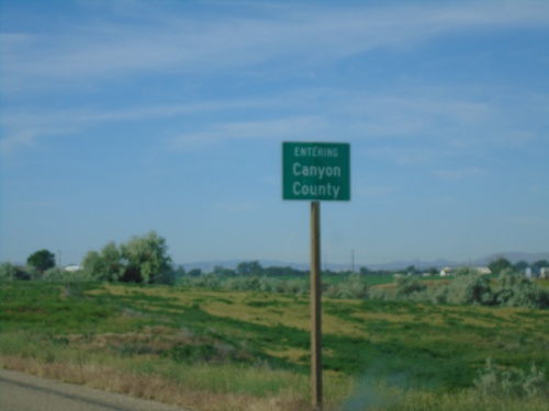
US-95 South - Canyon County
Entering Canyon County on US-95 south.
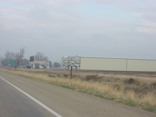
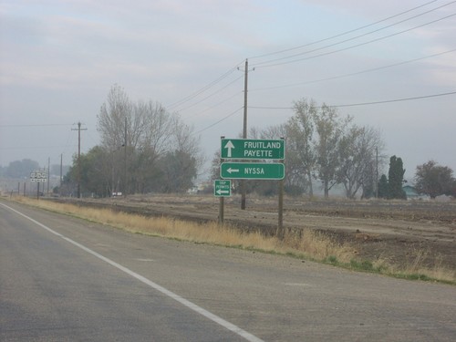
US-20/US-26 East/US-95 South - Parma
US-20/US-26 East/US-95 South in Parma
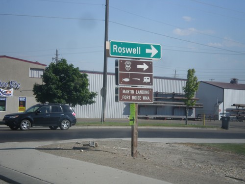
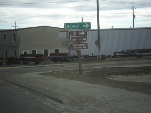
US-20/US-26 East/US-95 South - Roswell Jct.
US-20/US-26 East/US-95 South at Roswell junction (Old Highway 18) in Parma.
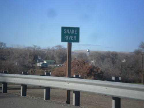
US-20/US-26 West - Snake River
US-20/US-26 West at the Snake River. The Snake River marks the boundary between Oregon and Idaho, starting just south of here.
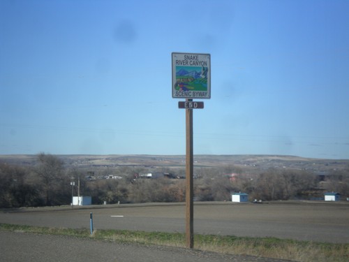
US-20/US-26 West - End Snake River Canyon Scenic Byway
End Snake River Canyon Scenic Byway on US-20/US-26 West, approaching the Oregon state line. This is the only End sign I have seen for a Scenic Byway in Idaho.
US-20/US-26 West - Apple Valley Road
US-20/US-26 west at Apple Valley Road. The Snake River Canyon Scenic Byway joins US-20/US-26 westbound here.
US-20/US-26 East/US-95 South - Parma
US-20/US-26 East/US-95 South in Parma
US-20/US-26 East/US-95 South - Roswell Jct.
US-20/US-26 East/US-95 South at Roswell junction (Old Highway 18) in Parma.
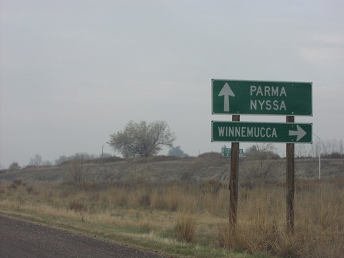
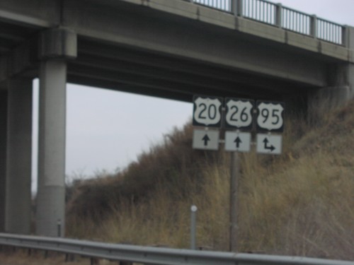
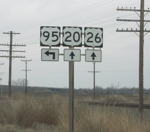
US-20/US-26 West at US-95 South
US-20/US-26 west at US-95 south to Winnemucc
US-20/US-26 West at US-95 South
US-20/US-26 west at US-95 south and Oregon Trail Sign
US-20/US-26 West at US-95 South
US-20/US-26 west at US-95 junction
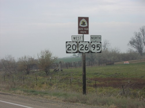
US-20/US-26 West/US-95 North
US-20/US-26 west, US-95 north and Oregon Trail Sign
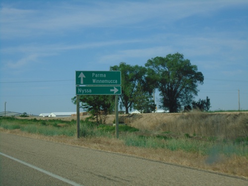
US-95 North/US-20/US-26 West Split
US-95 north at US-20/US-26 wes
US-95 North/US-20/US-26 West Split
US-95 north at US-20/US-26 west to Nyssa, OR
US-20/US-26 East at US-95
US-20/US-26 east at US-95 junction in Payette County.
US-20/US-26 East at US-95 South
US-20/US-26 east at US-95 south junction in Parma.
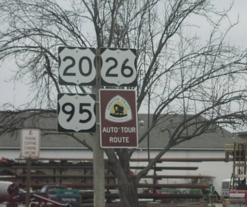
US-20/US-26 East/US-95 South
US-20/US-26 east, US-95 south and Oregon Trail shields in Parma.
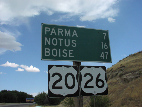
Distance Marker on US-20/US-26 East
Distance Marker To Notus/Parma/Boise on US-20/US-26 East, ID-OR Border
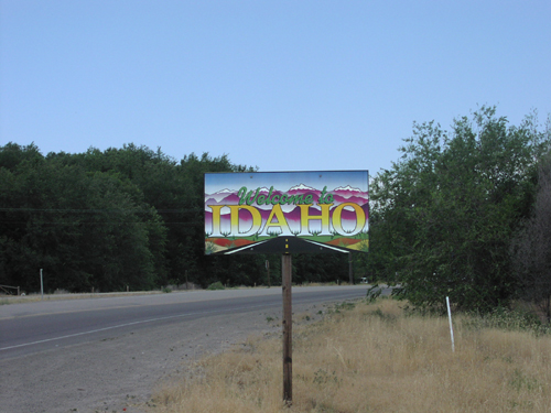
Welcome To Idaho - US-20/US-26 East
Welcome to Idaho on US-26/US-20 East
Star
ID-44 East - Entering Ada County
Entering Ada County on ID-44 east. Ada County is home to Boise, the capital of Idaho, and is the most populous county in the state.
Walters Ferry
End ID-45 South at ID-78
End ID-45 south at ID-78. Use ID-78 west for Marsing. Use ID-78 east for Murphy, the Owyhee County Seat.
ID-78 East Approaching ID-45
Junction ID-45 north on ID-78 east.
Jct. ID-45 on ID-78 East
Junction ID-45 on ID-78 east in Owyhee County.
Wilder
US-95 South Approaching ID-19 East
US-95 South approaching ID-19 East. Use ID-19 east to Caldwell. Continue south on US-95 and ID-19 West for Homedale and Winnemucca (Nevada). ID-19 joins US-95 south to Homedale.
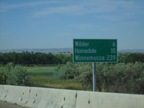
Distance Marker - US-95 South/ID-19 West South of Wilder
US-95 South/ID-19 West - Distance Marker. Distance to Homedale, Marsing, and Winnemucca (Nevada).
US-95 South Approaching ID-19 East
US-95 South approaching ID-19 East. Use ID-19 east to Caldwell. Continue south on US-95 and ID-19 West for Homedale and Winnemucca (Nevada). ID-19 joins US-95 south to Homedale.
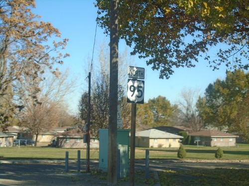
US-95 North - Wilder
US-95 north in Wilder.
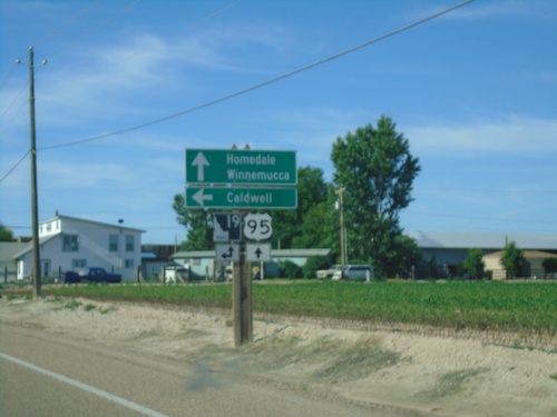
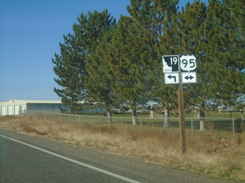
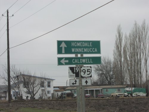
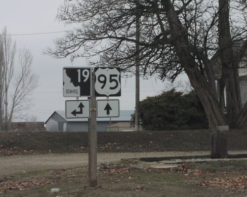
ID-19 West at US-95 - Wilder
ID-19 West at US-95 in Wilder. Turn right on US-95 North to Wilder; left for US-95 South/ID-19 West to Homedale.
ID-19 West at US-95 - Wilder
ID-19 West at US-95 in Wilder. ID-19 West follows US-95 South to Homedale.
ID-19 East - Distance Marker
Distance marker on ID-19 east. Distance to Greenleaf and Caldwell.
Golden Gate Ave. East at US-95
Golden Gate Ave. East at US-95 in Wilder. Turn right on US-95 south for Caldwell and Homedale. Turn left on US-95 north for Parma.
Distance Marker - US-95 South/ID-19 West South of Wilder
US-95 South/ID-19 West - Distance Marker. Distance to Homedale, Marsing, and Winnemucca (Nevada).
US-95 South - Entering Owyhee County and Snake River
US-95 South/ID-19 West - Entering Owyhee County / Snake River.
US-95 South Approaching ID-19 East
US-95 South approaching ID-19 East. Use ID-19 east to Caldwell. Continue south on US-95 and ID-19 West for Homedale and Winnemucca (Nevada). ID-19 joins US-95 south to Homedale.
US-95 South At ID-19 East
US-95 south at ID-19 east in Wilder. Turn left for ID-19 east. Continue straight for ID-19 west and US-95 south. ID-19 joins US-95 south to Homedale.