Clark County, Idaho
Localities: Dubois | Hamer | Humphrey | Monteview | Spencer
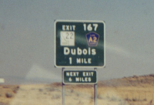
Dubois
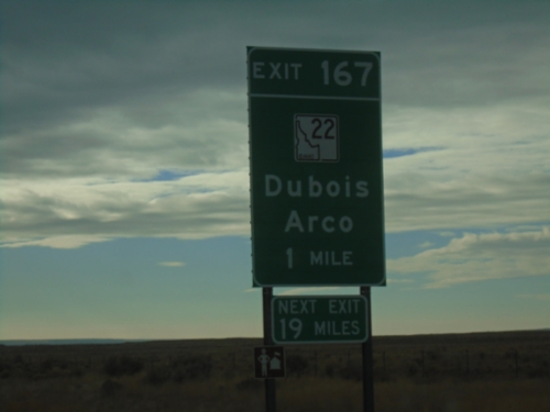
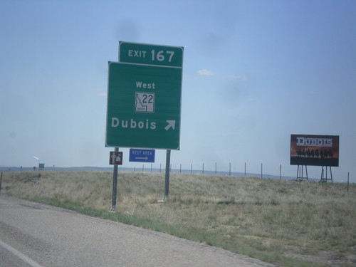
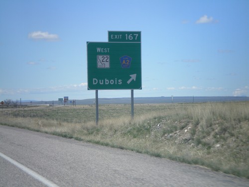
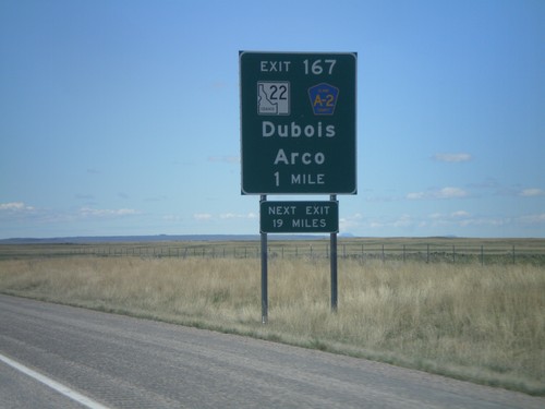
I-15 South - Exit 167
I-15 South approaching Exit 167 - ID-22/Dubois/Arco. Next Exit 19 Miles.
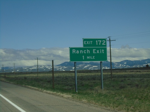
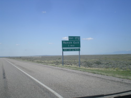
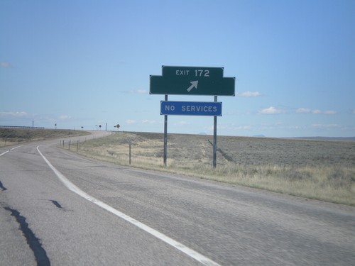
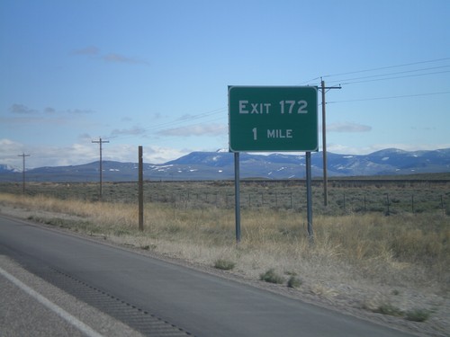
I-15 North - Exit 172
I-15 north approaching Exit 172 - Ranch Exit.
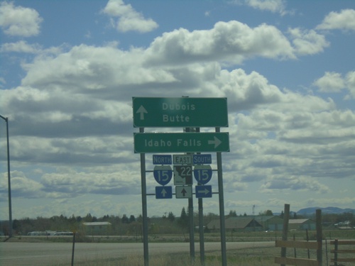
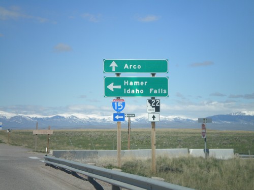
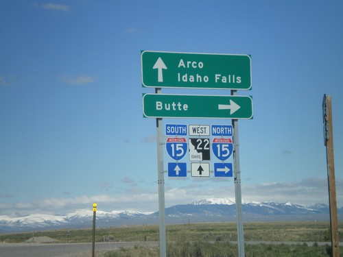
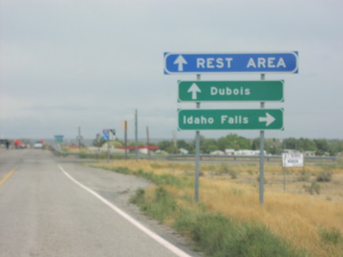
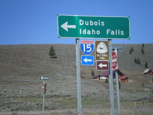
ID-22 East at I-15
ID-22 east at I-15. Use I-15 south for Idaho Falls. Use I-15 north for Butte (Montana). Continue east on ID-22 for Dubois.
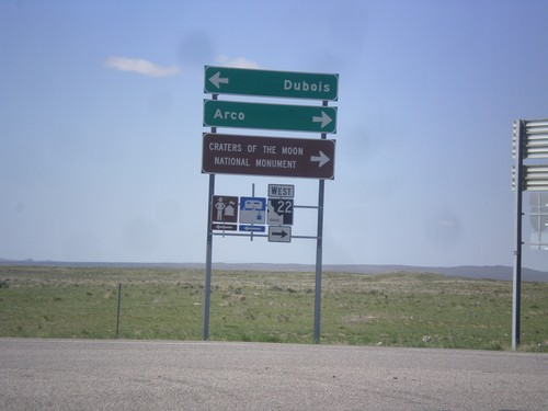
I-15 South Offramp at ID-22
I-15 south (Exit 167) offramp at ID-22. Turn right for ID-22 west to Craters of the Moon National Monument and Arco. Turn left for Dubois.
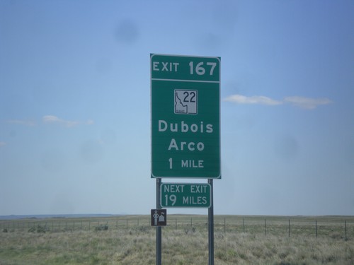
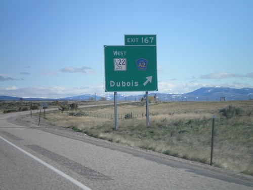
I-15 South - Exit 167
I-15 south at Exit 167 - ID-22 West/Dubois.
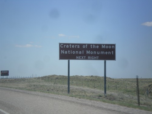
I-15 South Approaching Exit 167
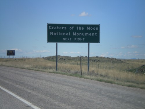
I-15 south approaching Exit 167. Use Exit 167 for Craters of the Moon National Monument.
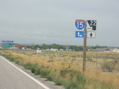
I-15 South - Exit 167
I-15 South approaching Exit 167 - ID-22/Dubois/Arco. The actual sign at the exit omits Arco from the destination.
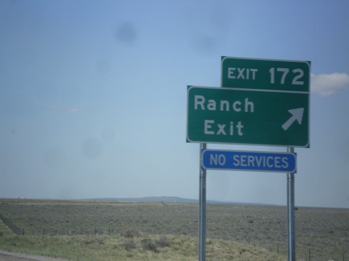
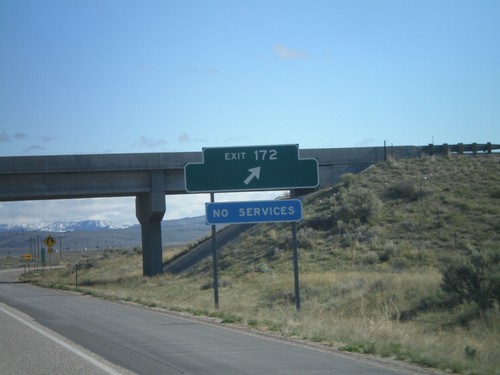
I-15 South - Exit 172
I-15 south approaching Exit 172 - Ranch Exit. The destination Ranch Exit was assigned to this interchange, after years of no have a destination. Before no destination, the exit was marked US Sheep Experiment Station.
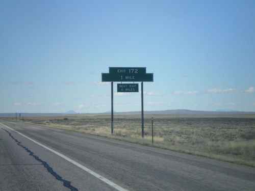
I-15 South - Exit 172
I-15 south approaching Exit 172 - Ranch Exit.
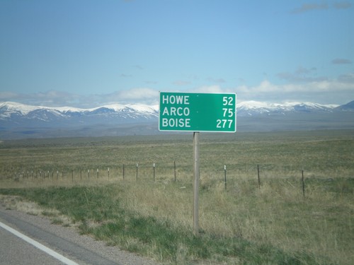
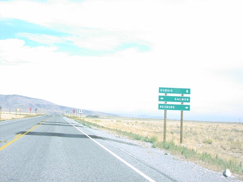
ID-22 West - Distance Marker
Distance marker on ID-22 west to Howe, Arco, and Boise.
ID-22 West
ID-22 just west of Dubois.
ID-22 West at I-15 South Onramp
ID-22 west at I-15 south Exit 167 onramp to Hamer and Idaho Falls. Continue west on ID-22 for Arco.
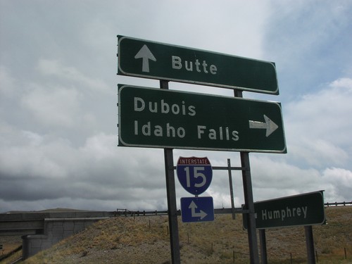
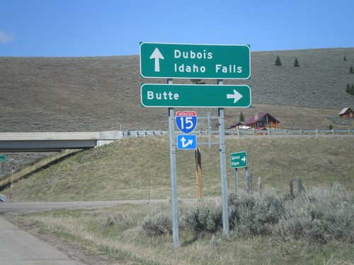
Begin ID-22 West at I-15
Begin ID-22 west at I-15 north to Butte. ID-22 continues west towards Arco. Use I-15 south for Idaho Falls.
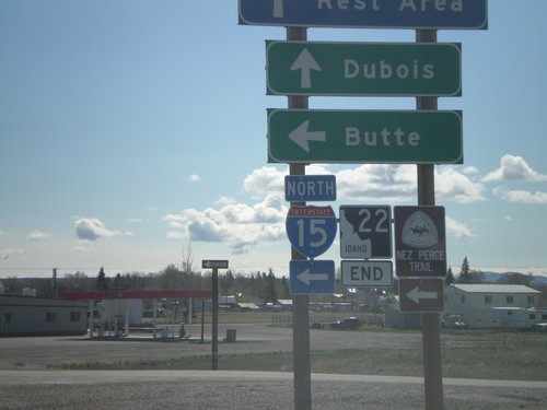
End ID-22 East at I-15
End ID-22 at I-15 north to Butte.
I-15 Exit 167 Offramp at ID-22
I-15 south at ID-22. Use ID-22 west for Arco, and Craters of the Moon National Monument.
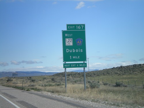
I-15 South - Exit 167
I-15 south at Exit 167 - ID-22 West/CR-A2/Dubois.
I-15 South Approaching Exit 167
I-15 south approaching Exit 167. Use Exit 167 for Craters of the Moon National Monument.
I-15 South - Exit 167
I-15 South approaching Exit 167 - ID-22/Clark County A2/Dubois/Arco. The actual sign at the exit omits Arco from the destination.
I-15 South - Exit 172
I-15 south at Exit 172. Exit 172 was formerly signed as US Sheep Experiment Station
I-15 South - Exit 172
I-15 south approaching Exit 172. Exit 172 does not have a destination, but it formerly had a destination to the US Sheep Experiment Station.
I-15 North - Exit 172
I-15 North at Exit 172. Exit 172 has no destinations, but formerly listed the US Sheep Experiment Station.
I-15 North - Exit 172
I-15 north approaching Exit 172. Exit 172 does not have a destination listed, but was formerly listed as US Sheep Experiment Station.
I-15 North - Exit 167
I-15 north Exit 167 - ID-22 West/Clark County A2/Dubois.
I-15 North - Exit 167
I-15 north approaching Exit 167 - ID-22 West/Clark County A2/Dubois.
ID-22 North Approaching I-15
ID-22 East Approaching I-15 Junction
ID-22 North at I-15
Freeway Entrance for I-15 at Eastern Terminus of ID-22 North
I-15 North Exit 167
I-15 North Exit 167 - ID-22/CR-A2/Dubois. Dubois is the county seat of Clark County, Idaho the smallest (population wise) county in the state.
Hamer
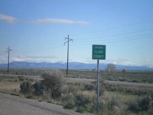
I-15 North - Entering Clark County
Entering Clark County on I-15 north at the Jefferson - Clark County line.
Humphrey
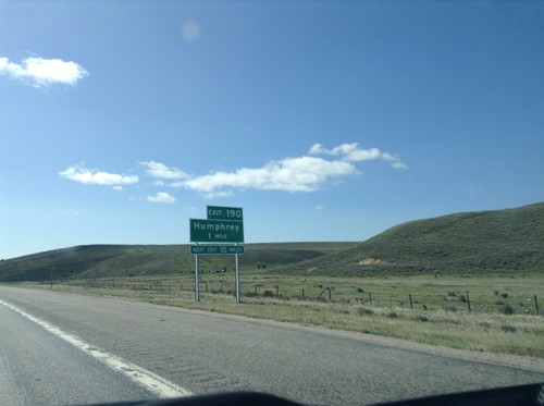
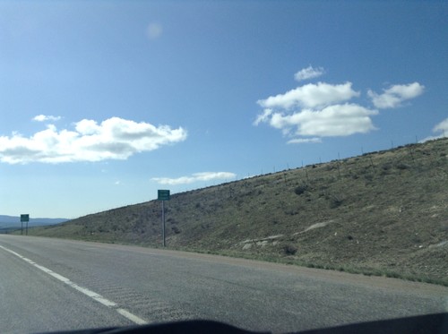
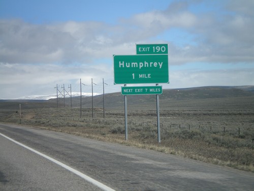
I-15 South - Exit 190
I-15 south approaching Exit 190 - Humphrey. This is the first exit on I-15 south in Idaho.
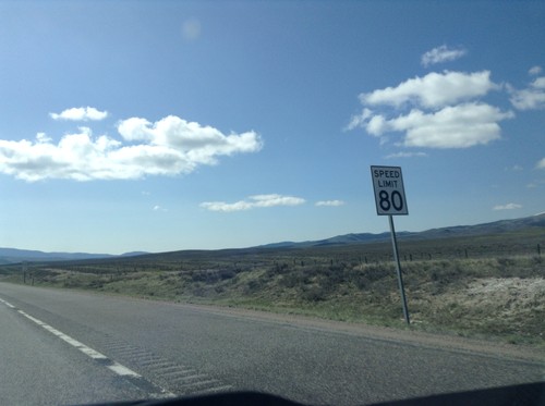
I-15 South - Speed Limit 80 MPH
Speed Limit 80 MPH on I-15 south, just south of the Idaho-Montana border. The speed limit along I-15 is 80 MPH to Idaho Falls.
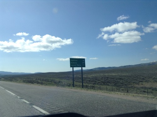
I-15 South - Distance Marker
First distance marker in Idaho along I-15 south. Distance to Spencer, Dubois, and Idaho Falls.
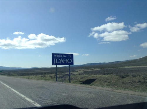
I-15 South - Welcome To Idaho
Welcome to Idaho on I-15 south at the Idaho-Montana stateline on Monida Pass.
I-15 South - Entering Clark County
I-15 south Entering Clark Count and Leaving Montana. Taken on Monida Pass on the Continental Divide between Idaho and Montana.
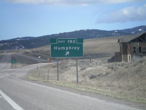
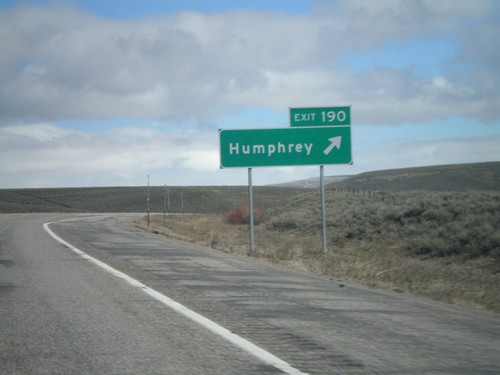
I-15 South - Exit 190
I-15 south at Exit 190 - Humphrey. This is the first exit inside Idaho on I-15 south.
I-15 South - Exit 190
I-15 south approaching Exit 190 - Humphrey. This is the first exit on I-15 south in Idaho.
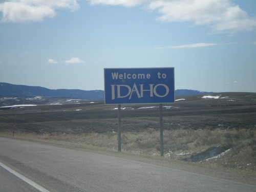
I-15 South - Welcome To Idaho
Welcome to Idaho on I-15 south at the Idaho-Montana stateline on Monida Pass.
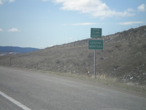
I-15 South - Entering Clark County
I-15 south Entering Clark Count and Leaving Montana. Taken on Monida Pass on the Continental Divide between Idaho and Montana.
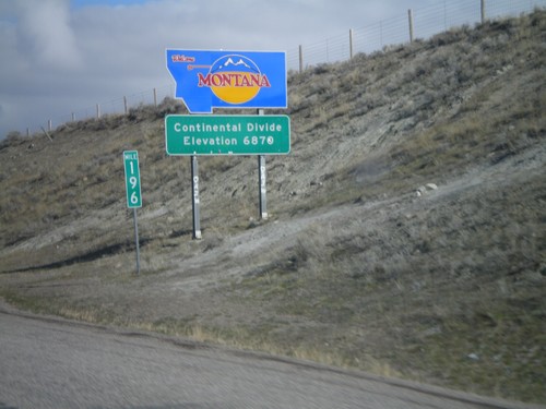
Welcome To Montana - I-15 North
Welcome to Montana on I-15 North at the Idaho-Montana state line on Monida Pass. Monida Pass is the Continental Divide.
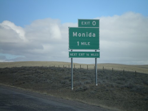
I-15 North - Exit 0 (Montana)
I-15 north approaching Montana Exit 0 - Monida. The signage is consistent with Idaho Transportation Department signs. The sign says next exit 16 miles, but the next exit is actually Exit 9, at Snowline. The next services are 16 miles in Lima.
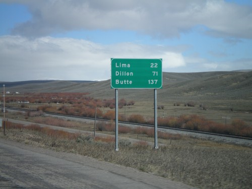
I-15 North - Distance Marker
Distance marker on I-15 north to Lima, Dillon, and Butte. All destinations are located within Montana. This is just north of Exit 190.
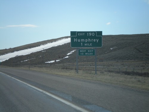
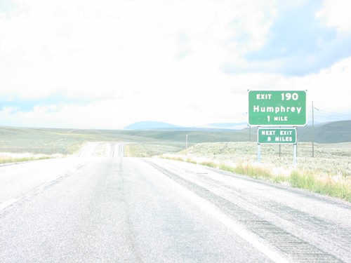
I-15 North - Exit 190
I-15 north at Exit 190 - Humphrey. This is the last exit in Idaho on I-15 north.
I-15 Onramp Exit 190
I-15 Freeway Entrance To Butte and Dubois at Last Idaho Interchange (Exit 190), Humphrey.
Monteview
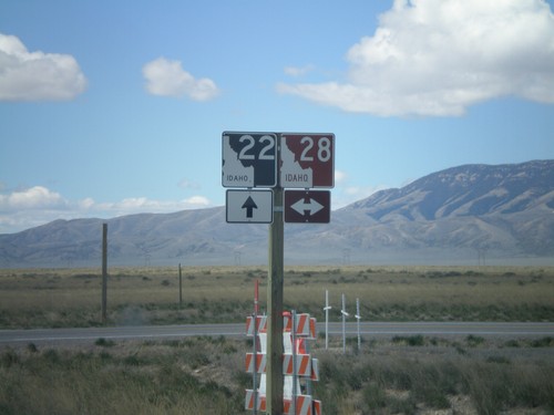
ID-22 West at ID-28
ID-22 west at ID-28. ID-28 has a brown shield because it is part of the Sacajawea Historic Byway.
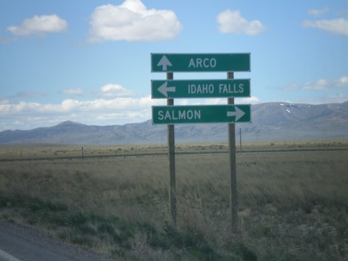
ID-22 West at ID-28
ID-22 west at ID-28 north to Salmon and south to Idaho Falls.
ID-22 West Approaching ID-28
ID-22 west approaching ID-28.
ID-22 West Approaching ID-28
ID-22 west approaching ID-28
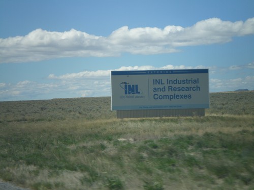
ID-22 West - Idaho National Laboratory
Entering the Idaho National Laboratory on ID-22 west.
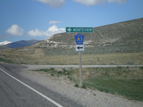
ID-22 West at Clark County A1
ID-22 west at Clark County A1 south to Monteview.
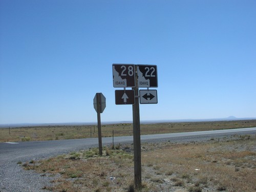
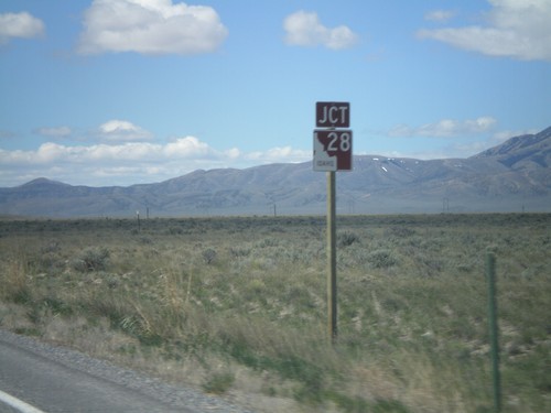
ID-28 South at ID-22
ID-28 South at ID-22
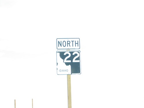
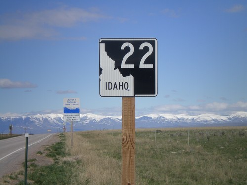
ID-22 North
ID-22 Shield on ID-22 North
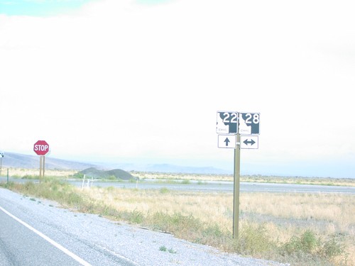
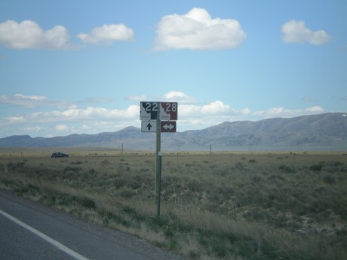
ID-22 North at ID-28
ID-22/ID-28 Junction on ID-22 East
ID-22 North at ID-28
ID-22/ID-28 Junction to Dubois/Salmon/Rexburg on ID-22 East
Spencer
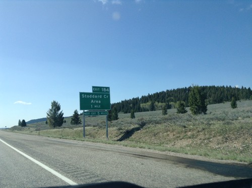
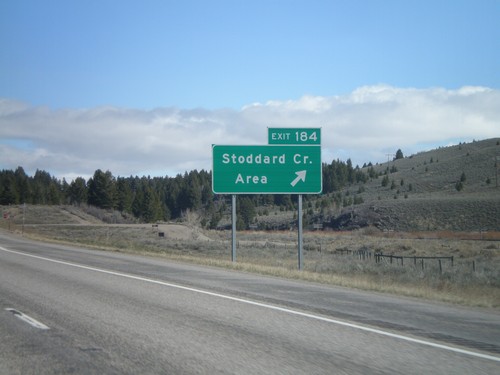
I-15 South - Exit 184
I-15 south approaching Exit 184 - Stoddard Creek Area
I-15 South Onramp at Exit 180
I-15 south onramp at Exit 180 to Dubois and Idaho Falls.
I-15 Exit 180 Onramp
I-15 north onramp at Exit 180 to Butte. Use I-15 south for Dubois and Idaho Falls.
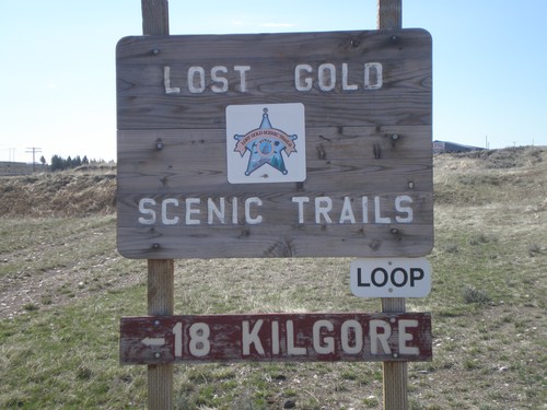
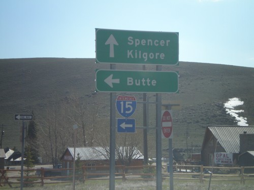
Lost Gold Scenic Trails Loop - Spencer
Lost Gold Scenic Trails Loop in Spencer on Idamon Road. Use Idamon Road for Kilgore.
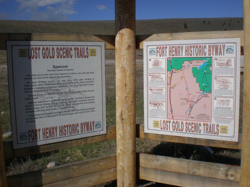
Lost Gold Scenic Trails and Fort Henry Historic Byway
Lost Gold Scenic Trails and Fort Henry Historic Byway information and map.
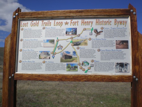
Lost Gold Trails Loop/Fort Henry Historic Byway
Lost Trails Loop and Fort Henry Historic Byway information in Spencer.
I-15 Exit 180 Onramp
I-15 north onramp at Exit 180 to Butte (Montana).
I-15 South - Exit 180 Offramp
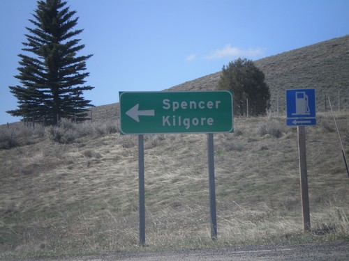
I-15 South Exit 180 offramp. Turn left for Spencer and Kilgore.
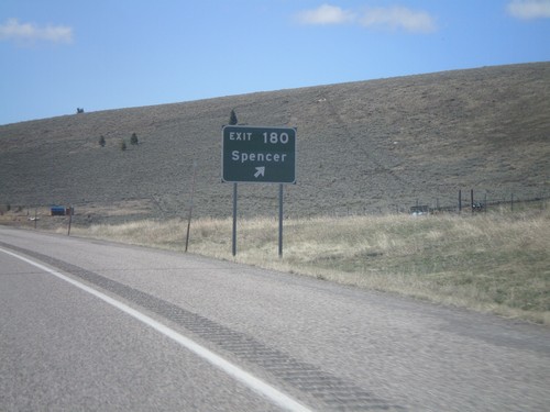
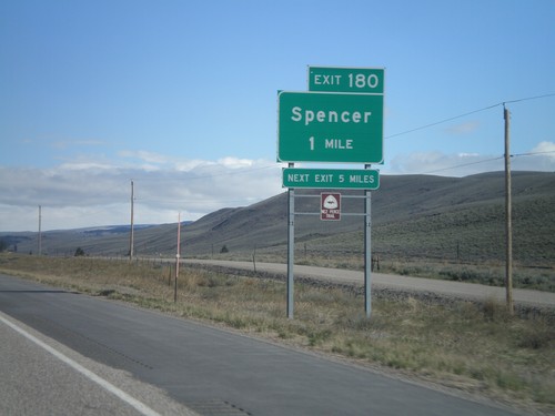
I-15 South - Exit 180
I-15 south at Exit 180 - Spencer
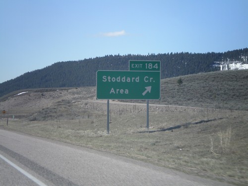
I-15 South - Exit 184
I-15 South Exit 184 - Stoddard Creek Area
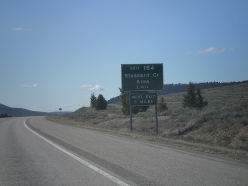
I-15 South - Exit 184
I-15 south approaching Exit 184 - Stoddard Creek Area
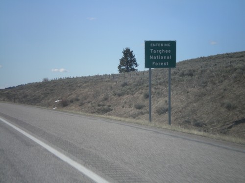
I-15 South - Entering Targhee National Forest
Entering Targhee National Forest on I-15 south.
I-15 North - Exit 190
I-15 north approaching Exit 190 - Humphrey.
I-15 North - Exit 184
I-15 north Exit 184 - Stoddard Creek Area
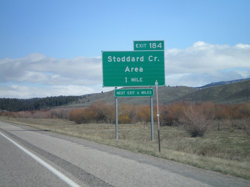
I-15 North - Exit 184
I-15 north approaching Exit 184 - Stoddard Creek Area
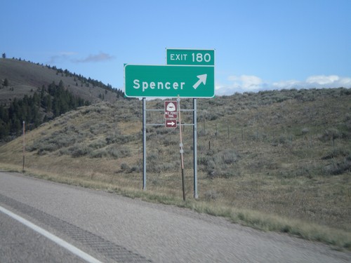
I-15 North - Exit 180
I-15 north at Exit 180 - Spencer. The Nez Perce Trail leaves I-15 here.
I-15 North - Exit 180
I-15 North Exit 180 - Spencer. Spencer is the last town on I-15 north in Idaho. Spencer lies at the base of Monida Pass. the Nez Perce Trail exits I-15 here as well.
I-15 North Exit 190
Humphrey Exit on I-15 North, Humphrey. Last Idaho exit.