Chouteau County, Montana
Localities: Big Sandy | Box Elder | Fort Benton
Big Sandy
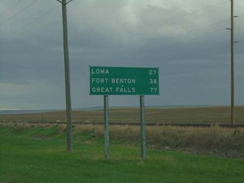
US-87 South - Distance Marker
Distance marker on US-87 south. Distance to Loma, Fort Benton, and Great Falls.
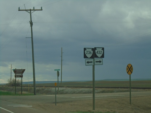
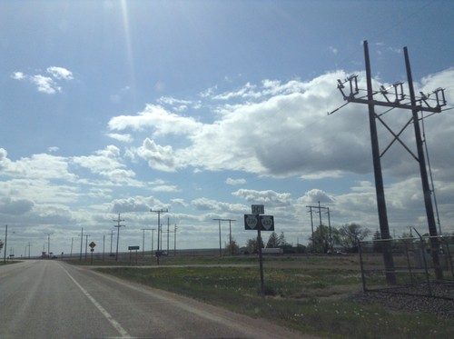
US-87 South at MTS-432/MTS-236 Junction
US-87 South at MTS-432 and MTS-236 in Big Sandy
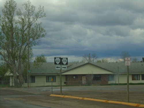
US-87 North at MTS-432/MTS-236 Junction
US-87 North at MTS-432 and MTS-236 in Big Sandy
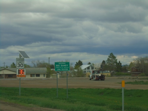
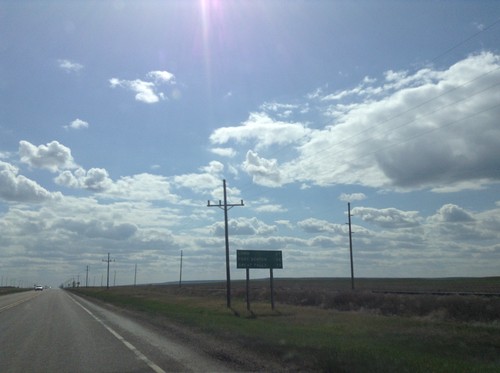
US-87 - Entering Big Sandy
Entering Big Sandy - Home of US Senator Jon Tester
US-87 South - Distance Marker
Distance marker on US-87 south. Distance to Loma, Fort Benton, and Great Falls.
US-87 South at MTS-432 and MTS-236
US-87 South at MTS-432 and MTS-236 in Big Sandy.
Box Elder
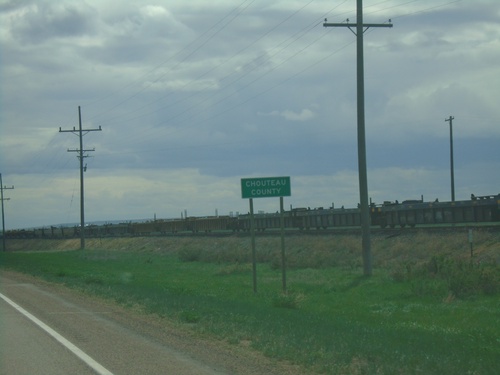
US-87 South - Chouteau County
Entering Chouteau County on US-87 south.
Fort Benton
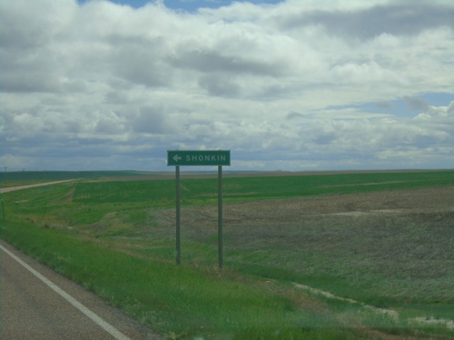
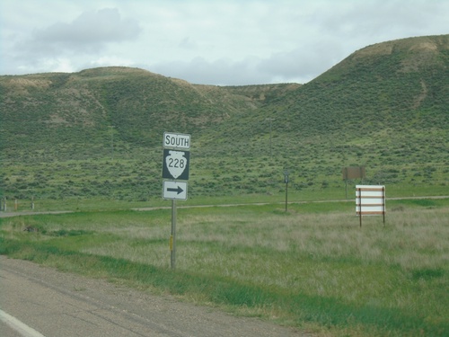
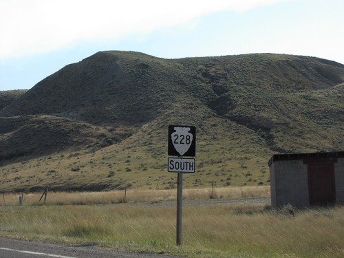
MTS-228 South at Shonkin Junction
MTS-228 South at Shonkin junction.
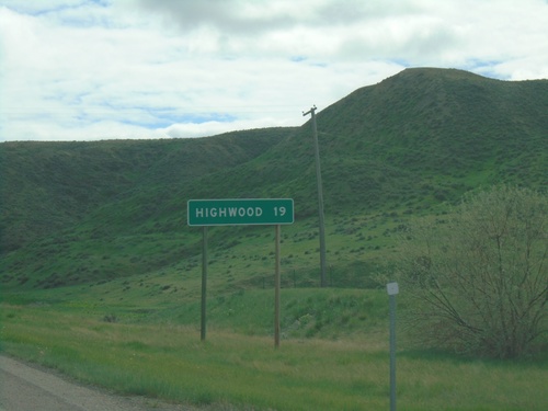
MTS-228 South - Distance Marker
Distance marker to Highwood on MTS-228 south
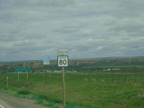
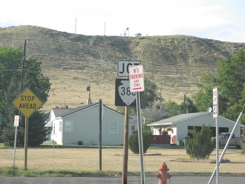
MT-80 South at MTS-228
MT-80 South at MTS-228 in Chouteau County
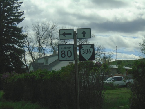
MT-80 South at MTS-386
MT-80 South at MTS-386 in Fort Benton.
MT-80 South - Fort Benton
MT-80 south descending into Fort Benton.
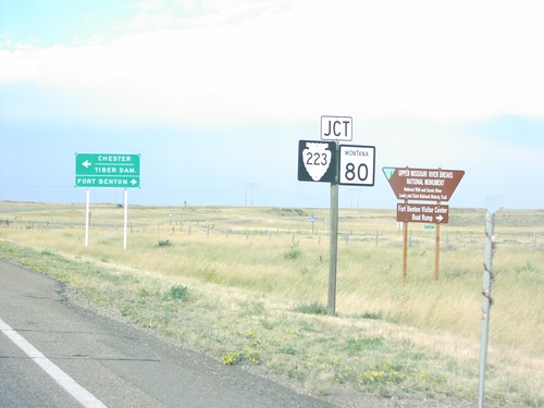
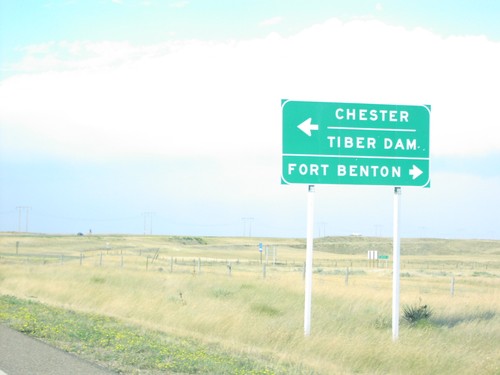
US-87 South at MT-80 and MTS-223
US-87 South at MT-80 and MTS-223. Use MT-80 for Fort Benton; use MTS-223 for Chester and Tiber Dam.
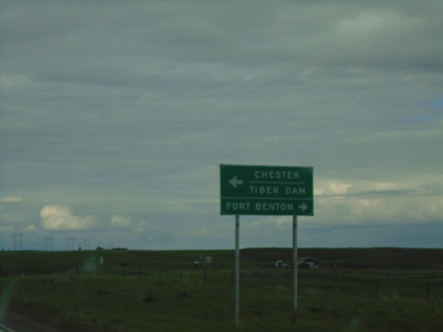
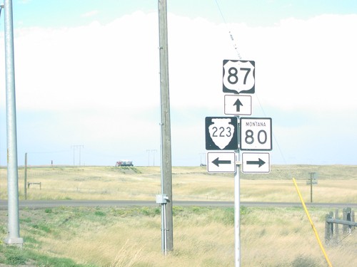
US-87 North at MT-80/MTS-223
US-87 north at MT-80 to Fort Benton and MTS-223 to Chester and Tiber Dam.
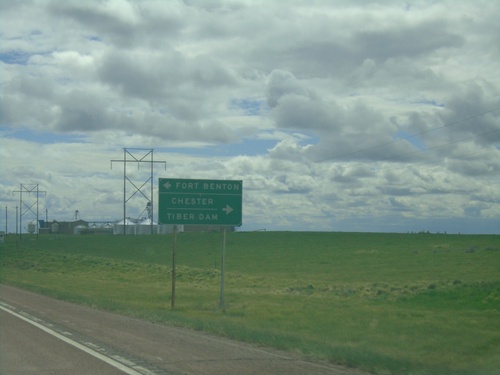
US-87 South at MT-80 and MTS-223
US-87 South at MT-80 and MTS-223. Use MT-80 for Fort Benton; use MTS-223 for Chester and Tiber Dam.
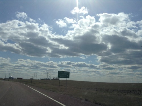
US-87 South Approaching MT-80 and MTS-223
US-87 South Approaching MT-80 and MTS-223, above Fort Benton, Montana.
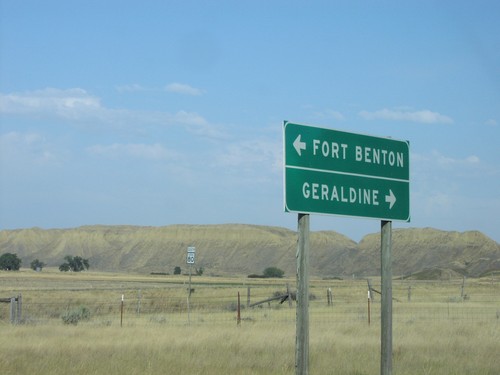
End MTS-228 at MT-80
End MTS-228 at MT-80 to Fort Benton and Geraldine
MT-80 North at MTS-386
MT-80 north at MTS-386
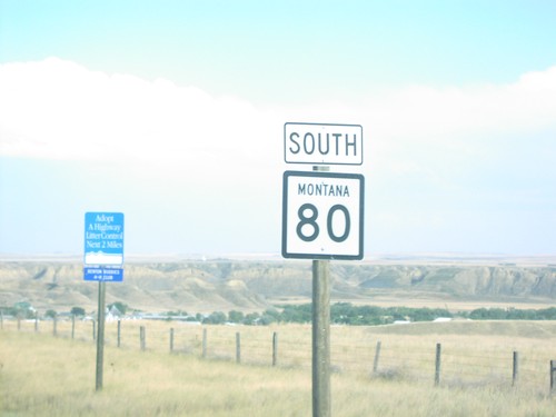
MT-80 South
MT-80 south shield
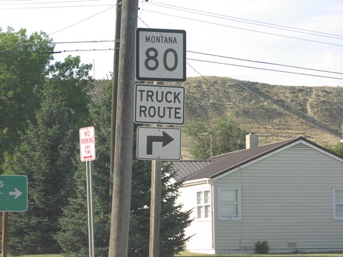
MT-80 South at MTS-386
MT-80 Truck Route at MTS-386 junction
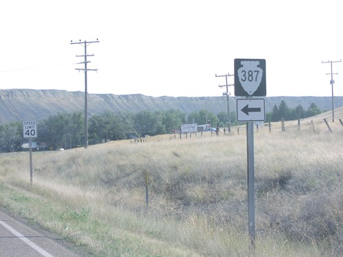
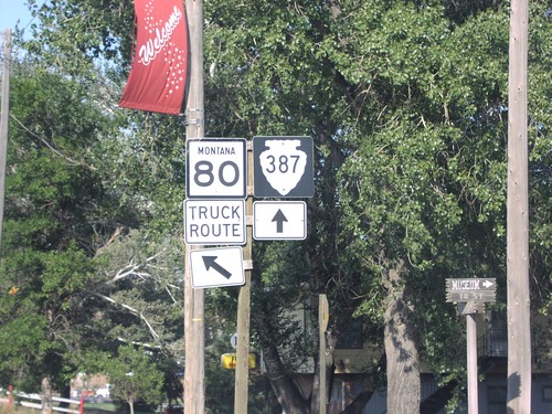
MT-80 South at MTS-387
MT-80 south at MTS-387
MTS-228 South
MTS-228 south shield
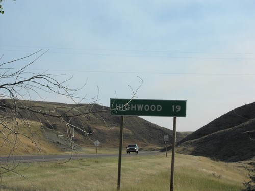
MTS-228 South - Distance Marker
Distance marker to Highwood on MTS-228 south
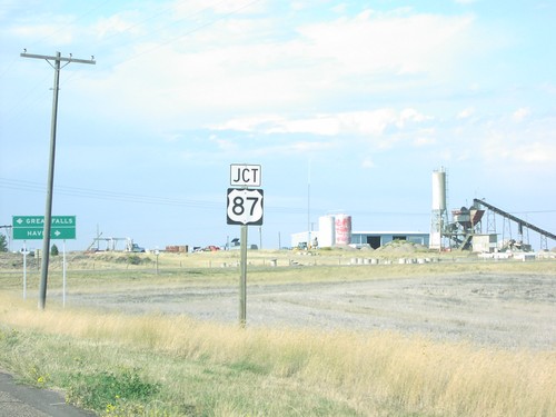
MTS-387 North Approaching US-87
Jct US-87 on MTS-387 north
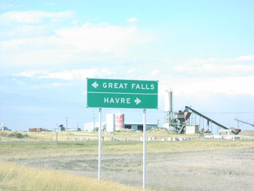
MTS-387 North at US-87
End MTS-387 north at US-87 to Great Falls and Havre.
US-87 North Approaching MT-80/MTS-223
US-87 north at MT-80/MTS-223 junction.
US-87 North at MT-80 and MTS-223
US-87 north at MT-80 East and MTS-223 West, on hill above Fort Benton.
US-87 North at MT-80/MTS-223
US-87 north at MT-80 to Fort Benton and MTS-223 to Chester and Tiber Dam.
MT-80 North at MTS-387
MT-80 north (Truck Route) at MTS-387.