Madison County, Montana
Localities: Alder | Ennis | Norris | Schusters Place | Silver Star | Twin Bridges | Varney | Whitehall
Alder
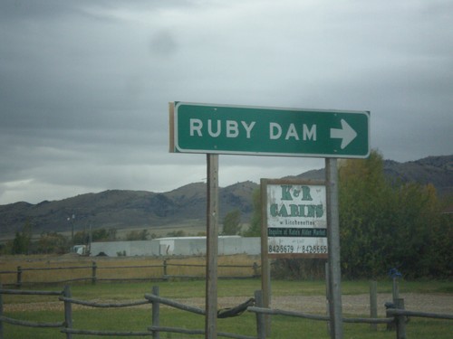
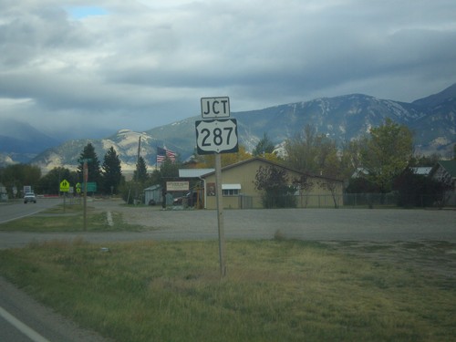
MT-287 South at MTS-357
MT-287 south at MTS-357 to Ruby Dam.
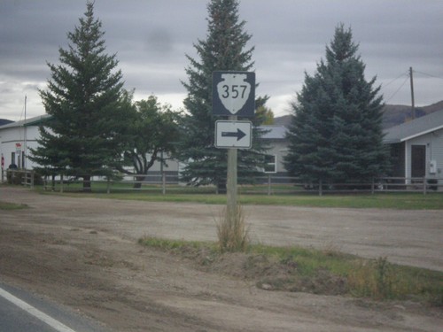
MT-287 South Approaching MTS-357
MT-287 South approaching MTS-357 in Alder.
Ennis

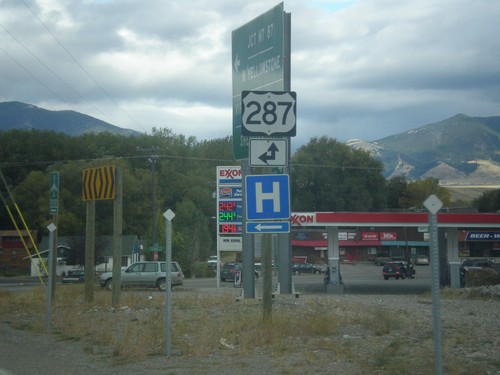
US-287 North at MT-287
US-287 North at MT-287 in Ennis.
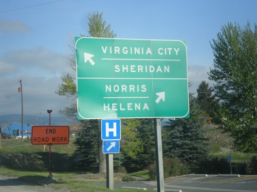
US-287 North at MT-287
US-287 North at MT-287 in Ennis. Merge left on MT-287 for Virginia City and Sheridan. Merge right to continue north on US-287 for Norris and Helena.
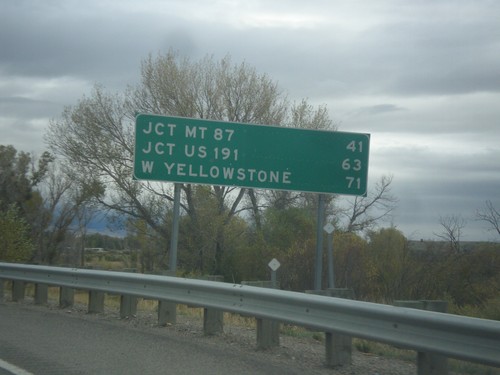
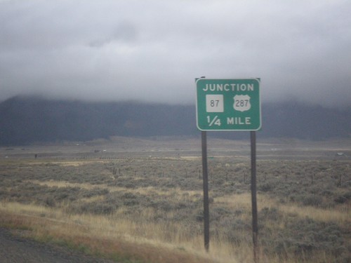
US-287 South - Distance Marker
Distance marker on US-287 south. Distance to Jct. MT-87, Jct. US-191, and West Yellowstone.
End MT-287 South at US-287
End MT-287 south at US-287 in Ennis. Turn left for US-287 north; straight for US-287 south.
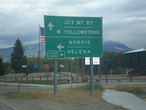
End MT-287 South at US-287
End MT-287 South at US-287. Turn left for US-287 north to Norris and Helena. Continue straight for US-287 south to West Yellowstone and Jct. MT-87. Turn right for the Madison Valley Veterans’ Memorial.
MT-287 South Approaching US-287
MT-287 South approaching US-287 in Ennis.
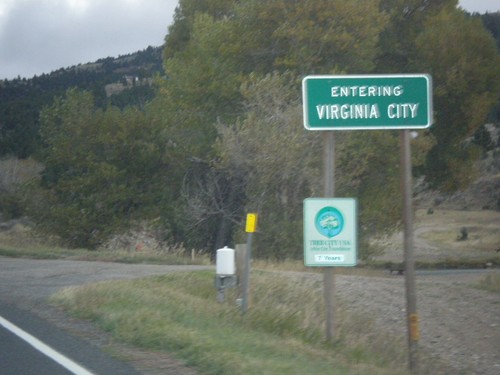
MT-287 South - Virginia City
Entering Virginia City on MT-287 south. Virginia City is the county seat of Madison County, and was the capitol of Montana Territory from 1865 to 1875.
Norris
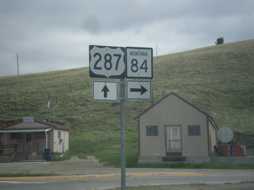
US-287 North at MT-84
US-287 north at MT-84 west in Norris.
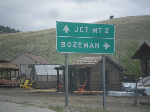
US-287 North Approaching MT-84
US-287 North approaching MT-84. Turn right on MT-84 east to Bozeman. Continue north on US-287 to MT-2 Jct.
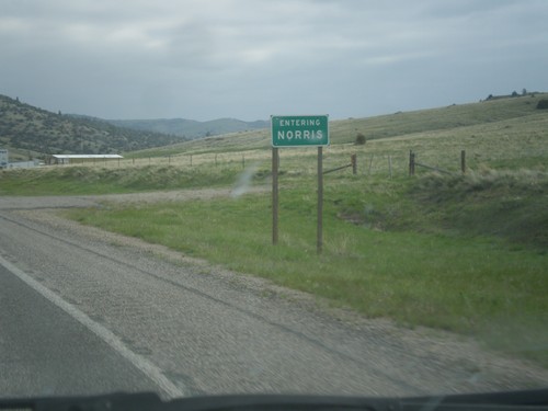
US-287 North - Norris
Entering Norris on US-287 north.
Schusters Place
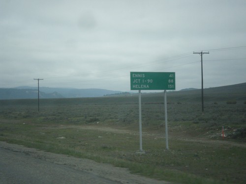
US-287 North - Distance Marker
Distance Marker on US-287 north. Distance to Ennis, Jct. I-90, and Helena.
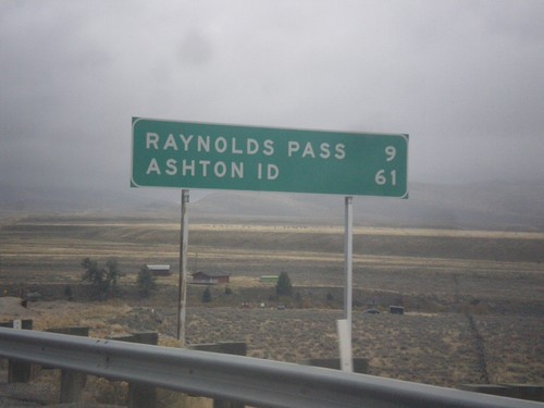
MT-87 South - Distance Marker
Distance marker on MT-87 south. Distance to Raynolds Pass (State Line - Continental Divide) and Ashton, ID.
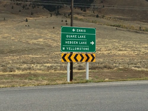
End MT-87 North at US-287
End MT-87 North at US-287. Use US-287 north for Ennis; use US-287 south for Quake Lake, Hebgen Lake, and West Yellowstone.
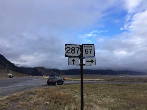
US-287 South at MT-87
US-287 South at MT-87 in Madison County.
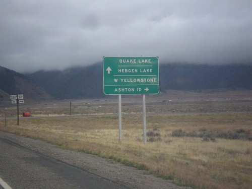
US-287 South at MT-87
US-287 South at MT-87 South. Turn right for MT-87 south to Ashton, ID. Continue south on US-287 for Quake Lake, Hebgen Lake, and West Yellowstone.
US-287 South Approaching MT-87
US-287 South approaching MT-87 in Madison County.
Silver Star
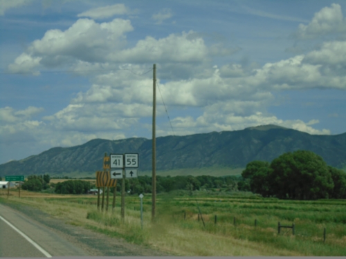
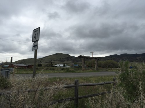
MT-41 North at MT-55
MT-41 North at MT-55 in Madison County.
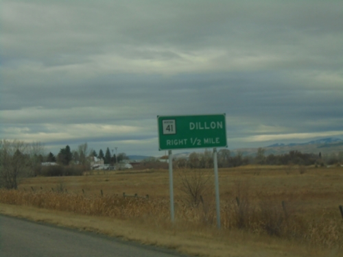
MT-41 South at MT-55
MT-41 South at MT-55 in Jefferson County.
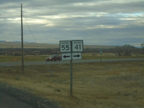
MT-41 South at MT-55
MT-41 South at MT-55 in Madison County. Use MT-55 north to Whitehall and I-90; MT-41 south to Twin Bridges and Dillon.
End MTS-422 at MT-41
End MTS-422 at MT-41 in Silver Star. Turn right for Silver Star; left for Twin Bridges.
MTS-422 West at MT-41
End MTS-422 West at MT-41 in Silver Star, at foot of Jefferson River bridge.
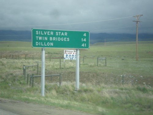
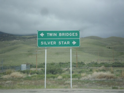
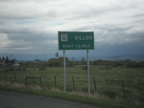
MT-41 South - Distance Marker
Distance marker on MT-41 south. Distance to Silver Star, Twin Bridges, and Dillon.
End MT-55 South at MT-41
End MT-55 South at MT-41. Turn right for MT-41 north to Butte; continue straight for MT-41 south to Twin Bridges and Dillon.
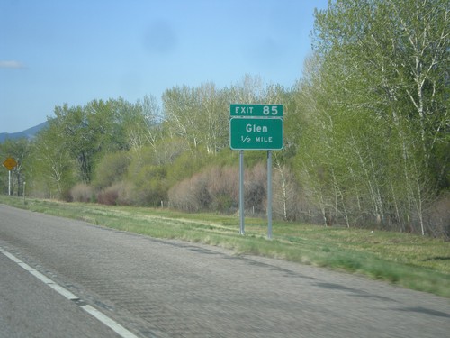
I-15 South - Exit 85
I-15 south approaching Exit 85 - Glen.
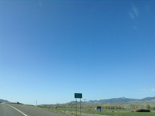
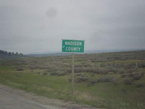
I-15 South - Madison County
Madison County on I-15 south.
Twin Bridges
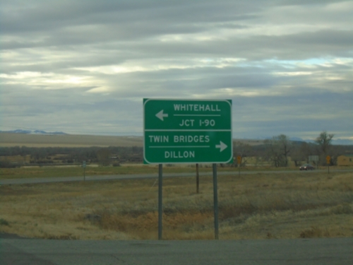
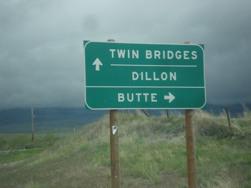
MT-41 South at MT-287
MT-41 South at MT-287 in Twin Bridges. Turn right to continue south on MT-41 to Dillon. Continue straight for MT-287 south to Sheridan and Virginia City.
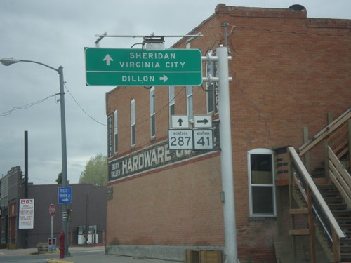
MT-41 South Approaching MT-287
MT-41 South approaching MT-287. Use MT-41 south for Dillon. Drivers will need to turn right in Twin Bridges to continue south on MT-41.
MT-41 South at MT-287
MT-41 South at MT-287 in Twin Bridges. Turn right to continue south on MT-41 to Dillon. Continue straight for MT-287 south to Sheridan and Virginia City.
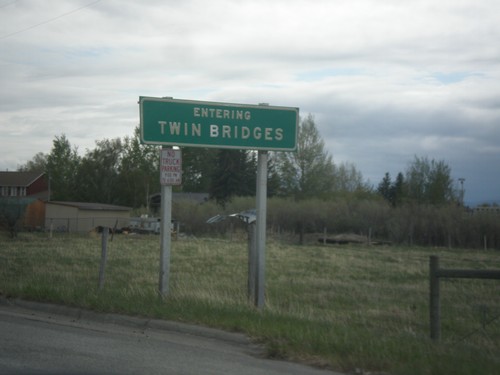
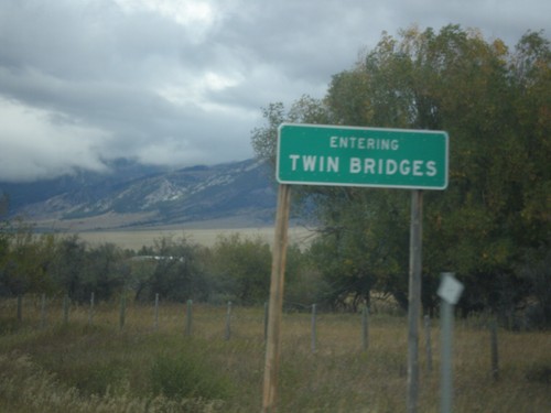
MT-41 South - Twin Bridges
Entering Twin Bridges on MT-41 south.
MT-41 South Approaching MT-287
MT-41 South approaching MT-287. Use MT-41 south for Dillon. Drivers will need to turn right in Twin Bridges to continue south on MT-41.
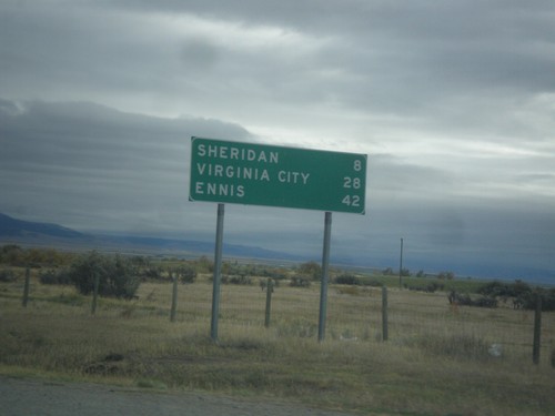
MT-287 South - Distance Marker
Distance marker on MT-287 south. Distance to Sheridan, Virginia City, and Ennis.
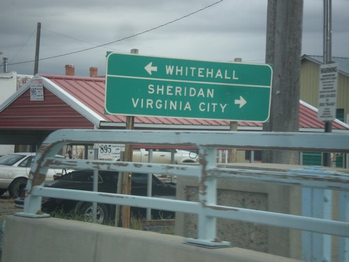
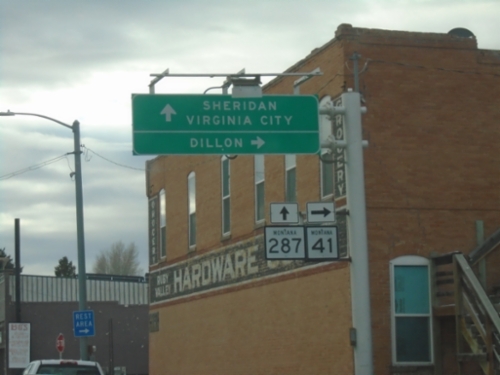
MT-41 North at MT-287
MT-41 North at MT-287 south to Sheridan and Virginia City. Turn left to continue north on MT-41 to Whitehall.
MT-41 North Approaching MT-287
MT-41 North approaching MT-287 in Twin Bridges.
MT-41 North - Twin Bridges
Entering Twin Bridges on MT-41 north.
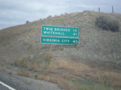
MT-41 North - Distance Marker
Distance marker on MT-41 north. Distance to Twin Bridges, Whitehall, and Virginia City (via MT-287).
Varney
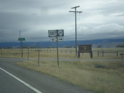
US-287 South at MTS-249
US-287 South at MTS-249 West in Madison County.
Whitehall
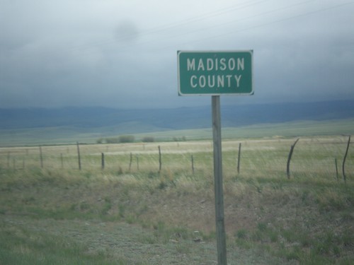
MT-55 South - Madison County
Entering Madison County on MT-55 south.
No Place Associated
MT-87 North - Madison County
Madison County on MT-87 north at the Montana-Idaho state line. The stateline is on Raynolds Pass which is on the continental divide.
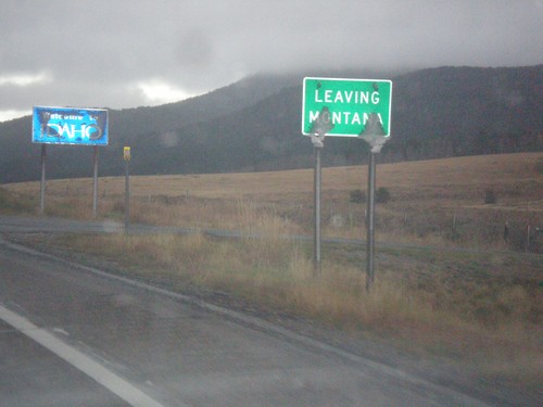
MT-87 South - Raynolds Pass
MT-87 at Raynolds Pass - Leaving Montana. The Idaho welcome sign is in the background. An early season snow storm had just passed through the area, leaving wet snow on all of the signs.