Churchill County, Nevada
Localities: Eastgate | Fallon | Fallon Station | Middlegate
No Place Associated
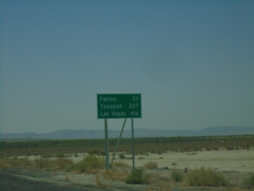
US-95 South - Distance Marker
Distance marker on US-95 South. Distance to Fallon, Tonopah, and Las Vegas.
Eastgate
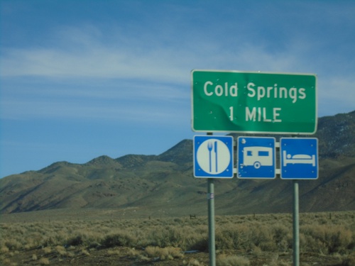
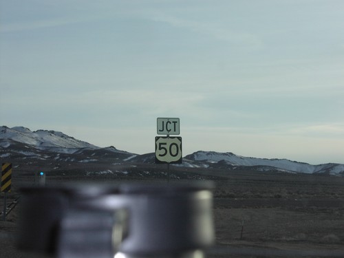
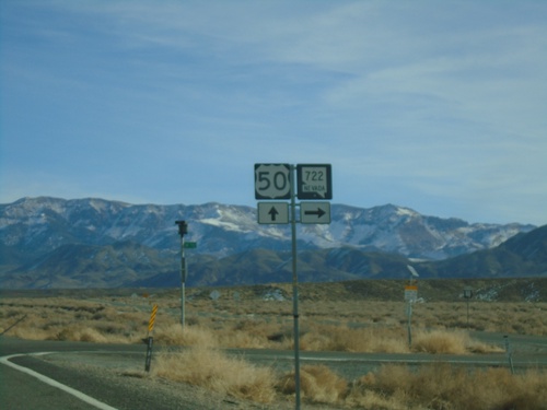
US-50 East - Cold Springs
US-50 East approaching Cold Springs.
Fallon
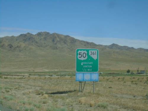
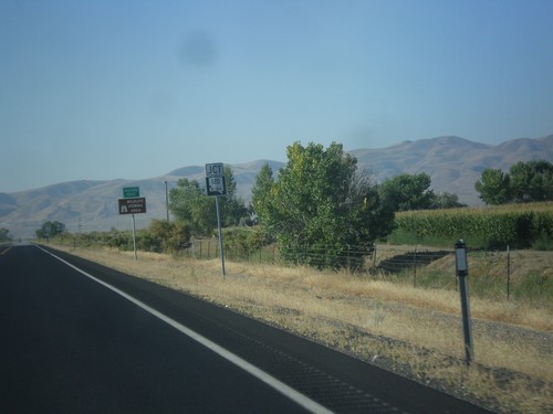
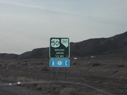
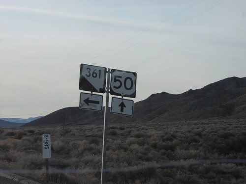
NV-361 North Approaching US-50 - Middlegate Junction
NV-361 North approaching US-50 - Middlegate Junction.
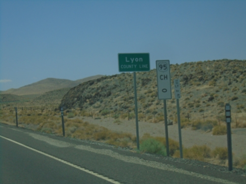
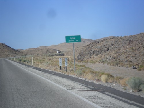
US-95 South - Lyon County
Lyon County Line on US-95 South. Mile 0 US-95 Churchill (CH) County. US-95 runs through a short 2 mile stretch of Lyon County.
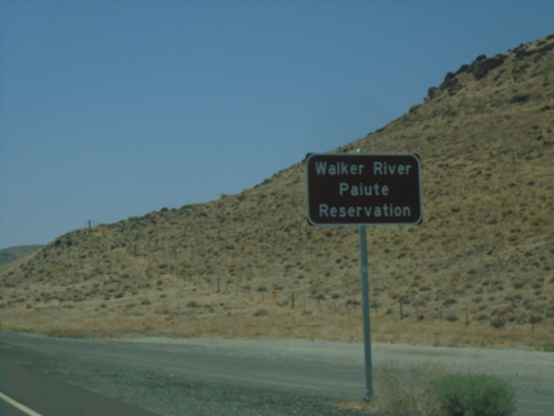
US-95 South - Walker Paiute Indian Reservation
Entering Walker Paiute Indian Reservation on US-95 South
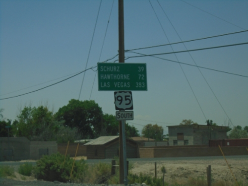
US-95 South - Distance Marker
Distance marker on US-95 south. Distance to Schurz, Hawthorne, and Las Vegas.
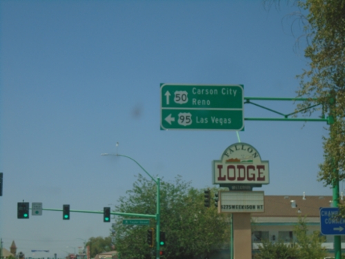
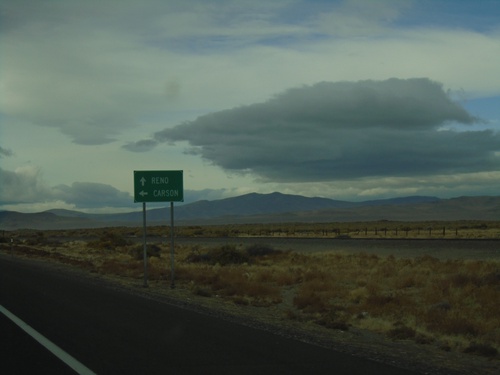
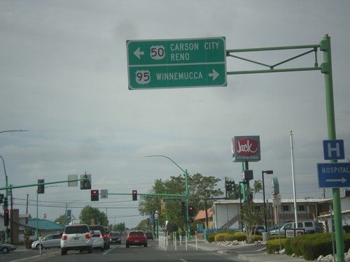
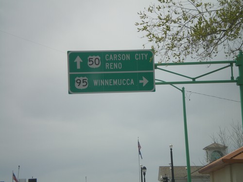
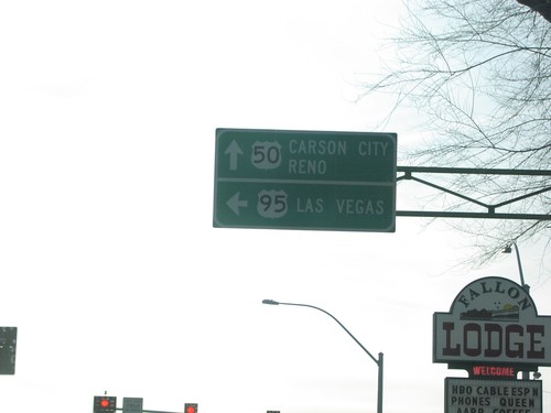
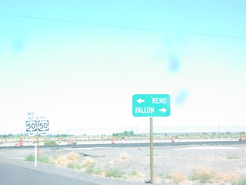
US-50 West/US-95 South at US-50/US-95 Split
US-50 West/US-95 South at US-50/US-95 Split in Fallon. Use US-50 West to Carson City and Reno; US-95 South to Las Vegas.
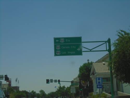
US-95 South at US-50
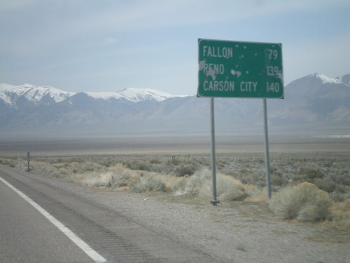
US-95 South at US-50 in Fallon. Use US-50 East to Ely. Turn right for US-50 West to Carson City and US-95 South to Las Vegas.
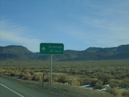
US-50 East - Antelope Junction
US-50 East approaching Antelope junction.
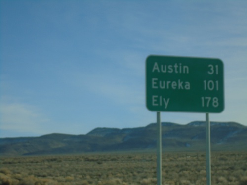
US-50 East - Distance Marker
Distance marker on US-50 east. Distance to Austin, Eureka, and Ely.
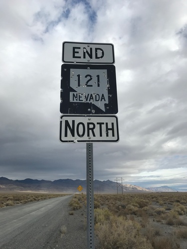
End NV-361 North at US-50
End NV-361 North at US-50 - Middlegate Junction. Use US-50 west for Fallon; US-50 east for Austin.
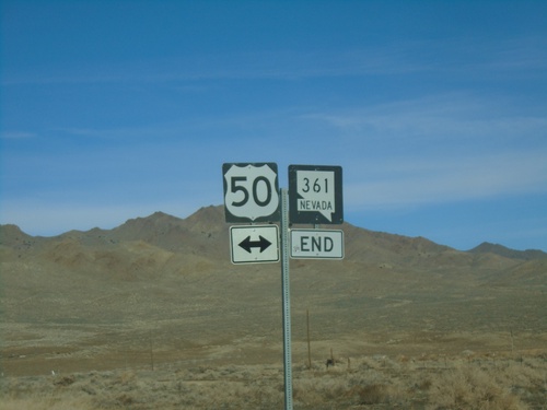
End NV-361 North at US-50
End NV-361 North at US-50 - Middlegate Junction.
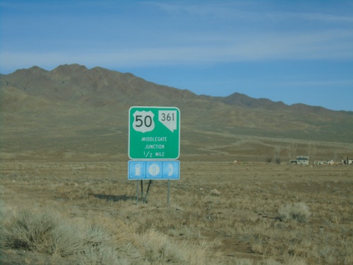
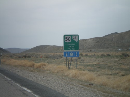
NV-361 North Approaching US-50 - Middlegate Junction
NV-361 North approaching US-50 - Middlegate Junction.
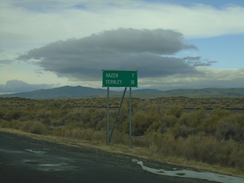
Alt. US-50 West - Distance Marker
Distance marker on Alt. US-50 West. Distance to Hazen and Fernley.
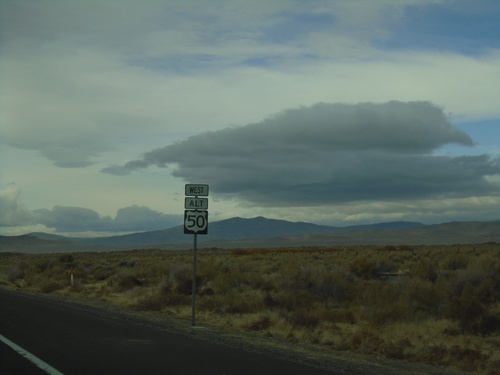
Alt. US-50 West - Churchill County
First Alt. US-50 shield westbound in Churchill County
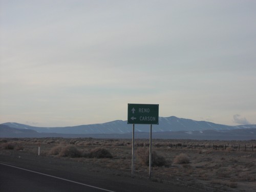
US-50 West at Alt. US-50 West
US-50 west at Alt. US-50 west. Use US-50 west for Carson (City). Continue ahead for Alt. US-50 west to Reno.
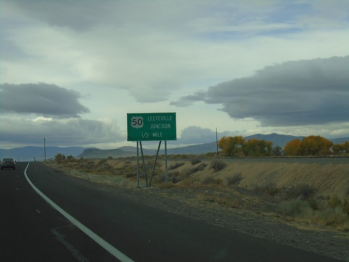
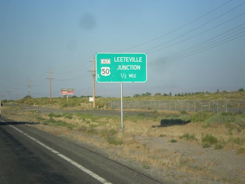
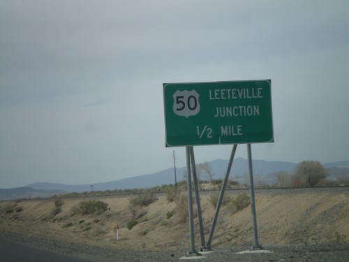
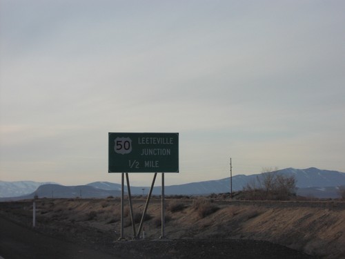
US-50 West - Leeteville Junction
US-50 west approaching Leeteville Junction of US-50 and Alt. US-50.
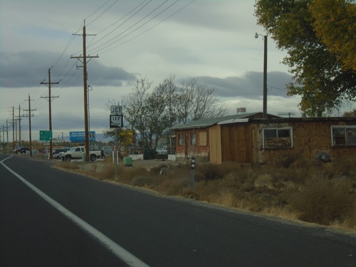
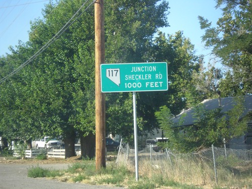
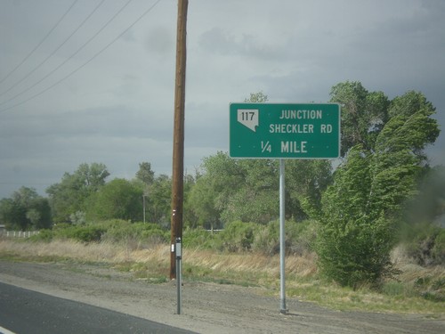
US-50 West Approaching NV-117
US-50 West Approaching NV-117 - Sheckler Cut Off
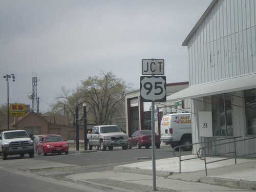
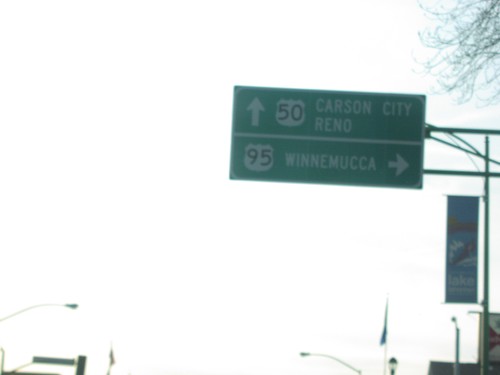
US-50 West at US-95 North to Winnemucca
US-50 west at US-95 north junction to Winnemucca in Fallon.
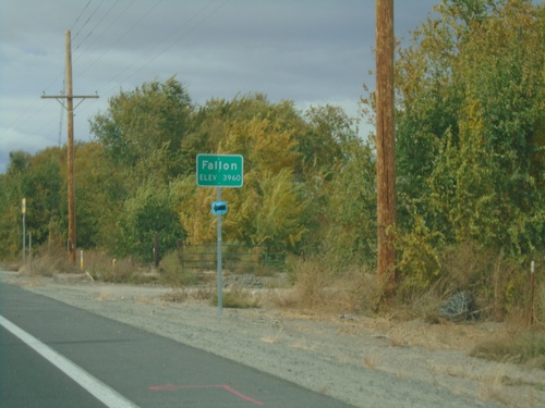
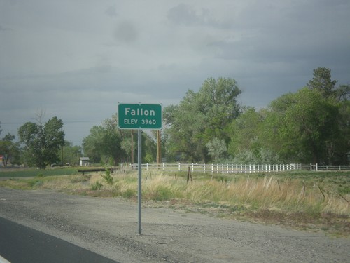
US-50 West - Fallon
Entering Fallon on US-50 west. Elevation 3960 Feet.
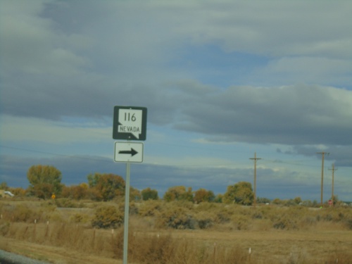
US-50 West Approaching NV-116
US-50 west approaching NV-116 in Churchill County.
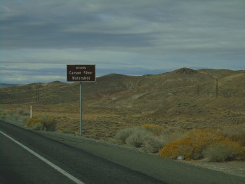
US-50 West - Entering Carson River Watershed
Entering Carson River Watershed on US-50 west. Taken at the summit of the Stillwater Range.
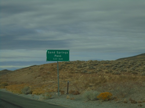
US-50 West - Sand Springs Pass
Sand Springs Pass on US-50 west. Elevation 4644 Feet.
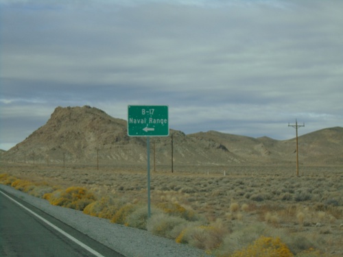
US-50 West at NV-839 South
US-50 west at NV-839 south to B-17 Naval Range.
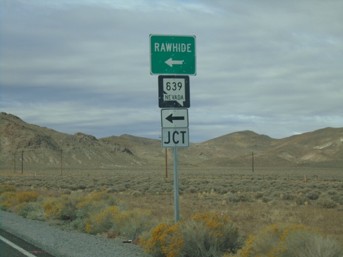
US-50 West at NV-839
US-50 west at NV-839 south to Rawhide.
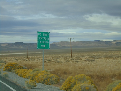
US-50 West - US Navy Centroid Facility
US-50 West at US Navy Centroid Facility junction.
NV-121 South approaching US-50
Junction US-50 on NV-121 south in Churchill County.
End NV-121 North - Churchill County
End NV-121 North. Unpaved road continues northbound as Dixie Valley Road
US-50 East At NV-117
US-50 east at NV-117 east in Churchill County.
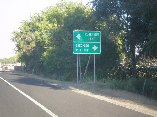
US-50 East Approaching NV-117
US-50 East Approaching NV-117/Sheckler Cut Off. Turn left for Roberson Lane.
US-50 East Approaching Leeteville Junction
US-50 East Approaching Leeteville Junction (US-50 Alt. Junction). Many intersections in rural Nevada are referred to by name.
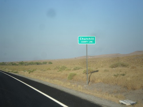
US-50 East - Churchill County Line
Churchill County Line on US-50 east.
US-95 South - Lyon County
Lyon County Line on US-95 South. US-95 runs through a short 2 mile stretch of Lyon County.
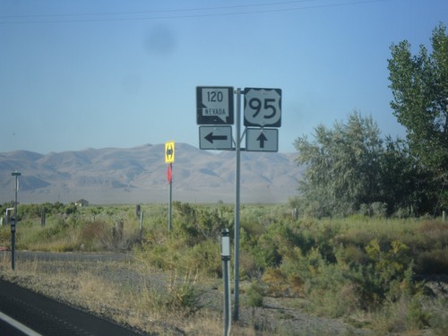
US-95 South Approaching NV-120
US-95 South Approaching NV-120 East (Pasture Road).
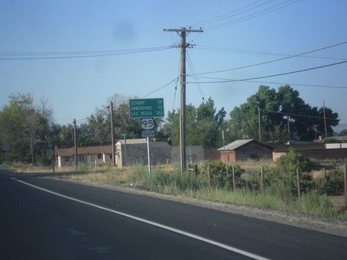
US-95 South - Distance Marker
Distance marker on US-95 south. Distance to Schurz, Hawthorne, and Las Vegas.
US-95 South - NV-117 Jct.
US-95 South approaching NV-117/Sheckler Road.
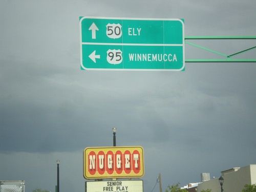
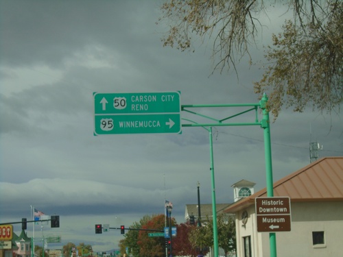
US-50 East/US-95 North - Fallon
US-50 East/US-95 North at US-95 north. Turn left for US-95 north to Winnemucca; continue straight for US-50 east to Ely.
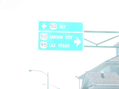
US-95 North at US-50
US-95 north at US-50 in Fallon. Turn left for US-50 west to Carson City and Reno. Turn right for US-50 East (not signed) and US-95 north to Winnemucca. US-95 joins US-50 for a few blocks through Fallon.
US-95 North Approaching US-50
US-95 North approaching US-50 in Fallon.
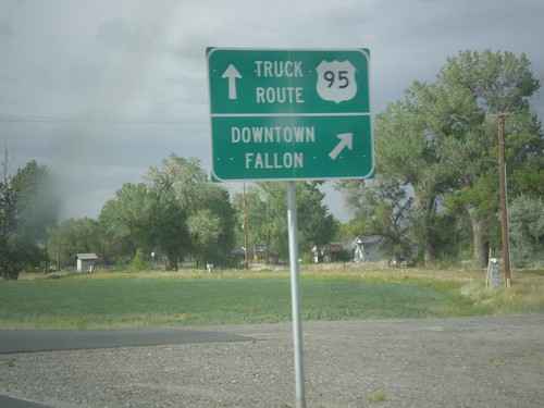
US-95 North - Fallon Truck Route
US-95 north at Maine St. junction. Turn right for Downtown Fallon; continue straight for US-95 North along the Truck Route.
US-95 North - Fallon
Fallon - Elevation 3960 on US-95 north.
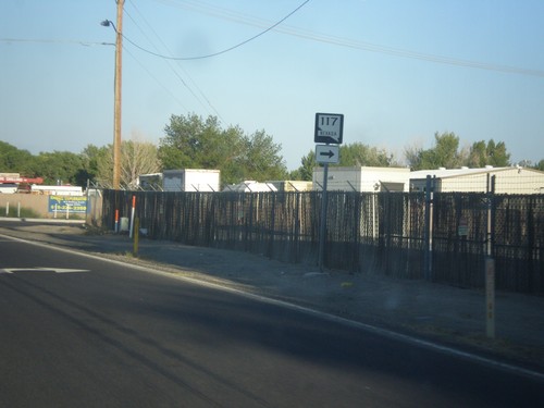
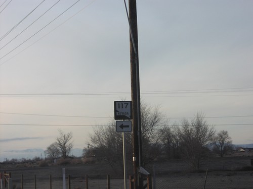
US-95 North at NV-117
US-95 north at NV-117 in Fallon.
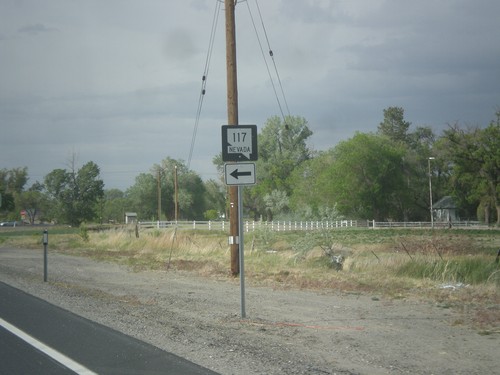
US-95 North Approaching NV-117
US-95 North approaching NV-117 - Sheckler Road.
US-50 West at Alt. US-50 West
US-50 west at Alt. US-50 west. Use US-50 west for Carson (City). Continue ahead for Alt. US-50 west to Reno.
US-50 West - Leeteville Junction
US-50 west approaching Leeteville Junction of US-50 and Alt. US-50.
US-50 West at US-95 North
US-50 west at US-95 north to Winnemucca. Continue on US-50 west for Carson City and Reno.
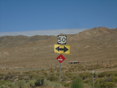
US-50 West Approaching US-95
US-50 west approaching US-95.
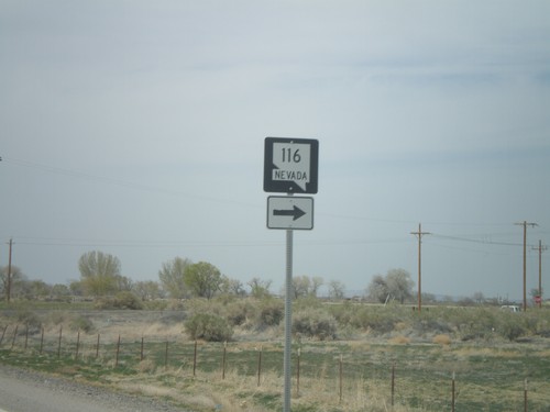
US-50 West Approaching NV-116
US-50 west approaching NV-116
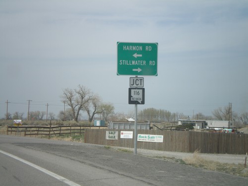
US-50 West at NV-116
US-50 west at NV-116 - Stillwater Road and Harmon Road.
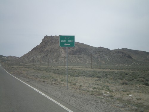
US-50 West at NV-839 South
US-50 west at NV-839 south to B-17 Naval Range.
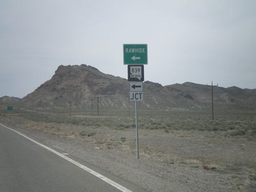
US-50 West at NV-839
US-50 west at NV-839 south to Rawhide.
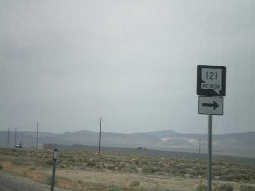
US-50 West Approaching NV-121
US-50 west approaching NV-121
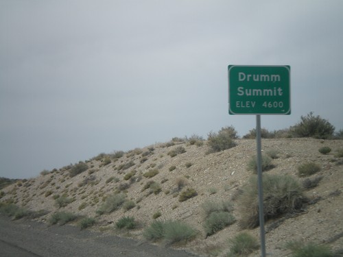
US-50 West - Drumm Summit
US-50 west at Drumm Summit - Elevation 4600 Feet.
US-50 West - Distance Marker
Distance marker on US-50 west to Fallon, Carson City, and Reno.
US-50 West Approaching Middlegate Jct.
US-50 west approaching Middlegate Junction (NV-361).
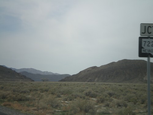
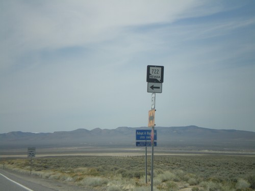
US-50 West Approaching NV-722
US-50 west approaching NV-722
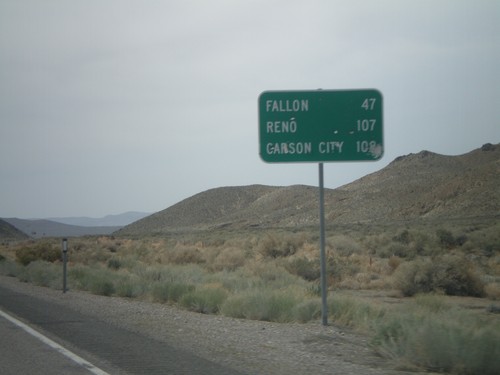
US-50 West - Distance Marker
Distance marker on US-50 west to Fallon, Reno, and Carson City.
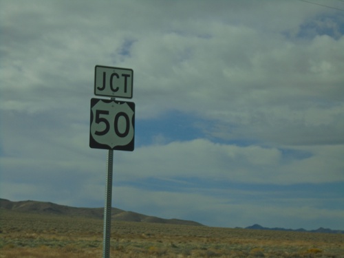
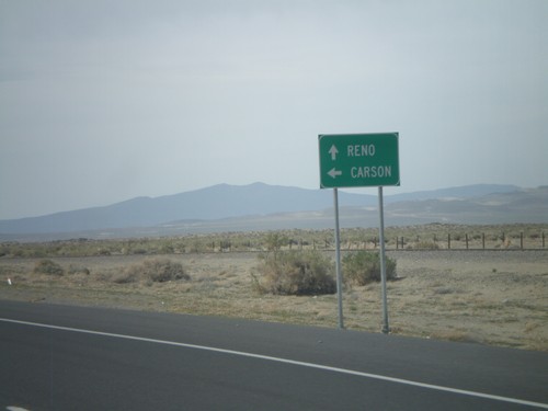
US-95 South at US-50
US-95 south at US-50 to Ely and Reno
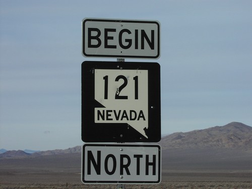
Begin NV-121 North at US-50
Begin NV-121 north at US-50 junction in Churchill County.
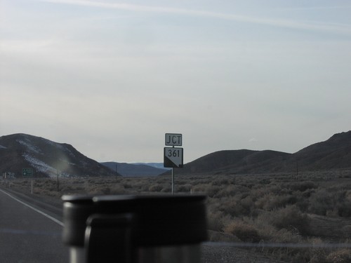
Jct. NV-361 on US-50 West
Junction NV-361 south on US-50 west in Churchill County.
NV-121 South at US-50
Junction US-50 on NV-121 south in Churchill County.
US-50 West Approaching NV-361
US-50 west approaching Middlegate Junction in Churchill County.
US-50 West Approaching US-50A - Leeteville Jct.
Approaching US-50/Alt US-50 junction in Churchill County.
US-50 West at Alt. US-50
Directional marker on US-50 west at Alt US-50 junction to Reno and Carson City.
US-50 West at NV-117
NV-117 shield on US-50 west in Churchill County.
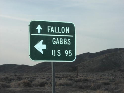
US-50 West at NV-361 South to Gabbs
Directional marker to US-95, Gabbs, and Fallon on US-50 west at NV-361 junction in Churchill County.
US-50 West at US-95 North to Winnemucca
US-50 west at US-95 north junction to Winnemucca in Fallon.
US-50 West/US-95 South at US-50/US-95 Split
US-50 West/US-95 South at US-50/US-95 Split in Fallon. Use US-50 West to Carson City and Reno; US-95 South to Las Vegas.
US-50 East Approaching Alt. US-50 West
US-50/US-50 ALT Junction on US-50 East to Reno and Fallon
Fallon Station
US-95 South at NV-120
US-95 South at NV-120 East (Pasture Road).
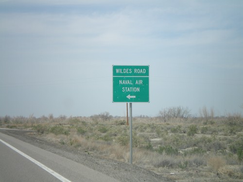
US-50 West at NV-118
US-50 west at NV-118 - Wildes Road to the Naval Air Station.
Middlegate
End NV-361 North at US-50 - Middlegate Junction
End NV-361 North at US-50 - Middlegate Junction
US-50 East at NV-722 East
US-50 East at NV-722 East in Churchill County.
End NV-361 North at US-50 - Middlegate Junction
End NV-361 North at US-50 - Middlegate Junction
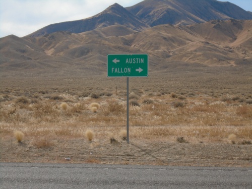
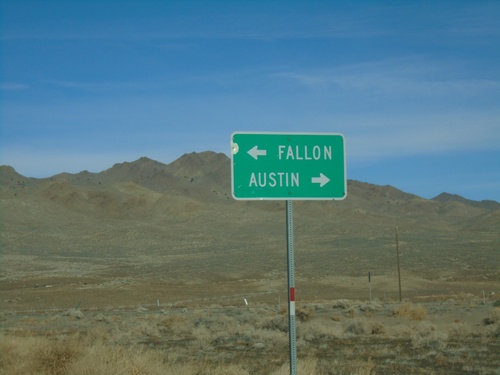
End NV-121 at US-50
Directional sign to Austin and Fallon at southern terminus of NV-121 at US-50 in Churchill County.
US-50 West at NV-722 East
US-50 west at NV-722 east
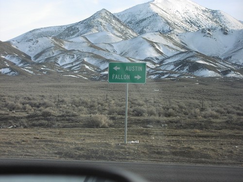
End NV-121 at US-50
Directional sign to Austin and Fallon at southern terminus of NV-121 at US-50 in Churchill County.
US-50 West at NV-361 South
NV-361/US-50 junction in Churchill County.
No Place Associated
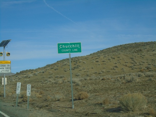
NV-361 North - Churchill County
Churchill County Line on NV-361 North. Milemarkers for both Mineral County and Churchill County are posted below the county line sign.
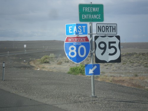
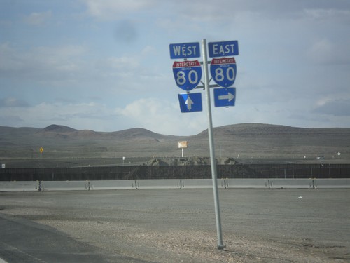
US-95 North at I-80 East (Exit 83)
US-95 north at I-80 (Exit 83) onramp. US-95 north joins I-80 east to Winnemucca.
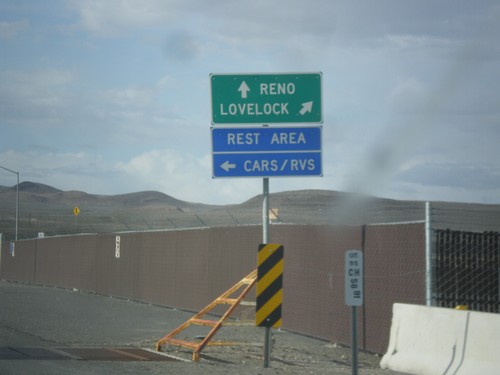
US-95 North Approaching I-80
US-95 north approaching I-80. Use I-80 East/US-95 North to Lovelock; use I-80 West/Alt. US-95 South to Reno. Turn left to enter the Rest Area. Notice the post mile marker at the base of the sign.
US-95 North Approaching I-80
US-95 north approaching I-80 in Churchill County.
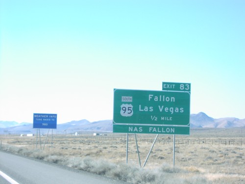
I-80 East Exit 83
I-80 east at Exit 83 - US-95 South/Fallon/Las Vegas. US-95 north joins I-80 east to Winnemucca.
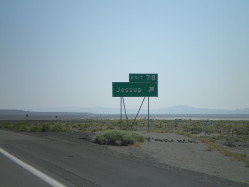
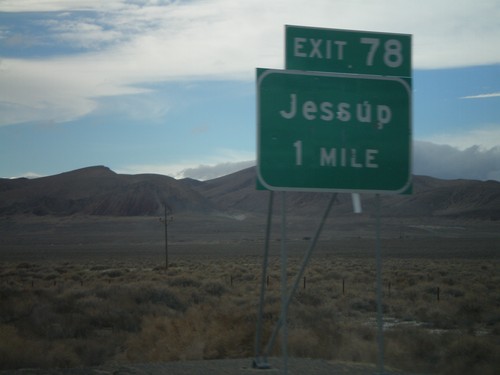
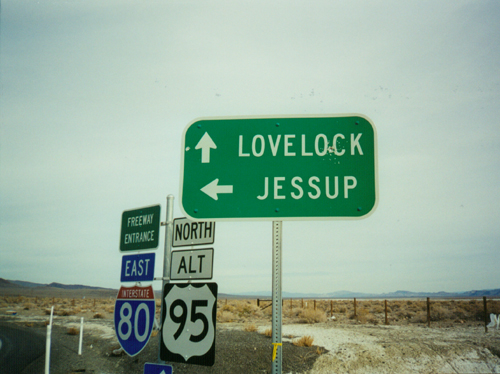
I-80 East Exit 78
I-80 east at Exit 78 - Jessup
I-80 West Exit 78
I-80 west approaching Exit 78 - Jessup
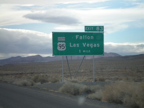
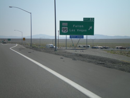
I-80 West Exit 83
I-80 west approaching Exit 83 - US-95 South/Fallon/Las Vegas. US-95 follows I-80 between here and Winnemucca.
I-80 West Exit 83
US-95 South/Fallon/Las Vegas exit on I-80 west
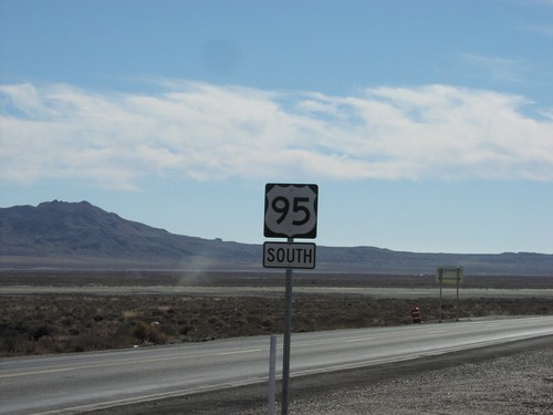
US-95 South
First US-95 south reassurance marker after leaving I-80
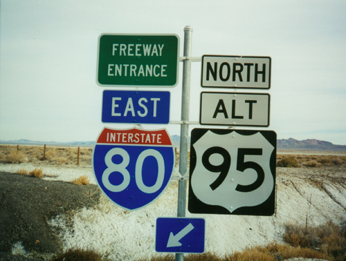
I-80 East/Alt. US-95 North Onramp - Exit 78
I-80/US-95 ALT freeway entrance at Exit 78 - Jessup
I-80 East/Alt. US-95 North Onramp - Exit 78
I-80 east onramp to Lovelock at Exit 78 - Jessup.
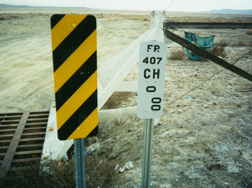
Nevada Postmile - FR-407
Nevada Post Mile Marker at the Jessup exit (Exit 78) on I-80. The postmile refers to FR-407 - which is the internal number for a Frontage Road.