Lyon County, Nevada
Localities: Carson City | Dayton | Fernley | Mound House | Schurz | Silver Springs | Smith Valley | Yerington
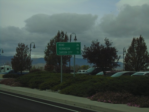
Carson City
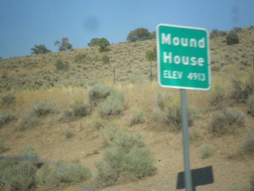
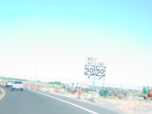
US-50 East - Mound House
Entering Mound House on US-50 east.
Dayton
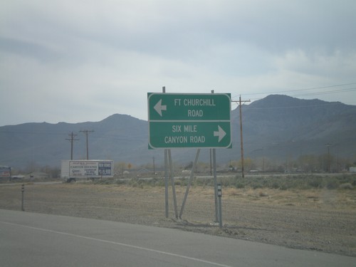
US-50 West - Six Mile Canyon Road
US-50 west approaching Six Mile Canyon Road and Fort Churchill Road.
Fernley
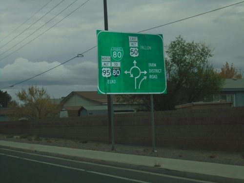
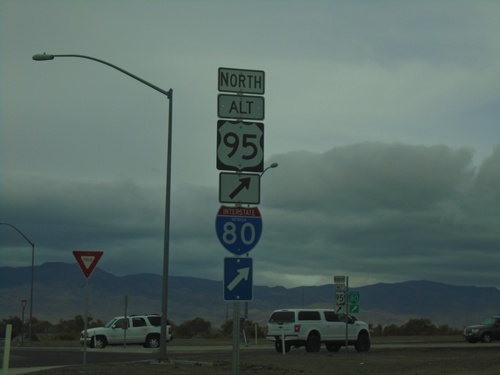
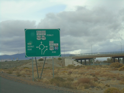
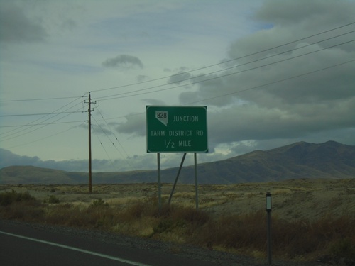
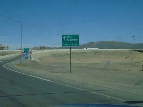
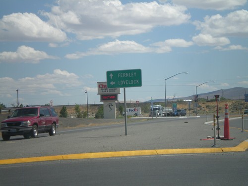
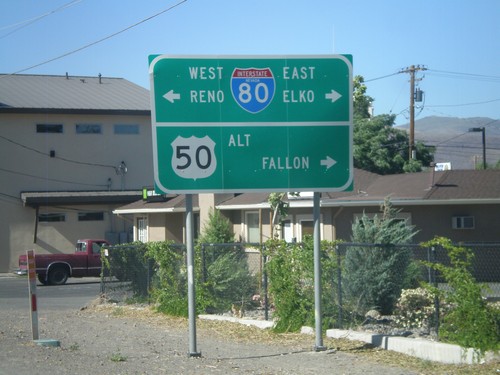
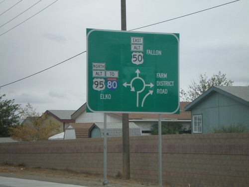
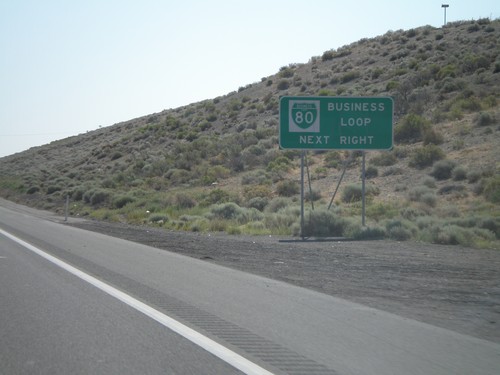
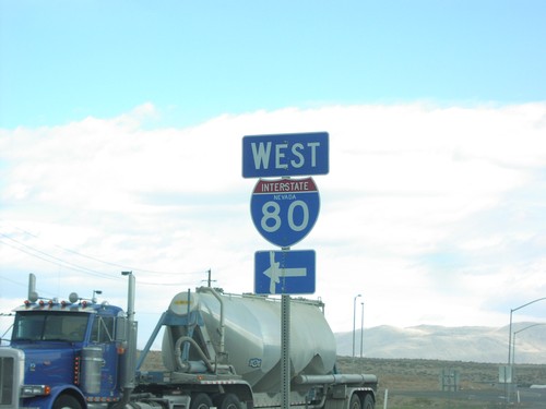
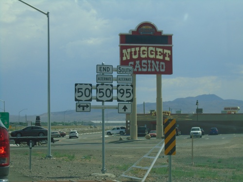
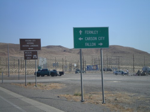
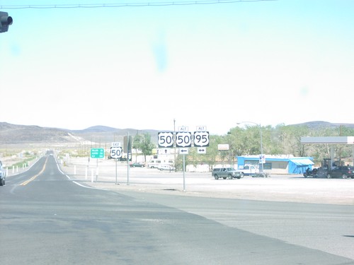
Alt. US-95 North/Alt. US-50 East/BL-80 East - Roundabout
Approaching roundabout on Alt. US-95 North/Alt. US-50 East/BL-80 East. Roundabout for BL-80 East/To I-80/Alt. US-95 North/Elko; Alt. US-50 East to Fallon; (NV-828)/Farm District Road.
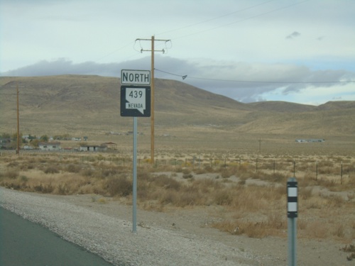
NV-439 North - Mile 1
Storey County Mile 1 on NV-439 North. This type of postmile sign is being rolled out across Nevada. The new style are larger and have the route shield in it.
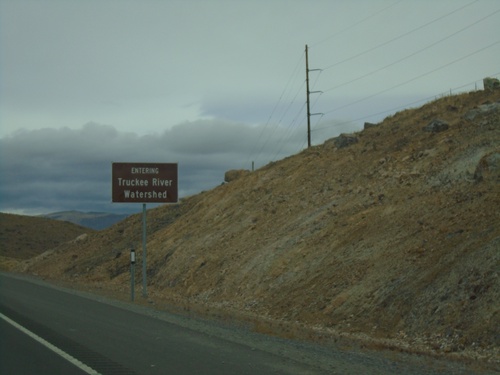
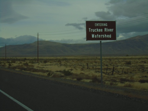
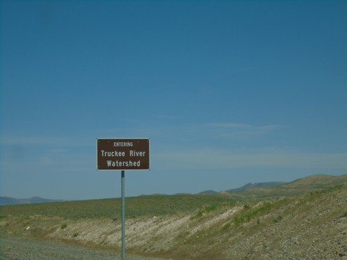
NV-439 North - Truckee Watershed
Entering the Truckee River Watershed on NV-439 north.
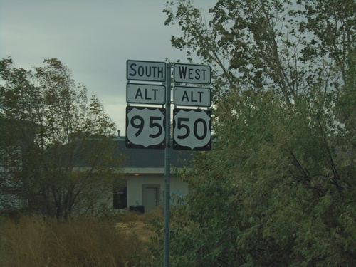
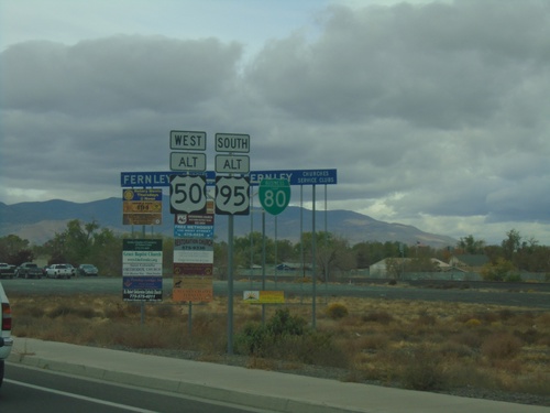
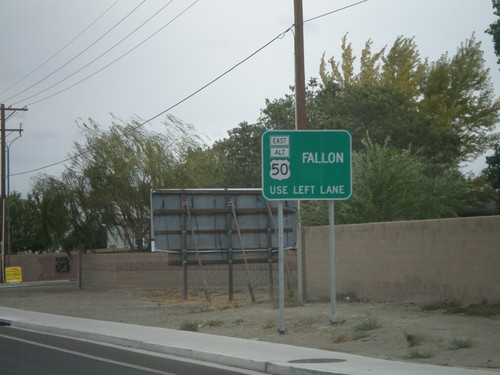
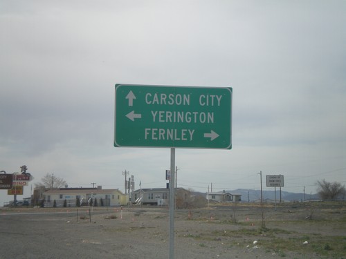
Alt. US-50 West/Alt. US-95 South - Fernley
Alt. US-50 West/Alt. US-95 South in Fernley
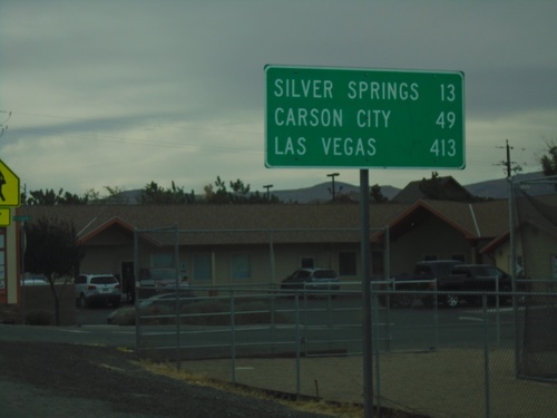
Alt. US-95 South/Alt. US-50 West - Distance Marker
Distance Marker on Alt. US-95 South/Alt. US-50 West. Distance to Silver Springs, Carson City, and Las Vegas.
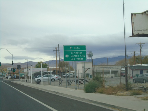
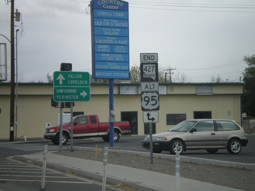
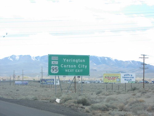
US-95 Alt. South/US-50 Alt. West at NV-427 North
US-95A South/US-50A West/BL-80 West at US-95A South to Carson City, Yerington, and Las Vegas. Use BL-80 West and NV-427 North to Reno.
Alt. US-95 South/Alt. US-50 West/BL-80 West - Distance Marker
Distance marker on Alt. US-95 South/Alt. US-50 West/BL-80 West. Distance to Reno (via I-80), Yerington, and Carson City.
Alt. US-95 South/Alt. US-50 West/BL-80 - Fernley
Alt. US-95 South/Alt. US-50 West/BL-80 on E. Main St. in Fernley
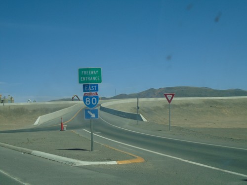
Alt. US-50 West at Alt. US-95 Roundabout
Alt. US-50 West at Alt. US-95 roundabout. Turn right for Alt. US-95 North/To I-80
Alt. US-50 West Approaching Alt. US-95/NV-828/BL-80
Alt. US-50 West Approaching Alt. US-95/NV-828/BL-80 roundabout in Fernley. Use Alt. US-95 North/To I-80/(BL-80) to Reno; Alt. US-95 South/Alt. US-50 West/(BL-80) to Fernley; and (NV-828) for Farm District Road.
Alt. US-50 West - Ragtown Pass
Alt. US-50 West entering the Truckee River Watershed at Ragtown Pass.
Alt. US-50 West Approaching NV-828
Alt. US-50 West approaching NV-828 - Farm District Road.
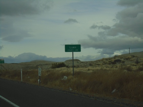
Alt. US-50 West - Lyon County
Lyon County Line on Alt. US-50 West
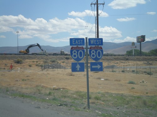
BL-80 West/NV-427 North at I-80 East
BL-80 West/NV-427 North at I-80 East.
BL-80 West/NV-427 North at I-80 East
BL-80 West/NV-427 North at I-80 East to Lovelock. Continue under freeway for I-80 west to Reno; continue on NV-427 for Wadsworth.
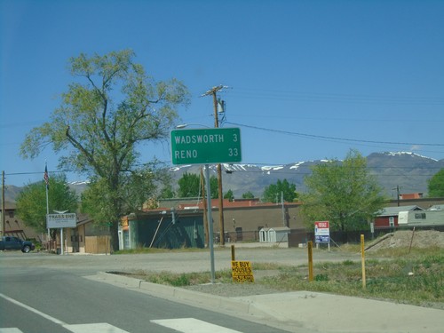
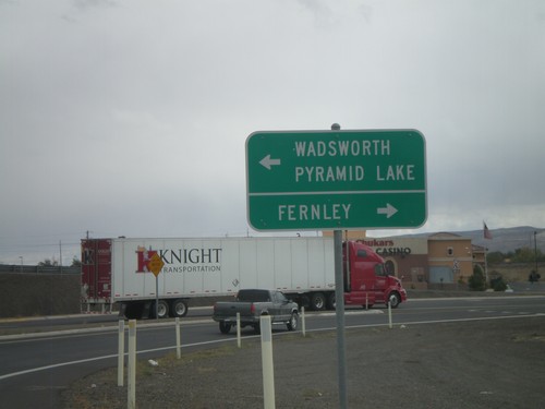
BL-80 West/NV-427 North - Distance Marker
Distance Marker on BL-80 West/NV-427 North. Distance to Wadsworth and Reno.
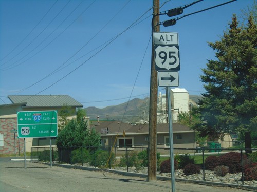
US-95 Alt. North/US-50 Alt. West at BL-80/NV-427
US-95 ALT at US-50 ALT to Fallon and BL-80/NV-427 to Reno and Elko. Turn right to continue north US-95 Alt.
Alt. US-95 North/Alt. US-50 East - Truckee River Watershed
Entering the Truckee River Watershed on Alt. US-95 North/Alt. US-50 East. Taken at the divide in the Virginia Range. These type of watershed signs have been appearing in western Nevada.
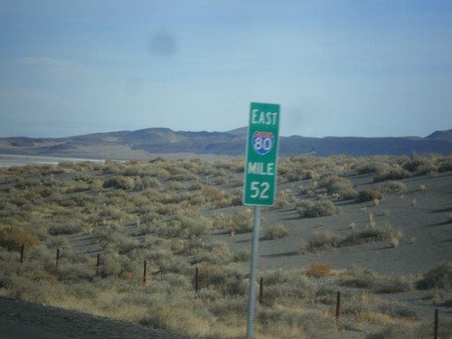
I-80 East - Milemarker 52
Mile 52 on I-80 east. This type of mile marker appears throughout Lyon and portions of Pershing County along I-80 and are recent in 2017.
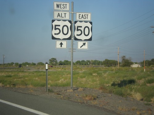
US-50 East approaching Alt. US-50 West
Approaching US-50/US-50 ALT Junction on US-50 East
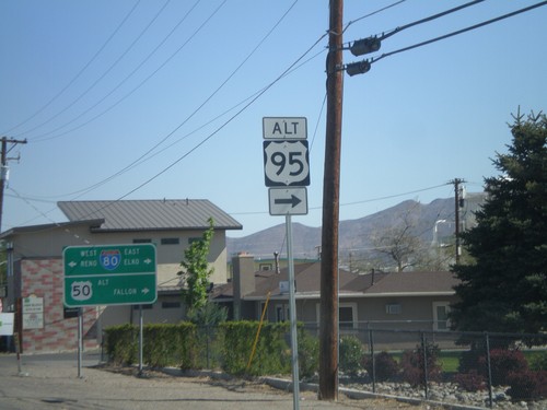
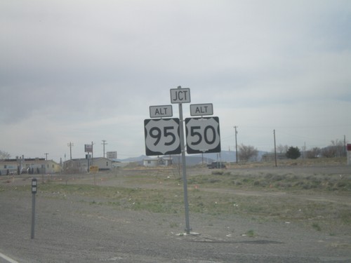
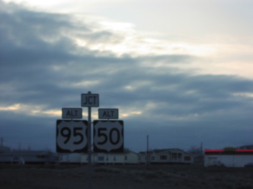
US-95 Alt. North at US-50 Alt./BL-80
US-95 ALT at US-50 ALT to Fallon and BL-80 to Reno and Elko. Turn right to continue on US-95 Alt.
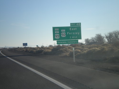
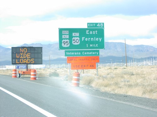
I-80 East Approaching Exit 48
I-80 east approaching Exit 48. Use Exit 48 for Fallon and Ely via Alt. US-50 east.
NV-427 South at I-80 East
NV-427 south at I-80 east to Lovelock. Continue south on NV-427/BL-80 into downtown Fernley.
NV-427 South at I-80
NV-427 South at I-80 (Exit 46) onramp. Turn right for I-80 west; continue under highway for I-80 east. BL-80 starts here and runs through downtown Fernley, rejoining I-80 at Exit 48.
NV-427 South - Fernley
NV-427 South in Fernley.
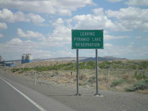
NV-427 South - Leaving Pyramid Lake Indian Reservation
Leaving the Pyramid Lake Indian Reservation on NV-427 south. The Pyramid Lake Indian Reservation is home to the Pyramid Lake Paiute Tribe.
Alt. US-95 North at Alt. US-50/BL-80/NV-427
Alt. US-95 north at Alt. US-50/BL-80 east to Fallon and Elko and BL-80/NV-427 west to Reno.
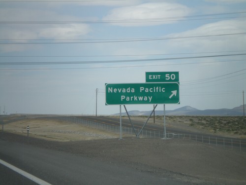
I-80 East - Exit 50
I-80 east at Exit 50 - Nevada Pacific Parkway. This exit was completed in 2010.
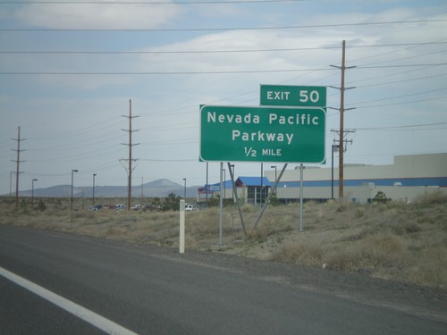
I-80 East Approaching Exit 50
I-80 east approaching Exit 50 - Nevada Pacific Parkway.
Alt. US-95/BL-80 In Fernley Roundabout
Alt. US-95/Alt. US-50/BL-80 in Fernley roundabout. Turn right for Alt. US-95 North/BL-80.
Alt. US-95 at Alt. US-50 In Fernley Roundabout
BL-80/Alt. US-50 East/Alt. US-95 North at Alt. US-50 split in roundabout.
Alt. US-95 North/Alt. US-50 East Approaching Split
BL-80/Alt. US-50 East/Alt. US-95 North approaching roundabout. Alt. US-50 East traffic leaves here towards Fallon. Alt. US-95 North traffic follows BL-80 towards I-80 and Elko. Farm District Road (NV-828) leaves to the south. This roundabout is a recent development in Fallon.
BL-80/Alt. US-95/Alt. US-50 Approaching Split
BL-80/Alt. US-50/Alt. US-95 approaching Alt. US-50 split. Stay in left lane for Alt. US-50 towards Fallon.
End NV-427 South at Alt. US-95 and Alt. US-50
End of NV-427 south at Alt. US-95/Alt. US-50 south to Hawthorne and Yerrington. BL-80 continues eastwards from NV-427 to Alt. US-95 North/Alt. US-50 East. Continue on BL-80 east for Fallon and Lovelock.
End NV-427 at Alt. US-95/Alt. US-50
End of NV-427 south at Alt. US-95/Alt. US-50 south to Hawthorne and Yerrington. Alt. US-50 is not signed at this intersection, but Alt. US-50 and Alt. US-95 are concurrent south of Fernley to Silver Springs at US-50 junction.
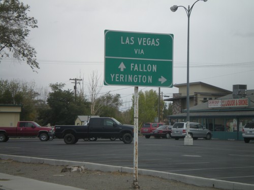
NV-427 South - Two Routes to Las Vegas
BL-80/NV-427 South approaching Alt. US-50/Alt. US-95. For Las Vegas via Yerrington, use Alt. US-95 South. For Las Vegas via Fallon, use Alt. US-50 East.
NV-427 South Approaching Alt. US-95/Alt. US-50
NV-427/BL-80 south approaching Alt. US-95/Alt. US-50. Alt. US-50 is not signed at this intersection.
I-80 East Exit 46 Offramp at NV-427
I-80 east Exit 46 offramp at NV-427. Use NV-427 north for Wadsworth and Pyramid Lake. Use NV-427 south, also signed as BL-80 for Fernley.
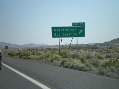
I-80 East Exit 65
I-80 east at Exit 65 - Nightingale/Hot Springs
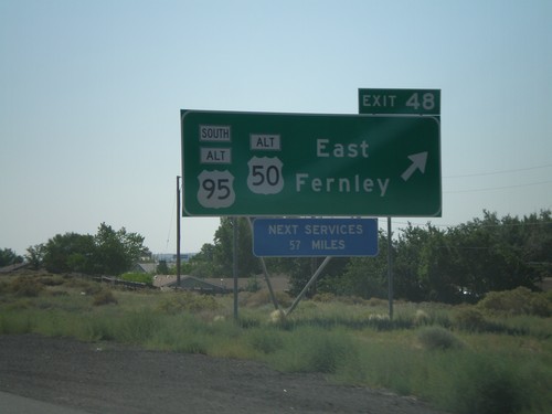
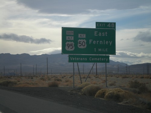
I-80 East Exit 48
I-80 east at Exit 48 - Alt. US-95 South/Alt. US-50/East Fernely. Next services on I-80 east are 57 miles.
I-80 East Approaching Exit 48
I-80 east approaching Exit 48. Use Exit 48 for Fallon and Ely via Alt. US-50 east.
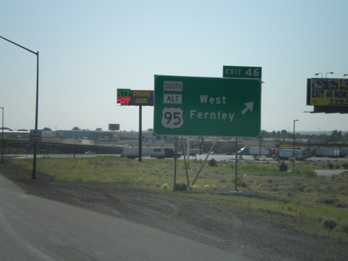
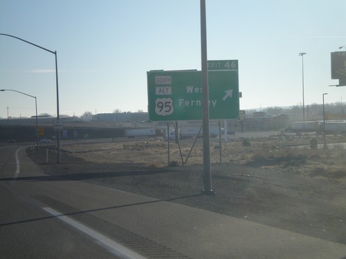
I-80 East Exit 46
I-80 east at Exit 46 - US-95 Alt South/West Fernley
I-80 East Approaching Exit 46
I-80 east approaching Exit 46. Use Exit 46 for Las Vegas and Yerrington via Alt. US-95 South.
I-80 East Approaching Exit 46
I-80 east approaching Exit 46. Use Exit 46 for Bus. I-80 through Fernley.
I-80 East Exit 48
I-80 east approaching Exit 48 - US-95 Alt South/US-50 Alt/East Fernley
I-80 East Exit 46
I-80 east at Exit 46 - US-95 Alt South/West Fernley
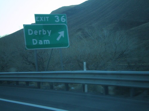
I-80 East Exit 36
I-80 east at Exit 36 - Derby Dam
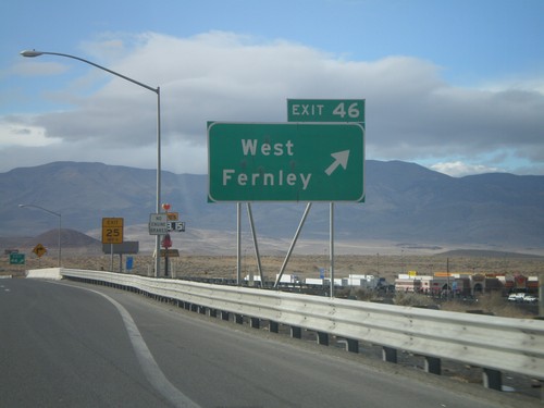
I-80 West Exit 46
I-80 west at Exit 46 - West Fernley
I-80 West Exit 48
I-80 west approaching Exit 48 - US-95 Alt South/US-50 Alt/East Fernley
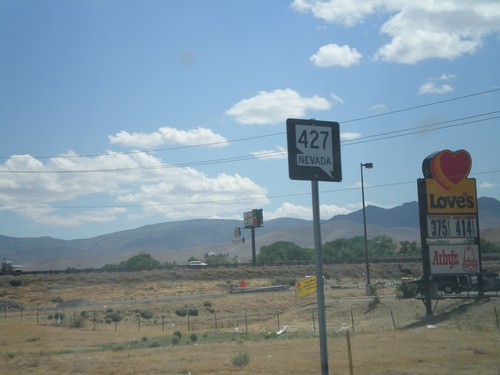
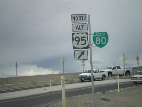
Begin NV-427 North at US-95 Alt.
Begin NV-427 north at US-95A junction.
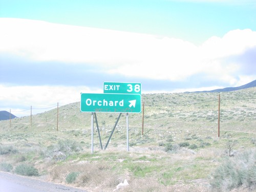
I-80 West Exit 38
I-80 west at Exit 38, Orchard
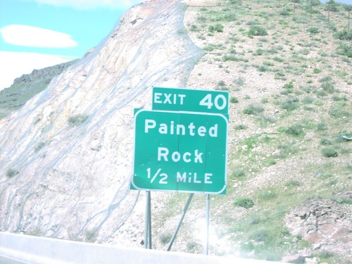
I-80 West Exit 40
I-80 west approaching Exit 40, Painted Rock
I-80 West Exit 48
I-80 west approaching Exit 48, Alt US-95A/Alt US-50/East Fernley, 1 mile.
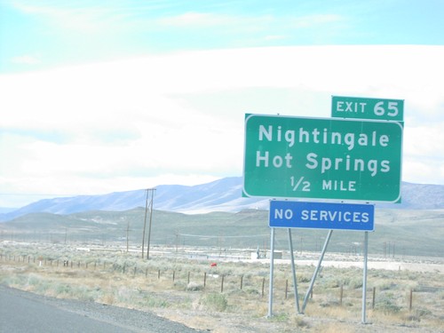
I-80 West Exit 65
I-80 west approaching Exit 65, Nightingale/Hot Springs, 1/2 mile.
NV-427 North at I-80
NV-427 north at I-80 west onramp.
NV-427 North at I-80 West to Reno
NV-427 north at I-80 west to Reno.
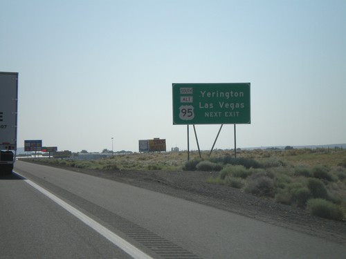
US-95 Alt. South at NV-427 North
US-95A South/BL-80 West at US-95A South to Carson City and Yerrington, and NV-427 North to Reno.
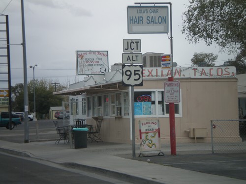
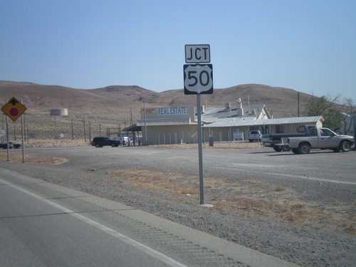
US-95 Alt. South at US-50 Alt.
BL-80/US-95A South at US-50A junction.
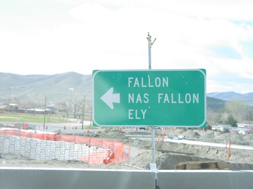
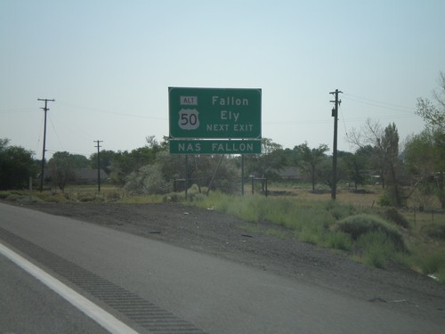
US-95 Alt. South at US-50 Alt. East
BL-80 west at US-50A to Fallon, NAS Fallon, and Ely.
I-80 West Exit 48
Use Exit 48, ALT US-95 for Yerrington and Carson City on I-80 west in Fernley.
I-80 West Exit 48
I-80 west at ALT US-95, Exit 48 in Fernley.
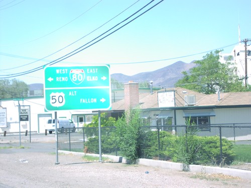
US-95 Alt. North at US-50 Alt./BL-80
US-95 ALT at US-50 ALT to Fallon and BL-80 to Reno and Elko.
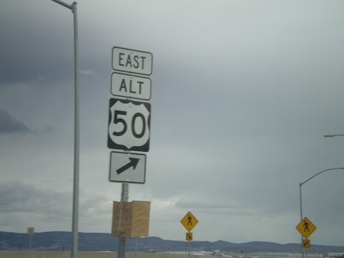
US-50 East at Alt. US-50 West
Approaching US-50/US-50 ALT Junction on US-50 East
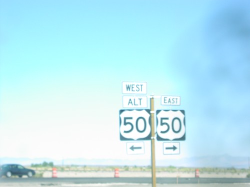
US-50 East at Alt. US-50 West
US-50/US-50 ALT Junction on US-50 East
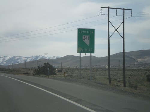
Mound House
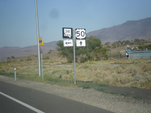
US-50 East at NV-341
US-50 East at NV-341 North in Lyon County.
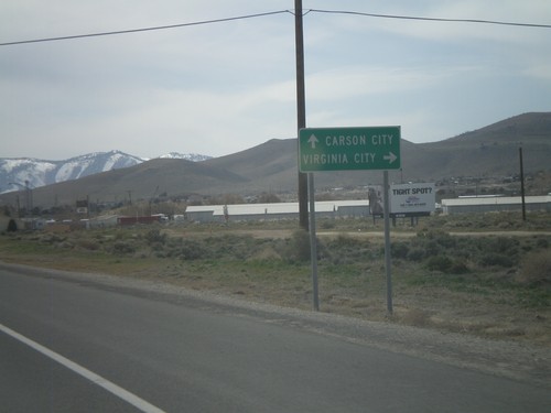
US-50 East Approaching NV-341
US-50 east approaching NV-341. Use NV-341 north for Virginia City. Continue east on US-50 to Dayton.
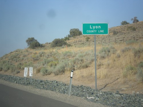
US-50 East - Lyon County
Lyon County Line on US-50 east.
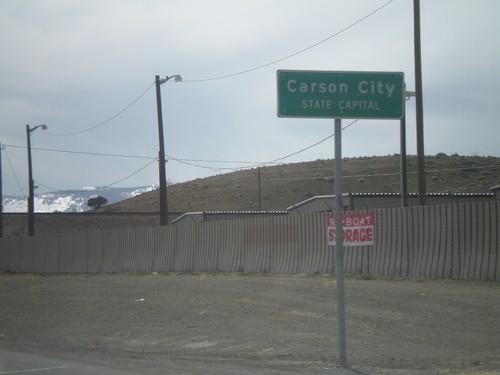
US-50 West - Entering Carson City
US-50 west at the Lyon County - Carson City line. When entering all other counties in Nevada, the county name is above the words County Line. In Carson City, the County Line is replaced with State Capitol.
US-50 West at NV-341 North
US-50 west at NV-341 north. Use NV-341 for Virginia City.
US-50 West Approaching NV-341
US-50 west approaching NV-341 north to Virginia City. Continue west on US-50 for Carson City.
US-50 West Approaching NV-341
US-50 west approaching NV-341
Schurz
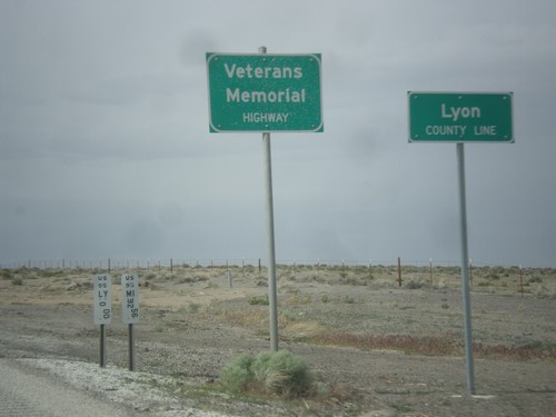
US-95 North - Lyon County Line
Lyon County Line on US-95 north. US-95 is signed as the Veterans Memorial Highway throughout Nevada.
Silver Springs
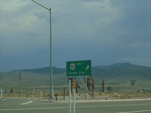
End NV-439 South at US-50
End NV-439 South at US-50 Roundabout in Lyon County. Exit roundabout for US-50 West to Carson City.
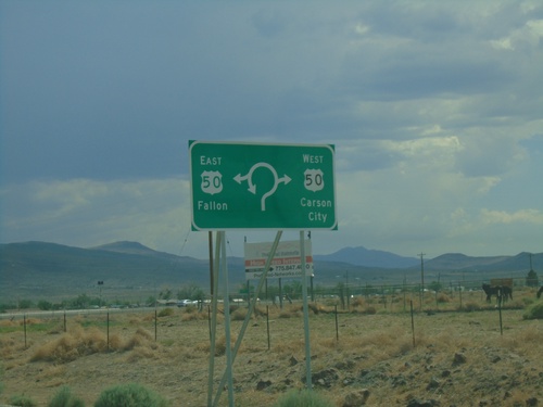
End NV-439 South at US-50 Roundabout
End NV-439 South at US-50 Roundabout in Lyon County. Use US-50 East for Fallon; US-50 West for Carson City.
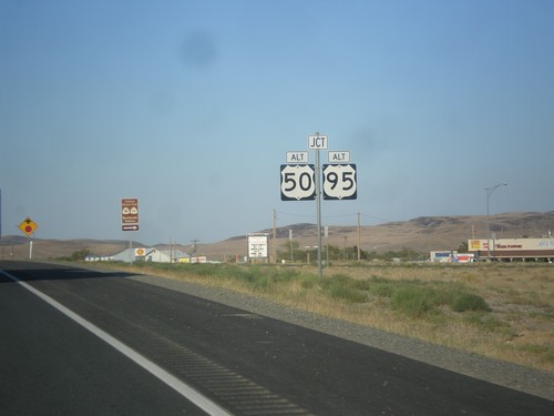
Alt. US-50 West/Alt. US-95 South at US-50
Alt. US-50 West/Alt. US-95 South at US-50. This is the western end of Alt. US-50. Normally the shields for the Alternate routes in Nevada do not spell out the text ALTERNATE - instead they usually read ALT.
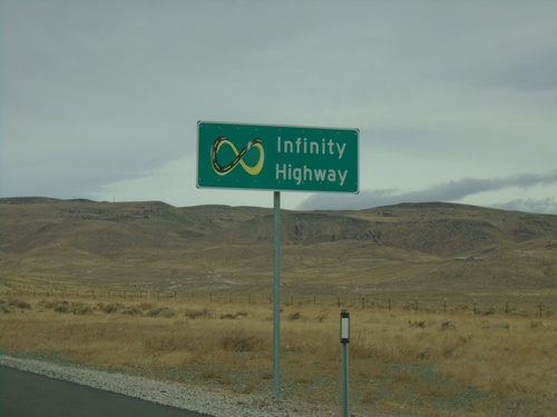
NV-439 North - Infinity Highway
Infinity Highway on NV-439 North. NV-439 North passes by the Tesla Gigafactory.
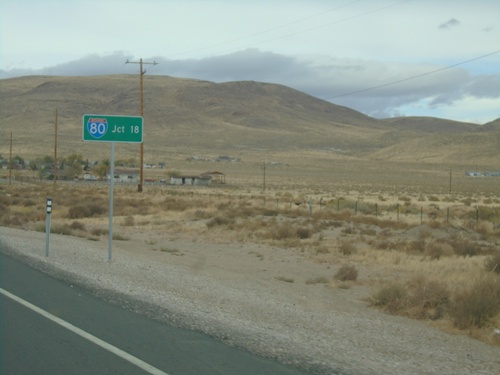
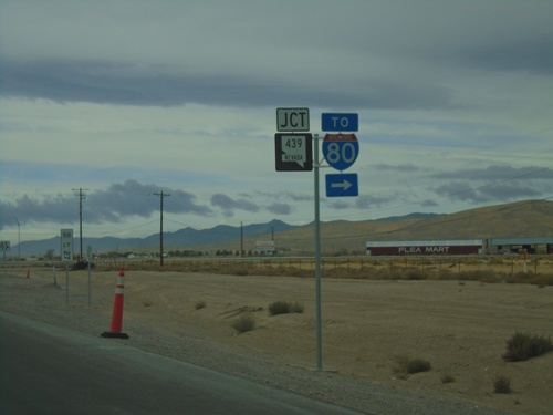
NV-439 North - Distance Marker
Distance marker on NV-439 North. Distance to I-80.
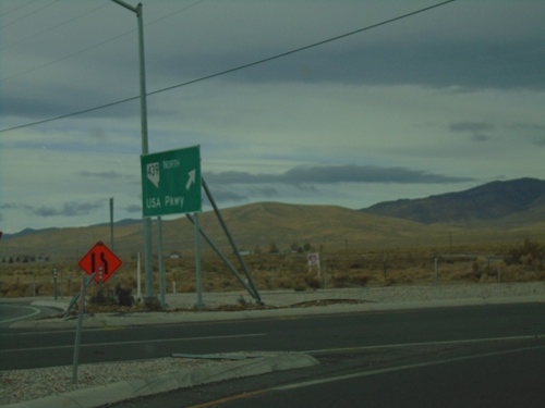
NV-439 North - USA Parkway
NV-439 North - USA Parkway.
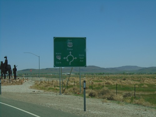
US-50 West at NV-439 North
US-50 West Roundabout at NV-439 North/USA Parkway
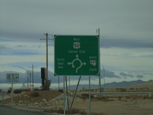
US-50 West at NV-439 Roundabout
US-50 West at NV-439 roundabout in Lyon County. Use US-50 West for Carson City; use NV-439 North for Clark; South Opal Ave. also enters the roundabout here.
US-50 West Approaching NV-439
US-50 West approaching NV-439/To I-80 in Lyon County.
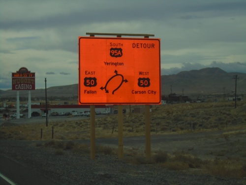
Alt. US-50 West/Alt. US-95 South - US-50
Alt. US-50 West/Alt. US-95 South at US-50. Currently there is a construction project to replace the intersection with a roundabout. Use US-50 West for Carson City; US-50 East for Fallon; Alt. US-95 South for Yerington. This is the western end of Alt. US-50.
Alt. US-50 West/Alt. US-95 South - Silver Springs
Entering Silver Springs on Alt. US-50 West/Alt. US-95 South
US-50 East at NV-439 Roundabout
US-50 East at NV-439 (USA Parkway) Roundabout in Lyon County. Use US-50 East for Fallon; NV-439 North for Clark (I-80 Jct.); turn south for South Opal Ave.
US-50 East Approaching NV-439
US-50 East approaching NV-439 (USA Parkway) in Lyon County.
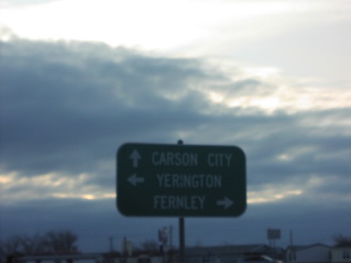
US-50 East at US-95 Alt./US-50 Alt.
US-50 East at US-95 Alt./US-50 Alt. junction. Continue east on US-50 to Fallon; right on US-95 Alt. South to Yerington; left on US-95 Alt. North/US-50 Alt. East to Fernley.
US-50 East Approaching Alt. US-95 and Alt. US-50
US-50 East approaching Alt. US-95 and Alt. US-50 in Silver Springs.
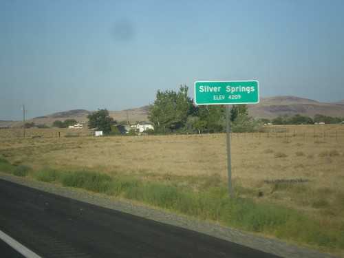
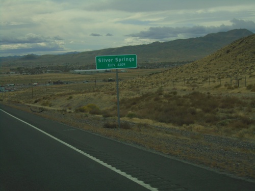
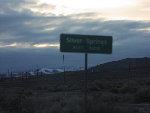
US-50 East - Silver Springs
Entering Silver Springs on US-50 east.
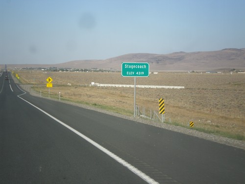
US-50 East - Stagecoach
Entering Stagecoach on US-50 east.
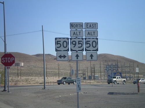
Alt. US-95 North at US-50/Alt. US-50
Alt. US-95 North at US-50/Alt. US-50 in Silver Springs. This is the western end of Alt. US-50. Alt. US-50 follows Alt. US-95 north to Fernley, thence east to outside of Fallon rejoining with US-50.
Alt. US-95 North Approaching US-50/Alt. US-50
Alt. US-95 North Approaching US-50/Alt. US-50. Turn left on US-50 west for Carson City and Virginia City National Historic Landmark; right on US-50 east for Fallon. Continue ahead on Alt. US-50 East/Alt. US-95 North for Fallon.
Alt. US-95 North Approaching US-50
Alt. US-95 North approaching US-50 and Alt. US-50 in Silver Springs.
US-50 West at Alt. US-50 and Alt.US-95
US-50 west at Alt US-50/Alt US-95 junction in Silver Springs. Use Alt. US-50 East/Alt. US-95 North for Fernley. Use Alt. US-95 South for Yerington. Continue on US-50 west for Carson City.
US-50 West Approaching Alt. US-50 and Alt. US-95
US-50 west at Alt US-50/Alt US-95 junction in Silver Springs.
US-50 West - Silver Springs
Entering Silver Springs on US-50 west.
US-50 West Approaching US-95 Alt./US-50 Alt.
US-50 west at Alt US-50/Alt US-95 junction in Silver Springs.
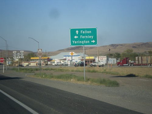
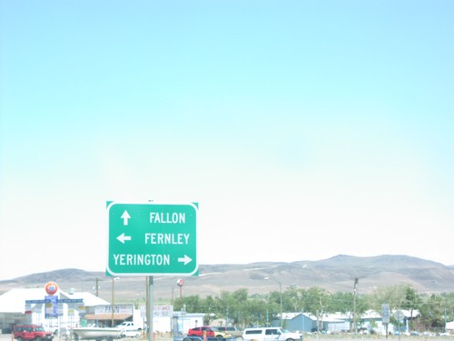
US-50 West at US-95 Alt./US-50 Alt.
Directional marker to Fernley, Yerrington, and Carson City on US-50 west at Alt US-50/Alt US-95 junction in Silver Springs.
US-50 East at US-95 Alt.
US-95A/US-50 Junction to Fallon, Fernley, and Yerrington in Silver Springs.
US-50 East at Alt. US-95 and Alt. US-50
US-50/US-95 ALT Junction on US-50 East to Fallon
Smith Valley
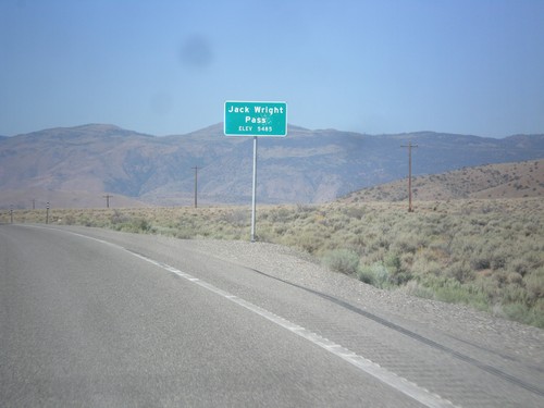
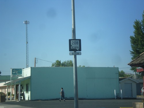
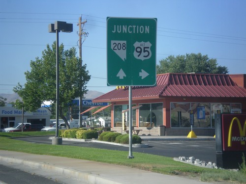
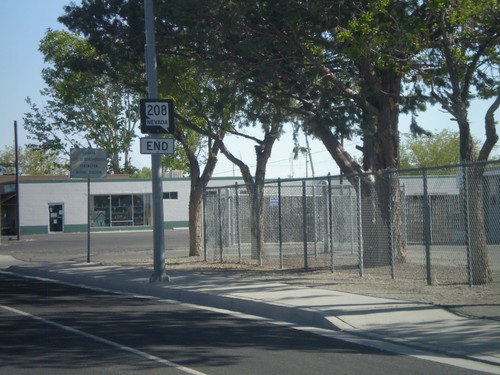
NV-208 West - Jack Wright Pass
Jack Wright Pass - Elevation 5484 Feet.
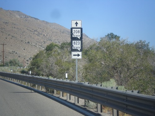
NV-208 West at NV-823
NV-208 West at NV-823 (Lower Colony Road).
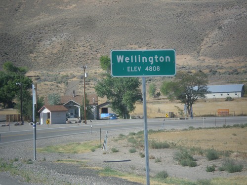
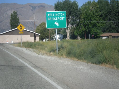
NV-208 West - Wellington
Entering Wellington on NV-208 west.
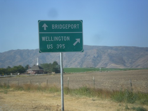
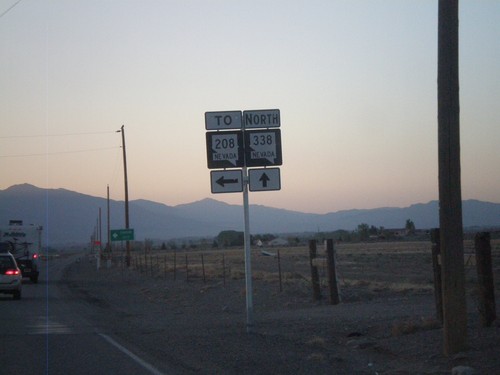
NV-208 West at NV-338
NV-208 west at NV-338 south to Bridgeport (California). Merge right to continue west on NV-208 to Wellington and US-395.
NV-208 West at NV-824
NV-208 west at NV-824. Turn left to continue west on NV-208 for Wellington and Bridgeport (California).
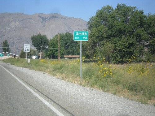
NV-208 West - Smith
Entering Smith on NV-208 west.
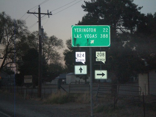
NV-208 North at NV-824
NV-208 north at NV-824 in Smith Valley. Turn right to continue on NV-208 towards Yerrington and Las Vegas.
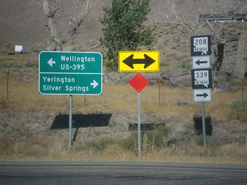
NV-338 North at NV-829 (To NV-208)
NV-338 North at NV-829 (To NV-208). This intersection is not well marked. NV-829 is marked To NV-208, when it should be marked To NV-208 South. Northbound NV-208 traffic should continue north on NV-338.
NV-338 North Approaching NV-829
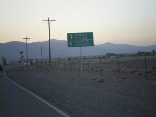
NV-339 north approaching NV-829. Use NV-829 north for Wellington and Gardnerville. Use NV-338 north for Yerrington and Las Vegas.
Yerington
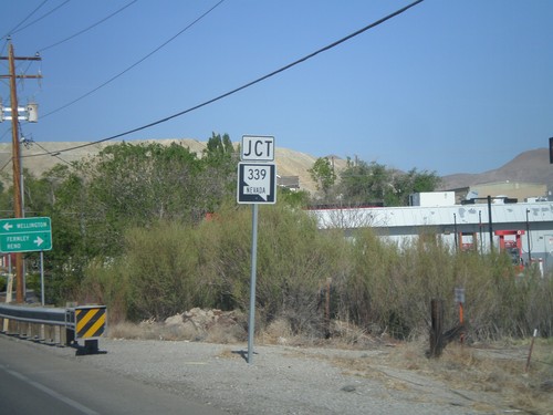
NV-208 West at NV-339
NV-208 west at NV-339. Turn right for NV-339 north to Yerington and Silver Springs. Turn left to continue west on NV-208 for Wellington and US-395 Jct.
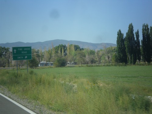
NV-208 West - Pine Grove Road Jct.
NV-208 West at Pine Grove Road Jct. Merge right to continue west on NV-208 towards Smith.
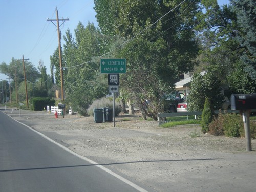
NV-208 South at NV-827
NV-208 South at NV-827 - Mason Road/Cremetti Lane Junction.
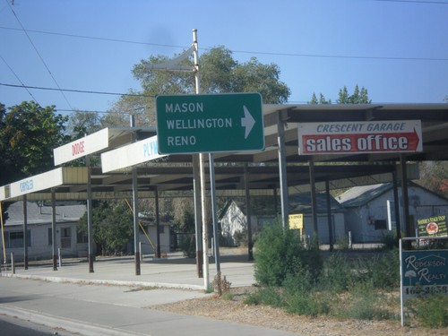
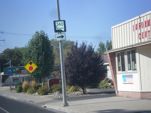
NV-208 South at NV-340 (Bridge St.)
NV-208 South at NV-340 (Bridge St.) west to Mason, Wellington, and Reno (via US-95 Alt.).
NV-208 South Approaching NV-340
NV-208 South approaching NV-340 in Yerington.
Begin NV-208 South - Yerington
Begin NV-208 South on Main St. in Yerington
US-95A North - Yerington
US-95A North along West Goldfield Ave. in Yerington
Alt. US-95 North Approaching NV-208
Alt. US-95 North Approaching NV-208 in Yerington. Turn right to continue north on Alt. US-95.
Alt. US-95 North - Yerrington
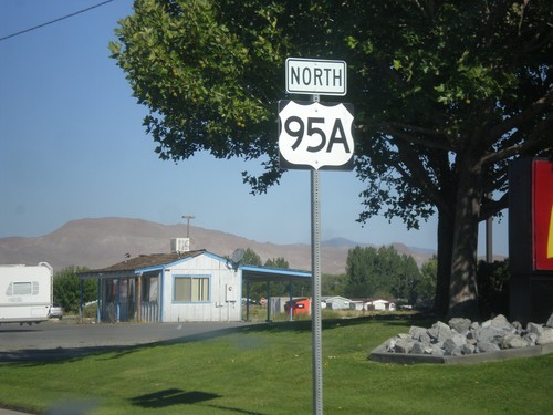
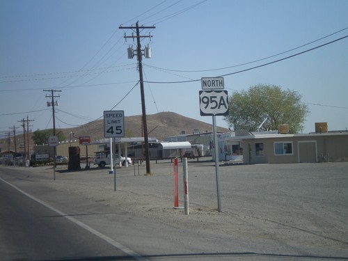
Alt. US-95 North, leaving Yerrington. This is the only instance that I have seen on any of the Nevada alternate US highways, where an "A" was used as the alternate designation. The normal alternate designation is with a separate sign on top of the shield with the word "ALT".
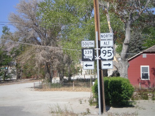
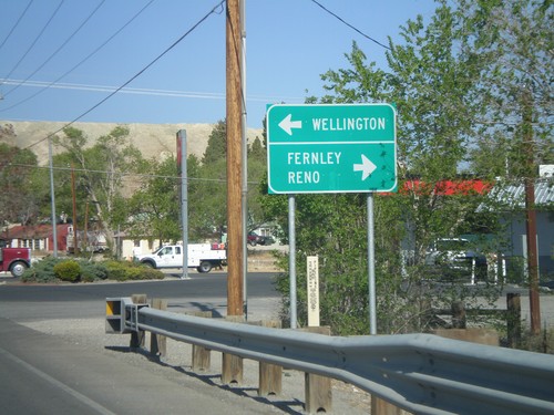
Alt. US-95 North at NV-339
Alt. US-95 North at NV-339 in Yerrington. Turn left for NV-339 south; turn right to continue north on Alt. US-95.
Alt. US-95 North Approaching NV-339
Alt. US-95 North approaching NV-339 in Yerrington. Use NV-339 south for Wellington; use Alt. US-95 north for Fernley and Reno.
Alt. US-95 North Approaching NV-339
Alt. US-95 North approaching NV-339.
NV-208 North Approaching Alt. US-95
NV-208 North approaching Alt. US-95 in Yerrington. Use Alt. US-95 South (straight ahead) for Hawthorne and Las Vegas. Use Alt. US-95 North (left) for Fernley.
NV-208 North Approaching Alt. US-95
NV-208 north approaching Alt. US-95 north in Yerrington. Below the Alt. US-95 shield is a Nevada post mile marker. Nevada state and US highways do not have traditional mile markers, but instead have these post mile markers. The mileage on these markers reset at each county line. The top line is the route type, in this case SR (State Route). The next line is the two character county abbreviation - LY for Lyon County. The number is the actual mileage, to two decimal places.
End NV-208 North
End NV-208 north at Alt. US-95 junction in Yerrington.