Harney County, Oregon
Localities: Burns | Crane | Diamond | Drewsey | Fields | Hines | New Princeton | Princeton | Riley | Wagontire
No Place Associated
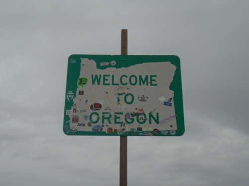
OR-140 West - Welcome To Oregon
Welcome to Oregon on OR-140 west. Taken at the Oregon-Nevada State Line.
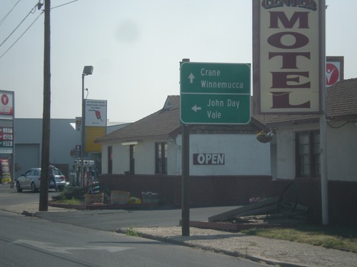
Burns
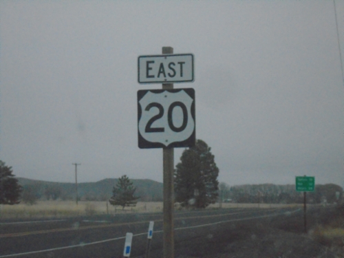
US-20 East - Harney County
US-20 east in Harney County.
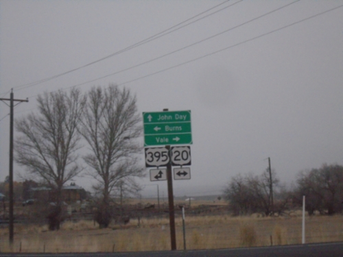
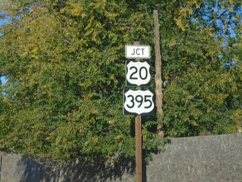
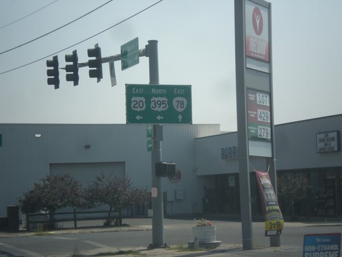
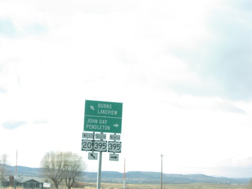
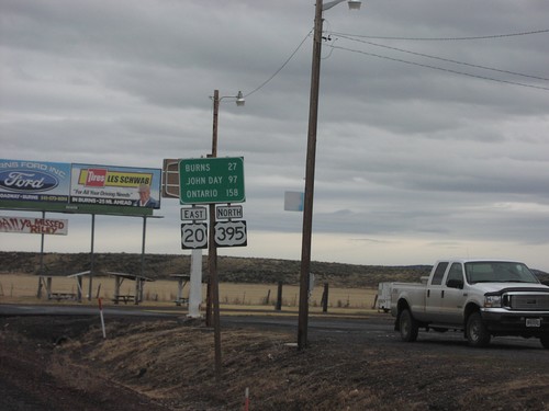
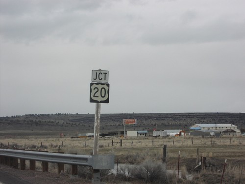
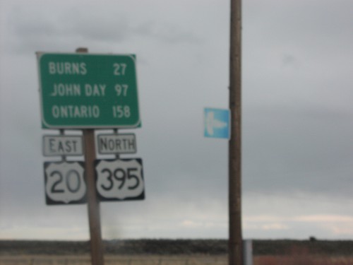
Fry Road North at US-20/US-395 Junction
Fry Road North at US-20/US-395 Junction. Turn right for US-20 East to Vale; left for US-20 West/US-395 South to Burns; continue straight for US-395 North to John Day.
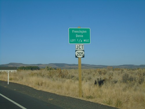
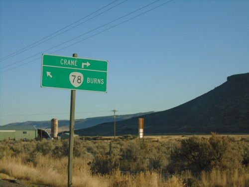
End OR-205 North at OR-78
End OR-205 North at OR-78 in Harney County. Turn right for OR-78 East to Crane; left for OR-78 West to Burns.
OR-78 East Approaching OR-205
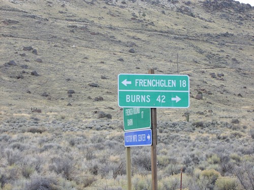
OR-78 East approaching OR-205. Use OR-205 south to Frenchglen and Denio (Nevada).
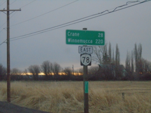
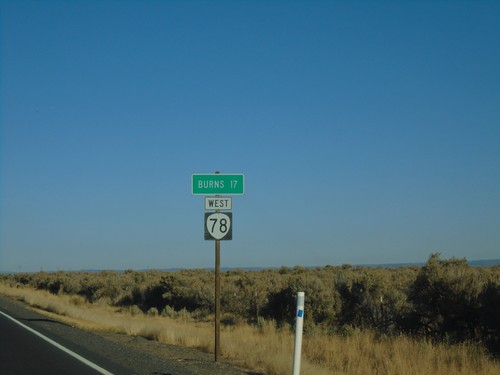
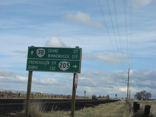
OR-78 East - Distance Marker
Distance marker on OR-78 east. Distance to Crane and Winnemucca (Nevada).
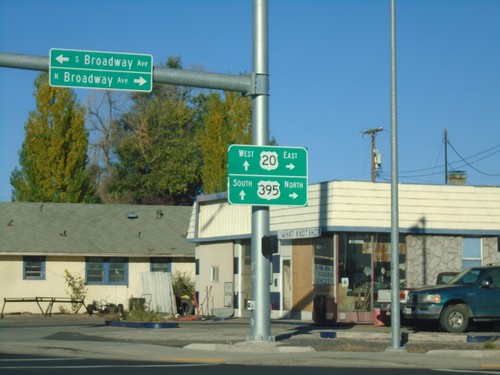
US-20 West/US-395 South - Burns
US-20 West/US-395 South in Burns
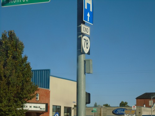
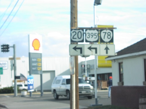
End OR-78 at US-20/US-395
End OR-78 at US-20/US-395 in Burns. Turn right for US-20 East/US-395 North; continue straight for US-20 West/US-395 South.
End OR-78 at US-20/US-395
End OR-78 at US-20/US-395 in Burns.
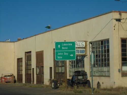
OR-78 West Approaching US-20/US-395
OR-78 West Approaching US-20/US-395 in Burns. Turn right for US-20 East/US-395 North to John Day (via US-395) and Vale (via US-20). Continue straight for US-20 West/US-395 South to Lakeview (via US-395) and Bend (via US-20).
OR-78 West Approaching US-20/US-395
OR-78 West Approaching US-20/US-395 in Burns.
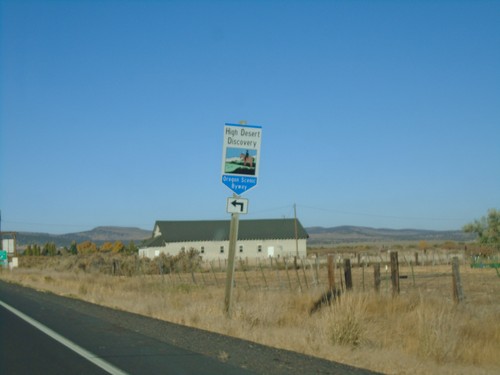
OR-78 West at OR-205 Junction
OR-78 West at OR-205 Junction. Turn left for the High Desert Discovery Scenic Byway.
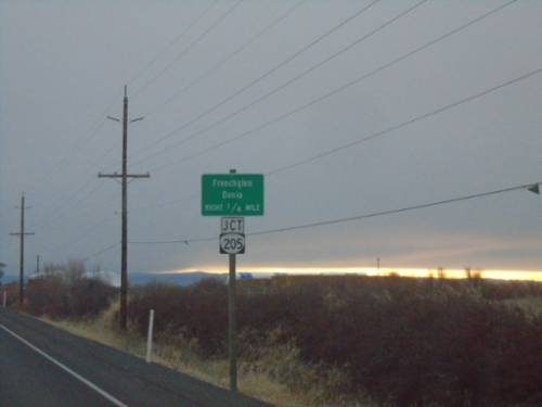
OR-78 West Approaching OR-205
OR-78 West approaching OR-205 south to Frenchglen and Denio (Nevada).
OR-78 West - Distance Marker
Distance marker on OR-78 west. Distance to Burns.
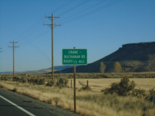
OR-78 West - Crane-Buchannan Road Jct.
OR-78 West approaching Crane-Buchannan Road Jct.
US-20 East/US-395 North at OR-78
US-20 East/US-395 north at OR-78 in Burns.
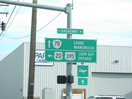
US-20 East/US-395 North Approaching OR-78
US-20 East/US-395 North approaching OR-78. Turn left for US-20 East/US-395 North to John Day (via US-395) and Value (via US-20). Continue straight for OR-78 East to Crane and Winnemucca (Nevada).
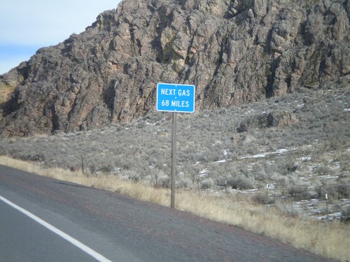
US-20 East - Next Gas 68 Miles
Next Gas 68 Miles on US-20 east. Taken just outside of the settlement of Buchanan. The next gas is in the town of Vale.
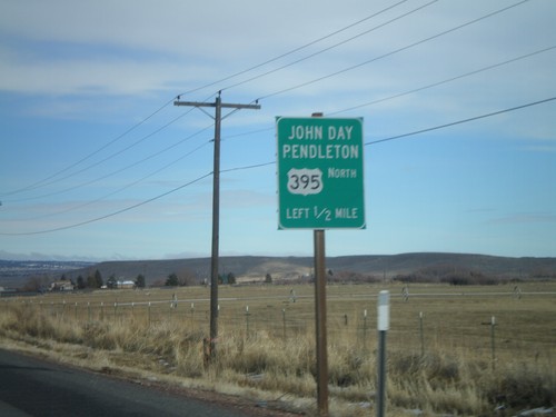
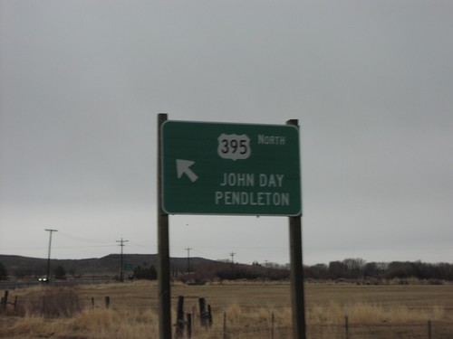
US-20 East/US-395 North Approaching US-395
US-20 East/US-395 North approaching US-395 north to John Day and Pendleton.
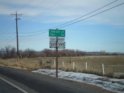
US-20 East/US-395 North - Distance Marker
Distance marker on US-20 East/US-395 north to John Day and Vale.
US-20 East/US-395 North Approaching OR-78
US-20 East/US-395 North approaching OR-78. Stay in the left lane for US-20 East/US-395 North for John Day and Vale.
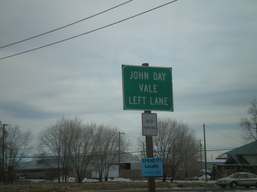
US-20 East at US-395 North
US-20 East/US-395 North at US-395 North to John Day and Pendleton.
US-20 East at US-395 North
US-20 East/US-395 North at US-395 North to John Day and Pendleton, and US-20 East to Vale and Ontario.
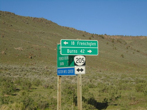
OR-78 East at OR-205 South
OR-78 east at OR-205 south to Frenchglen and Denio
US-20 East/US-395 North at OR-78
US-20/US-395 north at OR-78 junctio
US-20 East/US-395 North at OR-78
US-20/US-395 north at OR-78 to Crane and Winnemucca
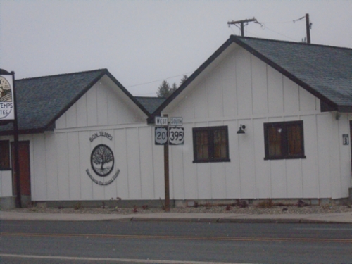
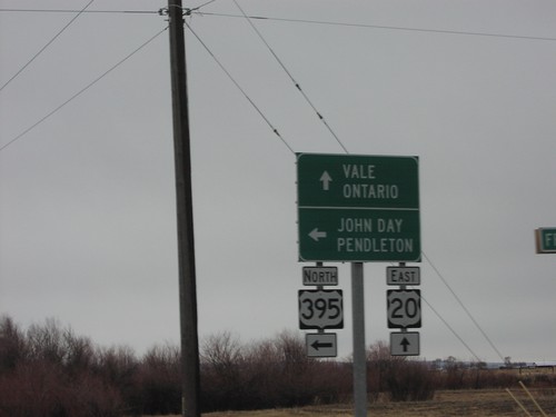
US-20 West at US-395 Jct.
US-20/US-395 north junction to John Day and Pendleton on US-20 west
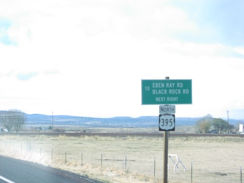
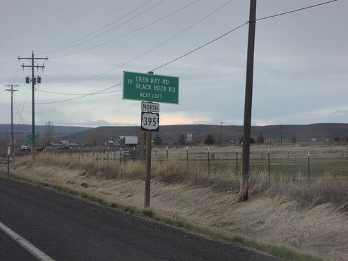
US-20 West at US-395 Jct.
Eben Ray Rd/Black Rock Rd Jct. on US-20 west at US-395 north jct
US-20 East Approaching US-395 North
US-20 east approaching US-395 junction in Burns.
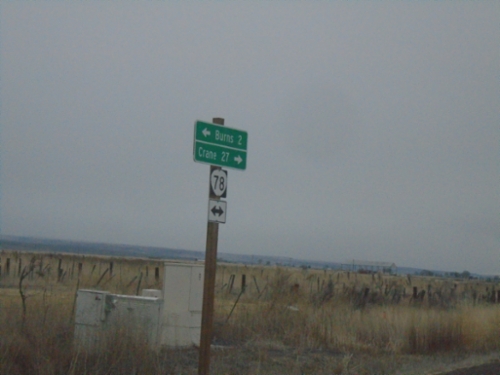
Crane
OR-78 - Crane Jct.
OR-78 at Crane Jct. Turn right for Crane, merge left for OR-78 West to Burns.
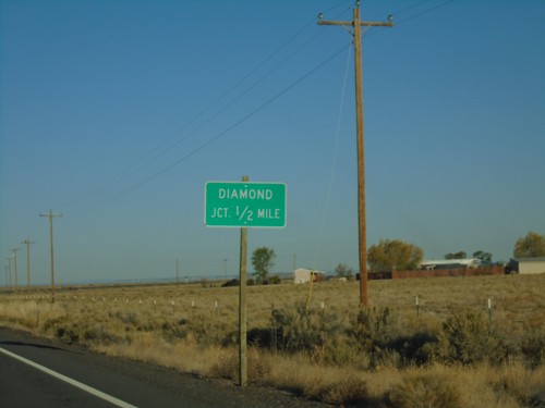
Diamond
Diamond-Grain Camp Rd at OR-205
End CR-409 at OR-205 to Frenchglen and Burns
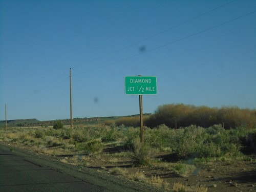
OR-205 North - Diamond Jct.
OR-205 north approaching Diamond Lane to Diamond.
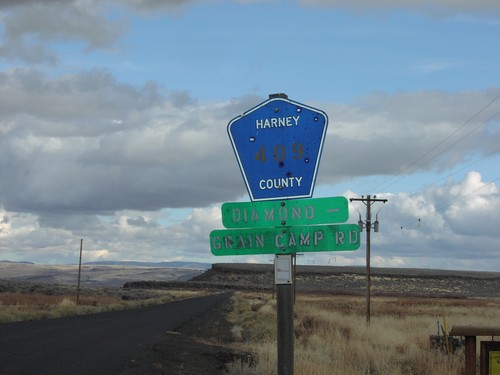
CR-409 Diamond-Grain Camp Rd
CR-409 Diamond-Grain Camp Road at OR-205 junction
Diamond-Grain Camp Rd at OR-205
End CR-409 at OR-205 to Frenchglen and Burns
Drewsey
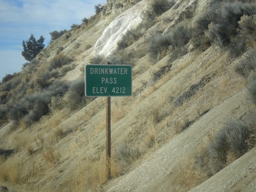
US-20 West - Drinkwater Pass
Drinkwater Pass - Elevation 4212 Feet on US-20 West.
Fields
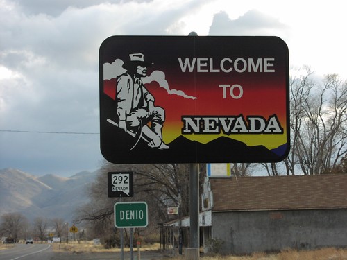
NV-292 - Welcome To Nevada
Welcome to Nevada on NV-292
Hines
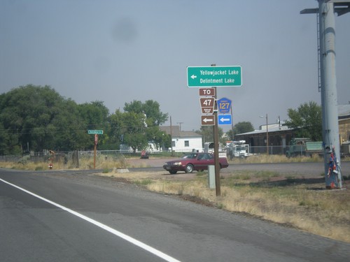
US-20 East/US-395 North - Hines Logging Road
US-20 East/US-395 North -at CR-127 Jct (Hines Logging Road). Use CR-127 for FR-47, Yellowjacket Lake, and Delintment Lake in the Malheur National Forest.
US-20/US-395 - Sage Hen Rest Area
Distance to Burns and Bend at the exit to the Sage Hen Summit Rest Area on US-395/US-20.
New Princeton
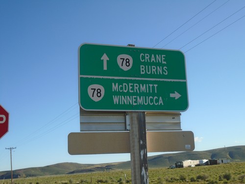
Lava Bed Road at OR-78
Lava Bed Road at OR-78. Use OR-78 east to McDermitt and Winnemucca (Nevada); OR-78 west to Crane and Burns.
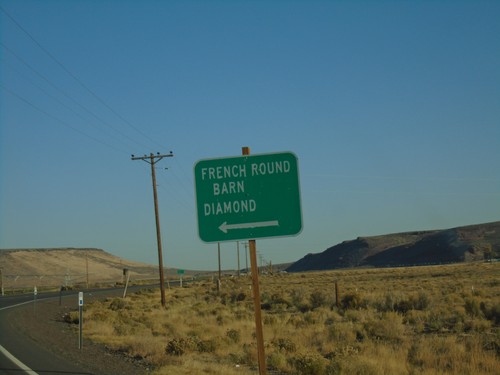
OR-78 North - French Round Barn/Diamond Jct.
OR-78 North at French Round Barn/Diamond Jct.
Princeton
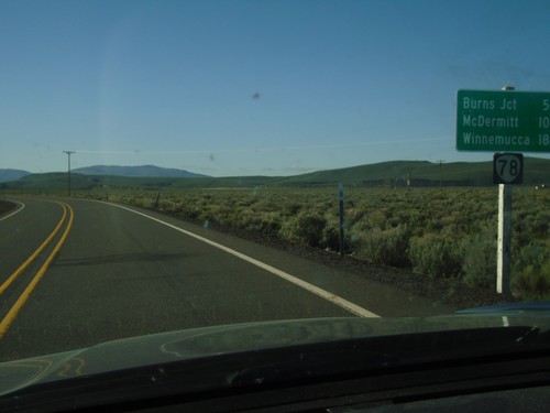
OR-78 East - Distance Marker
Distance marker on OR-78 east. Distance to Burns Jct., McDermitt (via US-95) and Winnemucca (Nevada via US-95).
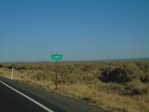
OR-78 West - Lawen
Community of Lawen on OR-78 west.
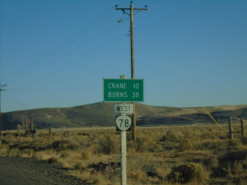
OR-78 West - Distance Marker
Distance marker on OR-78 west. Distance to Crane and Burns.
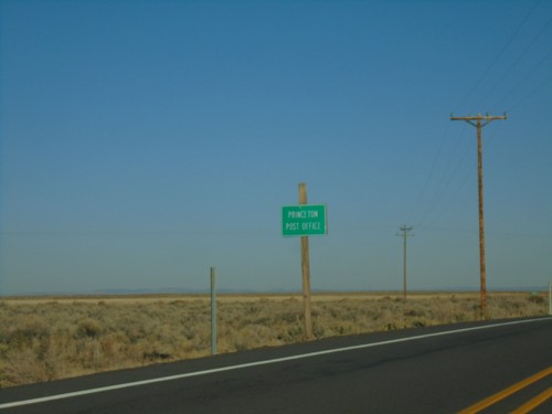
OR-78 West - Princeton Post Office
OR-78 west approaching Diamond Jct. Turn left for Princeton Post Office.
OR-78 West - Diamond Jct.
OR-78 West approaching Diamond Jct.
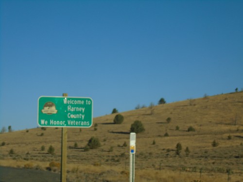
OR-78 West - Harney County
Entering Harney County on OR-78 west. Many of the eastern Oregon counties have a tagline on their county welcome sign saying “We Honor Veterans”.
Riley
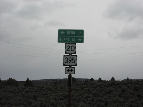
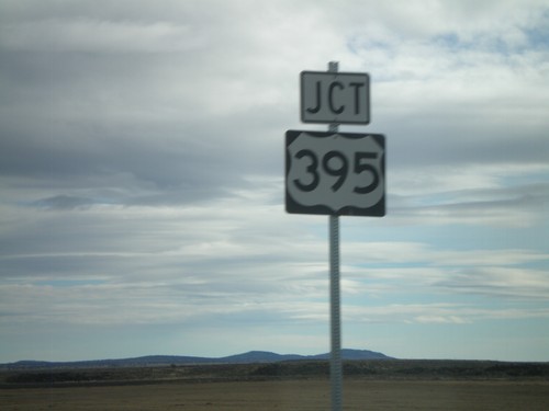
US-395 North at US-20 - Riley
US-395 North at US-20 in Riley. Use US-20 West to Bend and Portland; use US-395 North/US-20 East to Burns and John Day. US-395 North joins US-20 East to Burns.
US-395 North at US-20 - Riley
US-395 North at US-20 in Riley. Use US-20 West to Bend and Portland; use US-395 North/US-20 East to Burns and John Day. US-395 North joins US-20 East to Burns.
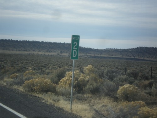
US-395 South - Milepost 2D
Milepost 2D on US-395 south. These types of mileposts have been appearing in Oregon in recent years. The letters represent the segment of the internal highway that this particular stretch is part of. In this case the D is the 4th named highway along US-395 south from the Washington line. (A=Umatilla-Stanfield, B=Pendleton-John Day, C=John Day Burns, D=Lakeview-Burns, E=Fremont).
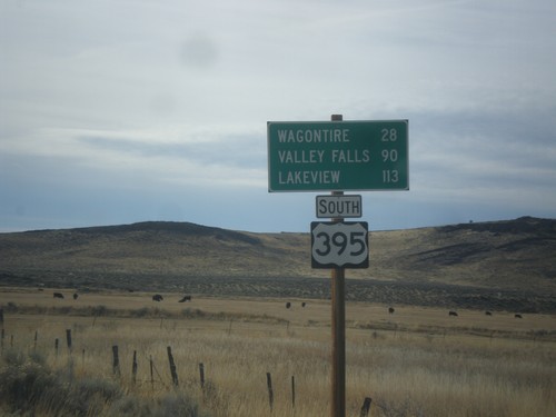
US-395 South - Distance Marker
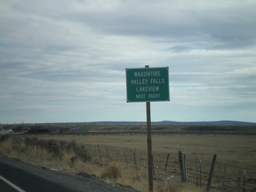
Distance marker on US-395 south. Distance to Wagontire, Valley Falls, and Lakeview.
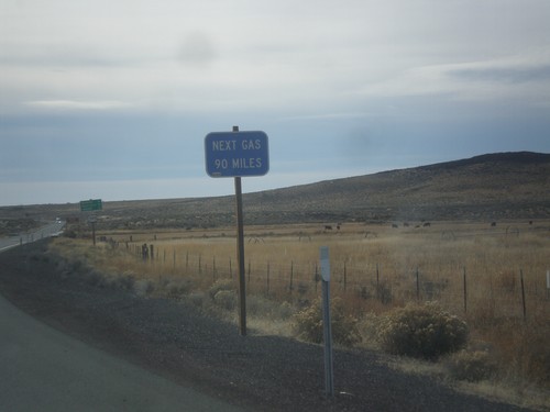
US-395 South - Next Gas 90 Miles
Next Gas 90 Miles on US-395 south. The next gas in this case is in Valley Falls. These types of signs are common in eastern Oregon after leaving a settlement with a gas pump.
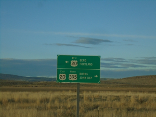
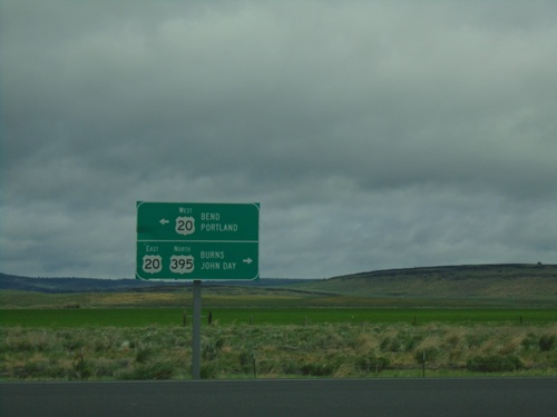
US-20 West at US-395 South
US-20 east at US-395. US-395 joins US-20 east through Burns.
US-20 East Approaching US-395
US-20 east approaching US-395. Use US-395 south for Wagontire, Valley Falls, and Lakeview.
US-20 East Approaching US-395
US-20 east approaching US-395
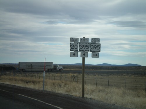
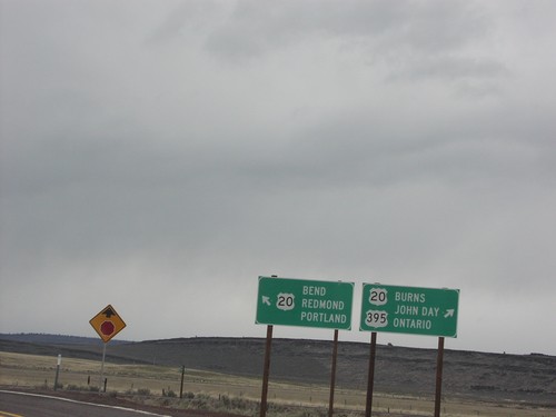
US-20 East/US-395 North - Riley
US-20 East/US-395 North - Distance Marker. Distance to Burns, John Day, and Ontario.
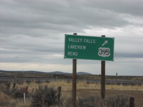
US-20 West at US-395 South
US-20 east at US-395 south to Valley Falls, Lakeview, and Reno.
US-20 West at US-395 South
US-20 East at US-395 South. US-395 North follows US-20 east into Burns.
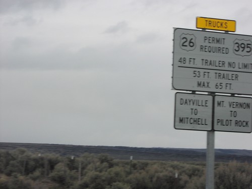
Truck Information on US-395 North
Truck information for US-26 and US-395 traffic approaching US-20 on US-395 north in Riley.
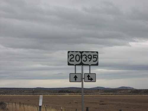
US-395 North at US-20
US-20 to Burns, and Bend on US-395 north in Riley.
US-395 North at US-20
Junction US-20 on US-395 north, in Riley.
US-395 North/US-20 East - Distance Marker
Distance marker on US-395 north/US-20 east in Riley.
Wagontire
End Christmas Valley Highway at US-395
End Christmas Valley Highway at US-395 in Lake County. Use US-395 South to Lakeview; US-395 North to Burns.
US-395 South Approaching Christmas Valley Junction
US-395 South approaching Christmas Valley junction in Lake County.
No Place Associated
OR-205 North - Distance Marker
Distance marker on OR-205 north. Distance to Burns.
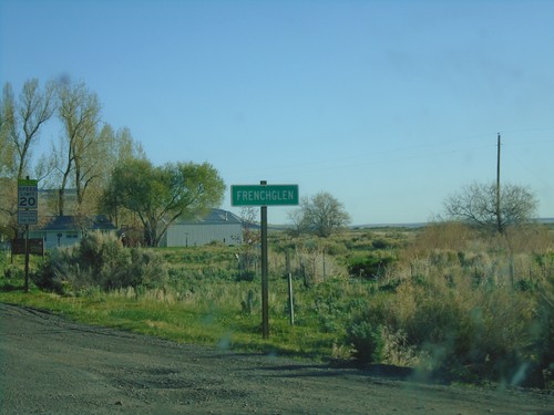
OR-205 North - Frenchglen
Entering Frenchglen on OR-205 north.
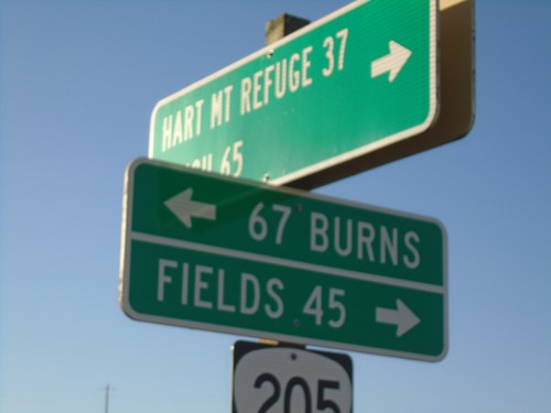
End Rock Creek Road at OR-205
End Rock Creek Road at OR-205 in Harney County. Turn right for Fields; left for Burns. Use Rock Creek Road for Hart Mountain Refuge and Plush.
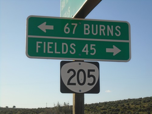
End Rock Creek Road at OR-205
End Rock Creek Road at OR-205 in Harney County. Turn right for Fields; left for Burns.
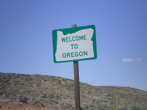
OR-140 West - Welcome To Oregon
Welcome to Oregon on OR-140 west. Taken at the Oregon-Nevada State Line.
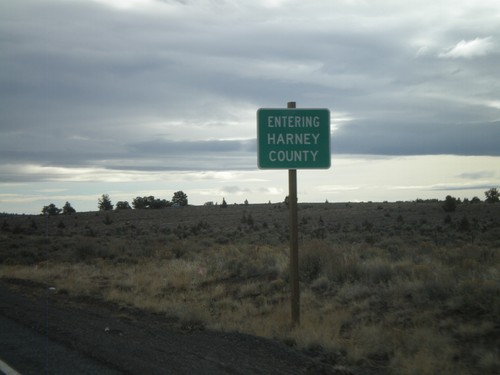
US-20 East - Entering Harney County
Entering Harney County on US-20 east at the Lake-Harney County Line.
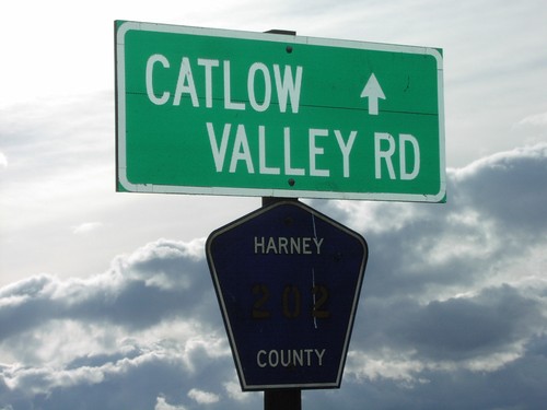
End OR-205 Begin CR-202 Catlow Valley Rd
End OR-205/Begin CR-202/Catlow Valley Road