Lake County, Oregon
Localities: Adel | Fort Rock | Lakeview | New Pine Creek | Silver Lake | Summer Lake | Valley Falls
No Place Associated
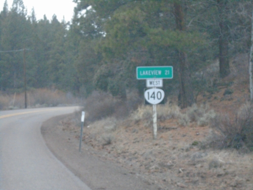
OR-140 West - Distance Marker
Distance marker on OR-140 west. Distance to Lakeview.
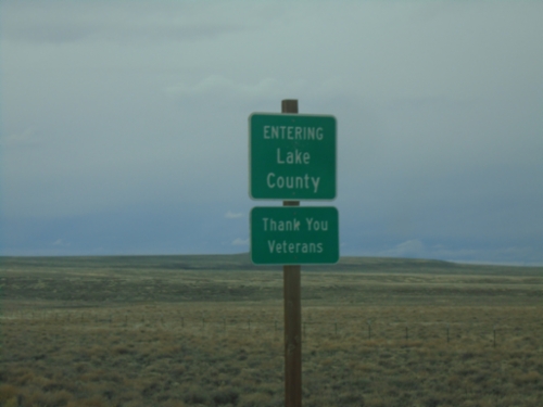
OR-140 West - Lake County
Entering Lake County on OR-140 west. A sign beneath reads Thank You Veterans. Many of the county boundaries in southern and eastern Oregon, as well as northern California have a message thanking veterans.
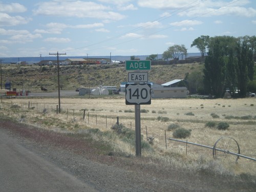
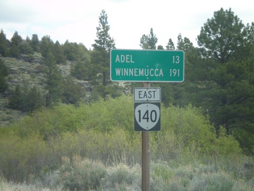
Adel
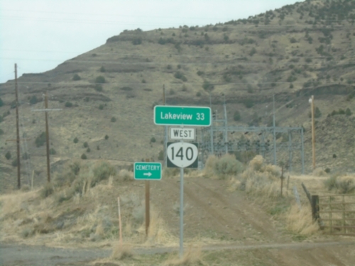
OR-140 West - Distance Marker
Distance marker on OR-140 west. Distance to Lakeview.
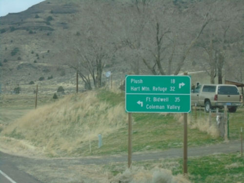
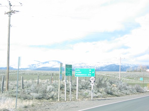
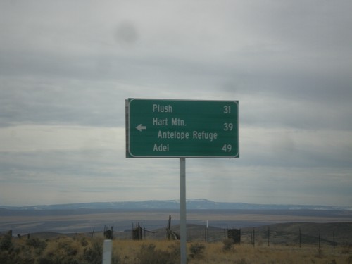
OR-140 West at Twentymile Road
OR-140 West at Twentymile Road in Adel. Turn right for Plush and Hart Mountain Refuge; turn left for Fort Bidwell (California) and Coleman Valley.
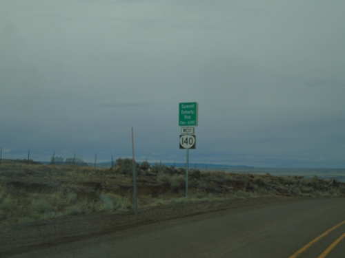
OR-140 West - Summit - Doherty Rim
Doherty Rim Summit, Elevation 6,240 Feet on OR-140 west in rural Lake County.
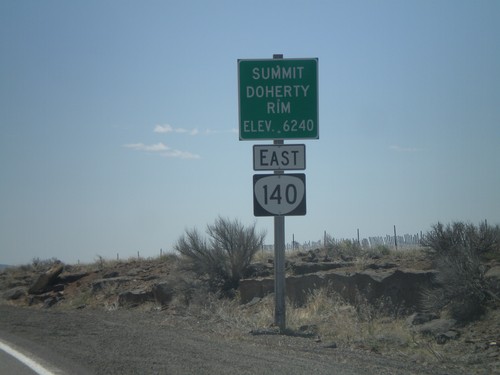
OR-140 East - Summit - Doherty Rim
Doherty Rim Summit, Elevation 6,240 Feet on OR-140 east in rural Lake County.
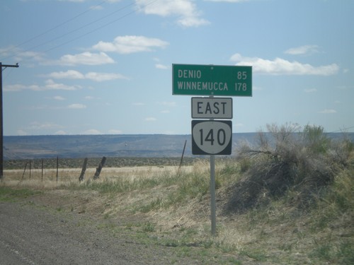
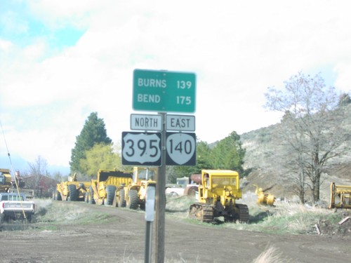
OR-140 East - Distance Marker
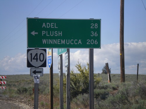
Distance marker to Denio and Winnemucca (both in Nevada) along OR-140 east, leaving Adel.
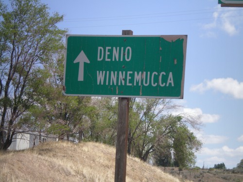
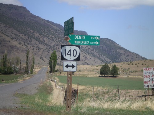
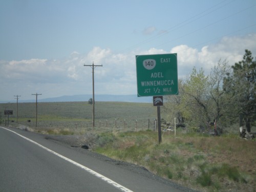
OR-140 East - Denio and Winnemucca
Use OR-140 east to Denio and Winnemucca (both in Nevada) in Adel.
Twentymile Road North at OR-140
Twentymile Road north at OR-140 in Adel. Turn right on OR-140 for Denio and Winnemucca (both in Nevada). Westbound destinations on fingerboard are broken off.
OR-140 East - Entering Adel
Entering Adel on OR-140 east. Adel is a small community in southeastern Lake County, Oregon. The OR-140 shield is incorrectly signed with a US highway type marker.
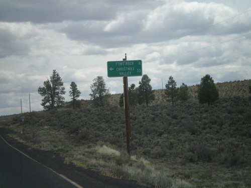
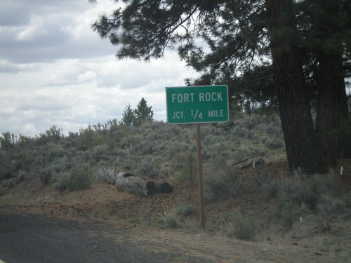
Fort Rock
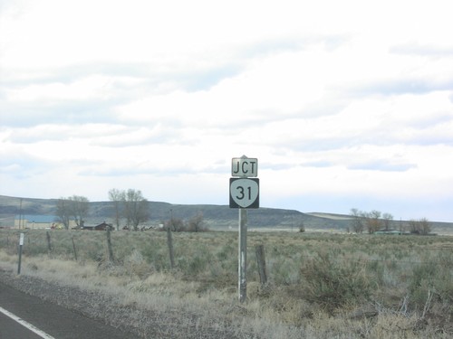
End Fort Rock Road at OR-31
End Fort Rock Road at OR-31 in rural Lake County.
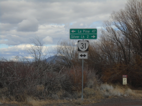
OR-31 South at Fort Rock Jct.
OR-31 south at Fort Rock/Christmas Valley Jct.
OR-31 South Approaching Fort Rock Jct.
OR-31 south approaching Fort Rock junction.
Lakeview
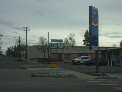
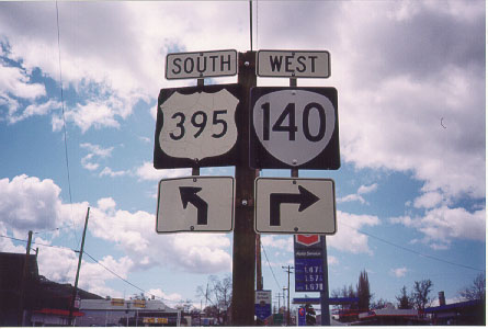
US-395 South/OR-140 West Split
US-395 South/OR-140 West split in Lakeview. Turn right for OR-140 west; left for US-395 south.
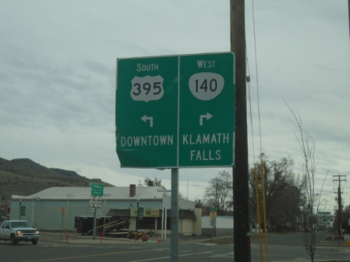
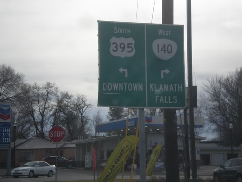
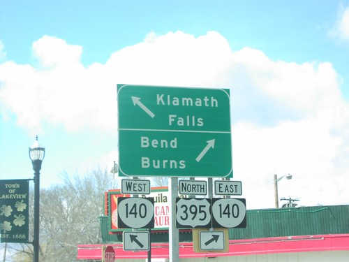
US-395 South/OR-140 West at US-395/OR-140 Split
US-395 South/OR-140 West at US-395/OR-140 Split in Lakeview. Turn right for OR-140 East to Klamath Falls; turn left for US-395 south to Downtown (Lakeview).
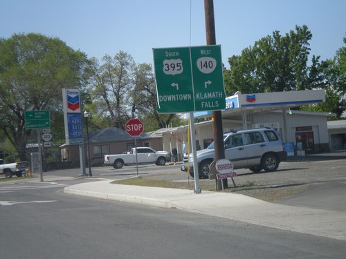
OR-140 West at US-395
OR-140 west at US-395. OR-140 west joins US-395 south into Lakeview. Use US-395 north for Burns and Bend. Use US-395 South/OR-140 West for Lakeview and Klamath Falls. US-395 is part of the Oregon Outback Scenic Byway.
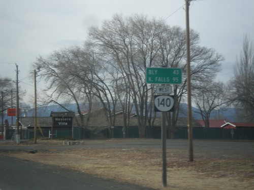
OR-140 West - Distance Marker
Distance marker on OR-140 west. Distance to Bly and Klamath Falls.
US-395 South/OR-140 West Approaching Split
US-395 South/OR-140 West approaching US-395/OR-140 split. Turn right for OR-140 west to Klamath Falls. Turn left for US-395 to Downtown (Lakeview).
US-395 South Approaching OR-140
US-395 south approaching OR-140. OR-140 west joins US-395 south into Lakeview.
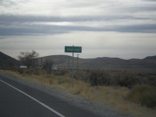
US-395 South - Alkali Lake
Entering Alkali Lake on US-395 south. Alkali Lake is home to a state rest area and a state highway maintenance station.
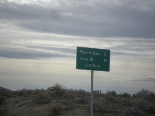
US-395 South - Horse Mountain Road
US-395 South approaching Horse Mountain Road to Horse Mountain and Poverty Basin.
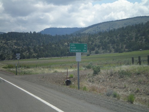
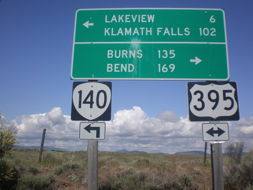
OR-140 East - Distance Marker
Distance marker on OR-140 east. Distance to Adel and Winnemucca (Nevada).
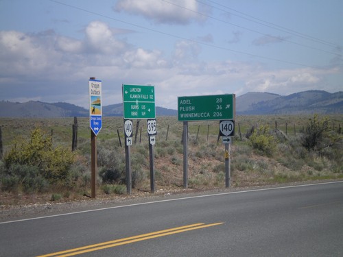
OR-140 East - Distance Marker
Distance marker on OR-140 east. Distance to Adel, Plush, and Winnemucca (Nevada). In the background is an OR-140 shield. This was taken just east of the US-395/OR-140 junction.
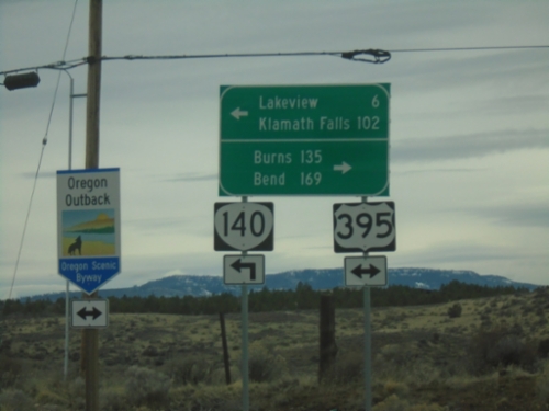
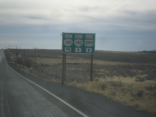
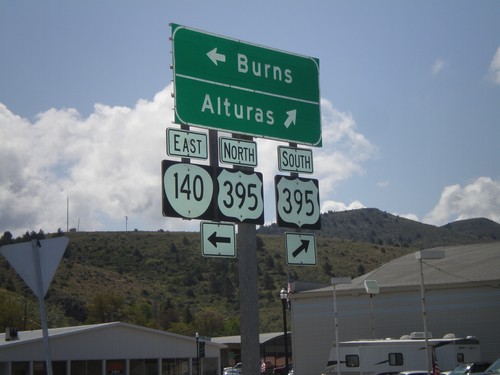
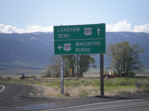
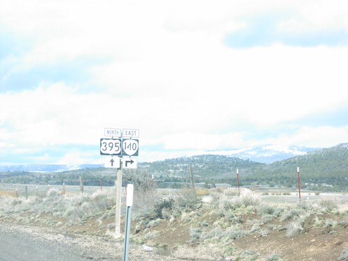
US-395 North/OR-140 East at Split
US-395 North/OR-140 East at US-395/OR-140 split. Turn right for OR-140 east to Adel, Plush, and Winnemucca (Nevada). Continue north on US-395 for Burns and Bend. US-395 is part of the Oregon Outback Scenic Byway.
US-395 North/OR-140 East - Distance Marker
Distance marker on US-395 North/OR-140 East. Distance to Burns and Bend.
OR-140 East at US-395
OR-140 east at US-395 junction. Turn right for US-395 south to Alturas (California). Turn left for US-395 North/OR-140 east to Burns. OR-140 east joins US-395 north through Lakeview.
US-395 South/OR-140 West Approaching Split
US-395 South/OR-140 West approaching US-395/OR-140 split. Turn right for OR-140 west to Klamath Falls. Turn left for US-395 to Downtown (Lakeview).
OR-140 West at US-395
OR-140 west at US-395. OR-140 west joins US-395 south into Lakeview. Use US-395 north for Burns and Bend. Use US-395 South/OR-140 West for Lakeview and Klamath Falls.
US-395 South OR-140
US-395 South at OR-140. Use OR-140 east for Adel, Plush, and Winnemucca (Nevada). OR-140 west joins US-395 into Lakeview.
US-395 South Approaching OR-140
US-395 south approaching OR-140 east to Adel and Winnemucca (Nevada).
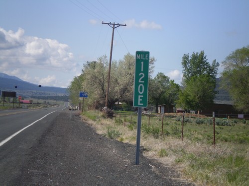
Milemarker at OR-31/US-395 Junction
Milemarker 120E at OR-31/US-395 junction. These type of milemarkers with the letter suffix have started to appear around Oregon. The letter indicates the segment of highway that the mileage is for. In Oregon, mile markers are posted according to internal highway, not posted route number (except for intersate highways). In this case the milemarker is for Fremont Highway. A posted highway can be composed of have multiple segments of internal highways. The milemarker in this photo is for the 5th (E is the 5th letter) segment of internal highway along posted route US-395. See here for more discussion: State Highways In Oregon
End OR-31 South at US-395
End OR-31 south at US-395. Use US-395 south for Lakeview and Reno (Nevada). Use US-395 north for Wagontire and Burns.
OR-31 South Approaching US-395
OR-31 south approaching US-395. This is the southern end of OR-31.
OR-31 South Approaching US-395
OR-31 South at US-395 junction. This is the southern end of OR-31.
Jct. OR-140 East on US-395 North
US-395 North/OR-140 East approaching US-395/OR-140 split. Use OR-140 east to Adel and Winnemucca (Nevada).
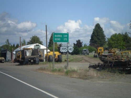
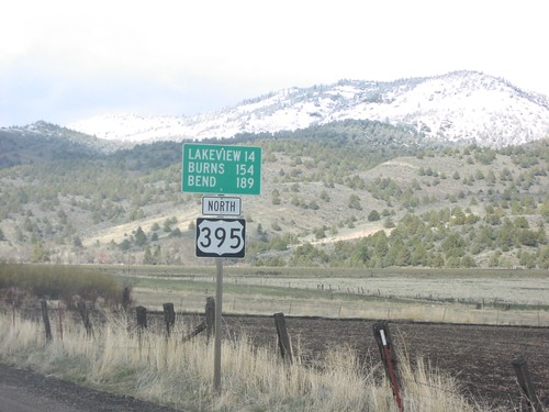
US-395 North - Distance Marker
Distance marker to Valley Falls, Burns, and Bend on US-395 north in Lake County.
US-395 North Approaching OR-140
US-395/OR-140 shields in Lake County.
US-395 North at OR-140
US-395 north at OR-140 west junction to Klamath Falls in Lakeview.
US-395 North at OR-140 East
OR-140 to Plush, Adel, and Winnmucca on US-395 north in Lake County.
US-395 North/OR-140 North - Distance Marker
Distance marker on US-395 north/OR-140 east in Lakeview.
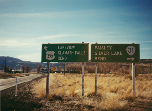
US-395 South At OR-31
US-395 South to Lakeview/Klamath Falls/Reno at OR-31 to Paisley/Silver Lake/Bend
US-395 South/OR-140 West Split
US-395 South/OR-140 West split in Lakeview. Turn right for OR-140 west; left for US-395 south.
New Pine Creek
US-395 North - Distance Marker
US-395 north distance marker to Lakeview, Burns, and Bend at the Oregon-California line.
Silver Lake
End Silver Creek Marsh Road at OR-31
End Silver Creek Marsh Road at OR-31. Turn right on OR-31 for Silver Lake. Turn left on OR-31 for La Pine.
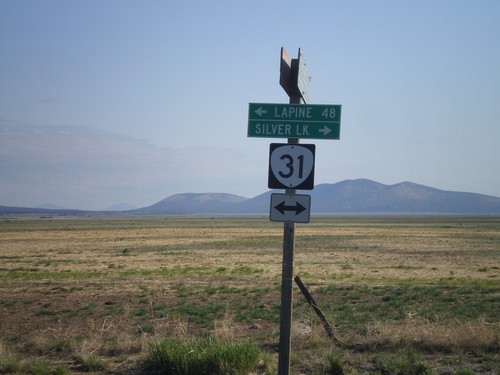
End Silver Lake Marsh Road at OR-31
End Silver Lake Marsh Road at OR-31. Turn right on OR-31 for Silver Lake. Turn left on OR-31 for La Pine.
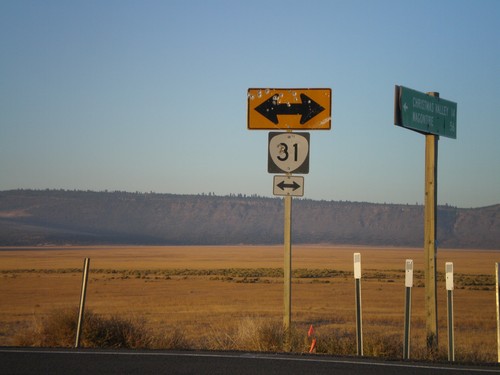
Christmas Valley-Wagontire Road at OR-31
Christmas Valley-Wagontire Road at OR-31.
Summer Lake
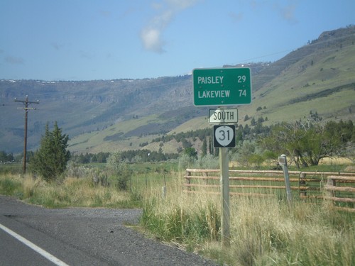
OR-31 South - Distance Marker
Distance marker on OR-31 south, leaving Summer Lake, Oregon. Distance to Paisley and Lakeview.
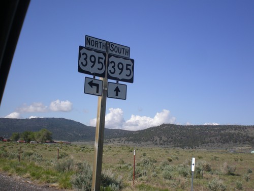
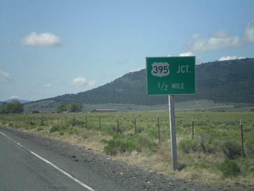
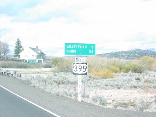
Valley Falls
Jct. OR-31 on US-395 North
Junction OR-31 on US-395 north in Valley Falls.
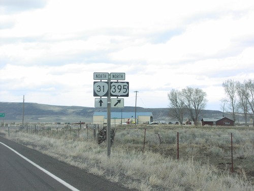
US-395 North at OR-31
OR-31/US-395 junction in Valley Falls.
No Place Associated
US-395 South - Hogback Road Jct.
US-395 South at Hogback Road Jct. Use Hogback Road for Plush, Hart Mountain Antelope Refuge, and Adel.
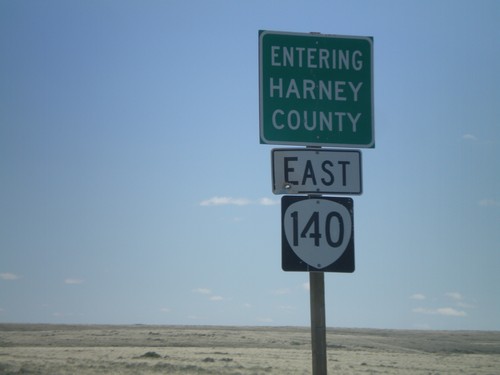
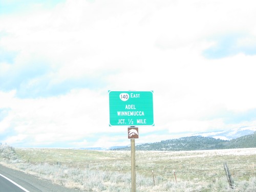
OR-140 East - Entering Harney County
Entering Harney County on OR-140 east. Taken at the Harney-Lake County Line. OR-140 briefly enters Harney County before leaving Oregon.