Wasco County, Oregon
Localities: Antelope | Boyd | Dufur | Fairbanks | Government Camp | Maupin | Mosier | Shaniko | The Dalles | Tygh Valley | Warm Springs
Antelope
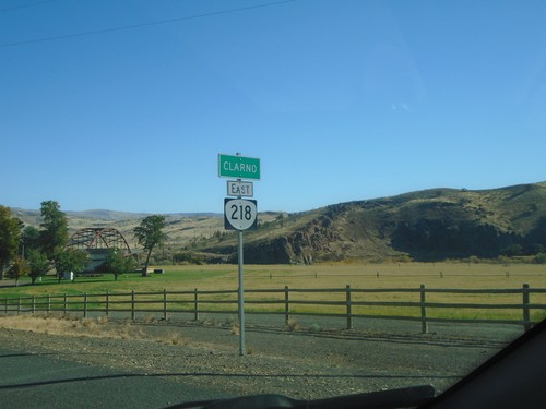
OR-218 East - Clarno
Entering Clarno on OR-218 east.
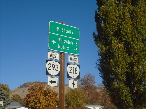
OR-218 West at OR-293 West - Antelope
OR-218 West at OR-293 West in Antelope. Turn left for OR-293 West to Willowdale and Madras; continue straight on OR-218 for Shaniko.
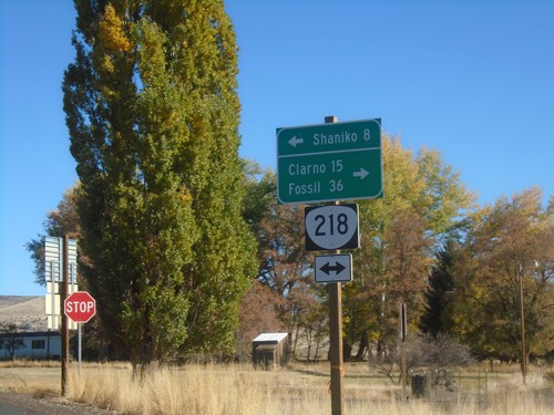
End OR-293 East at OR-218
End OR-293 East at OR-218 in Antelope. Use OR-218 west to Shaniko; OR-218 east to Clarno and Fossil.
OR-293 East Approaching OR-218
OR-293 East approaching OR-218 in Antelope.
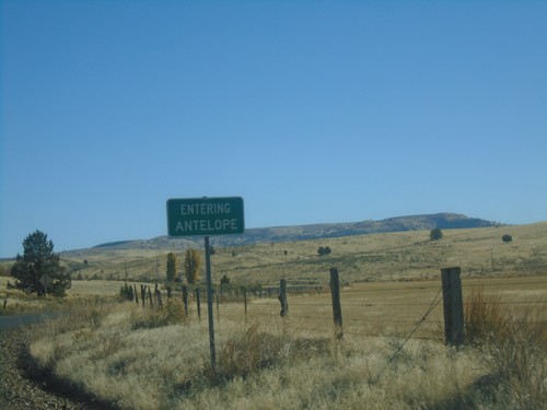
OR-293 East - Antelope
Entering Antelope on OR-293 East.
Boyd
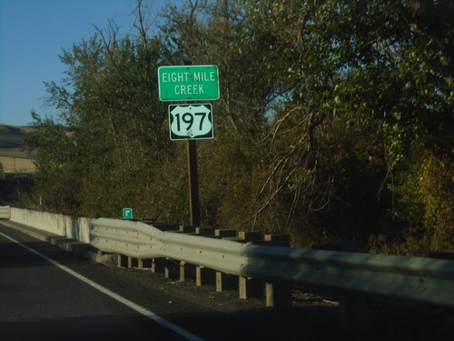
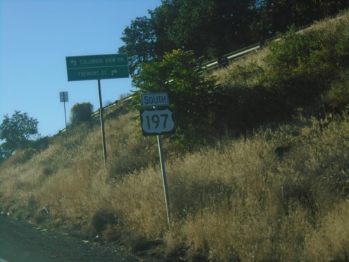
US-197 South - Eight Mile Creek
Eight Mile Creek on US-197 South.
Dufur
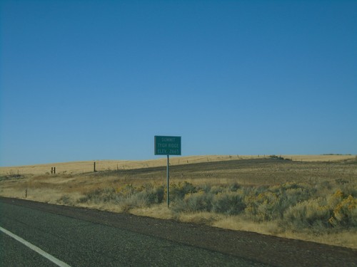
US-197 South - Tygh Ridge Summit
US-197 South at Tygh Ridge Summit - Elevation 2665 Ft.
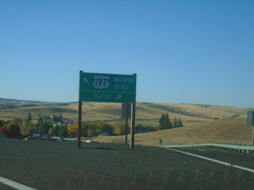
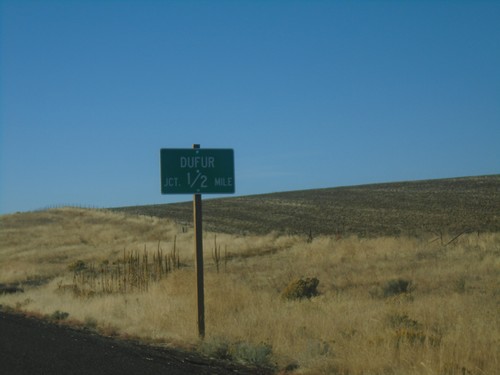
US-197 South at Dufur Jct.
US-197 South at Dufur Jct. Continue south on US-197 for Maupin and Bend.
US-197 South - Dufur Jct.
US-197 South - north entrance to Dufur Jct.
Fairbanks
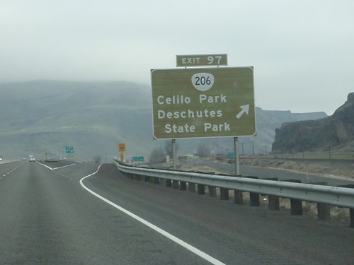
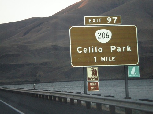
I-84 East - Exit 97
I-84 east at Exit 97 - OR-206/Celilo Park/Deschutes State Park.
Government Camp
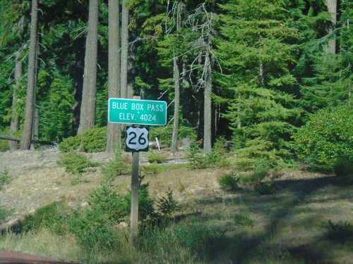
US-26 West - Blue Box Summit
US-26 West at Blue Box Summit - Elevation 4024 Feet.
Maupin
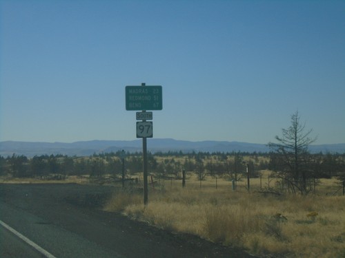
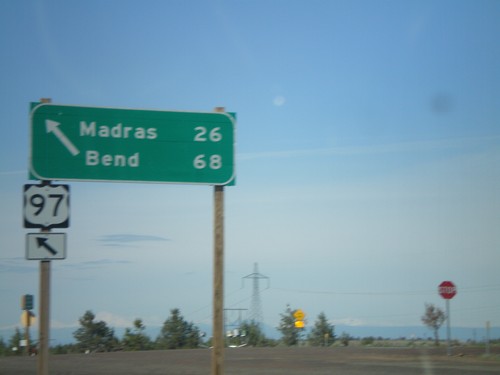
US-97 South - Distance Marker
Distance marker on US-97 south. Distance to Madras, Redmond, and Bend.
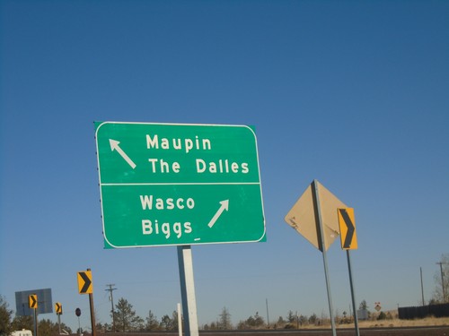
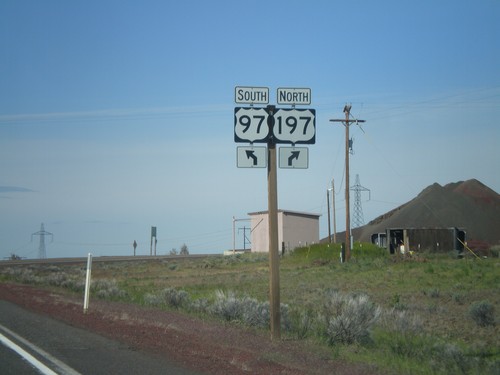
US-97 North at US-197 - Wasco County
US-97 North at US-197 in Wasco County. Use US-197 north for Maupin and The Dalles; US-97 North for Wasco and Biggs.
End US-197 South Approaching US-97
End US-197 South approaching US-97. Use US-97 south for Madras and Bend; US-97 north for Biggs and Wasco.
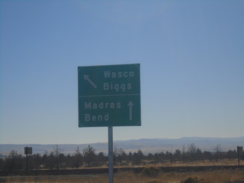
US-197 South Approaching US-197
US-197 South approaching US-197. Use US-97 north for Wasco and Biggs; US-97 south for Madras and Bend.
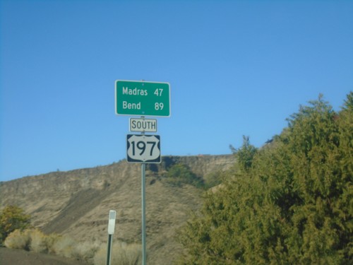
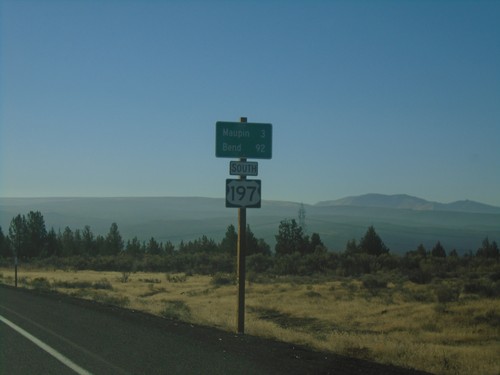
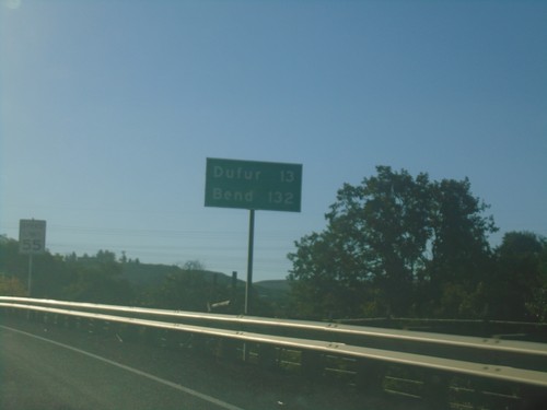
US-197 South - Distance Marker
Distance marker on US-197 south. Distance to Madras and Bend.
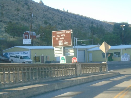
US-197 South - Deschutes River Recreation Area
US-197 South at Deschutes River Recreation Area/City Park (Bakeoven Road) junction.
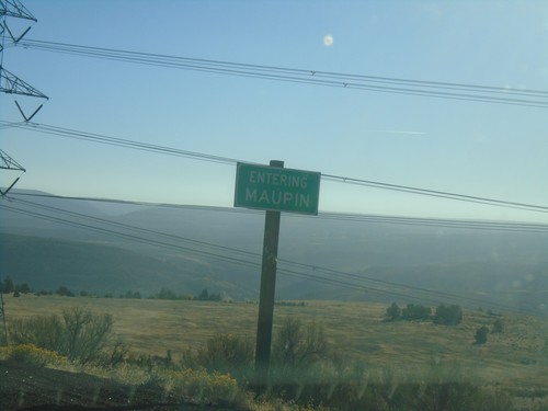
US-197 South - Maupin
Entering Maupin on US-197 South.
US-197 South - Distance Marker
Distance marker on US-197 south. Distance to Maupin and Bend.
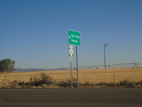
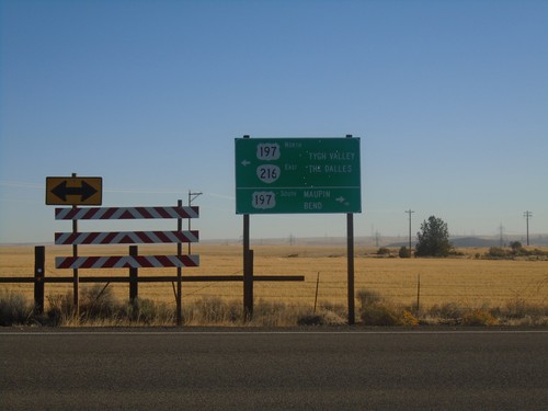
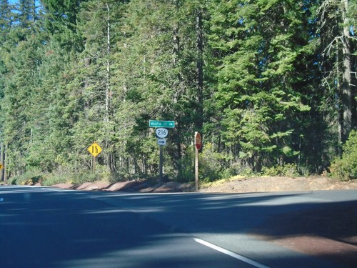
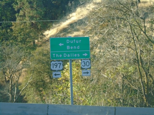
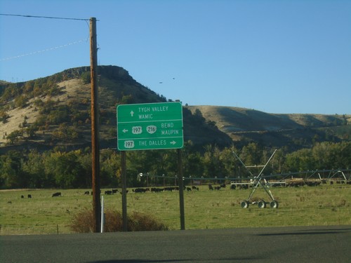
US-197 North at OR-216 West
US-197 North at OR-216 West to Government Camp and Portland. OR-216 East joins US-197 North to Tygh Valley.
OR-216 East at US-197
OR-216 East at US-197 in Wasco County. Turn right for US-197 South to Maupin and Bend. OR-216 East joins US-197 north to Tygh Valley. Turn left for US-197 North/OR-216 East to Tygh Valley and The Dalles.
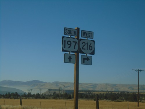
US-197 South/OR-216 West at US-197/OR-216 Split
US-197 South/OR-216 West at US-197/OR-216 Split. Turn right for OR-216 West to Government Camp and Portland.
US-197 South/OR-216 West at US-197/OR-216 Split
US-197 South/OR-216 West at US-197/OR-216 Split in Wasco County.
US-197 South/OR-216 West Approaching US-197/OR-216 Split
US-197 South/OR-216 West approaching US-197/OR-216 Split. Turn right for OR-216 West to Government Camp and Portland.
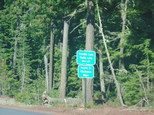
US-26 West - Timothy Lake/Olallie Lake Jct.
US-26 West approaching Timothy Lake/Olallie Lake Jct. (FS Road 42 - Skyline Road). Use FS Road 42 for access to the Clackamas River.
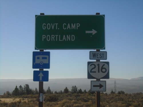
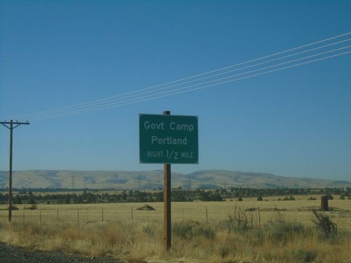
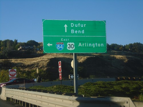
US-26 West at OR-216
US-26 West at OR-216 west to Maupin.
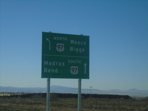
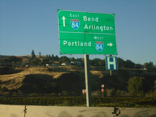
US-97 South at US-197
US-97 south at US-197. Use US-97 south for Madras and Bend. The northbound destination sign for US-197 was knocked over and lying on the ground.
US-97 South at US-197
US-97 south at US-197 junction. Taken at Shaniko Junction.
Mosier
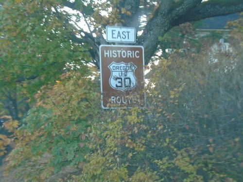
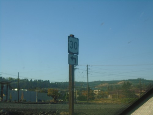
Historic US-30 East - Wasco County
Historic US-30 East in Wasco County. US-30 is signed like this throughout the Columbia River Gorge.
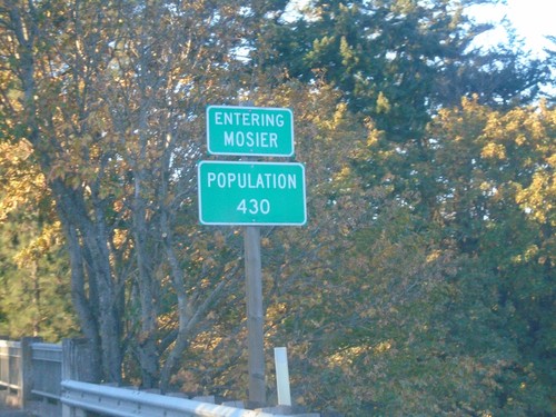
US-30 East - Mosier
Entering Mosier - Population 430 on US-30 East.
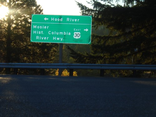
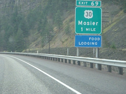
I-84 Exit 69 Offramp at US-30
I-84 Exit 69 Offramp at US-30. Turn left to return to I-84 Westbound to Hood River; turn right for US-30/Moiser/Historic Columbia River Highway.
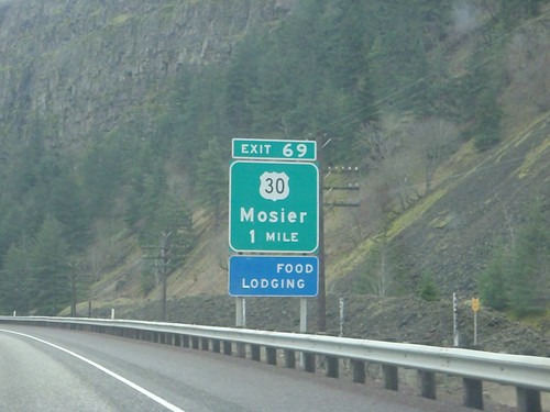
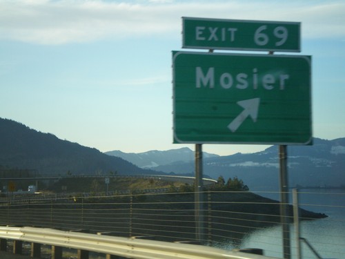
I-84 East Approaching Exit 69
I-84 east approaching Exit 69 - US-30/Mosier. US-30 leaves I-84 here, and parallels the south side of the highway to The Dalles.
I-84 East Approaching Exit 69
I-84 east approaching Exit 69 - US-30/Mosier. US-30 leaves I-84 here, and parallels the south side of the highway to The Dalles.
I-84 West - Exit 69
I-84 west at Exit 69 - Mosier.
Shaniko
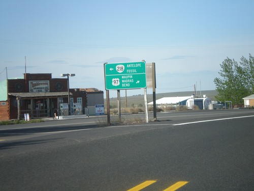
US-97 South at OR-218
US-97 south at OR-218 to Antelope and Fossil. Continue south on US-97 for Maupin, Madras, and Bend.
US-97 South Approaching OR-218
US-97 south approaching OR-218 in Shaniko.
The Dalles
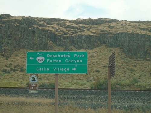
OR-206 - Celilo Village Junction
OR-206 at Celilo Village Junction. Turn right for Celilo Village; left for OR-206 East to Deschutes Park and Fulton Canyon.
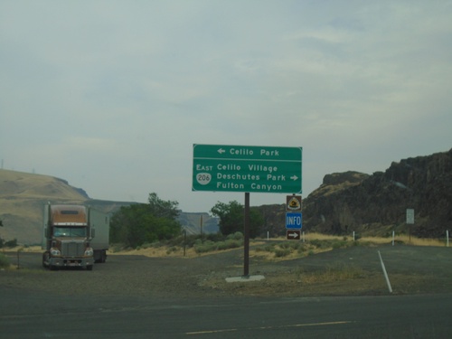
I-84 East Exit 97 Offramp at OR-206
I-84 East Exit 97 offramp at OR-206. Turn left for Celilo Park. Turn right for OR-206 East/Celilo Village/Deschutes Park/Fulton Canyon.
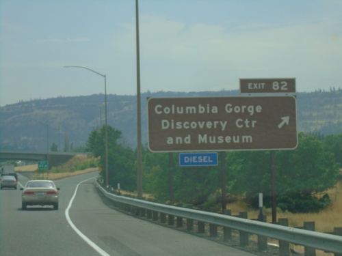
I-84 East - Exit 82
I-84 east at Exit 82 - Columbia Gorge Discovery Center and Museum.
US-197 South - Distance Marker
Distance marker on US-197 south. Distance to Dufur and Bend.
US-197 South - The Dalles
US-197 south in The Dalles.
US-197 South/US-30 West at Split
US-197 South/US-30 West at US-197/US-30 split. Turn right for US-30 west to The Dalles. Turn left for US-197 south to Dufur and Bend.
US-197 South/US-30 West at I-84 East
US-197 South/US-30 West at I-84/US-30 East to Arlington. Continue on US-197 South/US-30 West for Dufur and Bend.
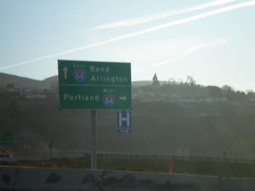
US-197 South at I-84
US-197 south at I-84 West. Use I-84 west to Portland. Continue over freeway for I-84 east to Arlington. Continue south on US-197 for Bend.
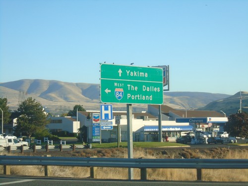
US-197 North at I-84 East
US-197 North at I-84 East to The Dalles and Portland. Continue north on US-197 for Yakima (Washington).
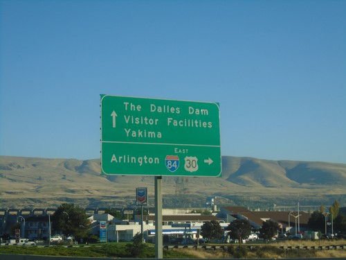
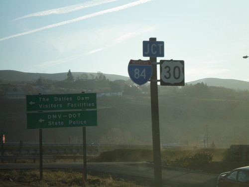
US-197 North/US-30 East at I-84 East
US-197 North/US-30 East at I-84 East to Arlington. Continue north on US-197 for The Dalles Dam Visitor Facilities and Yakima (Washington). US-30 east joins I-84 eastbound to Pendleton.
US-197 North/US-30 East Approaching I-84
US-197 North/US-30 East approaching I-84 in The Dalles.
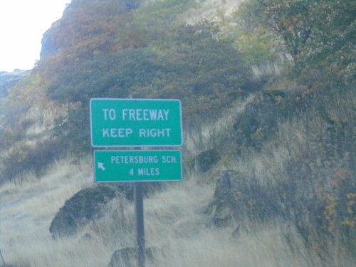
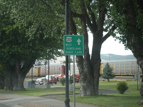
US-30 East - SE Frontage Road
US-30 East at SE Frontage Road. Turn left for the Petersburg School. Merge right for (I-84) Freeway.
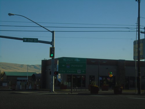
US-30 East - Webber St. at W 2nd St.
US-30 East - Webber St. at W 2nd St. Turn left for I-84 West to Portland; right for US-30 East to (The Dalles) City Center. Continue on Webber St. for Port Areas.
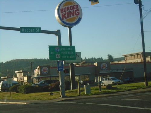
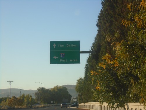
US-30 East at Webber St.
US-30 East (W 6th St.) at Webber St. in The Dalles. Turn left on Webber St. to continue east on US-30 for (The Dalles) City Center and Port Area. Also turn left for I-84 West to Portland.
US-30 West - The Dalles
US-30 West (W 2nd St.) at Webber St. Turn left ton Webber St. to continue on US-30 west.
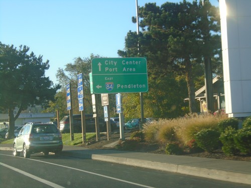
US-30 East at I-84 East
US-30 East at I-84 East to Pendleton. Continue east on US-30 for Port Areas and City Center (The Dalles).
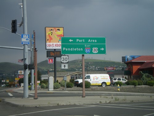
US-30 East - Port Areas
US-30 east at River Road to I-84 (Exit 82) and Port Areas. Continue east on US-30 for The Dalles.
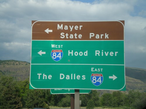
Rowena Access Road at I-84
Rowena Access Road at I-84 (Exit 76) onramp. Turn right for I-84 east to The Dalles. Turn left for I-84 west to Hood River, and to continue under freeway towards Mayer State Park.
W 2nd St. at US-30 and I-84
W 2nd St. in The Dalles at US-30 and I-84 east junction. Turn right for I-84 east, to Pendleton, and US-30 west. Continue ahead on 2nd St. for US-30 east. Turn left for the Port Area along the Columbia River.
W 2nd St. Approaching US-30
W 2nd St. approaching US-30 in The Dalles.
US-30 West - Downtown The Dalles
E 2nd St. west in downtown The Dalles. Use right lanes to continue west on US-30 toward Portland.
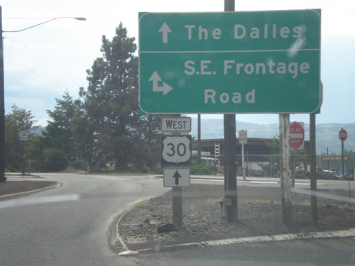
US-30 West at SE Frontage Road
US-30 west at SE Frontage Road.
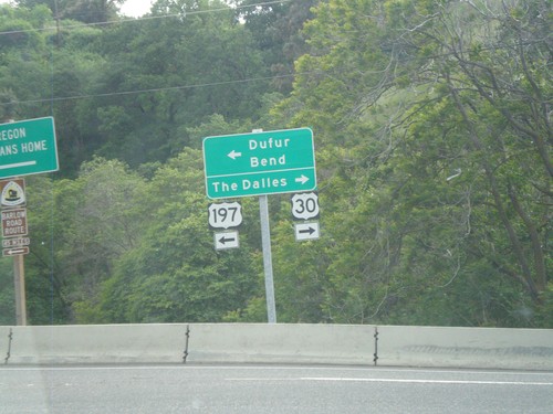
US-197 South/US-30 West at Split
US-197 South/US-30 West at US-197/US-30 split. Turn right for US-30 west to The Dalles. Turn left for US-197 south to Dufur and Bend.
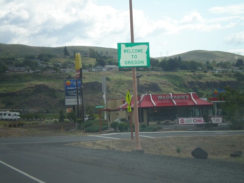
US-197 South - Welcome To Oregon
Welcome to Oregon on US-197 south in The Dalles. The Oregon welcome sign is about half a mile from the actual state line on the bridge over the Columbia River.
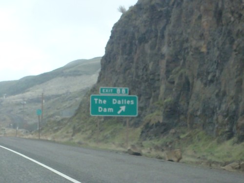
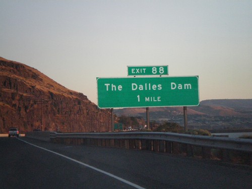
I-84 East - Exit 88
I-84 east at Exit 88 - The Dalles Dam. The Dalles Dam is the second dam on the Columbia River from the Pacific Ocean.
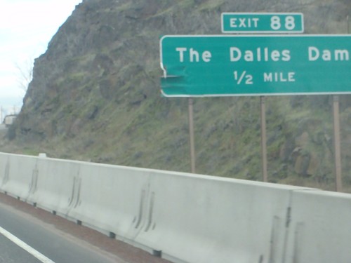
I-84 East Approaching Exit 88
I-84 east approaching Exit 88 - The Dalles Dam.
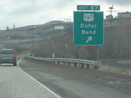
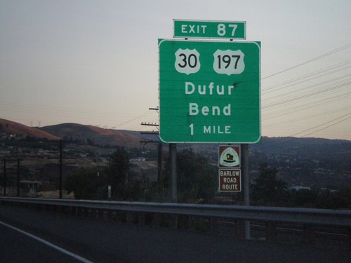
I-84 East - Exit 87
I-84 east at Exit 87 - US-197/Dufur/Bend. US-30 joins I-84 east to Pendleton.
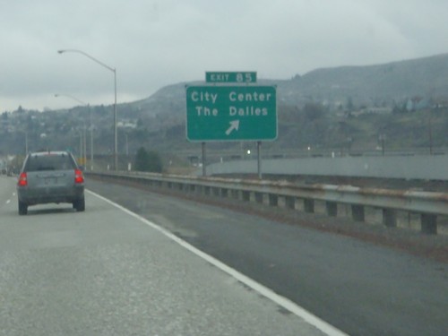
I-84 East - Exit 85
I-84 east at Exit 85 - City Center/The Dalles.
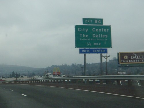
I-84 East Approaching Exit 84
I-84 east approaching Exit 84 - City Center/The Dalles/National Historic Districts.
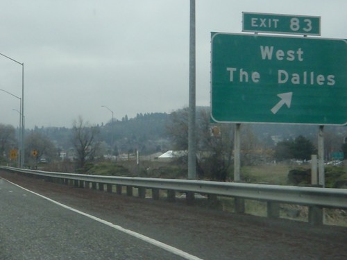
I-84 East - Exit 83
I-84 east at Exit 83 - West The Dalles.
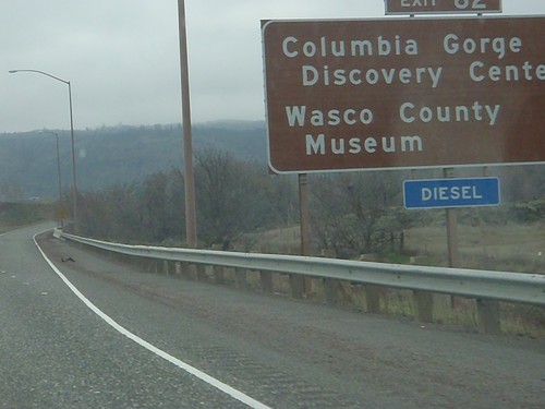
I-84 East - Exit 82
I-84 east at Exit 82 - Wasco County Museum/Columbia Gorge Discovery Center.
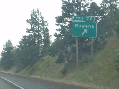
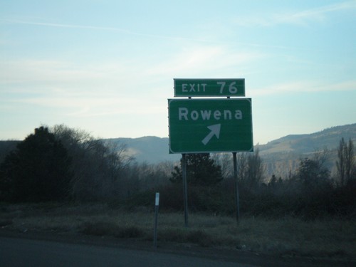
I-84 East - Exit 76
I-84 east at Exit 76 - Rowena.
I-84 West - Exit 87
I-84 west approaching Exit 87 - US-30/US-197/Dufur/Bend
I-84 West - Exit 88
I-84 west approaching Exit 88 - The Dalles Dam
I-84 West - Exit 97
I-84 west approaching Exit 97 - OR-206/Celilo Park
I-84 West - Exit 76
I-84 west at Exit 76 - Rowena.
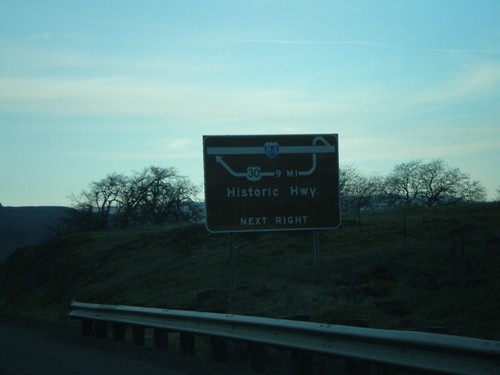
I-84 West Route Diagram Approaching Exit 76
Route diagram for Historic Columbia River Highway approaching Exit 76 on I-84 west.
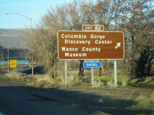
I-84 West - Exit 82
I-84 west at Exit 82 - Columbia Gorge Discovery Center/Wasco County Museum.
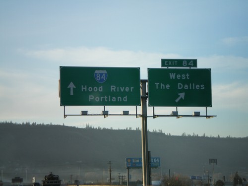
I-84 West - Exit 84
I-84 west at Exit 84 - West The Dalles. Continue west on I-84 for Hood River and Portland.
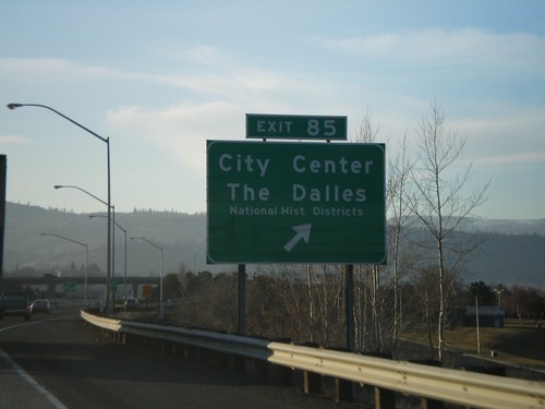
I-84 West - Exit 85
I-84 west at Exit 85 - City Center/The Dalles/National Historic Districts.
US-197 South Approaching I-84
US-197 south to Bend at I-84 west to Portland, and approaching I-84 east to Arlington.
US-197 South Approaching I-84/US-30
US-197 south approaching I-84/US-30. This junction is immediately after the Columbia River bridge.
Tygh Valley
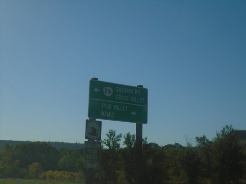
US-197 South at OR-216 East
US-197 South at OR-216 East to Sherars Bridge and Grass Valley. Turn right for Tygh Valley and Wamic. OR-216 west joins US-197 southbound.
OR-216 West at US-197
OR-216 West at US-197 in Wasco County. Use US-197 north for The Dalles; turn left for US-197 South/OR-216 West for Bend and Maupin; continue straight for Tygh Valley and Wamic. OR-216 west joins US-197 southbound.
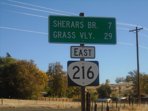
OR-216 East - Distance Marker
Distance marker on OR-216 east. Distance to Sherars Bridge and Grass Valley.
Warm Springs
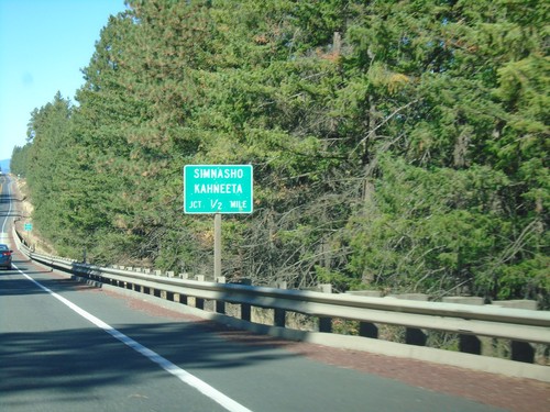
US-26 West Approaching Simhasho/Kahneeta Jct.
US-26 West approaching Simhasho/Kahneeta Jct.
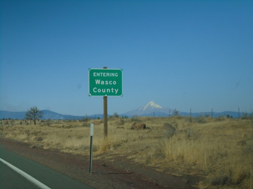
US-26 West - Wasco County
Entering Wasco County on US-26 west. Mount Hood is in the background.