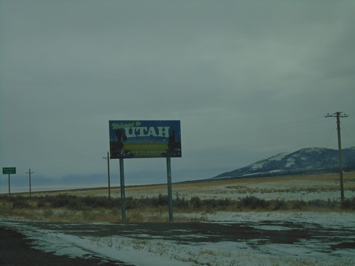
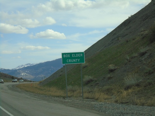
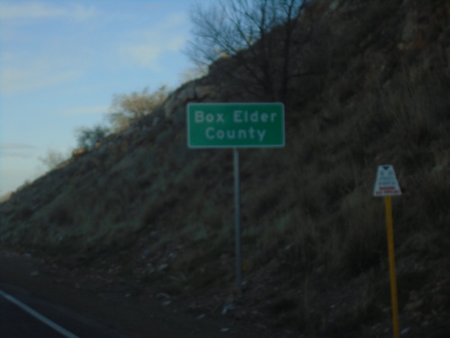
Box Elder County, Utah
Localities: Brigham City | Cedar Creek | Collinston | Corinne | Deweyville | Elwood | Garland | Grouse Creek | Honeyville | Howell | Lucin | Malta | Mantua | Park Valley | Perry | Portage | Riverside | Snowville | South Willard | Tremonton | Wendover | Willard
Brigham City
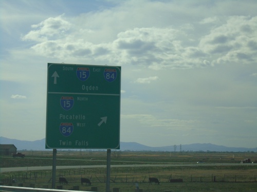
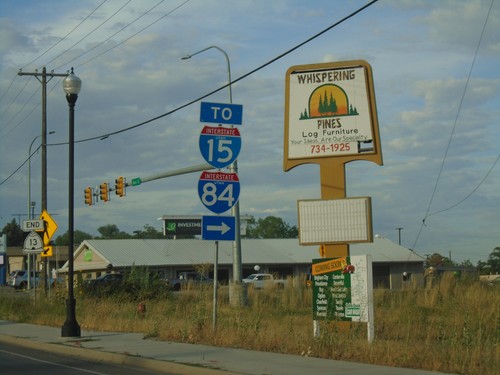
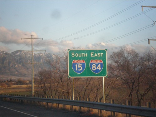
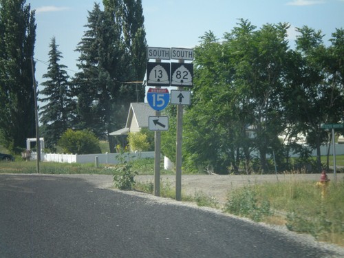
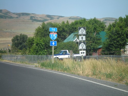
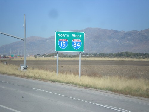
End US-91 South at I-15/I-84
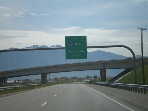
US-91 south at I-15 North/Pocatello (Idaho)/I-84 West/Twin Falls (Idaho). Use I-15 South/I-84 East for Ogden. US-91 south ends here.
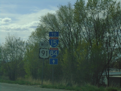
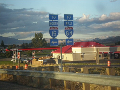
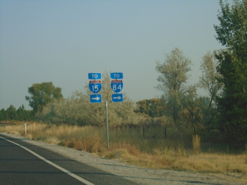
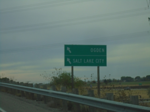
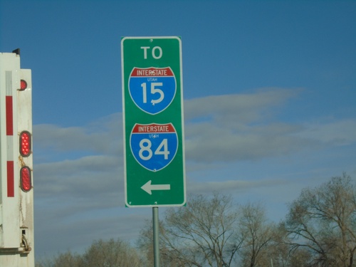
US-91 South - To I-15/I-84
US-91 South - To I-15/I-84 in Brigham City. US-91 is posted as US-91 west, which is the current direction of the roadway, although the route itself is a north-south route.
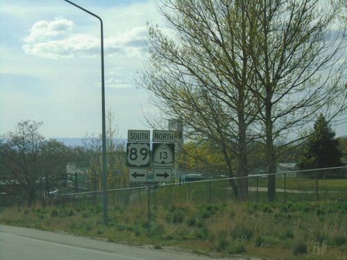
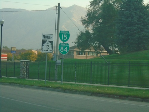
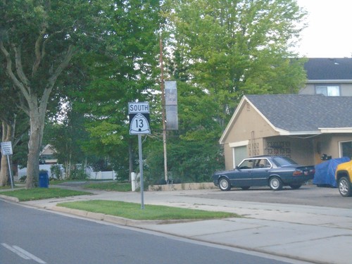
US-89/US-91 South at BL-15/UT-13/US-89 South
US-89/US-91 South at BL-15/UT-13/US-89 South (Main St.) in Brigham City. Turn left to continue south on US-89. Turn right for UT-13/(BL-15) North. US-89 separates from US-91 southbound.
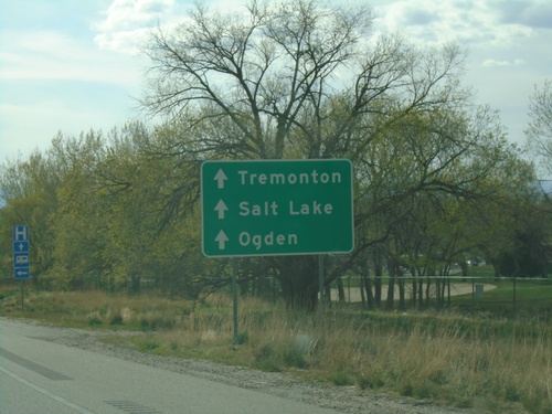
US-89/US-91 South Approaching BL-15/UT-13
US-89/US-91 South Approaching BL-15/UT-13 (Main St.) in Brigham City. Continue on US-91 South for Salt Lake/Tremonton/Ogden.
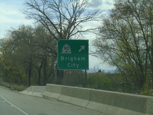
US-89/US-91 South at UT-90 Exit
US-89/US-91 South at UT-90/Brigham City exit.
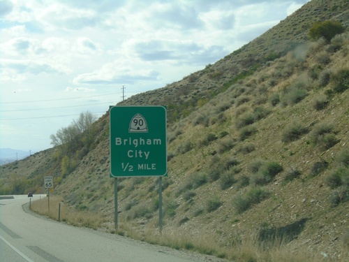
US-89/US-91 South Approaching UT-90
US-89/US-91 South approaching UT-90/Brigham City.
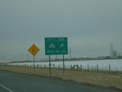
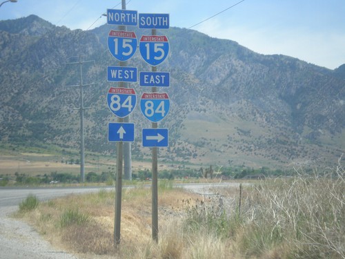
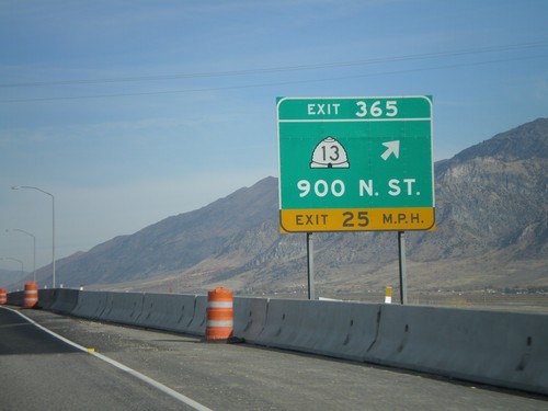
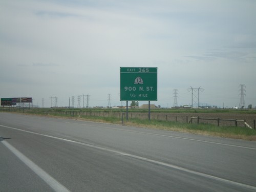
I-15 South/I-84 East - Exit 365
I-15 South/I-84 East at Exit 365 - UT-13/900 North St.
UT-13 North at I-15 South/I-84 East
UT-13 North at I-15 South/I-84 East (Exit 365) to Salt Lake City and Ogden.
UT-13 North at I-15/I-84
UT-13 North/BL-15 North/BL-84 West at I-15/I-84 (Exit 365). Use I-15 North/I-84 West to Tremonton; I-15 South/I-84 East to Ogden and Salt Lake City.
UT-13 North Approaching I-15/I-84
UT-13 North/BL-15 North/BL-84 West approaching I-15/I-84.
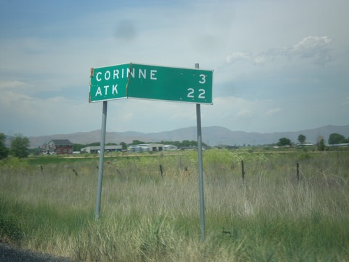
UT-13 North/BL-15 North/BL-84 West - Distance Marker
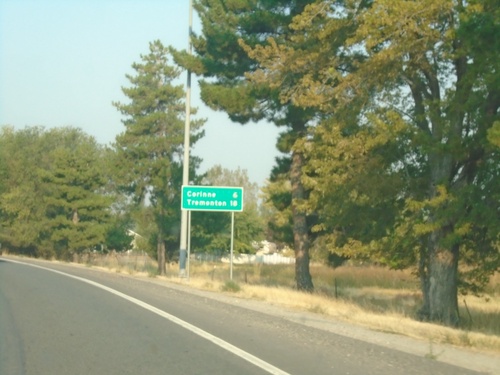
Distance Marker on UT-13 North/BL-15 North/BL-84 West. Distance to Tremonton and Corrine.
UT-13 North - Brigham City
UT-13 North/BL-15 North/BL-84 West in Brigham City
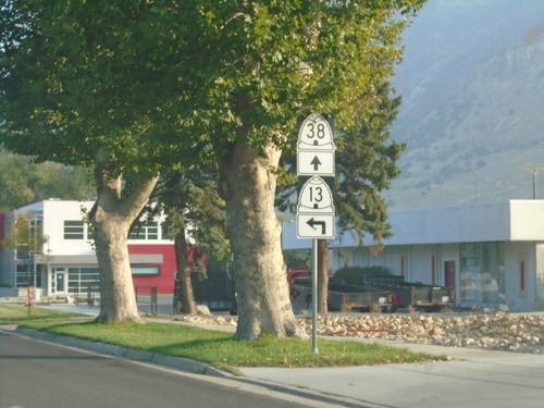
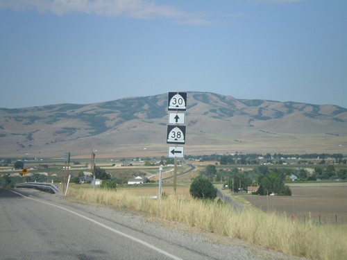
UT-13 North at UT-38
UT-13 North/BL-15 North/BL-15 West at UT-38 in Brigham City.
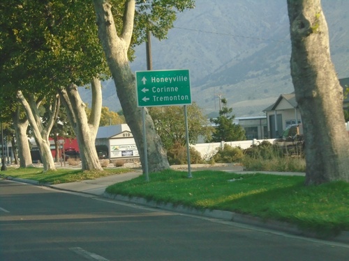
UT-13 North Approaching UT-38
UT-13 North/BL-15 North/BL-84 West approaching UT-38 in Brigham City. Use UT-38 north for Honeyville; use UT-13 North/BL-15 North/BL-84 West for Corrine and Tremonton.
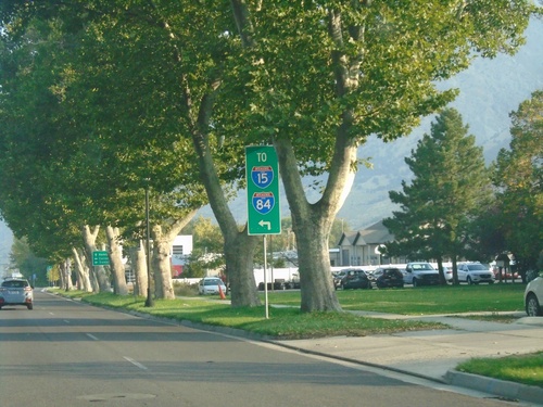
BL-15/BL-84/UT-15 North Approaching UT-38
BL-15/BL-84/UT-15 North (Main St.) approaching UT-38 in Brigham City. Merge left to continue north on UT-13 and for I-84 and I-15.
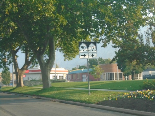
BL-15/BL-84/UT-13 North at UT-90
BL-15 North/BL-84 West/UT-13 North (S Main St.) at UT-90 (E 200 S)
BL-15/BL-84/UT-13 North - Brigham City
BL-15 North/BL-84 West/UT-13 North (S. Main St.) in Brigham City.
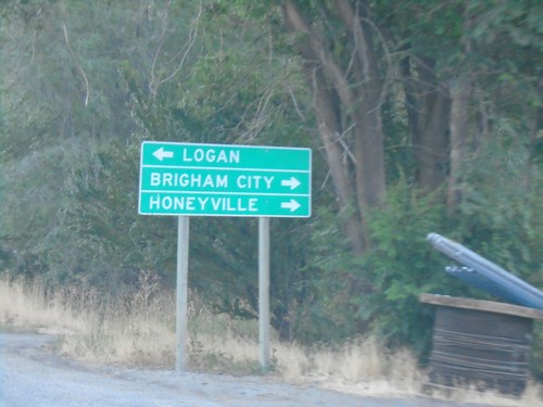
US-91 North at US-89/UT-13
US-91 north at US-89/UT-13. Use US-89 south for Perry. US-89 joins US-91 north to Logan.
US-91 North Approaching US-89/UT-13
US-91 north (1100 S) approaching US-89 and UT-13 (Main St).
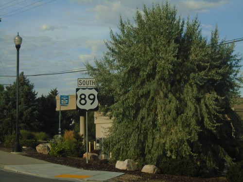
US-89 South - Brigham City
US-89 south in Brigham City.
End UT-13 South at US-89/US-91
End UT-13 South at US-89/US-91. Use US-91 South/US-89 North for access to I-15 and I-84.
End UT-13 South Approaching US-89/US-91
End UT-13 South approaching US-89/US-91 in Brigham city.
UT-13 South - Distance Marker
Distance marker on UT-13 south. Distance to Perry, Ogden, and Salt Lake City.
UT-13 South at UT-90
UT-13 South at UT-90 east to Logan. Continue south on UT-13 for Salt Lake City.
UT-13 South - Brigham City
UT-13 South in Brigham City
W 6900 North at I-15/I-84
W 6900 North at I-15/I-84 in Honeyville.
UT-13 North - Distance Marker
Distance marker on UT-13 north. Distance to Corrine, and ATK (an aerospace company).
I-15 North at UT-13 - Exit 368 Offramp
I-15 North at UT-13 (Exit 368 offramp) in Brigham City.
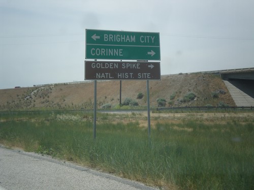
I-15 North at UT-13 - Exit 368 Offramp
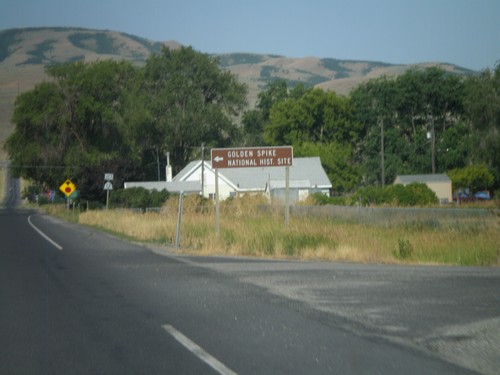
I-15 North Exit 368 offramp at UT-13. Turn left for Brigham City; turn right for Corrine and Golden Spike National Historic Site.
US-91 North at US-89/UT-13/BL-15/BL-84
US-91 north at US-89/UT-13/BL-15/BL-84. US-89 joins US-91 north to Logan.
US-91 North at US-89/UT-13
US-91 north at US-89/UT-13. Use US-89 south for Perry. US-89 joins US-91 north to Logan.
US-91 North Approaching US-89/UT-13
US-91 north approaching US-89 and UT-13.
I-15 North - Exit 365
I-15 north at Exit 365 - UT-13/900 North St.
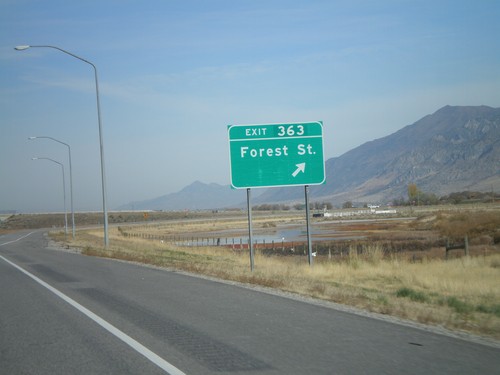
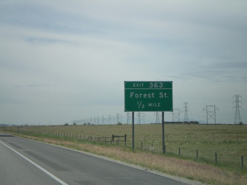
I-15 North - Exit 363
I-15 North at Exit 363 - Forest St.
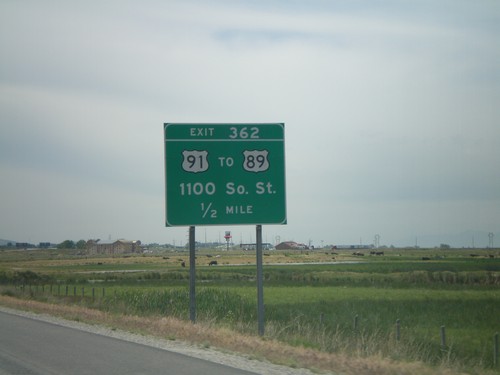
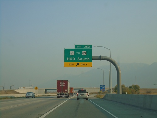
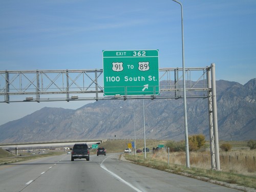
I-15 South - Exit 362
I-15 south approaching Exit 362 - US-91/To US-89/1100 South St.
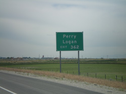
I-15 South - Approaching Exit 362
I-15 south approaching Exit 362. Use Exit 362 for Perry and Logan.
I-15 South - Exit 363
I-15 South at Exit 363 - Forest St.
I-15 South - Exit 365
I-15 south approaching Exit 365 - UT-13/900 North St
Cedar Creek
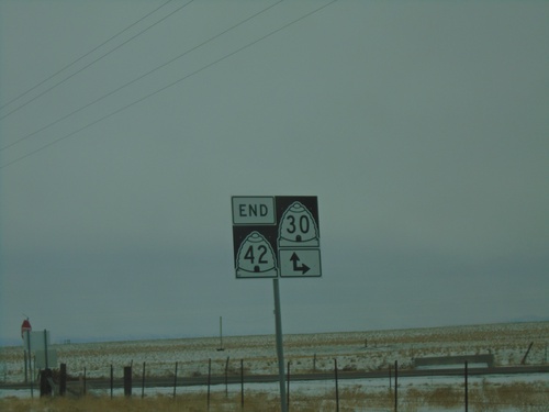
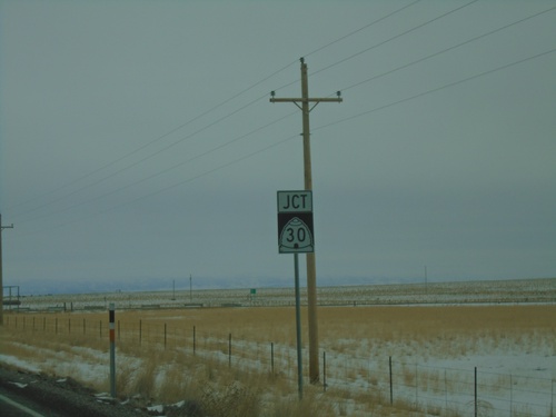
End UT-42 South at UT-30
End UT-42 South at UT-30 in Box Elder County.
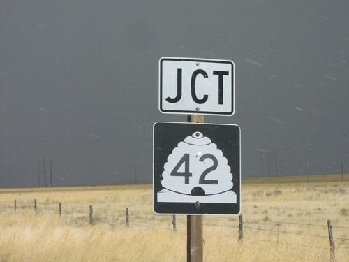
Jct. UT-42 on UT-30 East
UT-30 east approaching junction UT-42
Old US-30S - Idaho State Line
Idaho State Line at Utah border on Old US-30S
UT-30 East at UT-41
UT-30/UT-42 shields on UT-30 east
Collinston
UT-30 West At UT-38
UT-30 west at UT-38
UT-30 West Approaching UT-38
UT-30 west approaching UT-38. Use UT-38 south for Brigham City. Continue west on UT-30 for Tremonton.
Corinne
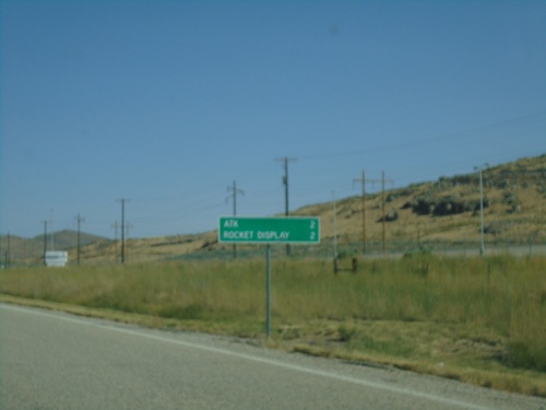
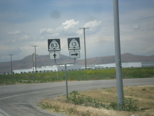
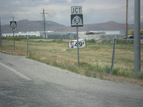
UT-83 North - Distance Marker
Distance marker on UT-83 north. Distance to ATK and Missile Display (both related to Northrup Grumman).
UT-83 North - Box Elder County
UT-83 North in Box Elder County
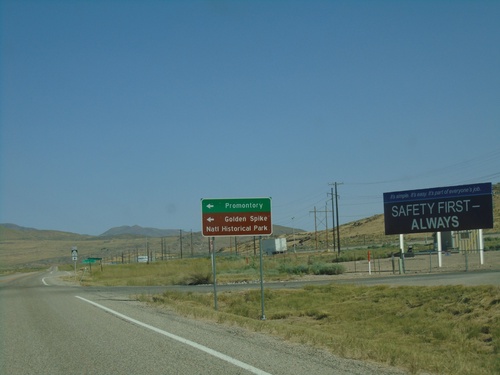
UT-83 North at Promontory Road
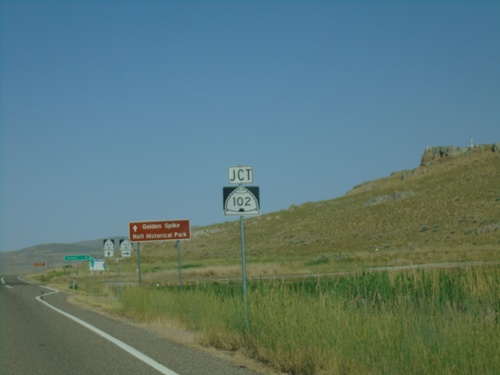
UT-83 North at Promontory Road to Promontory and Golden Spike National Historic Site.
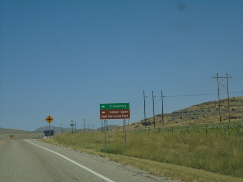
UT-83 North Approaching Promontory Road
UT-83 North approaching Promontory Road to Promontory and Golden Spike National Historic Park.
UT-83 North at N 6800 W and Iowa String Road
UT-83 North at N 6800 W and Iowa String Road
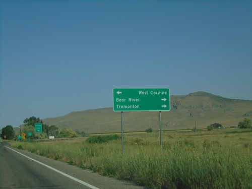
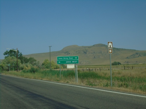
UT-83 North Approaching Iowa String Road and N 6800 W
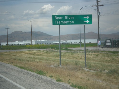
UT-83 North approaching Iowa String Road and N 6800 W. Use Iowa String Road to Bear River and Tremonton; use N 6800 W to West Corrine.
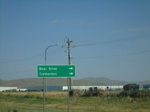
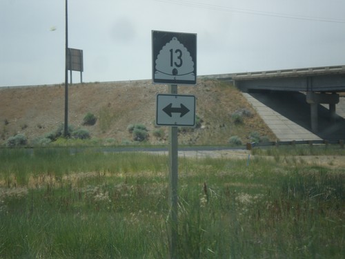
UT-13 North at UT-83
UT-13 north at UT-83. Turn right to continue north on UT-13 to Bear River and Tremonton.
UT-13 North at UT-83
UT-13 north at UT-83 in Corrine. Continue straight for UT-83; turn right for UT-13 north.
UT-13 North at UT-83
UT-13 north at UT-83. Turn right to continue north on UT-13 to Bear River and Tremonton.
UT-13 North Approaching UT-83
UT-13 North approaching UT-83 in Corrine.
Deweyville
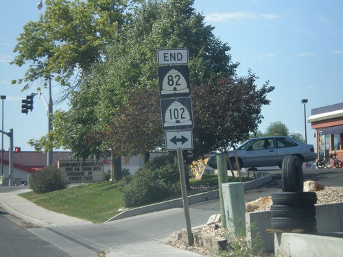
End UT-102 East at UT-38
End UT-102 East at UT-38 in Deweyvile. Turn right for UT-38 south to Brigham City and Honeyville; left for UT-38 north to Logan.
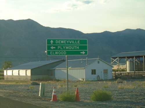
Elwood
UT-13 South at I-15 North/I-84 West - Exit 376
UT-13 South at I-15 North/I-84 West (Exit 376) onramp.
UT-13 South Approaching I-15/I-84
UT-13 South Approaching I-15/I-84 in Elwood. Use I-15 North/I-84 West to Snowville; I-15 South/I-84 East to Ogden and Salt Lake.
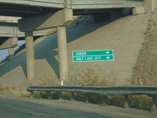
I-15 South/I-84 East - Tremonton
I-15 South/I-84 East in Tremonton. These types of signs are common along I-15/I-84 between Tremonton and Ogden.
UT-13 North at I-15 North/I-84 West - Exit 376
UT-13 North at I-15 North/I-84 West (Exit 376) onramp. Interstate shields with the UTAH text are becoming more common in Utah. It appears that all new interstate shields contain the UTAH text - at least in the Salt Lake area.
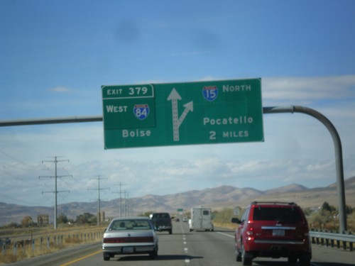
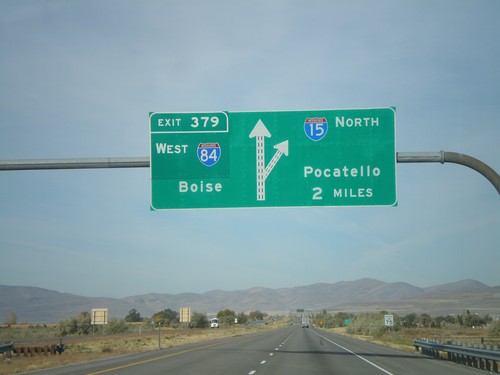
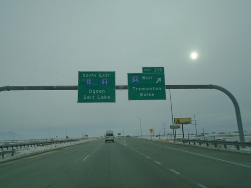
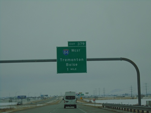
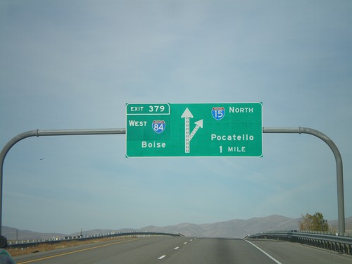
I-15 North - Exit 379
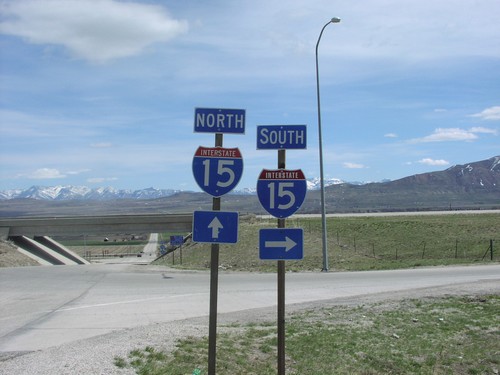
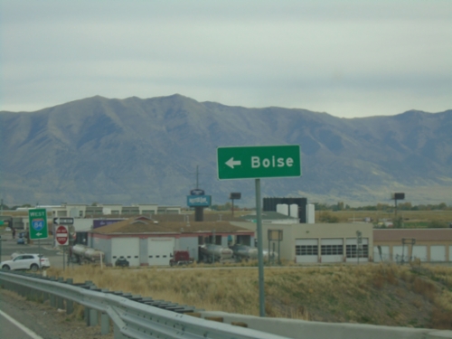
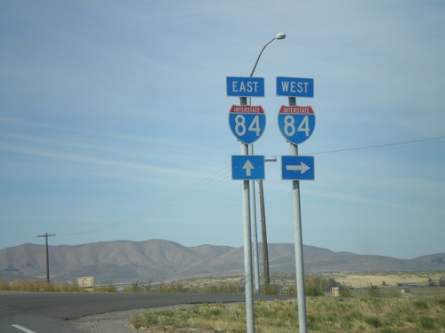
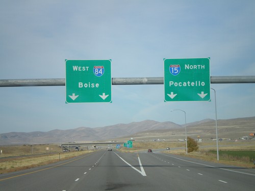
I-15 North/I-84 West approaching Exit 379 - I-84 West/Boise (Idaho). Continue north on I-15 towards Pocatello (Idaho). This is the northern end of the I-84/I-15 multiplex.
I-15 North - Exit 379
I-15 North/I-84 West approaching Exit 379 - I-84 West/Boise (Idaho). Continue north on I-15 for Pocatello (Idaho).
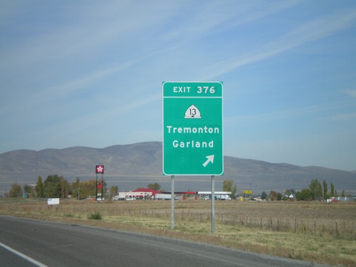
I-15 North - Exit 376
I-15 north at Exit 376 - UT-13/Tremonton/Garland
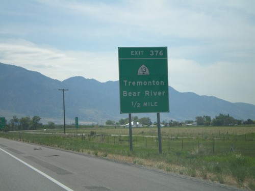
I-15 South - Exit 376
I-15 south at Exit 376 - UT-13/Tremonton/Bear River
Garland
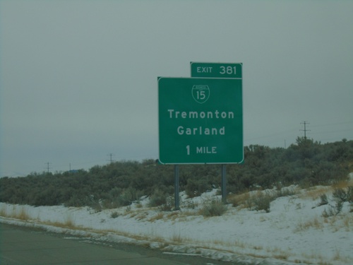
I-15 South - Exit 381
I-15 south approaching Exit 381 - BL-15/Tremonton/Garland.
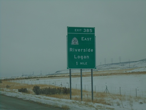
I-15 South - Exit 385
I-15 south approaching Exit 385 - UT-30 East/Riverside/Logan. This sign appears to be attached to an older, smaller sign.
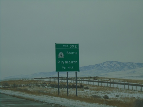
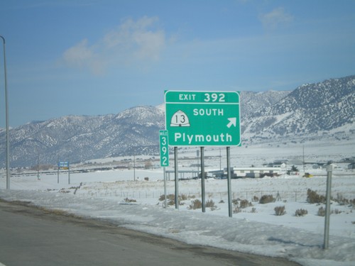
I-15 South - Exit 392
I-15 south approaching Exit 392 - UT-13 South/Plymouth.
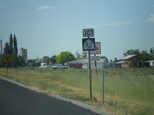
UT-13 South at UT-82
UT-13 south at UT-82. I-15 traffic should continue on UT-13 to avoid the city of Garland.
UT-13 South Approaching UT-82
UT-13 south approaching UT-82. Use UT-82 south for Garland and Tremonton. Use UT-13 south for Salt Lake.
UT-13 South Approaching UT-82
UT-13 south approaching UT-82
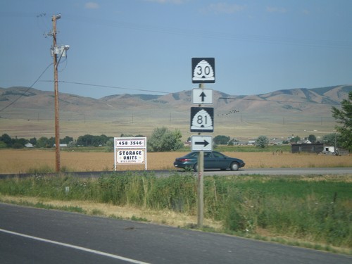
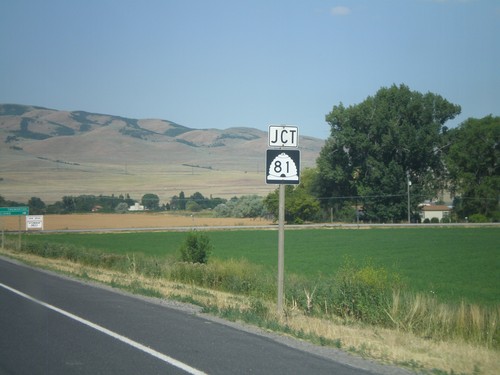
UT-30 West At UT-81 North
UT-30 west at UT-81 north
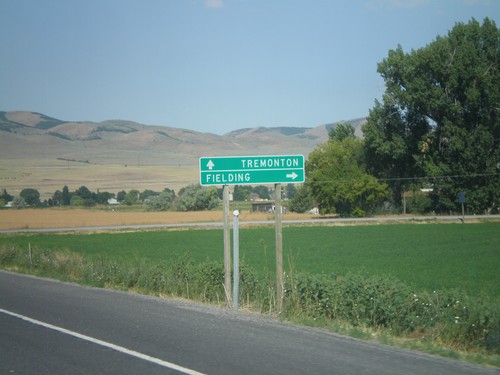
UT-30 West Approaching UT-81 North
UT-30 west approaching UT-81 north. Use UT-81 north for Fielding. Continue west on UT-30 for Tremonton.
UT-30 West Approaching UT-81
UT-30 west approaching UT-81
I-15 North - Exit 392
I-15 north at Exit 392 - UT-13 South/Plymouth.
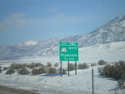
I-15 North - Exit 392
I-15 north approaching Exit 392 - UT-13 South/Plymouth.
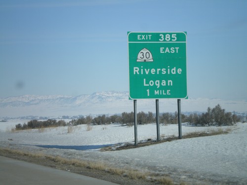
I-15 North - Exit 385
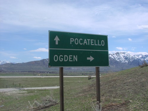
I-15 north approaching Exit 385 - UT-30 East/Riverside/Logan.
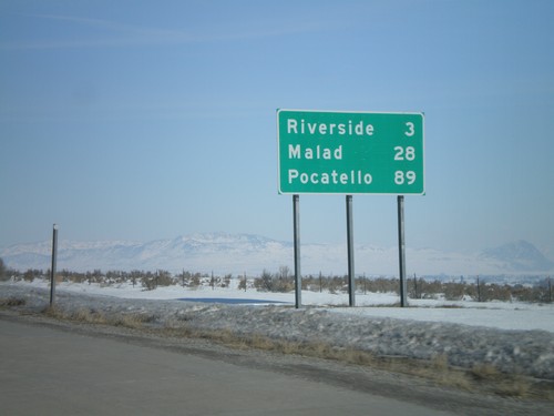
I-15 North - Distance Marker
Distance marker on I-15 north to Riverside, Malad, and Pocatello. This is the first distance marker north of the I-15/I-84 split.
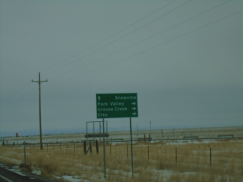
Grouse Creek
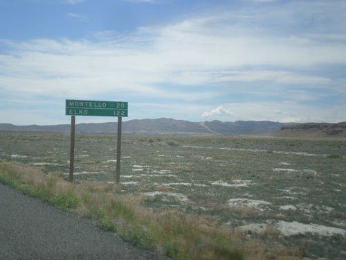
UT-30 West - Distance Marker
Distance marker on UT-30 west. Distance to Montello, and Elko. Both of those places are in Nevada.
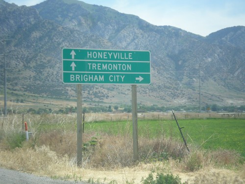
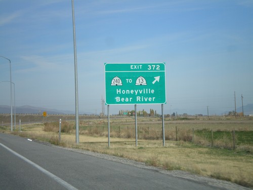
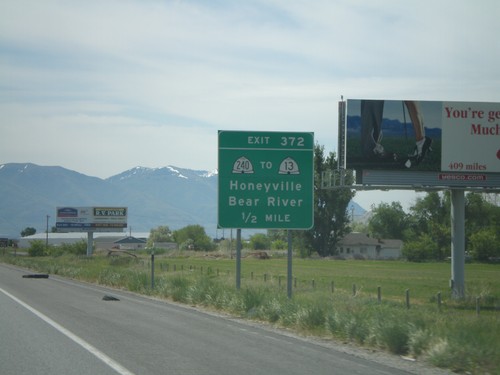
Honeyville
UT-13 North at 4600 West
UT-13 north at 4600 West. Turn right on 4600 West to I-15 and I-84.
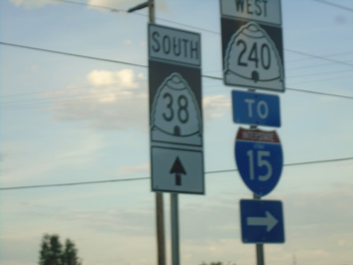
UT-38 South at UT-240 in Honeyville
UT-38 South at UT-240 in Honeyville. Turn right for UT-240 West and for I-15 access.
Begin UT-240 East at I-15 North
Begin UT-240 at I-15 north. Turn left for I-15 north to Tremonton; use UT-240 east to Honeyville.
W 6900 North at I-15/I-84 (Exit 372)
W 6900 North at I-15/I-84 (Exit 372) in Honeyville. Turn right for I-15 South/I-84 East to Brigham City. Continue over freeway for I-15 North/I-84 West to Tremonton and Honeyville (via UT-240).
UT-13 North at 4600 West
UT-13 north at 4600 West. Turn right on 4600 West to I-15 and I-84.
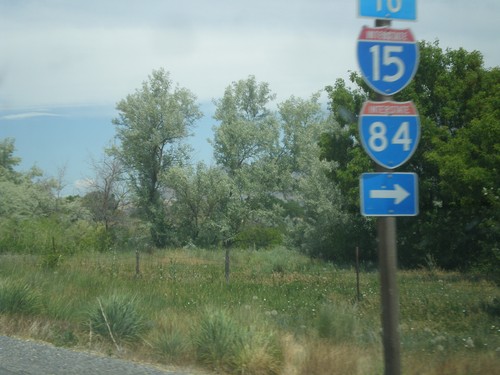
I-15 North - Exit 372
I-15 north at Exit 372 - UT-240/To UT-13/Honeyville/Bear River.
I-15 South - Exit 372
I-15 south approaching Exit 372 - UT-240/To UT-13/Honeyville/Bear River
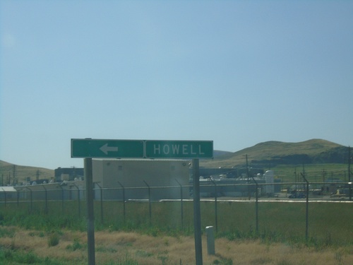
Howell
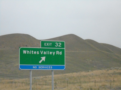
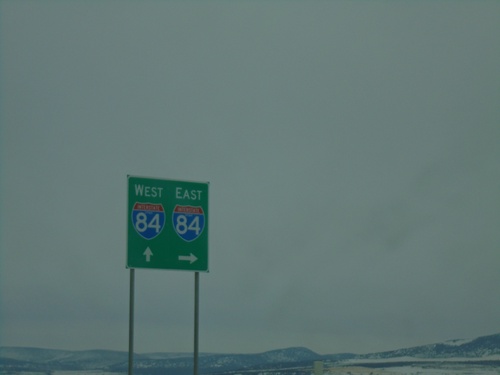
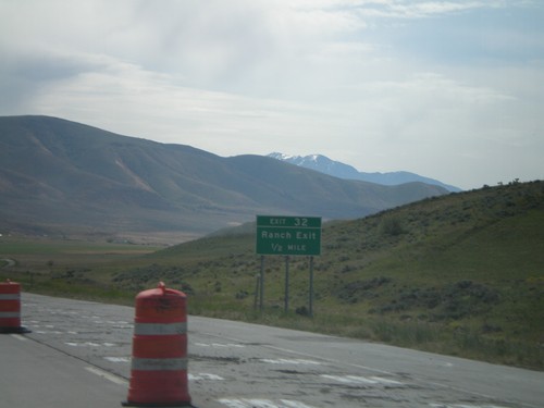
I-84 West - Exit 32
I-84 west at Exit 32 - Whites Valley Road. This interchange was renamed in 2021 from Ranch Exit.
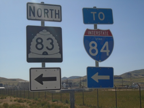
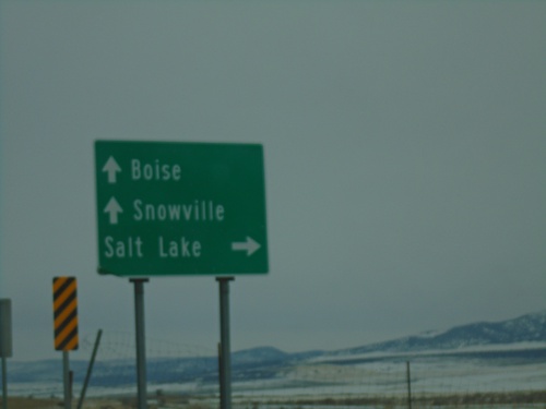
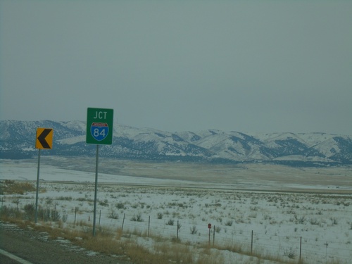
End UT-83 North at I-84 West
End UT-83 North at I-84 West to Snowville.
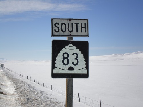
UT-83 North At I-84 (Exit 26)
End UT-83 north at I-84. Use I-84 east to Tremonton; use I-84 west to Snowville.
UT-83 North at I-84 (Exit 26)
End UT-83 north at I-84.
UT-83 North at Faust Valley Road
UT-83 North at Faust Valley Road. Turn left to continue north on UT-83 towards Howell.
UT-83 North to I-84 - Box Elder County
UT-83 North at Faust Valley Road. Turn left to continue north on UT-83 to I-84.
I-84 Onramp at Blue Creek IC
I-84 Onramp at Blue Creek IC in Box Elder County. Use I-84 west to Snowville; I-84 east to Tremonton.
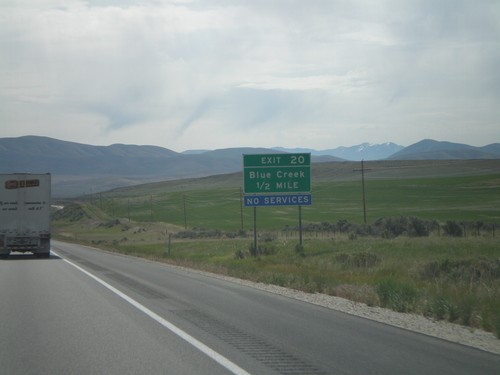
Blue Creek Frontage Road at I-84
Blue Creek Frontage Road at I-84 (Exit 20) in Box Elder County.
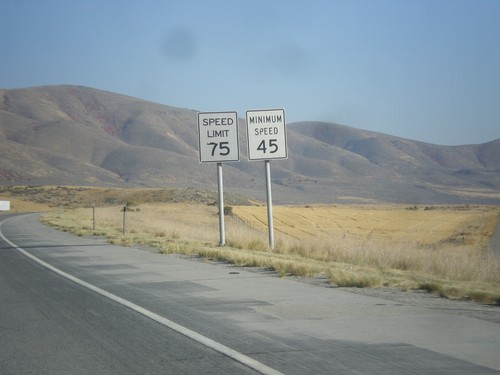
I-84 East - Speed Limit 75/Minimum Speed 45
Speed Limit 75/Minimum Speed 45 on I-84 east. Minimum speeds are not posted with every speed sign on Utah freeways, but are placed sporadically. A typical speed limit installation just contains the maximum speed.
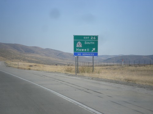
I-84 East - East 26
I-84 east at Exit 26 - UT-83 South/Howell.
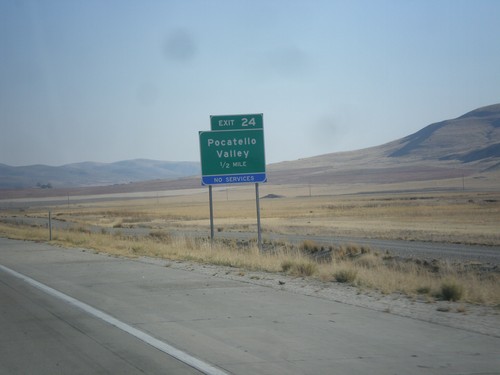
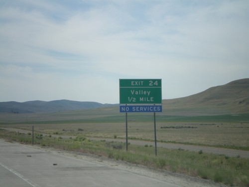
I-84 East - Exit 24
I-84 east approaching Exit 24 - Pocatello Valley. This interchange has recently been renamed from Valley.
I-84 East at UT-83
I-84 Exit 26 offramp at UT-83 - south to ATK and Howell.
UT-83 North At I-84
End UT-83 north at I-84 - east to Tremonton, west to Snowville.
UT-83 North at I-84 East
End UT-83 north at I-84.
UT-83 South
Begin UT-83, south of I-84 junction.
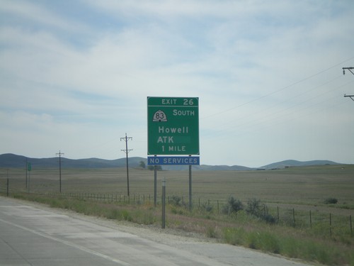
I-84 East Exit 26
I-84 east approaching Exit 26, UT-83 South/Howell/ATK, 1 mile.
I-84 East Exit 24
I-84 east approaching Exit 24, Valley, 1/2 mile.
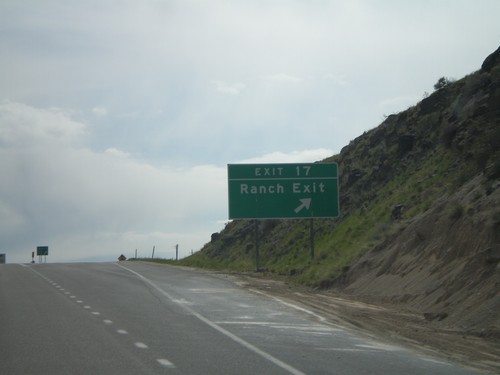
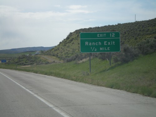
I-84 East Exit 17
I-84 east at Exit 17, Ranch Exit.
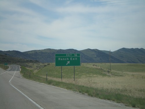
I-84 East Exit 16
I-84 east at Exit 16, Ranch Exit.
Lucin
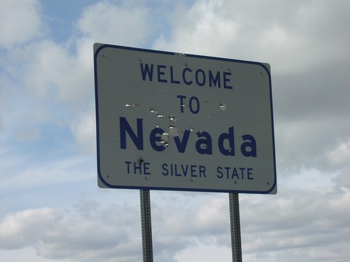
NV-233 South - Welcome To Nevada
Welcome to Nevada - The Silver State, at Utah line on NV-233 south
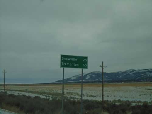
UT-30 East - Distance Marker
Distance marker to Snowville on UT-30 east at the Nevada line
UT-30 East - Welcome To Utah
Welcome to Utah on UT-30 east at the Nevada line
UT-30 East At Nevada-Utah Border
UT-30 East shield at Nevada border
Malta
UT-42 South - Distance Marker
Distance marker on UT-42 south. Distance to Snowville and Tremonton.
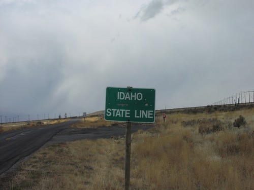
UT-42 South - Welcome To Utah
Welcome to Utah / Box Elder County at the Utah - Idaho state line on UT-42 south.
Mantua
US-89/US-91 South - Box Elder County
Entering Box Elder County on US-89/US-91 South.
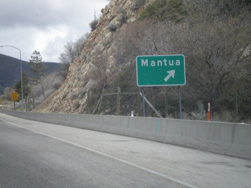
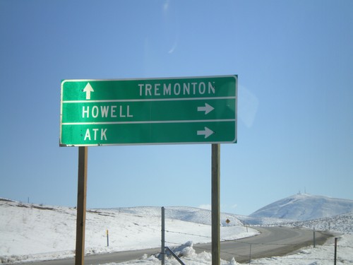
US-91/US-89 North at Mantua Exit
US-91/US-89 north at the Mantua exit.
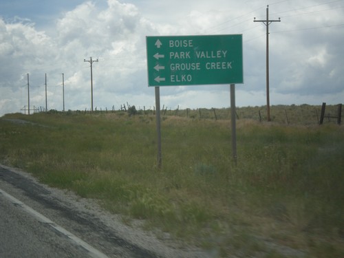
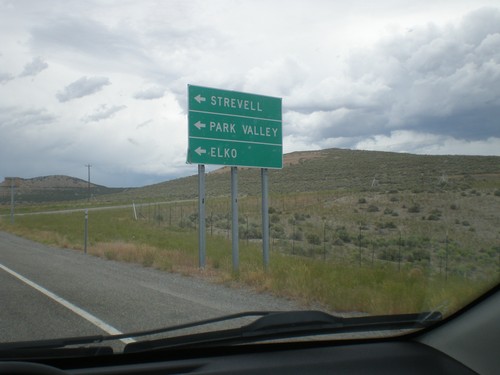
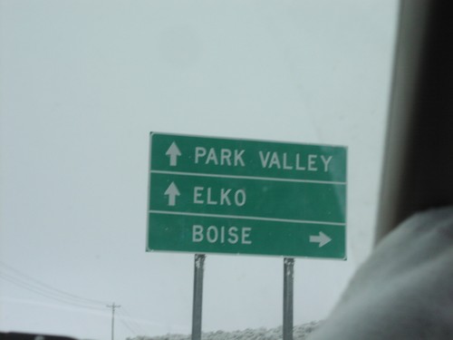
Park Valley
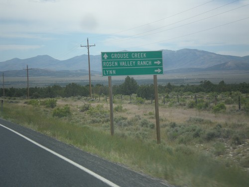
UT-30 West - Lynn Jct.
UT-30 west at junction to Lynn and Roden Valley Ranch. Continue west on UT-30 for Grouse Creek.
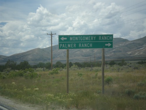
UT-30 West - Ranch Jct.
UT-30 west at junction to Montgomery Ranch and Palmer Ranch.
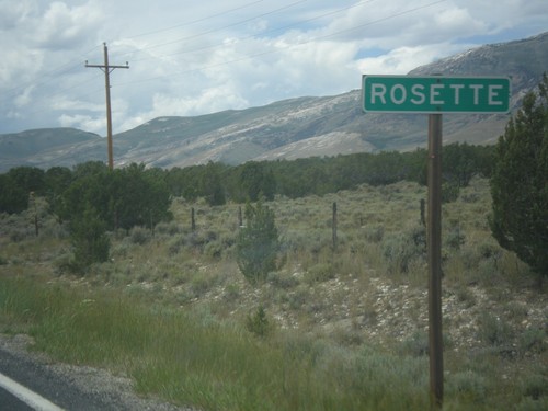
UT-30 West - Rosette
Entering Rosette on UT-30 west. Rosette has a post office but not much else.
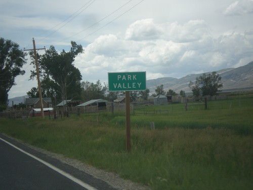
UT-30 West - Park Valley
Entering Park Valley on UT-30 west. Park Valley is a tiny community with not much more than a school and post office.
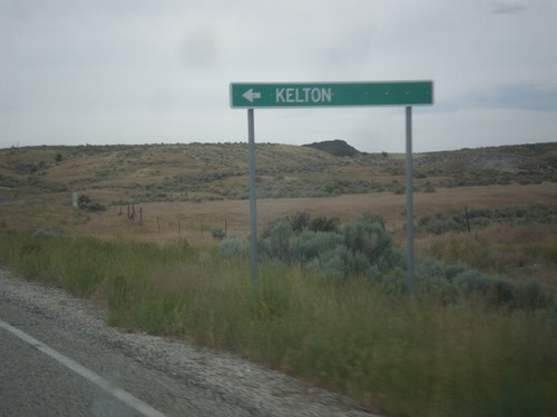
UT-30 West - Kelton Jct.
UT-30 west at turnoff to Kelton. Kelton is a ghost town that at one time was the rail head for all Idaho bound stage coaches.
Perry
I-15 North/I-84 West - Exit 362
I-15 North/I-84 West at Exit 362 - US-91/To US-89/1100 South St.
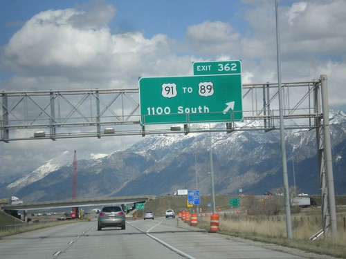
I-15 North/I-84 West - Exit 362
I-15 North/I-84 West at Exit 362 - US-91/To US-89/1100 South St.
I-15 North - Exit 362
I-15 north at Exit 362 - US-91/To US-89/1100 South St.
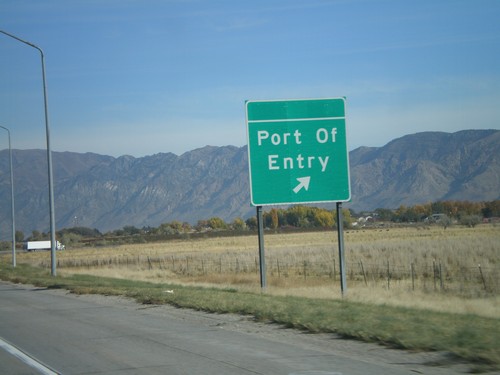
I-15 North at Port of Entry
I-15 North at (Willard) Port of Entry.
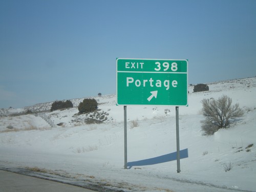
Portage
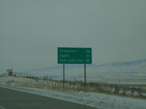
I-15 South - Distance Marker
Distance marker on I-15 south. Distance to Tremonton, Ogden, and Salt Lake City. This is the first distance marker southbound on I-15 in Utah.
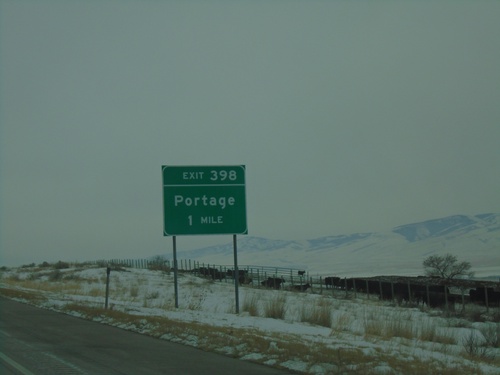
I-15 South - Exit 398
I-15 south approaching Exit 398 - Portage. This is the first exit southbound on I-15 in Utah.
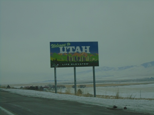
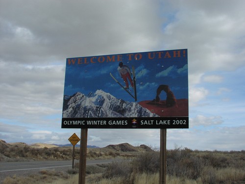
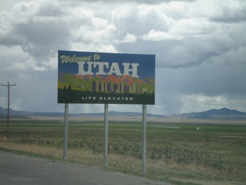
I-15 South - Welcome To Utah
Welcome to Utah - Life Elevated on I-15 south. Taken at the Idaho-Utah state line.
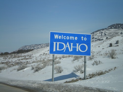
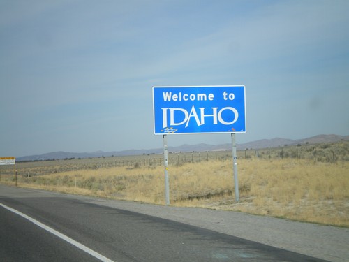
I-15 North - Welcome To Idaho
Welcome to Idaho on I-15 North at the Utah/Idaho border.
I-15 North - Exit 398
I-15 north at Exit 398 - Portage. This is the last Utah exit on I-15.
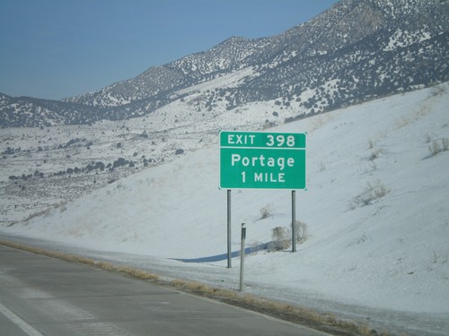
I-15 North - Exit 398
I-15 north approaching Exit 398 - Portage. This is the last exit in Utah on I-15.
Riverside
UT-30 West at UT-13
UT-30 west at UT-13. Continue west on UT-30 for I-15.
UT-30 West Approaching UT-13
UT-30 west approaching UT-13. Use UT-13 south for Tremonton and Garland. Use UT-13 north for Pocatello (Idaho).
UT-30 West Approaching UT-13
UT-30 west approaching UT-13. Use UT-13 south for the Golden Spike National Historic Site.
I-15 Exit 387 Onramp on Begin UT-30 East.
I-15 Shields at UT-30/I-15 Junction, Box Elder County.
UT-30 at I-15 Exit 387 Onramp
UT-30 at I-15 Junction To Pocatello and Ogden.
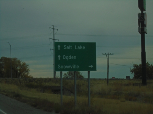
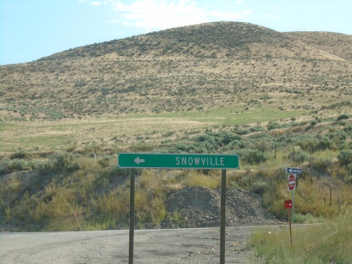
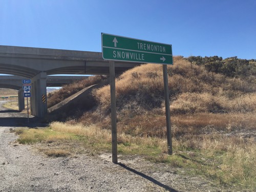
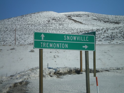
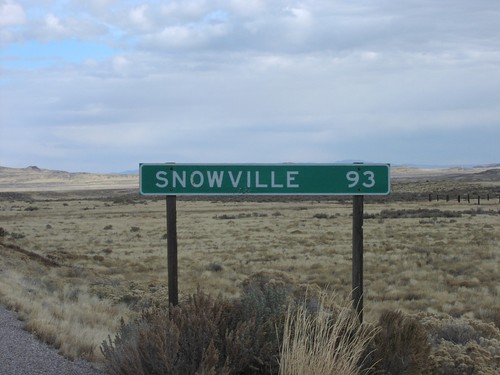
Snowville
End UT-30 at I-84 West
End UT-30 at I-84 West. Use I-84 west for Boise (Idaho). Continue east on county road to Snowville.
End UT-30 East at I-84
End UT-30 East at I-84 (Exit 5) in Box Elder County.
UT-30 East at I-84
UT-30 east at I-84 (Exit 5). Use I-84 west for Boise (Idaho); I-84 east for Salt Lake. Continue east on county road for Snowville. UT-30 ends here at I-84.
UT-30 East Approaching I-84
UT-30 East approaching I-84 (Exit 5).
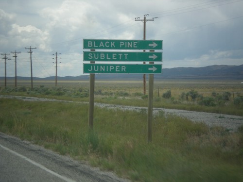
UT-30 East - Black Pine Road
UT-30 east at Black Pine Road jct. Turn north for Juniper, Sublette, and Black Pine.
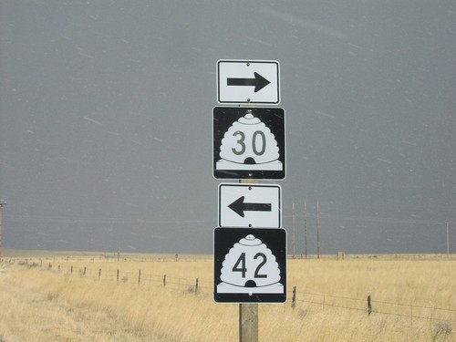
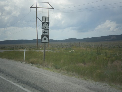
UT-42 South at UT-30
UT-42 South at UT-30 in Box Elder County. Use UT-30 west for Park Valley, Grouse Creek, and Elko (Nevada). Continue east on UT-30 for Snowville. UT-42 ends here.
UT-42 South Approaching UT-30
UT-42 South approaching UT-30 in Box Elder County.
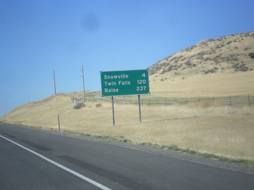
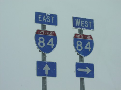
I-84 West - Distance Marker
Distance marker on I-84 west. Distance to Snowville, Twin Falls (ID), and Boise(ID).
UT-30 West at UT-42
UT-30 West at UT-42 in rural Box Elder County.
UT-30 West Approaching UT-42
UT-30 west approaching UT-42. Use UT-42 for Boise (Idaho). Continue west (turn left) on UT-30 for Park Valley, Grouse Creek, and Elko (Nevada). Boise is an interesting destination city to put on this sign since Boise is on the entire other side of the state from where UT-42 crosses into Idaho. Malta, or even Burley would be more appropriate.
UT-30 West - Distance Marker
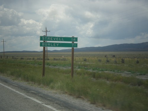
Distance marker on UT-30 west. Distance to Strevell, and Burley. Both of these communities are in Idaho, and both are accessed via UT-42.
UT-30 West - Black Pine Road
UT-30 west at Black Pine Road jct. to Black Pine, Sublett, and Juniper. All three of those destinations are tiny communities within Idaho.
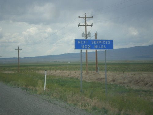
UT-30 East - Next Services 102 Miles
UT-30 west - Next Services 102 Miles. The next town with services is Montello, Nevada.
I-84 East at UT-30 - Exit 5
I-84 east at UT-30 junction. Turn left on UT-30 west for Strevell (Idaho), Park Valley, and Elko (Nevada).
UT-30 East at I-84
UT-30 east at I-84 (Exit 5). Use I-84 west for Boise (Idaho); I-84 east for Salt Lake. Continue east on county road for Snowville. UT-30 ends here at I-84.
UT-30 West - Box Elder County
UT-30 west in Box Elder County.
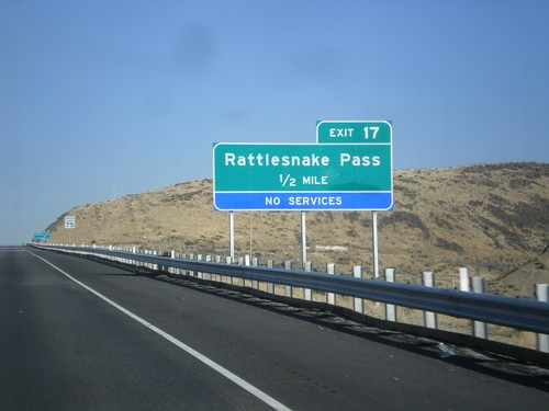
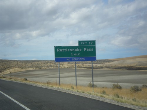
I-84 East - Exit 17
I-84 east approaching Exit 17 - Rattlesnake Pass. This exit was formerly called Ranch Exit.
I-84 East - Welcome To Utah
Welcome to Utah on I-84 east at the Utah-Idaho state line.
I-84 West - Welcome To Idaho
Welcome to Idaho on I-84 west at the Utah border.
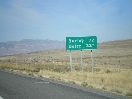
I-84 West - Last Distance Marker In Utah
Distance marker on I-84 west to Burley and Boise. Both cities are in Idaho. This is the last distance marker on I-84 in Utah.
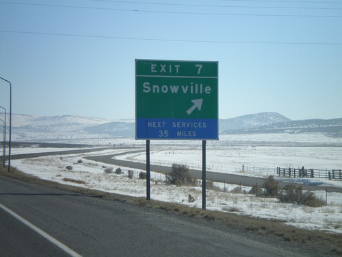
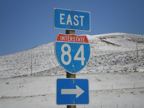
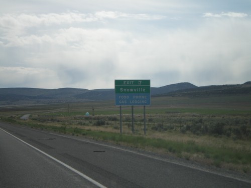
I-84 East - Exit 7
I-84 east at Exit 7 - Snowville.
I-84 East Exit 12
I-84 east approaching Exit 12, Ranch Exit, 1/2 mile.
I-84 East Exit 7
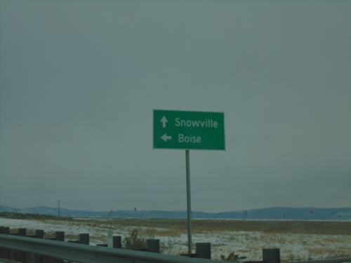
I-84 east approaching Exit 7, Snowville, next exit.
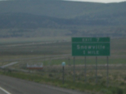
I-84 East Exit 7
I-84 east approaching Exit 7, Snowville, 1 mile.
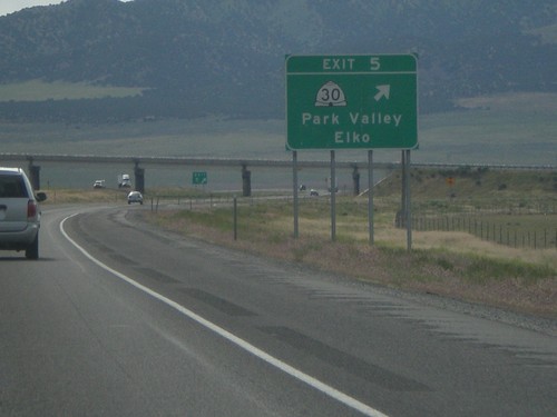
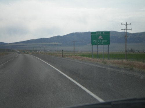
I-84 East Exit 5
I-84 east at Exit 5, UT-30/Park Valley/Elko, NV
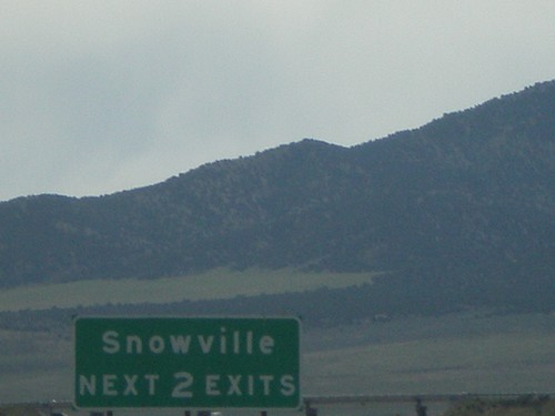
I-84 East - Snowville Next 2 Exits
Snowville Next 2 Exits, on I-84 east, approaching Exit 5.
I-84 East Exit 5
I-84 east approaching Exit 5, UT-30/Park Valley, 1 mile.
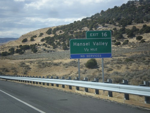
I-84 West - Exit 16
I-84 east approaching Exit 16 - Hansel Valley. This exit was recently renamed from Ranch Exit.
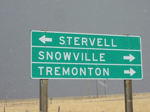
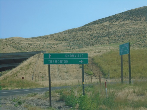
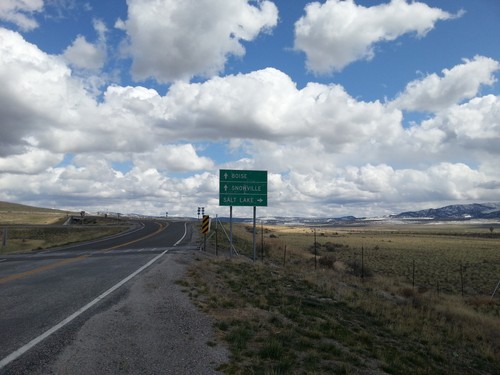
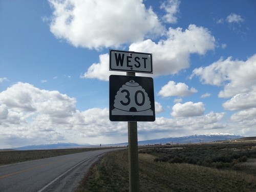
UT-30 East at UT-42
UT-30 east at UT-42 junction to Stervell, Tremonton, and Snowvi
I-84 Exit 5 Onramp on UT-30 West
I-84 west onramp to Boise on UT-30 west in Snowville.
I-84 Onramp at Exit 5 on UT-30 West
Frost covered I-84 shields at I-84/UT-30 junction in Snowville.
South Willard
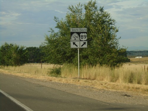
UT-126 South at I-15 and I-84
UT-126 South at I-15 and I-84 (Exit 351). Turn right for I-84 West/I-15 North.
I-15 North - Exit 351
I-15 north at Exit 351 - UT-126/To US-89/Willard
Tremonton
UT-13 South at I-15 South/I-84 East
UT-13 South at I-15 South/I-84 East to Ogden and Salt Lake City.
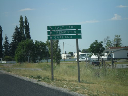
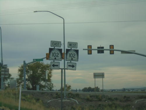
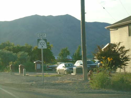
UT-102 East at UT-82 North
UT-102 East (Main St.) at UT-82 North (N 3rd East) in Tremonton.
UT-102 East at I-84 West
UT-102 East at I-84 West to Boise (Idaho).
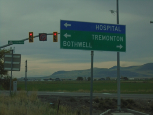
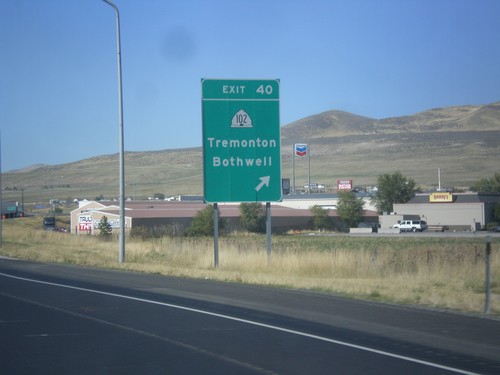
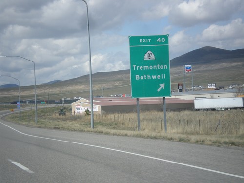
I-84 East - Exit 40 Offramp at UT-102
I-84 East - Exit 40 Offramp at UT-102 in Tremonton. Use UT-102 West to Bothwell; UT-102 East to Tremonton and Hospital.
I-84 Exit 40 Offramp at UT-102
I-84 Exit 40 Offramp at UT-102 (W 11200 North) in Tremonton.
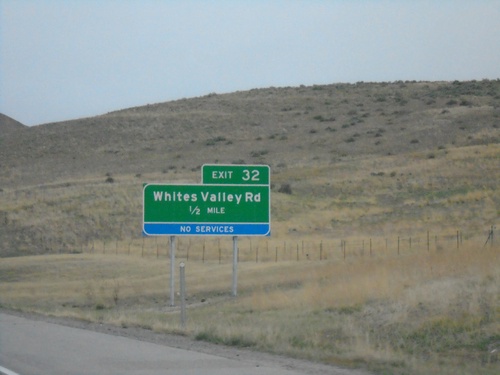
I-84 West - Exit 32
I-84 west approaching Exit 32 - Whites Valley Road. This interchange was renamed in 2021 from Ranch Exit.
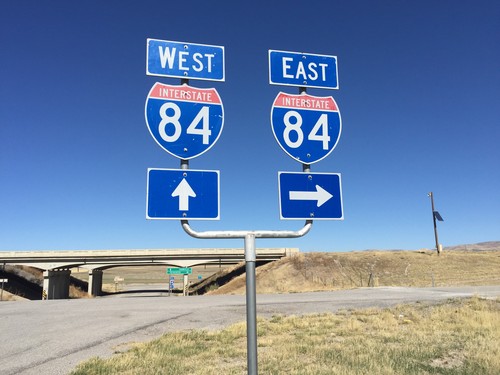
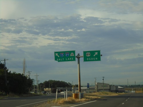
I-15 South at I-84 - Tremonton
I-15 South at I-84 in Tremonton. Use Exit 379 for I-84 West/Tremonton/Boise (Idaho). I-84 east joins I-15 southbound. Use I-15 South/I-84 East for Ogden and Salt Lake. The winter sun is glowing through the fog.
I-15 South - Exit 379
I-15 south approaching Exit 379 - I-84 West/Tremonton/Boise (Idaho). I-84 east joins I-15 southbound to Ogden.
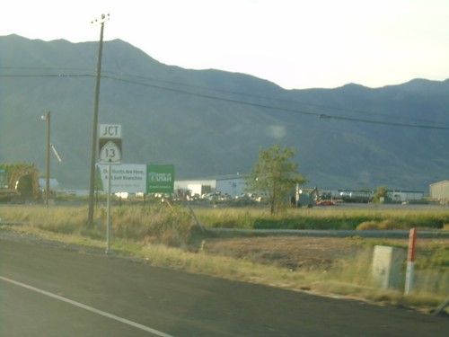
UT-83 North Approaching UT-102
UT-83 North approaching UT-102 in Box Elder County.
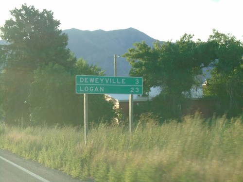
UT-102 East - Distance Marker
Distance marker on UT-102 East. Distance to Deweyville, and Logan.
UT-102 East - Tremonton
UT-102 East in Tremonton
UT-102 East Approaching UT-13
UT-102 East approaching UT-13 in Tremonton.
UT-102 East Approaching UT-13
UT-102 East approaching UT-13 in Tremonton. Use UT-13 South for Elwood; UT-13 North for Plymouth; UT-102 East for Deweyville.
UT-102 West Approaching I-84
UT-102 West approaching I-84 (Exit 40) in Tremonton.
I-84 West - Exit 40
I-84 west at Exit 40 - UT-102/Tremonton/Bothwell.
I-84 West - Exit 40
I-84 west at Exit 40 - UT-102/Tremonton/Bothwell.
End UT-82 South at UT-102
End UT-82 south at UT-102 in downtown Tremonton.
UT-102 West at I-84
UT-102 west at I-84 onramp for Exit 40.
UT-102 West at I-84 Onramps
UT-102 west approaching I-84 (Exit 40). Use I-84 west for Boise. Use I-84 east for Brigham City.
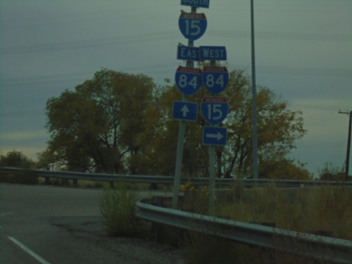
I-15 North - Exit 379
I-15 North/I-84 West Split (Exit 379) in Tremonton. Use I-15 north for Pocatello (Idaho); I-84 west for Boise (Idaho).
I-15 North - Exit 379
I-15 North/I-84 West approaching Exit 379 - I-84 West/Boise (Idaho). Continue north on I-15 for Pocatello (Idaho).
I-15 North - Exit 381
I-15 north approaching Exit 381 - Tremonton/Garland.
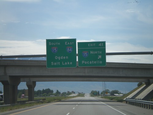
I-84 East at Exit 41 - I-15 Jct.
I-84 east at Exit 41, I-15 North/Pocatello. I-84 East joins I-15 south to Ogden.
I-84 East Exit 41 - 1/2 Mile
I-84 east approaching Exit 41, I-15 North/Pocatello, 1/2 mile.
I-84 East Exit 41 - 1 Mile
I-84 east approaching Exit 41, I-15 North/Pocatello, 1 mile.
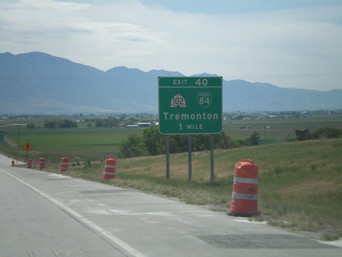
I-84 East Exit 40
I-84 east at Exit 40, UT-102/Tremonton.
I-84 East Exit 40
I-84 east approaching Exit 40, UT-102/BL-84/Tremonton, 1 mile.
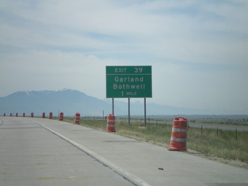
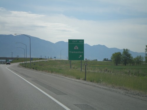
I-84 East Exit 39
I-84 east approaching Exit 39, Garland/Bothwell, 1 mile.
I-84 East Exit 32
I-84 east approaching Exit 32, Ranch Exit, 1/2 mile.
I-84 East Exit 20
I-84 east approaching Exit 20, Blue Creek, 1/2 mile.
I-84 West - Exit 17
I-84 west approaching Exit 17 - Rattlesnake Pass. This exit was recently renamed from Ranch Exit.
Wendover
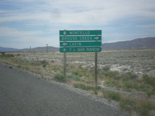
UT-30 West - Lucin and Grouse Creek Jct.
UT-30 west at Grouse Creek Road. Turn right for Grouse Creek, left for Lucin and T Bar Ranch. Continue west on UT-30 for Montello (Nevada).
Willard
US-89 North at UT-126 South
US-89 North at UT-126 South to I-15 and I-84 Junction.
US-89 North - Box Elder County
Entering Box Elder County on US-89 North.
I-15 South - Exit 351
I-15 south approaching Exit 351 - UT-126/To US-89/Willard/Pleasant View
US-89 South at UT-126
US-89 South at UT-126/To I-84/To I-15/Salt Lake. Merge right to continue south on US-89 for Ogden.
US-89 South Approaching UT-126
US-89 South approaching UT-126.
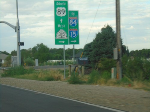
US-89 South at UT-315
US-89 South at UT-315/To I-15/To I-84 in Willard.
US-89 South Approaching UT-315
US-89 South approaching UT-315 in Willard.
US-89 South Approaching UT-315
US-89 South approaching UT-315/To I-84/To-15.
I-15 North/I-84 West - Willard
I-15 North/I-84 West in Willard.
I-15 North/I-84 West - Exit 357
I-15 North/I-84 West approaching Exit 357 - UT-315/750 North.

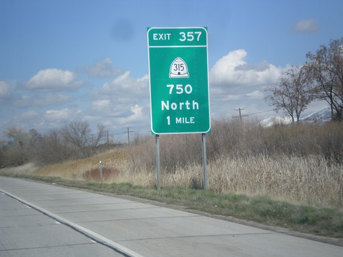
I-15 North - Exit 357
I-15 north at Exit 357 - UT-315/750 North
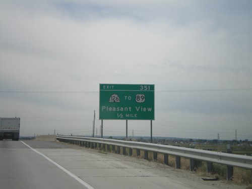
I-15 South - Exit 351
I-15 south at Exit 351 - UT-126/To US-89/Pleasant View
I-15 South - Exit 360
I-15 south at Exit 360 (since renamed to Exit 357) UT-315/Willard/Perry