Grand County, Utah
Localities: Cisco | Crescent Junction | Green River | Moab | Thompson Springs
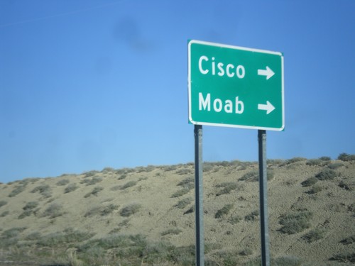
Cisco
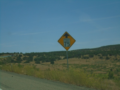
I-70 East - Speed Reduced to 75 MPH
I-70 East - Speed reduced to 75 MPH ahead. Approaching the Utah-Colorado State Line. The Speed Limit on I-70 in Utah is 80 MPH.
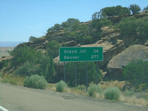
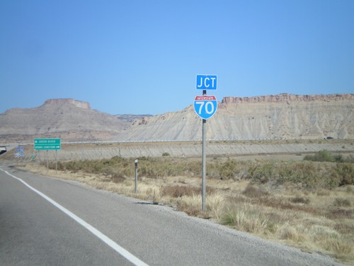
I-70 East - Distance Marker
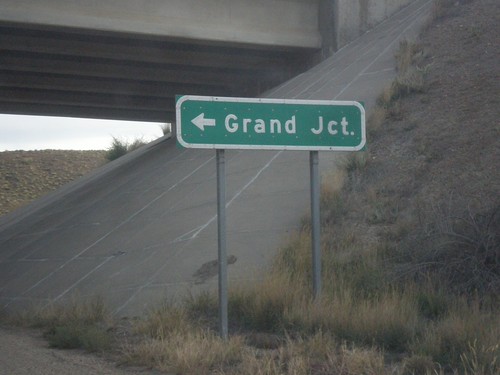
Distance marker on I-70 west. Distance to Grand Junction and Denver. This is the last distance marker along I-70 in Utah.
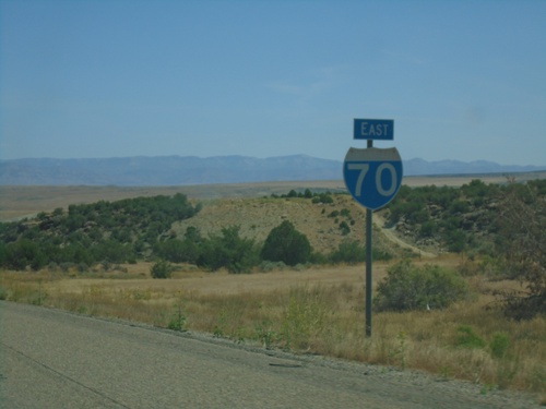
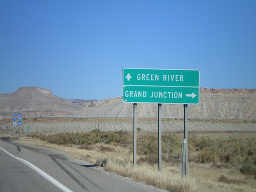
I-70 East - Grand County
I-70 east in Grand County. This is the last I-70 reassurance marker in Utah.
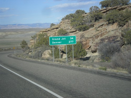
I-70 East - Distance Marker
Distance marker on I-70 west. Distance to Grand Junction and Denver. This is the last distance marker along I-70 in Utah.
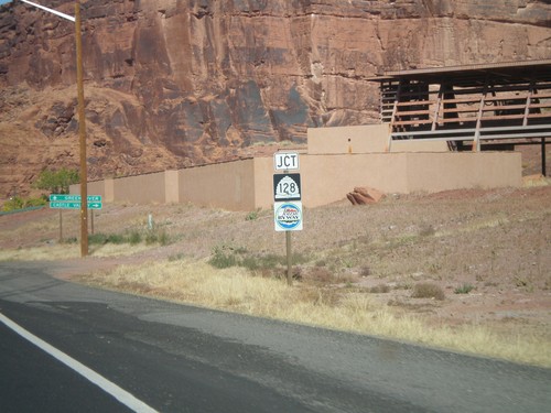
End UT-128 East at I-70
End UT-128 east at I-70 at Exit 204.
I-70 East - Exit 204 Offramp
I-70 east Exit 204 offramp. Turn right for UT-128 to Cisco and Moab.
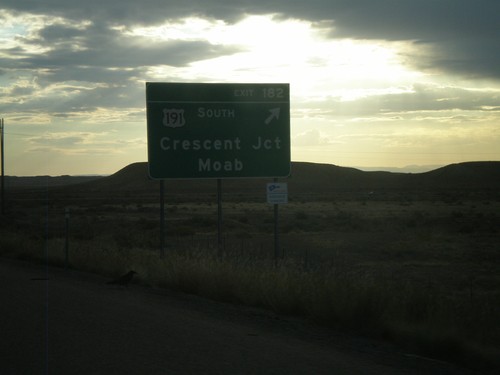
Crescent Junction
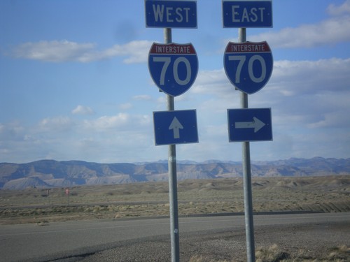
I-70 East - Exit 182
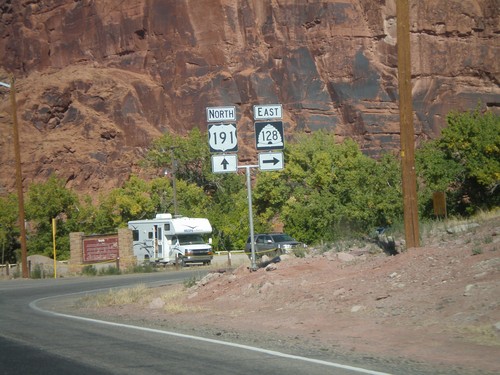
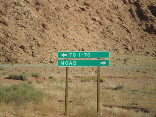
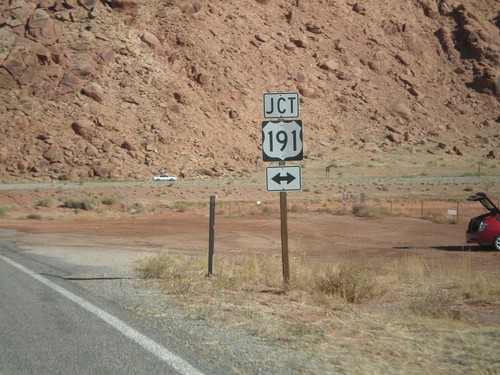
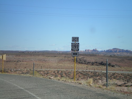
I-70 east at Exit 182 - US-191 South/Crescent Junction/Moab. US-191 south leaves I-70 here.
US-191 North at I-70
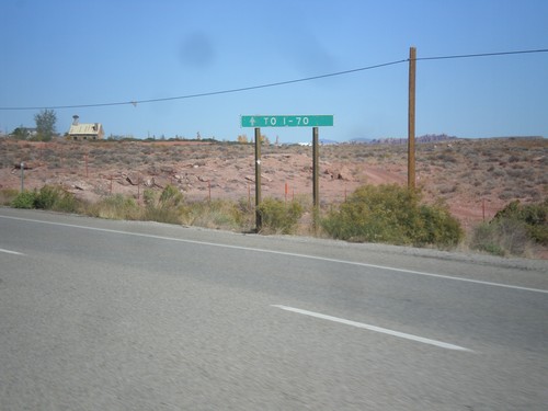
US-191 north at I-70 east. US-191 continues north along I-70 west.
US-191 North at I-70
US-191 north approaching I-70. Use I-70 west for Green River. Use I-70 east for Grand Junction (CO).
US-191 North Approaching I-70
US-191 north approaching I-70.
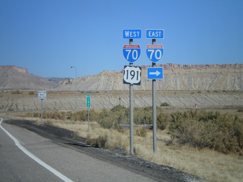
I-70 West Exit 180
I-70 West at US-191 Junction to Moab
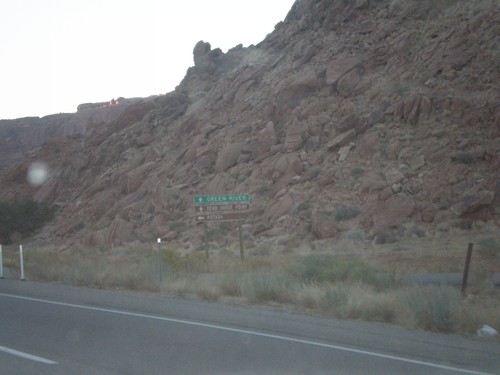
Green River
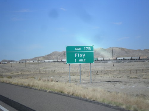
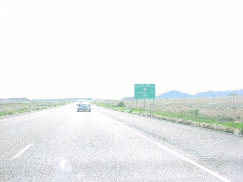
I-70 East Approaching Exit 175
I-70 east approaching Exit 175 - Floy. This exit previously was called Ranch Exit.
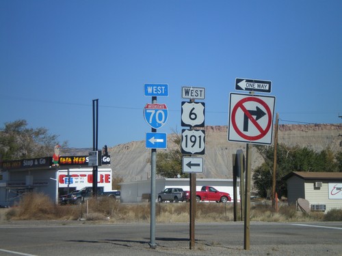
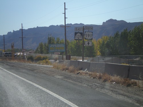
US-191 North at I-70/US-6 Onramp
US-191 north at I-70 west. US-191 continues north along I-70 west along with US-6 and US-50 (unsigned).
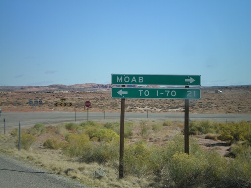
Moab
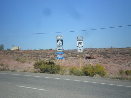
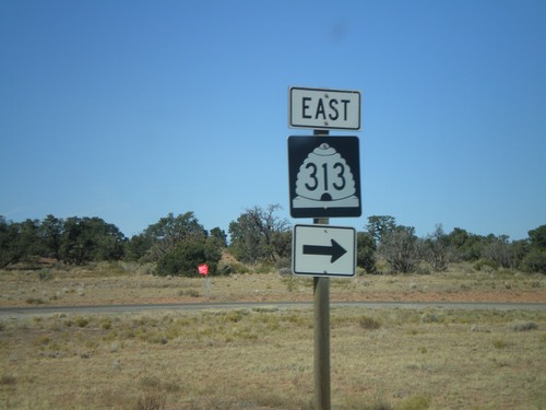
US-191 North at UT-313
US-191 North at UT-313. UT-313 is signed as a Utah Scenic Byway. UT-313 connects US-191 with Dead Horse Point State Park, and the Island in the Sky unit of Canyonlands.
US-191 North Approaching UT-313
US-191 north approaching UT-313. Continue north on US-191 north for I-70.
US-191 North Approaching UT-313
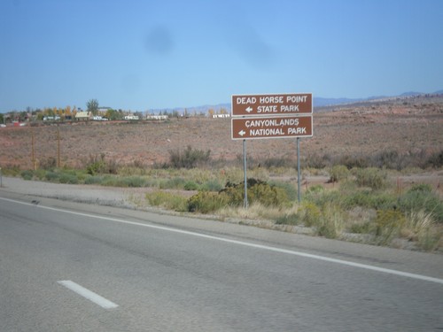
US-191 north approaching UT-313. Use UT-313 west for Dead Horse Point State Park, and Canyonlands National Park (Island In The Sky Unit).
End UT-128 East at US-191
End UT-128 east at US-191 in Moab. This intersection has been replaced with a stoplight in recent years. UT-128 follows the south side of the Colorado River east from Moab towards Colorado.
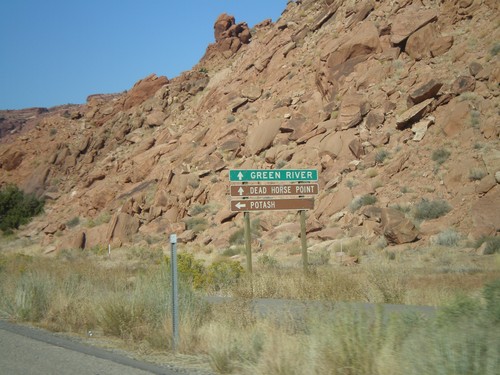
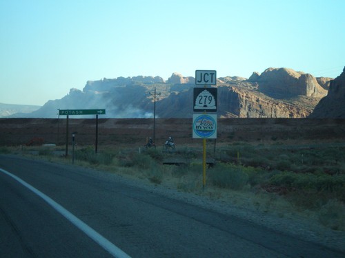
US-191 North Approaching UT-279
US-191 north approaching UT-279. Use UT-279 west for Potash. Use US-191 north for Green River and Dead Horse Point State Park.
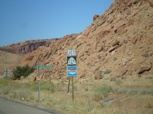
US-191 North Approaching UT-279
US-191 north approaching UT-279. UT-279 is signed as a Utah scenic byway.
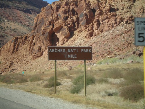
US-191 North - Arches National Park
Distance marker to Arches National Park on US-191 north.
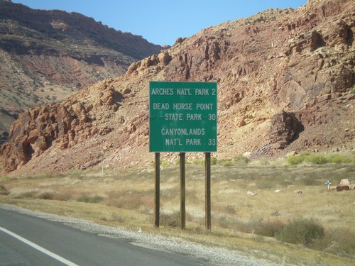
US-191 North - National Parks Distance Marker
Distance marker on US-191 north to Arches NP, Dead Horse Point SP, and Canyonlands NP.
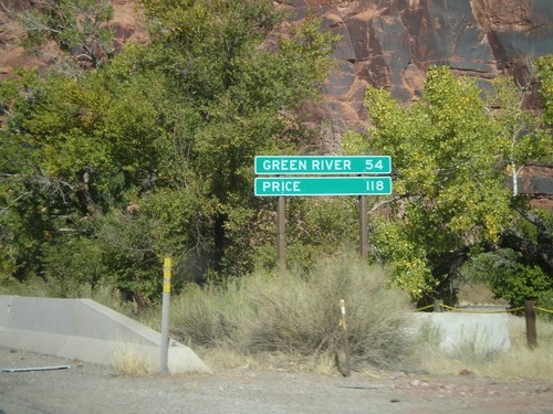
US-191 North - Distance Marker
Distance marker on US-191 north. Distance to Green River and Price.
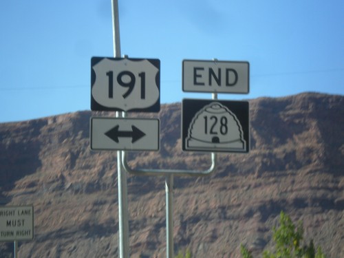
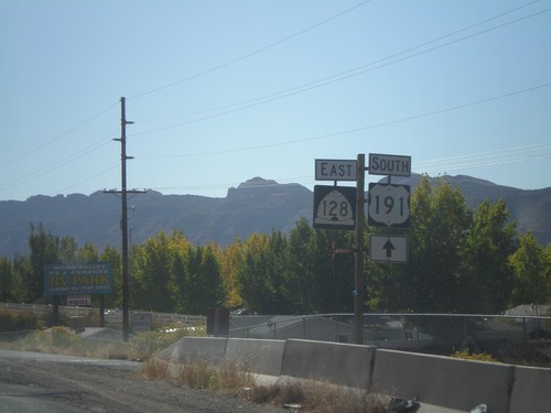
US-191 North at UT-128 East
US-191 north at UT-128 east.
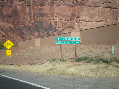
US-191 North Approaching UT-128
US-191 north approaching UT-128 east to Castle Valley.
US-191 North Approaching UT-128
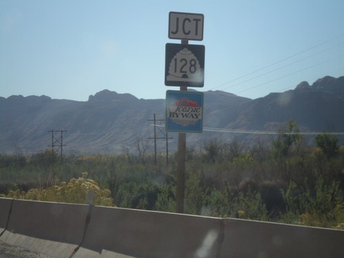
US-191 north approaching UT-128. UT-128 is signed as a Utah scenic byway.
US-191 South at UT-128
US-191 south at UT-128 east.
US-191 South Approaching UT-128
US-191 south approaching UT-128 east. UT-128 is marked as a Utah scenic byway.
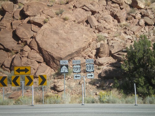
End UT-279 at US-191
End UT-279 east at US-191.
End UT-279 East at US-191
UT-279 east approaching US-191. Use US-191 north for I-70. Use US-191 south for Moab.
End UT-279 East at US-191
UT-279 east approaching US-191.
US-191 North Approaching UT-279
US-191 north approaching UT-279. Use UT-279 west for Potash. Use US-191 north for Green River and Dead Horse Point State Park.
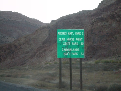
US-191 North - National Parks Distance Marker
Distance marker on US-191 north to Arches NP, Dead Horse Point SP, and Canyonlands NP.
US-191 South Approaching UT-279
US-191 south approaching UT-279 west to Potash. UT-279 is marked as a Utah scenic byway.
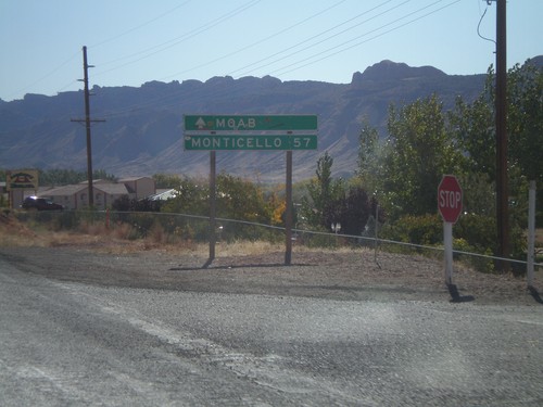
US-191 South - Distance Marker
US-191 south of UT-128. Distance marker to Moab and Monticello.
US-191 South at UT-128 East
US-191 south at UT-128 east.
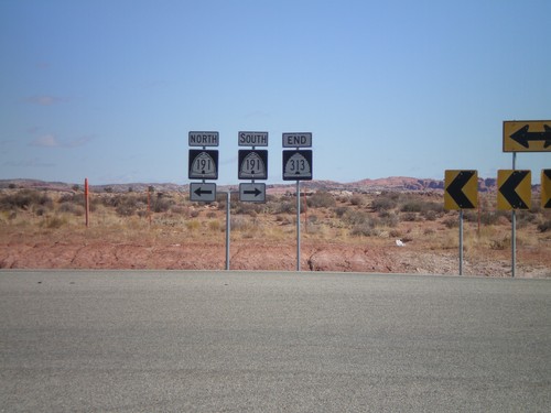
End UT-313 North at US-191
End UT-313 north at US-191. US-191 shields are incorrectly signed as UT-191.
End UT-313 at US-191
End UT-313 north approaching US-191. Use US-191 north for I-70. Use US-191 south for Moab.
End UT-313 At US-191
End UT-313 north approaching US-191.
UT-313 East at Canyonlands National Park
UT-313 east at Canyonlands NP access road.
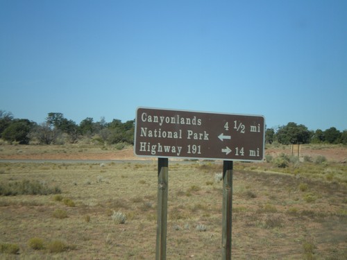
UT-313 at Canyonlands National Park Jct.
UT-313 north approaching Canyonlands NP access road. Turn right to continue on UT-313 to US-191.
Thompson Springs
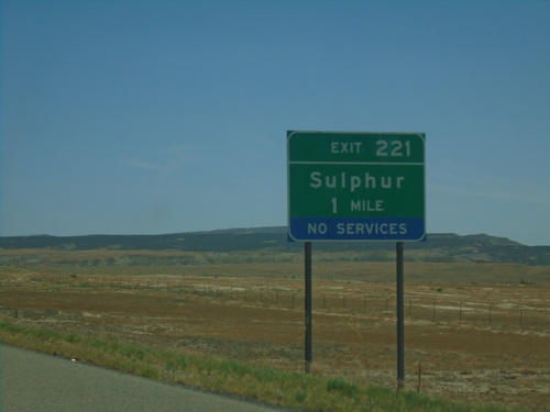
I-70 East - Exit 221
I-70 east approaching Exit 221 - Sulphur.
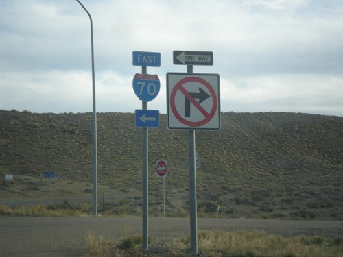
Yellowcat Road at I-70 - Grand County
Yellowcat Road at I-70 in Grand County.
Yellowcat Road at I-70 - Grand County
Yellowcat Road at I-70 in Grand County. Use I-70 East for Grand Junction (Colorado); I-70 East for Thompson.
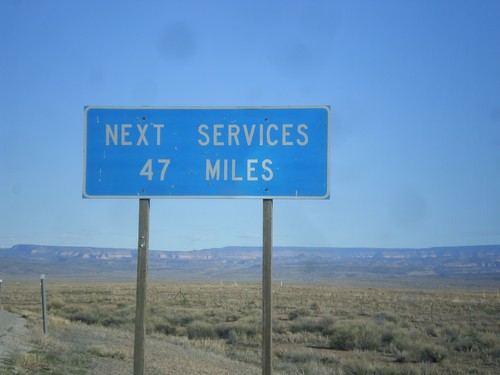
UT-128 - Next Services 47 Miles
Next services 47 miles (in Moab) on UT-128 west.
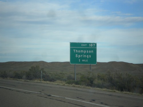
I-70 East - Exit 187
I-70 east approaching Exit 187 - Thompson Springs.
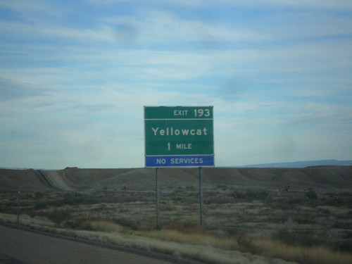
I-70 East - Exit 193
I-70 east approaching Exit 193 - Yellowcat.
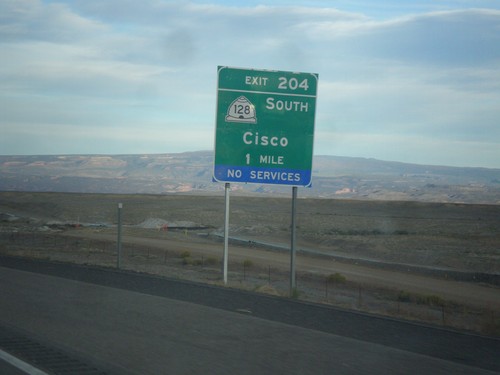
I-70 East - Exit 204
I-70 east approaching Exit 204 - UT-128 South/Cisco.
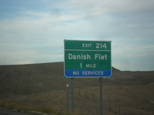
I-70 East - Exit 217
I-70 east approaching Exit 214 - Danish Flat.
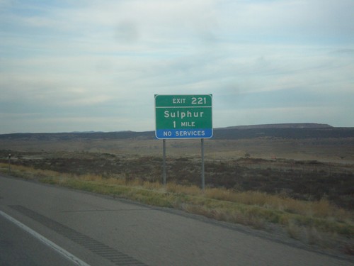
I-70 East - Exit 221
I-70 east approaching Exit 221 - Sulphur.
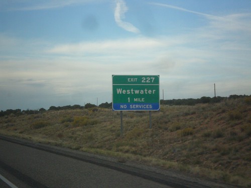
I-70 East - Exit 227
I-70 east at Exit 227 - Westwater. This is the last exit along I-70 in Utah. This is also the exit to access the Westwater whitewater run on the Colorado River.
I-70 East Onramp - Exit 187
I-70 east onramp at Exit 187. Turn left for I-70 east.
I-70 East Onramp to Grand Junction
I-70 East Onramp to Grand Junction (Colorado) at Exit 187.