San Juan County, Utah
Localities: Blanding | Bluff | La Sal | Lake Powell | Mexican Hat | Montezuma Creek | Monticello | Ucolo | White Mesa
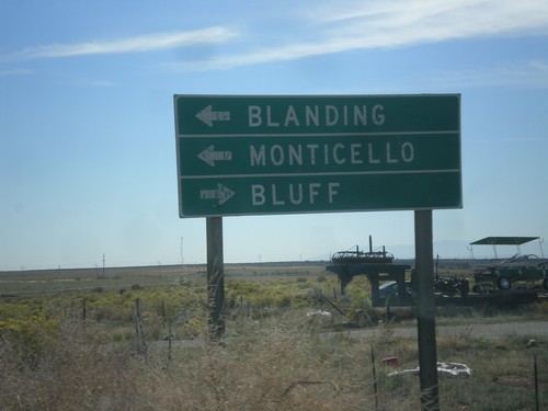
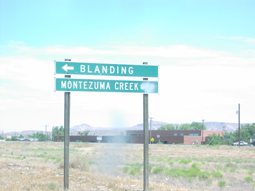
Blanding
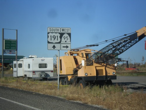
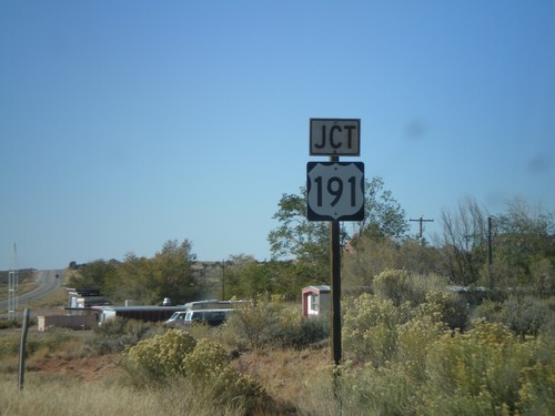
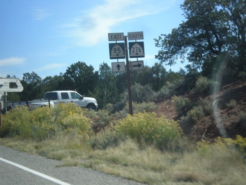
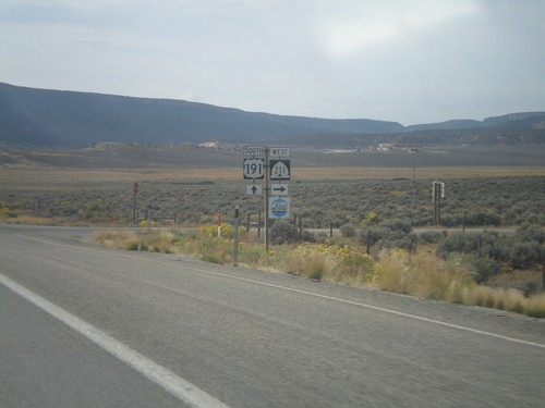
US-191 South at UT-95
US-191 south at UT-95 west, just south of Blanding.
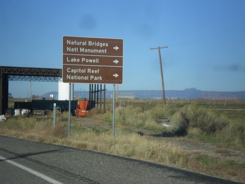
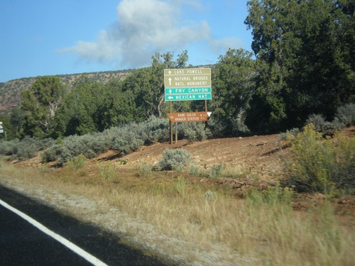
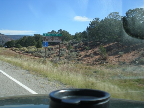
US-191 South Approaching UT-95
US-191 south approaching UT-95 west to Natural Bridges National Monument, Lake Powell, and Capitol Reef National Park.
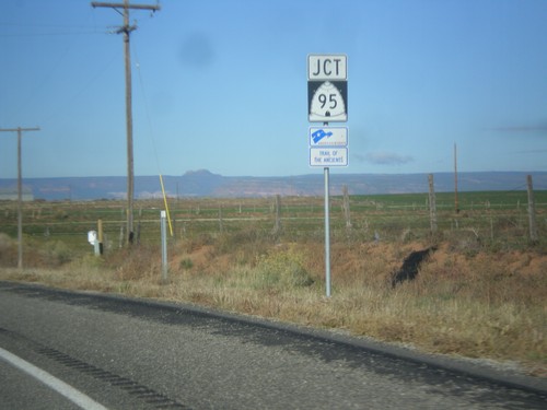
US-191 South Approaching UT-95
US-191 south approaching UT-95. UT-95 is part of the Trail of the Ancients Scenic Byway.
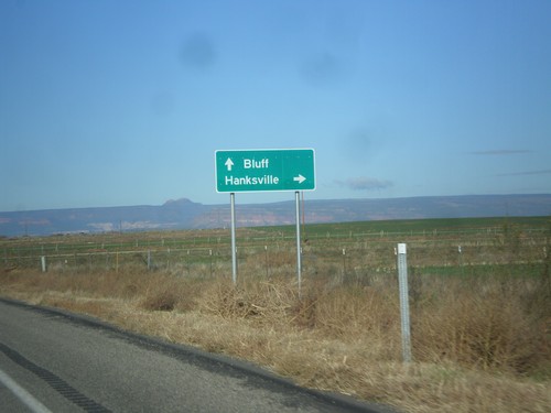
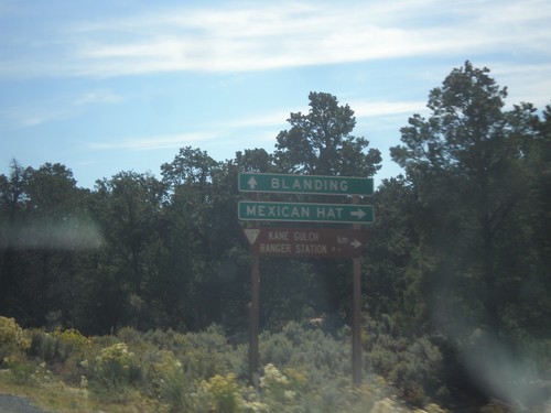
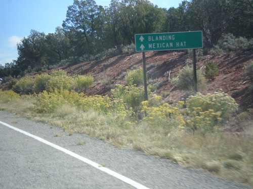
US-191 South Approaching UT-95
US-191 south approaching UT-95 west to Hanksville. Continue south on US-191 to Bluff. This sign is not typical for a junction between two state highways, in that it is not in all capitol letters, and there is not horizontal lines separating the cities.
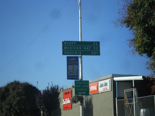
US-191 South - Distance Marker
Distance marker on US-191 south in Blanding. Distance to Bluff, Mexican Hat, and Phoenix. The last city is interesting, because US-191 does not go anywhere near Phoenix. A distance marker between Monticello and Blanding lists Flagstaff as the control city, which is also not on US-191.
US-191 South - Blanding
US-191 south at the Center St./Main St. intersection in Blanding. US-191 turns south on Main St.
US-191 South - Blanding
US-191 south at Main St. and Center St. in Blanding. US-191 turns south onto Main St. towards Bluff and Mexican Hat.
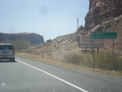
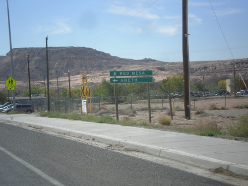
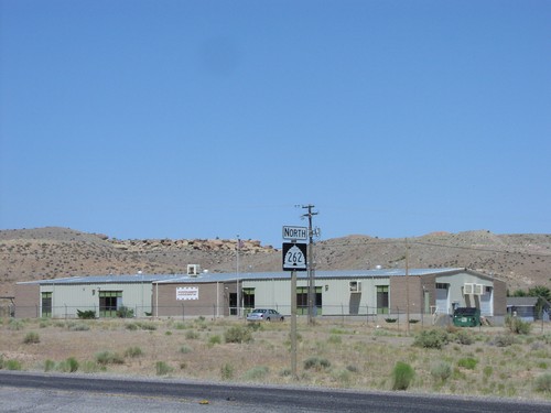
US-191 South Approaching UT-262
US-191 south approaching UT-262 west. Use UT-262 west for Montezuma Creek and Aneth. Continue south on US-191 for Bluff.
End UT-95 East at US-191
End UT-95 East at US-191. Turn right for Bluff; left for Blanding and Monticello.
End UT-95 Approaching US-191
End UT-95 approaching US-191 in San Juan County.
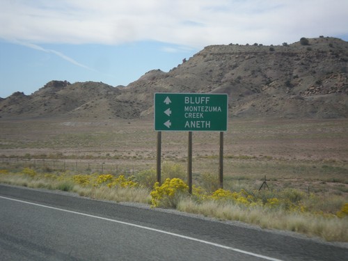
Bluff
US-163 West - Distance Marker
First distance marker along US-163 west. Distance to Mexican Hat and Monument Valley (Navajo Tribal Park).
US-191 South at US-163
US-191 South at US-163 in San Juan County. Turn left to continue south on US-191 to Mexican Water (Arizona). Continue straight for US-163 west to Mexican Hat. This is the eastern end of US-163 west.
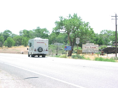
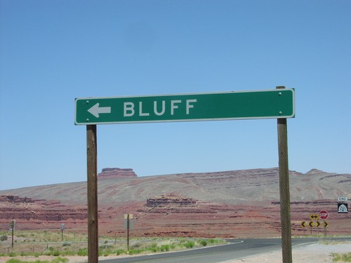
US-191 South - Bluff
US-191 south shield in Bluff.
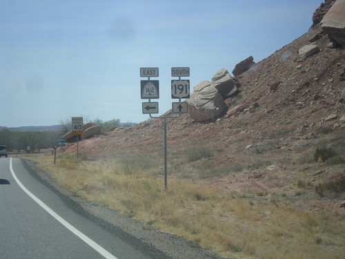
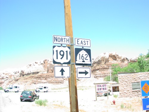
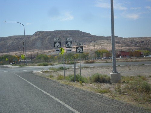
US-191 South at UT-162 East
US-191 South at UT-162 East in Bluff.
US-191 South Approaching UT-162
US-191 South approaching UT-162 in Bluff. Use UT-162 east for Montezuma Creek and Aneth.
US-191 South Approaching UT-162
US-191 South approaching UT-162 in Bluff.
US-191 North at UT-162 East
US-191 north at UT-162 junction in Bluff.
US-191 South - Bluff
US-191 shield in Bluff south of UT-163.
La Sal
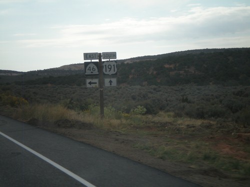
US-191 South at UT-46 East
US-191 South at UT-46 East at La Sal Junction.
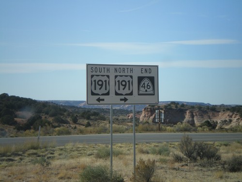
End UT-46 West at US-191
End UT-46 west at US-191.
UT-46 West Approaching US-191
UT-46 west approaching US-191.
Lake Powell
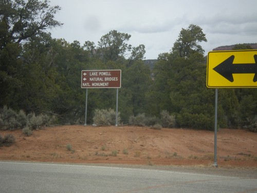
End UT-261 North at UT-95
End UT-261 North at UT-95 in San Juan County. Turn left for UT-95 west to Lake Powell and Natural Bridges National Monument.
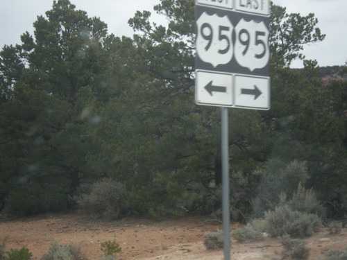
End UT-261 North at UT-95
End UT-261 North at UT-95 in San Juan County. The UT-95 shield is signed incorrectly as US-95.
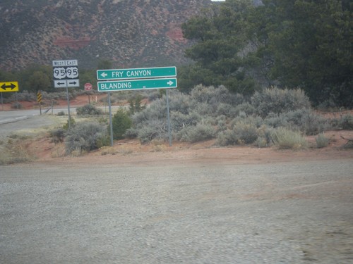
End UT-261 North at UT-95
End UT-261 North at UT-95 in San Juan County. Turn right on UT-95 east for Blanding; left on UT-95 west for Fry Canyon. The UT-95 shield is signed incorrectly as US-95.
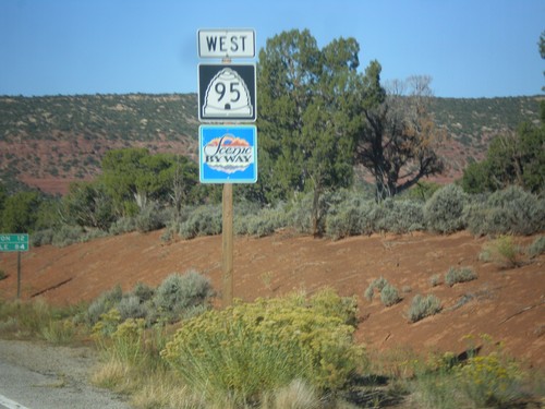
UT-95 West
UT-95 west in San Juan County. UT-95 is part of the Bicentennial-Trail of the Ancients Scenic Byway.
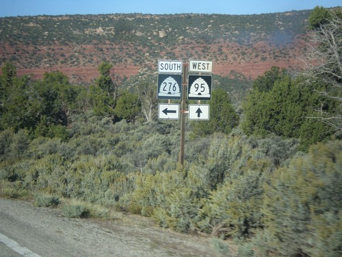
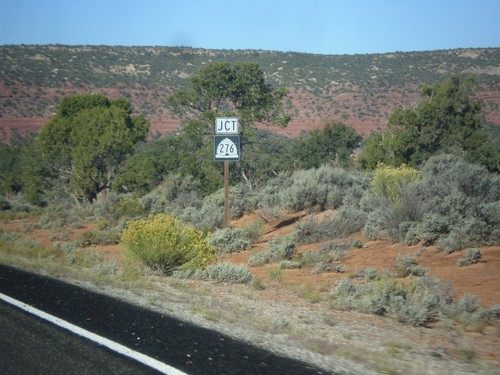
UT-95 West at UT-276 South
UT-95 west at UT-276 south in San Juan County.
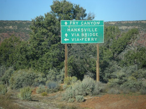
UT-95 West At UT-276 South
UT-95 west at UT-276 south. Use UT-276 for access to Lake Powell, and Hanksville via the ferry. Continue west on UT-95 for Hanksville via the bridge at Hite and Fry Canyon. At the time this picture was taken, the UT-276 ferry was not running.
UT-95 West Approaching UT-276
UT-95 west approaching UT-276 in San Juan County.
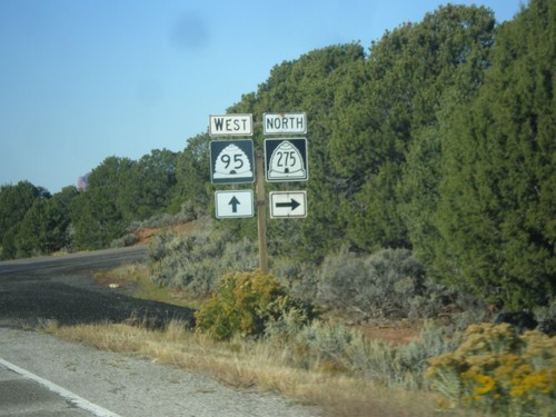
UT-95 West at UT-275
UT-95 west at UT-275 north in San Juan County.
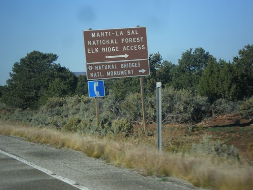
UT-95 West Approaching UT-275
UT-95 west approaching UT-275 north to Natural Bridges National Monument and Manti-La Sal Forest Elk Ridge Access. This is the entrance to Natural Bridges National Monument.
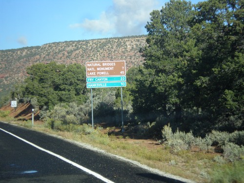
UT-95 West - Distance Marker
Distance marker on UT-95 west to Natural Bridges National Monument, Lake Powell, Fry Canyon, and Hanksville.
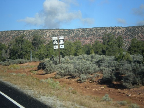
UT-95 West at UT-261
UT-95 west at UT-261 south in San Juan County.
UT-95 West at UT-261
UT-95 west at UT-261 south to Mexican Hat. Continue west on UT-95 for Natural Bridges National Monument, Fry Canyon, Lake Powell, and Hanksville.
UT-95 West at UT-261
UT-95 east at UT-261. Turn right for Mexican Hat; continue east towards Blanding.
UT-95 East Approaching UT-261
UT-95 East approaching UT-261 junction.
UT-95 East at UT-275
UT-95 east at UT-275 north to Natural Bridges National Monument.
UT-95 East Approaching UT-275
UT-95 East Approaching UT-275 north to Natural Bridges National Monument. Continue east on UT-95 for Blanding.
UT-95 East at UT-276
UT-95 east at UT-276 junction.
UT-95 East Approaching UT-276
UT-95 East approaching UT-276. Continue east on UT-95 for Mexican Hat and Blanding.
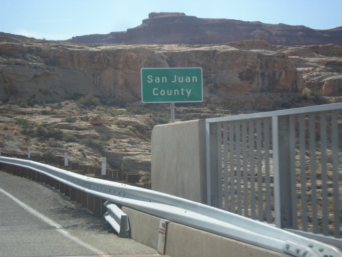
UT-95 East - San Juan County
Entering San Juan County on UT-95 east, crossing the Colorado River. This is the backwaters of Lake Powell, near Hite Marina.
Mexican Hat
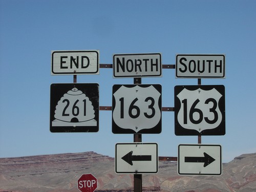
End UT-161 South at US-163
End of UT-261 at US-163 north of Mexican Hat.
End UT-261 South at US-163
Direction sign to Bluff via US-163 east, at the end of UT-261 near Mexican Hat.
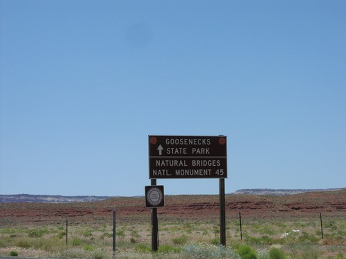
UT-261 North - Distance Marker
Distance marker to Goosenecks SP and Natural Bridges SP on UT-261 north near Mexican Hat.
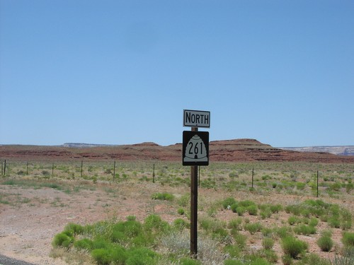
UT-261 North - Mexican Hat
UT-261 north shield at US-163 junction near Mexican Hat.
Montezuma Creek
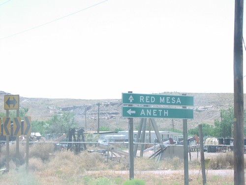
UT-162 East - Montezuma Creek
UT-162 east at Red Mesa Road in Montezuma Creek. Continue straight for Red Mesa; turn left to continue east on UT-162 to Aneth.
End UT-262 at UT-162
End UT-262 at UT-162. Turn right for UT-162 west; continue ahead for UT-162 east.
End UT-162 at UT-262
East end of UT-162 at UT-262 in Montezuma Creek.
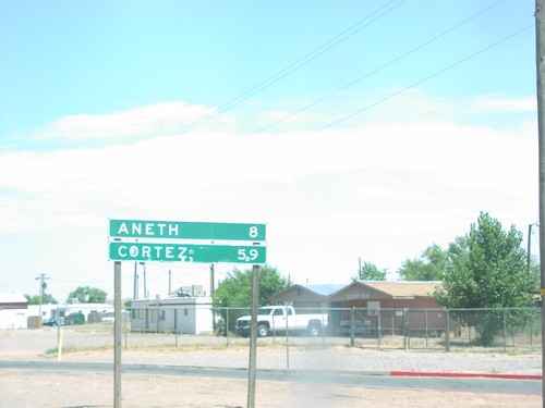
UT-162 - Distance Marker
Distance sign on UT-262 to Aneth and Cortez, CO in Montezuma Creek.
UT-262 East - Montezuma Creek
UT-262 east at Red Mesa Road in Montezuma Creek
UT-262 North - Montezuma Creek
UT-262 north shield in Montezuma Creek, at the UT-162 junction.
Monticello
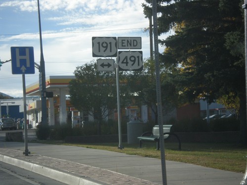
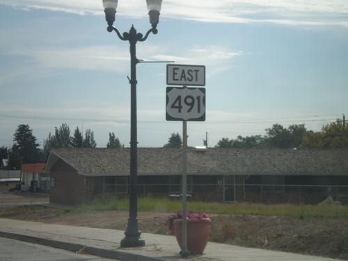
End US-491 North at US-191
End US-491 north at US-191 in Monticello. US-491 is former highway US-666, and runs from Gallup, New Mexico to Monticello, Utah. This is the northern terminus of US-491.
End US-491 at US-191
End US-491 at US-191. Use US-191 north for Moab; US-191 south for Blanding.
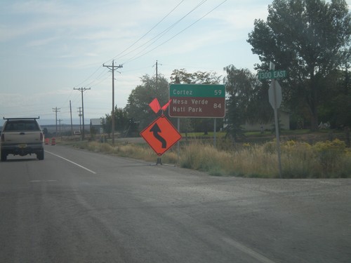
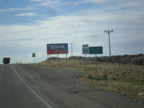
US-491 South - Distance Marker
Distance marker on US-491 south. Distance to Cortez and Mesa Verde National Park (both in Colorado). Taken on the east side of Monticello.
US-491 South - Monticello
US-491 south in Monticello. This is the first US-491 shield on US-491 southbound. US-491 was formerly US-666 until it was renamed in 2003.
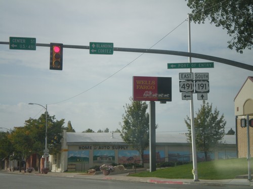
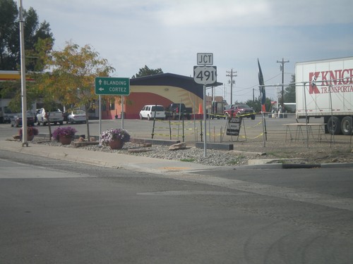
US-191 South at US-491
US-191 South at US-491. Use US-491 east for Cortez (Colorado); continue south on US-191 for Blanding. This is the northern end of US-491. Also US-491 east for the (Utah) Port of Entry.
US-191 South Approaching US-491
US-191 south approaching US-491 east. US-491 is a north-south highway, but is signed as an east-west highway in Utah.
US-191 South Approaching US-491
US-191 south approaching US-491 east. Use US-491 south for Cortez (Colorado); continue south on US-491 for Blanding.
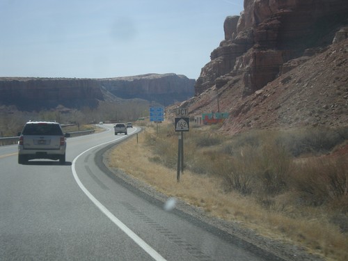
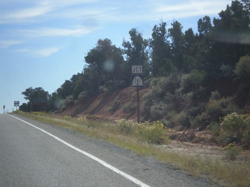
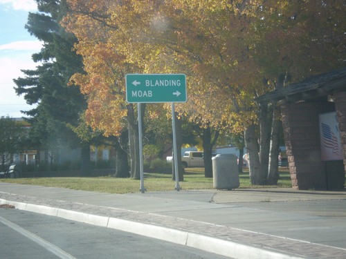
US-191 South at UT-211 West
US-191 South at UT-211 in San Juan County. UT-211 is a Utah Scenic Byway.
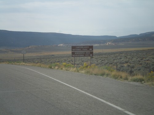
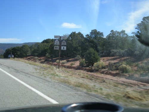
US-191 South Approaching UT-211
US-191 South approaching UT-211 west. Use UT-211 west for Canyonlands National Park (Needles District), and Newspaper Rock Recreational Site.
Ucolo
US-491 North - Welcome To Utah
Welcome to Utah on US-491 north at the Colorado-Utah Border. Also entering San Juan County.
White Mesa
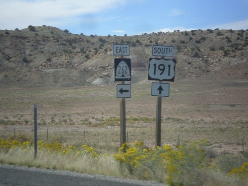
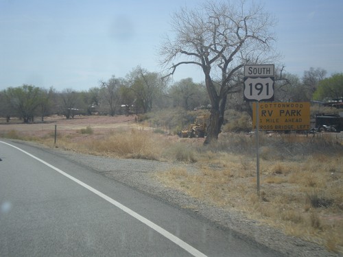
US-191 South at UT-262
UT-191 south at UT-262 east.
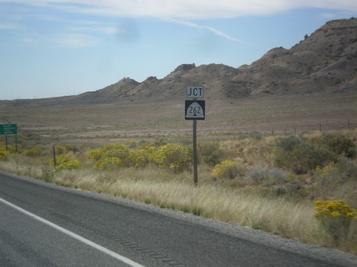
US-191 South Approaching UT-262
US-191 south approaching UT-262 junction.