Sevier County, Utah
Localities: Aurora | Elsinore | Glenwood | Joseph | Koosharem | Richfield | Salina | Sevier | Sigurd
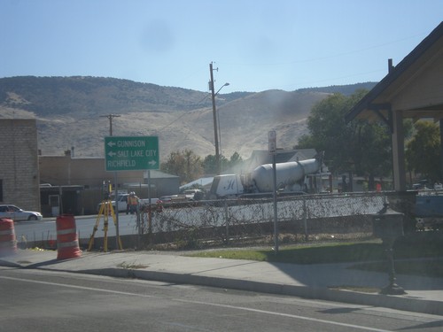
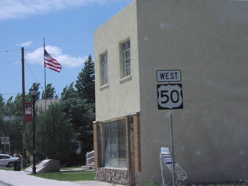
Aurora
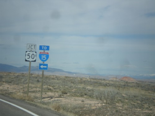
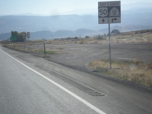
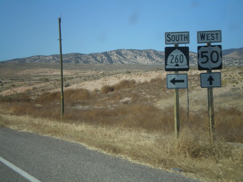
End UT-260 North at US-50
End UT-260 North at US-50. Use US-50 west for I-15 (in Scipio).
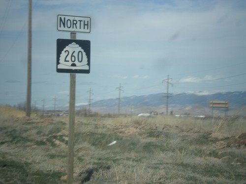
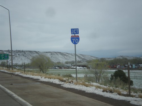
UT-260 North - Sevier County
UT-260 North in Sevier County,
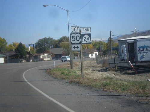
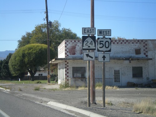
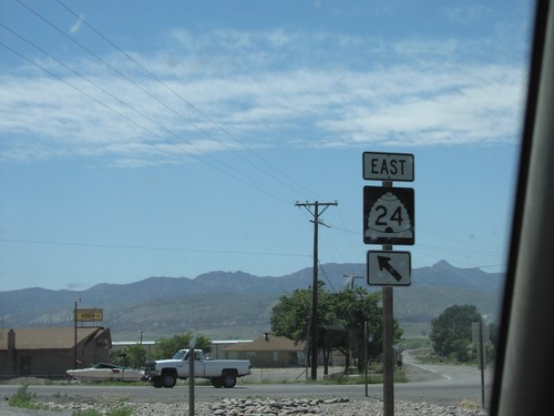
UT-24 East at UT-260 North
UT-24 East at UT-260 North. Use UT-260 for US-50 and I-15 (via US-50).
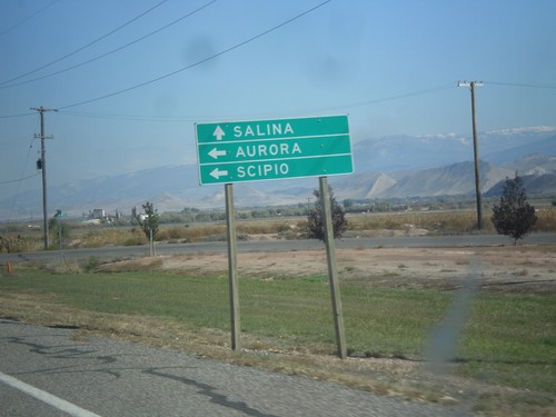
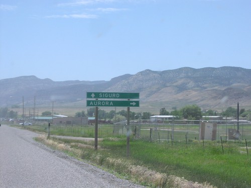
UT-24 west at UT-260
UT-24 west at UT-260 north to Aurora and Scipio. Continue west on UT-24 for Salina.
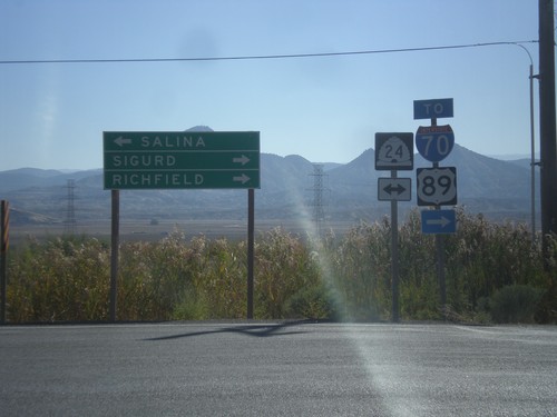
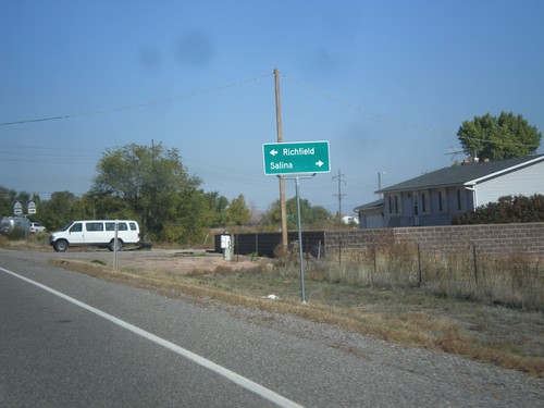
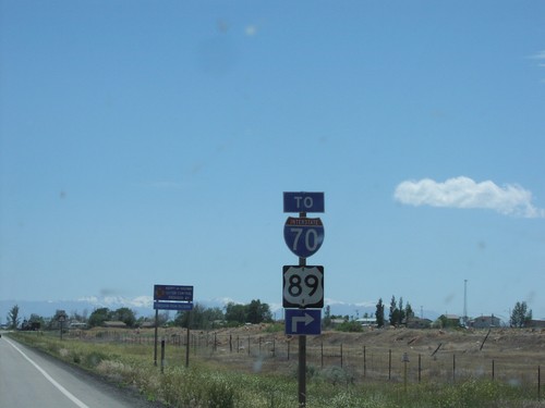
End UT-260 at UT-24
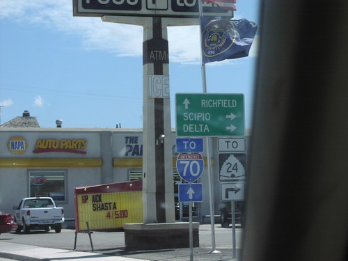
End UT-260 at UT-24. Turn right on UT-24 east for Sigurd and Richfield, and for access to I-70 and US-89. Turn left on UT-24 for Salina.
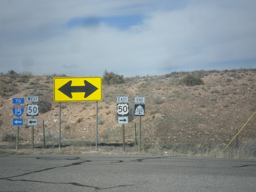
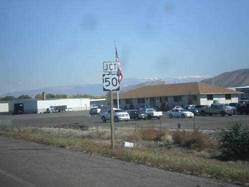
US-50 East Approaching UT-260
US-50 east approaching UT-260 south.
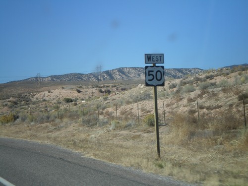
US-50 West Shield
US-50 west. Taken west of UT-260.
Elsinore
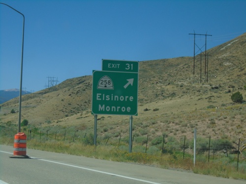
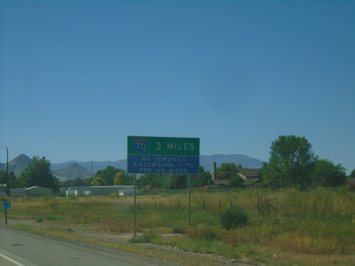
I-70 West - Exit 31
I-70 west at Exit 31 - UT-258/Elsinore/Monroe.
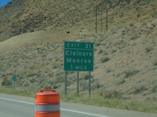
I-70 West - Exit 31
I-70 west approaching Exit 31 - Elsinore/Monroe.
Glenwood
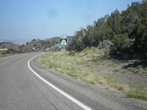
UT-24 West at UT-119
UT-24 west at UT-119 west to Richfield. Continue west on UT-24 for Salina.
Joseph
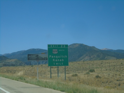
I-70 West - Exit 23
I-70 west approaching Exit 23 - US-89 South/Panguitch/Kanab. US-89 leaves I-70 westbound here.
I-70 West/US-89 South - Sevier County
I-70 West/US-89 South in Sevier County
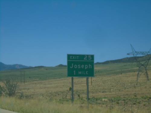
I-70 West - Exit 25
I-70 west approaching Exit 25 - Joseph
Koosharem
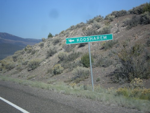
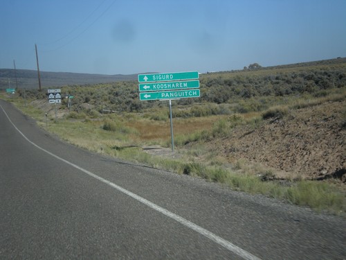
UT-24 West at Koosharem Cutoff
UT-24 West at Koosharem Cutoff in Sevier County.
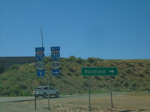
Richfield
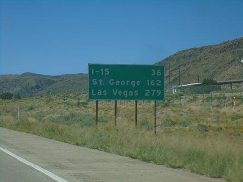
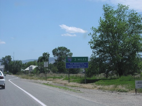
I-70 West - Distance Marker
Distance marker on I-70 west. Distance to I-15, St. George, and Las Vegas (Nevada). The last two destinations are via I-15 south.
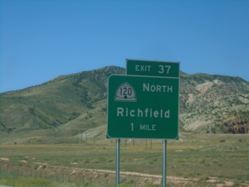
I-70 West - Exit 37
I-70 west approaching Exit 37 - UT-120 North/Richfield.
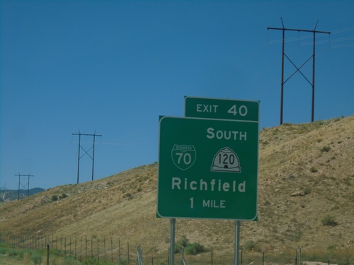
I-70 West - Exit 40
I-70 west approaching Exit 40 - BL-70/UT-120 South/Richfield.
UT-24 West Approaching UT-119
UT-24 west approaching UT-119 in Sevier County.
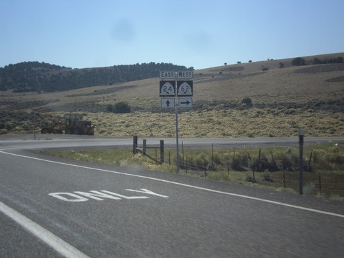
UT-24 West at UT-62 West
UT-24 west at UT-62 west in Sevier County.
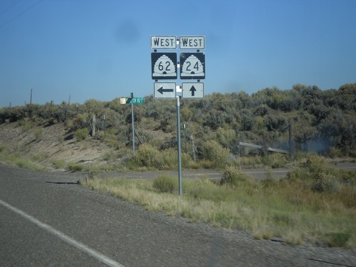
UT-24 West Approaching UT-62
UT-24 west approaching UT-62 west to Koosharem and Panguitch.
UT-24 East at UT-62
UT-24 East at UT-62 West.
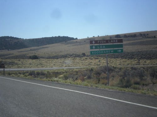
UT-24 East at UT-62 West
UT-24 east at UT-62 west to Koosharem. Continue east on UT-24 for Fish Lake and Loa.
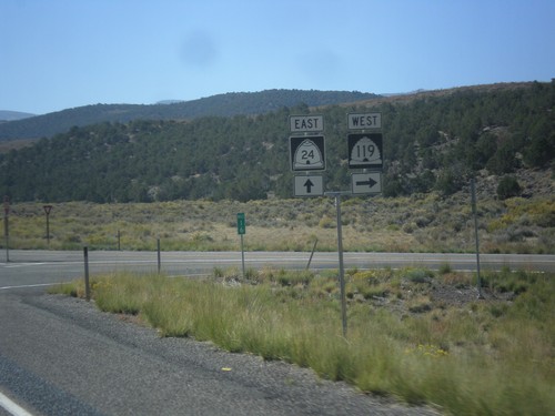
UT-24 East at UT-119
UT-24 east at UT-119 west.
Salina
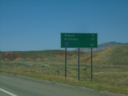
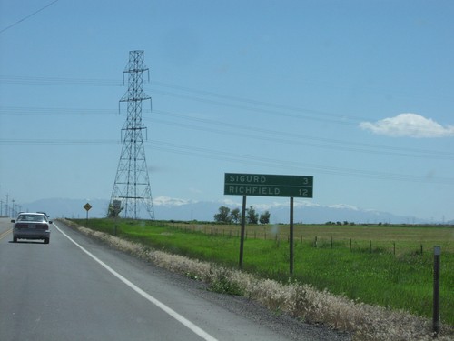
I-70 West - Distance Marker
Distance marker on I-70. Distance to Sigurd, Richfield, and I-15.
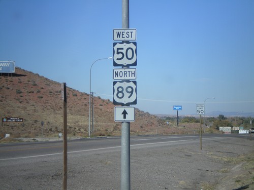
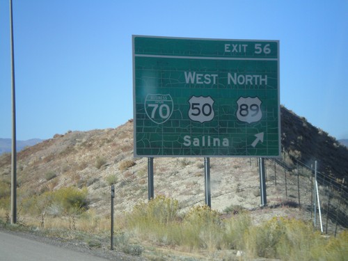
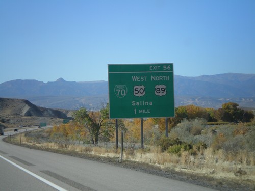
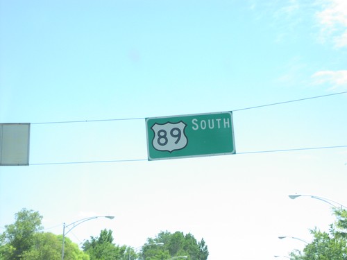
US-89 South/US-50 East at I-70
US-89 South/US-50 East at I-70 (Exit 56). US-89 south joins I-70 westbound; US-50 east joins I-70 westbound. Use I-70 West/US-89 south to Richfield.
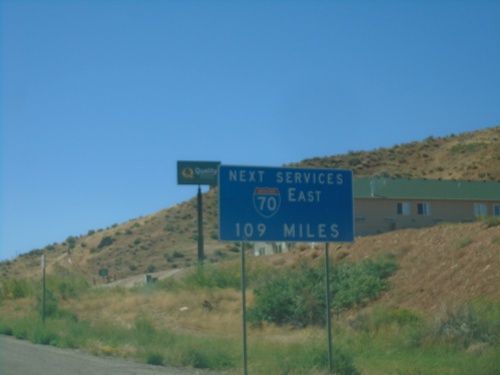
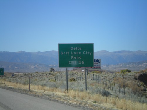
US-89 South/US-50 East Approaching I-70
US-89 South/US-50 East approaching I-70. Next services eastbound on I-70 is 109 miles, in Green River.
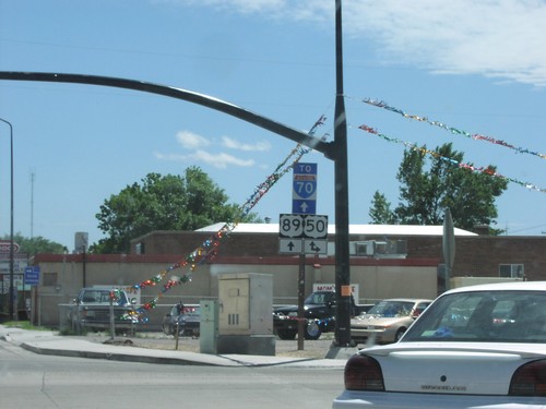
US-89 South/US-50 East/To I-70 - Salina
US-89 South/US-50 East/To I-70 in Salina
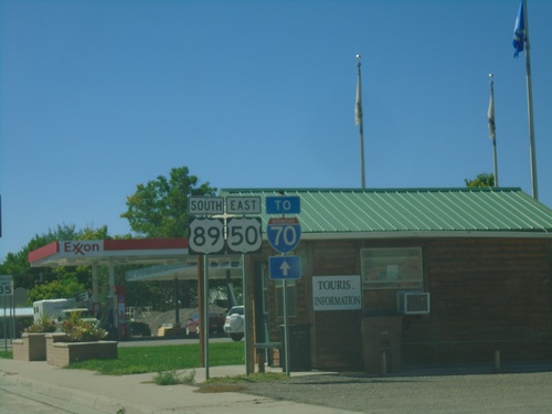
US-89 South at US-50/To UT-24/To I-70
US-89 south at US-50 in Salina. Use US-50 west for UT-24, Scipio and Delta. Continue south on US-89 to I-70 and Richfield. US-89 south joins US-50 east through Salina.
I-70 Information on US-89 South
US-89 south approaching Salina. Salina is where US-89 joins I-70. Next services eastbound on I-70 is 110 miles in Green River.
End UT-260 North at US-50
End UT-260 North at US-50. Use US-50 west for I-15 (in Scipio).
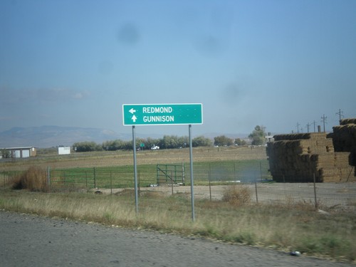
US-89 North at UT-256
US-89 north at UT-256 north to Redmond. Continue north on US-89 for Gunnison.
US-89 North Approaching UT-256
US-89 north approaching UT-256.
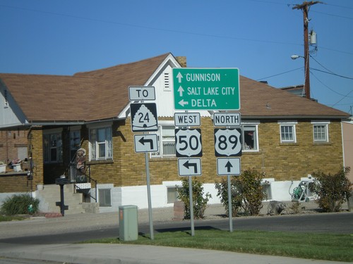
US-50 East at US-89
US-50 east at US-89 junction. Turn left on US-89 north for Gunnison and Salt Lake City. Turn right for US-89 South/US-50 East to Richfield.
End UT-24 at US-50.
End UT-24 at US-50 in Salina.
End UT-24 at US-50
End UT-24 at US-50 in Salina.
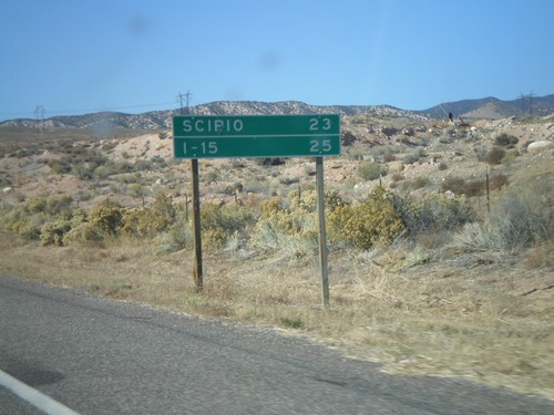
US-50 West - Distance Marker
Distance marker on US-50 west to Scipio and I-15.
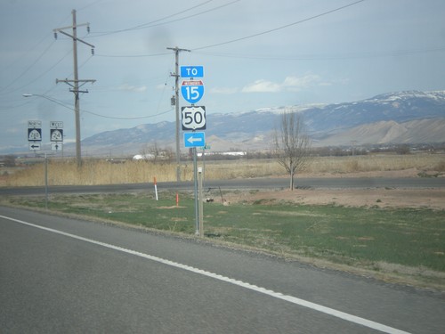
US-50 West at UT-260 South
US-50 west at UT-260 south.
US-50 West Approaching UT-260
US-50 west approaching UT-260 south to Richfield and Aurora. US-50 continues west to Scipio.
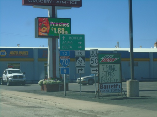
US-50 West at UT-24 East
UT-24 south on US-50 west.
US-89 North/US-50 Jct. - Salina
US-50 west/US-89 north split. Continue on US-89 for Gunnison and Salt Lake. Use US-50 west for UT-24 and Delta.
US-50 West/US-89 North - Entering Salina
US-50 west to US-89 north, just north of I-70.
I-70 West - Exit 56
I-70 west at Exit 56 - BL-70/US-50 West/US-89 North/Salina.
I-70 West Approaching Exit 56
I-70 west approaching Exit 56. Use Exit 56 for Delta, Salt Lake, and Reno(NV).
I-70 West - Exit 56
I-70 west approaching Exit 56 - BL-70/US-50 West/US-89 North/Salina. US-50 west exits I-70 here.
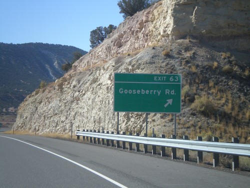
I-70 West - Exit 63
I-70 west at Exit 63 - Gooseberry Road
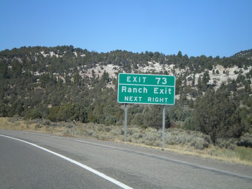
I-70 West - Exit 73
I-70 west approaching Exit 73 - Ranch Exit
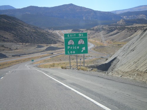
I-70 West - Exit 91
I-70 west at Exit 91 - UT-72/UT-10/Price/Loa.
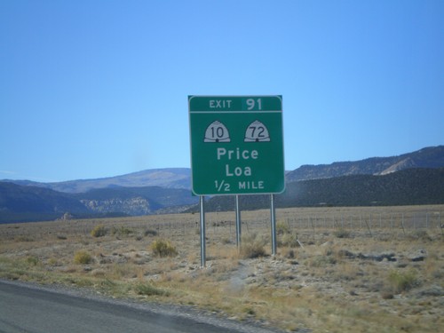
I-70 West - Exit 91
I-70 west approaching Exit 91 - UT-72/UT-10/Price/Loa.
US-50 West - Salina
US-50 west shield in Salina
US-50 West at UT-24 East
US-50 west at UT-24 junction near Aurora.
US-50 West at UT-24 East
UT-24/US-50 split near Aurora.
US-89 South - Salina
US-89 south in Salina at the US-50/US-89 intersection
US-89 South at US-50
US-89/US-50 junction To UT-24/To I-70 in Salina.
US-89 South at US-50
US-89/US-50 junction To I-70 in Salina
US-89 South To I-70
US-89 south at the northern entrance to Salina. Sign warning motorists that next services on I-70 east is 110 miles.
Sevier
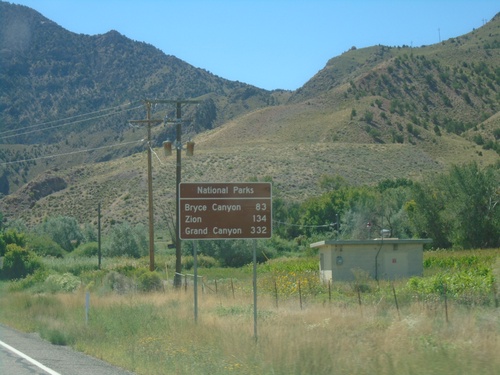
US-89 South - Distance Marker for National Parks
Distance Marker for National Parks on US-89 South. Distance to Bryce Canyon, Zion, and Grand Canyon (South Rim).
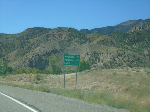
US-89 South - Distance Marker
Distance marker on US-89 south. Distance to Marysvale, Panguitch, and Kanab.
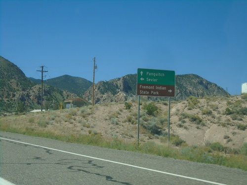
US-89 South - Sevier Highway
US-89 South at Sevier Highway junction. Use Sevier Highway west to Fremont Indian State Park; east to Sevier. Continue south on US-89 for Panguitch.
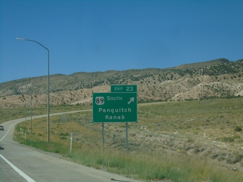
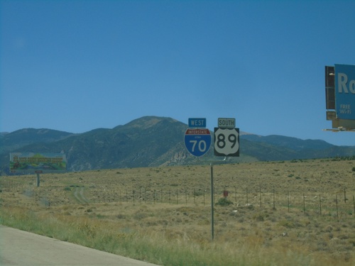
I-70 West - Exit 23
I-70 west at Exit 23 - US-89 South/Panguitch/Kanab. US-89 south leaves I-70 westbound here.
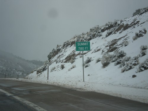
I-70 West - Summit
Summit Elevation 7180 Feet on I-70 west. This is the summit of the Pavant Range.
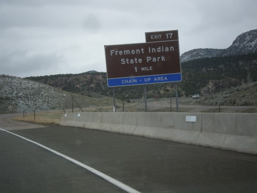
I-70 West - Exit 17
I-70 west approaching Exit 17 - Fremont Indian State Park.
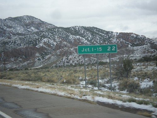
I-70 West - Distance Marker
Distance marker on I-70 west. Distance to Junction I-15.
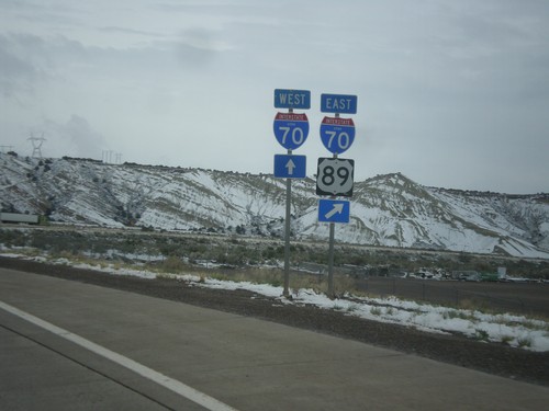
US-89 North at I-70
US-89 North at I-70. Merge right for I-70 East/US-89 north. Continue straight ahead for I-70 West. US-89 North joins I-70 East to Salina.
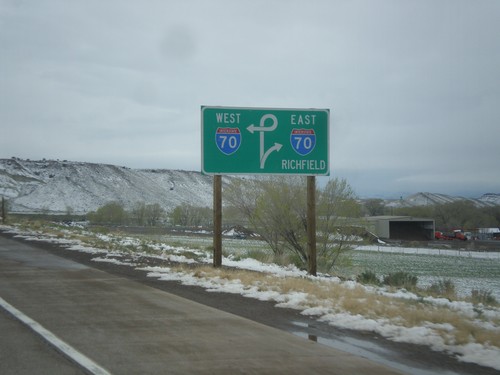
US-89 North Approaching I-70
US-89 North approaching I-70. Use I-70 east for Richfield.
US-89 North Approaching I-70
US-89 North approaching I-70 in Sevier County.
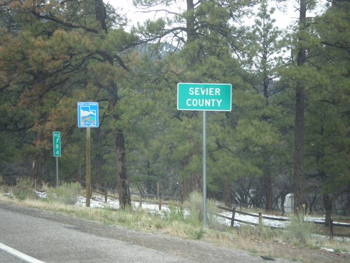
US-89 North - Sevier County
Entering Sevier County on US-89 north.
Sigurd
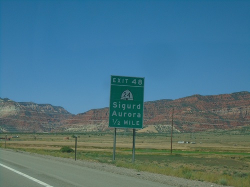
I-70 West - Exit 48
I-70 west approaching Exit 48 - UT-24/Sigurd/Aurora.
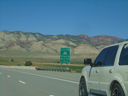
I-70 West - Exit 48
I-70 west approaching Exit 48 - UT-24/Sigurd/Aurora.
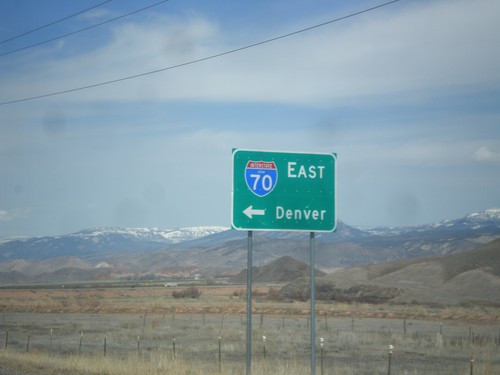
UT-24 West at I-70 (UT-259)
UT-24 west at I-70 east to Denver. There is a signed state highway, UT-259, that connects UT-24 to the I-70 ramps. This sign has been replaced in recent years to include the UTAH text in the I-70 shield.
UT-24 West at UT-259
UT-24 west at UT-259 junction. UT-259 is a short spur between UT-24 and I-70.
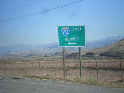
UT-24 West at I-70 (UT-259)
UT-24 west at I-70 east to Denver. There is a signed state highway, UT-259, that connects UT-24 to the I-70 ramps.
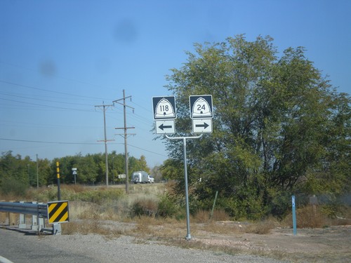
UT-24 West at UT-118
UT-24 west at UT-118. Turn right to continue west on UT-24.
UT-24 West Approaching UT-118
UT-24 west at UT-118. Turn right on UT-24 for Salina. Turn left on UT-118 for Richfield.
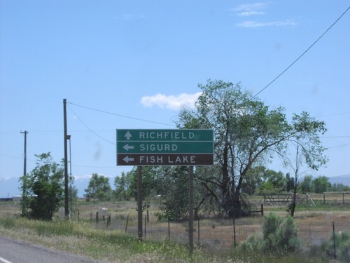
UT-24 East - Distance Marker
Distance to Sigurd and Richfield on UT-24 east, near Sigurd.
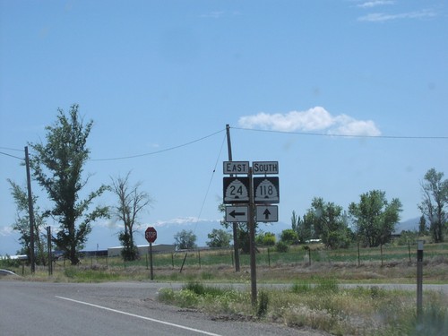
UT-24 East at UT-118
UT-24/UT-118 junction to Richfield and Sigurd. UT-118 follows the old route of US-89 through the Seiver Valley. US-89 now is cosigned with I-70.
UT-24 East at UT-118
UT-24/UT-118 junction near Sigurd.
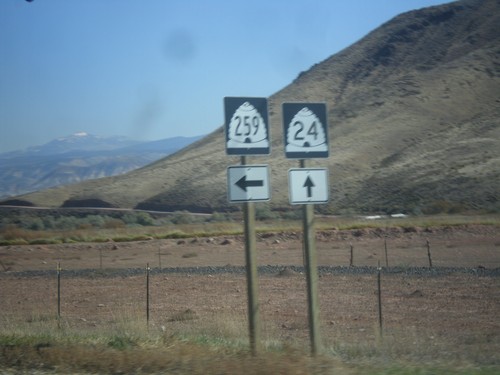
UT-24 East at UT-259 (To I-70)
US-24 east at UT-259 junction near Sigurd. UT-259 is a short spur which connects I-70 at Exit 59 to UT-24
UT-24 East at UT-259 to I-70
UT-24 east at UT-259 junction to I-70/US-89 near Sigurd.