Preston, Idaho
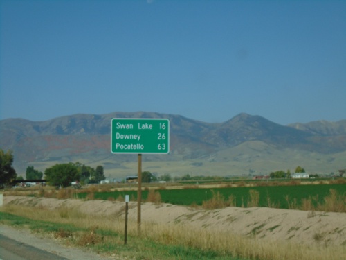
US-91 North - Distance Marker
Distance marker on US-91 north. Distance to Swan Lake, Downey, and Pocatello.
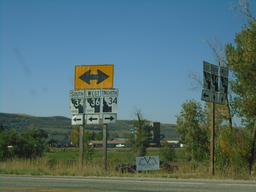
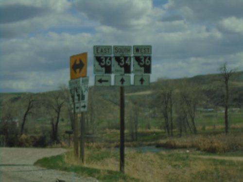
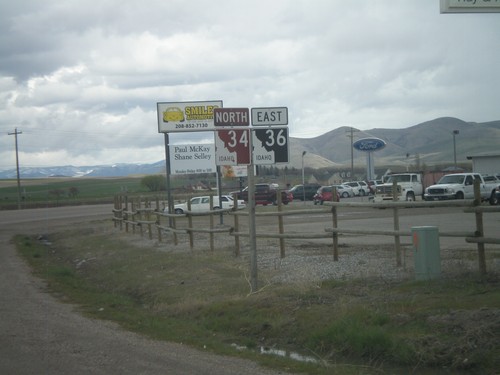
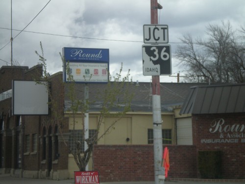
ID-36 West at ID-34 - Franklin County
ID-36 West at ID-34 in Franklin County. Turn right for ID-34 North; turn left for ID-34 South/ID-36 West. Notice the the old and new varieties of Idaho state highway markers (ID-34 North - New, ID-34 South/ID-36 West - Old).
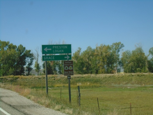
ID-36 West at ID-34 - Franklin County
ID-36 West at ID-34 in Franklin County. Use ID-34 North to Grace; ID-34 South/ID-36 West to Preston and Logan (Utah).
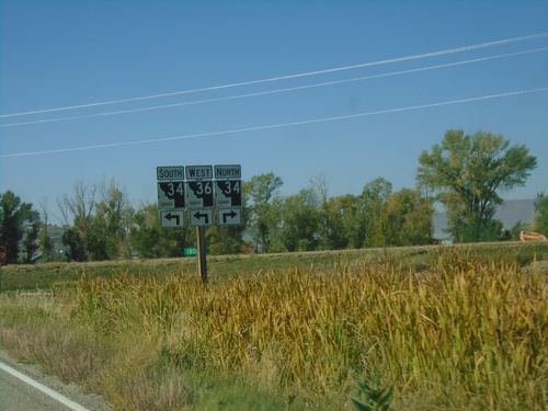
ID-36 West Approaching ID-34
ID-36 West approaching ID-34 in Franklin County. ID-36 West joins ID-34 south to Preston.
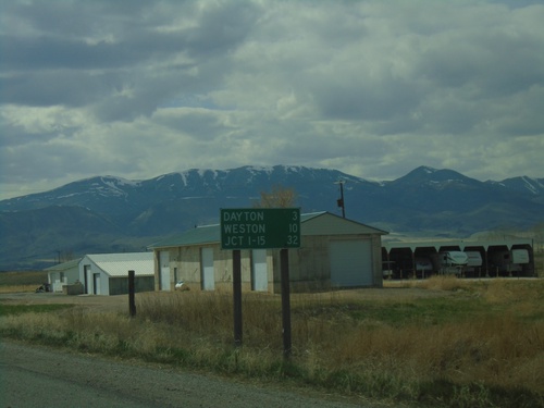
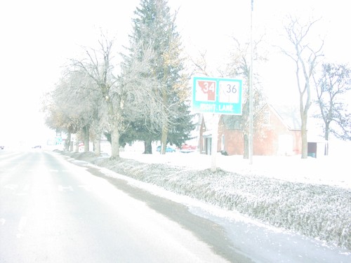
ID-36 West - Distance Marker
Distance marker on ID-36 west. Distance to Dayton, Weston, and Jct. I-15.
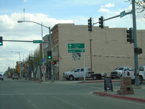
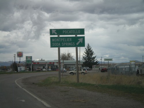
US-91 South/ID-36 West at US-91/ID-36 Split
US-91 South/ID-36 West (State St.) at US-91/ID-36 (Oneida St.) Split in Preston. Turn right on ID-36 West to Dayton; continue south on US-91 for Franklin and Logan (Utah).
US-91 South/ID-36 West Approaching ID-36 West
US-91 South/ID-36 West (State St.) approaching ID-36 West (Oneida St.)
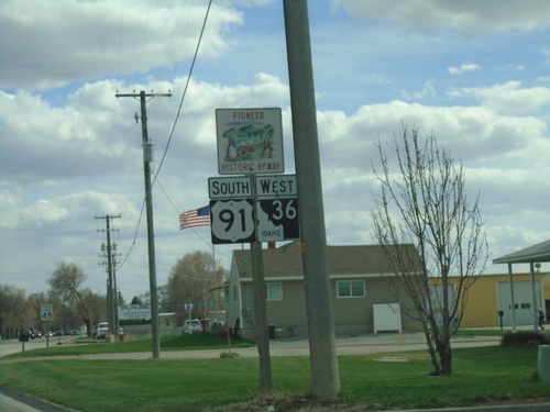
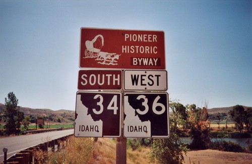
US-91 South/ID-36 West - Pioneer Historic Byway
US-91 South/ID-36 West - Pioneer Historic Byway
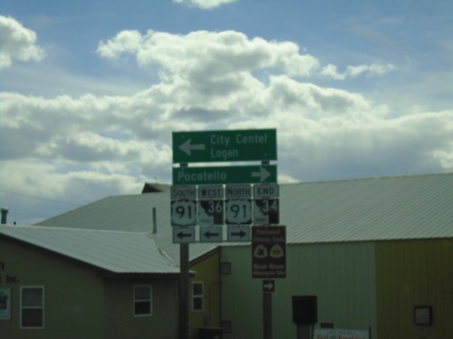
End ID-34 South at ID-36/US-91 - Preston
End ID-34 South at ID-36/US-91 in Preston. Turn right for US-91 north to Pocatello; left for US-91 South/ID-34 West to (Preston) City Center/Logan (Utah).
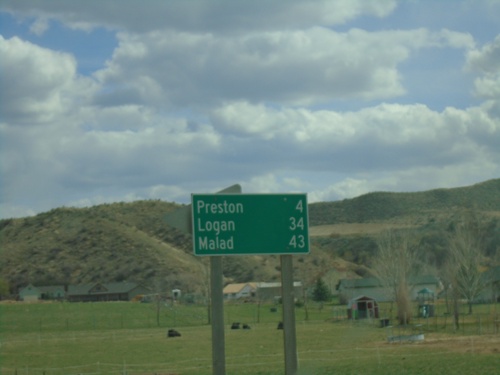
ID-34 South/ID-36 East - Distance Marker
Distance marker on ID-34 South/ID-36 East. Distance to Preston, Logan (Utah - via US-91), and Malad (via ID-36).
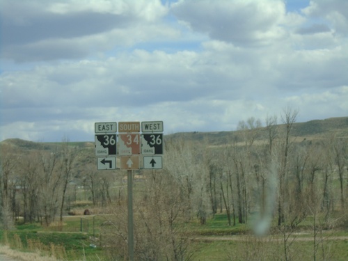
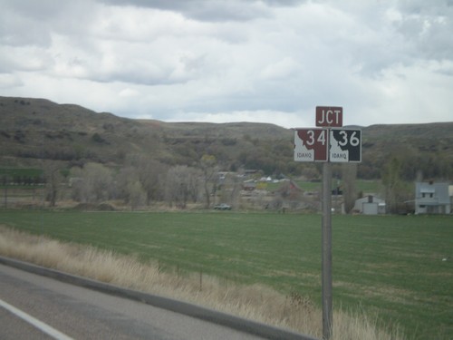
ID-34 South at ID-36
ID-34 South at ID-36 in Franklin County. Turn left for ID-36 East; continue straight for ID-34 South/ID-36 West.
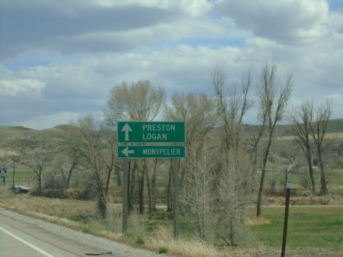
ID-34 South at ID-36
ID-34 South at ID-36 East to Montpelier. Continue south on ID-34 South/ID-36 West to Preston and Logan (Utah).
ID-34 South Approaching ID-36
ID-34 South approaching ID-36 in Franklin County. ID-34 south joins ID-36 west to Preston.
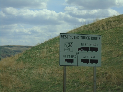
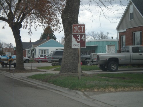
ID-34 South - ID-36 East Truck Information
ID-34 south approaching ID-36. Truck information for ID-36 east traffic.
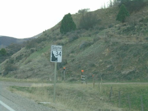
ID-34 South - Franklin County
ID-34 south in Franklin County
ID-34/ID-36 East at Split
ID-34/ID-36 east at ID-34/ID-36 split. ID-34 is signed as the Pioneer Historic Byway.
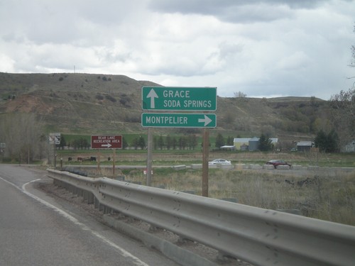
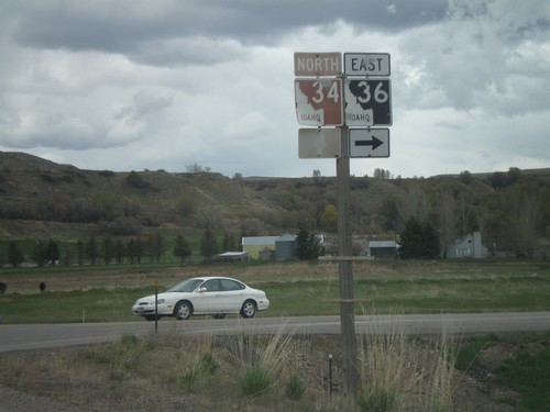
ID-34/ID-36 East Approaching Split
ID-34/ID-36 east approaching ID-34/ID-36 split. Use ID-36 east for Montpelier. Continue on ID-34 east for Grace and Soda Springs.
ID-34/ID-36 East Approaching Split
ID-34/ID-36 east approaching ID-34/ID-36 split. ID-34 is signed as the Pioneer Historic Byway.
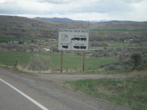
ID-34/ID-36 East - Restricted Truck Route on ID-36
Restricted Truck Route on ID-36 on ID-34/ID-36 east.
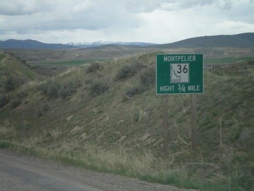
ID-34/ID-36 East Approaching ID-36
ID-34/ID-36 east approaching ID-36 east to Montpelier.
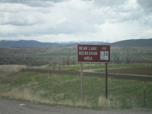
ID-34 North/ID-36 East - Bear Lake Rec. Area
ID-34 North/ID-36 East approaching ID-36. Use ID-36 East for the Bear Lake Recreation Area.
ID-34 North/ID-36 East
ID-34 North/ID-36 east in Preston. ID-34 is signed as the Pioneer Historic Byway.
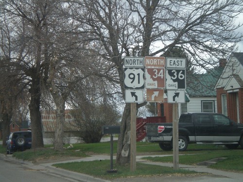
US-91 North/ID-36 East at ID-34/ID-36
US-91 north/ID-36 east at ID-34/ID-36. ID-36 leaves US-91 here, as well as the Pioneer Historic Byway.
US-91 North/ID-36 East at ID-34/ID-36
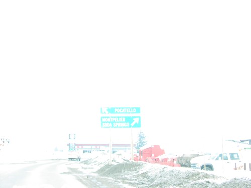
US-91 north/ID-36 east at ID-34/ID-36. Use US-91 north for Pocatello. Use ID-34 North/ID-36 east for Soda Springs and Montepelier.
US-91 North/ID-36 East Approaching ID-34/ID-36
US-91 North/ID-36 east approaching ID-34/ID-36 jct. This is the beginning of ID-34 north. The Pioneer Historic Byway leaves US-91 and joins ID-34 north.
US-91 North/ID-36 East Approaching ID-34
US-91 North/ID-36 East approaching ID-34 north. Use left lanes to continue on US-91 north.
US-91 North/ID-36 East Approaching ID-34
US-91 North/ID-36 East approaching ID-34. The Pioneer Historic Byway leaves US-91 here and continues along ID-34.
US-91 North/ID-36 East - ID-34 Jct.
US-91 north/ID-36 east approaching ID-34
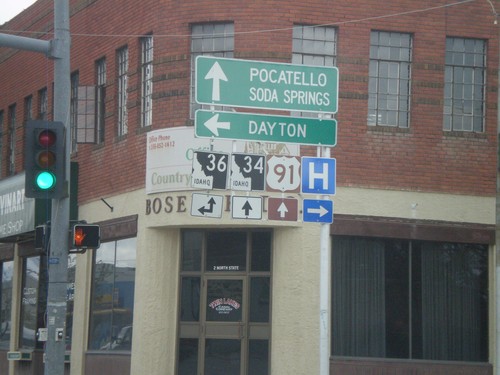
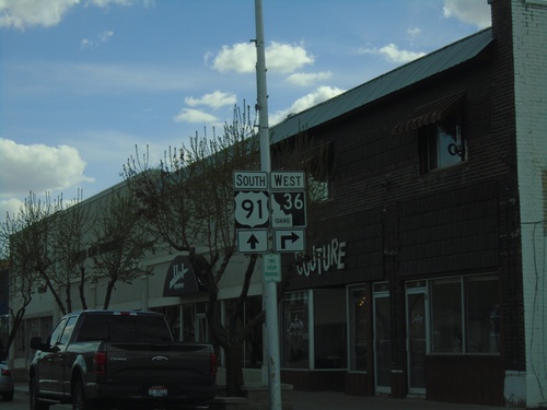
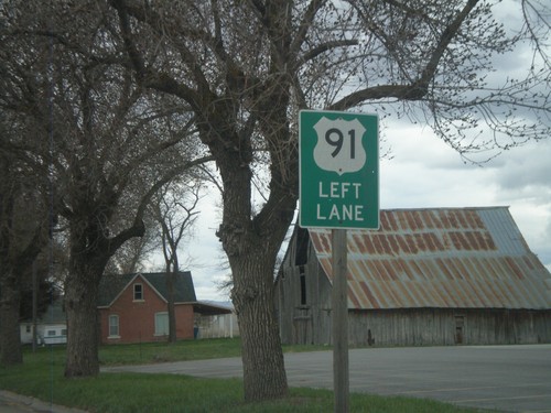
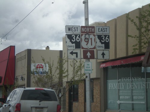
US-91 North at ID-36
US-91 north at ID-36 west. Use ID-36 west for Dayton. ID-36 east joins US-91 north through Preston. Continue on US-91 North/ID-36 east for Pocatello, Soda Springs, and ID-34 junction.
US-91 North Approaching ID-36
US-91 north approaching ID-36
US-91 North Approaching ID-36
US-91 north approaching ID-36
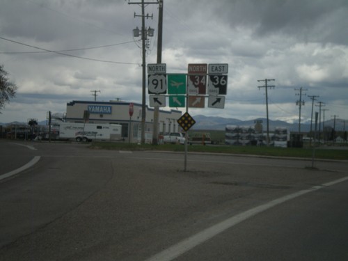
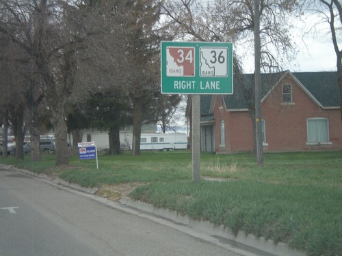
US-91 North at ID-34/ID-36
ID-34/ID-36 Right Lane Sign Approaching US-91/ID-36/ID-34 Junction, on US-91/ID-
US-91/ID-36 North at ID-34/ID-36
ID-34/ID-36/US-91 Junction to Pocatello, Soda Springs and Montpelier on US-91 N
US-91/ID-36 North at ID-34/ID-36
US-91/ID-36/ID-34 Junction on US-91 North
ID-36 West/ID-34 South - Pioneer Historic Byway
Pioneer Historic Byway/ID-34/ID-36 on ID-36 West at the Bear River.