Ely, Nevada
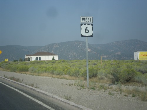
End NV-893 South at US-6/US-50
End NV-893 South at US-6/US-50 in White Pine County. Use US-6/US-50 East to Baker; US-6/US-50 West to Ely.
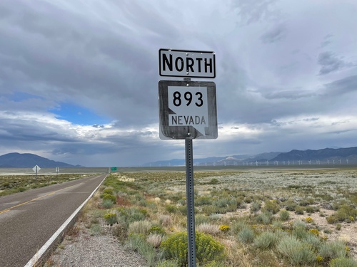
NV-893 North - White Pine County
A very weathered NV-893 shield in White Pine County.
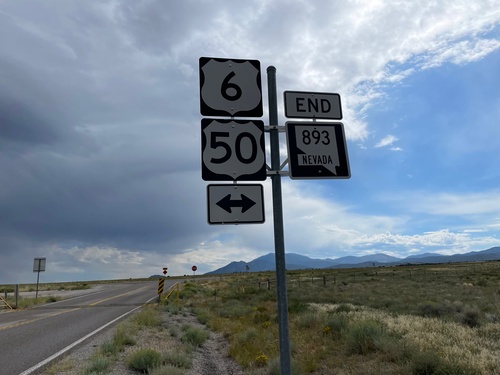
End NV-893 South at US-6/US-50
End NV-893 South at US-6/US-50 in White Pine County.
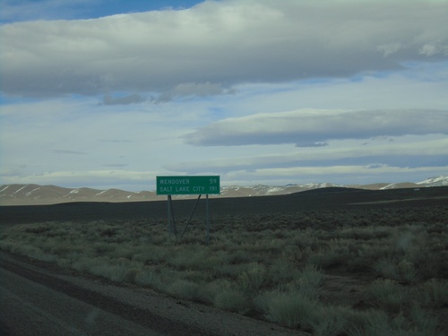
Alt. US-93 North - Distance Marker
Distance Marker on Alt. US-93 North. Distance to Wendover and Salt Lake City (Utah).
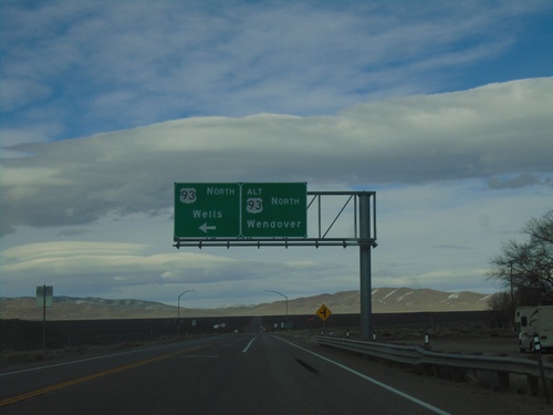
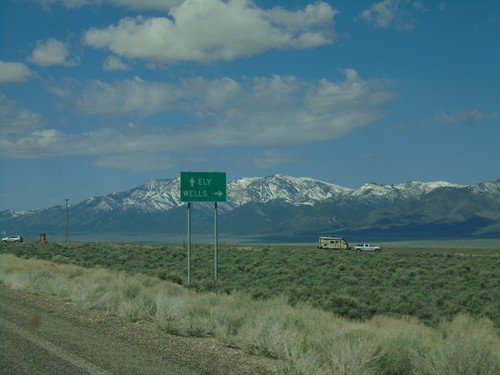
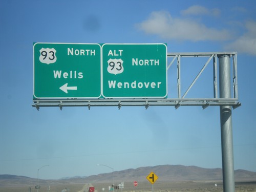
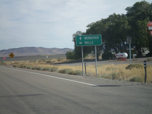
US-93 North at US-93 Alt. North
US-93 North at US-93 Alt. North. Continue straight for US-93 Alt. north to Wendover; turn left for US-93 north to Wells.
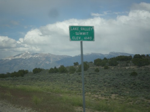
US-93 South - Lake Valley Summit
Lake Valley Summit - Elevation 6,140 Feet on US-93 south.
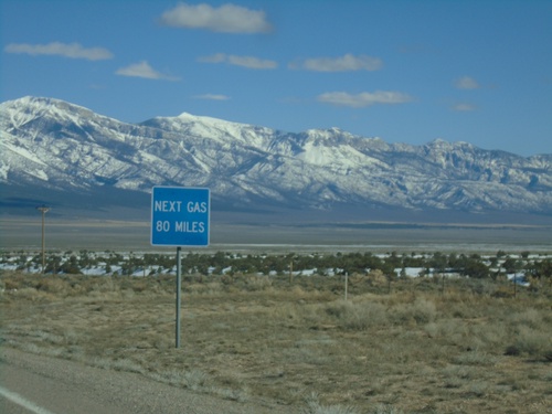
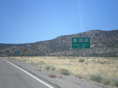
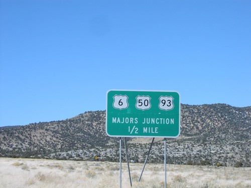
US-93 South - Next Gas 80 Miles
US-93 South - Next Gas 80 Miles in Pioche. Taken at Majors Junction.
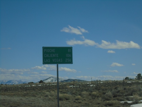
US-93 South - Distance Marker
Distance marker on US-93 south. Distance to Pioche, Caliente, and Las Vegas.
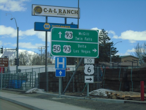
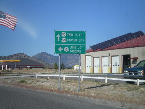
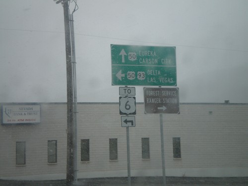
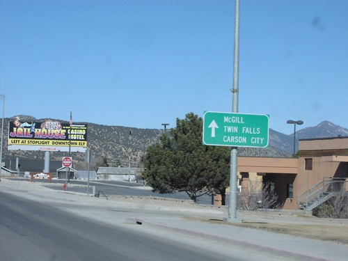
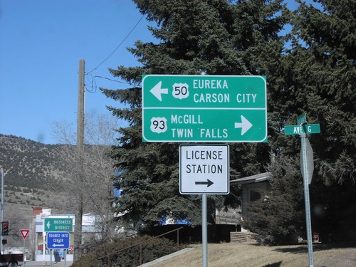
US-50 East at US-93
US-50 east at US-93. Continue ahead for US-93 north to McGill and Twin Falls (Idaho). Turn right for US-93 and US-50 for Delta (Utah, Las Vegas and US-6. US-50 joins US-93 south to Majors Junction.
US-50 East - Ely
Entering Ely on US-50 East. Ely is the county seat of White Pine County.
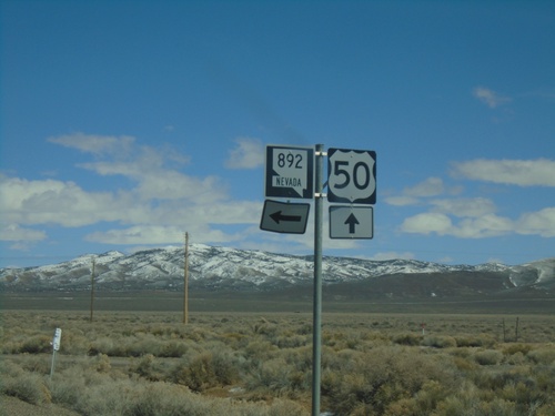
US-50 East at NV-892
US-50 East at NV-892 Junction in White Pine County.
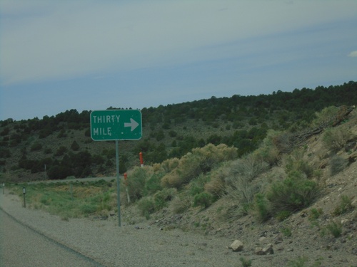
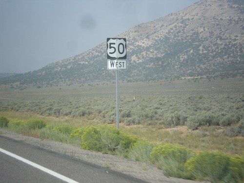
US-50 West - Thirty Mile Jct.
Thirty Mile Jct. on US-50 west in White Pine County.
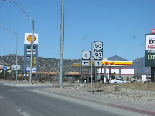
US-6 West at US-93/US-50
US-6 West at US-93/US-50. Use US-6/US-50 East/US-93 South for Pioche and Delta (Utah); use US-50 West/US-93 North for Ely, Carson City, and Twin Falls (Idaho).
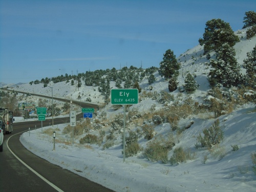
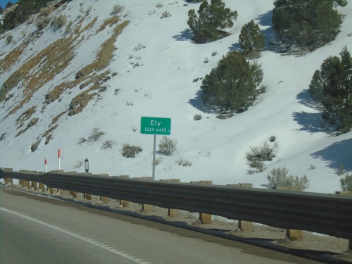
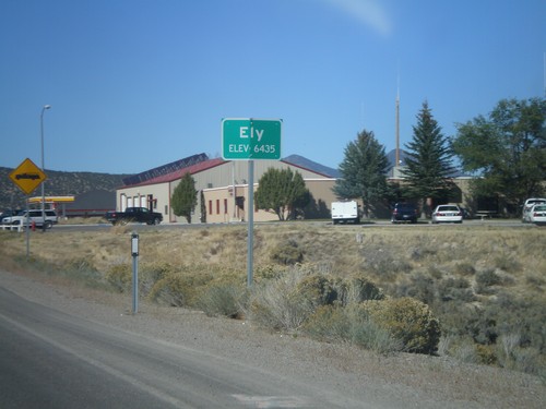
US-6 East - Ely
Entering Ely on US-6 west. Elevation 6435 Feet. Ely is the county seat of White Pine County. A US-6 postmile is in the background of the photo.
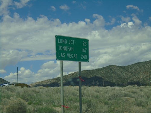
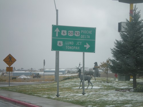
US-6 West - Distance Marker
Distance marker on US-6 west. Distance to Lund Jct., Tonopah, and Las Vegas (via NV-318).
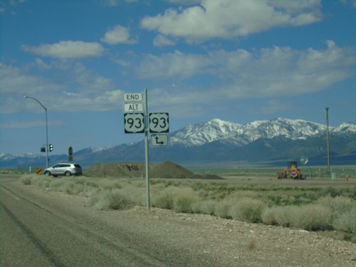
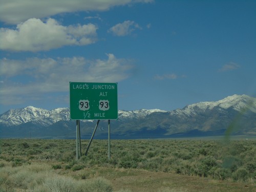
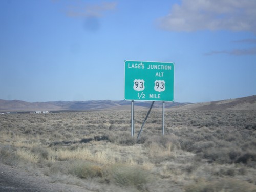
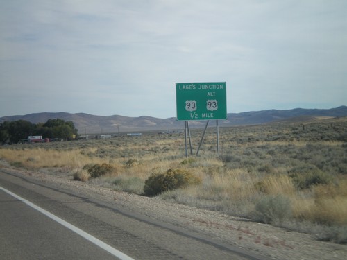
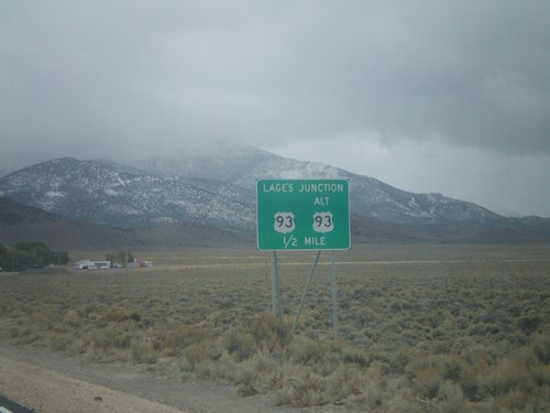
End Alt. US-93 South at US-93 - Lages Junction
End Alt. US-93 South at US-93 at Lages Junction.
End Alt. US-95 South at US-93
End Alt. US-95 South at US-93 at Lages Station. Turn right for US-93 north to Wells; straight for US-93 south to Ely.
Alt. US-93 South Approaching US-93
Alt. US-93 South approaching US-93 - Lages Junction.
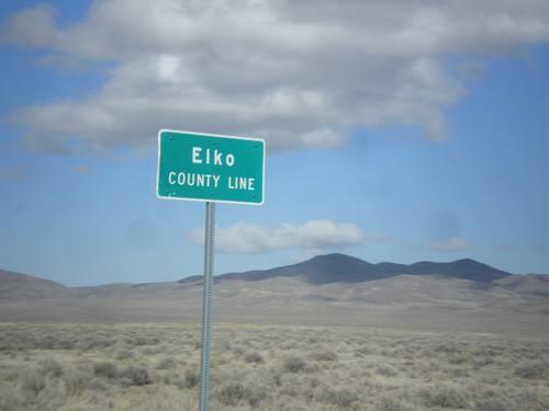
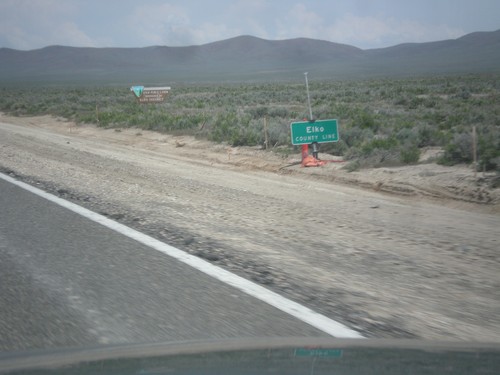
US-93 North - Elko County
Entering Elko County on US-93 north. Elko County is the fourth largest county by area in the lower 48 states.
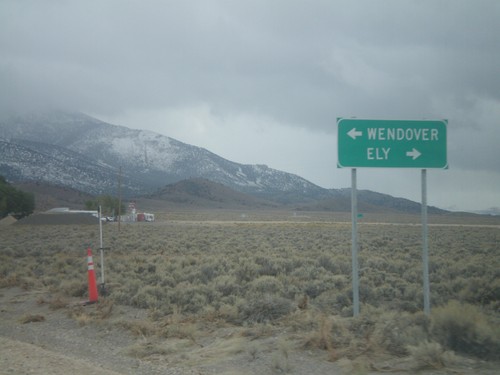
US-93 North at US-93 Alt. North
US-93 North at US-93 Alt. North. Continue straight for US-93 Alt. north to Wendover; turn left for US-93 north to Wells.
US-93 North Approaching Lages Junction
US-93 North approaching Lages Junction - US-93/Alt. US-93 Jct.
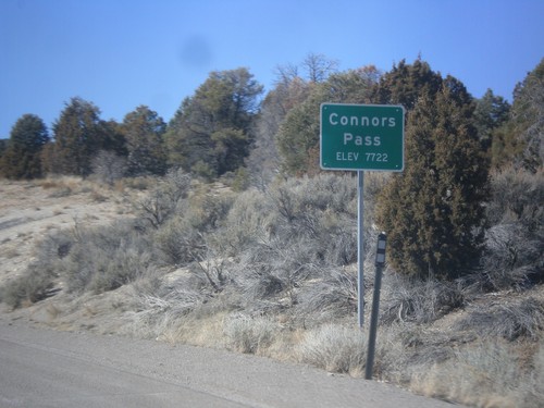
US-6/US-50 West/US-93 North - Connors Pass
US-6/US-50 West/US-93 North at Connors Pass - Elevation 7722 Feet. Connors Pass is a summit in the Schell Creek Range.
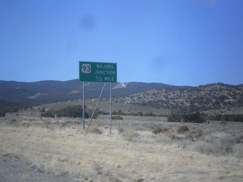
US-6/US-50 West Approaching US-93
US-6/US-50 West approaching US-93 - Majors Junction.
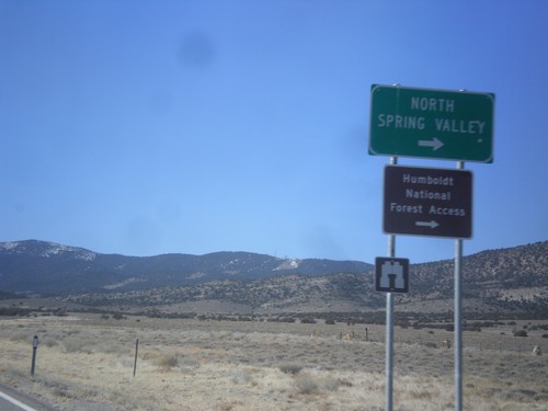
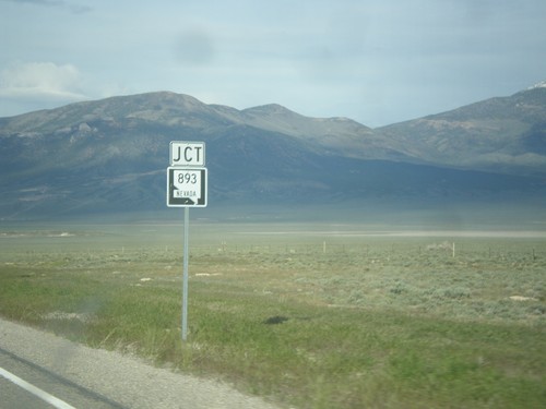
US-6/US-50 West Approaching NV-893
US-6/US-50 West approaching NV-893 to North Spring Valley and Humboldt National Forest access.
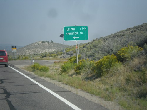
US-50 West - Illipah and Hamilton Jct.
US-50 West at Illipah and Hamilton Jct.
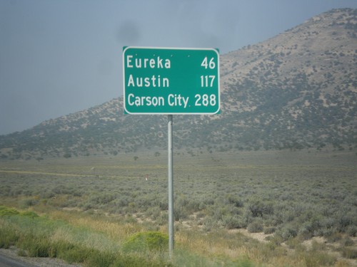
US-50 West - Distance Marker
Distance marker on US-50 west. Distance to Eureka, Austin, and Carson City.
US-50 West - White Pine County
US-50 west in White Pine County.
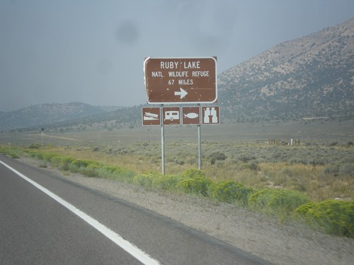
US-50 West - Ruby Lake NWR Jct.
US-50 west at junction to Ruby Lake National Wildlife Refuge in White Pine County.
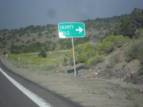
US-50 West - Thirty Mile Jct.
Thirty Mile Jct. on US-50 west in White Pine County.
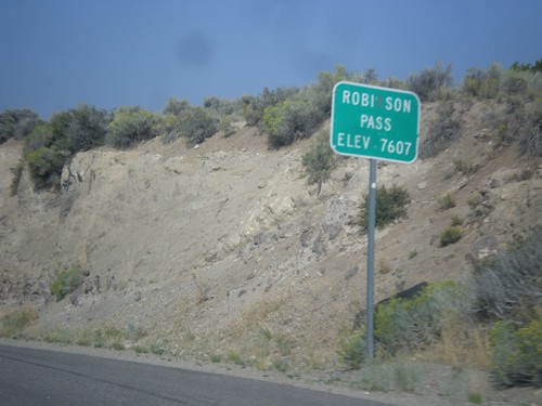
US-50 West - Robinson Summit
US-50 west at Robinson Pass - Elevation 7,607 Feet. Robinson Pass is in the Egan Range.
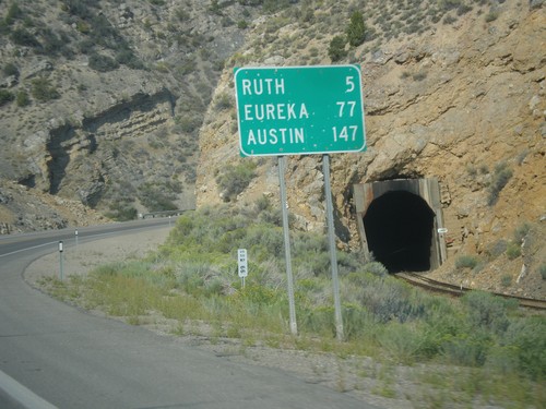
US-50 West - Distance Marker
Distance marker on US-50 west. Distance to Ruth, Eureka, and Austin.
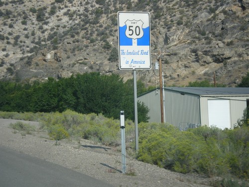
US-50 West - The Loneliest Road In America
The Loneliest Road in America on US-50 west. Taken at the west edge of Ely.
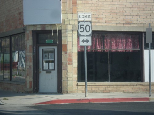
Mill St. at Clark St. (Bus. US-50)
Mill St. south at Clark St. in downtown Ely. Clark St. is one block south of the main route of US-50 and is signed as Bus. US-50. In this picture Bus. US-50 is shown as going in both directions, but Clark St. is one way eastbound.
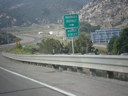
US-6 West - Murry St.
US-6 west approaching Murry St. into the Ely Business District. Murry St. used to be the former route of US-6 into Ely.
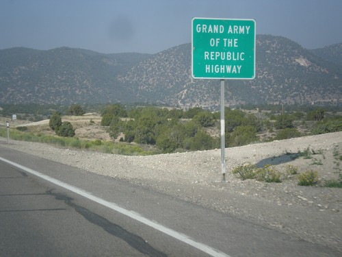
US-6 West - Grand Army of the Republic Highway
US-6 west - Grand Army of the Republic Highway.
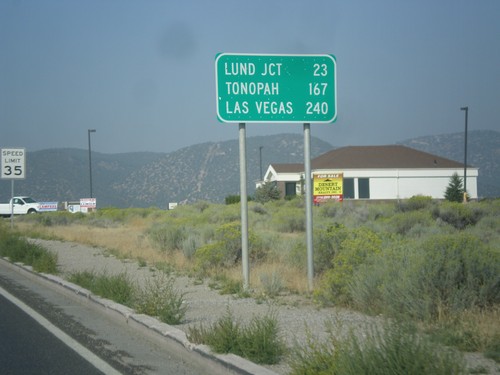
US-6 West - Distance Marker
Distance marker on US-6 west. Distance to Lund Jct., Tonopah, and Las Vegas (via NV-318).
US-6 West - Ely
US-6 west in Ely.
US-93 North - Elko County
Entering Elko County on US-93 north. Elko County is the fourth largest county by area in the lower 48 states.
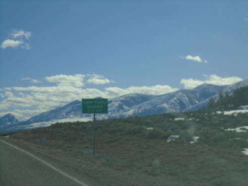
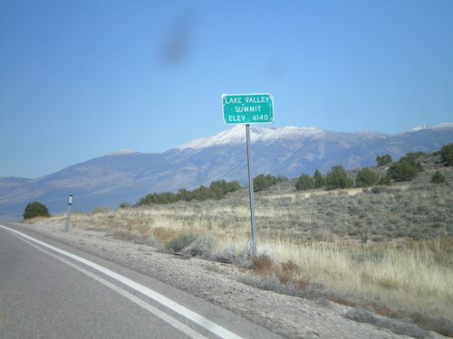
US-93 North - Lake Valley Summit
Lake Valley Summit - Elevation 6,140 Feet on US-93 north. Wheeler Peak is the mountain in the background. Wheeler Peak is the second highest mountain in Nevada and is located in Great Basin National Park.
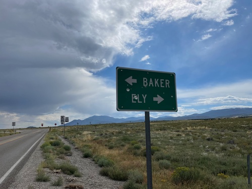
US-6/US-50 East Approaching NV-893
US-6/US-50 East approaching NV-893 in rural White Pine County, Nevada.
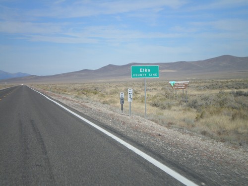
US-93 North - Elko County
Entering Elko County on US-93 north. Elko County is the fourth largest county by area in the lower 48 states.
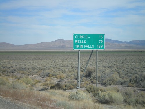
US-93 North - Distance Marker
Distance marker on US-93 north to Currie, Wells, and Twin Falls (Idaho). Taken just north of US-93/Alt. US-93 split.
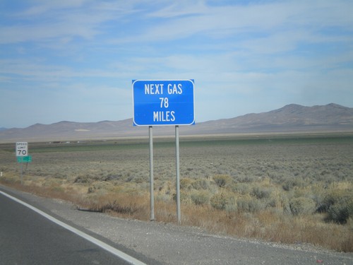
US-93 North - Next Gas 78 Miles
Next Gas 78 Miles on US-93 north. Taken just north of the Alt. US-93/US-93 intersection. Wells is the next city with gas.
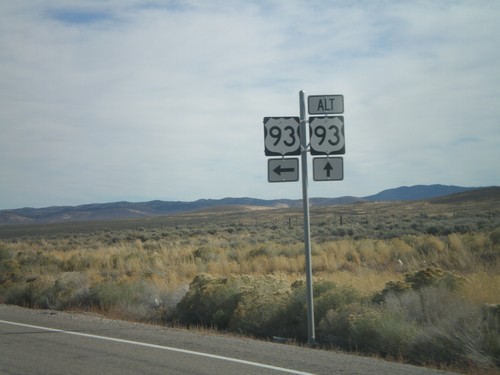
US-93 North at Alt. US-93
US-93 North at Alt. US-93 in White Pine County.
US-93 North at US-93 Alt. North
US-93 North at US-93 Alt. North. Continue straight for US-93 Alt. north to Wendover; turn left for US-93 north to Wells.
US-93 North Approaching Lages Junction
US-93 North approaching Lages Junction - US-93/Alt. US-93 Jct.
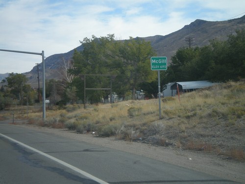
US-93 North - Mc Gill
Entering Mc Gill - Elevation 6193 Feet, on US-93 north.
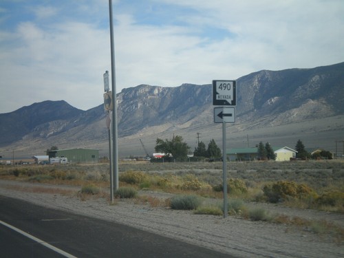
US-93 North at NV-490
US-93 north at NV-490 to Ely State Prison.
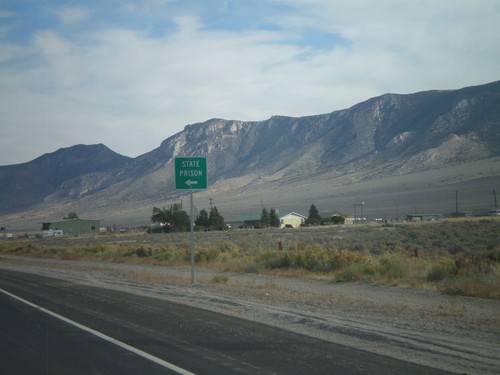
US-93 North Approaching NV-490
US-93 North Approaching NV-490 to State Prison (Ely State Prison).
US-50 East at US-93
US-50 east at US-93. Continue ahead for US-93 north to McGill and Twin Falls (Idaho). Turn right for US-93 and US-50 for Delta (Utah) and Las Vegas. US-50 joins US-93 south over Sacramento Pass.
US-50 East at US-93
US-50 east at US-93. US-50 joins US-93 through Ely to Majors Junction. Use US-93 South/US-50 East for US-6.
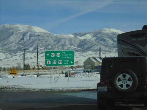
US-93 North/US-6 West/US-50 West at US-6
US-93 North/US-6 West/US-50 West at US-6 West junction. Use US-6 west for Lund Jct. and Tonopah. Use US-93 North/US-50 West for Twin Falls (Idaho via US-93) and Carson City (via US-50).
US-93 North - Entering Ely
Entering Ely - Elevation 6435 on US-93 North. Ely is the county seat of White Pine County.
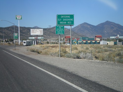
US-93 North - Entering Ely Shoshone Indian Reservation
US-93 North - Entering Ely Shoshone Indian Reservation. The Ely Shoshone Indian Reservation is a small reservation on the outskirts of Ely.
US-93 North Approaching Majors Jct.
US-93 North Approaching Majors Jct with US-50 and US-6.
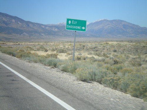
US-93 North at NV-894
US-93 north at NV-894 east to Shoshone.
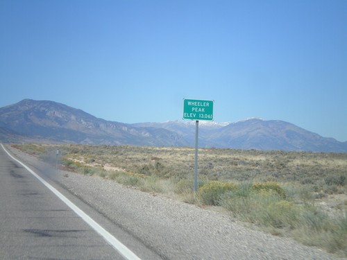
US-93 North - Wheeler Peak
US-93 North at Wheeler Peak sign - Elevation 13,061. Wheeler Peak is the snow covered mountain behind the sign. Wheeler Peak is within Great Basin National Park, and is the second highest mountain in Nevada.
US-93 North - Lake Valley Summit
Lake Valley Summit - Elevation 6,140 Feet on US-93 north. Wheeler Peak is the snow covered mountain in the background.
US-93 (Cutout) South of Majors Jct.
US-93 South cutout shield at Majors Junction.
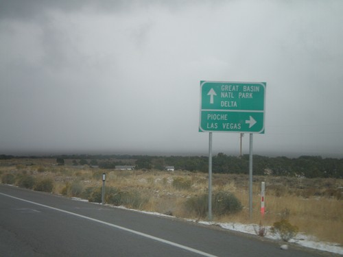
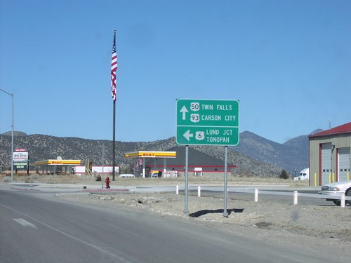
US-50 East/US-6 East/US-93 South at Majors Jct.
US-6 East/US-50 East/US-93 South at Majors Jct. Turn right for US-93 south to Pioche and Las Vegas. Continue straight on US-6/US-50 east for Great Basin National Park and Delta.
US-93 South/US-50 East at US-6
US-93 South/US-50 East at US-6 junction. US-6 combines with US-93 South to Majors Place; US-6 joins US-50 east to Delta, Utah. Turn right on US-6 west for Lund Junction and Tonopah. Continue straight on US-6/US-50 East/US-93 south for Pioche and Delta (Utah).
US-93 South at US-50 - Ely
US-93 south at US-50 in Ely. US-50 joins US-93 south to Majors Place. Continue straight for US-50 west to Eureka and Carson City. Turn left for US-93 South/US-50 East to Delta (Utah), Las Vegas, and US-6.
US-93 North - Distance Marker
Distance marker on US-93 north. Distance to Currie, Wells, and Twin Falls (Idaho).
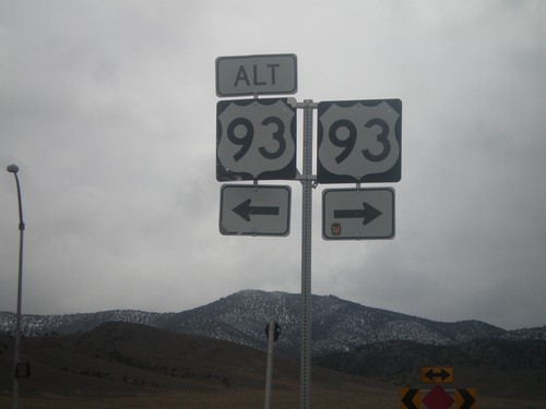
US-93 South At US-93 Alt. (Lages Jct)
US-93 south at Alt. US-93 at Lages Junction. Turn right to continue south on US-93; left for Alt. US-93 North.
US-93 South Approaching US-93 Alt. (Lages Jct)
US-93 south at Alt. US-93 north. Use US-93 south for Ely; Alt. US-93 North to Wendover.
US-93 South Approaching US-93 Alt. (Lages Jct)
US-93 south approaching Alt. US-93 at Lages Junction.
US-93 North Nearing Majors Jct.
US-93 North, US-93/US-6/US-50/Majors Junction, 1/2 Mile
US-93 North/US-50 West
US-93 North/US-50 West to Carson City, Twin Falls, and McGill. Taken immediatley north of US-6 west junction
US-93 North/US-50 West at US-50 West
US-93 North/US-50 West at US-50 West to Carson City/Eureka, and US-93 North to McGill/Twin Falls
US-93 North/US-50 West at US-6 West
US-93 North/US-50 West at US-6 west
US-93 North/US-50 West/US-6 West at US-6
US-93/US-6/US-50 North/West at US-6 West to Lund Junction and Tonopah