Eureka, Nevada
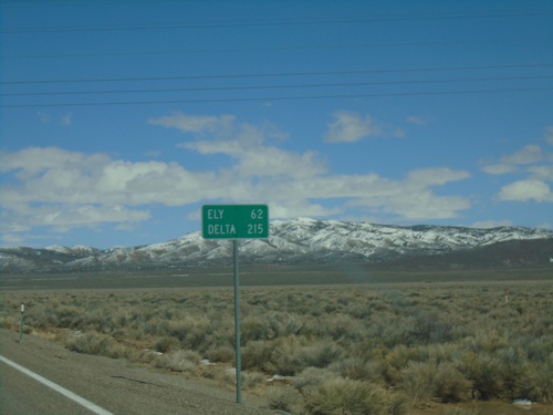
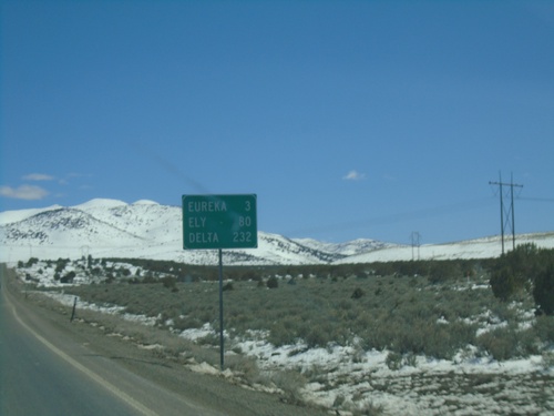
US-50 East - Distance Marker
Distance marker on US-50 east. Distance to Ely and Delta (Utah).
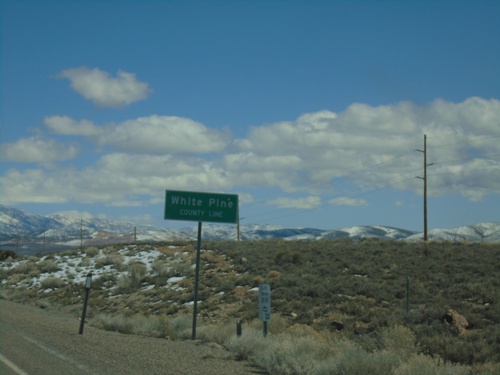
US-50 East - White Pine County Line
White Pine County Line on US-50 east.
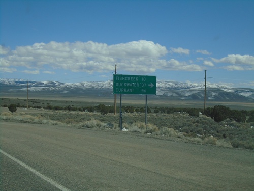
US-50 East - Duckwater Jct.
US-50 East at junction to Fishcreek, Duckwater, and Currant.
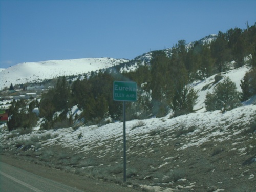
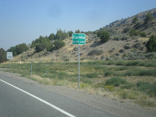
US-50 East - Eureka
Entering Eureka on US-50 East - Elevation 6481 Feet. Eureka is the county seat of Eureka County the second smallest county in Nevada.
US-50 East - Distance Marker
Distance marker on US-50 East. Distance to Eureka, Ely, and Delta (Utah).
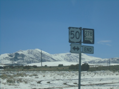
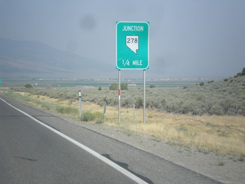
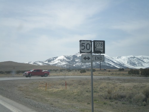
End NV-278 South at US-50
End NV-278 South at US-50 in Eureka.
End NV-278 South at US-50
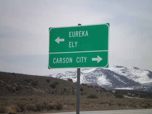
End NV-278 south at US-50. Use US-50 west for Carson City. Use US-50 east for Eureka and Ely.
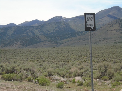
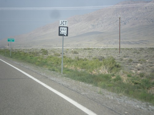
Begin NV-892 South - White Pine County
Begin NV-892 South in White Pine County
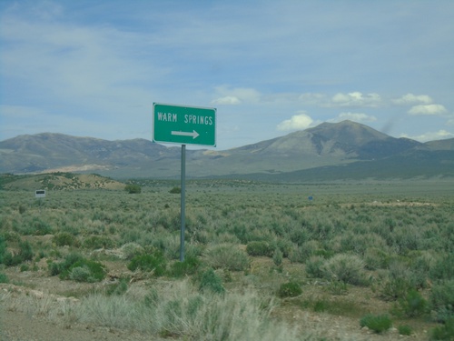
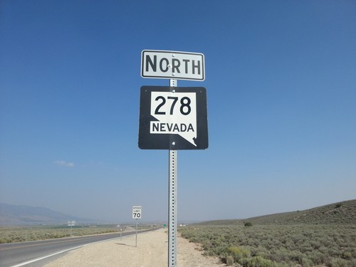
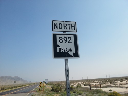
NV-892 North at Warm Springs Jct
NV-892 North at Warm Springs Jct
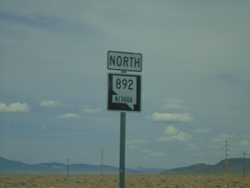
NV-892 North - White Pine County
NV-892 north in White Pine County. NV-892 connects US-50 with the ranches in the Newark Valley.
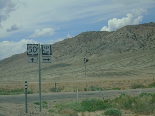
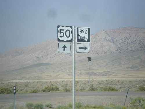
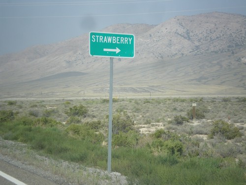
US-50 West at NV-892 North
US-50 West at NV-892 North to Strawberry.
US-50 West Approaching NV-892
US-50 West approaching NV-892 junction in White Pine County.
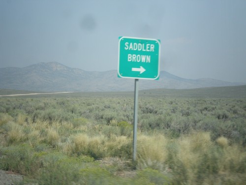
NV-278 North at Saddler Brown Road
NV-278 North at Saddler Brown Road.
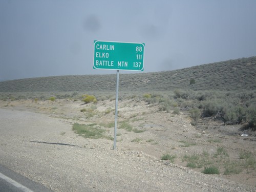
NV-278 North - Distance Marker
Distance marker on NV-278 north. Distance to Carlin, Elko, and Battle Mountain.
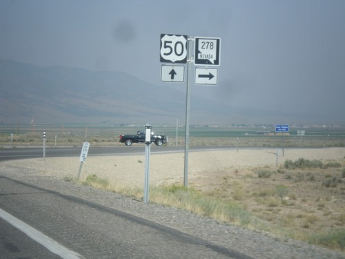
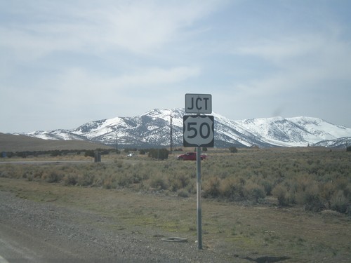
US-50 West at NV-278 North
US-50 west at NV-278 north. NV-278 connects US-50 north to I-80.
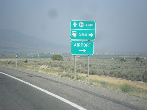
US-50 West at NV-278
US-50 west at NV-278 north to Carlin and (Eureka County) Airport. Continue west on US-50 for Austin.
US-50 West Approaching NV-278
US-50 west approaching NV-278 junction.
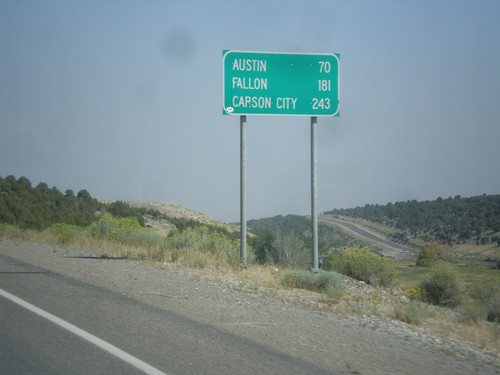
US-50 West - Distance Marker
Distance marker on US-50 west. Distance to Austin, Fallon, and Carson City.
US-50 West - Eureka
Entering Eureka on US-50 west. Eureka is the county seat of Eureka County, Nevada.
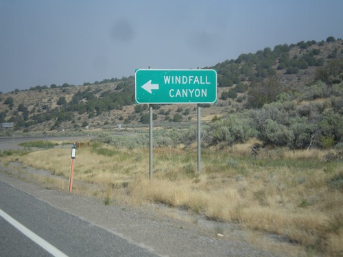
US-50 West - Windfall Canyon Jct.
US-50 west at junction to Windfall Canyon.
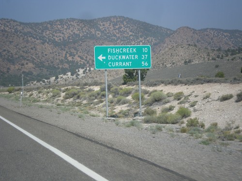
US-50 West - Duckwater Jct.
US-50 west at junction to Fishcreek, Duckwater, and Currant.
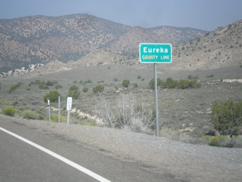
US-50 West - Eureka County Line
Eureka County Line on US-50 west.
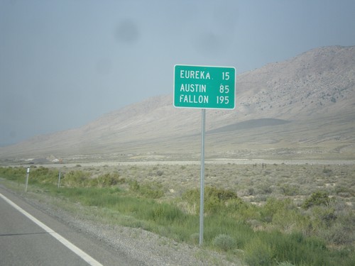
US-50 West - Distance Marker
Distance marker on US-50 west. Distance to Eureka, Austin, and Fallon.
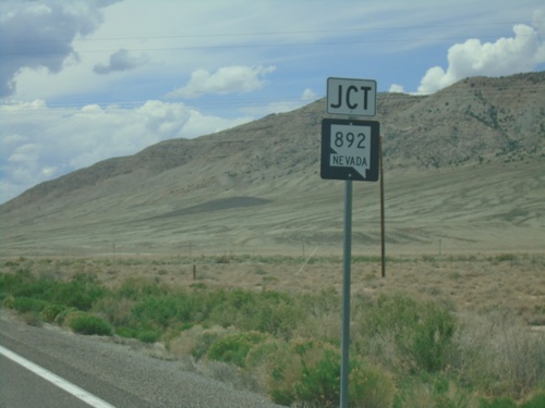
US-50 West at NV-892 North
US-50 West at NV-892 North to Strawberry.
US-50 West Approaching NV-892
US-50 west approaching NV-892 north to Strawberry.
US-50 West Approaching NV-892
US-50 West approaching NV-892 junction in White Pine County.
NV-278 North
NV-278 north in Eureka County. NV-278 connects US-50 near Eureka with I-80 at Carlin.
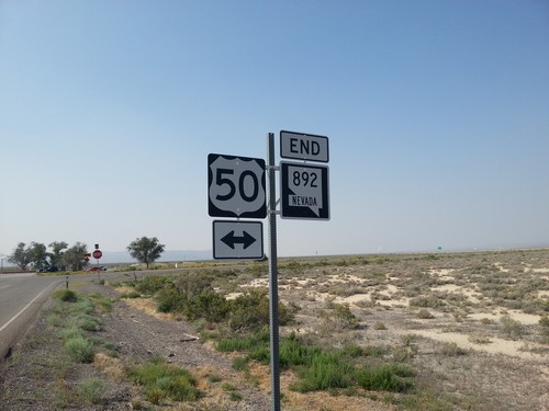
End NV-892 South at US-50
End NV-892 south at US-50 in White Pine County.
NV-892 North
NV-892 north in White Pine County. NV-892 connects US-50 with the community of Strawberry.
NV-278 South Approaching US-50
NV-278 south approaching US-50
Jct. US-50 On NV-278 South
Jct. US-50 on NV-278 South
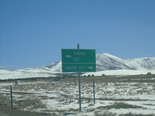
End NV-278 South at US-50
End NV-278 south at US-50. Use US-50 west for Carson City. Use US-50 east for Eureka and Ely.