Signs From August 2024
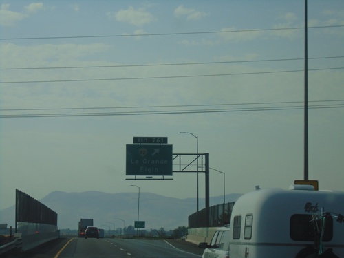
I-84 East - Exit 261
I-84 East at Exit 261 - OR-82/La Grande/Elgin.
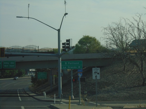
US-395 North at I-84 - Pendleton
US-395 North at I-84 in Pendleton. Use I-84 East to La Grande; I-84 West/US-395 North to Portland.
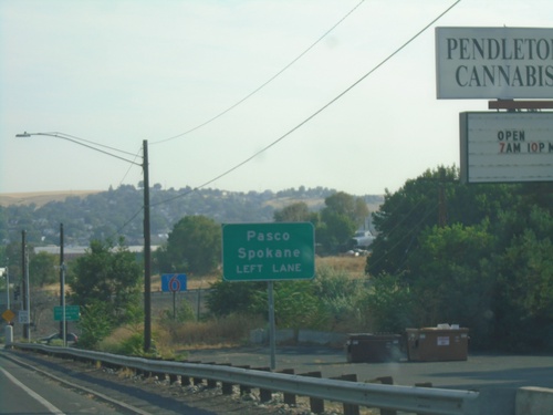
US-395 North Approaching I-84
US-395 north approaching I-84. Use left lane for I-84 West/US-395 North to Pasco and Spokane (both in Washington via US-395).
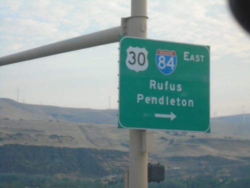
US-97 North at I-84/US-30 East
US-97 north at I-84/US-30 east for Rufus and Pendleton.
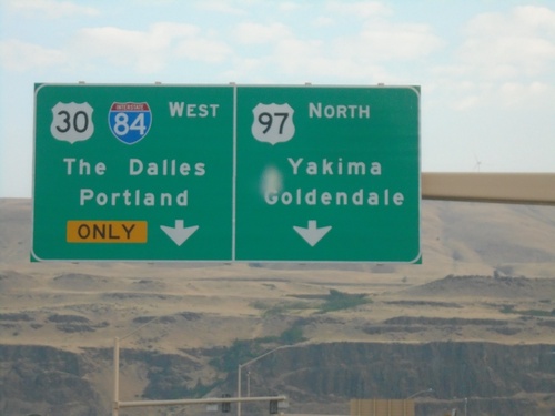
US-97 North at I-84
US-97 North at I-84/US-30 West in Biggs Junction. Use I-84/US-30 West to The Dalles and Portland. Continue north on US-97 for Goldendale (WA) and Yakima (WA).
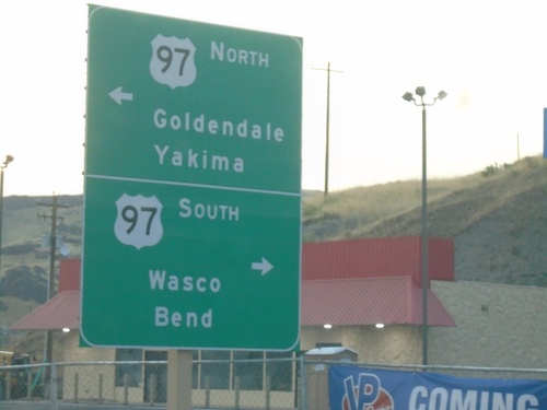
Biggs-Rufus Highway East at US-97
Biggs-Rufus Highway East at US-97 - Biggs Junction. Use US-97 south to Wasco and Bend; US-97 north to Goldendale (WA) and Yakima (WA).
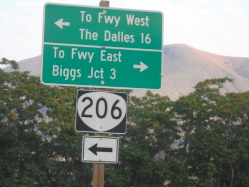
OR-206 West at Biggs-Rufus Highway
OR-206 West at Biggs-Rufus Highway. Turn left to continue on OR-206 west to Freeway West (I-84) and The Dalles. Turn right for Biggs-Rufus Highway to Freeway East (I-84) and Biggs Junction.
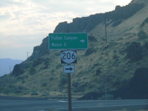
OR-206 East Approaching Biggs-Rufus Highway Junction
OR-206 East Approaching Biggs-Rufus Highway Junction. Turn right to continue east on OR-206 to Fulton Canyon and Wasco.
Deschutes State Park Access Road at OR-206
Deschutes State Park Access Road at OR-206. Use OR-206 East for I-84 Eastbound; OR-206 West for I-84 Westbound.
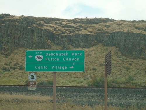
OR-206 - Celilo Village Junction
OR-206 at Celilo Village Junction. Turn right for Celilo Village; left for OR-206 East to Deschutes Park and Fulton Canyon.
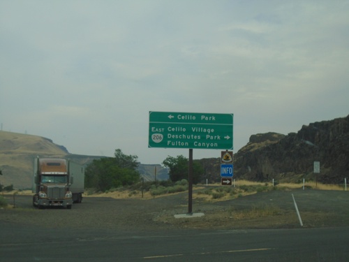
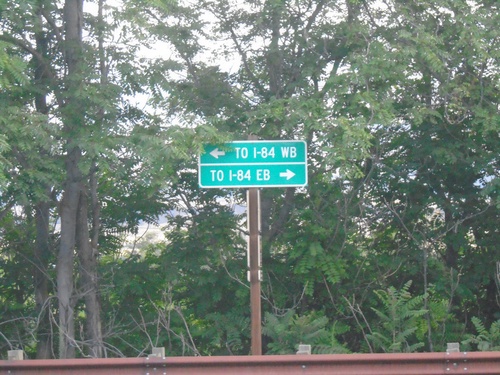
I-84 East Exit 97 Offramp at OR-206
I-84 East Exit 97 offramp at OR-206. Turn left for Celilo Park. Turn right for OR-206 East/Celilo Village/Deschutes Park/Fulton Canyon.
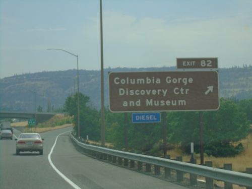
I-84 East - Exit 82
I-84 east at Exit 82 - Columbia Gorge Discovery Center and Museum.
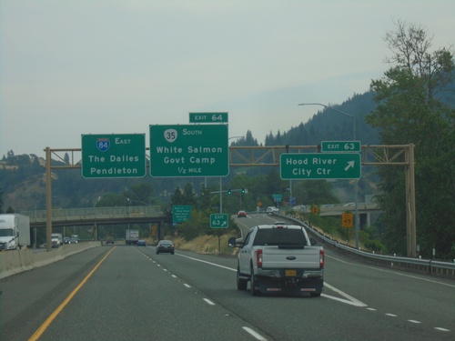
I-84 East - Exits 63 and 64
I-84 east at Exit 63 - Hood River City Center. Approaching Exit 64 - OR-35 South/White Salmon (Washington)/Government Camp. I-84 continues east to The Dalles and Pendleton.
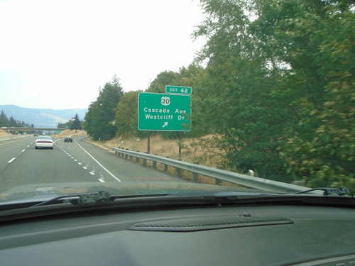
I-84 East - Exit 62
I-84 east at Exit 62 - US-30/Cascade Ave./Westcliff Drive. US-30 leaves I-84 here through the city of Hood River.
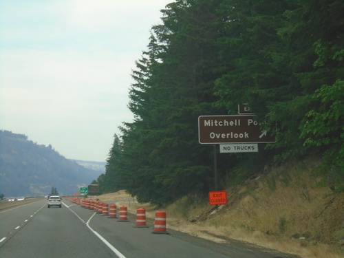
I-84 East - Exit 58
I-84 east at Exit 58 - Mitchell Point Overlook.
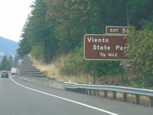
I-84 East - Exit 56
I-84 east approaching Exit 56 - Viento State Park.
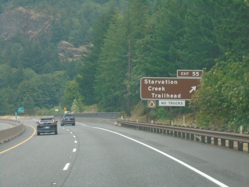
I-84 East - Exit 55
I-84 east at Exit 55 - Starvation Creek Trailhead
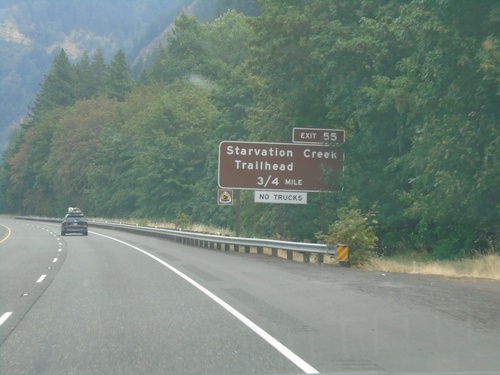
I-84 East - Exit 55
I-84 east approaching Exit 55 - Starvation Creek Trailhead.
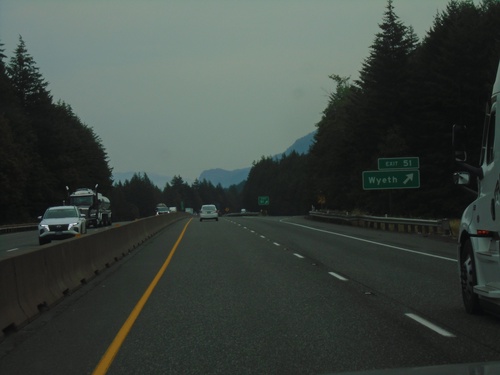
I-84 East - Exit 51
I-84 east at Exit 51 - Wyeth.
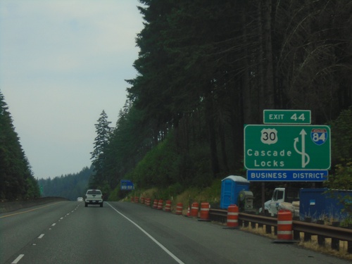
I-84 East - Exit 44 Route Diagram
Diagram of the Exit 44 interchange in Cascade Locks.
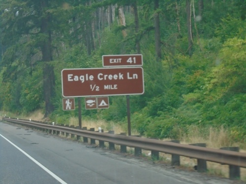
I-84 East - Exit 41
I-84 east approaching Exit 41 - Eagle Creek Lane.
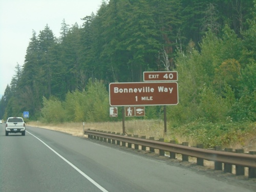
I-84 East - Exit 40
I-84 east approaching Exit 40 - Bonneville Way.
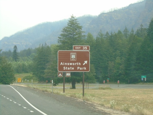
I-84 East - Exit 35
I-84 east at Exit 35 - Historic Route 30/Ainsworth State Park.
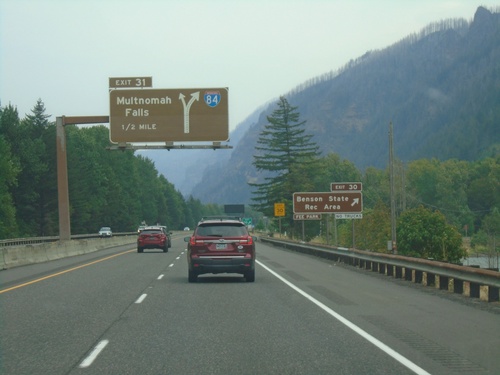
I-84 East - Exits 30 and 31
I-84 east at Exit 30 - Benson State Recreation Area. Approaching Exit 31 - Multnomah Falls. Exit 31 is a left exit.
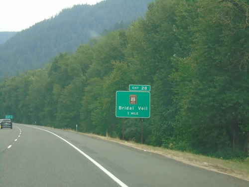
I-84 East - Exit 28
I-84 east approaching Exit 28 - Historic Route 30/Bridal Veil.
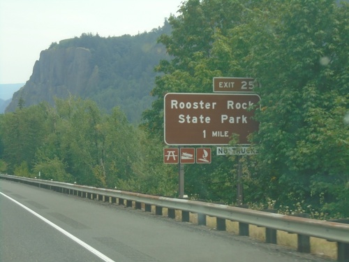
I-84 East - Exit 25
I-84 east approaching Exit 25 - Rooster Rock State Park.
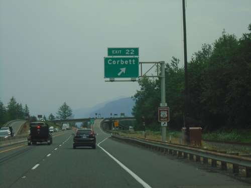
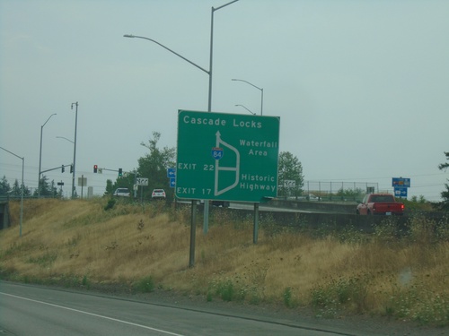
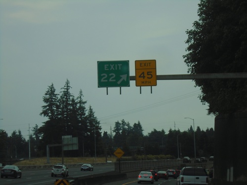
I-84 East - Exit 22
I-84 east at Exit 22 - Corbett. Use Exit 22 for access to Historic Route 30.
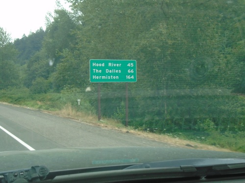
I-84 East - Distance Marker
First distance marker eastbound on I-84 after the Portland metro area. Distance to Hood River, The Dalles, and Hermiston.
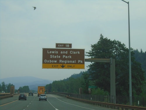
I-84 East - Exit 18
I-84 east approaching Exit 18 - Lewis and Clark State Park/Oxbow Regional Park.
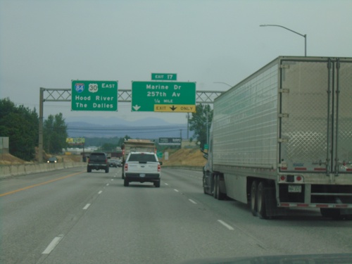
I-84 East Approaching Exit 17
I-84 east approaching Exit 17 - Marine Drive/257th Ave. Continue east on I-84/US-30 for The Dalles and Hood River.
I-84/US-30 East - Historic Columbia River Highway Diagram
Route diagram for the Historic Columbia River Highway on I-84/US-30 East. Use Exit 17 (last Portland Metro. Area exit) on I-84/US-30 East for the Historic Highway. The Historic Columbia River Highway and I-84/US-30 rejoin before Cascade Locks.
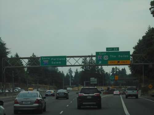
I-205 South - Exit 22
I-205 south at I-84 east - Exit 22.
I-205 South - Exit 22
I-205 south at Exit 22 - I-84/US-30 East/The Dalles. Continue south on I-205 for Portland and Salem.
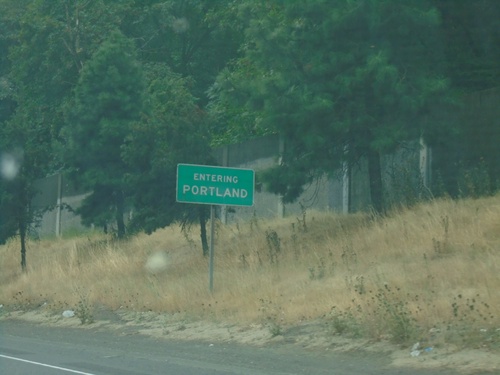
I-205 South - Entering Portland
Entering Portland on I-205 south, after briefly entering the city of Maywood Park. Portland is the largest city in Oregon.
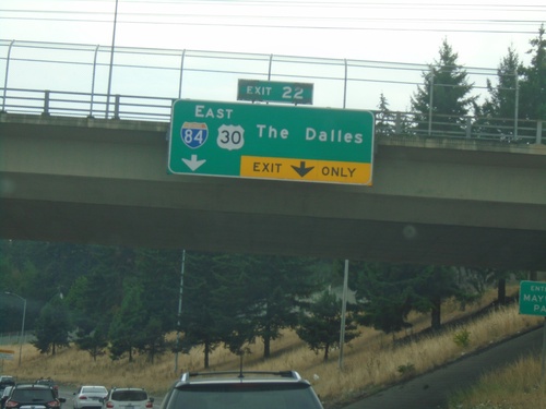
I-205 South - Exit 22
I-205 south approaching Exit 22 - I-84/US-30 East/The Dalles.
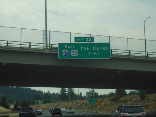
I-205 South - Exit 22
I-205 south approaching Exit 22 - I-84/US-30 East/The Dalles.
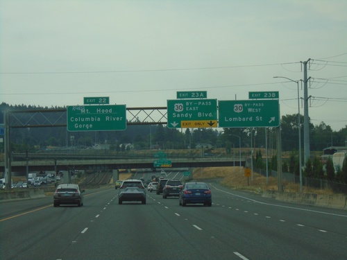
I-205 South - Exits 23B, 23A, and 22
I-205 South at Exit 23B - US-30 By-Pass West/Lombard St. Approaching Exit 23A - US-30 By-Pass East/Sandy Blvd. Use Exit 22 (I-84 East) to Mount Hood and Columbia River Gorge.
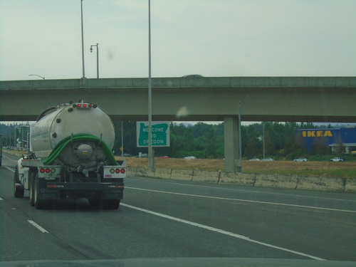
I-205 South - Welcome To Oregon
Welcome to Oregon on I-205 south. The welcome sign is in the middle of the Exit 24 interchange, on the south side of the Columbia River bridge. There is a sign on the Columbia River bridge marking the actual state line between Oregon and Washington.
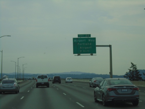
I-205 South - Exit 24
I-205 south at Exit 24 - Airport Way/Portland Airport.
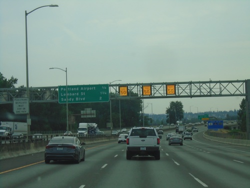
I-205 South - Distance Marker
Distance marker on I-205 south in Portland. Distance to Portland Airport, Lombard St., and Sandy Blvd. Electronic variable speed limit advisory signs showing an advised speed of 50 MPH.
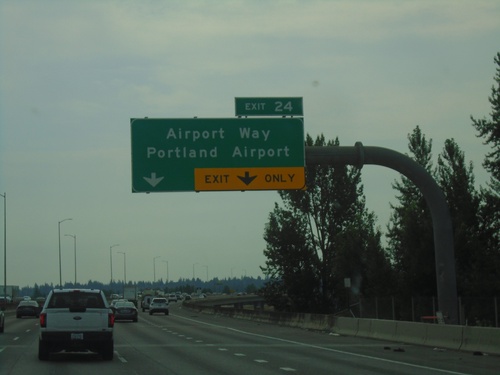
I-205 South - Exit 24
I-205 south approaching Exit 24 - Airport Way/Portland Airport. The actual interchange is in Oregon.
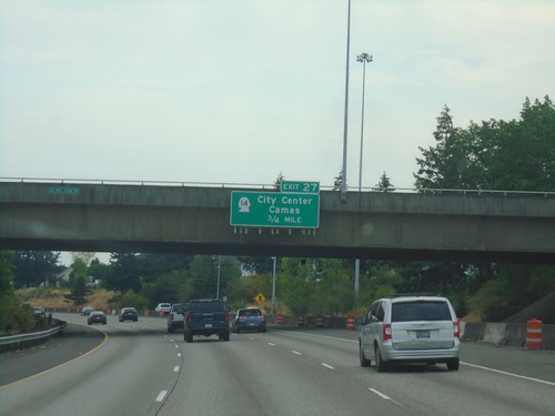
I-205 South - Exit 27
I-205 south approaching Exit 27 - WA-14 East/Camas and WA-14 West/(Vancouver)City Center.
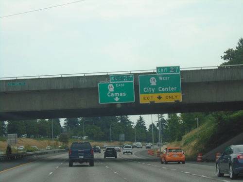
I-205 South - Exit 27
I-205 south approaching Exit 27 - WA-14/Camas/(Vancouver)City Center. WA-14 is the last exit on I-205 southbound in Washington.
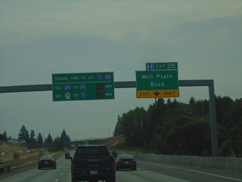
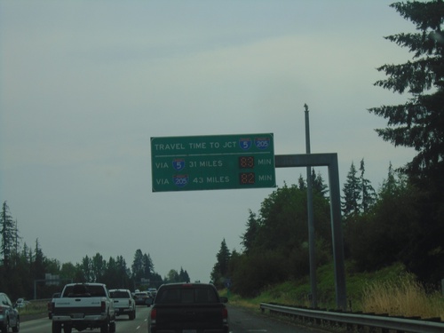
I-205 South - Exit 28
I-205 South approaching Exit 28 - Mill Plain Blvd. Travel times to I-84/I-5 Junction (Downtown Portland, Oregon) via I-84 and WA-14.
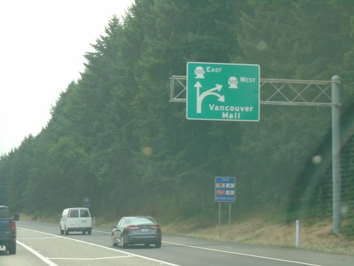
I-5 South - Exit 30
I-5 south at Exit 30. Exit diagram showing access to WA-500 and Vancouver Mall.
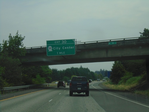
I-205 South - Exit 30
I-205 south approaching Exit 30 - WA-500/(Vancouver)City Center.
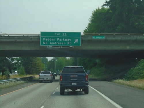
I-205 South - Exit 32
I-205 south at Exit 32 - Padden Parkway/NE Andresen Road.
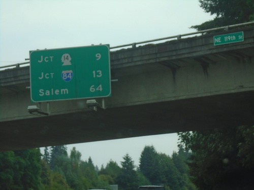
I-205 South - Distance Marker
Distance marker on I-205 south. Distance to Jct. WA-14, Jct. I-84, and Salem (Oregon).
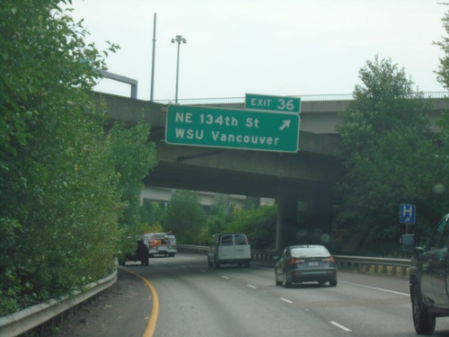
I-205 South - Exit 36
I-205 south at Exit 36 - NE 134th St./WSU Vancouver.
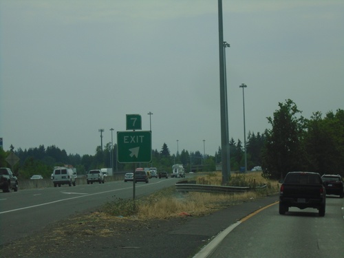
I-5 South - Exit 7
I-5 south at Exit 7 seperation.
I-5 South - Exit 7
I-5 south approaching Exit 7 - I-205 South/NE 134th St./Salem (Oregon). Continue south on I-5 for Portland (Oregon) and Vancouver.
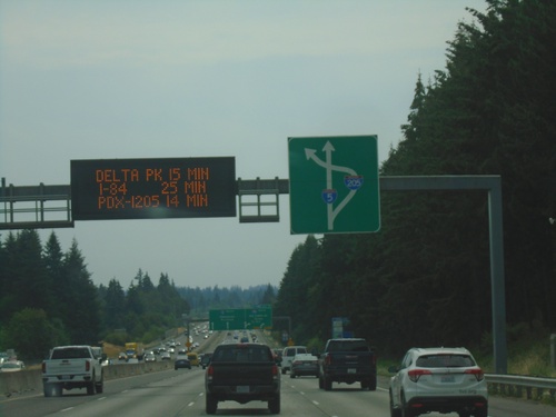
I-5 South Approaching Exit 7
I-5 South approaching Exit 7. Travel time for Portland Airport (via I-205), Delta Park and Downtown Portland. Route diagram for I-205/I-5 interchange.
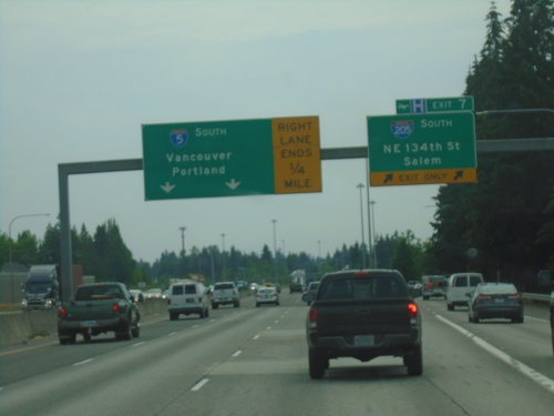
I-5 South - Exit 7
I-5 south approaching Exit 7 - I-205 South/NE 134th St./Salem (Oregon). Continue south on I-5 to Vancouver and Portland (Oregon).
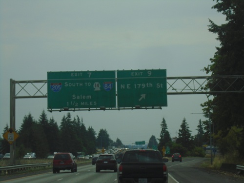
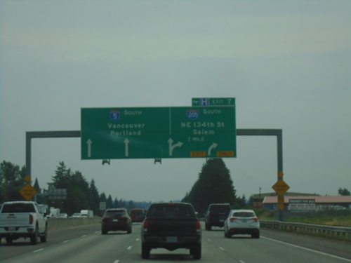
I-5 South - Exits 9 and 7
I-5 south at Exit 9 - NE 179th St. Approaching Exit 7 - I-205 South/To WA-14/To I-84/Salem.
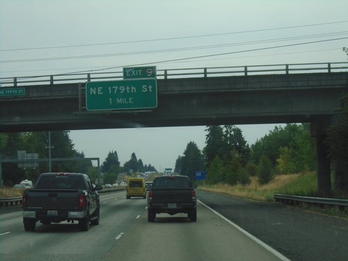
I-5 South - Exit 9
I-5 south approaching Exit 9 - NE 179th St.
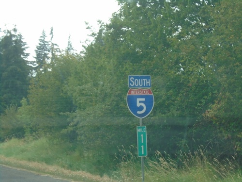
I-5 South - Clark County
I-5 South / Mile 11 in Clark County.
I-5 South - Travel Time To I-5/I-205 Junction in Tualatin
I-5 South Travel Time To I-5/I-205 Junction in Tualatin, Oregon. Travel time via I-5 south and I-205 south.
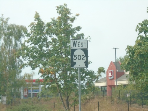
End WA-502 at I-5 South
End WA-502 at I-5 South freeway entrance.
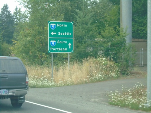
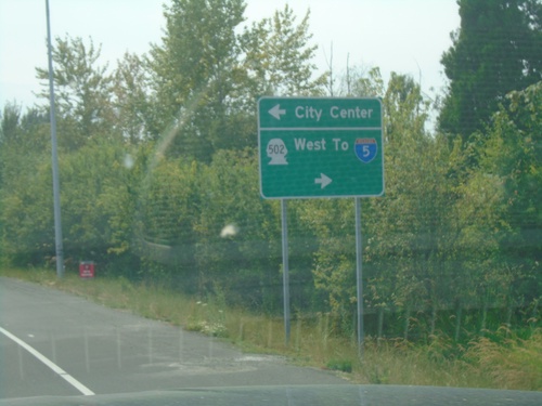
End WA-502 West at I-5
End WA-502 West at I-5. Use I-5 South to Portland (OR); I-5 North to Seattle.
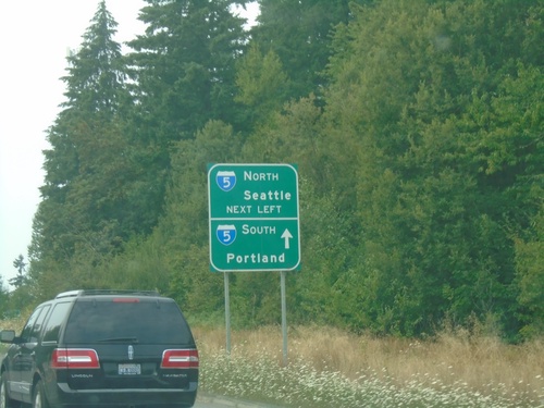
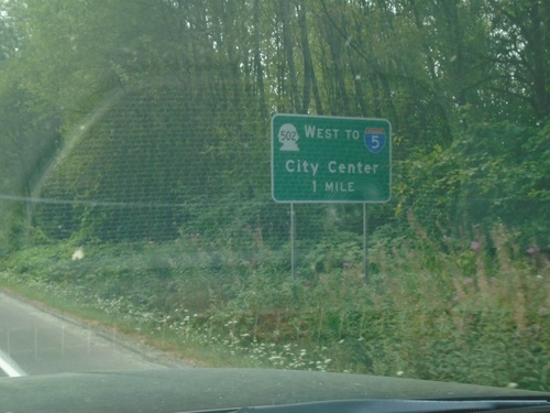
WA-502 West At I-5
WA-502 West at I-5. Turn left for I-5 North to Seattle; continue over freeway for I-5 South to Portland (OR).
WA-502 West - Battle Ground
WA-502 west in Battle Ground.
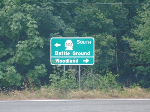
WA-503 South at WA-502 (Main St.)
WA-503 South at WA-502 (Main St.) in Battle Ground. Use WA-502 West to I-5; use Main St. east for City Center.
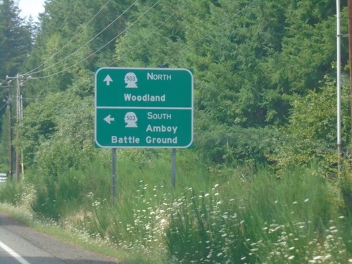
WA-503 South Approaching WA-502
WA-503 South approaching WA-502 in Battle Ground. Use WA-502 west to I-5 and City Center.
WA-503 South at NE 221st Ave.
WA-503 South at NE 221st Ave in Amboy. Turn right for Woodland; left to continue south on WA-503 to Battle Ground.
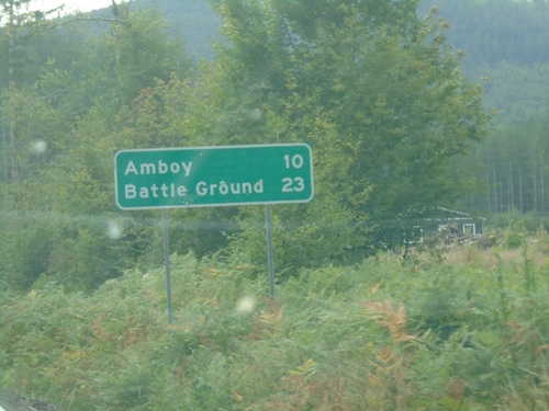
WA-503 South - Distance Marker
Distance marker on WA-503 south. Distance to Amboy and Battle Ground.
End WA-503 Spur West at WA-503
End WA-503 Spur West at WA-503. Turn left for WA-503 South to Amboy and Battle Ground. Continue straight for WA-503 North to Woodland.
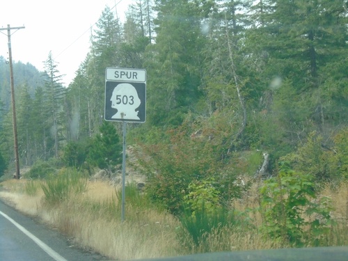
WA-503 Spur - West
WA-503 Spur west in Cowlitz County.
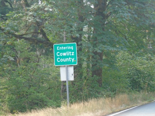
Begin WA-503 Spur West/Entering Cowlitz County
Entering Cowlitz County / Begin WA-503 Spur West
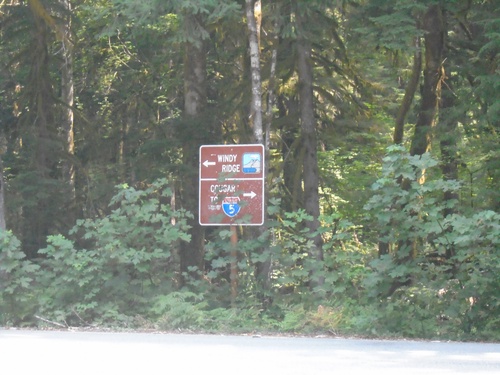
Lava Canyon Road South at Lewis River Road
Lava Canyon Road South at Lewis River Road. Turn left for Windy Ridge (part of the Mt. St. Helens National Monument). Turn right for I-5 and Cougar.
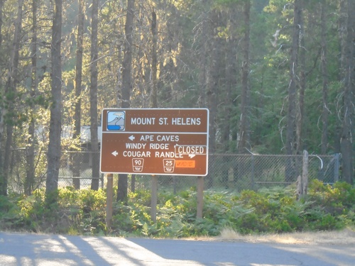
Lewis River Road (FR-90) at Lewis River-Randle Road (FR-25)
Lewis River Road (FR-90) at Lewis River-Randle Road (FR-25) in Northwoods. Use FR-25 north to Windy Ridge and Randle; FR-90 west to Ape Cave and Cougar. FR-25 is closed due to a slide between Northwoods and Wind Ridge when this photograph was taken.
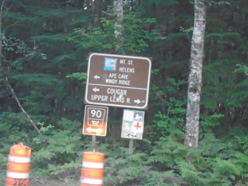
Curly Creek Road North at Lewis River Road (FR-90)
Curly Creek Road North at Lewis River Road (FR-90). Turn right for Upper Lewis River; left for Mt. St. Helens, Ape Cave, and Windy Ridge.
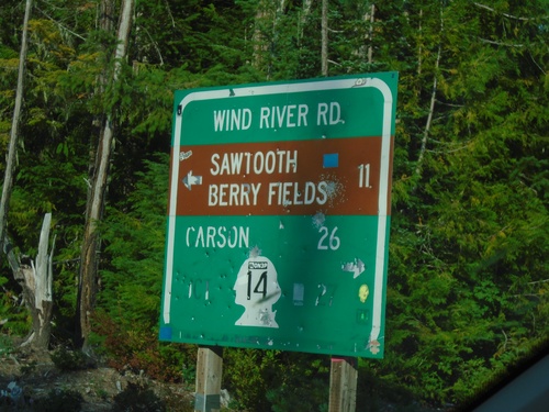
Curly Creek Road at Wind River Road
Curly Creek Road at Wind River Road. Use Wind River Road south to WA-14 and Carson. Use Wind River Road north to Sawtooth Berry Fields.
Wind River Road North at Curly Creek Road
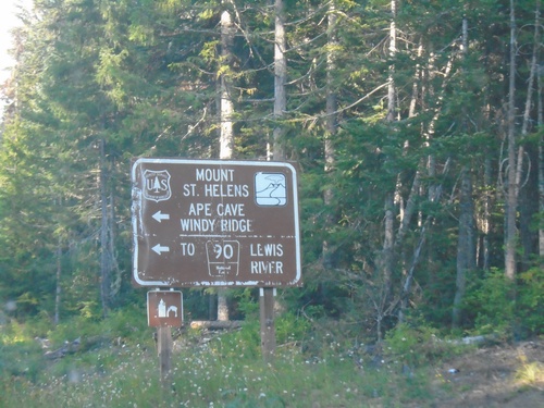
Wind River Road North at Curly Creek Road to Mount St. Helens, Ape Cave, Windy Ridge, and FR-90 to Lewis River.
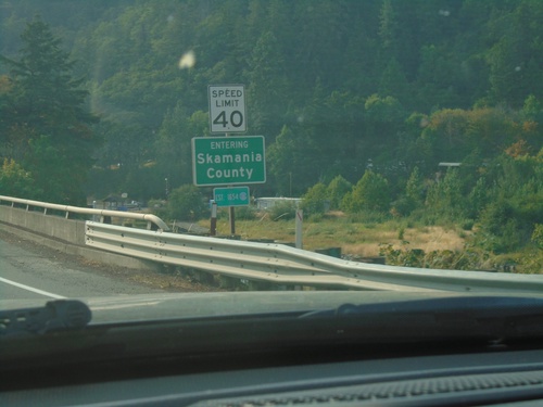
WA-14 West - Skamania County
Entering Skamania County on WA-14 west.
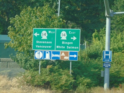
Hood River Bridge at WA-14
Hood River Bridge at WA-14. Use WA-14 East to Bingen and White Salmon; WA-14 west to Stevenson and Vancouver.
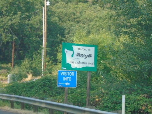
Hood River Bridge - Welcome To Washington
Welcome To Washington on Hood River Bridge northbound.
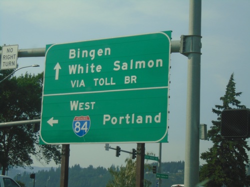
OR-35 North at I-84
OR-35 North at I-84. Use I-84 West to Portland. Continue north for the Toll Bridge over the Columbia River to White Salmon and Bingen, Washington.
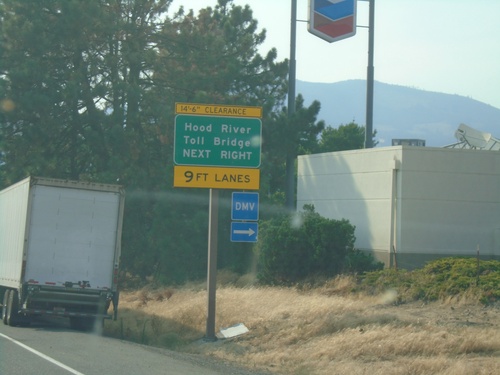
I-84 West Exit 64 Offramp
I-84 West Exit 64 offramp - use right lanes for Hood River Toll Bridge.
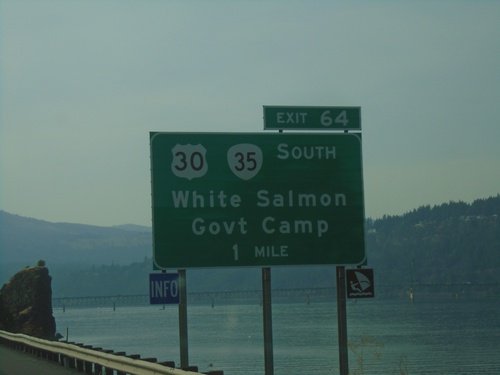
I-84 West - Exit 64
I-84 west at Exit 64 - US-30/OR-35 South/White Salmon(WA)/Government Camp.
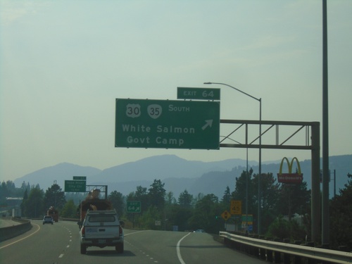
I-84 West Approaching Exit 64
I-84 west approaching Exit 64 - US-30/OR-35 South/White Salmon (WA)/Government Camp. The Columbia River is in the background.
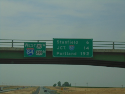
I-84/US-30 West/US-395 North - Distance Marker
Distance Marker on I-84/US-30 West/US-395 North at the overpass over Exit 193. Distance to Stanfield, Jct. I-82, and Portland.
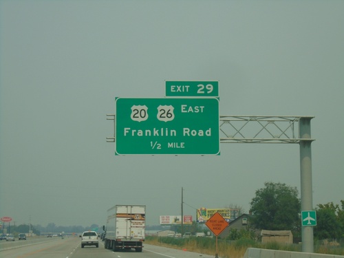
I-84 West - Exit 29
I-84 west approaching Exit 29 - US-20/US-26 East/Franklin Road.
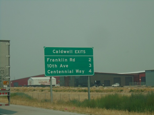
I-84 West - Caldwell Exits
Caldwell exits on I-84 west: Franklin Road, 10th Ave., Centennial Way
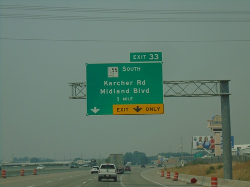
I-84 West - Exit 33
I-84 west approaching Exit 33 - ID-55 South/Karcher Road/Midland Blvd. ID-55 south leaves I-84 westbound.