Signs From June 2025
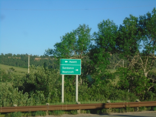
End WY-110 East at WY-24
End WY-110 East at WY-24. Use WY-24 east to Hulett; WY-24 west to Sundance and Moorcroft.
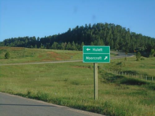
End WY-110 East at WY-24
End WY-110 East at WY-24 at Devils Tower. Use WY-24 west to Moorcroft; WY-24 east to Hulett.
End WY-110 East at WY-24
End WY-110 East at WY-24 at Devils Tower.
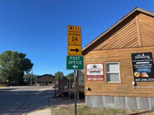
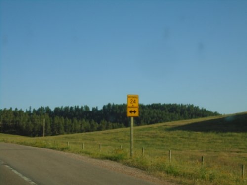
WY-24 West - Hulett
WY-24 west in Hulett. Turn right to continue west on WY-24. Turn left on Hill St. for Post Office.
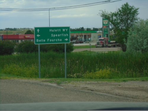
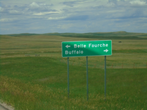
SD-34 West at US-85
SD-34 West at US-85. Use US-85 south to Spearfish; US-85 north to Belle Fourche. Continue west on SD-34 for Hulett, Wyoming.
SD-34 West at US-85
SD-34 West at US-85 in Belle Fourche. Use US-85 north for US-212.
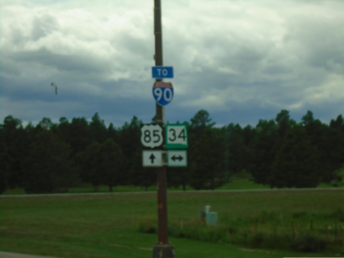
US-85 South at SD-34
US-85 South at SD-34 in Belle Fourche. Use US-85 south to I-90.
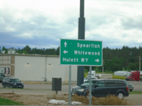
US-85 South at SD-34
US-85 South at SD-34. Use SD-34 east to Whitewood; SD-34 west to Hulett, WY. Continue south on US-85 to Spearfish.
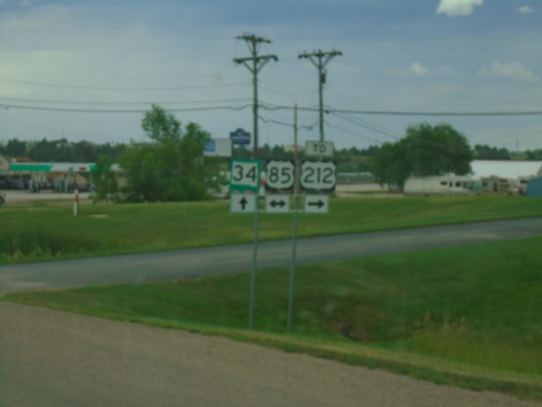
US-85 South at US-212
US-85 South at US-212 in Belle Fourche. Use US-85 south for I-90.
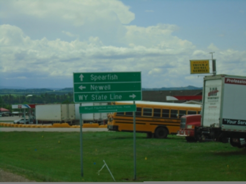
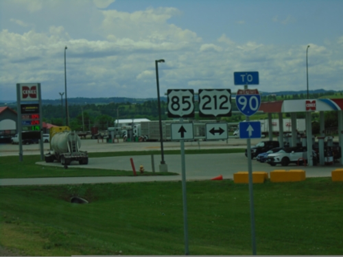
US-85 South Approaching US-212
US-85 South approaching US-212 in Belle Fourche. Use US-212 West to Wyoming State Line; US-212 East to Newell. Continue south on US-85 to Spearfish.
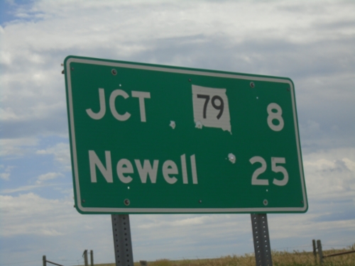
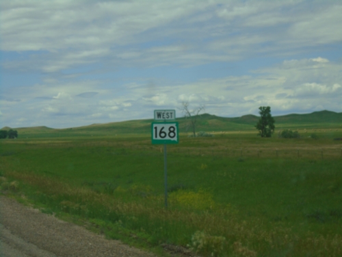
SD-168 East - Distance Marker
Distance marker on SD-168 east. Distance to SD-79 and Newell.
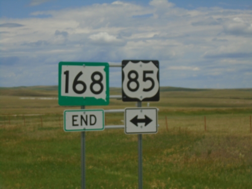
End SD-168 West at US-85
End SD-168 West at US-85 in Butte County.
End SD-168 West at US-85
End SD-168 West at US-85. Use US-85 North to Buffalo; US-85 South to Belle Fourche.
SD-168 West - Butte County
SD-168 West in Butte County
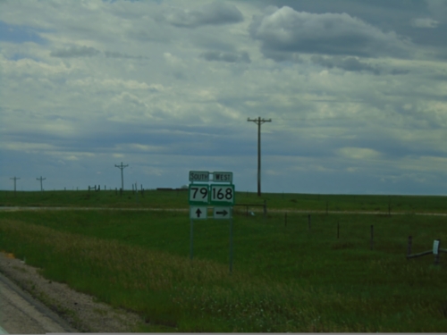
SD-79 South at SD-168 West
SD-79 South at SD-168 West in Butte County.
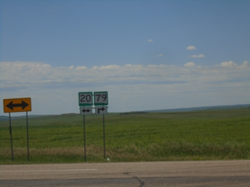
SD-20 West/SD-79 South at SD-20/SD-79 Split
SD-20 West/SD-79 South at SD-20/SD-79 split in Harding County.
SD-20 West/SD-79 South at SD-20/SD-79 Split
SD-20 West/SD-79 South at SD-20/SD-79 split. Use SD-79 South to Newell and Sturgis; use SD-20 West for Buffalo.
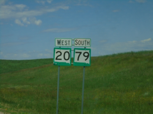
SD-20 West/SD-79 South
SD-20 West/SD-79 South in Harding County
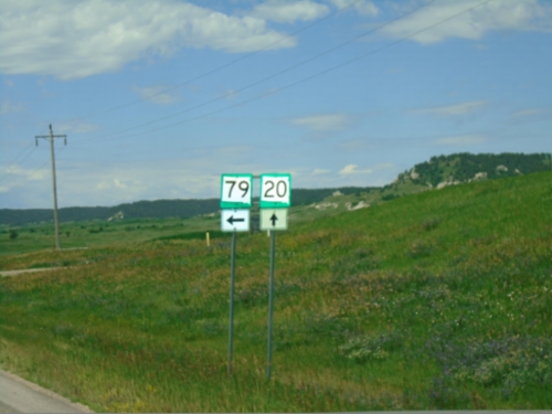
SD-79 South at SD-20
SD-79 South at SD-20 in Harding County. SD-79 South joins SD-20 West through Reva.
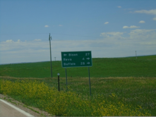
SD-79 South at SD-20
SD-79 South at SD-20 in Harding County. Use SD-20 East for Bison; SD-20 West/SD-79 South to Reva and Buffalo.
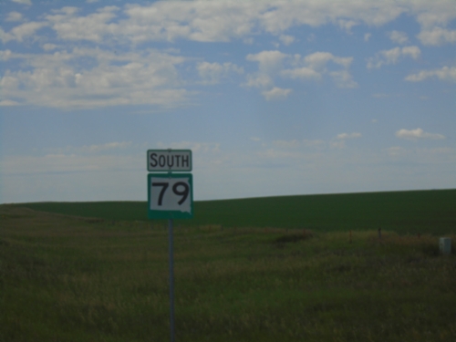
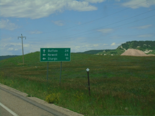
SD-79 South - Harding County
SD-79 south in Harding County. Taken just south of the Peace Valley Evangelical Church and Cemetery.
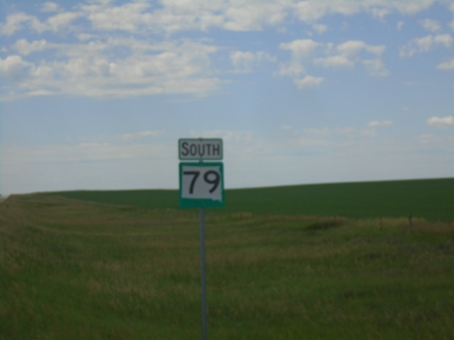
SD-79 South - Harding County
SD-79 south in Harding County. Taken just south of the Peace Valley Evangelical Church and Cemetery.
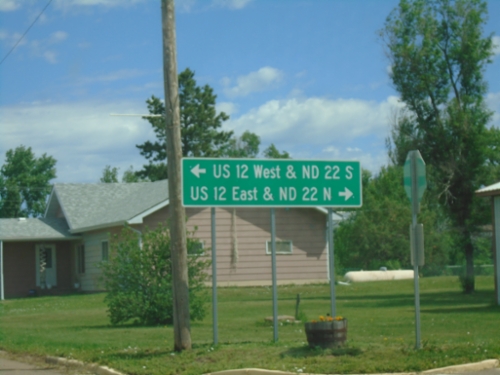
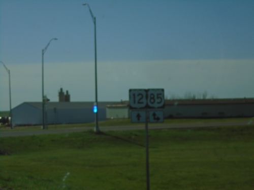
Main St. and 2nd Ave. - Reeder
Main St. north at 2nd Ave. in Reeder. Use 2nd Ave. West for US-12 West and ND-22 South; 2nd Ave. East for US-12 East and ND-22 North.
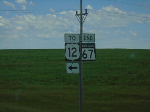
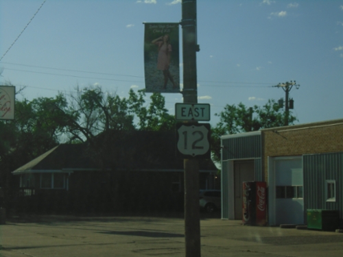
End ND-67 South at US-12
End ND-67 South at US-12 in Scranton.
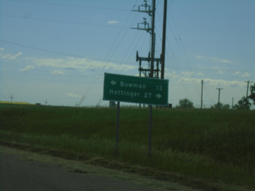
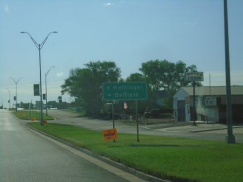
End ND-67 at US-12
End ND-67 at US-12 in Scranton. Use US-12 west to Bowman; east to Hettinger.
End ND-67 South at US-12
End ND-67 South at To US-12 in Scranton. ND-67 and US-12 are connected by a short ramp, which is not signed as any highway.
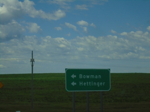
ND-67 South at US-12
ND-67 South at US-12 to Bowman and Hettinger.
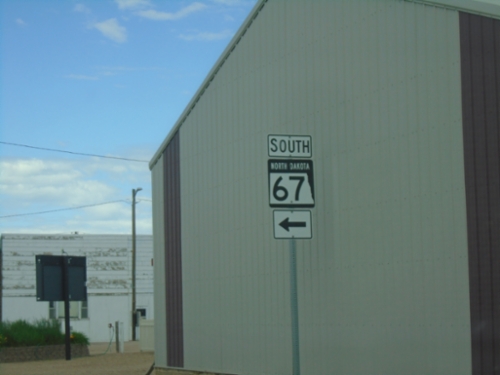
ND-67 South - Scranton
ND-67 South (Brodie St.) at Main Street. in Scranton.
ND-67 South - Scranton
ND-67 South in Scranton
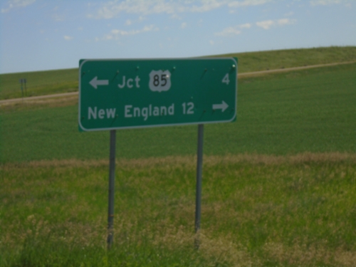
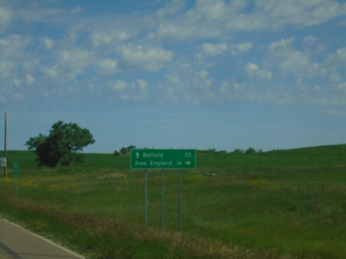
End ND-67 North at ND-21
End ND-67 North at ND-21. Use ND-21 west to Jct. US-85; ND-21 east to New England.
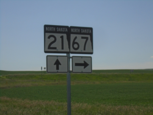
ND-21 East at ND-67
ND-21 East at ND-67 in Slope County
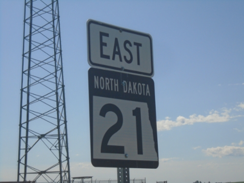
ND-21 East
ND-21 East in Slope County
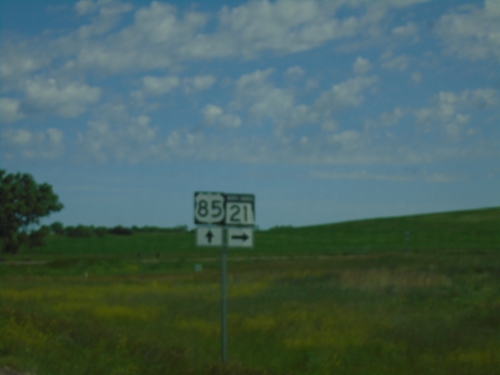
US-85 North at ND-21
US-85 North at ND-21 in Slope County.
US-85 North Approaching ND-21
US-85 North approaching ND-21 in Slope County. Continue north on US-85 for Belfield; use ND-21 east for New England.
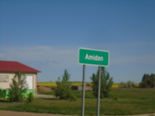
US-85 South - Amidon
Entering Amidon on US-85 south. Amidon is the county seat of Slope County.
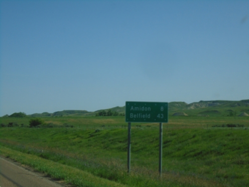
US-85 North - Distance Marker
Distance marker on US-85 north. Distance to Amidon and Belfield.
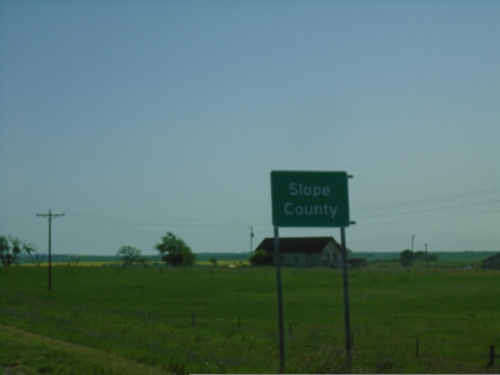
US-85 North - Slope County
Slope County on US-85 north. Slope County is the smallest by population in North Dakota.
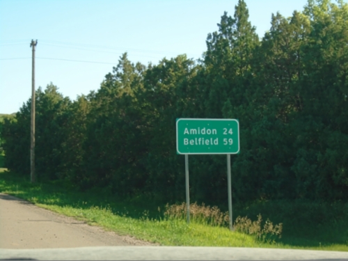
US-85 North - Distance Marker
Distance marker on US-85 north. Distance to Amidon and Belfield.
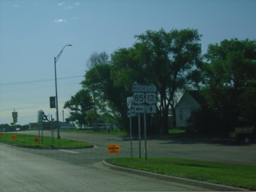
US-12 East/US-85 North at US-12/US-85 Split
US-12 East/US-85 North at US-12/US-85 split in Bowman.
US-12 East/US-85 North at US-12/US-85 Split
US-12 East/US-85 North at US-12/US-85 split in Bowman. Use US-85 north for Belfield; US-12 east for Hettinger.
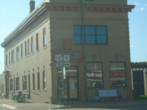
US-12 East at US-85 South - Bowman
US-12 East at US-85 South in Bowman. US-85 North joins US-12 east through Bowman.

US-12 East - Distance Marker
Distance marker on US-12 east. Distance to Bowman and Hettinger.
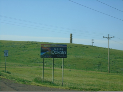
US-12 East - Entering North Dakota
North Dakota - Legendary on US-12 East. Taken at the Montana-North Dakota state line.
US-12 East - Distance Marker
Distance marker on US-12 east. Distance to Marmarth (ND) and Bowman (ND).
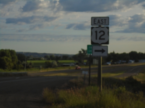
US-12 East - Baker
US-12 east in Baker.
US-12 East at MT-7
US-12 East at MT-7 in Baker.
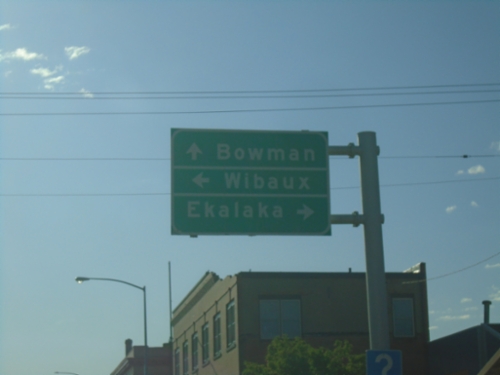
US-12 East at MT-7
US-12 East at MT-7 in Baker. Use MT-7 South to Ekalaka and MT-7 North to Wibaux. Continue east on US-12 to Bowman, North Dakota.
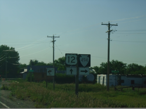
US-12 East at MTS-494
US-12 East at MTS-494 in Plevna.
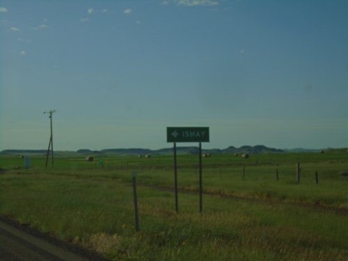
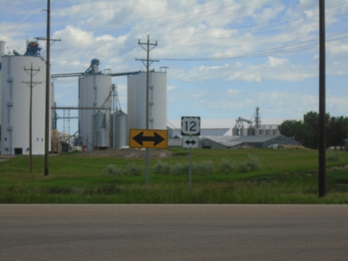
US-12 East at MTS-320
US-12 East at MTS-320 North to Ismay. The town of Ismay unofficially adopted the name Joe, Montana as part of a publicity stunt in the 1990s.
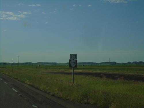
US-12 East Approaching MTS-320
US-12 East approaching MTS-320 in Fallon County.
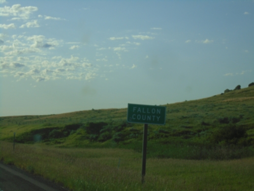
US-12 East - Fallon County
Entering Fallon County on US-12 west.
I-94 East - Exit 141 Offramp at US-12
I-94 East - Exit 141 Offramp at US-12. Turn right to continue east on US-12.
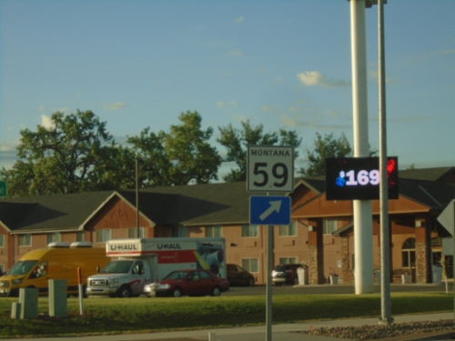
MT-59 Shield at Roundabout at I-94 Interchange
Non-standard design of an MT-59 shield at the roundabout on the south side of the I-94/MT-59 interchange.
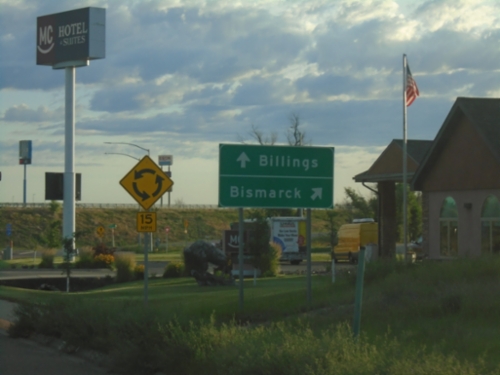
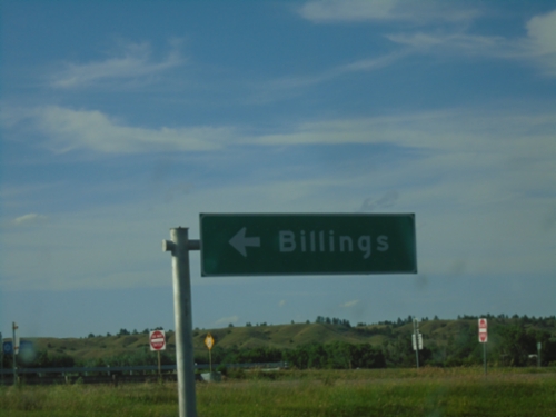
MT-59 South at I-94 West
MT-59 South at I-94 West to Billings. Continue under freeway for I-94 East to Bismarck (North Dakota).
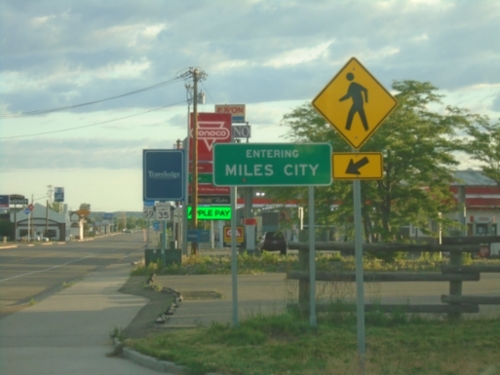
MT-59 North - Miles City
Entering Miles City on MT-59 north. Miles City is the county seat of Custer County and is the 11th largest city in Montana (2020 Census).
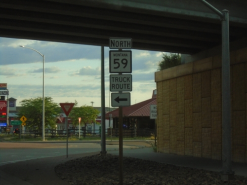
MT-59 North at I-94 West
MT-59 North at I-94 West. Use I-94 West for the MT-59 truck route through Miles City.
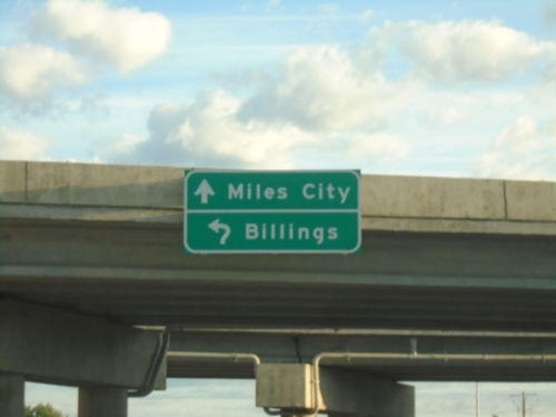
MT-59 North Approaching I-94 West
MT-59 North approaching I-94 West in Miles City. Use I-94 west for Billings; continue north on MT-59 to Miles City.
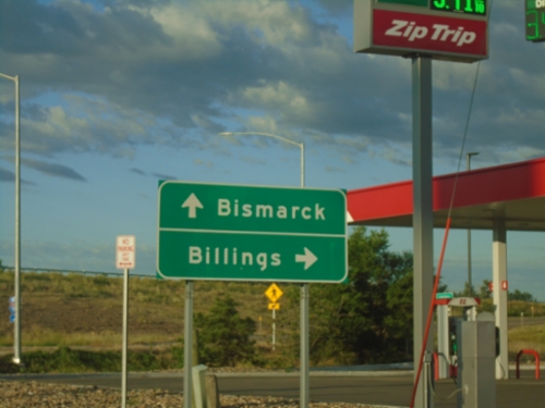
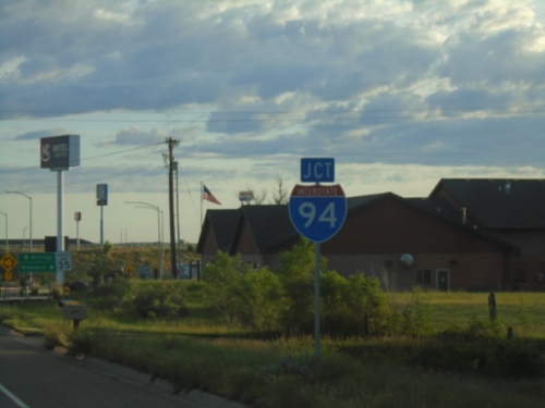
MT-59 North at I-94
MT-59 North at roundabout approaching I-94. Use I-94 east for Bismarck (ND); I-94 west for Billings.
MT-59 North Approaching I-94
MT-59 North approaching I-94 in Miles City.
I-94 Freeway Entrance - East Forsyth Interchange
I-94 Freeway Entrance at East Forsyth interchange (Exit 95).
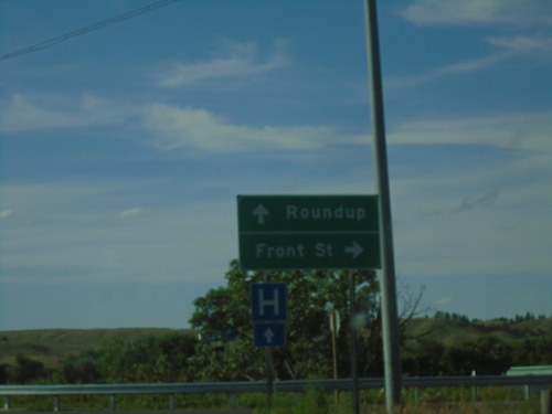
US-12 West at Front St. - Forsyth
US-12 West at Front St. in Forsyth. Continue west on US-12 for Roundup.
US-12 West at I-94 West
US-12 West at I-94 West to Billings.
I-94 East - Exit 93 Interchange at US-12
I-94 East - Exit 93 Interchange at US-12 West.
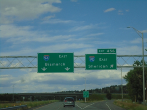
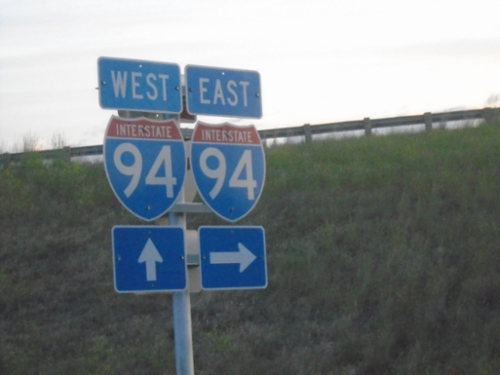
I-90 East - Exit 456 - I-94 Jct.
I-90 east at Exit 456 - I-94 East/Bismarck (North Dakota). Merge right to continue east on I-90 to Sheridan (Wyoming). This is the beginning of I-94. The eastern end of I-94 is the Canadian border at Port Huron, Michigan.
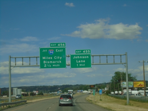
I-90 East - Exits 455 and 456
I-90 east approaching Exit 455 - Johnson Lane, 1 mile. Approaching Exit 456 - I-94 East/Miles City/Bismarck (North Dakota).
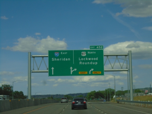
I-90 East - Exit 452
I-90 east at Exit 452 - US-87 North/Lockwood/Roundup. Continue on I-90/US-212 East/US-87 South towards Sheridan (WY). US-87 south joins I-90 east to Sheridan, Wyoming. This is the eastern end of the Billings business loop.
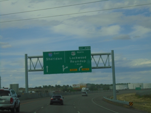
I-90 East - Exit 452
I-90 east approaching Exit 452 - US-87 North/Lockwood/Roundup. Continue east on I-90 to Sheridan (Wyoming).
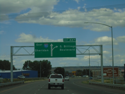
I-90 East - Exit 447
I-90 East at Exit 447 - Billings Blvd. Continue east on I-90 towards Sheridan (Wyoming).
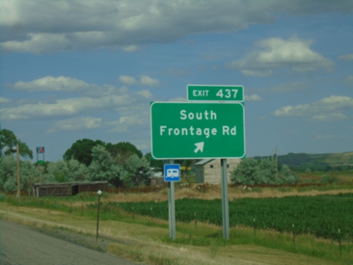
I-90 East - Exit 437
I-90 east at Exit 437 - South Frontage Road. This is the eastern end of the Laurel business loop.
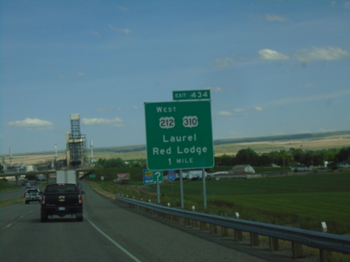
I-90 East - Exit 434
I-90 east approaching Exit 434 - US-212 West/US-310/Laurel/Red Lodge. US-212 east joins I-90 eastbound.
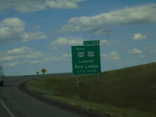
I-90 East - Exit 434
I-90 east approaching Exit 434 - US-212 West/US-310/Laurel/Red Lodge. US-212 East joins I-90 eastbound to Little Bighorn National Battlefield.
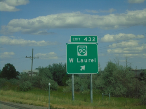
I-90 East - Exit 432
I-90 east approaching Exit 432 - BL-90/Laurel.
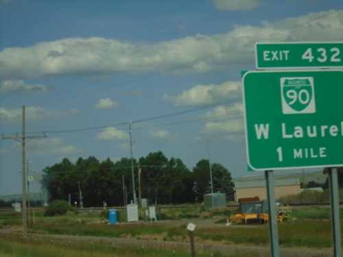
I-90 East - Exit 433
I-90 east approaching Exit 433 - BL-90/Laurel. This is the west end of the Laurel business loop.

I-90 East - Exit 426
I-90 east at Exit 426 - Park City.
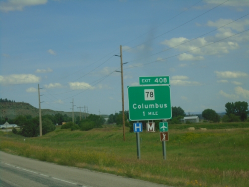
I-90 East - Exit 408
I-90 east approaching Exit 408 - MT-78/Columbus. Columbus is the county seat of Stillwater County.
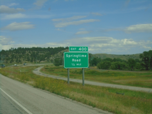
I-90 East - Springtime Road
I-90 east approaching Exit 400 - Springtime Road.

I-90 East - Exit 396
I-90 east approaching Exit 396 - Ranch Access.

I-90 East - Stillwater County
Stillwater County on I-90 east.

I-90 East - Exit 392
I-90 east approaching Exit 392 - Reed Point.

I-90 East - Exit 384
I-90 east approaching Exit 384 - Bridger Creek Road.

I-90 East - Exit 377
I-90 east approaching Exit 377 - Greycliff.
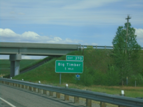
I-90 East - Exit 370
I-90 east approaching Exit 370 - Big Timber.
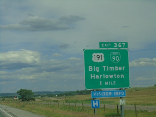
I-90 East - Exit 367
I-90 east approaching Exit 367 - BL-90/US-191 North/Big Timber/Harlowton. US-191 north leaves I-90 eastbound here. Westbound US-191 South joins I-90 to Bozeman.
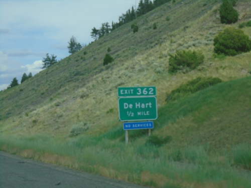
I-90 East - Exit 362
I-90 east approaching Exit 362 - De Hart.

I-90 East - Exit 354
I-90 east approaching Exit 354 - MTS-563/Springdale.
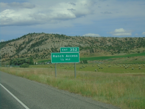
I-90 East - Exit 352
I-90 east approaching Exit 352 - Ranch Access.

I-90 East - Exit 350
I-90 east approaching Exit 350 - East End Access.

I-90 East - Exit 343
I-90 east approaching Exit 343 - Mission Creek Road.

I-90 East - Exit 340
I-90 east at Exit 340 - US-89 North/White Sulphur Springs. US-89 leaves I-90/US-191 here.

US-89 North at I-90/US-191
US-89 North at I-90/US-191 in Livingston. Use I-90 East/US-191/US-89 North to Billings; use I-90 West/US-191 South to Butte. US-89 North joins I-90 East/US-191 north through Livingston. Lights above sign assembly will flash during when interstate is closed.
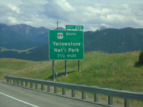
I-90 East - Exit 333
I-90 east approaching Exit 333 - US-89 South/Yellowstone National Park. Use US-89 south for the North Entrance to Yellowstone National Park at Gardiner Montana. US-89 North joins I-90 East/US-191 North through Livingston.

I-90 East - Exit 330
I-90 east approaching Exit 330 - BL-90/Livingston.
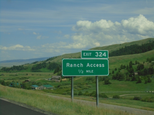
I-90 East - Exit 324
I-90 east approaching Exit 324 - Ranch Access.
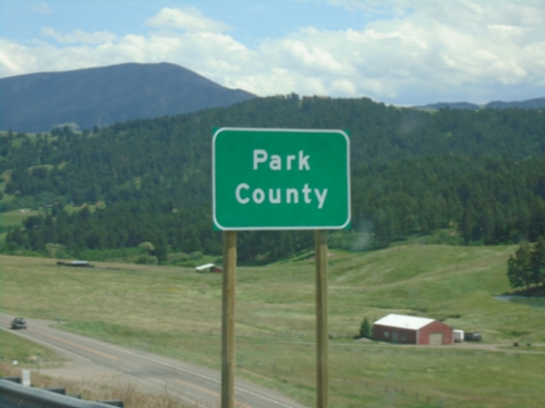
I-90 East - Park County
Entering Park County on I-90 East/US-191 North.
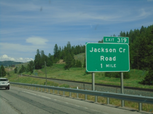
I-90 East - Exit 319
I-90 east approaching Exit 319 - Jackson Creek Road.
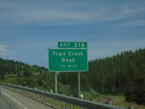
I-90 East - Exit 316
I-90 east approaching Exit 316 - Trail Creek Road.
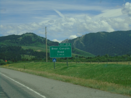
I-90 East - Exit 313
I-90 east approaching Exit 313 - Bear Canyon Road.
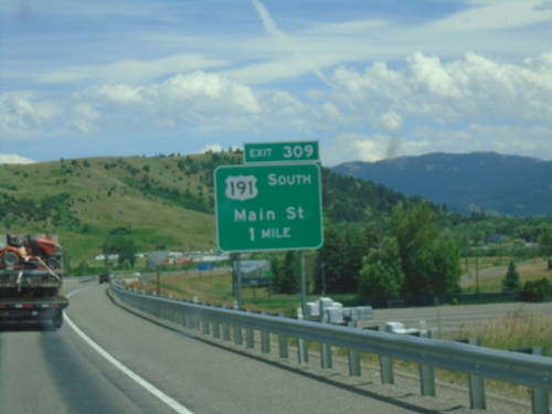
I-90 East - Exit 309
I-90 east approaching Exit 309 - US-191 South/Main St. This is the eastern end of the Bozeman business loop. US-191 joins I-90 eastbound to Big Timber.

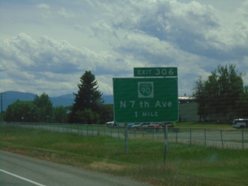
I-90 East - Exit 306
I-90 east at Exit 306 - BL-90/To US-191/N. 7th Ave.
I-90 East - Exit 306
I-90 east approaching Exit 306 - BL-90/N. 7th Ave. This is the western end of the Bozeman business loop.

I-90 East - Exit 305
I-90 east at Exit 305 - MTS-412/N 19th Ave./Springhill Road.
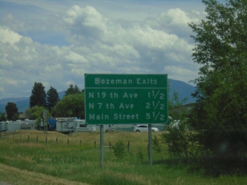
I-90 East - Bozeman Exits
Bozeman exits on I-90 east: N 19th Ave., N 7th Ave. and Main St.
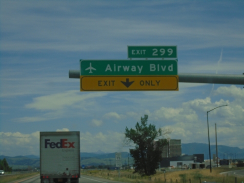
I-90 East - Exit 299
I-90 east at Exit 299 - Airway Blvd. Use Exit 299 for access to Bozeman Yellowstone International Airport (BZN).
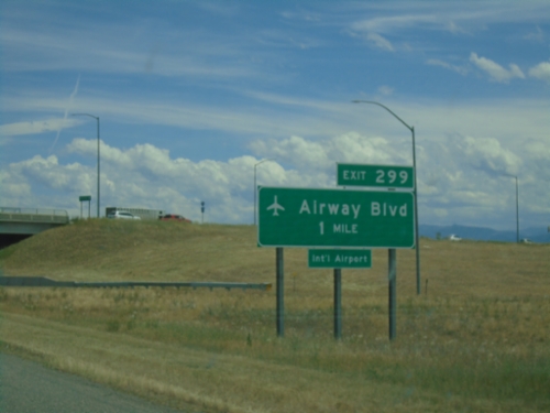
I-90 East - Exit 299
I-90 east approaching Exit 299 - Airway Blvd. in Belgrade. Use Exit 299 for access to Bozeman Yellowstone International Airport.

I-90 East - Exit 298
I-90 east approaching Exit 298 - MTS-291/MT-85/Belgrade/West Yellowstone.
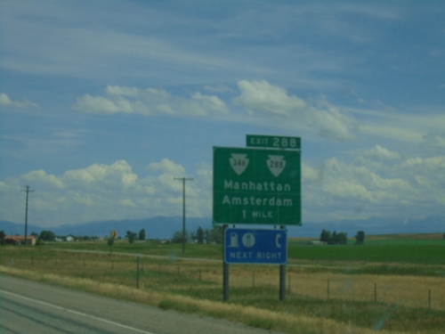
I-90 East - Exit 288
I-90 east approaching Exit 288 - MTS-288/MTS-346/Manhattan/Amsterdam.
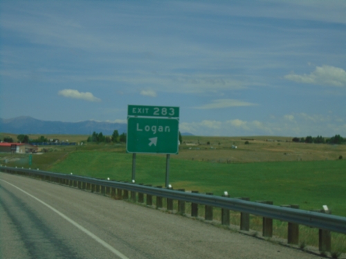
I-90 East - Exit 283
I-90 east at Exit 283 - Logan
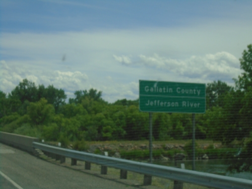
I-90 East - Gallatin County
Entering Gallatin County on I-90 east at the Jefferson River bridge.

I-90 East - Exit 278
I-90 east approaching Exit 278 - MT-2/MTS-205/Three Forks/Trident.

I-90 East - Exit 267
I-90 east approaching Exit 267 - Milligan Canyon Road.

I-90 East - Exit 256
I-90 east at Exit 256 - MTS-359/Cardwell/Boulder.
End MT-55 North at I-90
End MT-55 North at I-90 in Whitehall.

End MT-55 North at I-90
End MT-55 North at I-90 in Whitehall. Use I-90 West to Butte; I-90 East to Billings.
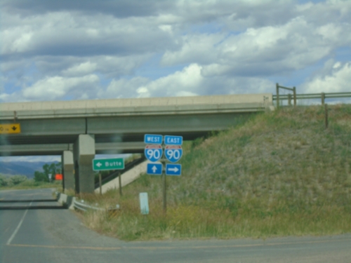
MT-2 East/MT-55 North at MT-69 and MT-55/To I-90
MT-2 East/MT-55 North at MT-69 and MT-55/To I-90 in Whitehall. Turn left for MT-55 North to I-90; continue straight for MT-2 East/MT-69 North.

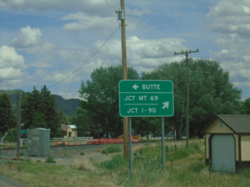
MT-2 East/MT-55 North - Whitehall
MT-2 East/MT-55 North in Whitehall
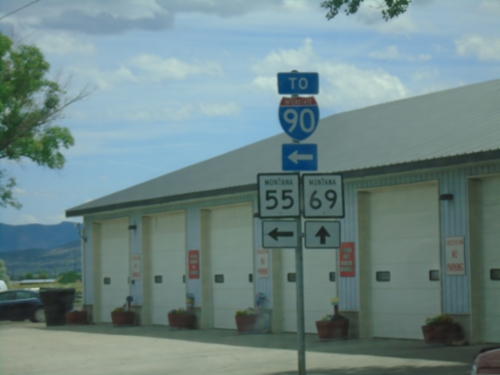
MT-55 North at MT-2
MT-55 North at MT-2 in Whitehall.
MT-55 North at MT-2
MT-55 North at MT-2 in Whitehall. Use MT-2 west to Butte; MT-2 East/MT-55 North to Jct I-90 and Jct. MT-69.

MT-55 North Approaching MT-2
MT-55 North approaching MT-2 in Whitehall.
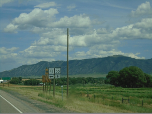
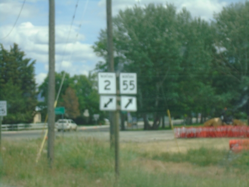
MT-41 North at MT-55
MT-41 North at MT-55 in Madison County.

ID-75 North at US-20
ID-75 north at US-20. Use US-20 east for Carey; US-20 west for Fairfield. Continue north to Sun Valley.