Signs From July 2025
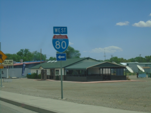
NV-305 North at I-80 West
NV-305 North at I-80 West in Battle Mountain.
NV-305 North at I-80 West
NV-305 North at I-80 West (Exit 231). Use I-80 west for Winnemucca. Continue north on NV-305 for Battle Mountain.
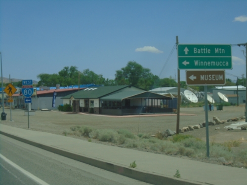
NV-305 North at I-80 - Battle Mountain
NV-305 North at I-80 in Battle Mountain.
End NV-361 North at US-50 - Middlegate Junction
End NV-361 North at US-50 - Middlegate Junction
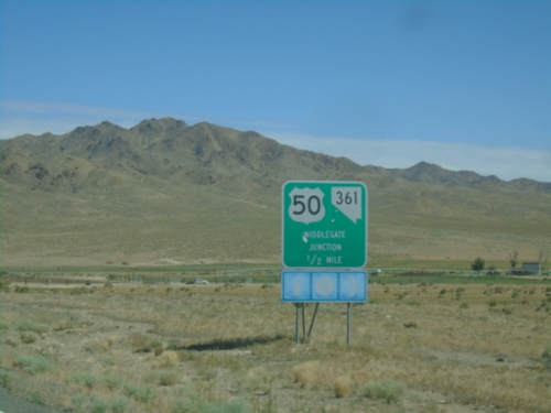
NV-361 North Approaching US-50 - Middlegate Junction
NV-361 North approaching US-50 - Middlegate Junction.
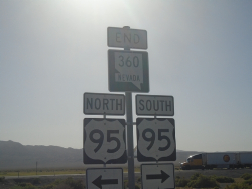
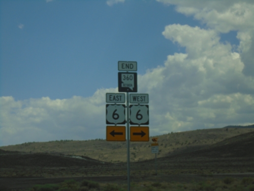
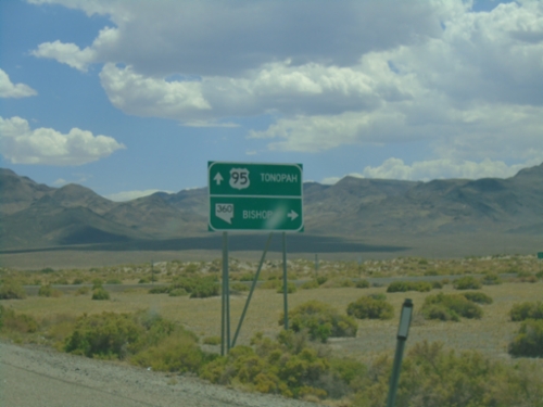
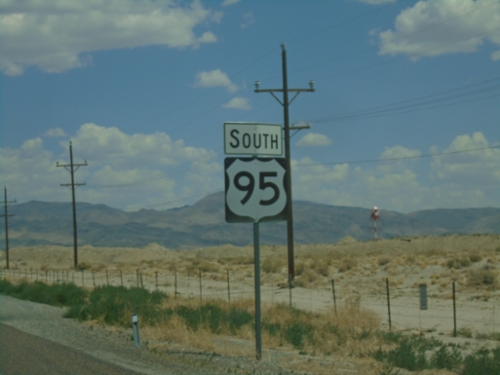
End NV-360 North at US-95
End NV-360 North at US-95 in Mineral County.
End NV-360 North at US-95
End NV-360 North at US-95. Use US-95 south to Tonopah; US-95 north to Mina and Hawthorne.
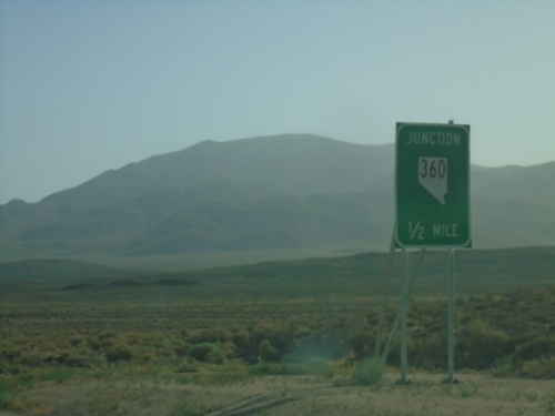
NV-360 North Approaching US-95
NV-360 North approaching US-95 in Mineral County.
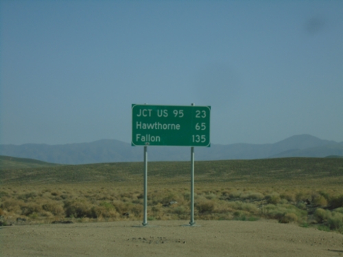
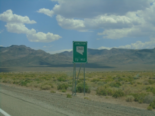
NV-360 North - Distance Marker
Distance marker on NV-360 north. Distance to Jct. US-95, Hawthorne, and Fallon.
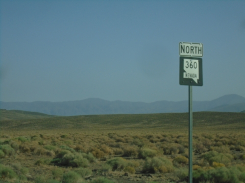
NV-360 North - Mineral County
NV-360 North in Mineral County
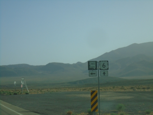
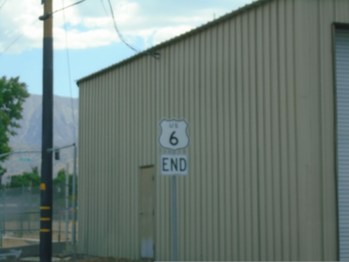
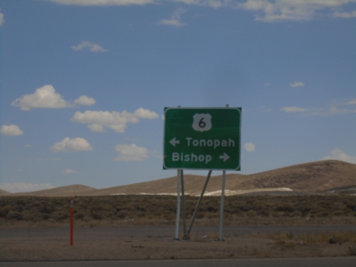
US-6 East at NV-360
US-6 East at NV-360 in Mineral County.
US-6 East at NV-360
US-6 East at NV-360 to Hawthorne. Continue east on US-6 to Tonopah.
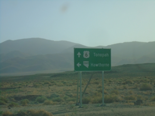
US-6 East Approaching NV-360
US-6 East approaching NV-360 in Mineral County.
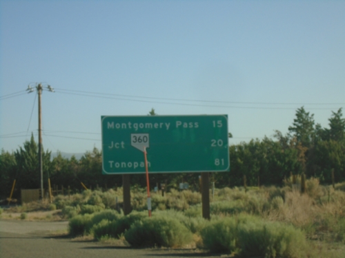
US-6 East - Distance Marker
Distance marker on US-6 east. Distance to Montgomery Pass (NV), Jct NV-360, Tonopah (NV).
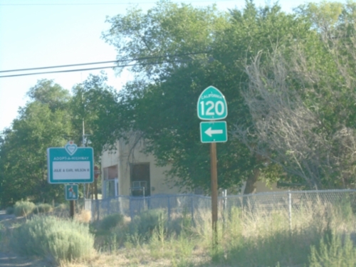
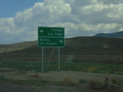
US-6 East at CA-120
US-6 East at CA-120 West in Benton.
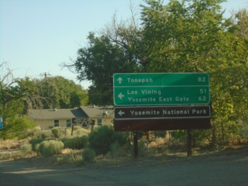
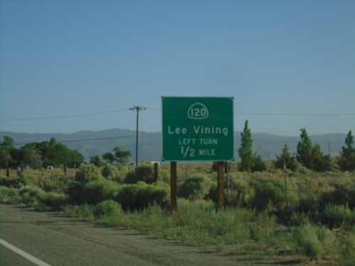
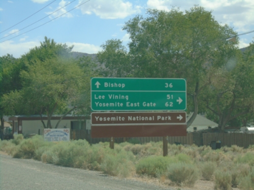
US-6 East Approaching CA-120
US-6 East approaching CA-120 west to Lee Vining, Yosemite East Gate and Yosemite National Park. Continue east on US-6 to Tonopah (Nevada).
US-6 East Approaching CA-120
US-6 East approaching CA-120 East to Lee Vining.
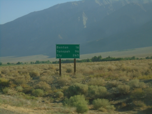
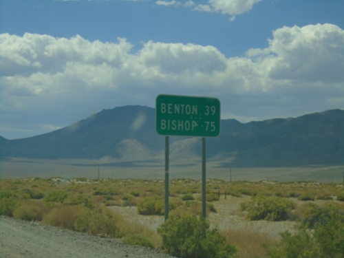
US-6 East - Distance Marker
Distance marker on US-6 east. Distance to Benton, Tonopah (NV), and Ely (NV).
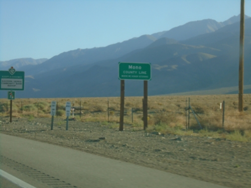
US-6 East - Mono County
Mono County Line on US-6 East.
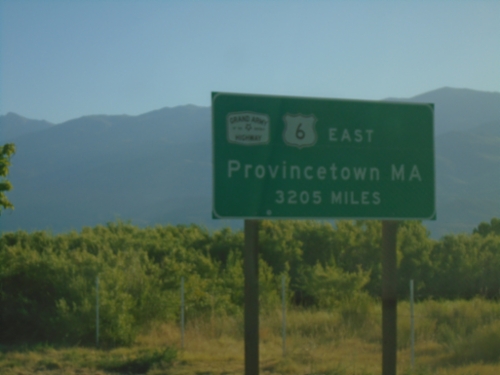
US-6 East - Distance Marker
Distance marker on US-6 east. Distance to eastern terminus in Provincetown, MA - 3205 miles. US-6 is the Grand Army of the Republic Highway.
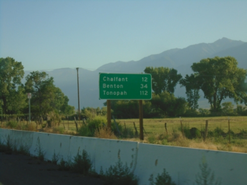
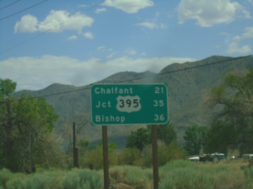
US-6 East - Distance Marker
First distance marker eastbound on US-6. Distance to Chaflant, Benton, and Tonopah (Nevada).
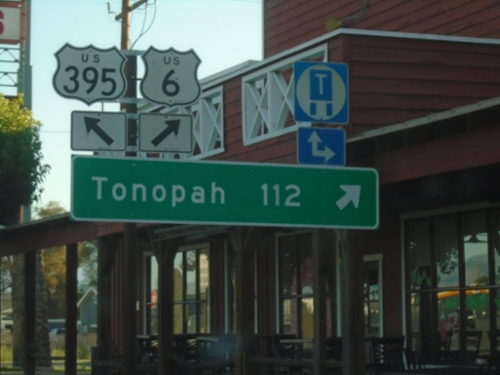
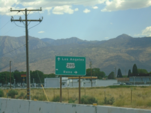
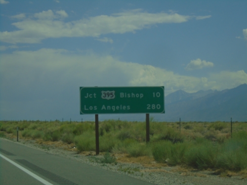
US-395 North at US-6
US-395 north at US-6 in Bishop. Use US-6 east for Tonopah (Nevada). This is the western terminus of US-6. The eastern end of US-6 is Provincetown, MA.
US-395 North Approaching US-6
US-395 north approaching US-6 in Bishop. Use US-6 east for US-95. This is the western terminus of US-6.
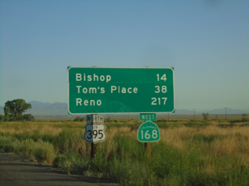
US-395 North/CA-168 West - Distance Marker
Distance marker on US-395 North/CA-168 West. Distance to Bishop, Tom’s Place, and Reno (Nevada)
US-395 North Approaching CA-168
US-395 north approaching CA-168 east. Use CA-168 east for US-95 (in Nevada). CA-168 heads east from here over the White Mountains into Nevada.
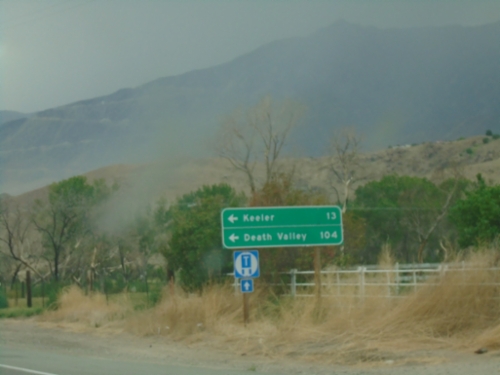
US-395 South at CA-136
US-395 south at CA-136 east to Keeler and Death Valley.
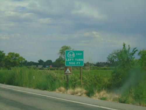
US-395 South/CA-168 East Approaching US-395/CA-168 Split
US-395 South/CA-168 East approaching US-395/CA-168 split in Big Pine.
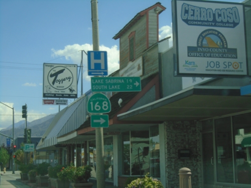
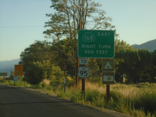
US-395 South at CA-168 West
US-395 South at CA-168 West to Lake Sabrina and South Lake. CA-168 east joins US-395 south to Big Pine.
End US-6 West at US-395
End US-6 West at US-395 in Bishop. The eastern end of US-6 is in Provincetown, Massachusetts.
US-6 West Approaching US-395
Approaching western end of US-6 at US-395 junction. Turn right for US-395 north towards Reno (Nevada). Continue ahead for US-395 south towards Los Angeles.
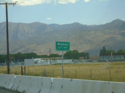
US-6 West - Bishop
Bishop City Limit on US-6 south. Bishop is the largest city in Inyo County.
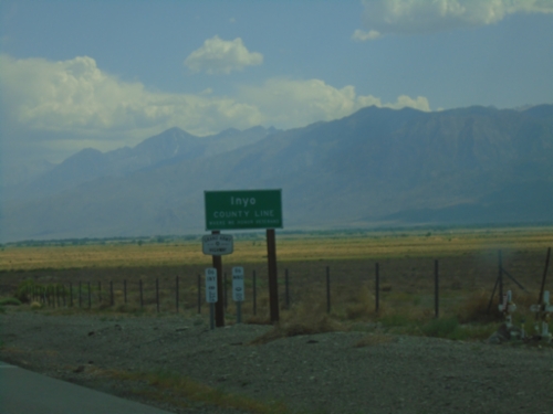
US-6 West - Inyo County Line
Inyo County Line on US-6 west. US-6 is part of the Grand Army of the Republic Highway. Taken at the Mono-Inyo county line.
US-6 West - Distance Marker
Distance marker on US-6 west. Distances to Jct. US-395 - Bishop, and Los Angeles.
US-6 West - Distance Marker
Distance marker on US-6. Distance to Chaflant, Jct. US-395, and Bishop.
US-6 West at CA-120 West
US-6 West at CA-120 West. Use CA-120 west for Lee Vining, Yosemite East Gate, and Yosemite National Park. Continue west on US-6 for Bishop.

US-6 West Approaching CA-120
US-6 west approaching CA-120 west to Lee Vining.
End NV-360 at US-6
End NV-360 at US-6. Use US-6 west to Bishop (California); US-6 east to Tonopah.
End NV-360 South at US-6
End NV-360 South at US-6 in Mineral County.
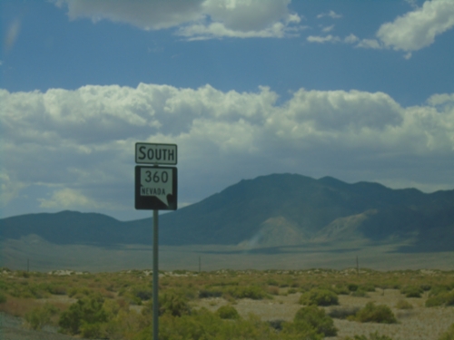
NV-360 South at US-6
NV-360 South at US-6. Use US-6 west for Bishop (California) and Los Angeles (California). Use US-6 east for Tonopah and Las Vegas (via US-95).
NV-360 South - Distance Marker
Distance marker on NV-360 south. Distance to Benton (CA) and Bishop (CA).
NV-360 South - Mineral County
NV-360 South in Mineral County
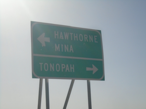
US-95 South at NV-360
US-95 south at NV-360. Use NV-360 south to Bishop (CA); continue south on US-95 to Tonopah.
US-95 South Approaching NV-360
US-95 South approaching NV-360 in Mineral County.
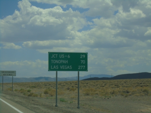
US-95 South - Distance Marker
Distance marker on US-95 south. Distance to Jct. US-6, Tonopah, and Las Vegas.
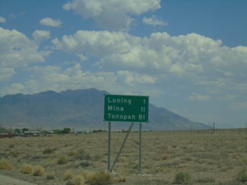
US-95 South - Distance Marker
Distance marker on US-95 south. Distance to Luning, Mina, and Tonopah.
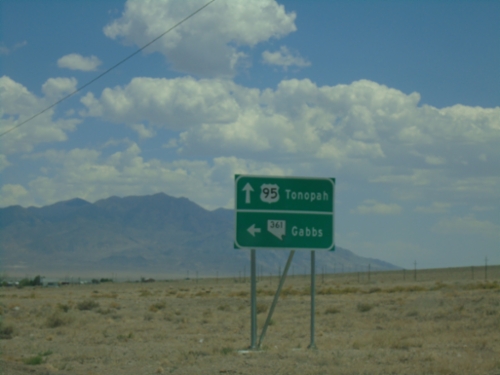
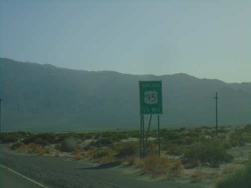
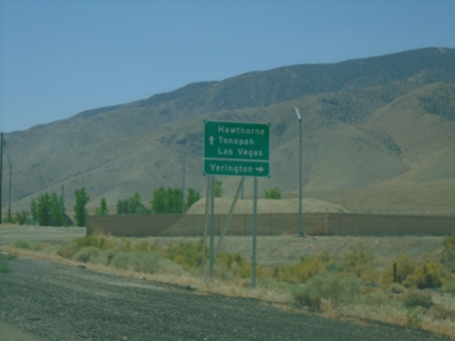
US-95 South at NV-361
US-95 South at NV-361 North to Gabbs. Continue south on US-95 to Tonopah.
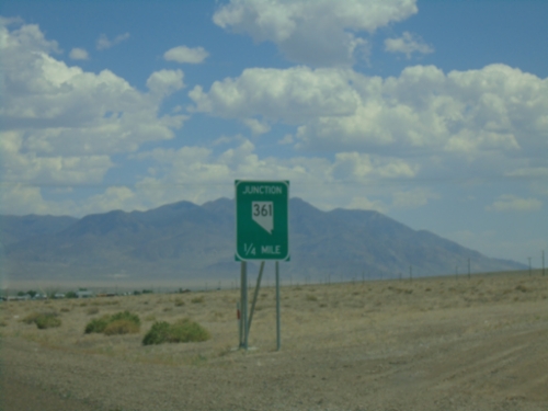
US-95 South Approaching NV-361
US-95 South approaching NV-361 in Luning.
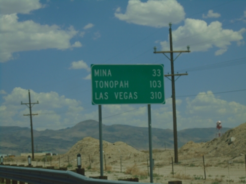
US-95 South - Distance Marker
Distance marker on US-95 south. Distance to Mina, Tonopah, and Las Vegas.
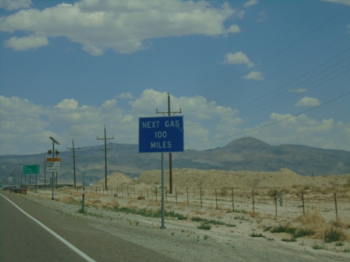
US-95 South - Next Gas 100 Miles
Next Gas 100 Miles (in Tonopah) on US-95 south.
US-95 South - Mineral County
US-95 South in Mineral County
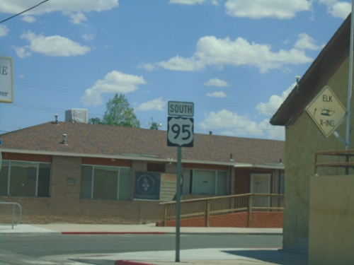
US-95 South - Hawthorne
US-95 South in Hawthorne
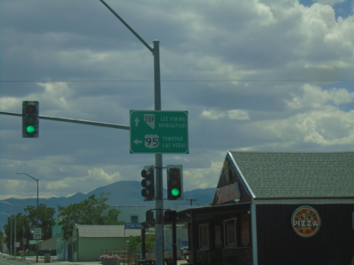
US-95 South at NV-359 South
US-95 south at NV-359 west to Lee Vining (CA) and Bridgeport (CA). Turn left to continue south on US-95 to Tonopah and Las Vegas.
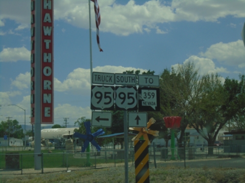
US-95 South at Truck US-95
US-95 South at Truck US-95 in Hawthorne. Continue south on US-95 for NV-359.
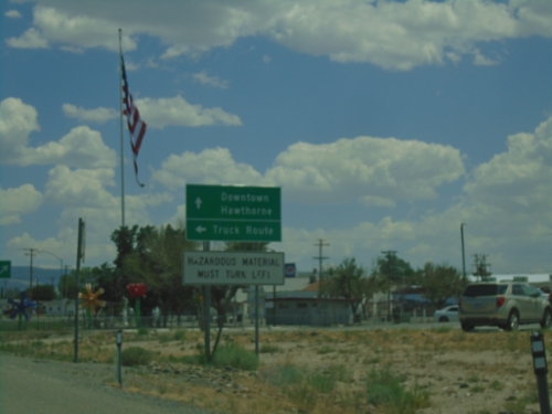
US-95 South Approaching US-95 Truck Route
US-95 south approaching Truck US-95 South. Turn left for Truck Route; continue straight for US-95 to Downtown Hawthorne. Hazardous Material Must Turn Left.
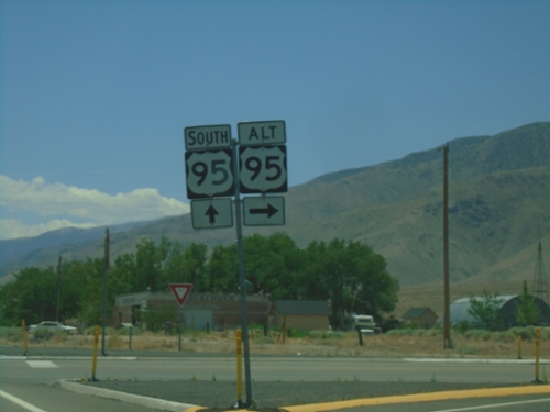
US-95 South/US-95 Alt.
US-95 south at Alt US-95 north to Yerrington
US-95 South Approaching Alt. US-95
US-95 South approaching Alt. US-95. Use Alt. US-95 North to Yerrington; US-95 south to Hawthorne, Tonopah, and Las Vegas.
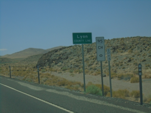
US-95 South - Lyon County
Lyon County Line on US-95 South. Mile 0 US-95 Churchill (CH) County. US-95 runs through a short 2 mile stretch of Lyon County.
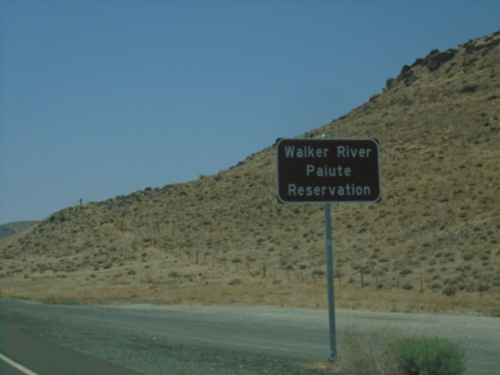
US-95 South - Walker Paiute Indian Reservation
Entering Walker Paiute Indian Reservation on US-95 South
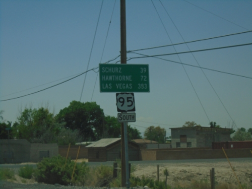
US-95 South - Distance Marker
Distance marker on US-95 south. Distance to Schurz, Hawthorne, and Las Vegas.
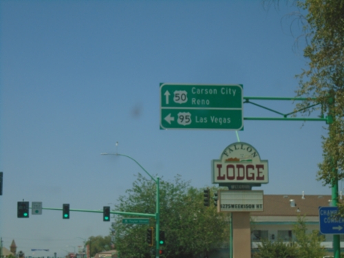
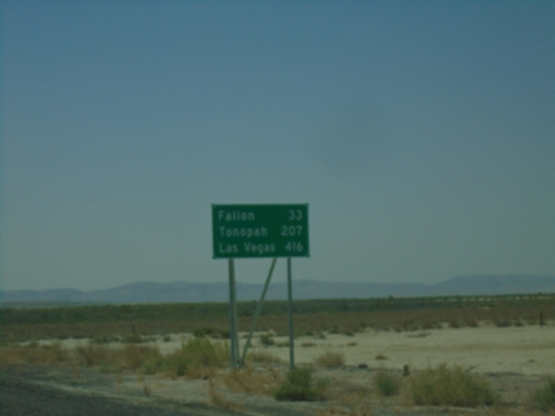
US-50 West/US-95 South at US-50/US-95 Split
US-50 West/US-95 South at US-50/US-95 Split in Fallon. Use US-50 West to Carson City and Reno; US-95 South to Las Vegas.
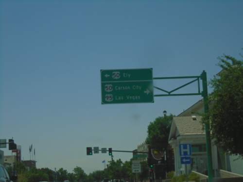
US-95 South at US-50
US-95 South at US-50 in Fallon. Use US-50 East to Ely. Turn right for US-50 West to Carson City and US-95 South to Las Vegas.
US-95 South - Distance Marker
Distance marker on US-95 South. Distance to Fallon, Tonopah, and Las Vegas.
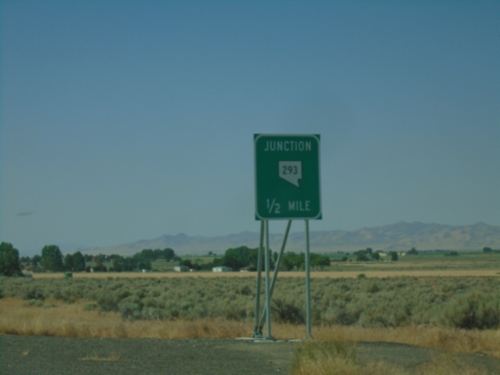
US-95 South Approaching NV-293
US-95 South approaching NV-293 in Orovada.
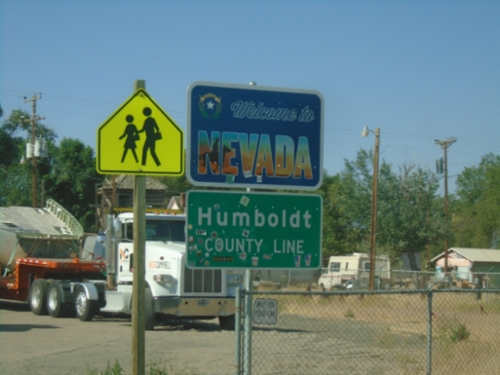
US-95 South - Welcome To Nevada
US-95 South - Welcome To Nevada / Humboldt County Line. Taken at the state line of Nevada and Oregon in McDermitt.
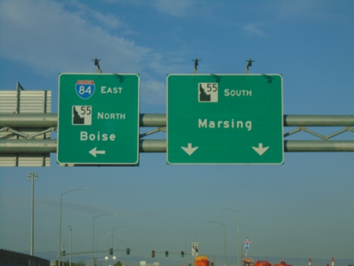
Karcher Road West Approaching I-84 East/ID-55 North
Karcher Road West approaching I-84 East/ID-55 North (Exit 33) to Boise. Continue west on ID-55 for Marsing.
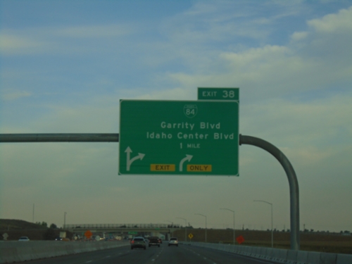
I-84 West - Exit 38
I-84/US-30 west at Exit 38 - BL-84/Garrity Blvd./Idaho Center Blvd.
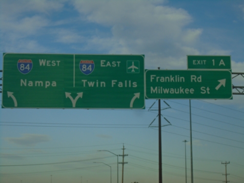
I-184 West - Exit 1A
I-184 west at Exit 1A - Franklin Road/Milwaukee St.. Approaching I-84 to Nampa and Twin Falls.
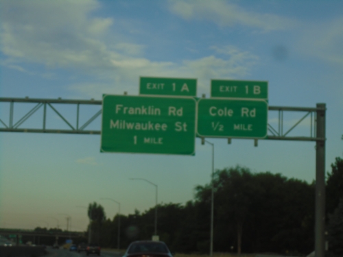
I-184 West - Exits 1B and 1A
I-184 west approaching Exit 1B - Cole Road. Approaching Exit 1A - Franklin Road/Milwaukee St.
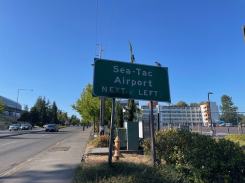
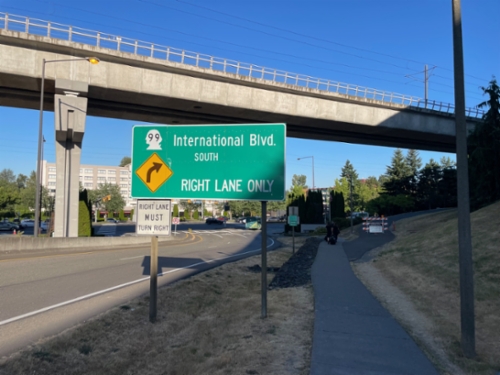
WA-99 North Approaching Sea-Tac Airport
WA-99 North approaching Sea-Tac Airport entrance.
SeaTac Airport Arrivals Road Approaching WA-99
SeaTac Airport Arrivals Road approaching WA-99. Use right lane for WA-99 South/International Blvd.
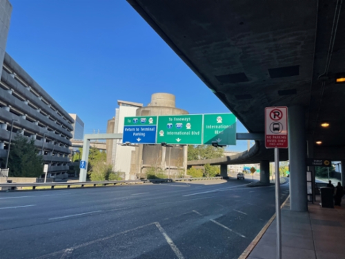
SeaTac Airport Arrivals Road At Airport Expressway
SeaTac Airport Arrivals Road at Airport Expressway to I-5/I-405/WA-509 Freeways and Return to Terminal/Parking. Use right lanes for WA-99/International Blvd.
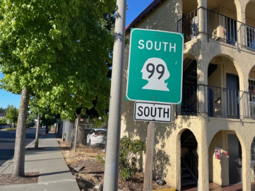
WA-99 South - SeaTac
WA-99 South (International Blvd) in SeaTac. South is repeated twice on this sign assembly.
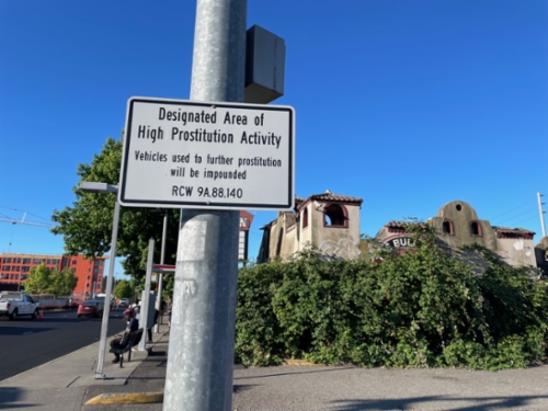
WA-99 South - Designated Area of High Prostitution Activity
WA-99 South (International Blvd.) in SeaTac - Designated Area of High Prostitution Activity - Vehicles used to farther prostitution will be impounded.
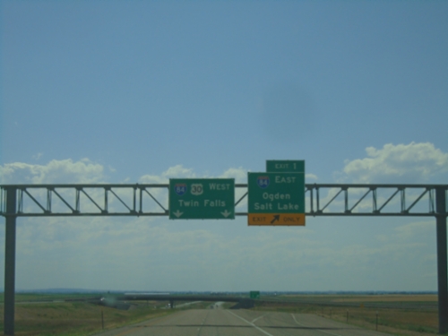
I-86 West - Exit 1
End I-86 West at I-84. Use Exit 1 for I-84 East/Ogden (UT)/Salt Lake(UT). Continue straight for I-84/US-30 West to Twin Falls.
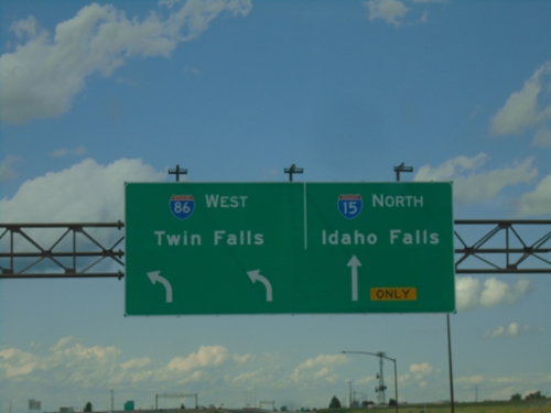
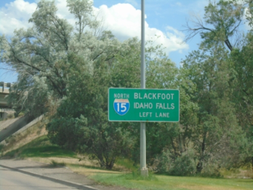
I-15 North at I-86 West
I-15 North at I-86 West to Twin Falls. Continue north on I-15 to Idaho Falls.
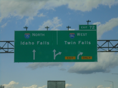
I-15 North at Exit 72
I-15 north at Exit 72 - I-86 West/Twin Falls. Continue north on I-15 to Idaho Falls.
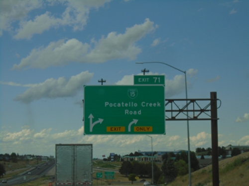
I-15 North - Exits 71
I-15 north at Exit 71 - BL-15/Pocatello Creek Road.
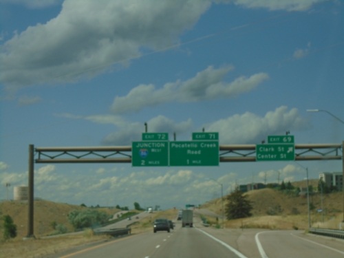
I-15 North - Exits 69, 71, and 72
I-15 north at Exit 69 - Clark St./Center St. Approaching Exit 71 - Pocatello Creek Road, and Exit 72 - Junction I-86 West.
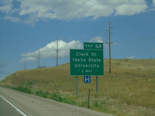
I-15 North - Exit 69
I-15 north approaching Exit 69 - Clark St./Idaho State University.
BL-15 South (S 5th Ave) at I-15 North
BL-15 South (S 5th Ave) at I-15 North in Pocatello.
BL-15 South (S 5th Ave) at I-15 North
BL-15 South (S 5th Ave) at I-15 North in Pocatello. Use I-15 north to Blackfoot and Idaho Falls. This is the southern end of the Pocatello business loop.
S 5th Ave. South Approaching I-15 North
S 5th Ave. South (BL-15) approaching I-15 North to Blackfoot and Idaho Falls.
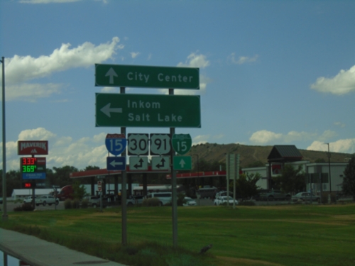
S 5th Ave North at I-15 South
S 5th Ave North at I-15 South in Pocatello. Turn left for I-15/US-91 South/US-30 East to Inkom and Salt Lake. Continue straight for BL-15/US-91 North/US-30 West to (Pocatello) City Center.
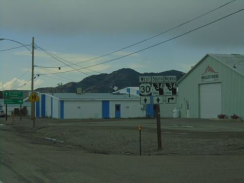
US-30 West at ID-34
US-30 west at ID-34 in Soda Springs. ID-34 joins US-30 west through Soda Springs.
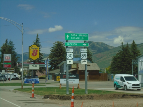
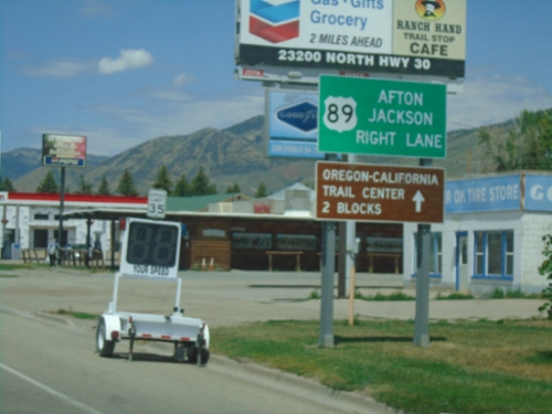
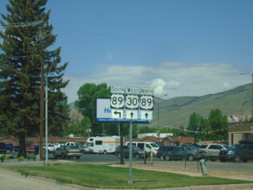
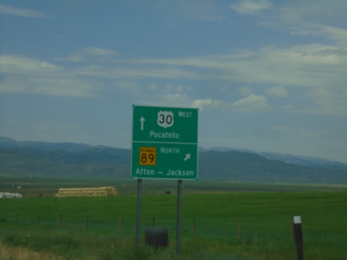
US-89 North/US-30 West at US-89 North
US-89 north/US-30 west at US-89 north to Jackson (WY). Continue west on US-30 for Soda Springs and Pocatello.
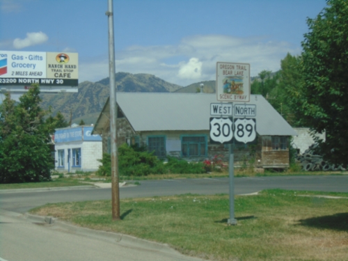
US-30 West/US-89 North - Montpelier
US-30 West/US-89 North approaching US-30/US-89 split in Montpelier. Use US-89 north for Afton (WY) and Jackson (WY). Continue straight for the Oregon-California Trail Center.
US-30 West/US-89 North - Montpelier
US-30 West/US-89 North - part of the Oregon Trail - Bear Lake Scenic Byway. Taken in Montpelier.
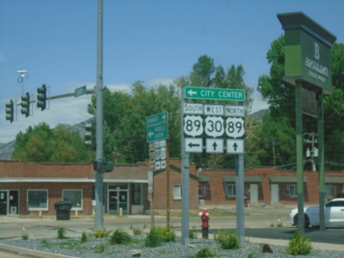
US-30 West at US-89
US-30 West at US-89 in Montpelier. Turn left for US-89 south at (Montpelier) City Center. Continue straight for US-30 West/US-89 North.
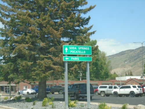
US-30 West at US-89
US-30 west at US-89. Turn left for US-89 south to Paris. Continue ahead for US-30 West towards Soda Springs and Pocatello, and US-89 north.
US-30 West at US-89
US-30 west at US-89 in Montpelier. US-89 joins US-30 through Montpelier.
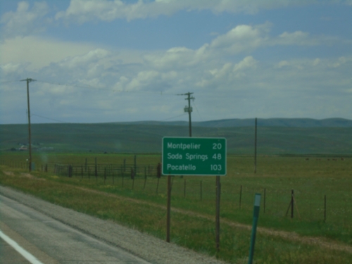
US-30 West - Distance Marker
First distance marker on US-30 west in Idaho. Distance to Montpelier, Soda Springs, and Pocatello.
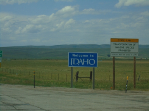
Welcome To Idaho - US-30 West
Welcome to Idaho on US-30 west. Entering Bear Lake County. Taken at the Wyoming-Idaho Border.
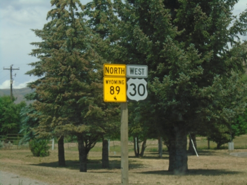
US-30 West/WY-89 North at WY-89
US-30 West/WY-89 North at WY-89 north jct. Use WY-89 north for Afton. Continue west on US-30 for Pocatello (Idaho).
US-30 West/WY-89 North at WY-89
US-30 West/WY-89 North at WY-89 north jct. Use WY-89 north for Afton and Jackson. Continue west on US-30 for Pocatello (Idaho).
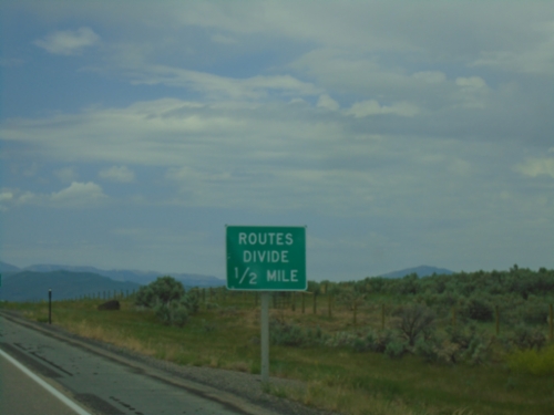
Routes Divide on US-30 West/WY-89 North
Routes Divide on US-30 West/WY-89 North approaching WY-89 North junction. The Routes Divide sign is common in Wyoming whenever a multiplexed route splits.
US-30 West/WY-89 North - Cokeville
US-30 West/WY-89 North in Cokeville.
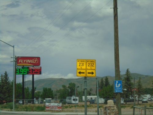
US-30 West at WY-231/WY-232
US-30 west at WY-231/WY-232 in Cokeville.
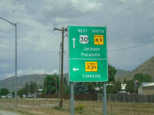
US-30 West/WY-89 North Approaching WY-231/WY-232
US-30 West/WY-89 North approaching WY-231/WY-232 (not signed). Use WY-231 for Cokeville. Continue on US-30 West/WY-89 North for Jackson and Pocatello (Idaho).
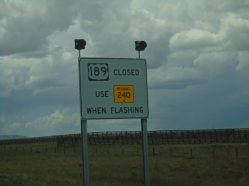
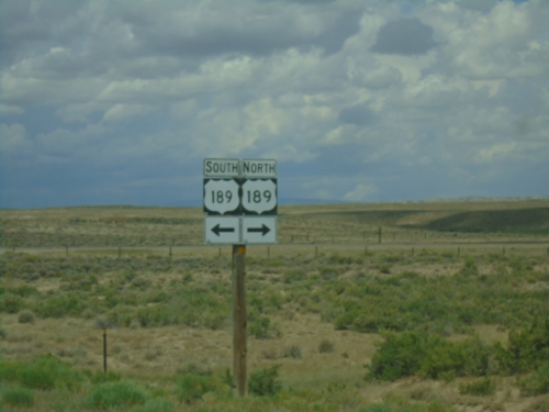
US-189 South - Road Closure Information
US-189 south approaching WY-240. When lights are flashing US-189 is closed - use WY-240.
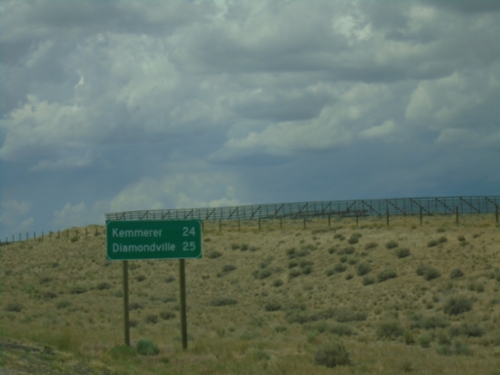
US-189 South - Distance Marker
Distance marker on US-189 south. Distance to Kemmerer and Diamondville.
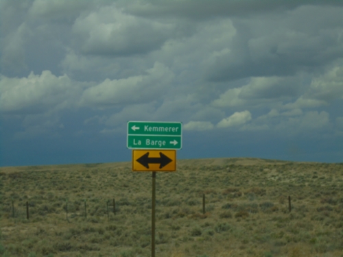
End WY-372 at US-189
End WY-372 (La Barge Road) at US-189. Use US-189 north for La Barge; use US-189 south for Kemmerer.
End WY-372 at US-189
End WY-372 (La Barge Road) at US-189.
WY-372 West Approaching US-189
WY-372 West (La Barge Road) approaching US-189.
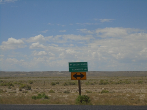
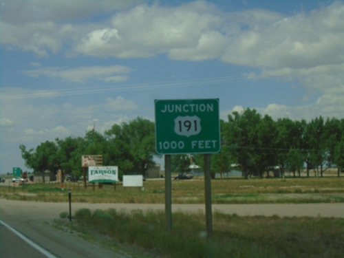
End WY-28 West at WY-372
End WY-28 west at WY-372 (La Barge Road). Use WY-372 north for Kemmerer; use WY-372 south for Green River.
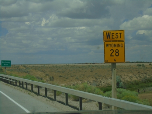
WY-28 West - Farson
WY-28 west in Farson. Approaching the Big Sandy River bridge.
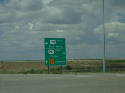
WY-28 West at US-191
WY-28 West at US-191 in Farson. Use US-191 North to Pinedale; US-191 South to Rock Springs. Continue west on WY-28 for Kemmerer.
WY-28 West Approaching US-191
WY-28 west approaching US-191 in Farson.
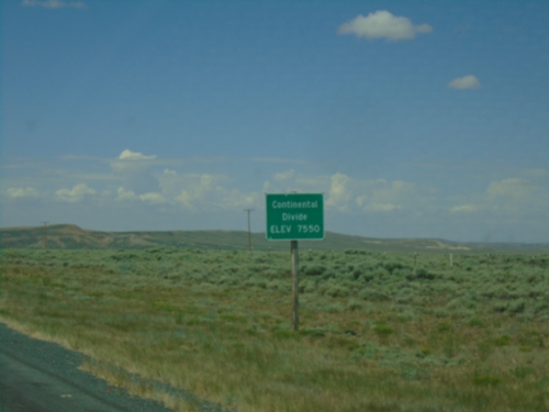
WY-28 West - Continental Divide
WY-28 West - Continental Divide (South Pass) - Elevation 7550 Feet.
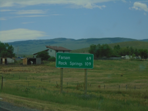
WY-28 West - Distance Marker
Distance marker on WY-28 west. Distance to Farson and Rock Springs.
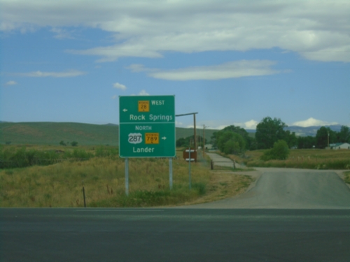
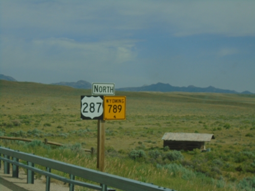
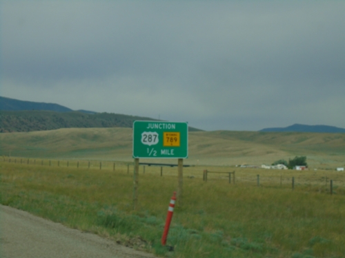
US-287/WY-789 North at WY-28
US-287 North/WY-789 North at WY-28. Turn left for WY-28 to Rock Springs; turn right for US-287/WY-789 to Lander.
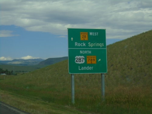
US-287/WY-789 North Approaching WY-28
US-287/WY-789 North approaching WY-28. Use US-287/WY-789 north for Lander. Use WY-28 west for Rock Springs.
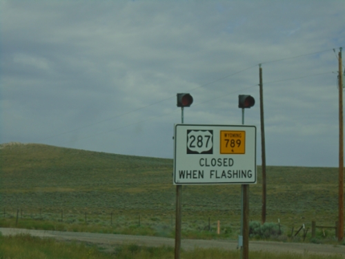
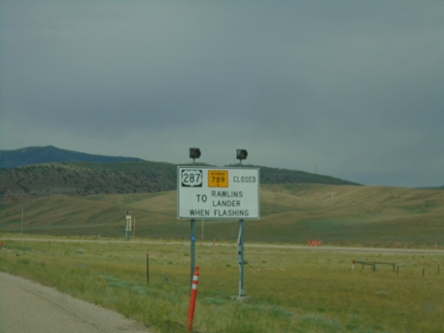
US-287/WY-789 North - Winter Closure
US-287/WY-789 North Closed When Flashing.
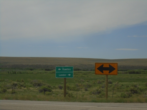
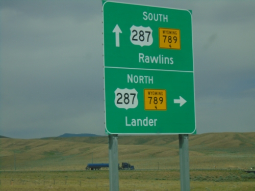
End WY-135 South at US-287/WY-789
End WY-135 South at US-287/WY-789. Use US-287/WY-789 North to Lander; US-287/WY-789 South to Rawlins.
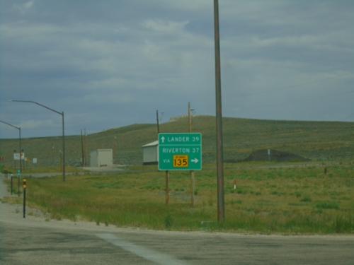
US-287/WY-789 North at WY-135
US-287/WY-789 North at WY-135 junction. Use WY-135 north for Riverton, continue on US-287/WY-789 for Lander. Taken in the community of Sweetwater Station.
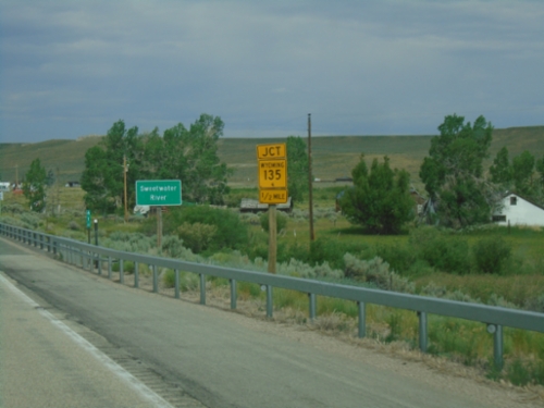
US-287/WY-789 North Approaching WY-135
US-287/WY-789 North approaching WY-135 at Sweetwater Station. Crossing the Sweetwater River.
US-287/WY-789 North - Carbon County
US-287/WY-789 North in Carbon County
US-287/WY-789 Closed When Flashing - Muddy Gap Junction
US-287/WY-789 Closed When Flashing at Muddy Gap Junction. US-287/WY-789 closed to Rawlins and Lander when lights flashing.
End WY-220 West at US-287/WY-789
End WY-220 West at US-287/WY-789 - Muddy Gap Junction. Turn right for US-287/WY-789 North to Lander; straight for US-287/WY-789 South to Rawlins.
WY-220 West Approaching US-287/WY-789
WY-220 West approaching US-287/WY-789.
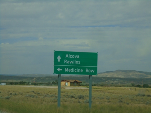
WY-220 West at WY-487
WY-220 west at WY-487 south to Medicine Bow. Continue west on WY-220 for Alcova and Rawlins.
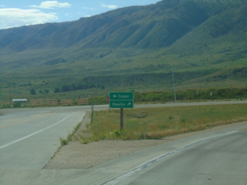
End WY-257 South at WY-220
End WY-257 South (Casper West Belt) at WY-220. Use WY-220 West to Rawlins; WY-220 East to Casper.
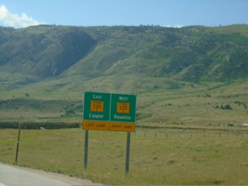
End WY-257 South at WY-220
End WY-257 South (Casper West Belt) at WY-220. Use WY-220 West to Rawlins; WY-220 East to Casper.
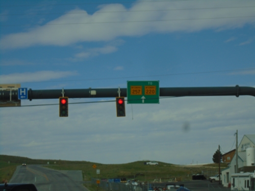
US-20/US-26 West at Bus. US-20/Bus. US-26/WY-257
US-20/US-26 West at Bus. US-20/Bus. US-26/WY-257/To WY-220 in Casper.
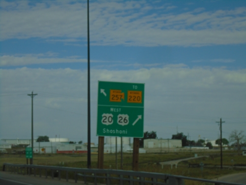
US-20/US-26 West at WY-257/To WY-220
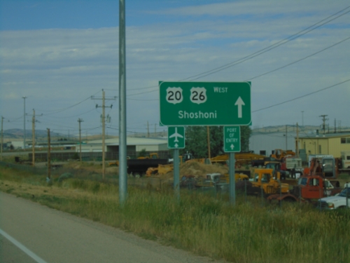
US-20/US-26 West at WY-257/To WY-220 (Casper West Belt Loop) and Bus. US-20/Bus. US-26 (not signed). Turn right to continue west on US-20/US-26 to Shoshoni.
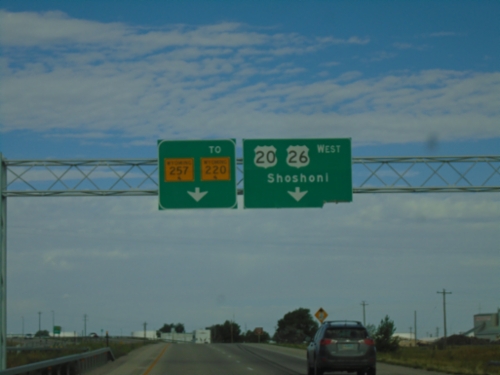
US-20/US-26 West at WY-257/To WY-220 and Bus. US-20/Bus. US-26
US-20/US-26 West at WY-257/To WY-220 and Bus. US-20/Bus. US-26 (not marked) in Casper. Use right lane to continue west on US-20/US-26 to Shoshoni. Continue straight for WY-257/To WY-220 which is the Casper West Belt Route.
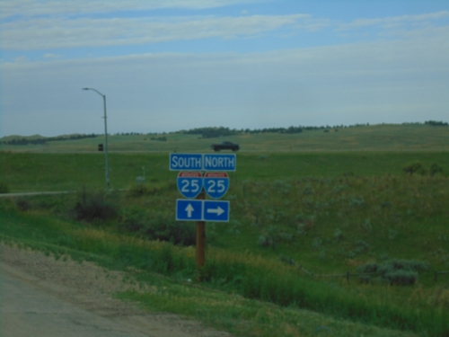
I-25 South - Exit 189 Offramp
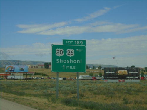
I-25 South - Exit 189 offramp to US-20/US-26 West/Shoshoni.
I-25 South - Exit 189
I-25 south approaching Exit 189 - US-20/US-26 West/Shoshoni.
I-25 South - Exit 191
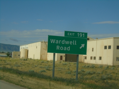
I-25 south at Exit 191 - Wardwell Road. This is the first exit along I-25 in the Casper area.
I-25 South - Exit 191
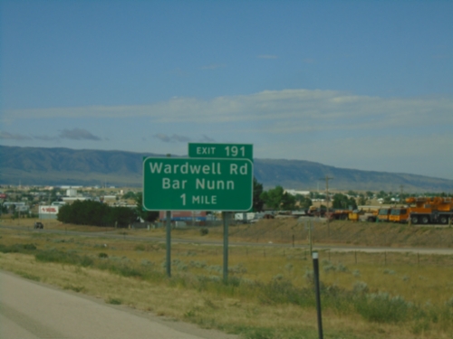
I-25 south approaching Exit 191 - Wardwell Road/Bar Nunn.
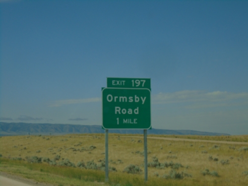
I-25 South - Exit 197
I-25/US-87 South approaching Exit 197 - Ormsby Road.
End WY-259 South at I-25
End WY-259 South at I-25 in Natrona County.
End WY-259 South at I-25
End WY-259 South at I-25 to Casper.
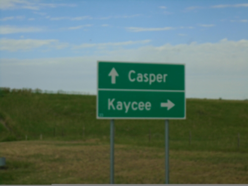
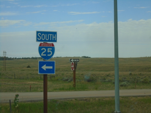
WY-259 South at I-25
WY-259 South at I-25 in Natrona County. Use I-25 north to Kaycee; I-25 south to Casper.
WY-259 South at I-25
WY-259 South at I-25 (Exit 210) in Natrona County.
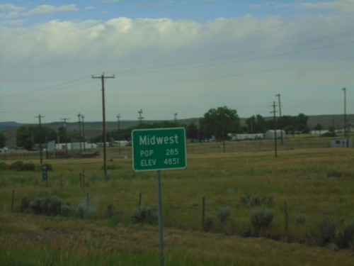
WY-387 West - Midwest
Entering Midwest on WY-387 West.
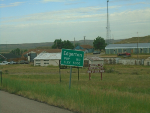
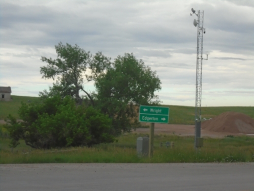
WY-387 West - Edgerton
Entering Edgerton on WY-387 West.
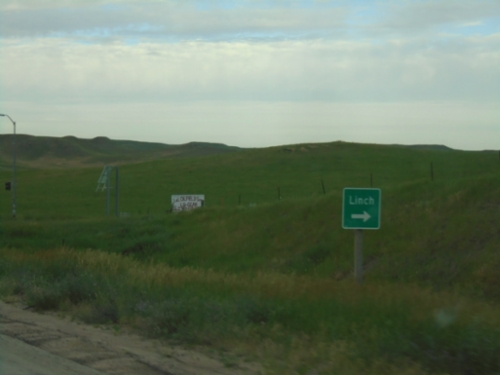
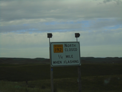
WY-387 South at WY-192
WY-387 South at WY-192. Use WY-192 north for Linch.
WY-387 West Approaching WY-192
WY-387 West approaching WY-192 in Johnson County. WY-192 Closed When Lights Flashing.
End WY-50 South at WY-387
End WY-50 South at WY-387 in Campbell County. Use WY-387 West to Edgerton; WY-387 East to Wright.
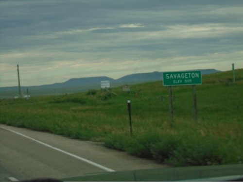
WY-50 South - Savageton
Entering Savageton - Elevation 5115 on WY-50 south.
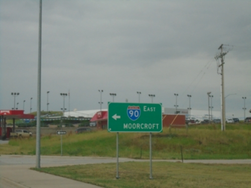
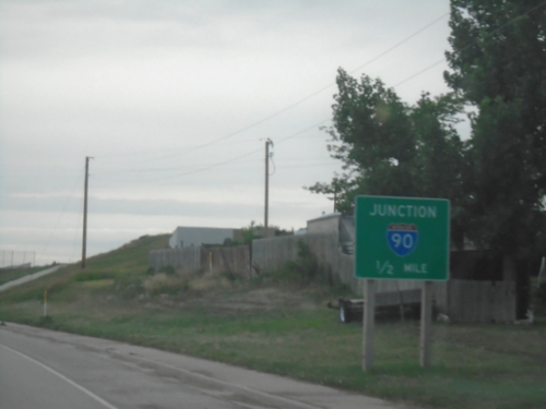
BL-90 West/WY-50 South at I-90 West
BL-90 West/WY-50 South at I-90 West to Moorcroft.
I-90 West - Exit 124 Offramp
I-90 West - Exit 124 offramp in Gillette. Turn right for BL-90/(To) US-14/(To) US-16.
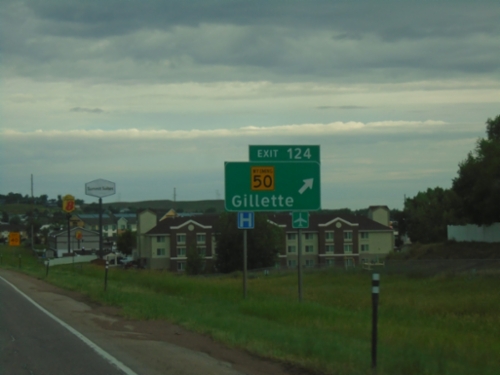
I-90 West - Exit 124
I-90 west at Exit 124 - WY-50/Gillette.
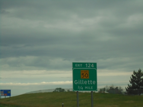
I-90 West - Exit 124
I-90 west approaching Exit 124 - WY-50/Gillette.
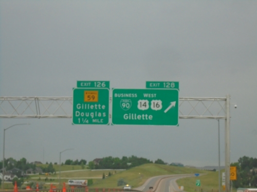
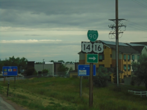
I-90 West - Exits 128 and 126
I-90 West at Exit 128 - BL-90/US-14/US-16 West/Gillette. Approaching Exit 126 - WY-59/Gillette/Douglas.
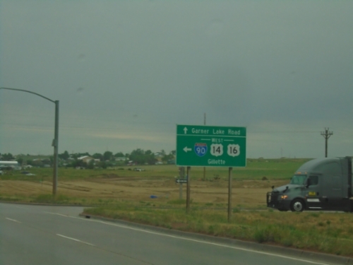
Garner Lake Road at I-90 West
Garner Lake Road at I-90/US-14/US-16 West. Turn left for I-90/US-14/US-16 West to Gillette.
Garner Lake Road North at I-90
Garner Lake Road North at I-90/US-14/US-16 (Exit 129) in Gillette. Use I-90/US-14/US-16 East to Moorcroft; I-90/US-14/US-16 West to Gillette.
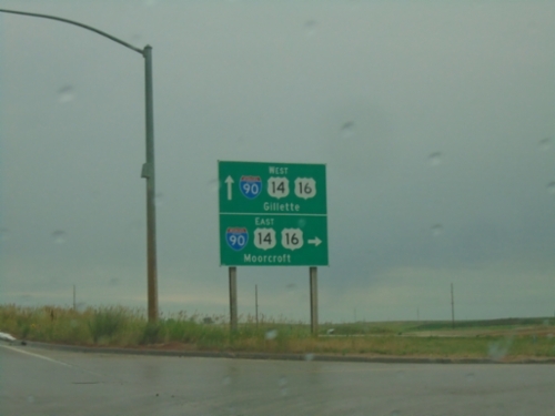
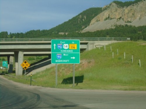
BL-90/US-14/US-16 at I-90 Junction
BL-90/US-14/US-16 at I-90 in Moorcroft. Use I-90 East to Sundance; I-90/US-14/US-16 West to Gillette.
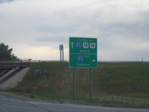
BL-90/US-14/US-16 West Approaching I-90
BL-90/US-14/US-16 West approaching I-90 in Moorcroft.
US-14 West Approaching US-16/BL-90
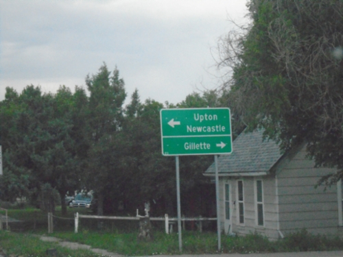
US-14 West approaching US-16/BL-90 in Moorcroft. Turn right for BL-90/US-14/US-16 West to Gillette; turn left for BL-90/US-16 East to Upton and Newcastle.
US-14 West at WY-113
US-14 West at WY-113 to Pine Haven.
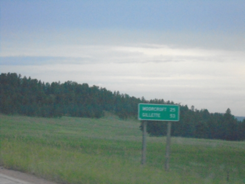
US-14 West - Distance Marker
Distance marker on US-14 west. Distance to Moorcroft and Gillette.
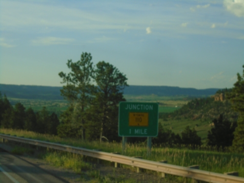
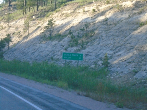
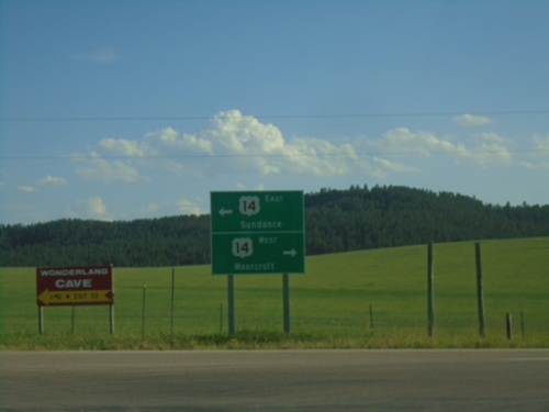
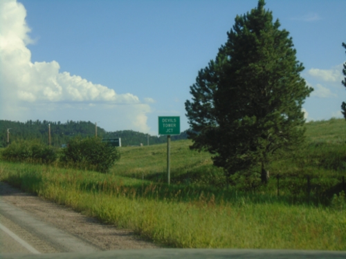
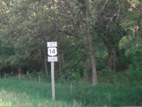
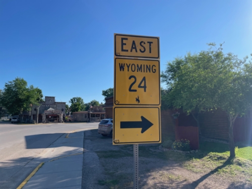
End WY-24 West at US-14
End WY-24 West at US-14 at Devils Tower Junction. Use US-14 west to Moorcroft; US-14 east to Sundance.
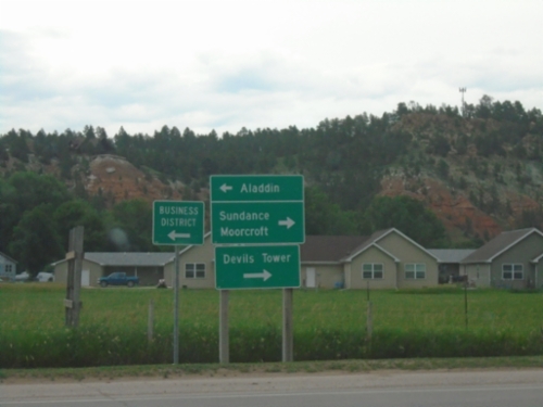
End WY-112 South at WY-24
End WY-112 South at WY-24 in Hulett. Use WY-24 East to Aladdin; use WY-24 West to Sundance, Moorcroft, and Devils Tower.
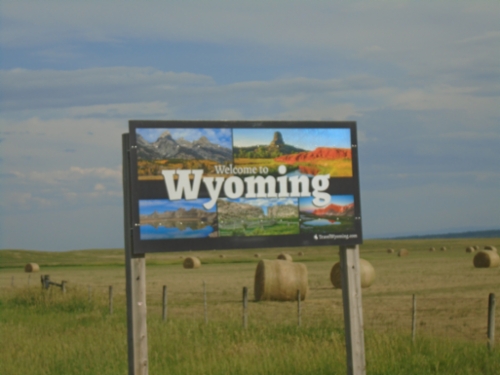
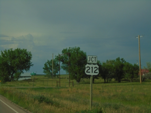
US-212 East - Welcome To Wyoming
Welcome to Wyoming on US-212 East. Taken at the Montana-Wyoming State Line.
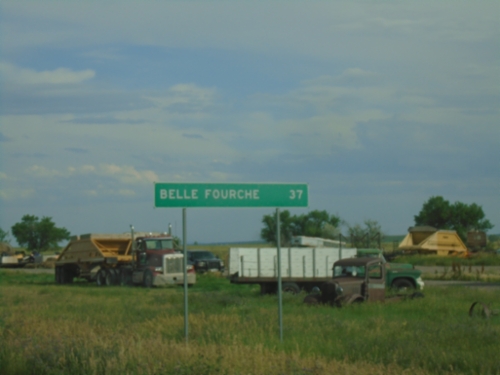
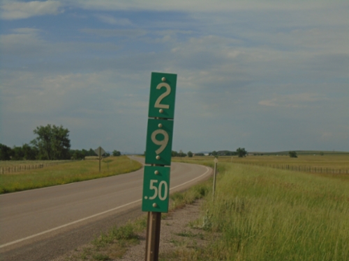
US-212 East - Distance Marker
Distance marker on US-212 east. Distance to Belle Fourche (SD).
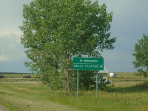
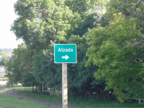
MTS-326 Approaching US-212
MTS-326 Approaching US-212 in Alzada. Use US-212 West to Broadus; US-212 East to Belle Fourche (SD).
MTS-326 North approaching US-212
MTS-326 North Approaching US-212 in Alzada.
WY-112 North - Milemarker
Milemarker 29.5 on WY-112 at the Wyoming-Montana State Line. Looking north into Montana in this photograph.
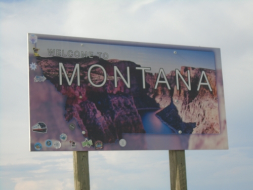
MTS-326 North - Welcome To Montana
Welcome to Montana on MTS-326 North. Taken at the Wyoming-Montana State Line.
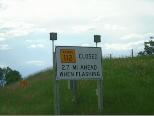
WY-112 North - Winter Closure
WY-112 North Closed 1.2 Miles Ahead When Flashing.
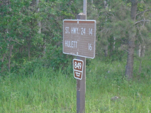
FS-849 West - Distance Marker
Distance Marker on FS-849 West. Distance to St. Hwy 24 and Hulett.
Farall Road at FS-841
Farall Road at FS-841. Use Farall Road for Hulett and Sundance.
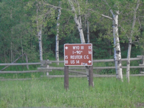
Bear Lodge Road at Farrall Road
Bear Lodge Road at Farrall Road. Use Farrall Road west to Reuter Campground and US-14; Farrall Road east to WYO-111 and I-90.
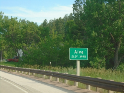
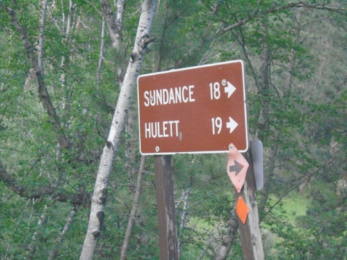
WY-24 East - Alva
Entering Alva on WY-24 East. Elevation 3995.
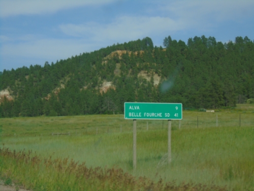
WY-24 - Distance Marker
Distance marker on WY-24 east. Distance to Alva and Belle Fourche, SD.
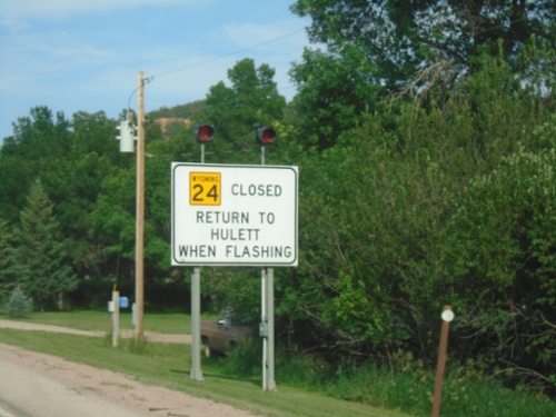
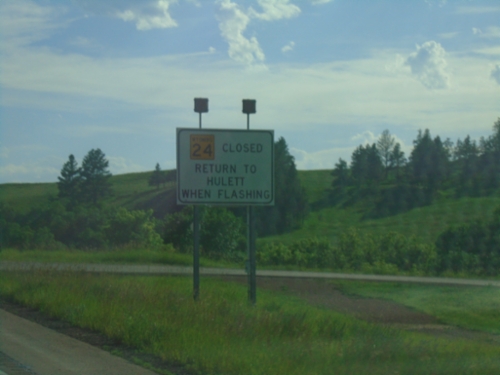
WY-24 East - Return To Hulett When Flashing
WY-24 Closed - Return To Hulett When Flashing on WY-24 East.
WY-24 East at WY-110
WY-24 East at WY-110 to Devils Tower.
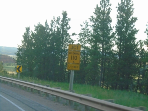
WY-24 East Approaching WY-110
WY-24 East approaching WY-110 near Devils Tower.
WY-24 East Approaching WY-110
WY-24 East approaching WY-110 junction.
WY-24 East - Distance Marker
Distance marker on WY-24 east. Distance to Devils Tower and Hulett.
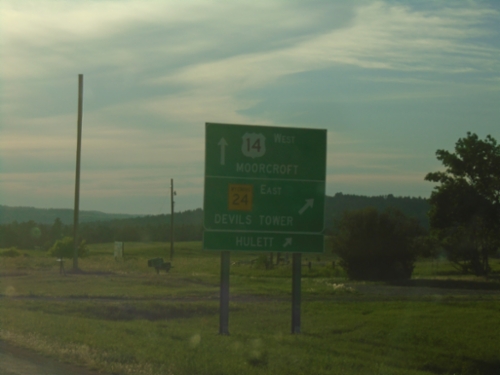
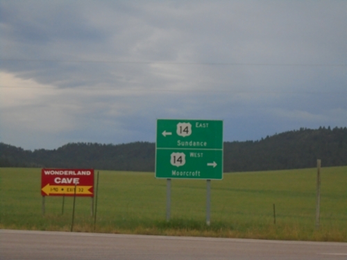
US-14 West at WY-24 East
US-14 West at WY-24 East - Devils Tower Junction. Use WY-24 east to Devils Tower and Hulett. Continue west on US-14 to Moorcroft.
WY-116 North at BL-90/US-14
WY-116 north at BL-90/US-14. Turn right on BL-90/US-14 East for WY-585 and Sundance (City Center). Turn left for US-14 West to I-90 and Devils Tower.
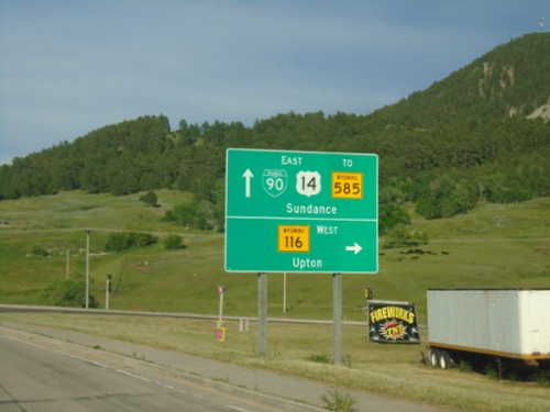
BL-90/US-14 East at WY-116
BL-90/US-14 East at WY-116 junction. Turn right for WY-116 south to Upton; continue straight for BL-90/US-14 East/To WY-585 to Sundance.
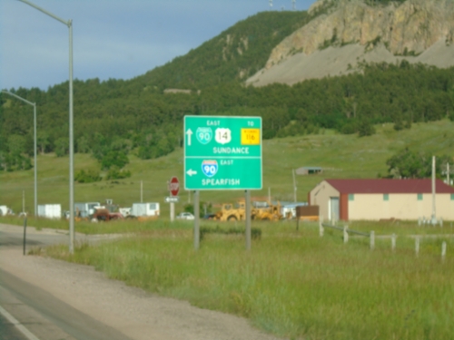
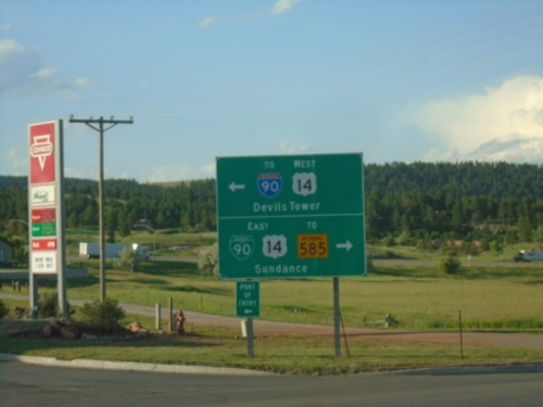
US-14 East at I-90 East (Exit 185)
US-14 East at I-90 East (Exit 185) to Spearfish (South Dakota). Continue on road for BL-90/US-14 East/To WY-116 to Sundance.
US-14 East at I-90 (Exit 185)
US-14 East at I-90 (Exit 185) in Sundance. Turn right for I-90 West to Moorcroft. Continue under the freeway for I-90/US-14 East/To WY-116/Sundance.
US-14 East Approaching I-90
US-14 East approaching I-90 in Sundance (Exit 185).
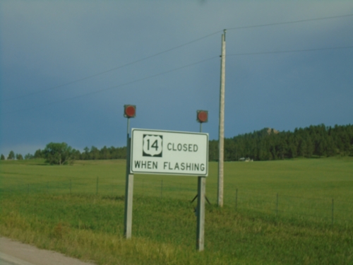
US-14 East - Closed When Flashing
US-14 East Closed When Flashing at Devils Tower Junction.
End WY-24 West at US-14
End WY-24 West at US-14 at Devils Tower Junction. Use US-14 west to Moorcroft; US-14 east to Sundance.
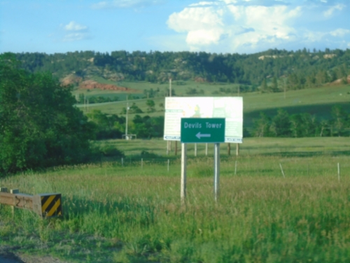
WY-24 West - Devils Tower Junction
WY-24 west approaching US-14 at Devils Tower Junction.
WY-24 West Approaching US-14
WY-24 West approaching US-14 at Devils Tower Junction.
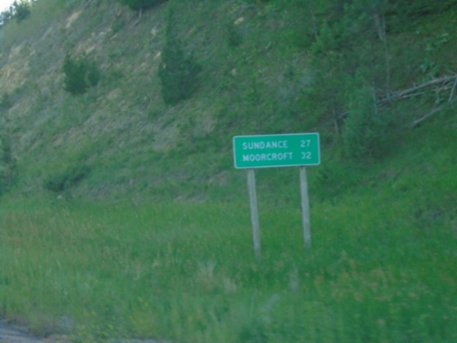
WY-24 West - Distance Marker
Distance marker on WY-24 west. Distance to Sundance and Moorcroft.
WY-24 West - Winter Closure
WY-24 West is closed when lights are flashing. Return to Hulett.
WY-24 West Approaching WY-112
WY-24 West approaching WY-112 to Alzada (Montana).
WY-24 East - Hulett
WY-24 East in Hulett
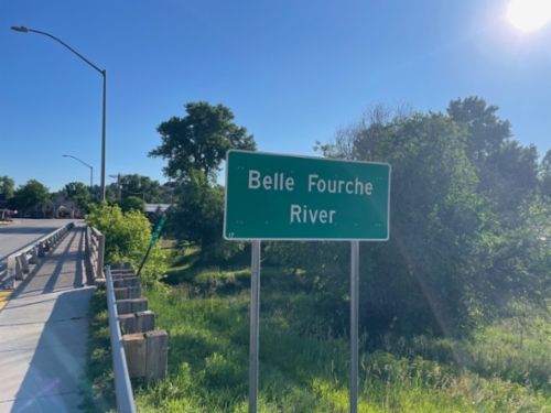
WY-24 East - Belle Fourche River
Belle Fourche River on WY-24 east in Hulett.