Signs From British Columbia
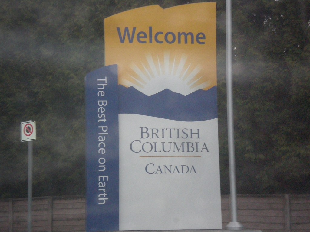
BC-99 North - Welcome to British Columbia
Welcome to British Columbia on BC-99 north. Taken just north of Canada Customs.
Taken 04-29-2017
 Surrey
Metro Vancouver
British Columbia
Canada
Surrey
Metro Vancouver
British Columbia
Canada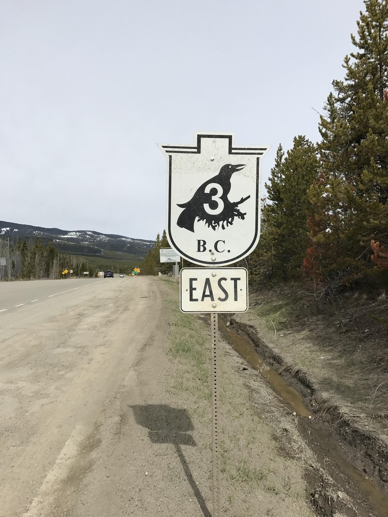
BC-3 East - Sunday Summit
BC-3 East shield at the top of Sunday Summit.
Taken 04-29-2017
 Copper Mountain
Okanagan-Similkameen
British Columbia
Canada
Copper Mountain
Okanagan-Similkameen
British Columbia
Canada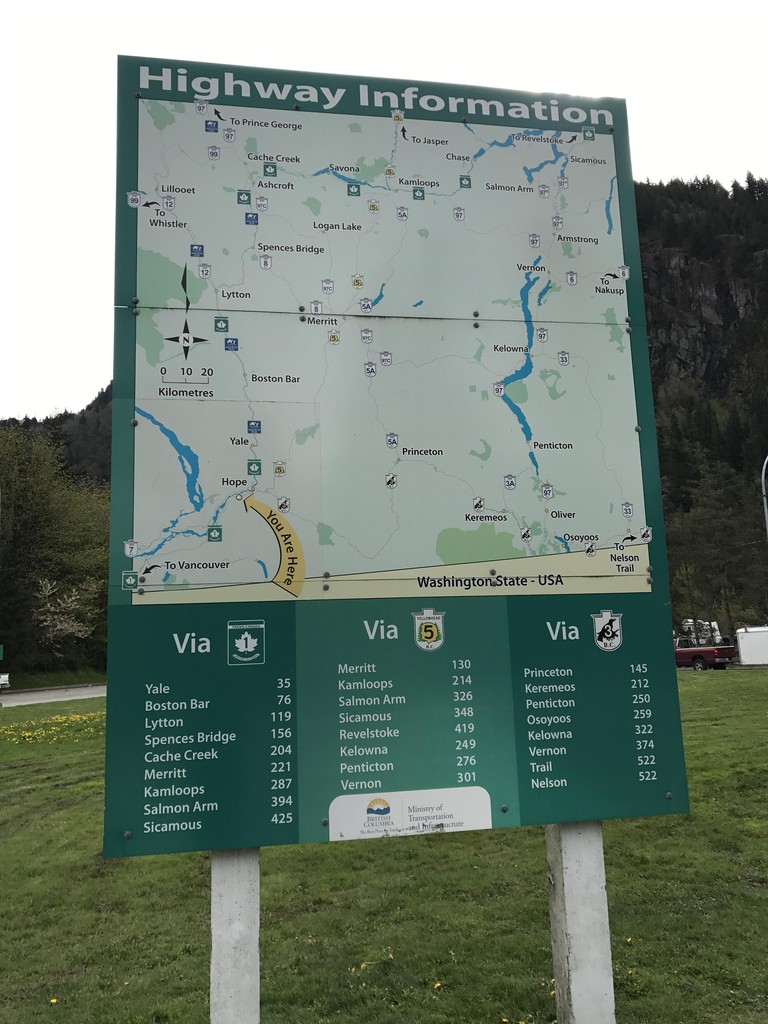
Hunter Creek Rest Area - Highway Information
Route map for the adjacent area of British Columbia, and distances to major destinations. Three routes split off into the interior of British Columbia at Hope just east of here: BC-5 to Coquihalla Pass, TC-1 through the Frasier River Canyon, and BC-3 over Allison Pass.
Taken 04-29-2017

 Hope
Fraser Valley
British Columbia
Canada
Hope
Fraser Valley
British Columbia
Canada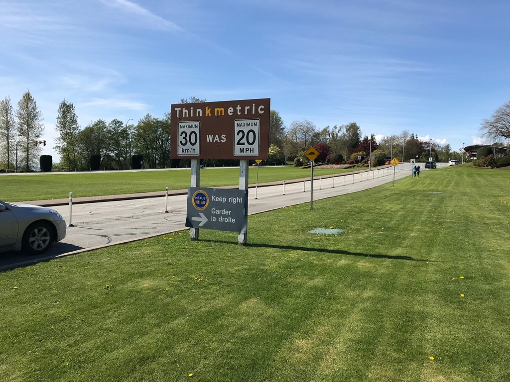
BC-99 North - Think Metric
BC-99 North at US/Canada border. Think metric - 30 km/h was 20 MPH. A smaller sign below that instructs Nexus traffic to keep right.
Taken 04-28-2017
Surrey
Metro Vancouver
British Columbia
Canada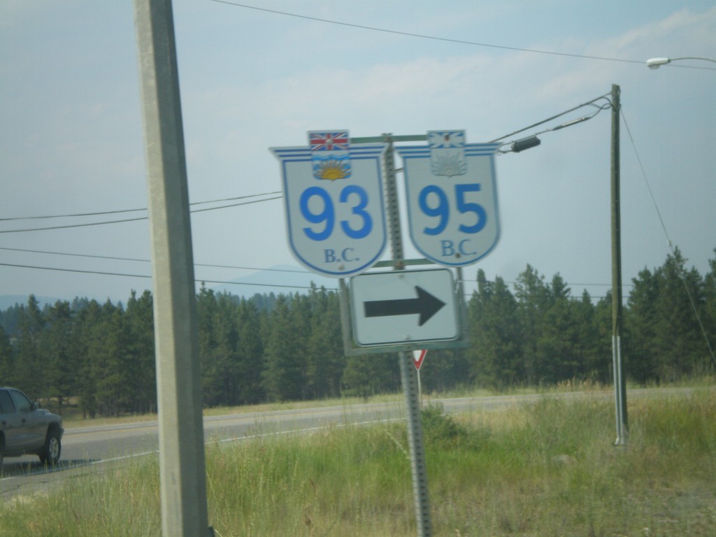
BC-95/BC-93 North at BC-95A
BC-95/BC-93 north at BC-95A.
Taken 07-16-2007


 Ta Ta Creek
East Kootenay
British Columbia
Canada
Ta Ta Creek
East Kootenay
British Columbia
Canada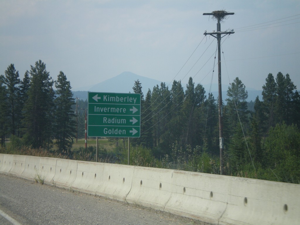
BC-95/BC-93 North at BC-95A
BC-93/BC-95 north to Radium, Golden, and Invermere, at BC-95A south to Kimberley.
Taken 07-16-2007
Ta Ta Creek
East Kootenay
British Columbia
Canada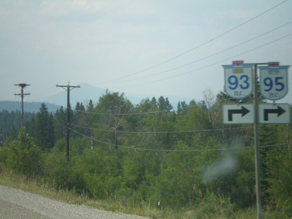
BC-95/BC-93 North at BC-95A
BC-93/BC-95 approaching BC-95A. Turn right for BC-93/BC-95 north.
Taken 07-16-2007
Ta Ta Creek
East Kootenay
British Columbia
Canada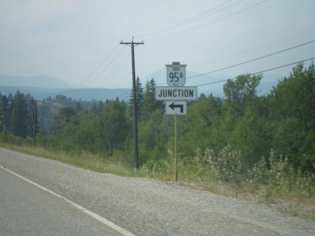
BC-95/BC-93 North at BC-95A
BC-93/BC-95 north approaching BC-95A.
Taken 07-16-2007
Ta Ta Creek
East Kootenay
British Columbia
Canada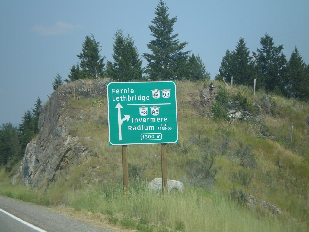
BC-3 East/BC-95 North at BC-93/BC-95
Approaching BC-3 East/BC-95 North split in 1300 metres. BC-3 East joins BC-93 South to Fernie and Lethbridge (AB). BC-95/BC-93 north to Invermere and Radium.
Taken 07-16-2007
Cranbrook
East Kootenay
British Columbia
Canada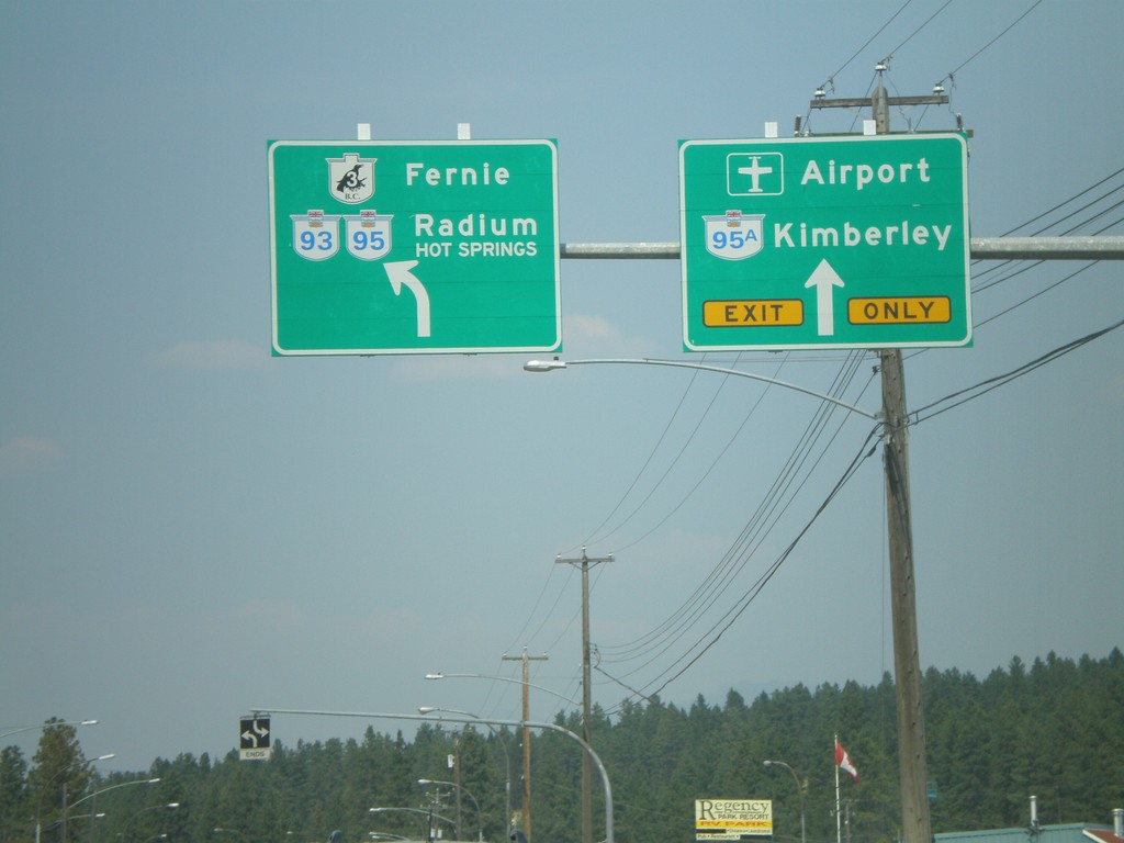
BC-3 East/BC-95 North at BC-95A
BC-3/BC-95 west to Fernie and Radium Hot Springs at BC-95A to Kimberley.
Taken 07-16-2007
Cranbrook
East Kootenay
British Columbia
Canada