Signs From California
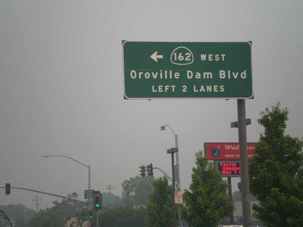
CA-162 West - Oroville Dam Blvd.
CA-162 west (Olive Highway) at Oroville Dam Blvd. CA-162 turns left here and continues on Oroville Dam Blvd.
Taken 07-06-2008
 Oroville
Butte County
California
United States
Oroville
Butte County
California
United States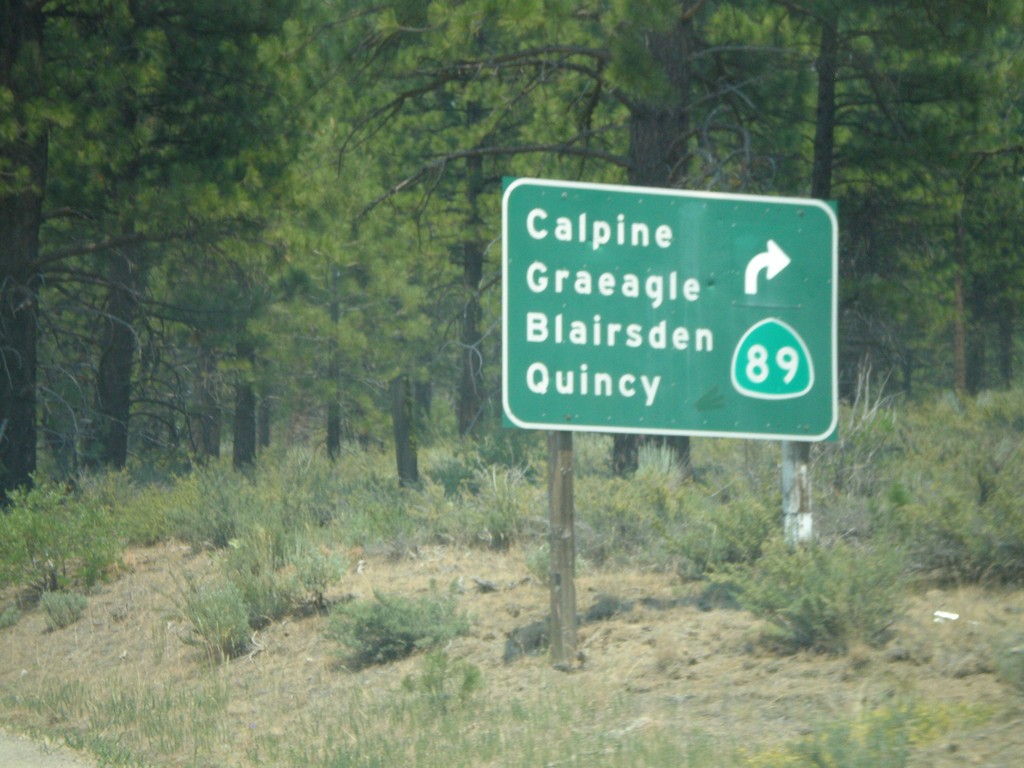
CA-49 South/CA-89 North Split
CA-49 south at CA-89 north split. CA-89 turns left here towards Calpine, Graeagle, Blairsden, and Quincy.
Taken 07-03-2008

 Calpine
Sierra County
California
United States
Calpine
Sierra County
California
United States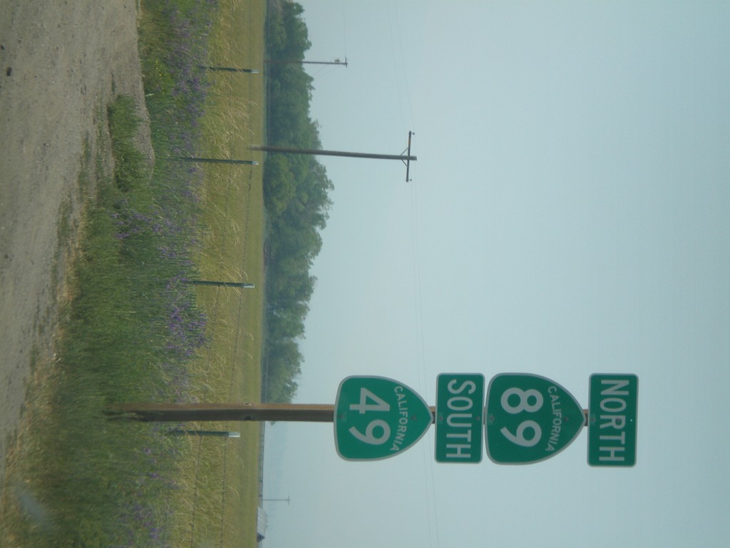
CA-89 North/CA-49 South
CA-49 South/CA-89 North shields north of Sierraville.
Taken 07-03-2008
Sierraville
Sierra County
California
United States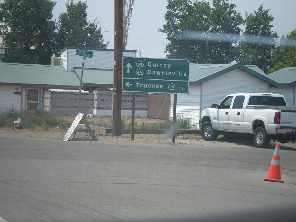
CA-49 South at CA-89
CA-49 south at CA-89 south to Truckee. CA-89 north joins CA-49 south to Sattley.
Taken 07-03-2008
Sierraville
Sierra County
California
United States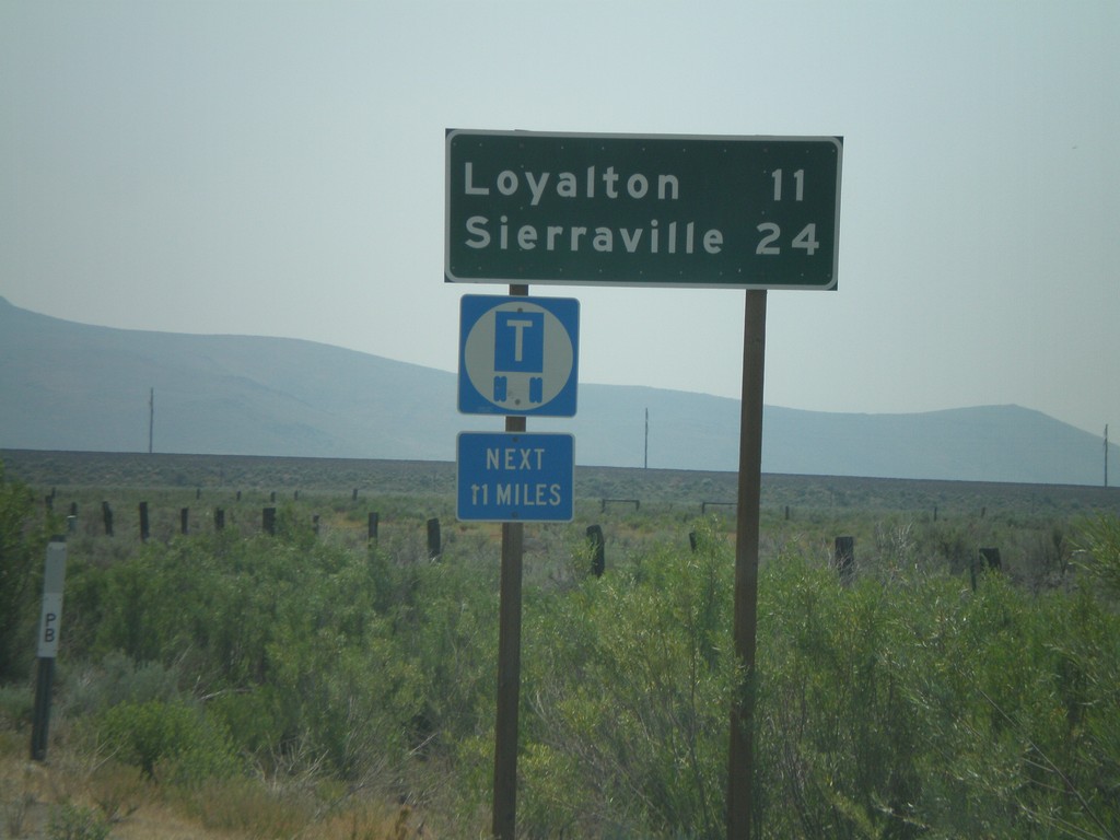
CA-49 South - Distance Marker
First distance marker on CA-49 south to Loyalton and Sierraville.
Taken 07-03-2008
Chilcoot-Vinton
Plumas County
California
United States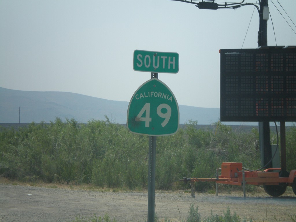
CA-49 South
First CA-49 shield south of CA-70.
Taken 07-03-2008
Chilcoot-Vinton
Plumas County
California
United States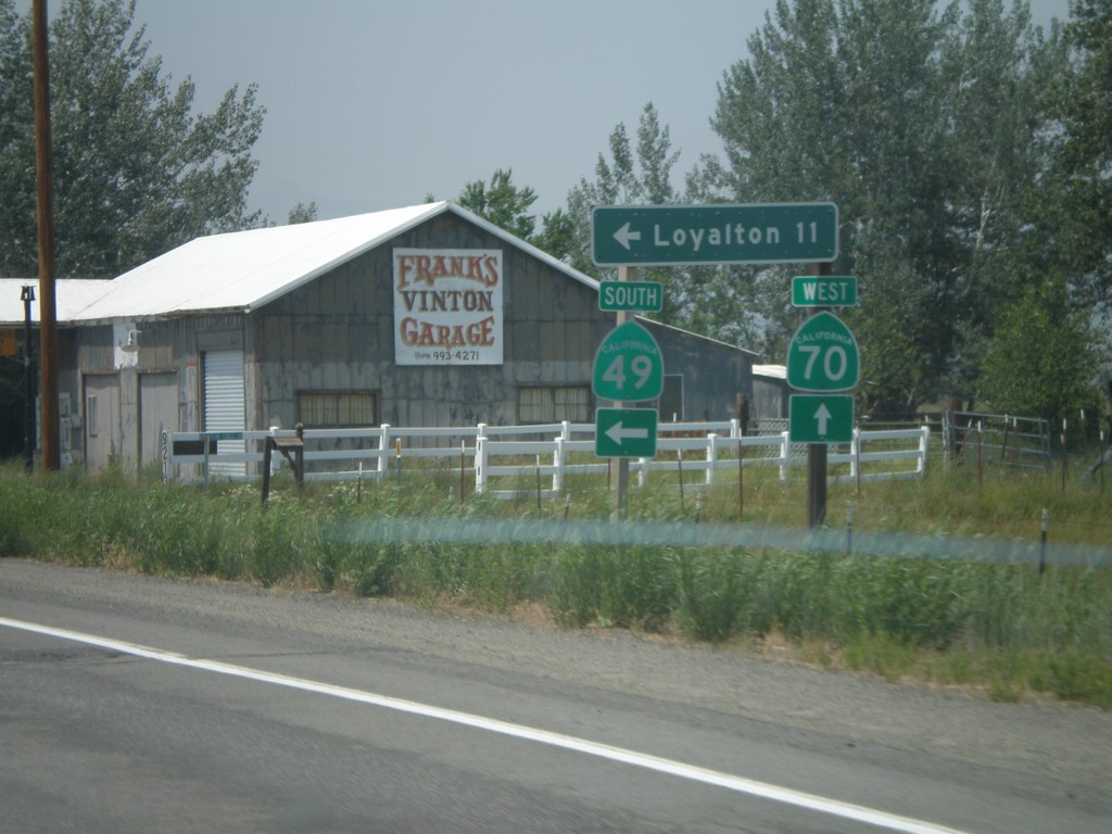
CA-70 West at CA-49 South
CA-70 west at CA-49 south to Loyalton. This is the northern beginning of CA-49 which goes through the California Gold Country.
Taken 07-03-2008
 Chilcoot-Vinton
Plumas County
California
United States
Chilcoot-Vinton
Plumas County
California
United States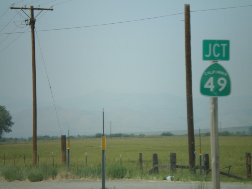
CA-70 West Approaching CA-49
CA-70 west approaching CA-49 south.
Taken 07-03-2008
Chilcoot-Vinton
Plumas County
California
United States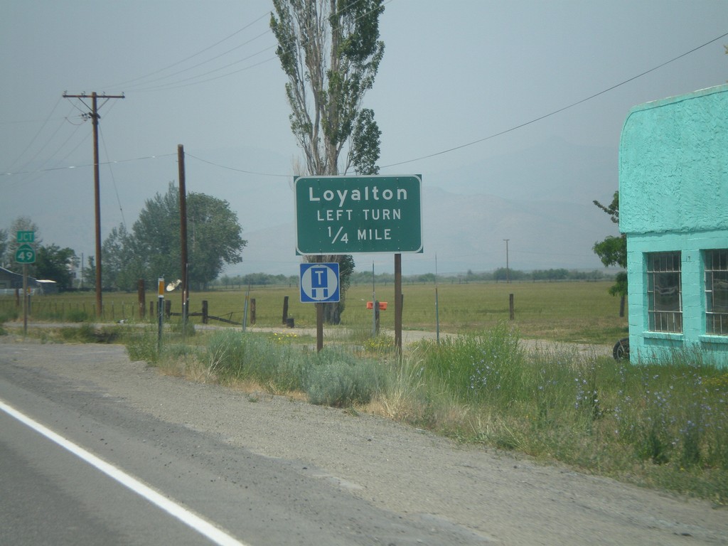
CA-70 West Approaching CA-49
CA-70 west approaching CA-49 south to Loyalton.
Taken 07-03-2008
Chilcoot-Vinton
Plumas County
California
United States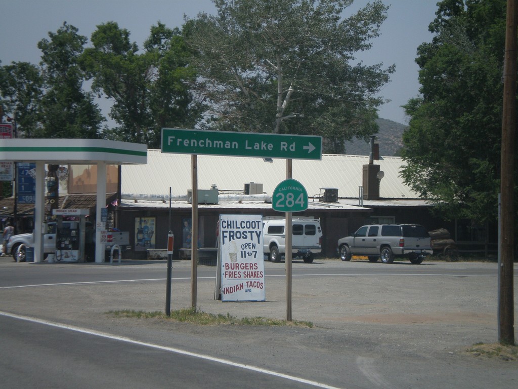
CA-70 West at CA-284 North
CA-70 west at CA-284 north to Frenchman Lake.
Taken 07-03-2008
 Chilcoot-Vinton
Plumas County
California
United States
Chilcoot-Vinton
Plumas County
California
United States