Signs From California
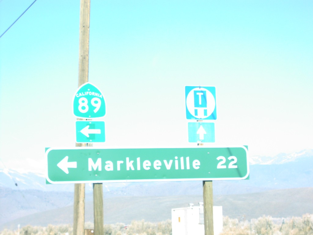
US-395 North at CA-89 North
Distance marker to Markleeville on US-395 north at CA-89 junction in Topaz. This is the southern end of CA-89.
Taken 02-01-2005

 Coleville
Mono County
California
United States
Coleville
Mono County
California
United States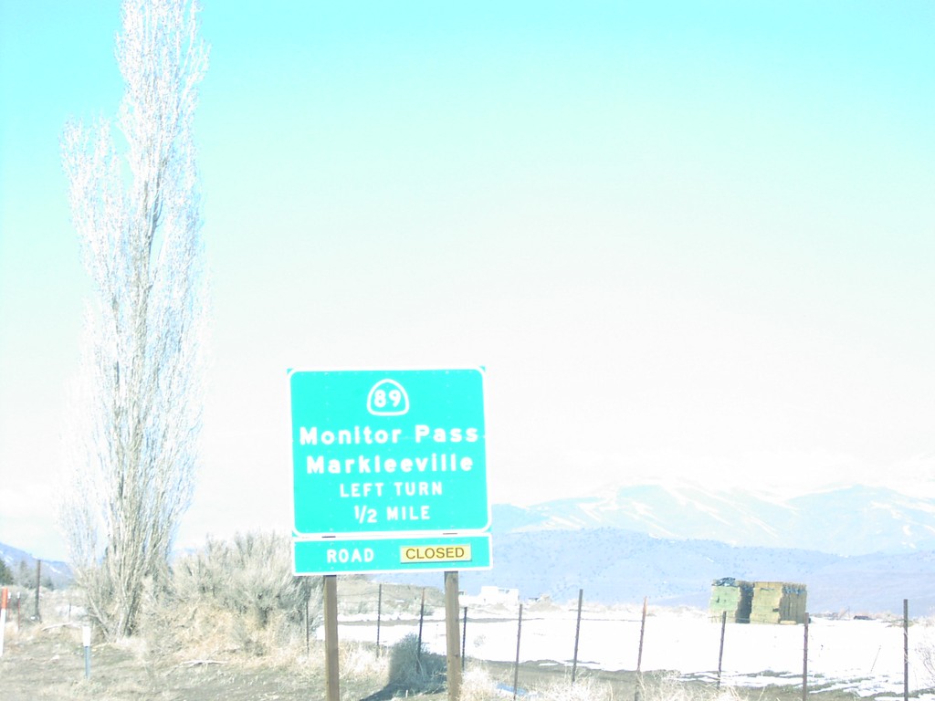
US-395 South at CA-89
US-395 north at CA-89 junction to Markleeville and Monitor Pass in Topaz. Monitor Pass is closed when this was taken.
Taken 02-01-2005
Coleville
Mono County
California
United States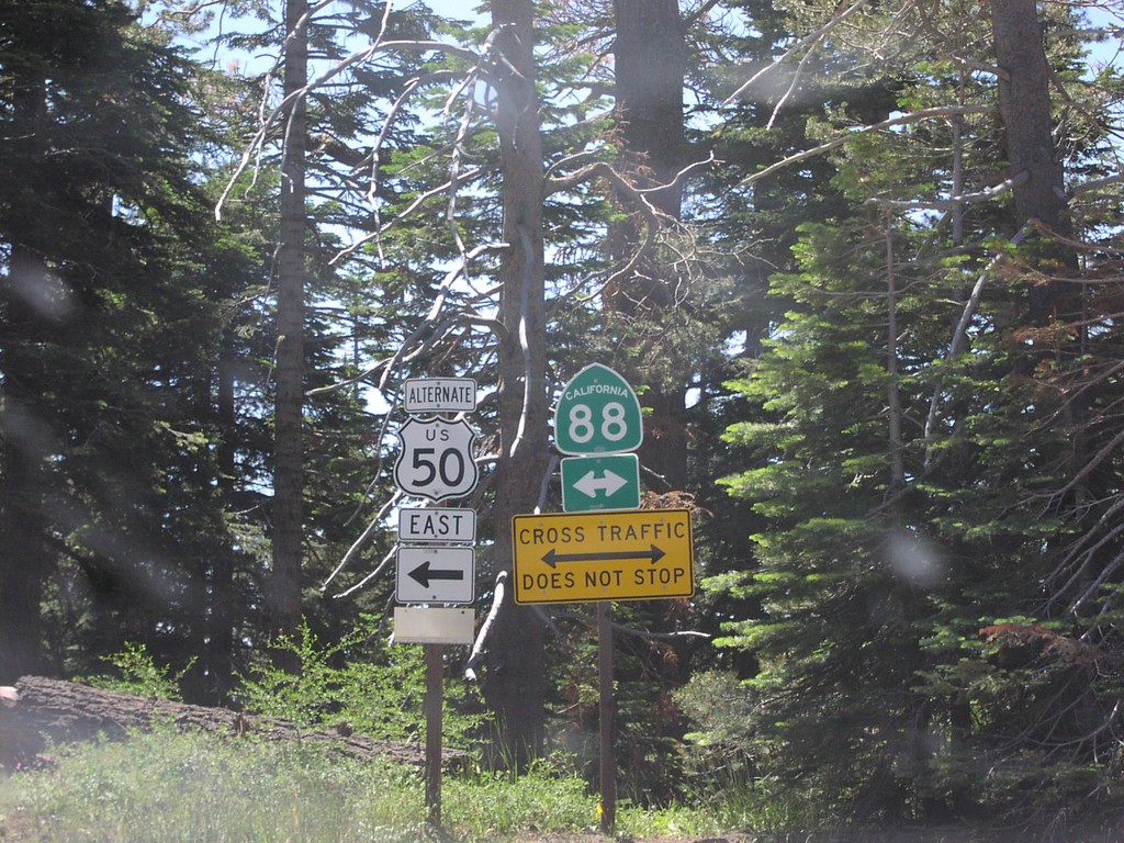
End Mormon Emigrant Trail at CA-88 (US-50 Alt)
End Mormon Emigrant Trail (US-50 ALT) at CA-88 near Kirkwood
Taken 07-01-2004

 Tragedy Spring
Amador County
California
United States
Tragedy Spring
Amador County
California
United States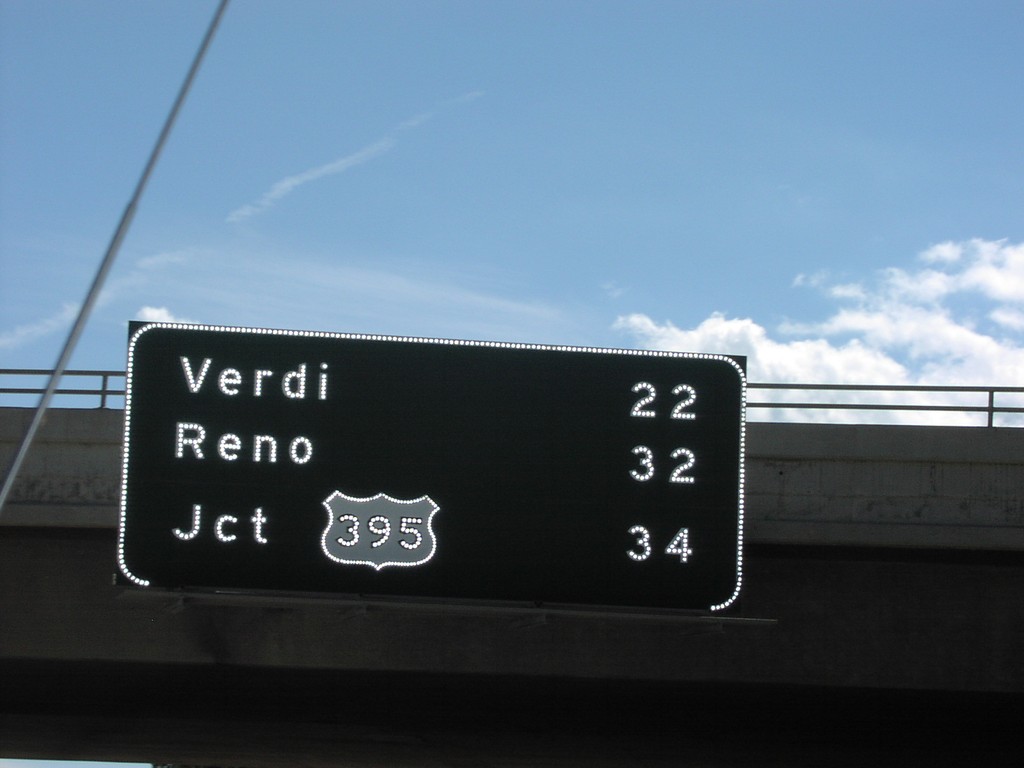
I-80 East - Distance Marker
Distance Marker to Reno/Verdi/US-395 on I-80 East
Taken 07-01-2001
 Truckee
Nevada County
California
United States
Truckee
Nevada County
California
United States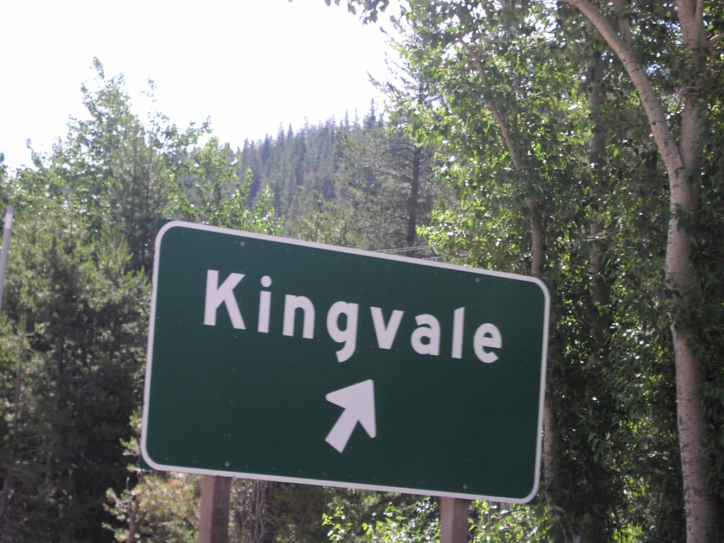
I-80 East Exit 171
Kingvale Exit on I-80 East
Taken 07-01-2001
Troy
Placer County
California
United States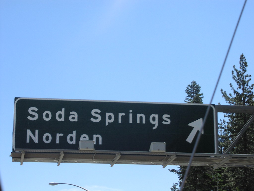
I-80 East Exit 174
Soda Springs/Norden Exit on I-80 East
Taken 07-01-2001
Soda Springs
Nevada County
California
United States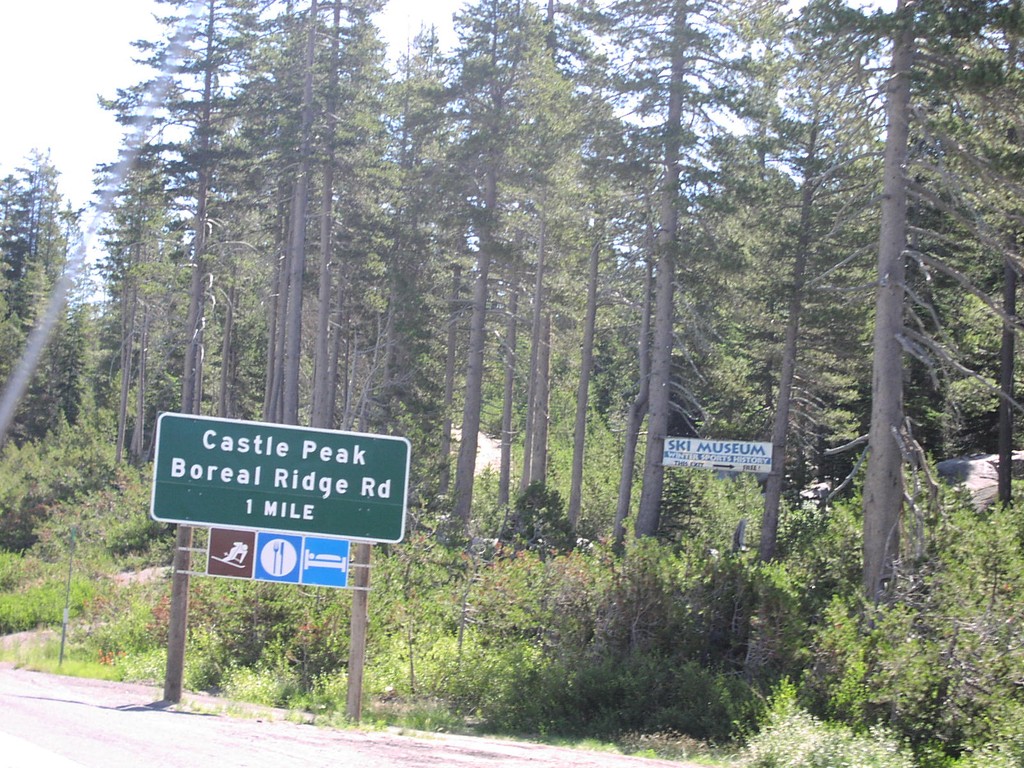
I-80 East Exit 176
Castle Peak Area/Boreal Ridge Road Exit at Donner Pass on I-80 East, Nevada Coun
Taken 07-01-2001
Truckee
Nevada County
California
United States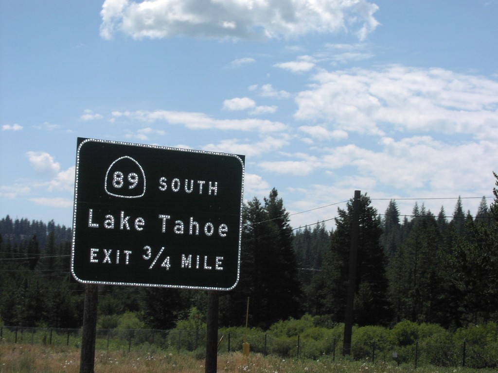
I-80 East Exit 185
CA-89 South/Lake Tahoe Exit on I-80 East
Taken 07-01-2001
Truckee
Nevada County
California
United States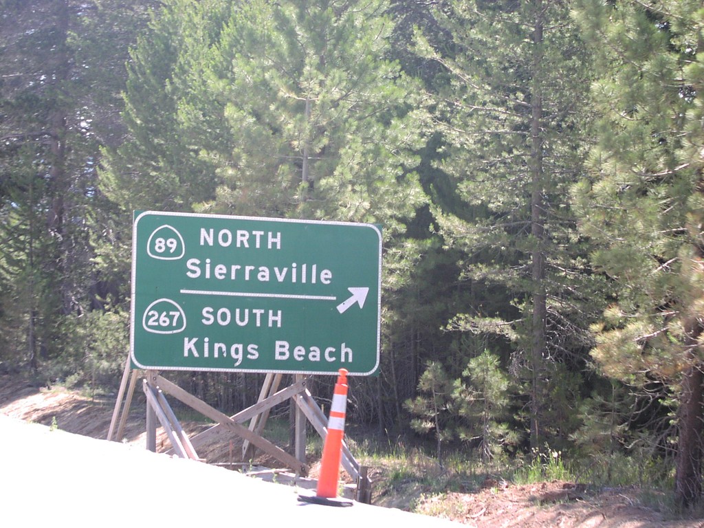
I-80 East Exit 188A
Approaching CA-89/CA-267 Exit on I-80 East. This was taken during the construction for the new interchange resulting in Exits 188AB.
Taken 07-01-2001
 Truckee
Nevada County
California
United States
Truckee
Nevada County
California
United States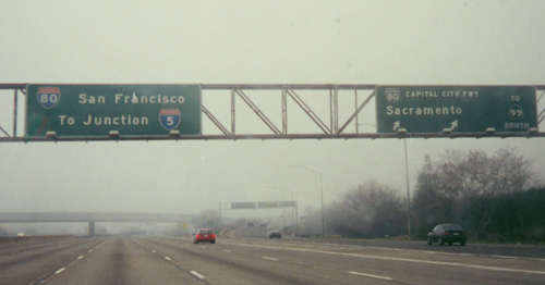
I-80 West Exit 95
I-80 west at Exit 95 - BL-80/To CA-99 South/Capitol City Freeway/Sacramento Exit on I-80 West. I-80 overheads to San Francisco and I-5.
Taken 12-01-2000


 North Highlands
Sacramento County
California
United States
North Highlands
Sacramento County
California
United States