Signs From California
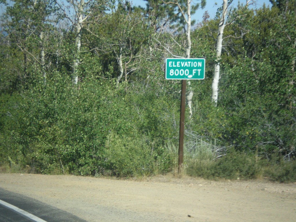
CA-89 North - Elevation 8000 Feet
Elevation 8000 Feet on CA-89 north. Taken on north descent from Monitor Pass.
Taken 08-12-2016
 Markleeville
Alpine County
California
United States
Markleeville
Alpine County
California
United States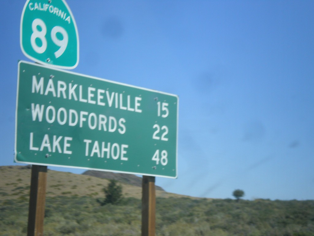
CA-89 North - Distance Marker
Distance marker on CA-89 north. Distance to Markleeville, Woodfords, and Lake Tahoe.
Taken 08-12-2016
Coleville
Mono County
California
United States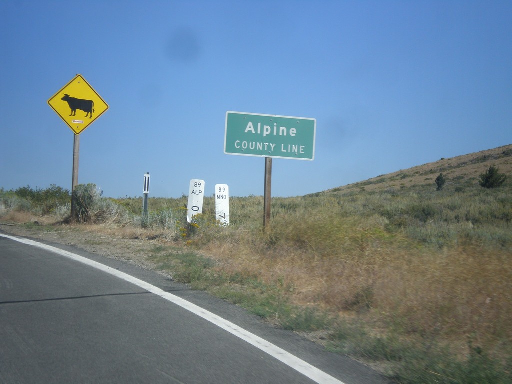
CA-89 North - Alpine County Line
Alpine County Line on CA-89 north. Open range.
Taken 08-12-2016
Coleville
Mono County
California
United States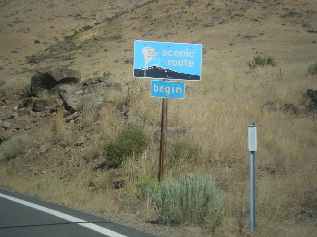
CA-89 North - Begin Scenic Route
Begin Scenic Route on CA-89 north.
Taken 08-12-2016
Coleville
Mono County
California
United States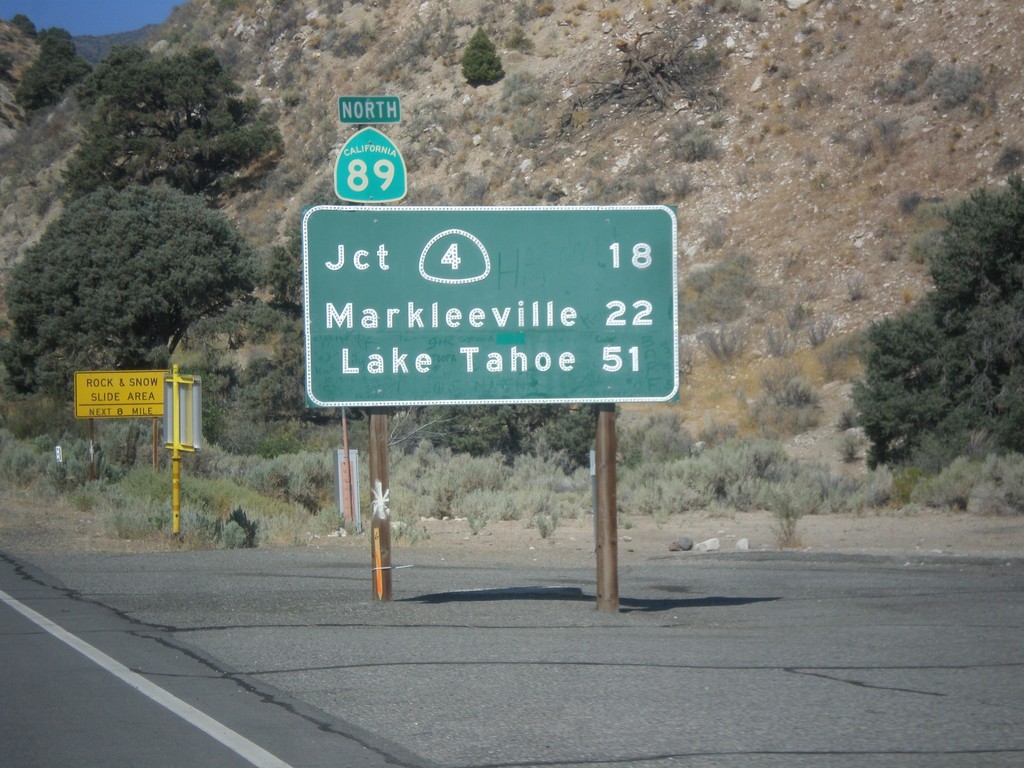
CA-89 North - Distance Marker
First distance marker on CA-89 north. Distance to CA-4 Jct., Markleeville, and Lake Tahoe.
Taken 08-12-2016
 Coleville
Mono County
California
United States
Coleville
Mono County
California
United States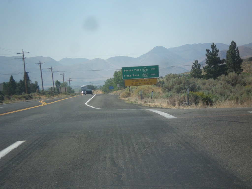
US-395 South - Sierra Pass Information
Sierra pass closure information on US-395 south. Information for Sonora Pass (CA-108) and Tioga Pass (CA-120). At the time this photo was taken both passes were open.
Taken 08-12-2016


 Coleville
Mono County
California
United States
Coleville
Mono County
California
United States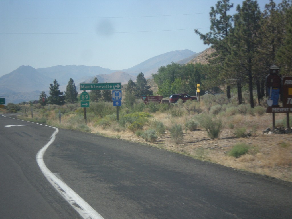
US-395 North at CA-89 North
US-395 south at CA-89 north to Markleeville. This is the southern end of CA-89.
Taken 08-12-2016
Coleville
Mono County
California
United States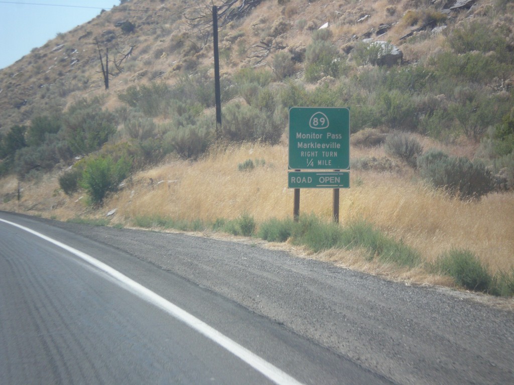
US-395 South at CA-89
US-395 south at CA-89 North to Markleeville and Monitor Pass. Monitor Pass was open when this was taken. This is the southern end of CA-89.
Taken 08-12-2016
Coleville
Mono County
California
United States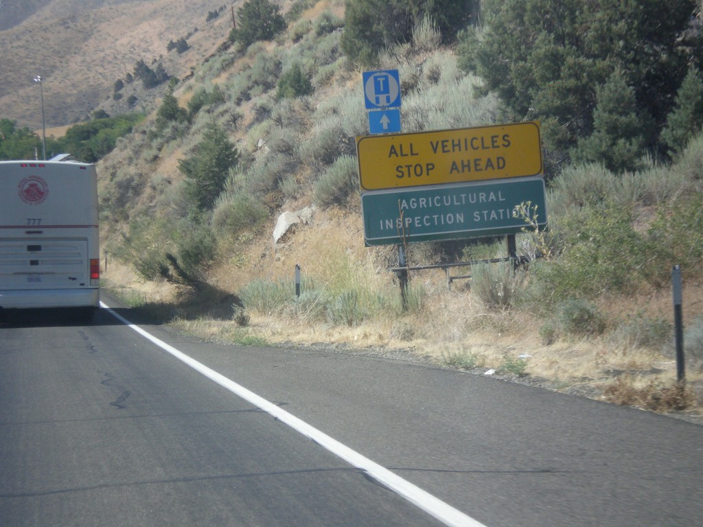
US-395 South - California Agricultural Inspection Station
US-395 South approaching California Agricultural Inspection - Topaz Border Station. All southbound traffic must stop for inspection.
Taken 08-12-2016
Coleville
Mono County
California
United States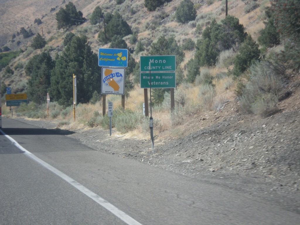
US-395 South - Welcome To California
Welcome to California / Mono County Line on US-395 south.
Taken 08-12-2016
Coleville
Mono County
California
United States