Signs From California
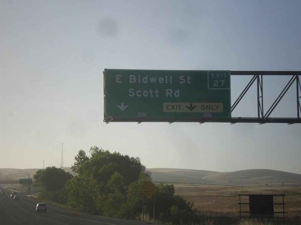
US-50 East - Exit 27
US-50 east at Exit 27 - E. Bidwell St./Scott Rd.
Taken 06-15-2015
 Folsom
Sacramento County
California
United States
Folsom
Sacramento County
California
United States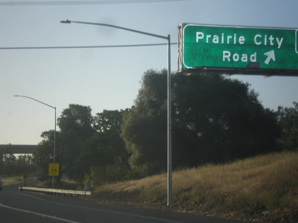
US-50 East - Exit 25
US-50 east at Exit 25 - Prairie City Road.
Taken 06-15-2015
Folsom
Sacramento County
California
United States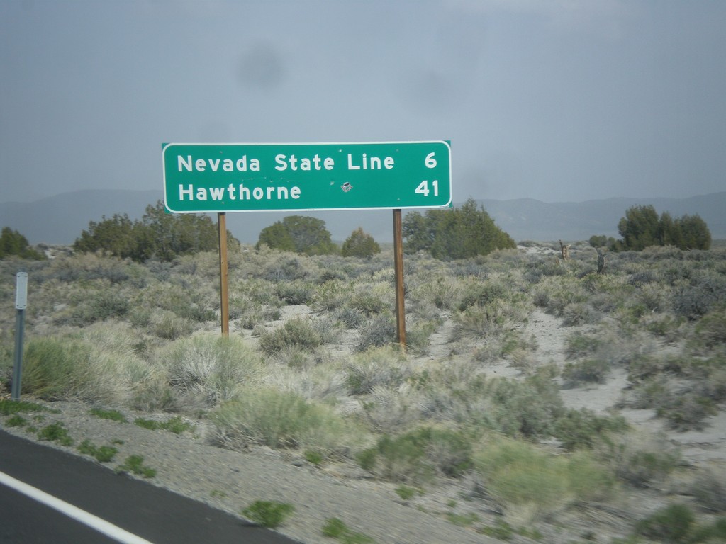
CA-167 East - Distance Marker
Distance marker on CA-167 east. Distance to Nevada State Line and Hawthorne (Nevada).
Taken 05-05-2014
 Lee Vining
Mono County
California
United States
Lee Vining
Mono County
California
United States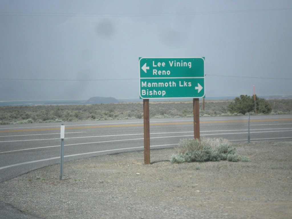
CA-120 East at US-395
CA-120 east at US-395. Turn right for US-395 south to Bishop and Mammoth Lakes. Turn left for US-395 north to Lee Vining and Reno. Turn right to continue east on CA-120.
Taken 05-05-2014

 Lee Vining
Mono County
California
United States
Lee Vining
Mono County
California
United States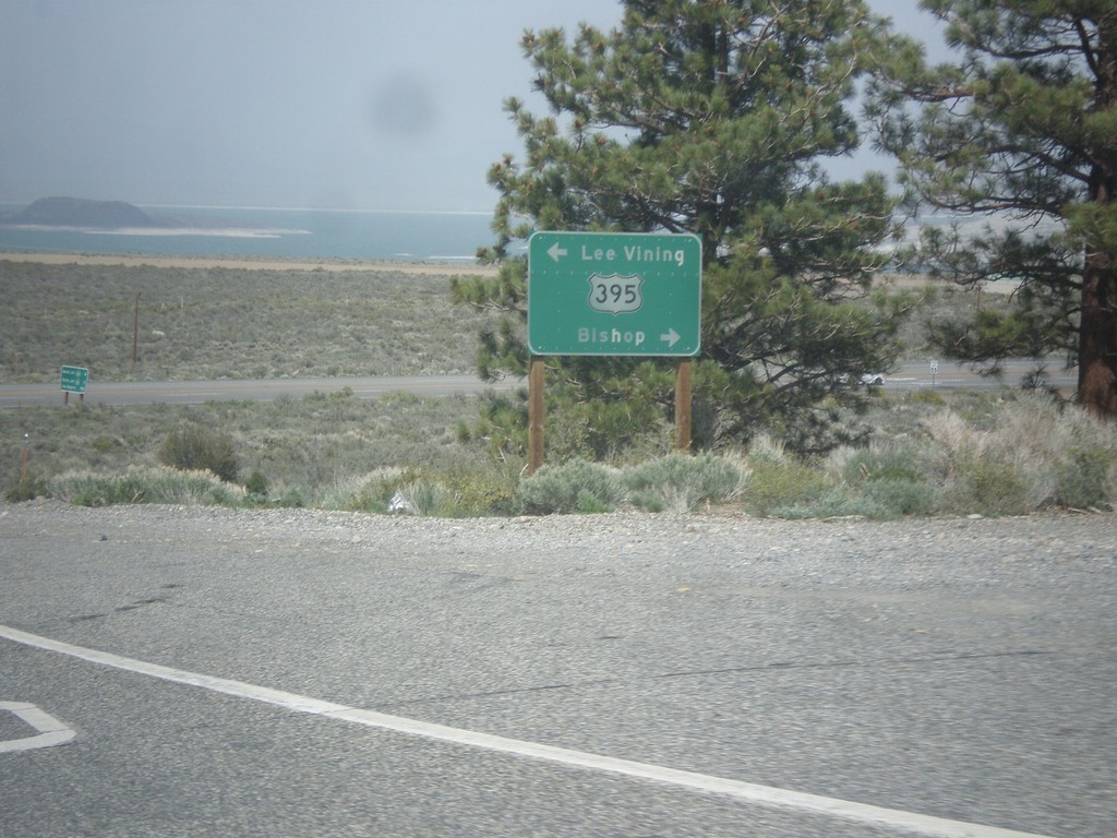
CA-120 East at US-395
CA-120 east at US-395. Turn right for US-395 north to Lee Vining; left for US-395 south to Bishop. Turn right on US-395 to continue east on CA-120.
Taken 05-05-2014
Lee Vining
Mono County
California
United States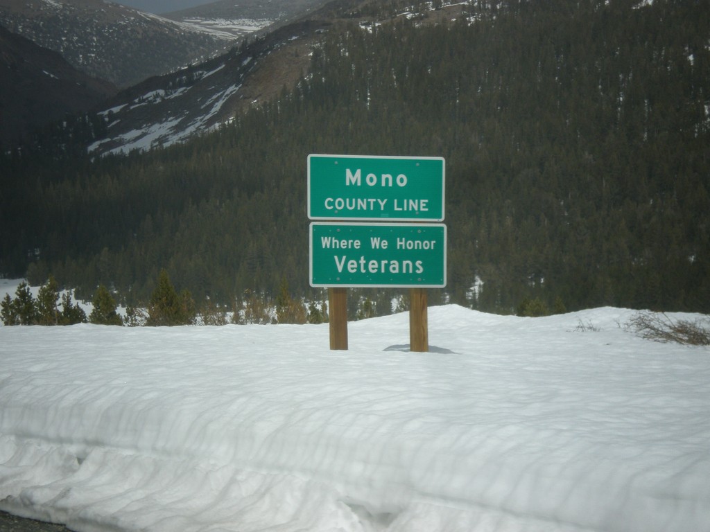
CA-120 East - Mono County Line
Mono County Line on CA-120 east at Tioga Pass.
Taken 05-05-2014
Lee Vining
Mono County
California
United States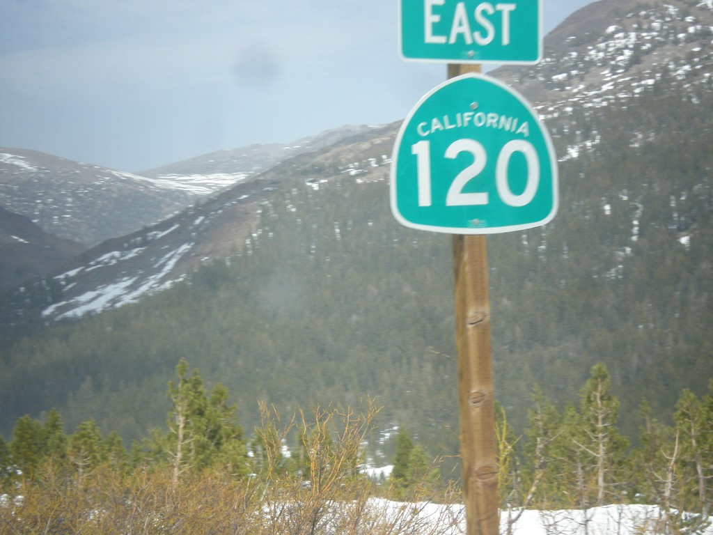
CA-120 East - Tioga Pass
First CA-120 shield after leaving Yosemite National Park at Tioga Pass.
Taken 05-05-2014
Lee Vining
Mono County
California
United States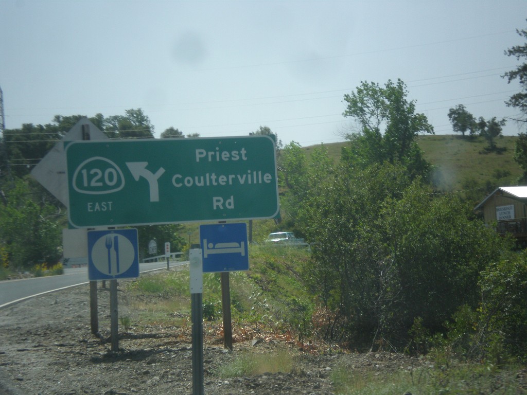
CA-120 East - Priest Coulterville Road
CA-120 East at Priest Coulterville Road in Tuolumne County.
Taken 05-05-2014
Jamestown
Tuolumne County
California
United States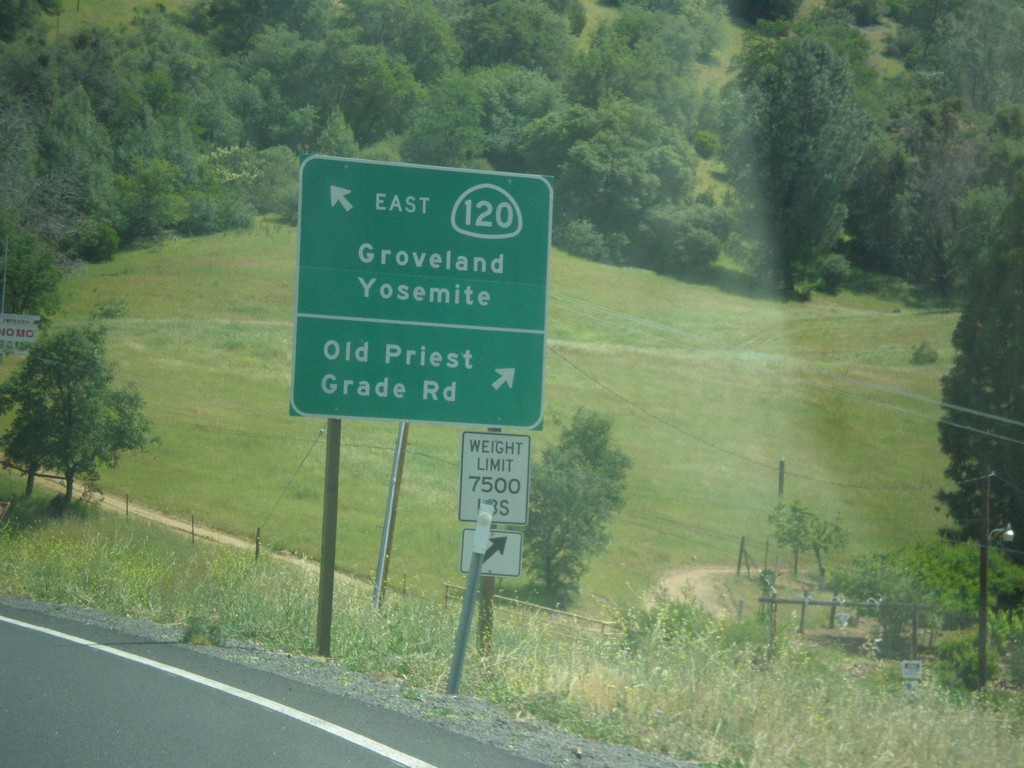
CA-120 East - Old Priest Grade Road
CA-120 East at Old Priest Grade Road. Continue east on CA-120 for Groveland and Yosemite.
Taken 05-05-2014
Moccasin
Tuolumne County
California
United States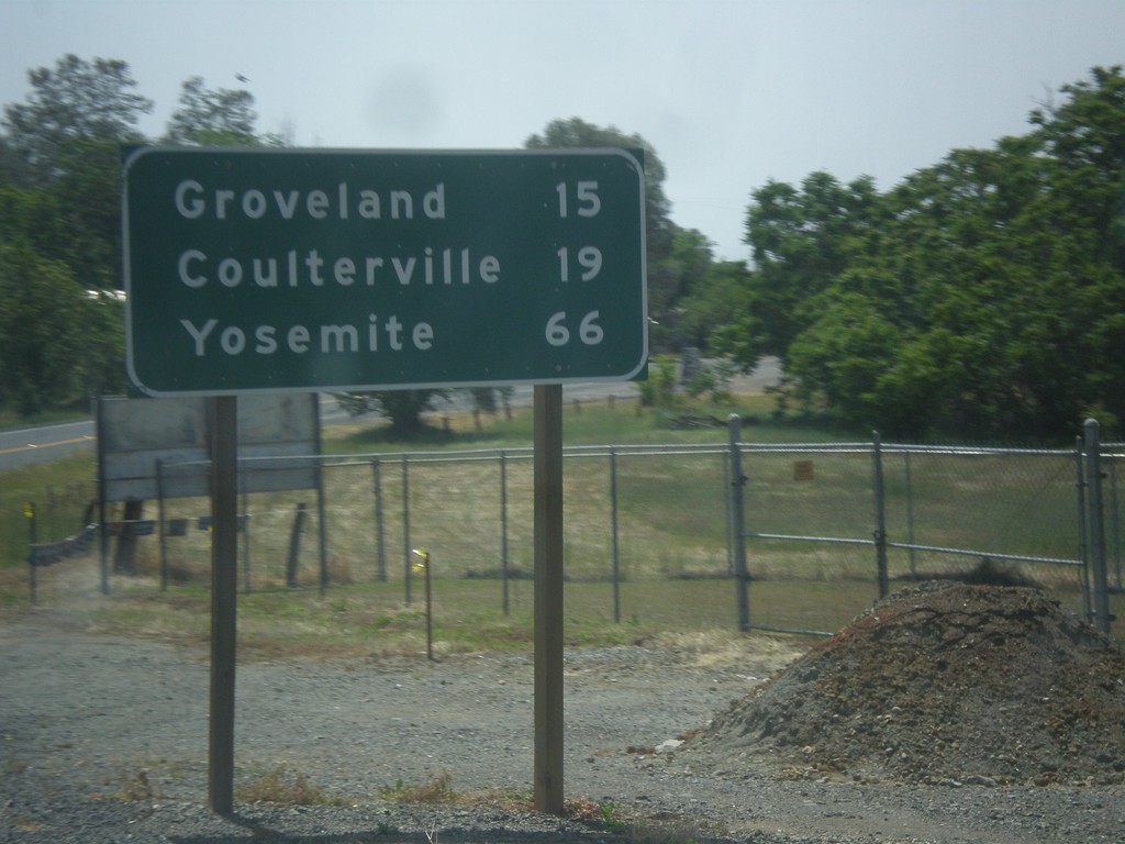
CA-49 South/CA-120 East - Distance Marker
Distance marker on CA-49 South/CA-120 East. Distance to Groveland, Coulterville, and Yosemite.
Taken 05-05-2014
 Chinese Camp
Tuolumne County
California
United States
Chinese Camp
Tuolumne County
California
United States