Signs From California
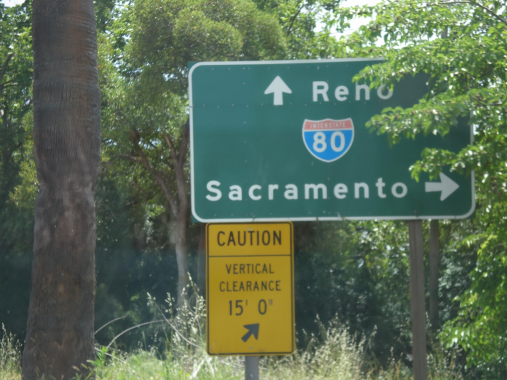
Horseshoe Bar Road East at I-80
Horseshoe Bar Road East at I-80. Turn right for I-80 west to Sacramento; continue over freeway for I-80 east to Reno.
Taken 05-04-2014
 Loomis
Placer County
California
United States
Loomis
Placer County
California
United States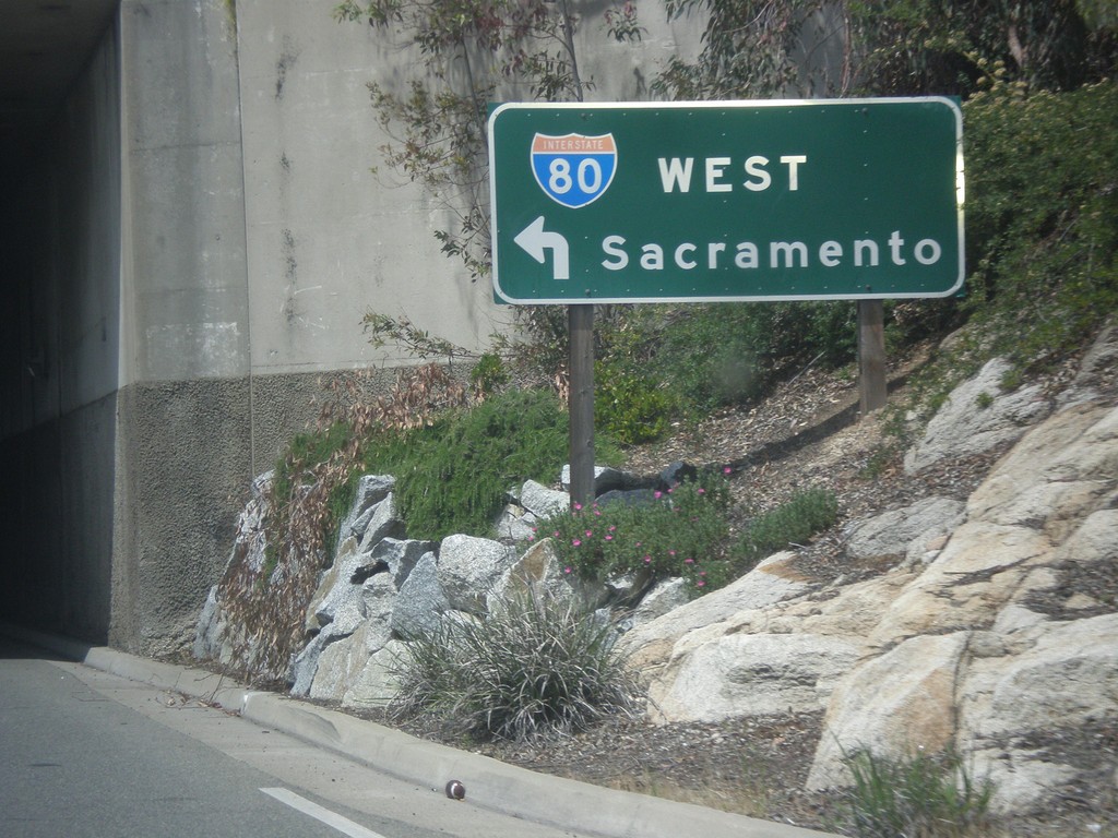
Rocklin Road West at I-80 West
Rocklin Road West at I-80 West to Sacramento (Exit 108).
Taken 05-04-2014
Rocklin
Placer County
California
United States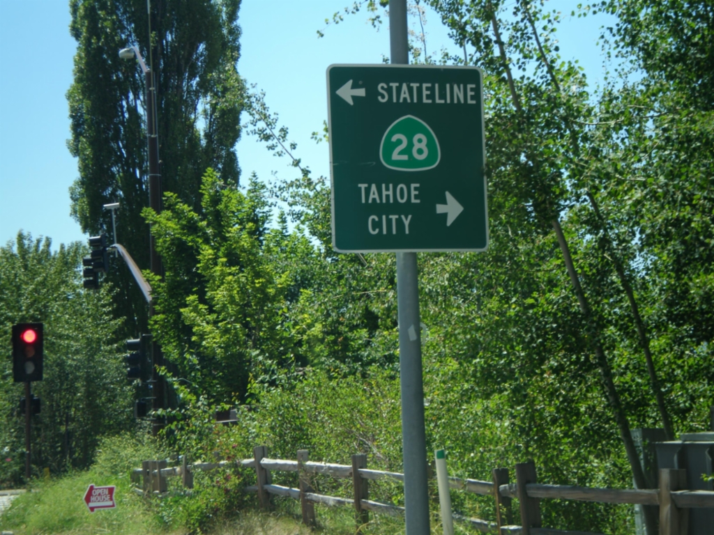
End CA-267 South at CA-28
End CA-267 south at CA-28 in Kings Beach. Turn right for CA-28 west to Tahoe City; turn left for CA-28 east to Stateline.
Taken 07-28-2012

 Kings Beach
Placer County
California
United States
Kings Beach
Placer County
California
United States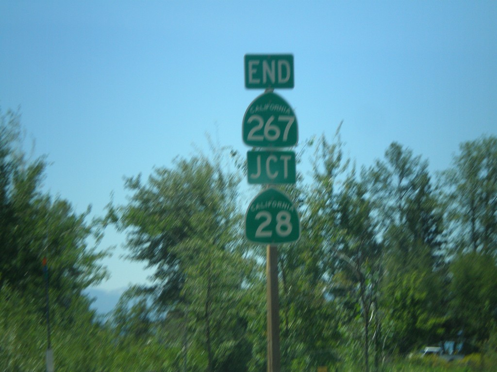
End CA-267 South at CA-28
End CA-267 south at CA-28 in Kings Beach.
Taken 07-28-2012
Kings Beach
Placer County
California
United States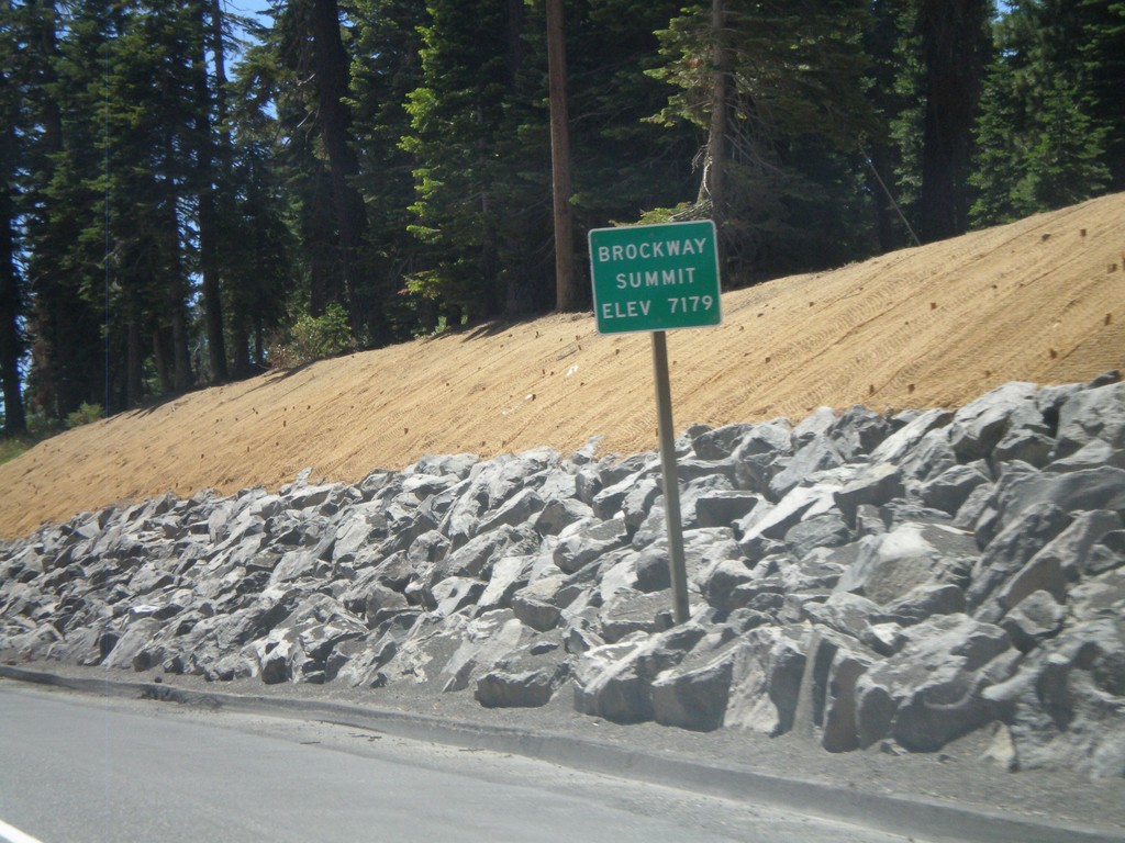
CA-267 South - Brockway Summit
CA-267 South - Brockway Summit (Elevation 7179 Feet). Brockway Summit divides the Truckee area from the Tahoe Basin. CA-267 south quickly descends into Lake Tahoe.
Taken 07-28-2012
Truckee
Placer County
California
United States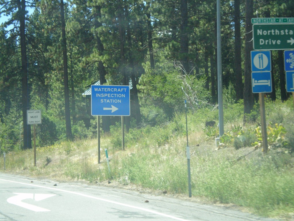
CA-267 South at Northstar Road
CA-267 South at Northstar Road. Turn right for Northstar-At-Tahoe Ski Area and for (Lake Tahoe) Watercraft Inspection. All watercraft launching in Lake Tahoe need to be inspected prior to launching.
Taken 07-28-2012
Truckee
Placer County
California
United States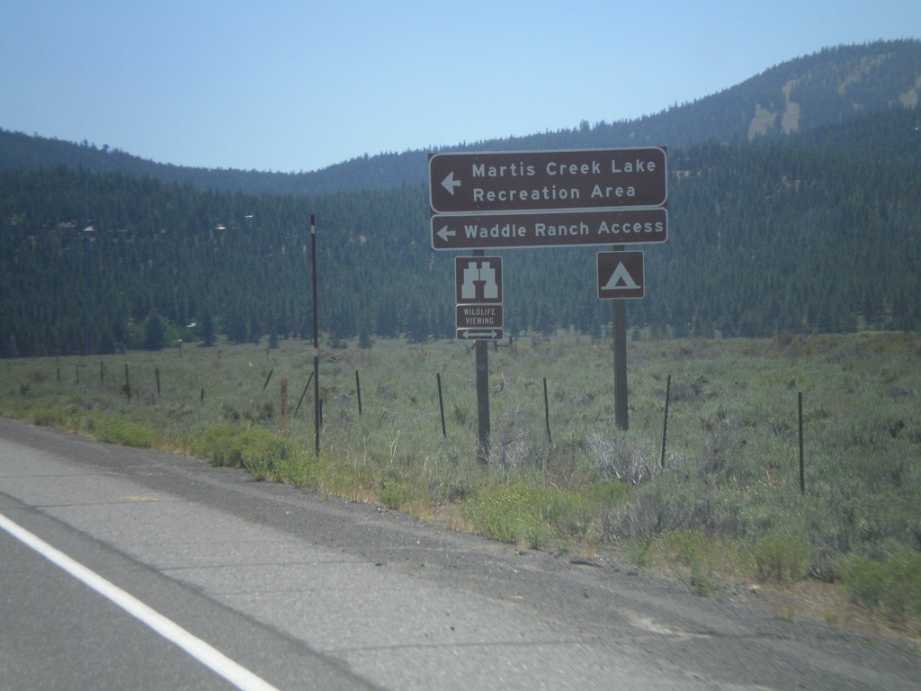
CA-267 South at Martis Creek Lake Jct.
CA-267 south at Martis Creek Lake Jct. Turn left for Martis Creek Lake Recreation Area, and Waddle Ranch Access. The ski slopes of Northstar-At-Tahoe are visible on the upper right side of the picture.
Taken 07-28-2012
Truckee
Placer County
California
United States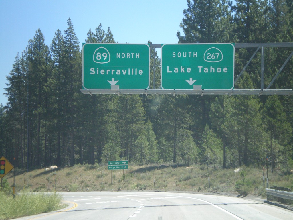
I-80 East Exit 188B Offramp at CA-89/CA-267
I-80 east Exit 188B offramp at CA-89/CA-267 junction. Turn left for CA-89 north to Sierraville. Turn right for CA-267 south to Lake Tahoe.
Taken 07-28-2012
 Truckee
Nevada County
California
United States
Truckee
Nevada County
California
United States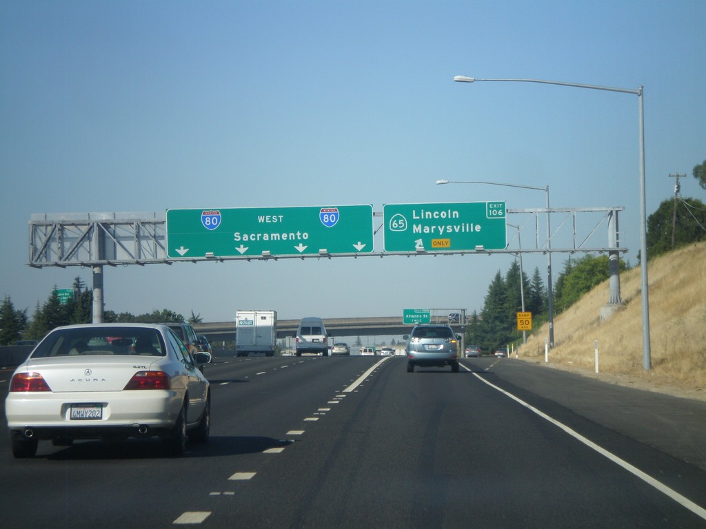
I-80 West - Exit 106
I-80 west at Exit 106 - CA-65/Lincoln/Marysville. Continue west on I-80 for Sacramento.
Taken 07-27-2012
 Rocklin
Placer County
California
United States
Rocklin
Placer County
California
United States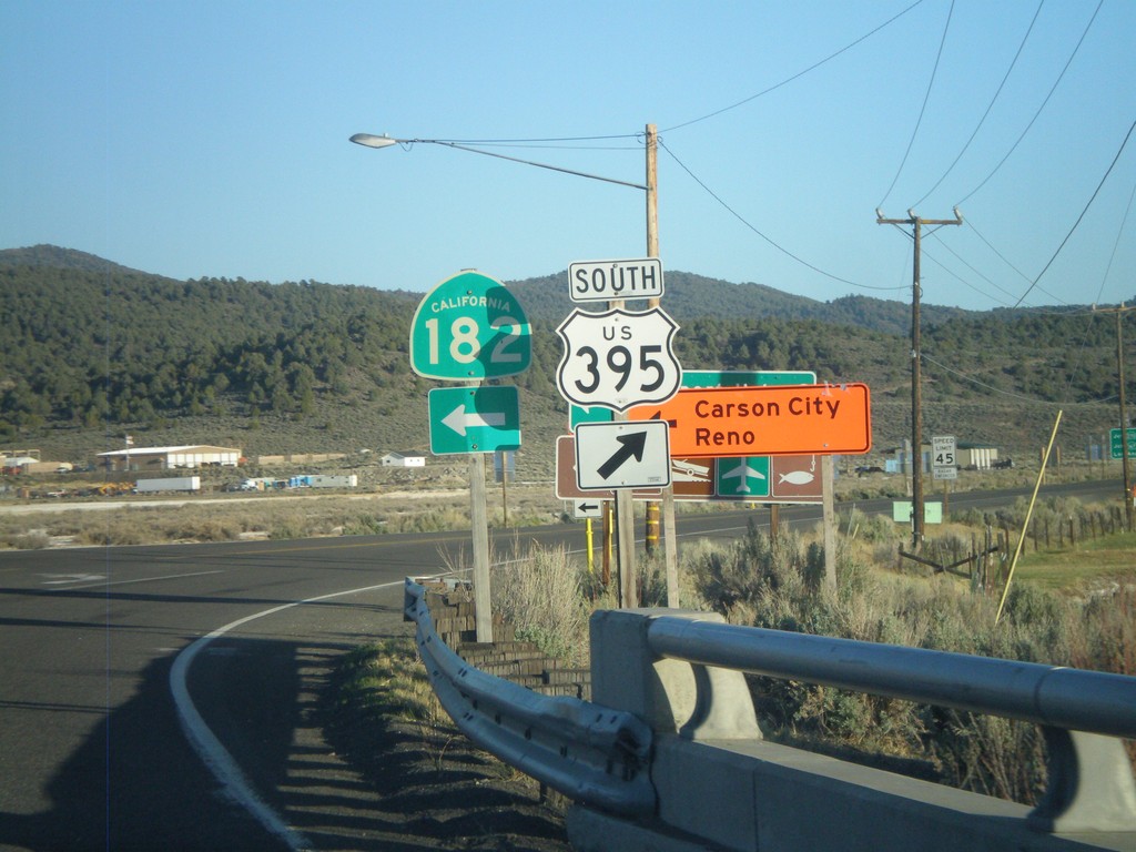
US-395 South at CA-182
US-395 south at CA-182 in Bridgeport. When this picture was taken, US-395 was closed in the evenings north of Bridgeport, so northbound US-395 traffic had to use CA-182 to reach Reno and Carson City, hence the orange directional signs.
Taken 05-06-2012

 Bridgeport
Mono County
California
United States
Bridgeport
Mono County
California
United States