Signs From California
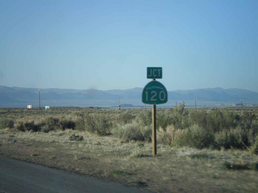
US-395 North At CA-120 East
US-395 north at CA-120 east. CA-120 west joins US-395 north to Lee Vining.
Taken 05-06-2012

 Lee Vining
Mono County
California
United States
Lee Vining
Mono County
California
United States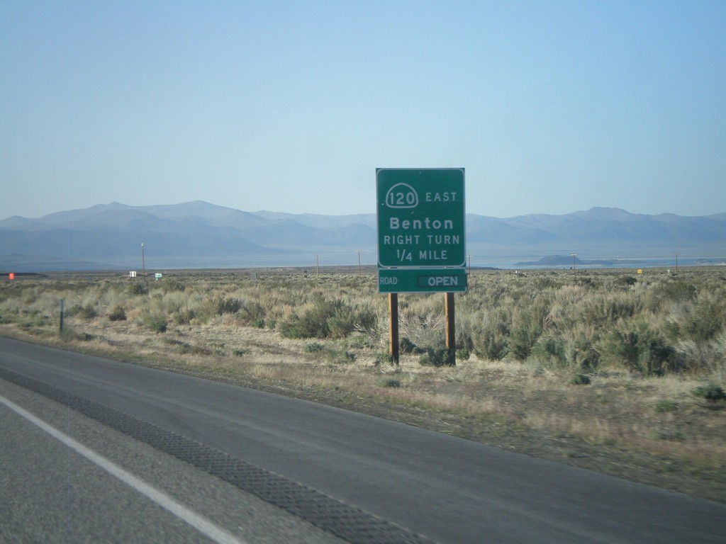
US-395 North Approaching CA-120 East
US-395 North Approaching CA-120 East to Benton. CA-120 west joins US-395 north to Lee Vining.
Taken 05-06-2012
Lee Vining
Mono County
California
United States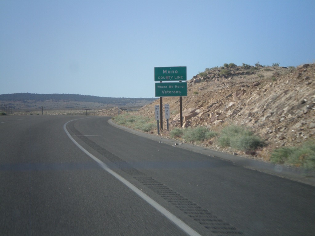
US-395 North - Mono County
Mono County Line on US-395 north.
Taken 05-06-2012
Mesa
Inyo County
California
United States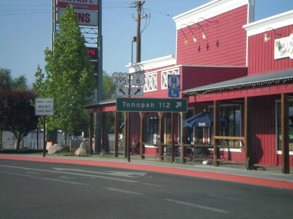
US-395 North at US-6
US-395 north at US-6 in Bishop. Use US-6 east for Tonopah (Nevada). This is the western terminus of US-6. The eastern end of US-6 is Provincetown, MA.
Taken 05-06-2012
 Bishop
Inyo County
California
United States
Bishop
Inyo County
California
United States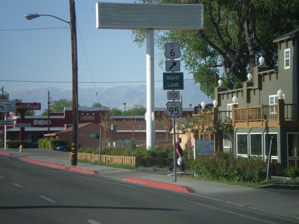
US-395 North Approaching US-6
US-395 north approaching US-6 in Bishop. Use US-6 east for US-95. This is the western terminus of US-6.
Taken 05-06-2012
 Bishop
Inyo County
California
United States
Bishop
Inyo County
California
United States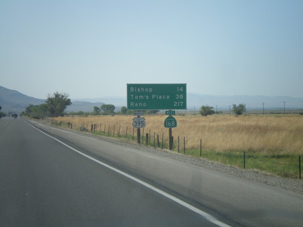
US-395 North/CA-168 West - Distance Marker
Distance marker on US-395 North/CA-168 West. Distance to Bishop, Tom’s Place, and Reno.
Taken 05-06-2012
 Big Pine
Inyo County
California
United States
Big Pine
Inyo County
California
United States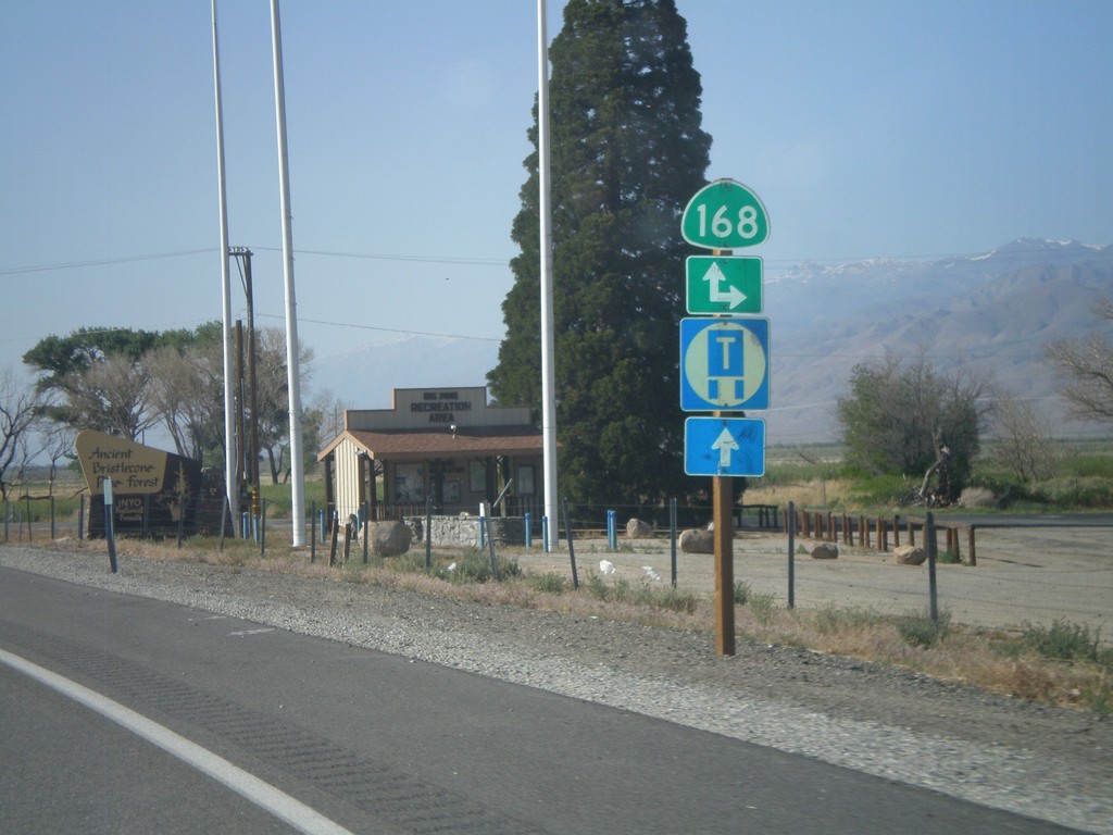
US-395 North at CA-168
US-395 north at CA-168 east. CA-168 west joins US-395 north to Bishop.
Taken 05-06-2012
Big Pine
Inyo County
California
United States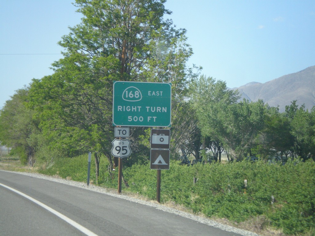
US-395 North Approaching CA-168
US-395 north approaching CA-168 east. Use CA-168 east for US-95 (in Nevada). CA-168 heads east from here over the White Mountains into Nevada.
Taken 05-06-2012
Big Pine
Inyo County
California
United States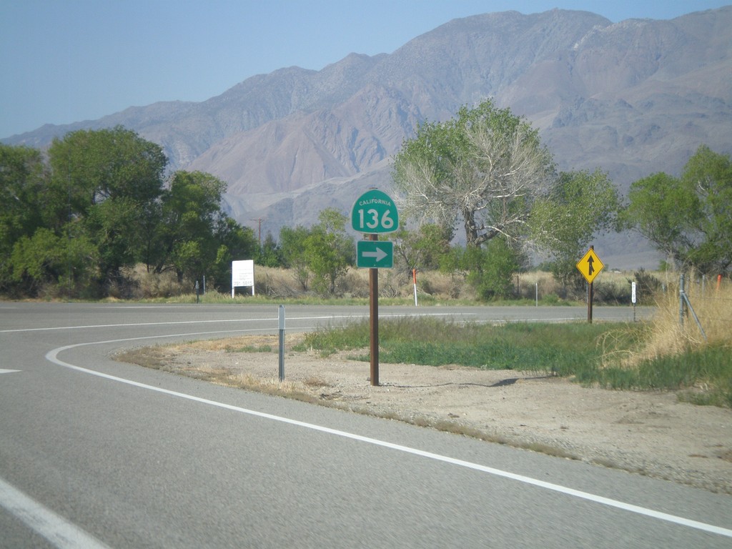
US-395 North at CA-136 East
US-395 North at CA-136 East on the south side of Lone Pine. CA-136 heads east across the north and east edges of dry Owens Lake to CA-190 junction.
Taken 05-06-2012
 Lone Pine
Inyo County
California
United States
Lone Pine
Inyo County
California
United States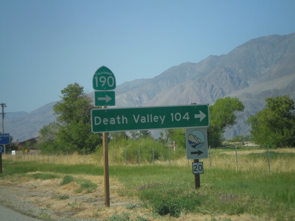
US-395 North at CA-136 (To CA-190)
US-395 north at CA-136 north to CA-190. Use CA-136 east for Death Valley. The logo at the bottom of the sign, with the number 20 written on it, is for the Eastern Sierra Scenic Byway. Site number 20 refers to the Highest to Lowest and Desert’s Edge interpretive site.
Taken 05-06-2012
 Lone Pine
Inyo County
California
United States
Lone Pine
Inyo County
California
United States