Signs From California
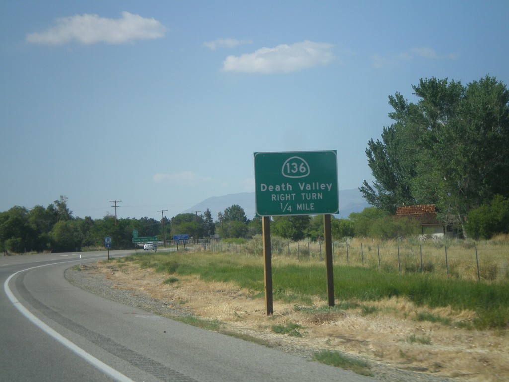
US-395 North Approaching CA-136
US-395 north approaching CA-136 east to Death Valley.
Taken 05-06-2012

 Lone Pine
Inyo County
California
United States
Lone Pine
Inyo County
California
United States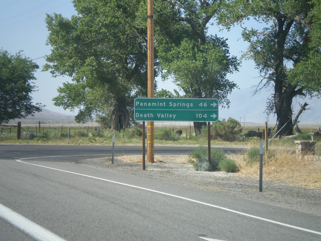
US-395 North at CA-190 East
US-395 north at CA-190 east. Use CA-190 east for Death Valley and Panamint Springs.
Taken 05-06-2012
 Olancha
Inyo County
California
United States
Olancha
Inyo County
California
United States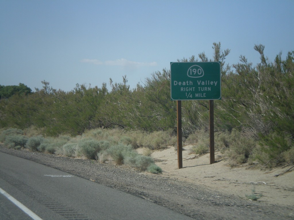
US-395 North Approaching CA-190
US-395 north approaching CA-190 east to Death Valley.
Taken 05-06-2012
Olancha
Inyo County
California
United States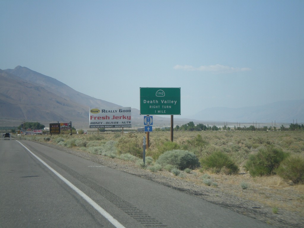
US-395 North Approaching CA-190
US-395 north approaching CA-190 east to Death Valley.
Taken 05-06-2012
Olancha
Inyo County
California
United States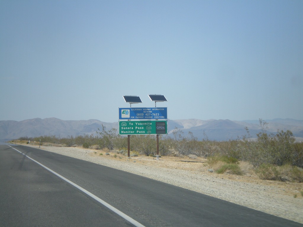
US-395 North - Sierra Nevada Pass Information
Sierra Nevada mountain pass information on US-395 north. This sign shows the status of CA-120 (Tioga Pass), CA-108 (Sonora Pass), and CA-89 (Monitor Pass). At the time this picture was taken, the only pass still closed was Tioga Pass.
Taken 05-06-2012


 Inyokern
Kern County
California
United States
Inyokern
Kern County
California
United States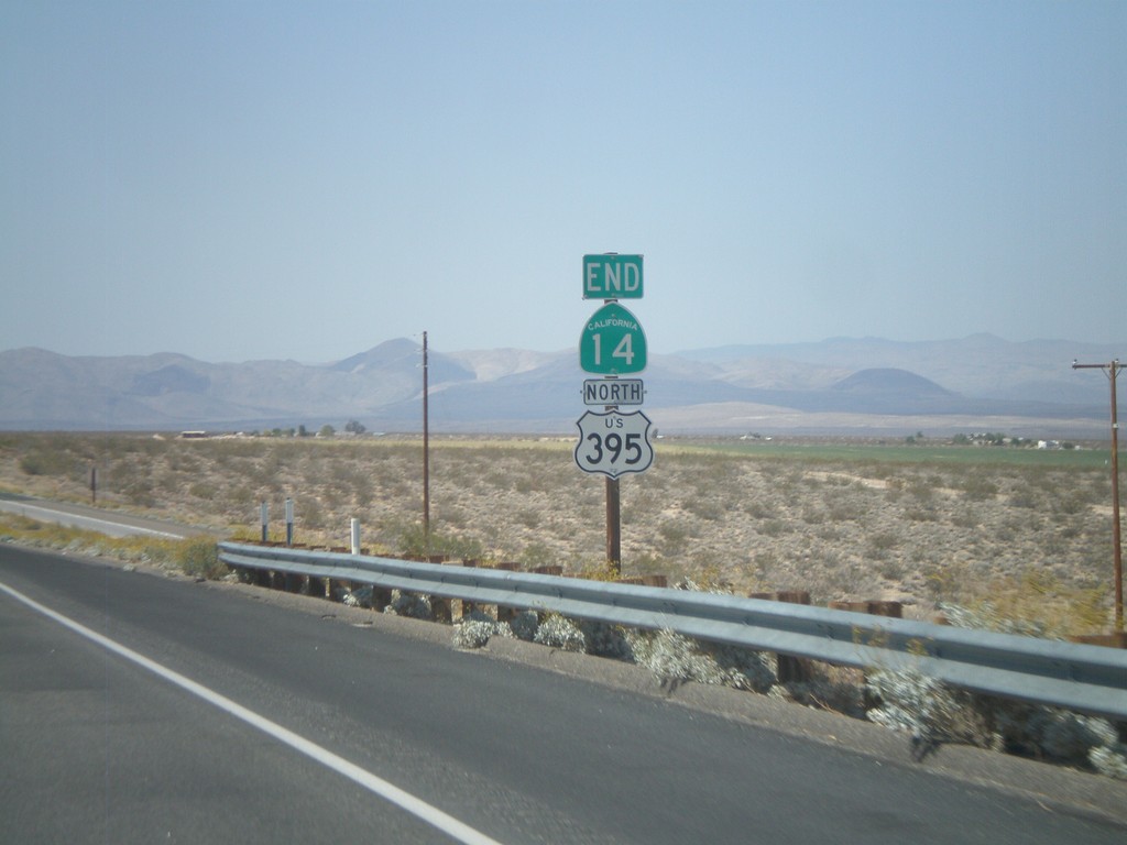
End CA-14 North at US-395
End CA-14 north at US-395. CA-14 starts in Los Angeles, and runs 116 miles to US-395 in Kern County.
Taken 05-06-2012
 Inyokern
Kern County
California
United States
Inyokern
Kern County
California
United States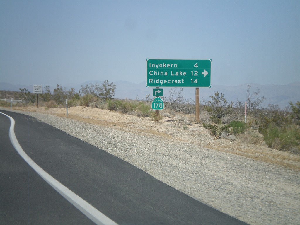
CA-14 North/CA-178 East at CA-178 East
CA-14 North/CA-178 East at CA-178 East junction. Turn right for CA-178 east to Inyokern, China Lake, and Ridgecrest. CA-178 leaves US-395 here.
Taken 05-06-2012
 Inyokern
Kern County
California
United States
Inyokern
Kern County
California
United States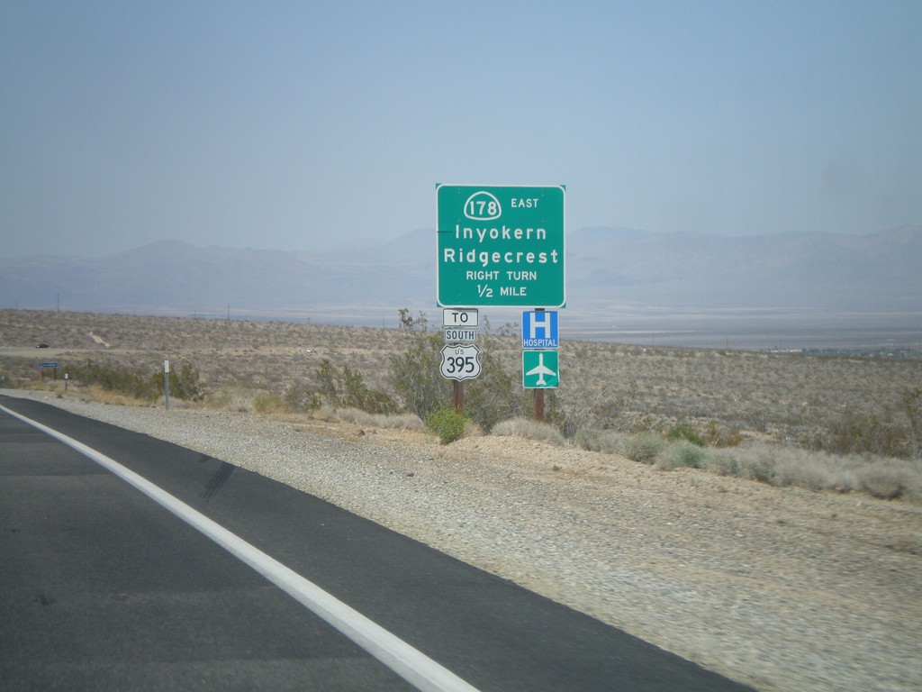
CA-14 North/CA-178 East Approaching CA-178 East
CA-14 North/CA-178 East approaching CA-178 east. Use CA-178 east for Inyokern, Ridgecrest, and US-395 south. Northbound US-395 traffic continue north on CA-14.
Taken 05-06-2012
Inyokern
Kern County
California
United States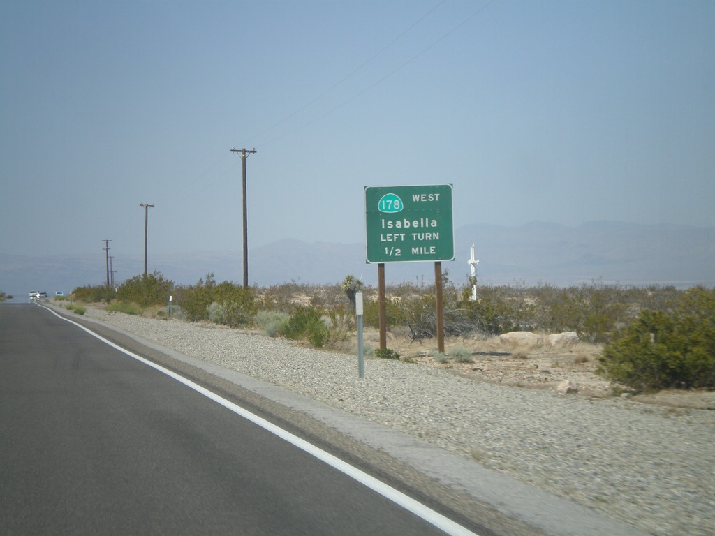
CA-14 North Approaching CA-178 West
CA-14 North approaching CA-178 West to Isabella. CA-178 east joins CA-14 north briefly to the Inyokern area.
Taken 05-06-2012
Inyokern
Kern County
California
United States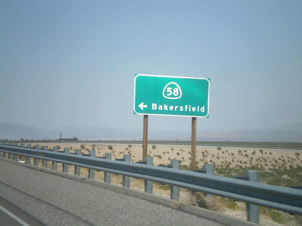
CA-14 North at CA-58 West Onramp
CA-14 North at CA-58 West onramp to Bakersfield.
Taken 05-06-2012
 California City
Kern County
California
United States
California City
Kern County
California
United States