Signs From California
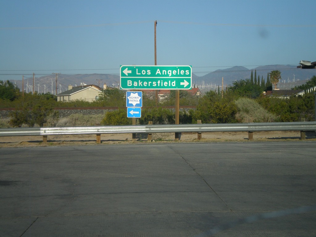
CA-14 South at Bus. CA-58
CA-14 south at Bus. CA-58 in Mojave. Turn right for Bus. CA-58 west towards Bakersfield. Turn left to continue south on CA-14 and Bus. CA-58 east towards Los Angeles.
Taken 05-05-2012

 Mojave
Kern County
California
United States
Mojave
Kern County
California
United States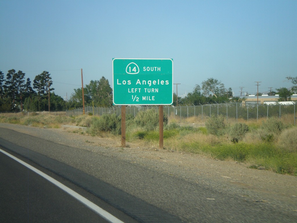
CA-14 South Approaching Bus. CA-58
CA-14 South approaching Bus. CA-58. To continue south on CA-14 towards Los Angeles, turn left at intersection.
Taken 05-05-2012
Mojave
Kern County
California
United States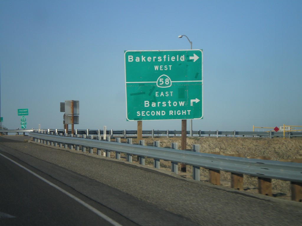
CA-14 South at CA-58
CA-14 south at CA-58. Turn right for CA-58 west to Bakersfield. Continue over overpass and take second right for CA-58 east to Barstow.
Taken 05-05-2012
 California City
Kern County
California
United States
California City
Kern County
California
United States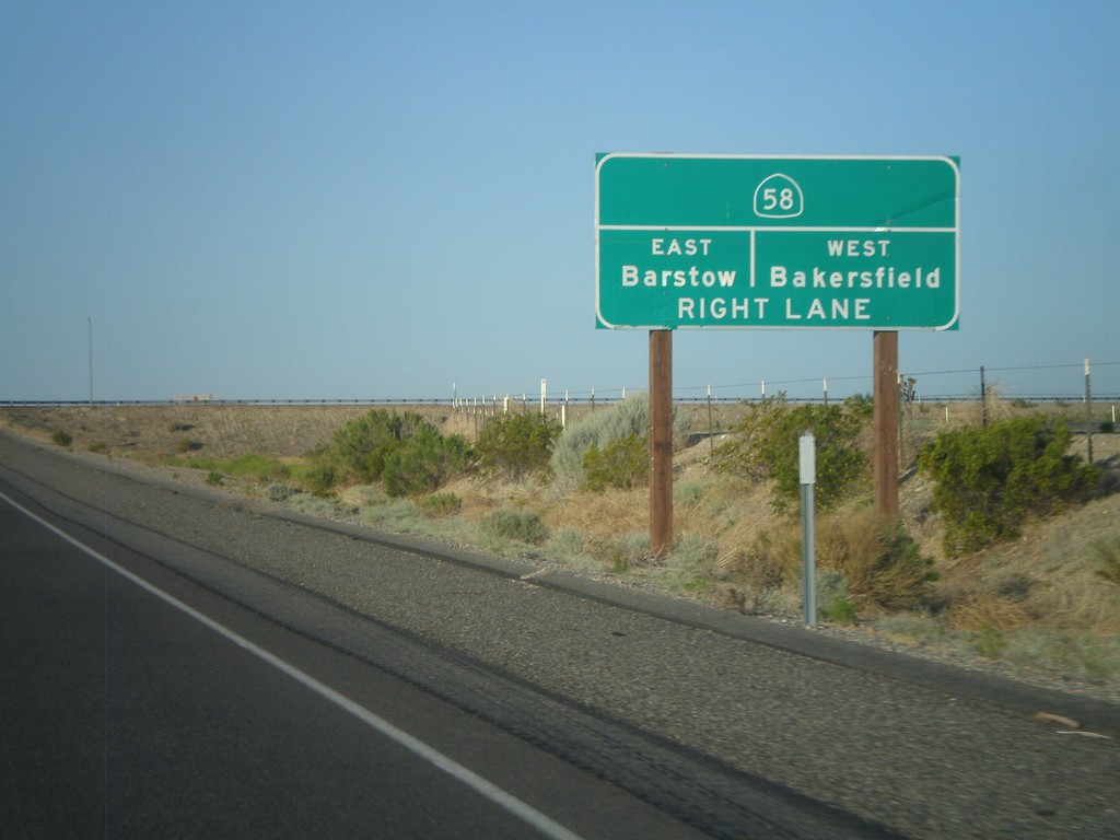
CA-14 South Approaching CA-58
CA-14 South approaching CA-58 to Barstow (east) and Bakersfield (west).
Taken 05-05-2012
Mojave
Kern County
California
United States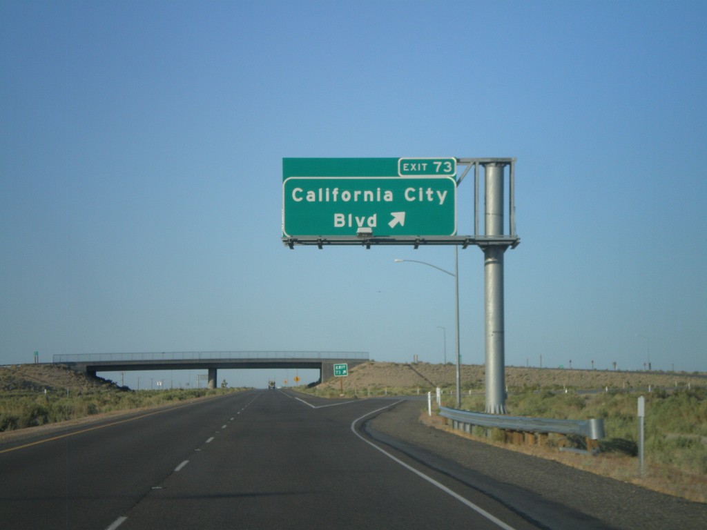
CA-14 South - Exit 73
CA-14 south at Exit 73 - California City Blvd.
Taken 05-05-2012
Mojave
Kern County
California
United States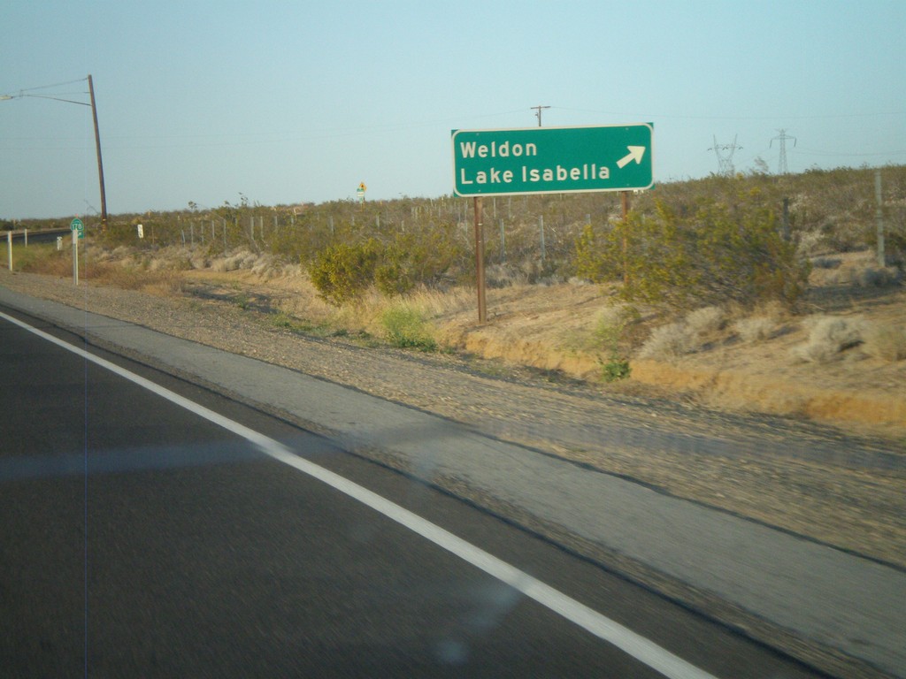
CA-14 South/CA-178 West at Split
CA-14 South/CA-178 West at CA-14/CA-178 split. Turn right for CA-178 west to Weldon and Lake Isabella.
Taken 05-05-2012
 Inyokern
Kern County
California
United States
Inyokern
Kern County
California
United States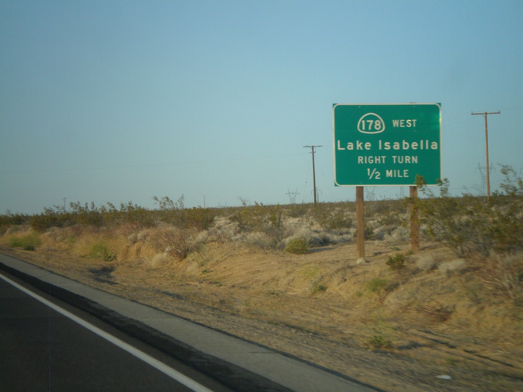
CA-14 South/CA-178 West Approaching CA-178 West
CA-14 South/CA-178 West approaching CA-178 West. Use CA-178 west for Lake Isabella.
Taken 05-05-2012
Inyokern
Kern County
California
United States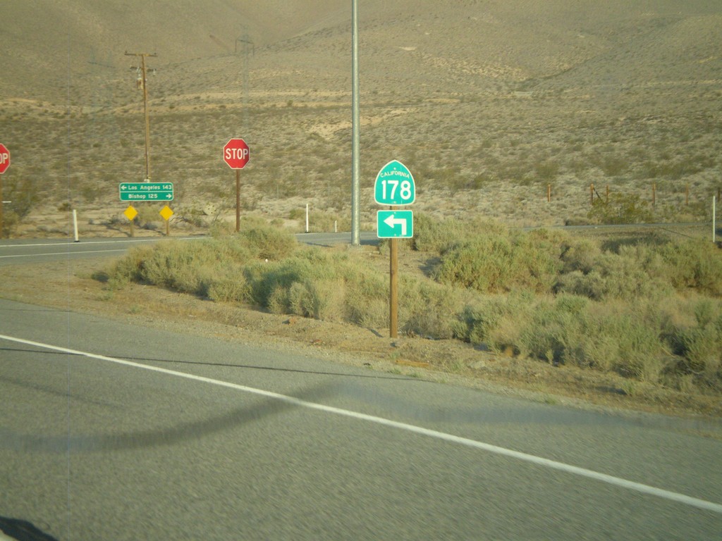
CA-178 West at CA-14
CA-178 west at CA-14 near Inyokern. CA-178 joins CA-14 south for the next few miles. Turn left to continue on CA-178.
Taken 05-05-2012
Inyokern
Kern County
California
United States
CA-178 West Approaching CA-14
CA-178 west approaching CA-14. Turn right on CA-14 north for Bishop; left on CA-14 South/CA-178 West for Los Angeles. CA-178 west joins CA-14 south for a few miles.
Taken 05-05-2012
Inyokern
Kern County
California
United States
CA-178 West at Brown Road
CA-178 west at Brown Road, to US-395 north towards Bishop. Continue west on CA-178 for CA-14 junction.
Taken 05-05-2012
 Inyokern
Kern County
California
United States
Inyokern
Kern County
California
United States