Signs From California
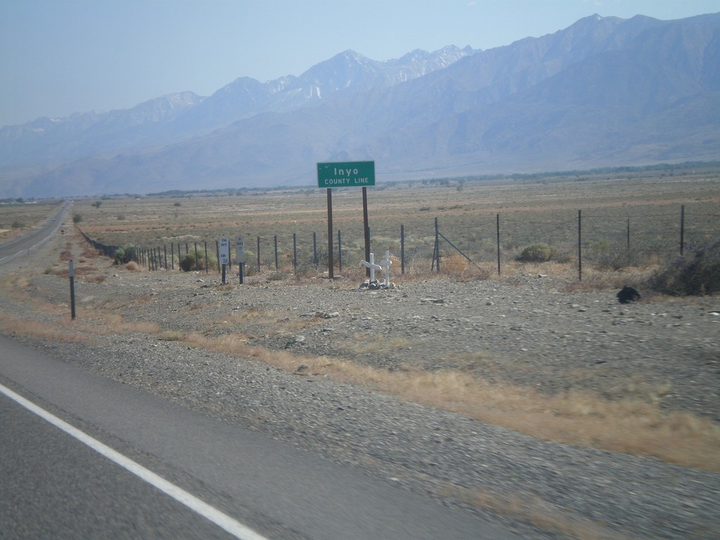
US-6 West - Inyo County Line
Inyo County Line on US-6 west. Taken at the Mono-Inyo county line.
Taken 05-04-2012
 Bishop
Inyo County
California
United States
Bishop
Inyo County
California
United States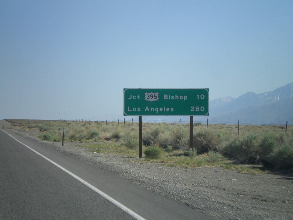
US-6 West - Distance Marker
Distance marker on US-6 west. Distances to Jct. US-395 - Bishop, and Los Angeles.
Taken 05-04-2012
 Bishop
Mono County
California
United States
Bishop
Mono County
California
United States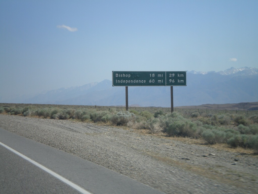
US-6 West - Distance Marker
Distance marker on US-6 west. Distance to Bishop and Independence. This is an older style distance marker which lists distances in miles and kilometers. These dual unit signs are scattered around California, although they tend to be older with button copy lettering.
Taken 05-04-2012
Chalfant Valley
Mono County
California
United States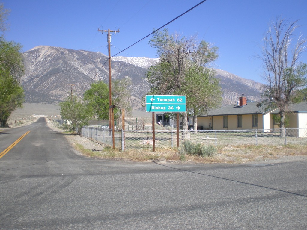
End CA-120 East at US-6
End CA-120 east at US-6. Use US-6 west for Bishop; US-6 east for Tonopah (Nevada).
Taken 05-04-2012
 Benton
Mono County
California
United States
Benton
Mono County
California
United States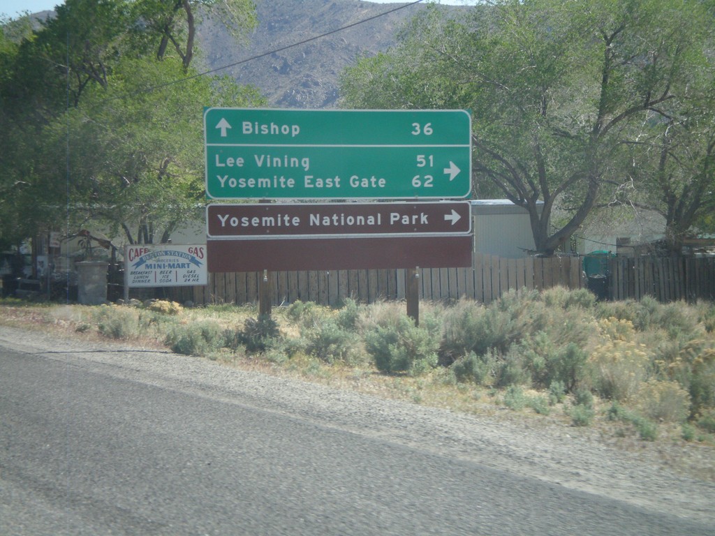
US-6 West at CA-120 West
US-6 West at CA-120 West. Use CA-120 west for Lee Vining, Yosemite East Gate, and Yosemite National Park. Continue west on US-6 for Bishop.
Taken 05-04-2012
Benton
Mono County
California
United States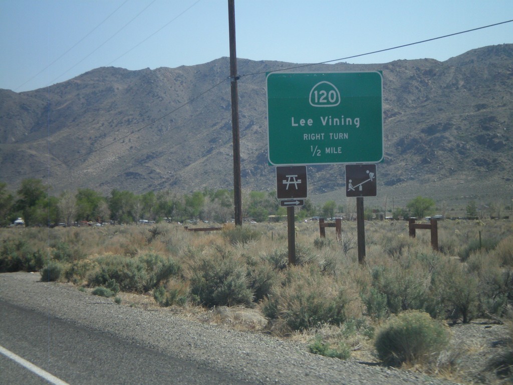
US-6 West Approaching CA-120
US-6 west approaching CA-120 west to Lee Vining.
Taken 05-04-2012
Benton
Mono County
California
United States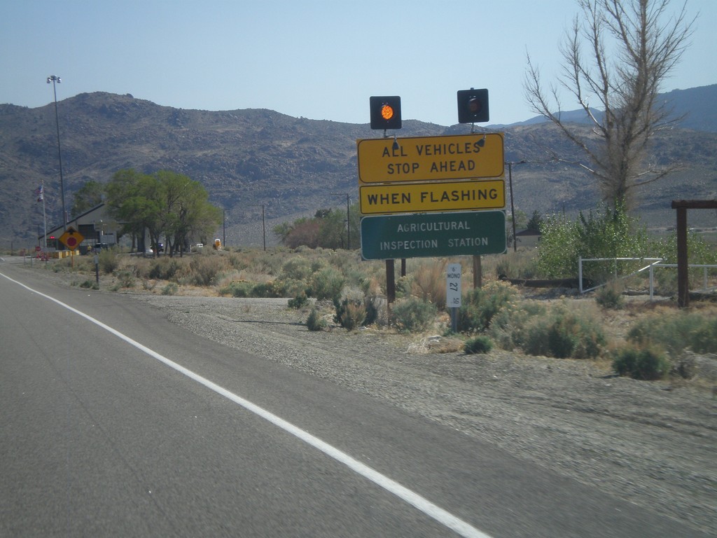
US-6 West - California State Agricultural Inspection
US-6 west approaching the California State Agricultural Inspection Station at Benton. All traffic must stop for inspection. I was waved through on this day.
Taken 05-04-2012
Benton
Mono County
California
United States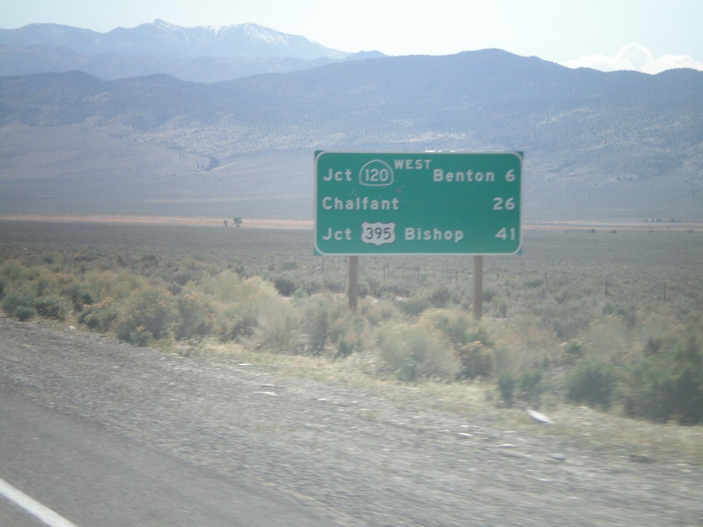
US-6 West - Distance Marker
Distance marker on US-6 west. Distance to Jct. CA-120 West/Benton, Chalfant, and Jct. US-395/Bishop. This is the first distance marker on US-6 inside of California.
Taken 05-04-2012
Benton
Mono County
California
United States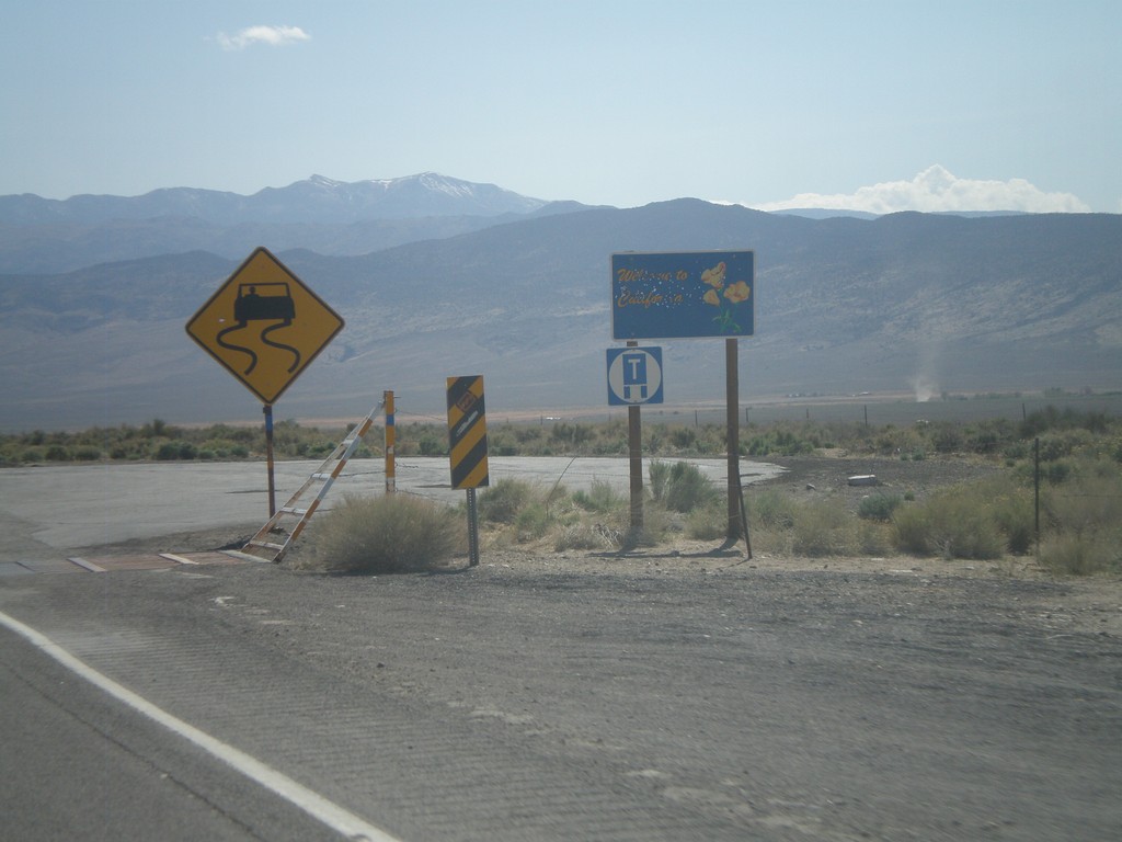
US-6 West - Welcome to California
Welcome to California on US-6 west. Taken at the Nevada-California state line. The cattle guard marks the actual state line.
Taken 05-04-2012
Benton
Mono County
California
United States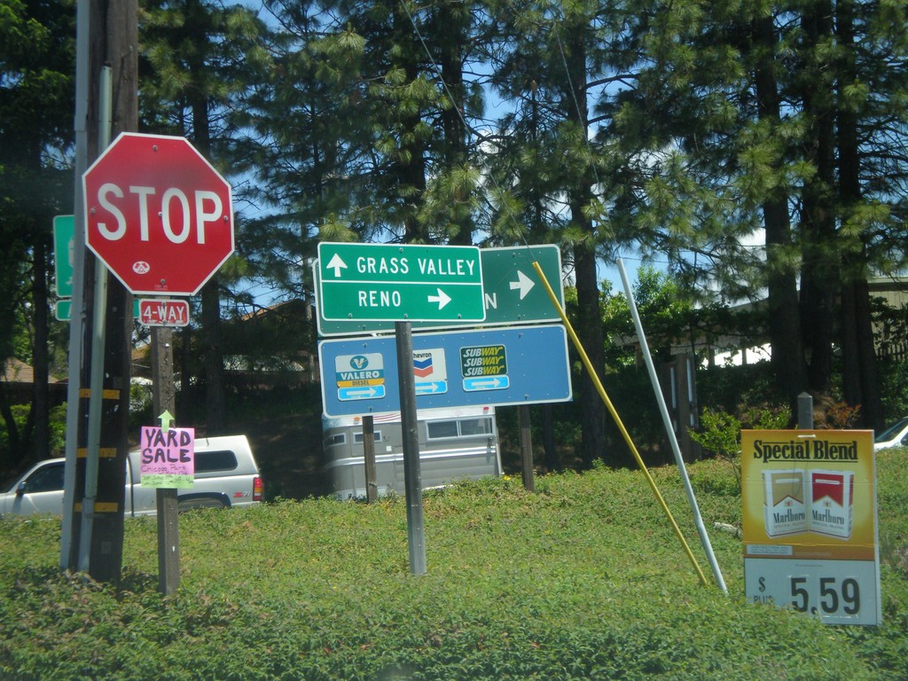
S. Auburn St. at I-80 Onramp and CA-174 Jct.
S. Auburn St. at I-80 East onramp and CA-174. Turn right for I-80 east to Reno; continue ahead for CA-174 West to Grass Valley.
Taken 06-13-2011

 Colfax
Placer County
California
United States
Colfax
Placer County
California
United States