Signs From California
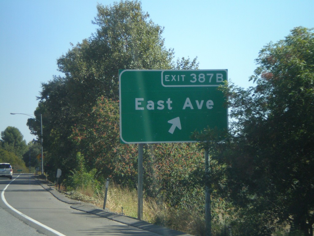
CA-99 South - Exit 387B
CA-99 south at Exit 387B - East Ave.
Taken 09-25-2010
 Chico
Butte County
California
United States
Chico
Butte County
California
United States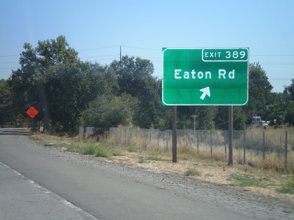
CA-99 South - Exit 389
CA-99 south at Exit 389 - Eaton Road.
Taken 09-25-2010
Chico
Butte County
California
United States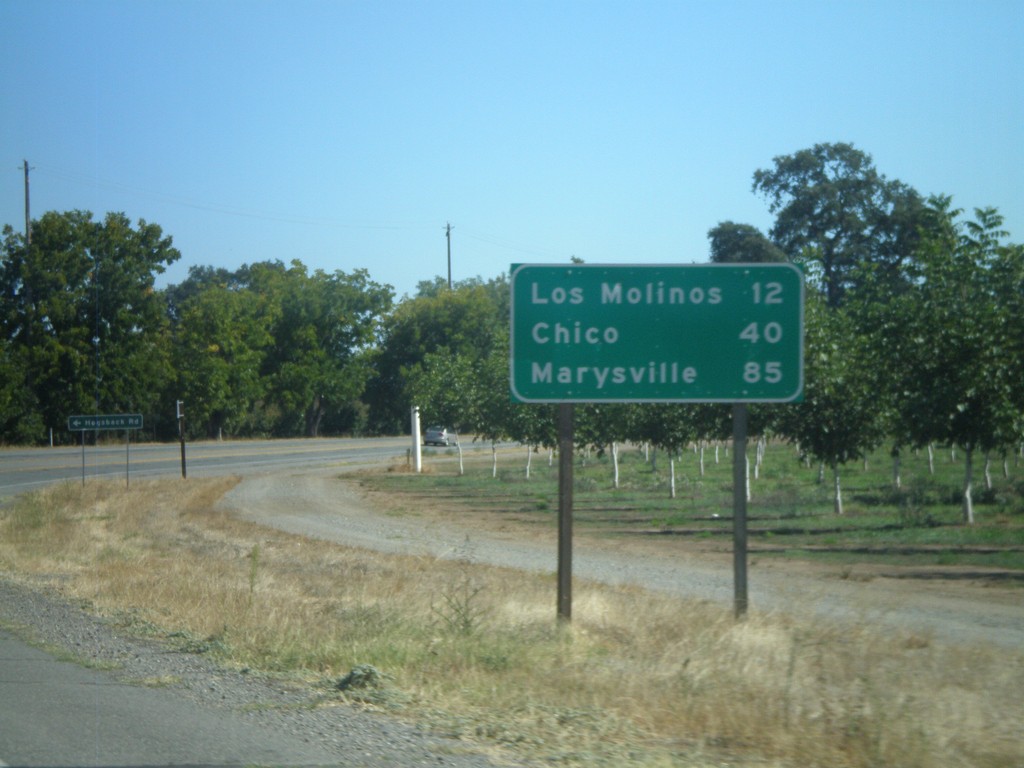
CA-99 South - Distance Marker
Distance marker on CA-99 south to Los Molinos, Chico, and Marysville.
Taken 09-25-2010
Red Bluff
Tehama County
California
United States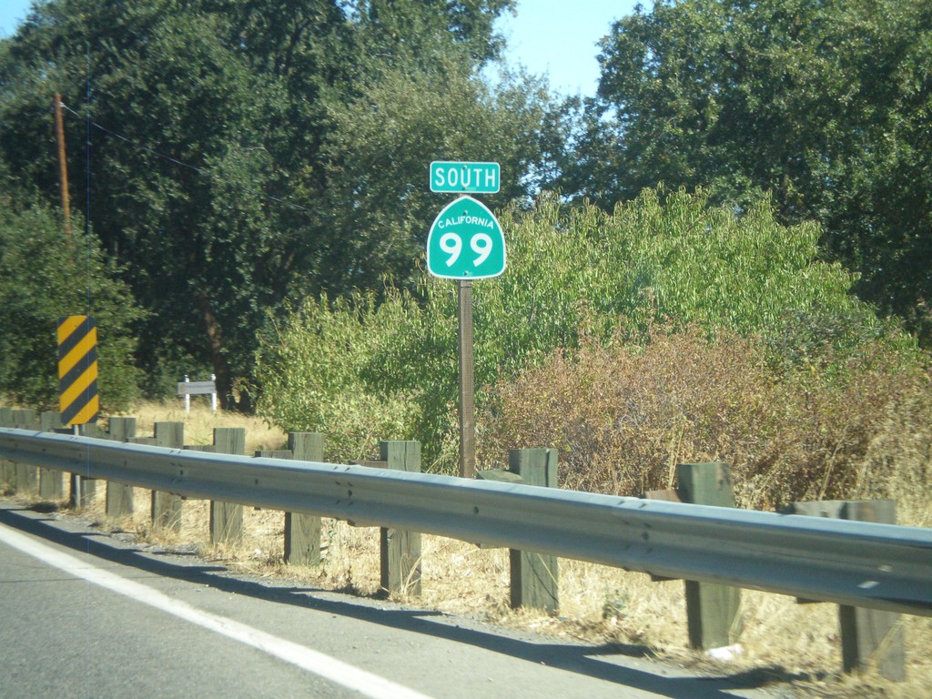
CA-99 South
CA-99 south. This is the first CA-99 shield on CA-99 southbound.
Taken 09-25-2010
Red Bluff
Tehama County
California
United States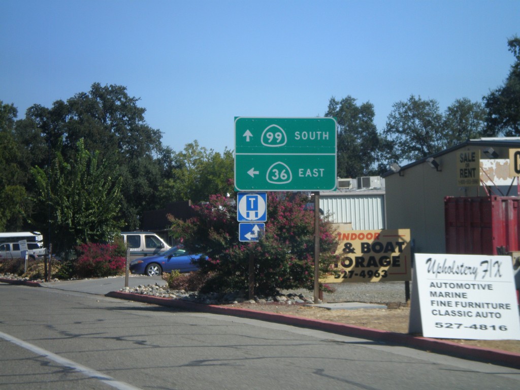
CA-36 East at CA-99
CA-36 East at CA-99. Turn left to continue east on CA-36. Continue straight ahead for CA-99.
Taken 09-25-2010
 Red Bluff
Tehama County
California
United States
Red Bluff
Tehama County
California
United States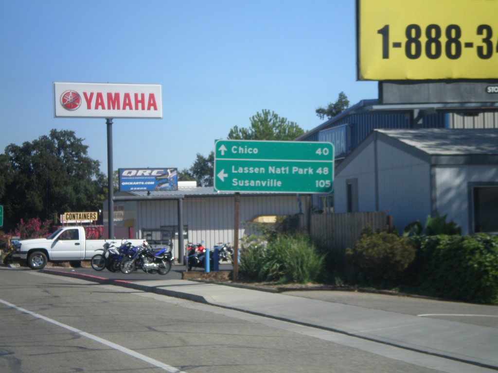
CA-36 East at CA-99
CA-36 east at CA-99. Use CA-36 east for Lassen National Park and Susanville. Continue south on CA-99 for Chico.
Taken 09-25-2010
Red Bluff
Tehama County
California
United States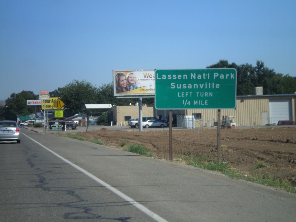
CA-36 East at CA-99
CA-36 east approaching CA-99. Turn left at junction (CA-36) for Lassen National Park and Susanville.
Taken 09-25-2010
Red Bluff
Tehama County
California
United States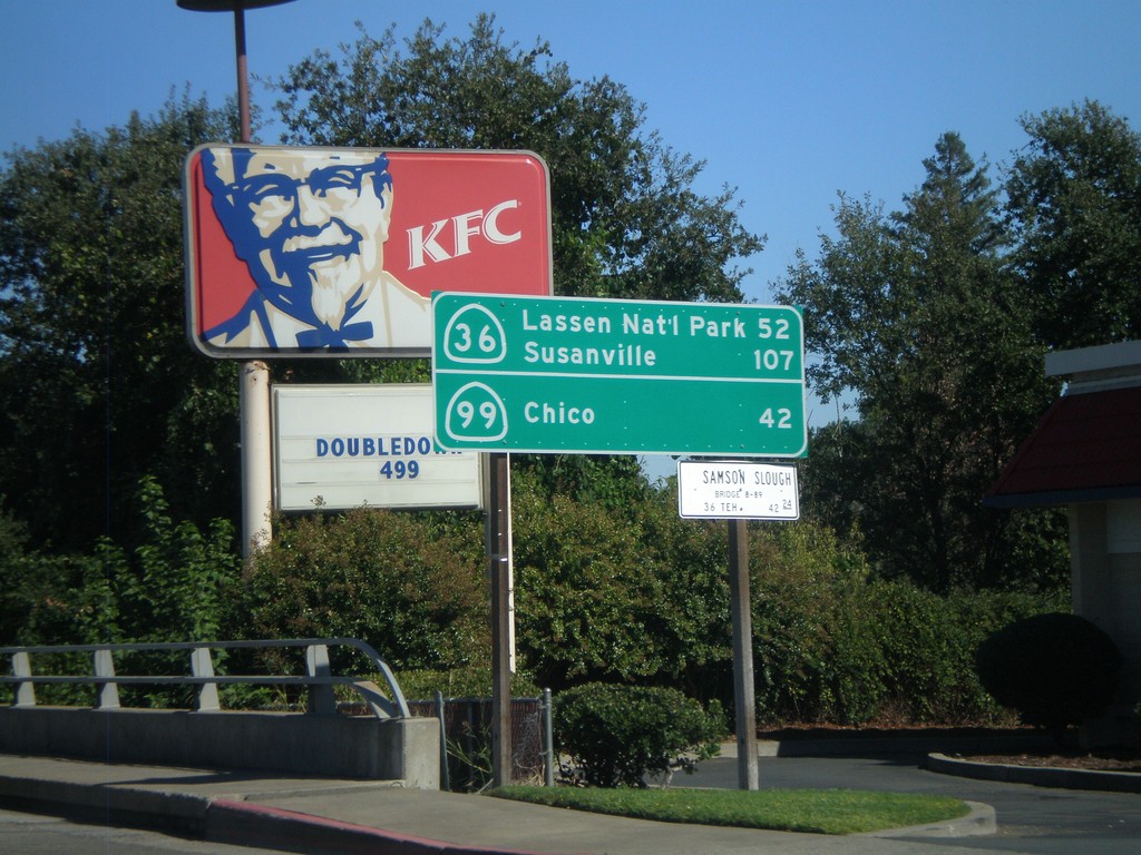
CA-36 East - Distance Marker
Distance marker on CA-36 east to Lassen Park and Susanville, via CA-36. Distance to Chico via CA-99.
Taken 09-25-2010
Red Bluff
Tehama County
California
United States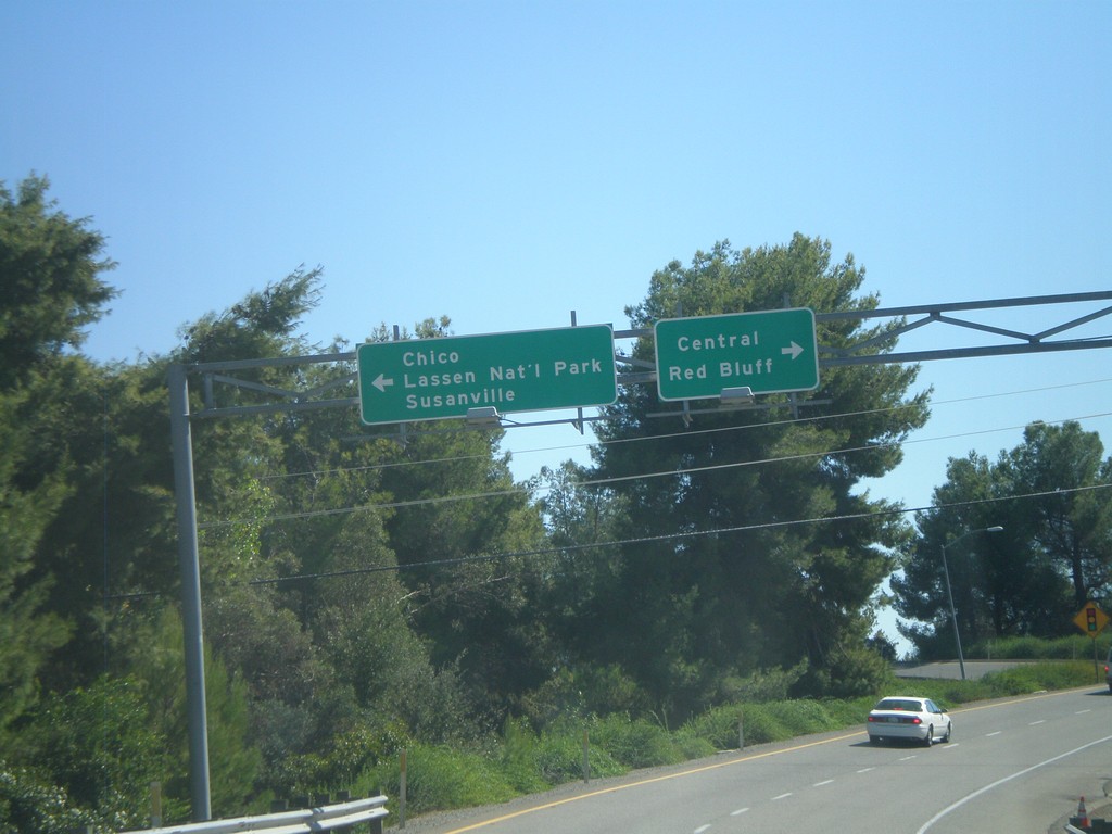
I-5 South - Exit 649 Offramp
I-5 south on Exit 649 offramp (CA-36). Turn left on CA-36 east for Chico (via CA-99), Lassen National Park, and Susanville. Turn right on CA-36 west for Central Red Bluff.
Taken 09-25-2010
 Red Bluff
Tehama County
California
United States
Red Bluff
Tehama County
California
United States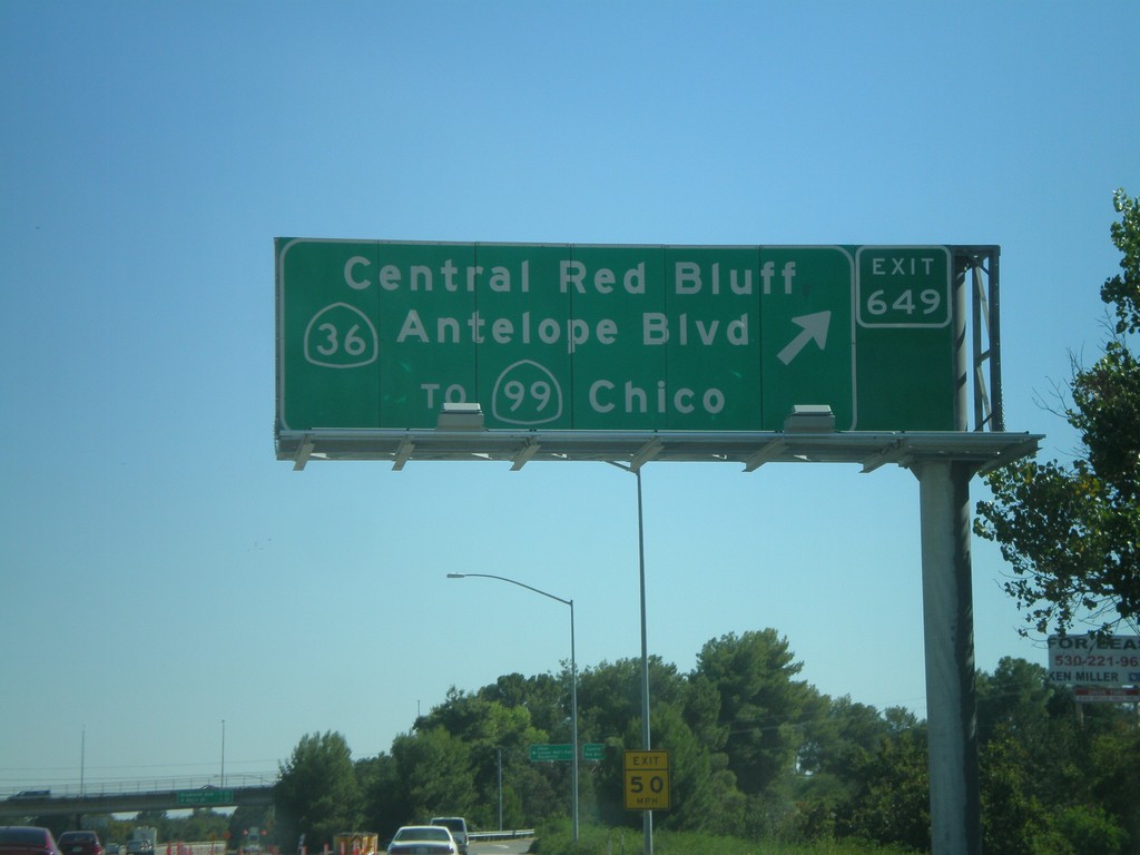
I-5 South - Exit 649
I-5 south at Exit 649 - CA-36/Central Red Bluff/Antelope Blvd./To CA-99/Chico. This used to be the northern terminus of CA-99, but it was moved east of here to the CA-36 junction a few years back.
Taken 09-25-2010
Red Bluff
Tehama County
California
United States