Signs From California
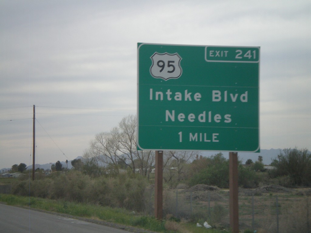
I-10 West Approaching Exit 241
I-10 west approaching Exit 241 - US-95/Intake Blvd/Needles. US-95 north leaves I-10 here. US-95 south joins I-10 east to Quartzsite, AZ.
Taken 03-22-2010

 Blythe
Riverside County
California
United States
Blythe
Riverside County
California
United States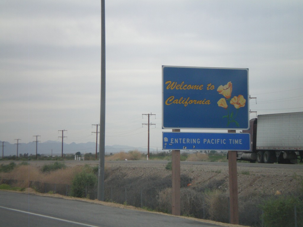
I-10 West - Welcome To California
Welcome to California on I-10 West/US-95 north, just west of the California State Agricultural Inspection Station. Entering Pacific Time Zone.
Taken 03-22-2010
Blythe
Riverside County
California
United States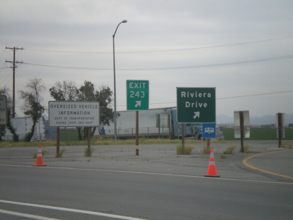
I-10 West - Exit 243
I-10 west at Exit 243 - Riviera Drive. Taken upon leaving the California State Agricultural Inspection Station.
Taken 03-22-2010
Blythe
Riverside County
California
United States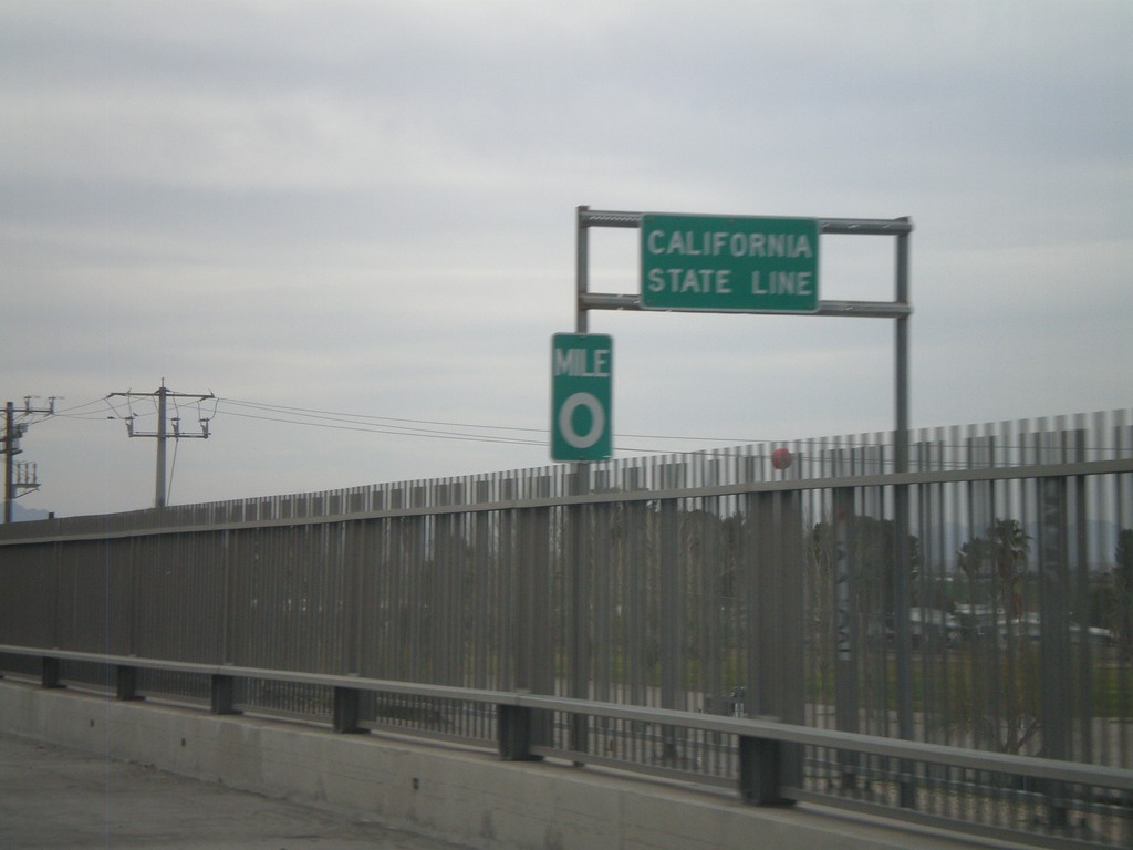
I-10 West - California State Line
California State Line on I-10 west crossing the Colorado River, at the Arizona-California Border.
Taken 03-22-2010
Blythe
Riverside County
California
United States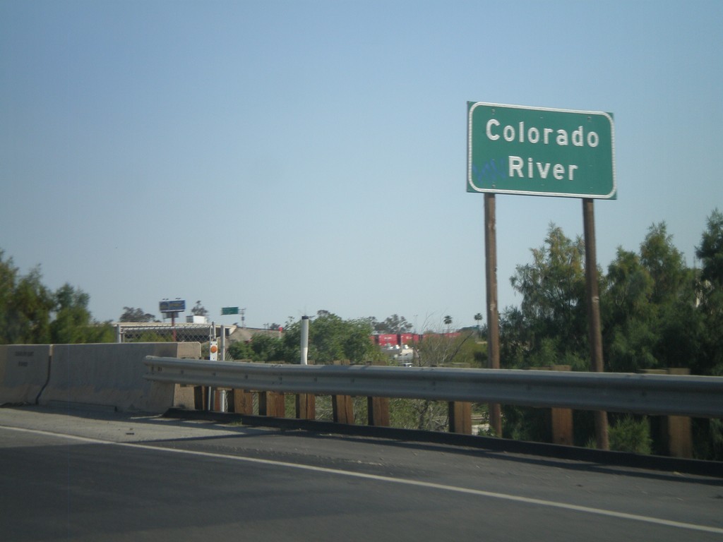
I-8 East - Colorado River
I-8 east at the Colorado River. The Colorado River marks the boundary between California and Arizona.
Taken 03-20-2010
 Winterhaven
Imperial County
California
United States
Winterhaven
Imperial County
California
United States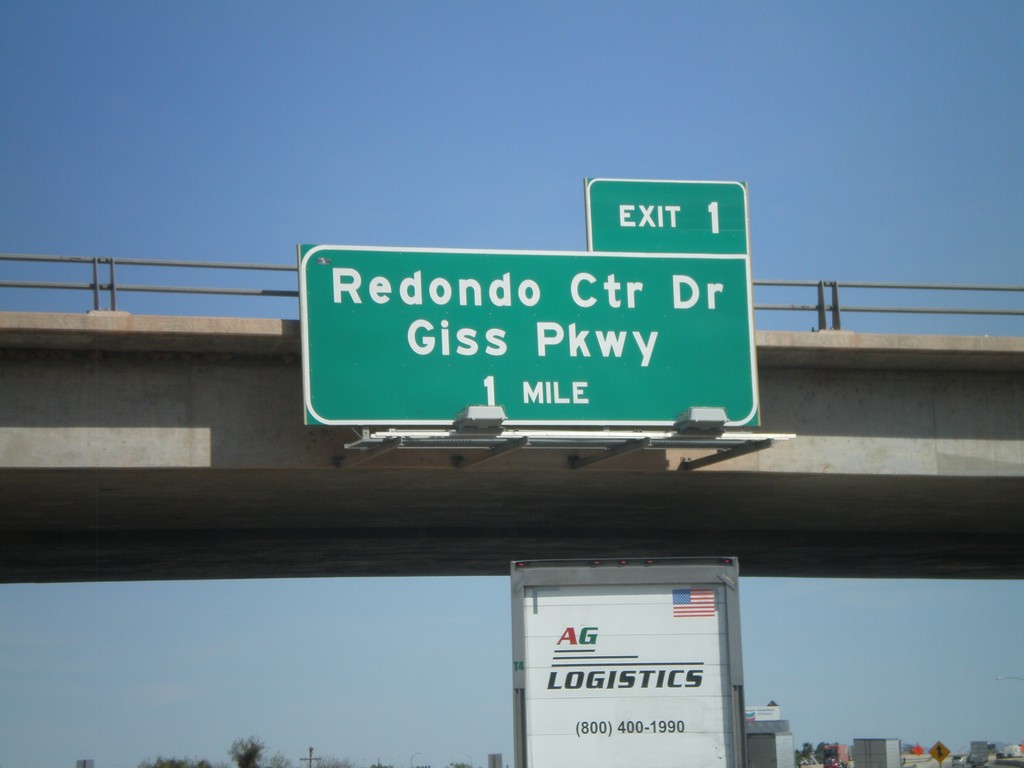
I-8 East - Arizona Exit 1
I-8 east approaching Arizona Exit 1 - Redondo Center Drive/Giss Parkway. This sign appears to have been placed by the Arizona DOT.
Taken 03-20-2010
Winterhaven
Imperial County
California
United States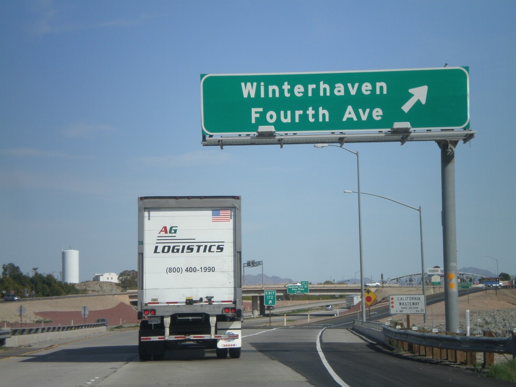
I-8 East - Exit 172
I-8 east at Exit 172 - Winterhaven/Fourth Ave. This is the last exit in California along I-8 east. Also crossing the California Wasteway.
Taken 03-20-2010
Winterhaven
Imperial County
California
United States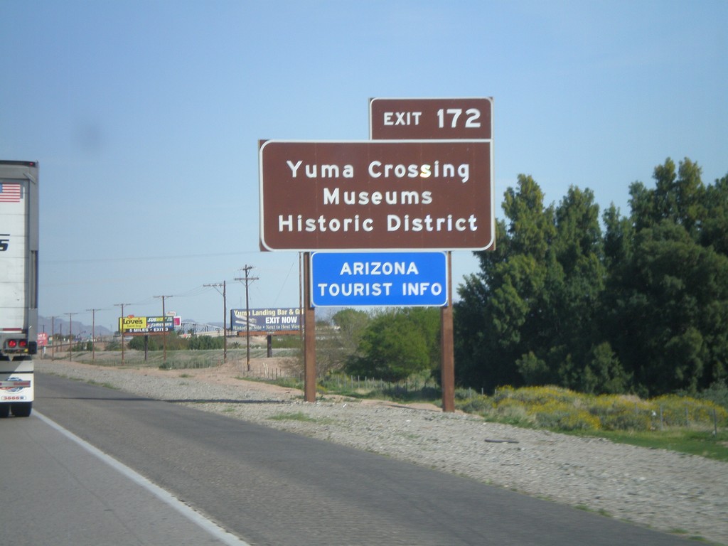
I-8 East Approaching Exit 172
I-8 east approaching Exit 172. Use Exit 172 for Yuma Crossing, Museums, and Historic District. Also use Exit 172 for the Arizona Welcome Center. While Exit 172 is in California, it does provide access to the city of Yuma, Arizona. This sign appears to have been placed by the Arizona DOT.
Taken 03-20-2010
Winterhaven
Imperial County
California
United States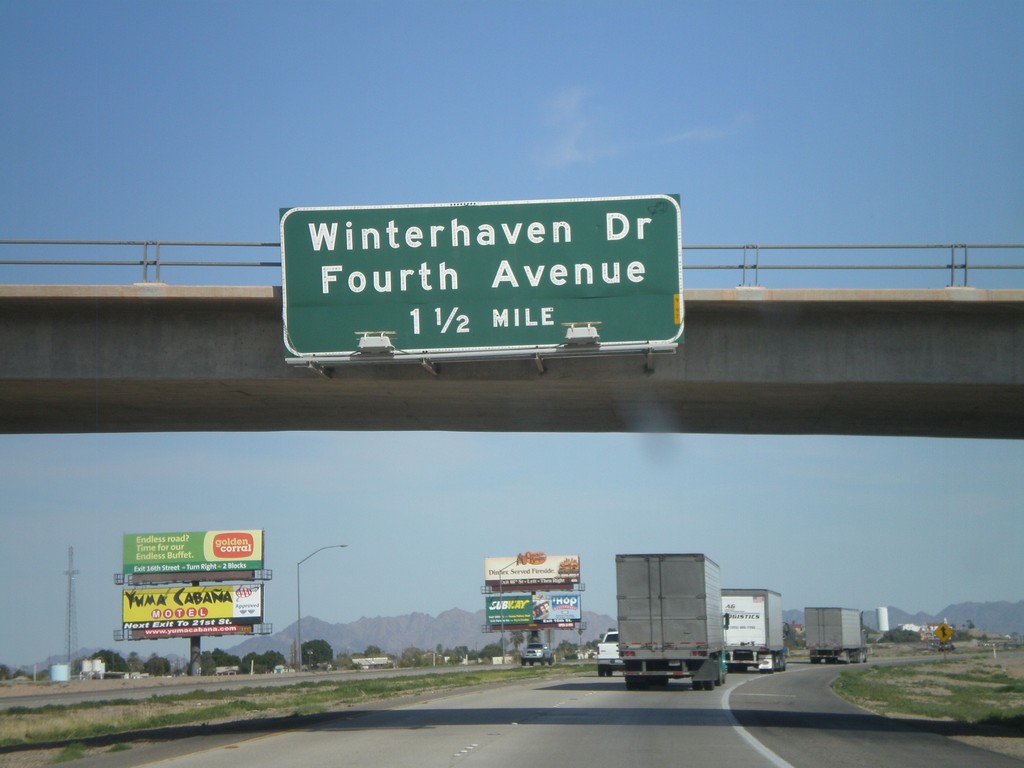
I-8 East Approaching Exit 172
I-8 east approaching Exit 172 - Winterhaven Drive/Fourth Ave.
Taken 03-20-2010
Winterhaven
Imperial County
California
United States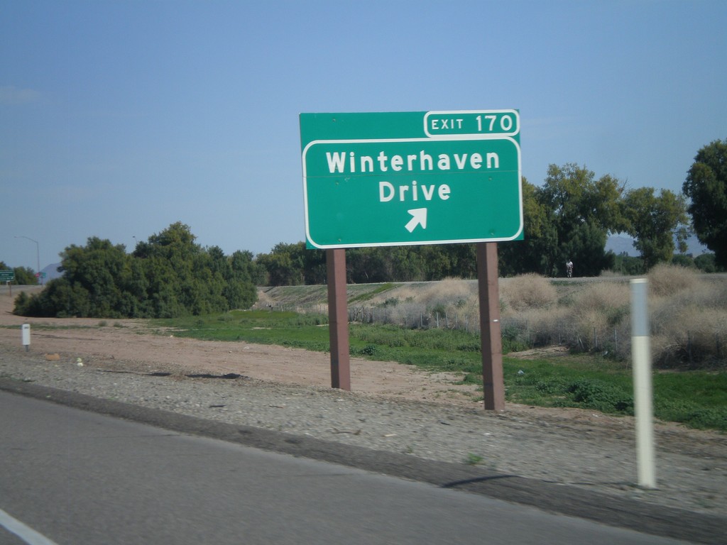
I-8 East - Exit 170
I-8 east at Exit 170 - Winterhaven Drive
Taken 03-20-2010
Winterhaven
Imperial County
California
United States