Signs From Hawaii
HI-560 West - Kūhiō Highway
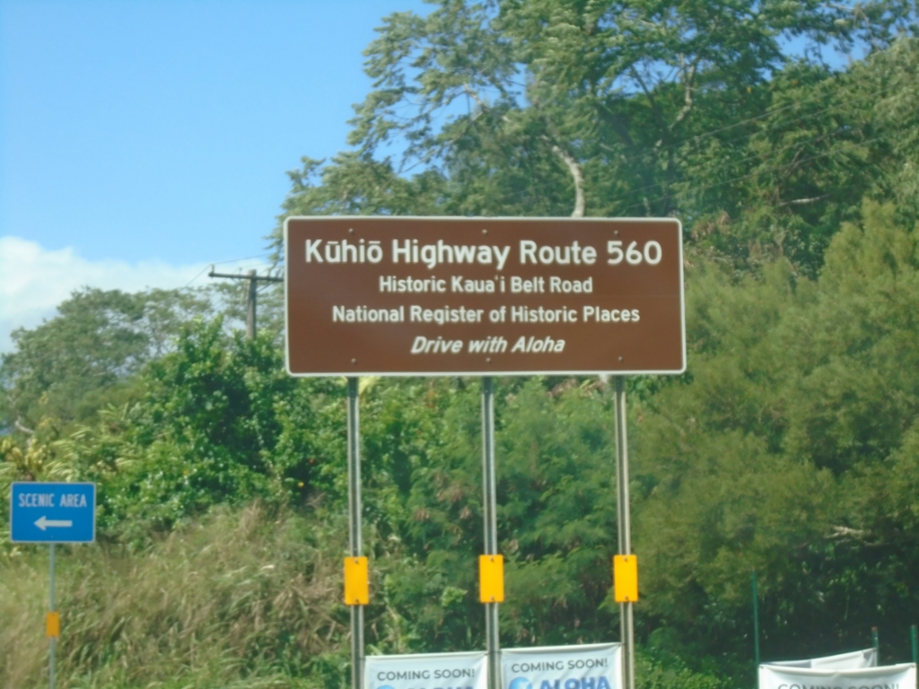
Kūhiō Highway Route 560 - Historic Kauaʻi Belt Road. HI-560 is the northwestern segment of the Kauaʻi Belt Route and connects Princeville with Hāʻena State Park.
Taken 02-20-2025
 Princeville
Kauai County
Hawaii
United States
Princeville
Kauai County
Hawaii
United States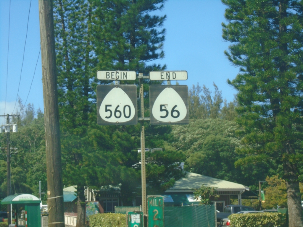
End HI-56/Begin HI-560 - Princeville
End HI-56/Begin HI-560 in Princeville. Both routes are part of the Kūhiō Highway.
Taken 02-20-2025
 Princeville
Kauai County
Hawaii
United States
Princeville
Kauai County
Hawaii
United States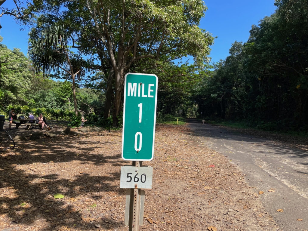
Mile 10 - Begin/End of HI-560
Mile 10 - HI-560 in Ha’ena State Park. The mile markers in Hawaii have the route number listed on a separate sign at the bottom of the mile marker assembly. This is the end/beginning of HI-560 and is the end of the road system on the northwest side of the island of Kauaʻi.
Taken 02-19-2025
Haena
Kauai County
Hawaii
United States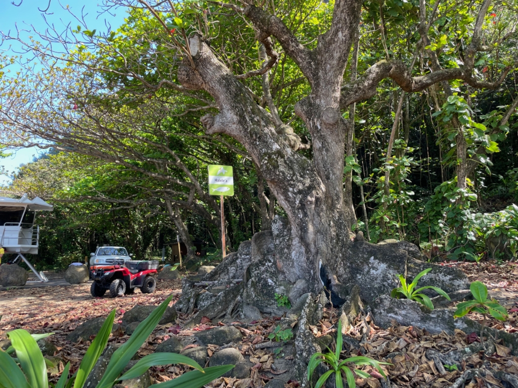
Moku of Halele‘a
Moku of Halele‘a at end of HI-560. These signs indicate boundaries between different moku, which is a traditional land subdivision on Kaua‘i. Each moku is subdivided into ahupua‘a. For more information
Taken 02-19-2025
Haena
Kauai County
Hawaii
United States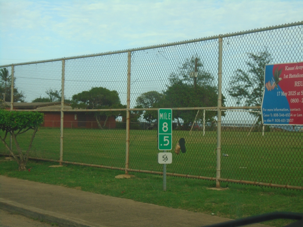
HI-56 North - Milemarker
Mile 8.5 on HI-56 North (Kūhiō Highway) in Kapa’a.
Taken 02-18-2025
Kapaʻa
Kauai County
Hawaii
United States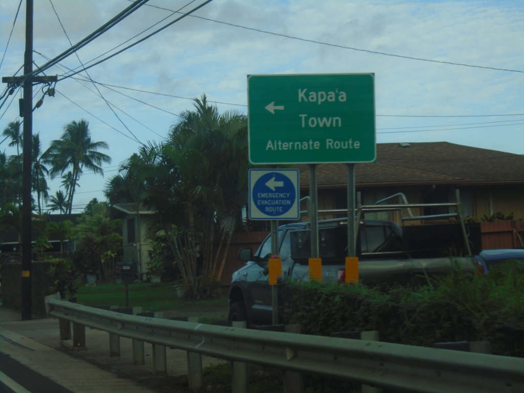
HI-56 North at Kapa'a Bypass (HI-5600)
HI-56 North (Kūhiō Highway) at Kapa’a Bypass (HI-5600) to Kapa’a Town Alternate Route.
Taken 02-18-2025
 Kapaʻa
Kauai County
Hawaii
United States
Kapaʻa
Kauai County
Hawaii
United States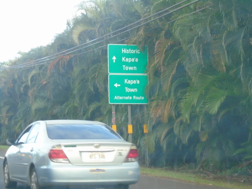
HI-56 North at Kapa'a Bypass (HI-5600)
HI-56 North (Kūhiō Highway) at Kapa’a Bypass (HI-5600) to Kapa’a Town Alternate Route. Continue north on HI-56 for Historic Kapa’a Town.
Taken 02-18-2025
Kapaʻa
Kauai County
Hawaii
United States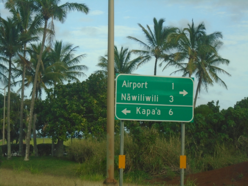
HI-56 North Approaching HI-51
HI-56 North (Kūhiō Highway) approaching HI-51 (Kapule Highway). Use HI-51 south to (Līhuʻe) Airport and Nāwiliwili. Turn left to continue north on HI-56 to Kapa’a.
Taken 02-18-2025
 Lihue
Kauai County
Hawaii
United States
Lihue
Kauai County
Hawaii
United States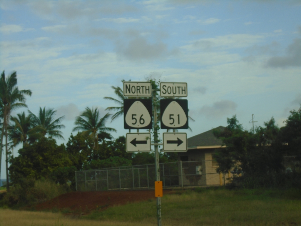
HI-56 North At HI-51 (Kapule Highway)
HI-56 North (Kūhiō Highway) at HI-51 (Kapule Highway).
Taken 02-18-2025
Lihue
Kauai County
Hawaii
United States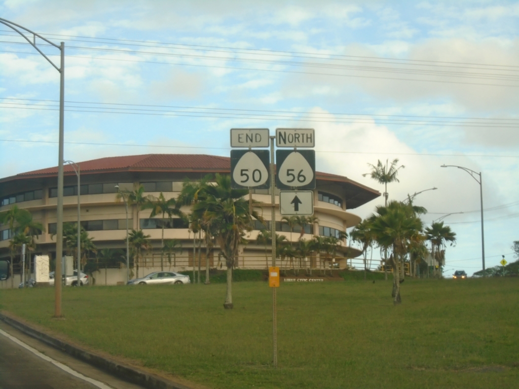
End HI-50 East at HI-56 and Rice St.
End HI-50 East (Kaumualiʻi Highway) at HI-56 North (Kūhiō Highway) and Rice St.
Taken 02-18-2025
 Lihue
Kauai County
Hawaii
United States
Lihue
Kauai County
Hawaii
United States