Signs From Idaho
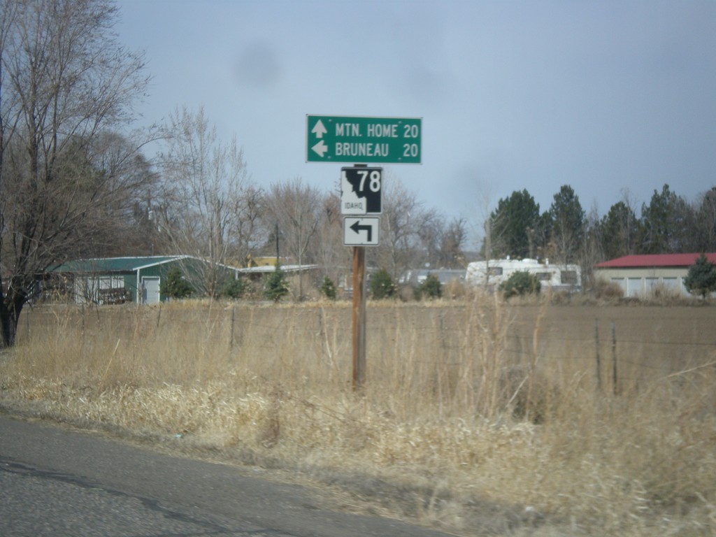
BL-84 West at ID-78
BL-84 west at ID-78 in Hammett. Use ID-78 west for Bruneau; continue west on BL-84 to Mountain Home.
Taken 03-16-2013

 Hammett
Elmore County
Idaho
United States
Hammett
Elmore County
Idaho
United States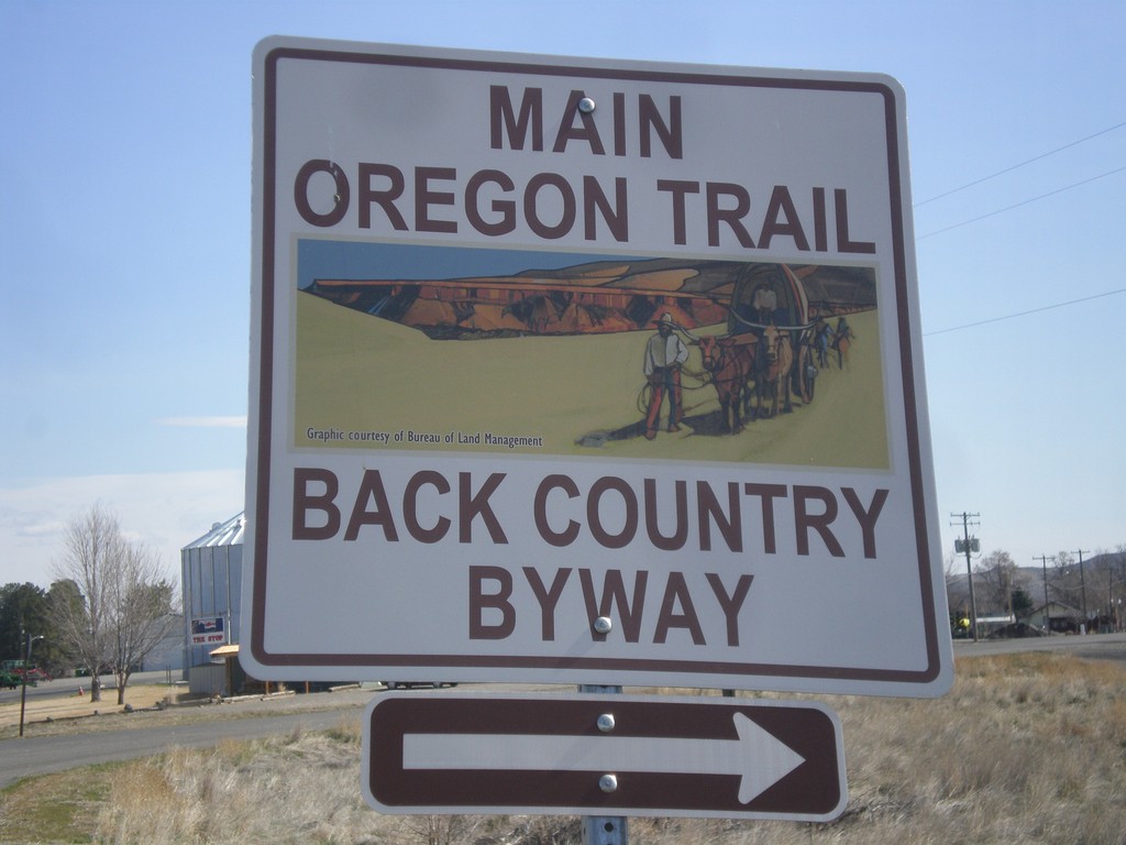
Old Oregon Trail at BL-84 (1st St.)
East Old Oregon Trail Highway at BL-84 (1st St) in Glenns Ferry. Turn right to take 1st St. into Glenns Ferry. The 1st St. is part of the Main Oregon Trail Back Country Byway.
Taken 03-16-2013
Glenns Ferry
Elmore County
Idaho
United States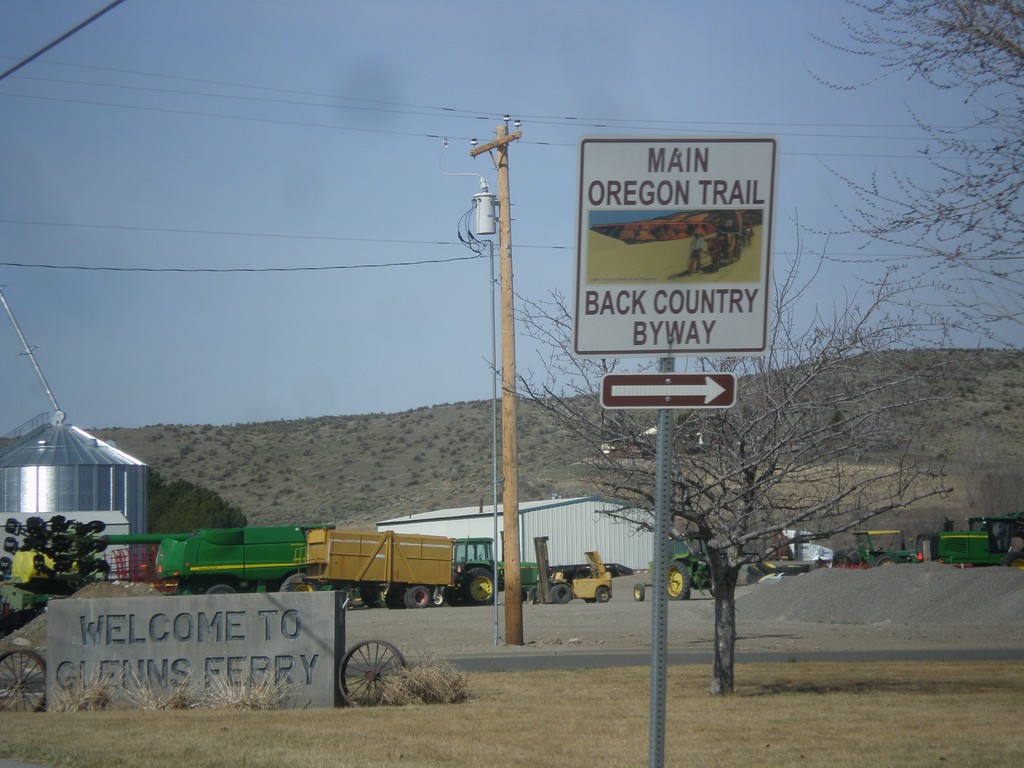
BL-84 West - Main Oregon Trail Back Country Byway
Turn right on to continue on the Oregon Trail Back Country Byway and BL-84 (Railroad Ave) in Glenns Ferry.
Taken 03-16-2013
Glenns Ferry
Elmore County
Idaho
United States
BL-84 West - Glenns Ferry
BL-84 west (1st St.) at Railroad Ave. in Glenns Ferry. Turn right on Railroad Ave. to continue on west BL-84.
Taken 03-16-2013
Glenns Ferry
Elmore County
Idaho
United States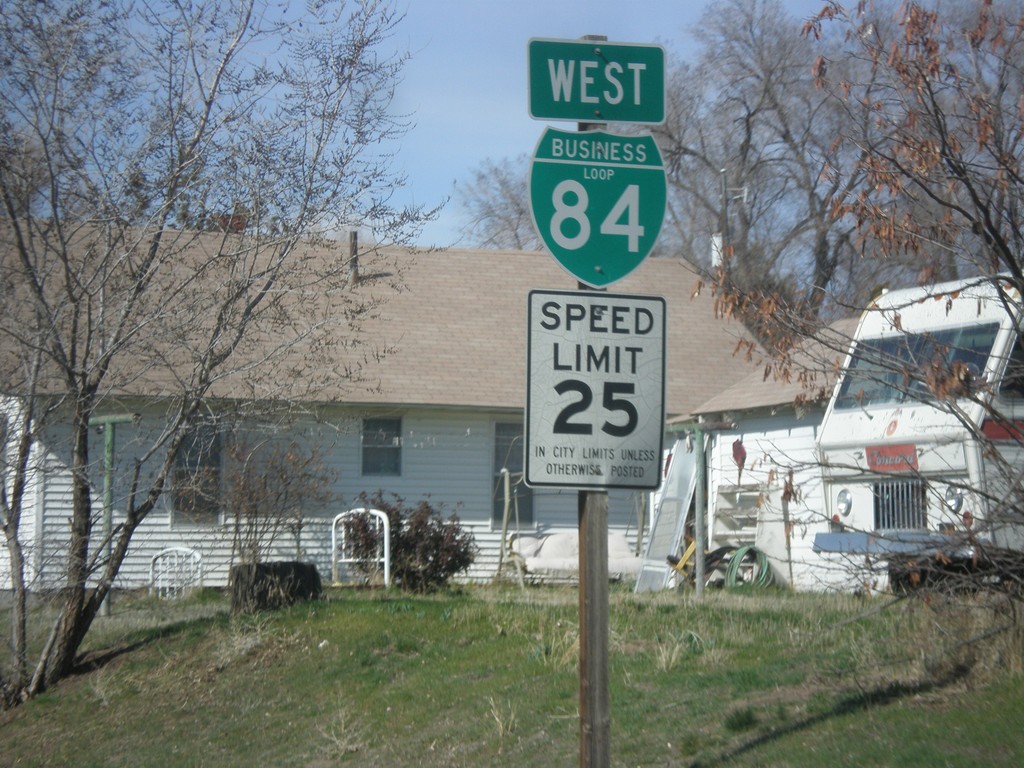
BL-84 West - Glenns Ferry
Speed limit 25 MPH on BL-84 west in Glenns Ferry.
Taken 03-16-2013
Glenns Ferry
Elmore County
Idaho
United States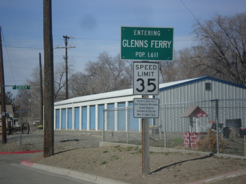
BL-84 West - Entering Glenns Ferry
Entering Glenns Ferry, Idaho on BL-84 west - Population 1,611.
Taken 03-16-2013
Glenns Ferry
Elmore County
Idaho
United States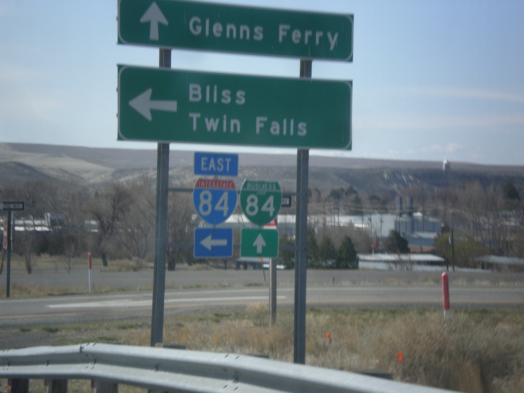
Old US-30 at I-84 East and BL-84
Old US-30 at I-84 East/BL-84 junction. Turn left on I-84 east towards Bliss and Twin Falls. Continue straight for BL-84 into Glenns Ferry.
Taken 03-16-2013


 Glenns Ferry
Elmore County
Idaho
United States
Glenns Ferry
Elmore County
Idaho
United States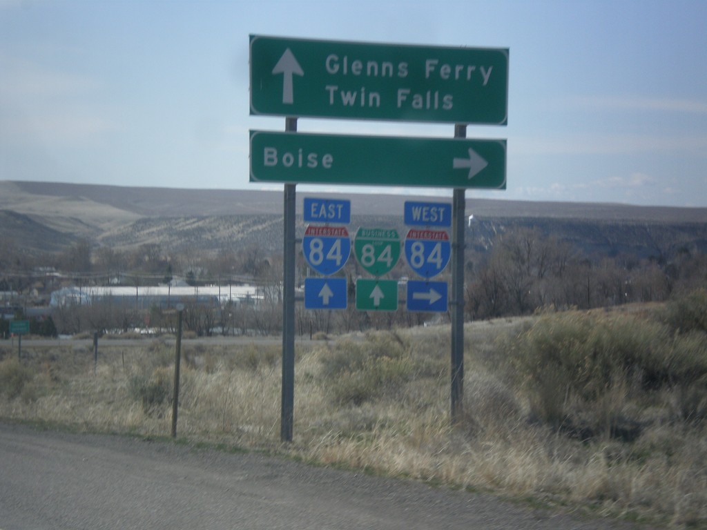
Old US-30 at I-84/BL-84
Old US-30 at I-84/BL-84 junction. Turn right on I-84 west towards Boise. Continue ahead for I-84/BL-84 towards Glenns Ferry and Twin Falls.
Taken 03-16-2013
Glenns Ferry
Elmore County
Idaho
United States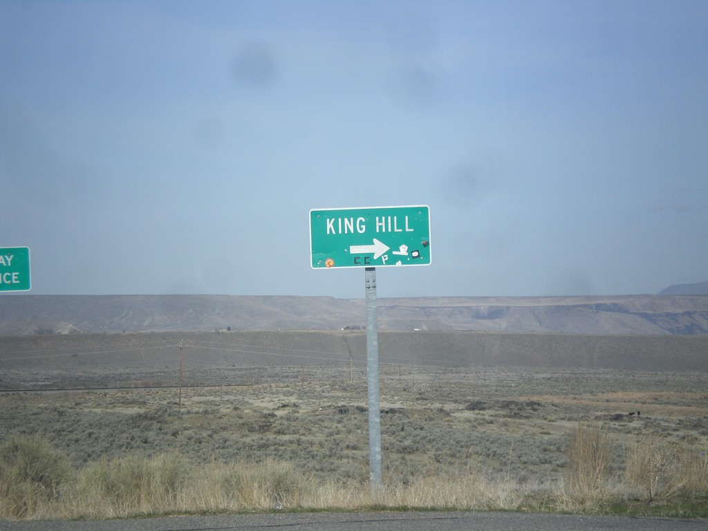
I-84 West - Exit 129 Offramp
I-84 west Exit 129 offramp. Turn right for King Hill.
Taken 03-16-2013
King Hill
Elmore County
Idaho
United States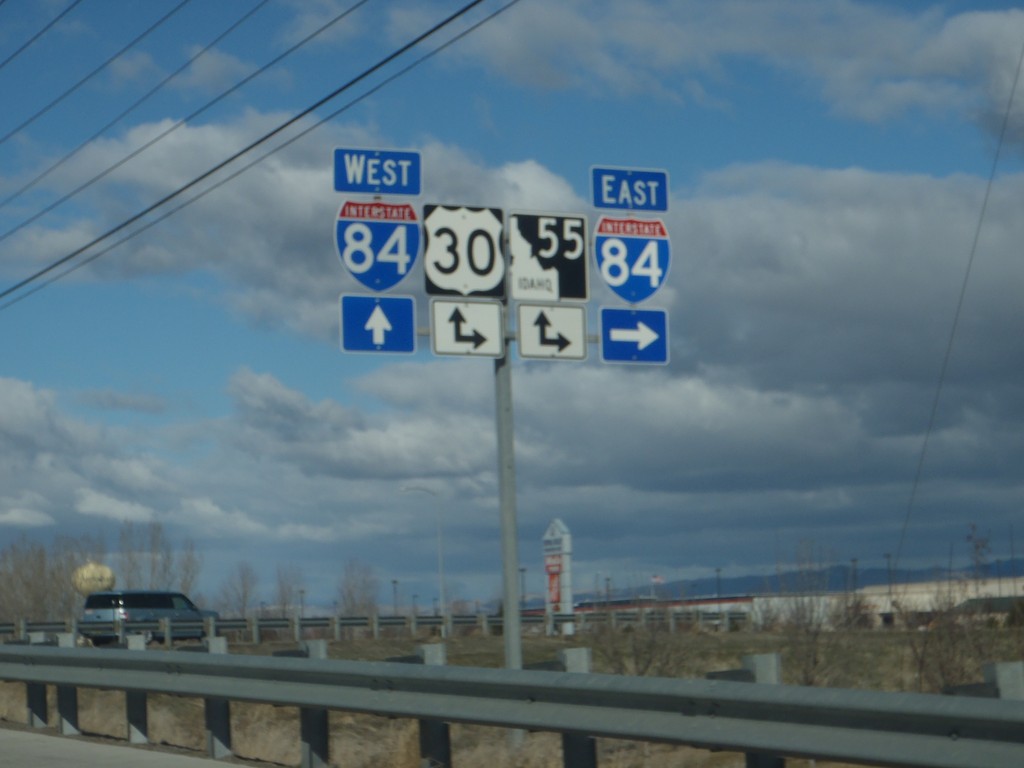
End ID-69 North at I-84/US-30/ID-55
End ID-69 North at I-84/US-30/ID-55. Turn right for I-84/US-30 East/ID-55 north; continue over freeway for I-84/US-30 West/ID-55 South.
Taken 02-17-2013

 Meridian
Ada County
Idaho
United States
Meridian
Ada County
Idaho
United States