Signs From Idaho
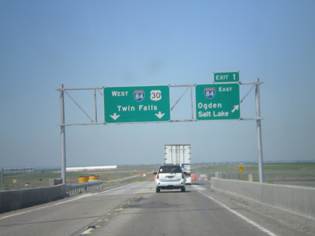
End I-86 West at I-84
End I-86 west at I-84. Merge right onto Exit 1 for I-84 East/Ogden/Salt Lake. Continue ahead for I-84/US-30 West/Twin Falls. This is the western end of I-86.
Taken 07-05-2011


 Cotterel
Cassia County
Idaho
United States
Cotterel
Cassia County
Idaho
United States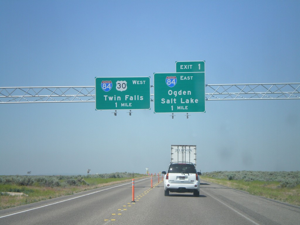
I-86 West at I-84
I-86 west at Exit 1 - I-84 East/Ogden/Salt Lake and I-84 West/US-30 West/Twin Falls. I-86 ends at I-84.
Taken 07-05-2011
Declo
Cassia County
Idaho
United States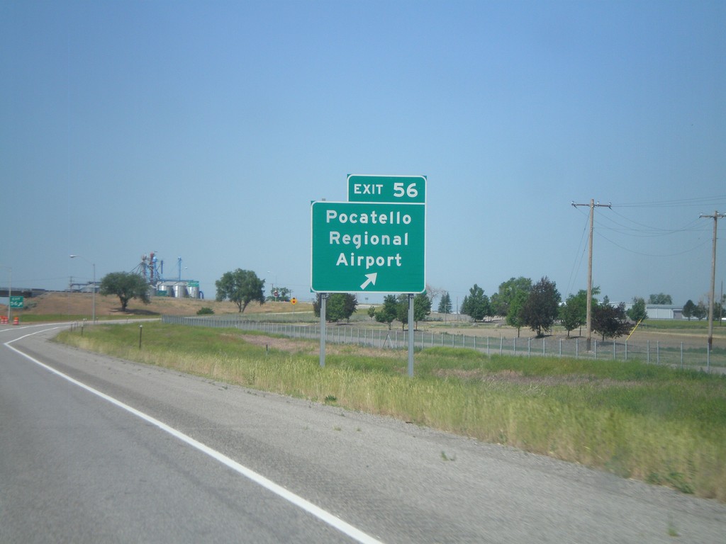
I-86 West - Exit 56
I-86 west at Exit 56 - Pocatello Regional Airport.
Taken 07-05-2011
Arbon Valley
Power County
Idaho
United States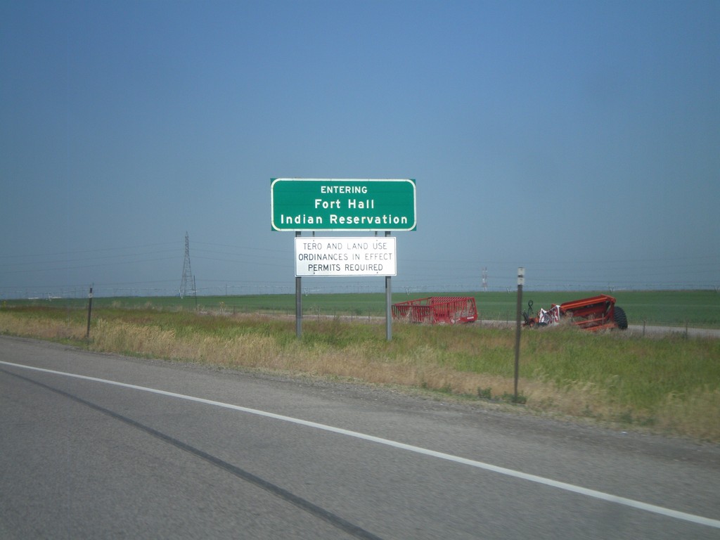
I-86 West - Fort Hall Indian Reservation
Entering the Fort Hall Indian Reservation on I-86 west.
Taken 07-05-2011
Arbon Valley
Power County
Idaho
United States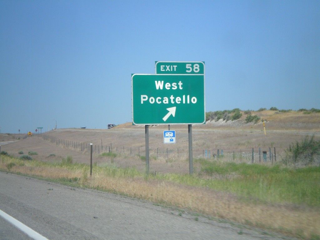
I-86 West - Exit 58
I-86 west at Exit 58 - West Pocatello. US-30 joins I-86 here westbound.
Taken 07-05-2011
Pocatello
Power County
Idaho
United States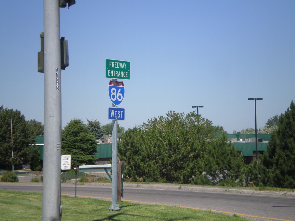
I-86 West - Freeway Entrance
I-86 west onramp at Exit 61. The Freeway Entrance type sign assembly is not common in Idaho.
Taken 07-05-2011
 Chubbuck
Bannock County
Idaho
United States
Chubbuck
Bannock County
Idaho
United States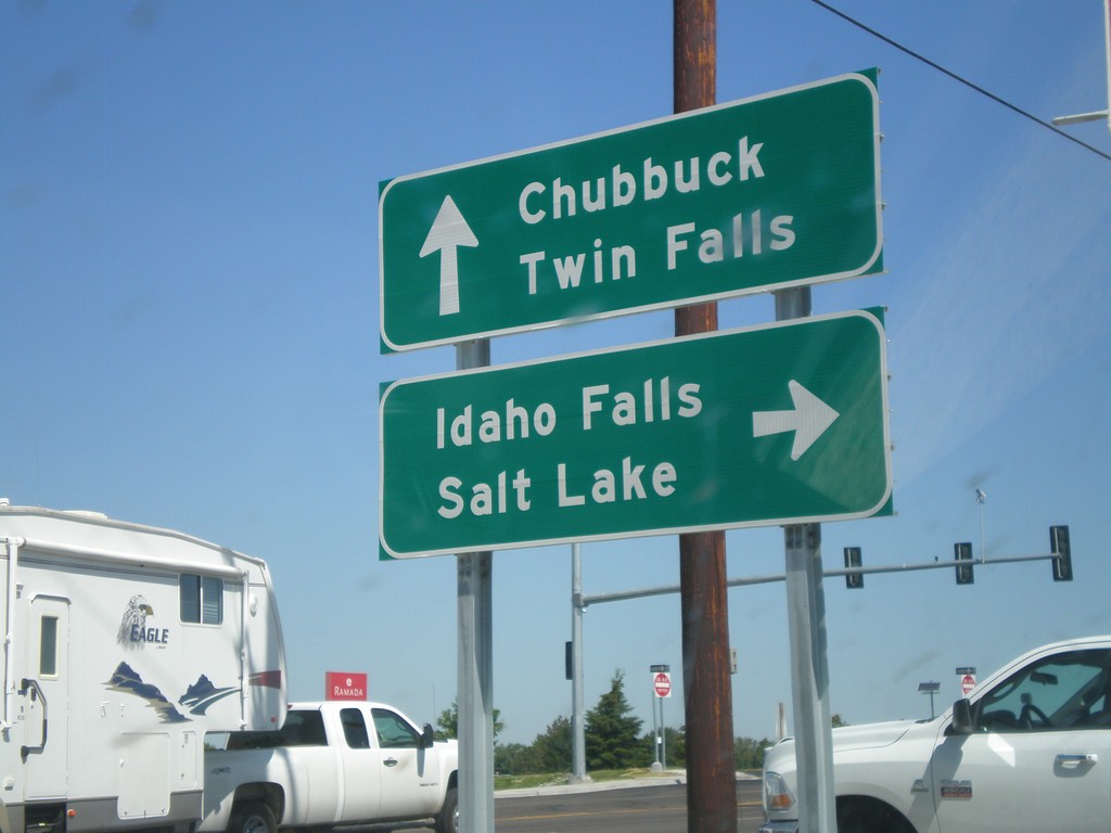
US-91 North at I-86
US-91 north at I-86 (Exit 61) onramp. Turn right on I-86 for Idaho Falls and Salt Lake. Continue over overpass for I-86 west to Twin Falls. US-91 continues north to Chubbuck.
Taken 07-05-2011
Chubbuck
Bannock County
Idaho
United States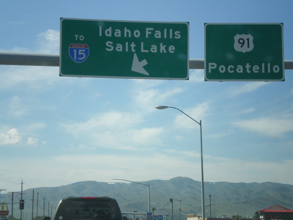
US-91 South at I-86 East (To I-15)
US-91 south at I-86 east (To I-15). Use I-86 east for Idaho Falls and Salt Lake. Continue south on US-91 for Pocatello. I-86 east ends at I-15 just east of here.
Taken 07-05-2011
 Chubbuck
Bannock County
Idaho
United States
Chubbuck
Bannock County
Idaho
United States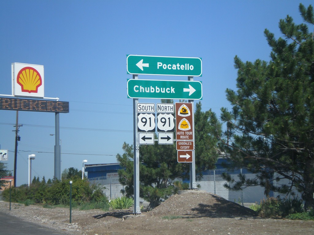
I-86 West - Exit 61 Offramp at US-91
I-86 west at Exit 61 offramp, US-91 jct. Use US-91 north for Chubbuck. Use US-91 south for Pocatello. US-91 north is part of the Oregon/California Trail - Goodale Cutoff.
Taken 07-05-2011
Pocatello
Bannock County
Idaho
United States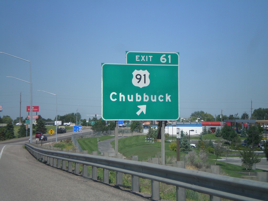
I-86 West - Exit 61
I-86 west at Exit 61 - US-91/Chubbuck.
Taken 07-05-2011
Chubbuck
Bannock County
Idaho
United States