Signs From Idaho
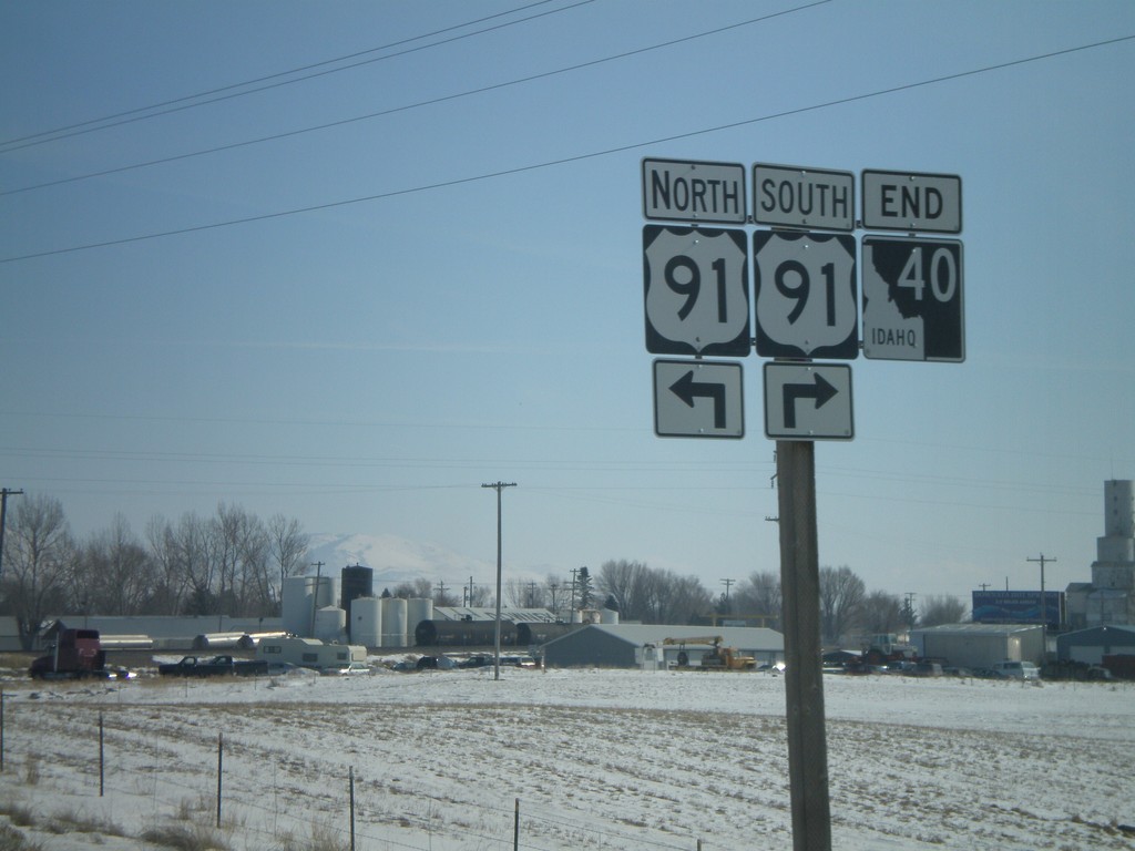
End ID-40 at US-91
End ID-40 east at US-91.
Taken 02-17-2008

 Downey
Bannock County
Idaho
United States
Downey
Bannock County
Idaho
United States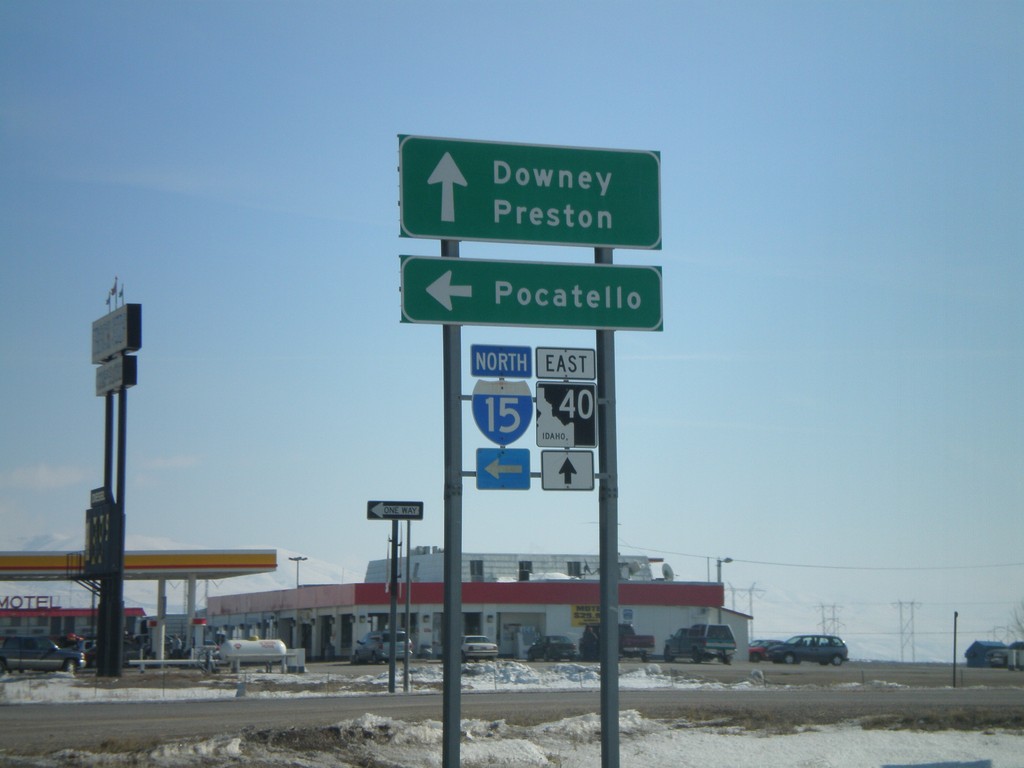
ID-40 East at I-15 North
ID-40 east to Downey and Preston at I-15 north to Pocatello.
Taken 02-17-2008
 Downey
Bannock County
Idaho
United States
Downey
Bannock County
Idaho
United States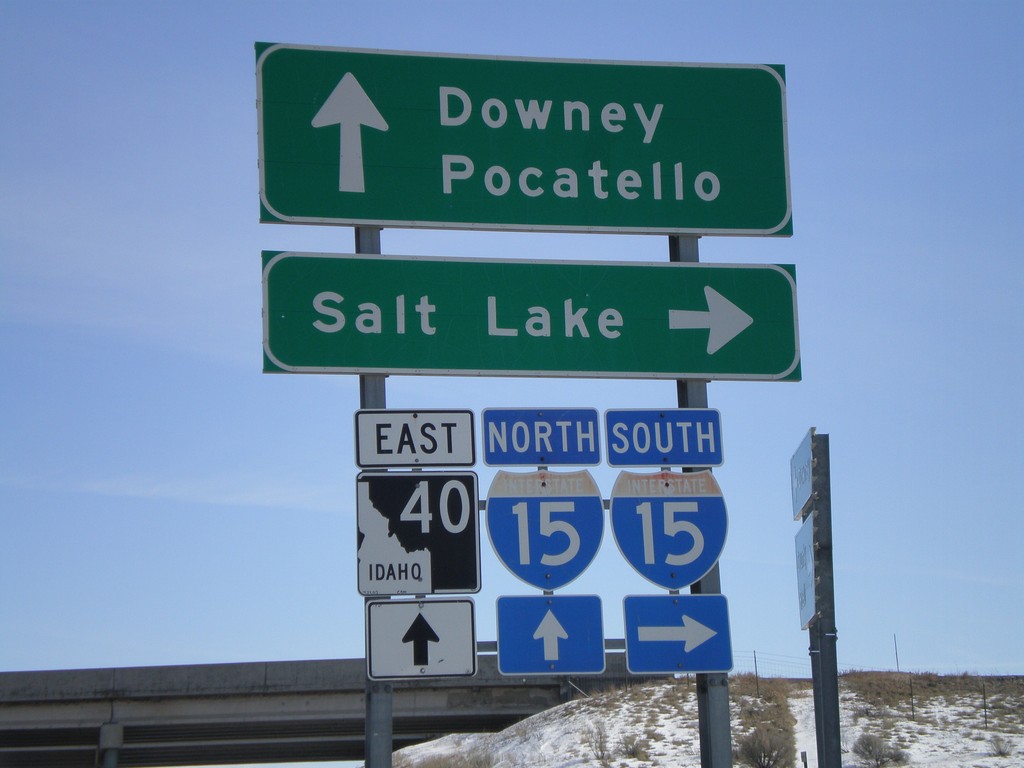
Begin ID-40 East at I-15
Begin ID-40 east at I-15 south to Salt Lake.
Taken 02-17-2008
Downey
Bannock County
Idaho
United States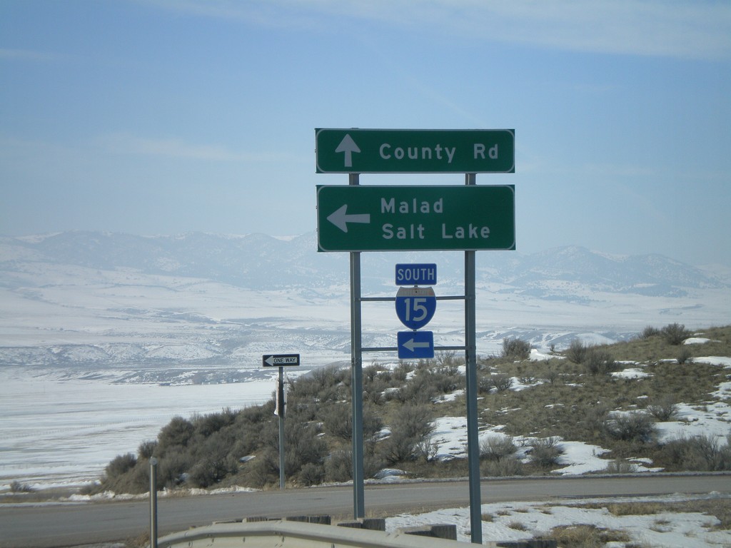
End ID-40 West at I-15 South
End ID-40 west at I-15 south to Malad and Salt Lake.
Taken 02-17-2008
Downey
Bannock County
Idaho
United States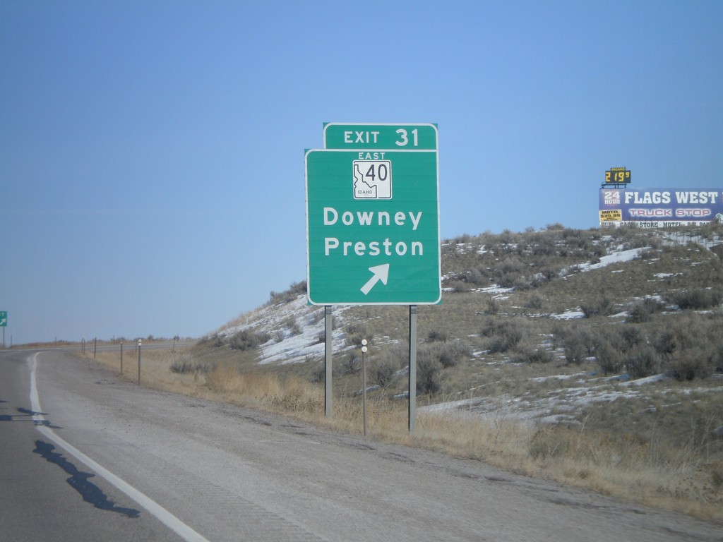
I-15 North - Exit 31
I-15 north at Exit 31 - ID-40 East/Downey/Preston.
Taken 02-17-2008
Downey
Bannock County
Idaho
United States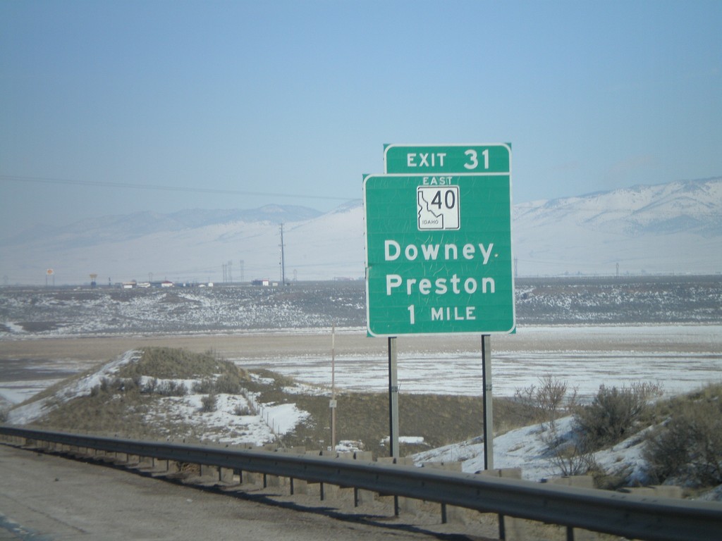
I-15 North - Exit 31
I-15 north approaching Exit 31 - ID-40 East/Downey/Preston.
Taken 02-17-2008
Downey
Bannock County
Idaho
United States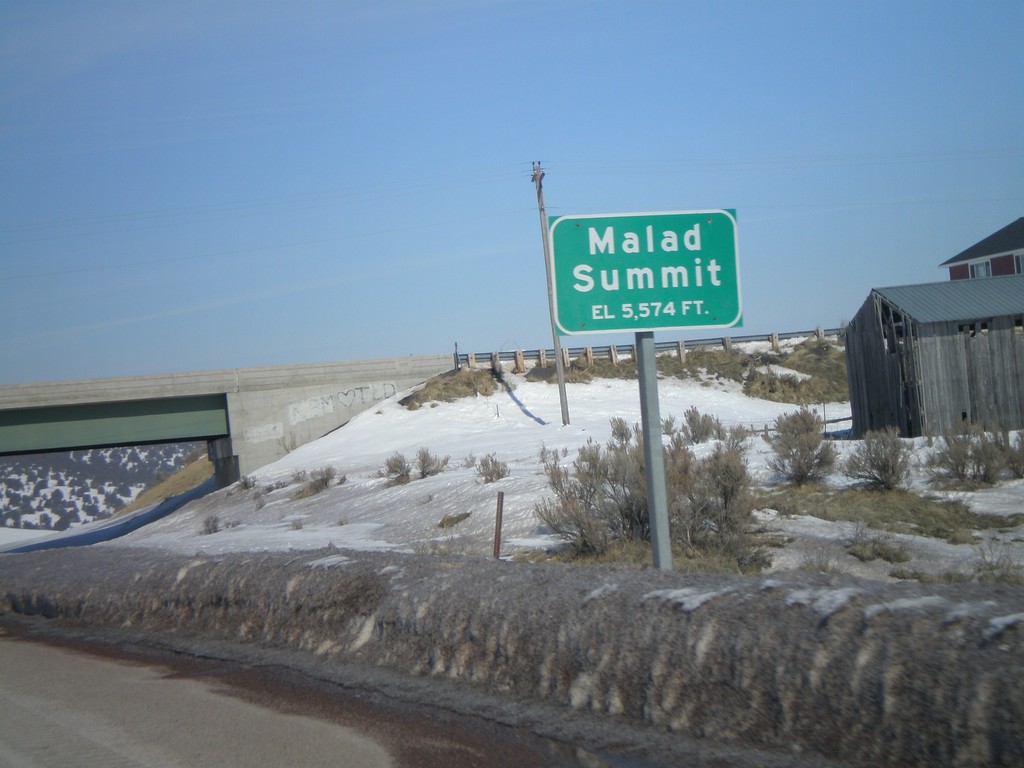
I-15 North - Malad Summit
I-15 north at Malad Summit - Elevation 5,574 Feet.
Taken 02-17-2008
Malad City
Oneida County
Idaho
United States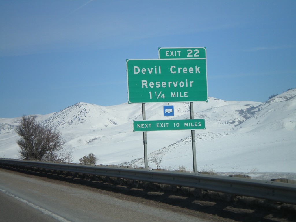
I-15 North - Exit 22
I-15 north approaching Exit 22 - Devil Creek Reservoir.
Taken 02-17-2008
Malad City
Oneida County
Idaho
United States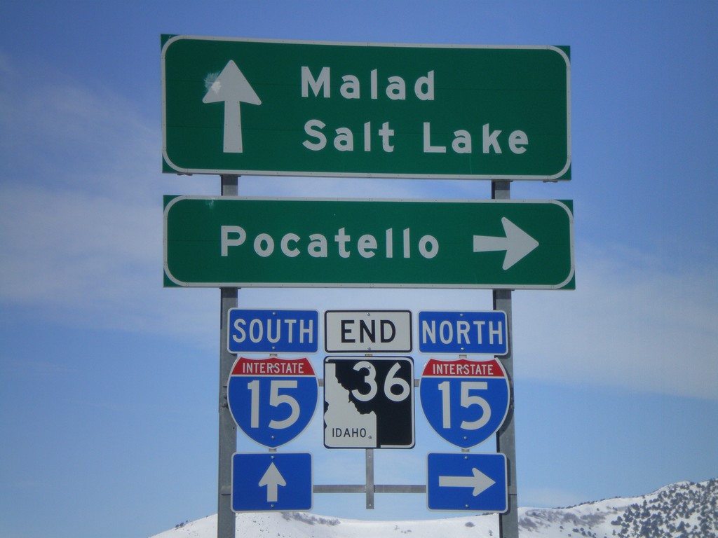
End ID-36 West at I-15
End ID-36 west at I-15 north to Pocatello, and south to Malad and Salt Lake.
Taken 02-17-2008
 Malad City
Oneida County
Idaho
United States
Malad City
Oneida County
Idaho
United States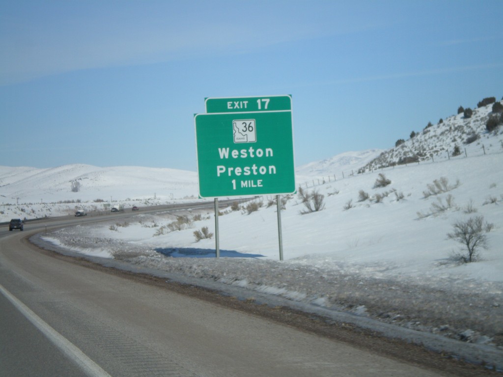
I-15 North - Exit 17
I-15 north approaching Exit 17 - ID-36/Weston/Preston.
Taken 02-17-2008
Malad City
Oneida County
Idaho
United States