Signs From Idaho
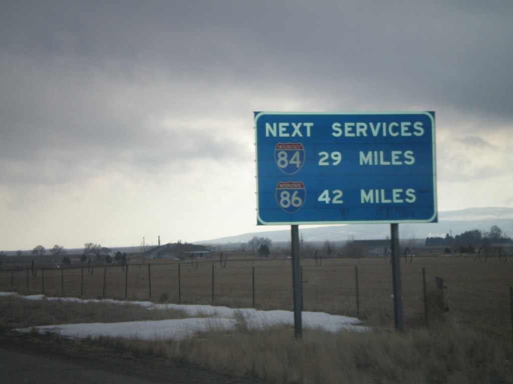
I-84 East - Next Services via I-84 and I-86
I-84 east approaching Exit 216. This sign shows the next services on I-84 and I-86. The next gas along I-86 is 42 miles (American Falls).
Taken 02-17-2008


 Rupert
Minidoka County
Idaho
United States
Rupert
Minidoka County
Idaho
United States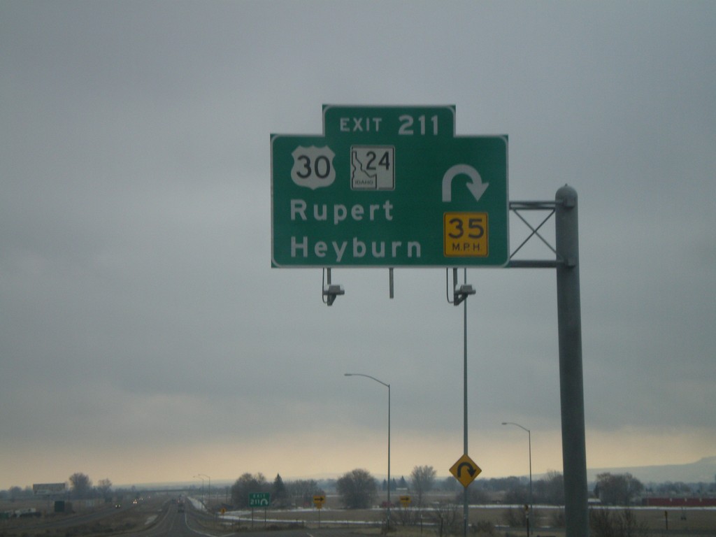
I-84 East - Exit 211
I-84 east at Exit 211 - US-30/ID-24/Rupert/Heyburn. This is one of the few overheads on Idaho highways outside of the metro. areas.
Taken 02-17-2008
 Rupert
Minidoka County
Idaho
United States
Rupert
Minidoka County
Idaho
United States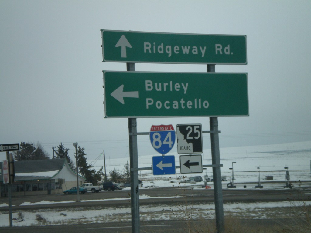
ID-25 East at I-84/ID-25 East
ID-25 east at I-84 east (Exit 194) to Burley and Pocatello. ID-25 follows I-84 east 7 miles.
Taken 02-17-2008
 Hazelton
Jerome County
Idaho
United States
Hazelton
Jerome County
Idaho
United States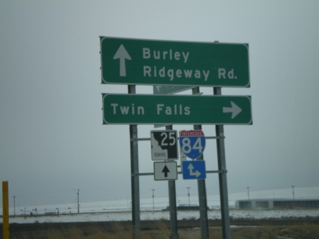
ID-25 East at I-84 West
ID-25 east at I-84 west (Exit 194) to Twin Falls. ID-25 continues east on I-84.
Taken 02-17-2008
Hazelton
Jerome County
Idaho
United States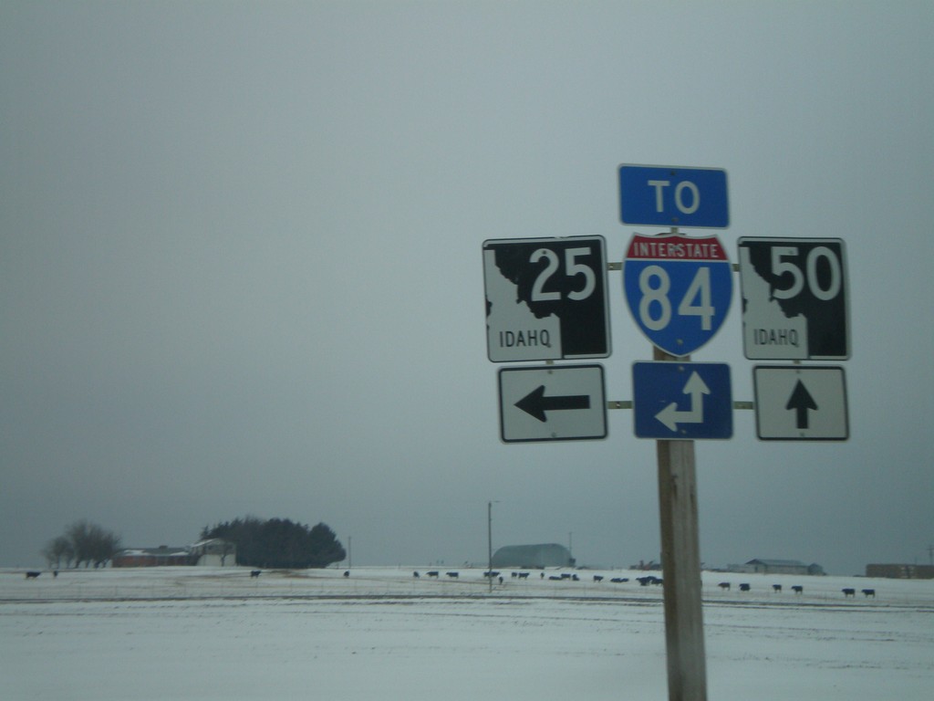
ID-25 East at ID-50
ID-25 east at ID-50 south. Use either ID-25 or ID-50 for I-84 access.
Taken 02-17-2008
 Eden
Jerome County
Idaho
United States
Eden
Jerome County
Idaho
United States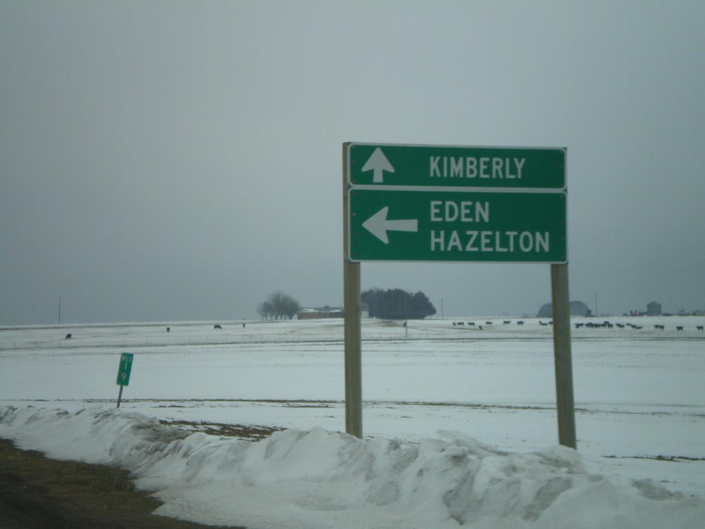
ID-25 East at ID-50 to Kimberly
ID-25 east to Eden and Hazelton, at ID-50 south to Kimberly.
Taken 02-17-2008
Eden
Jerome County
Idaho
United States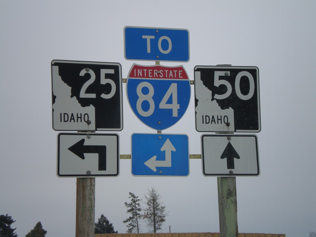
ID-25 East at ID-50
ID-25 east approaching ID-50. Use either ID-50 south or ID-25 east for I-84. ID-25 east parallels I-84 from here until the Hazelton area.
Taken 02-17-2008
Eden
Jerome County
Idaho
United States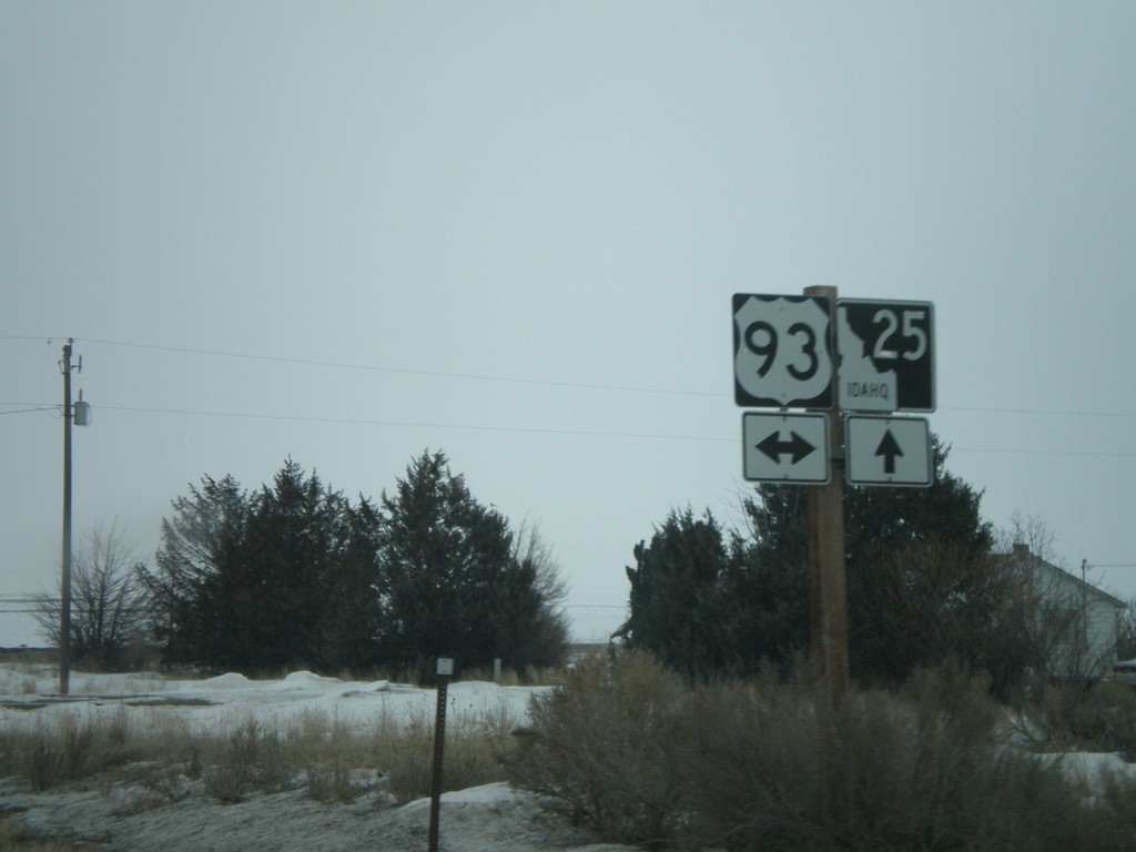
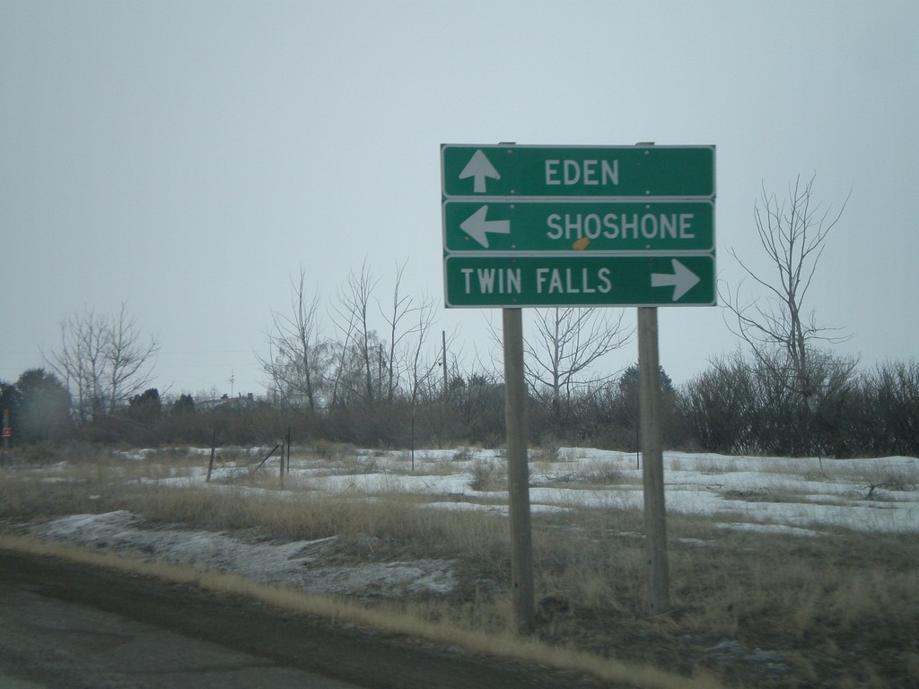
ID-25 East at US-93
ID-25 east approaching US-93 - south to Twin Falls, north to Shoshone.
Taken 02-17-2008
 Jerome
 County
Idaho
United States
Jerome
Jerome County
Idaho
United States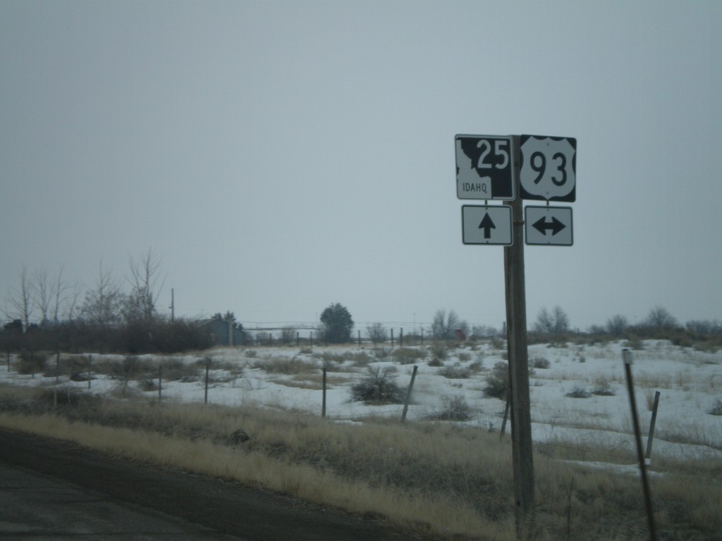
ID-25 East Approaching US-93
ID-25 east approaching US-93.
Taken 02-17-2008
Jerome
Jerome County
Idaho
United States