Signs From Idaho
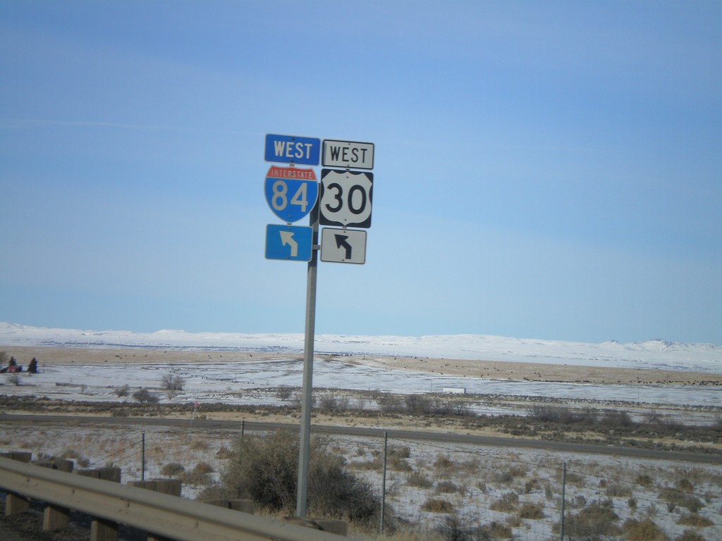
US-30 West At I-84 West Exit 137
US-30 West at I-84 west Exit 137 onramp.
Taken 01-16-2008


 Bliss
Gooding County
Idaho
United States
Bliss
Gooding County
Idaho
United States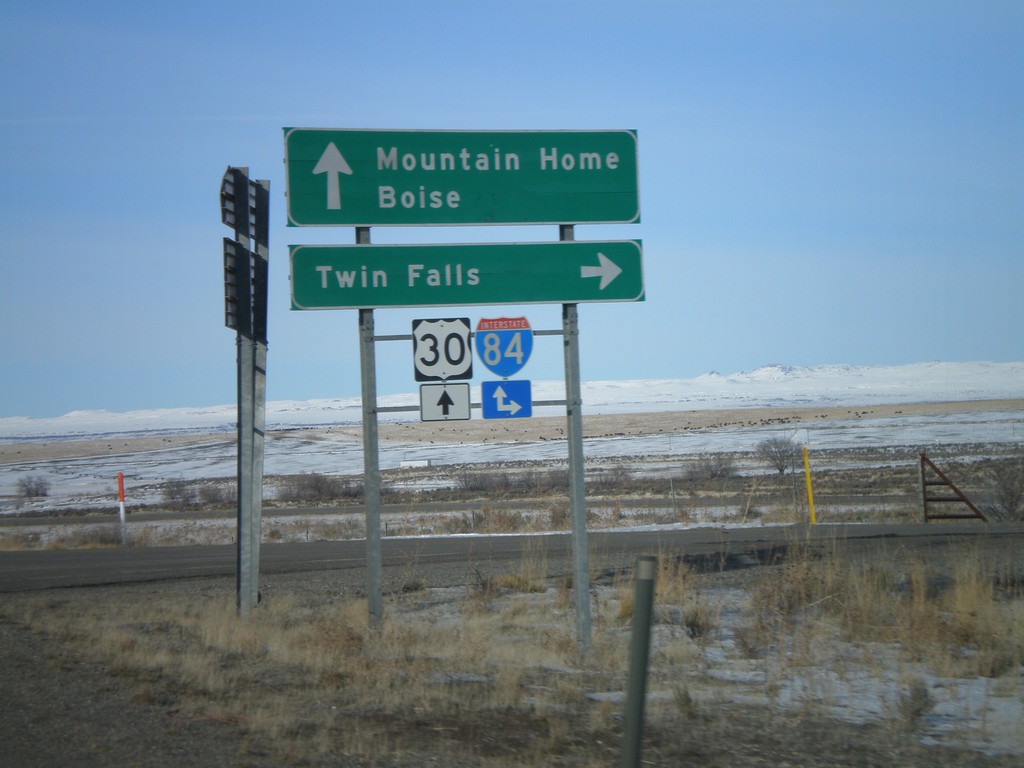
US-30 West At I-84 East - Exit 137
US-30 West/BL-84 West at I-84 east onramp to Twin Falls at Exit 137.
Taken 01-16-2008
Bliss
Gooding County
Idaho
United States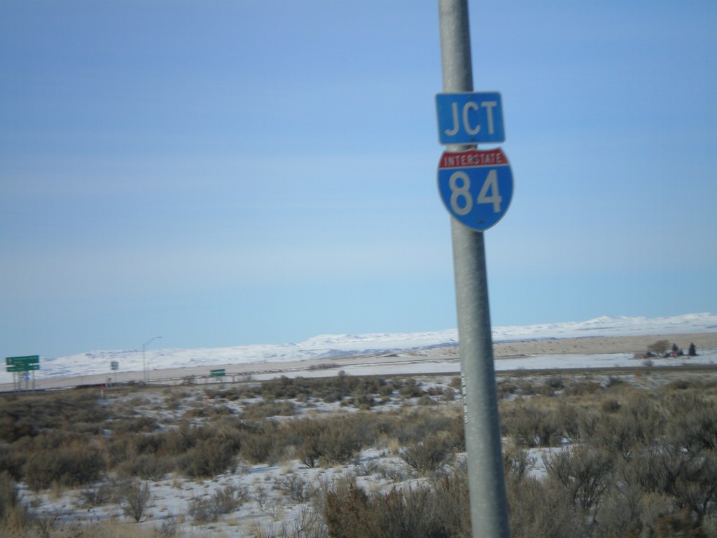
US-30 West Approaching I-84
US-30 West/BL-84 West approaching I-84 near Exit 137.
Taken 01-16-2008
Bliss
Gooding County
Idaho
United States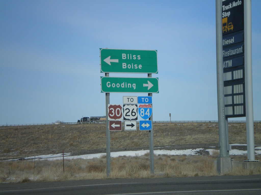
US-30 West at BL-84
US-30 west at BL-84. Turn left for US-30 to Boise and Bliss. Turn right for US-26 and I-84 to Gooding.
Taken 01-16-2008
Bliss
Gooding County
Idaho
United States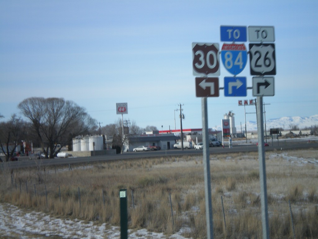
US-30 West Approaching BL-84
US-30 west approaching BL-84/To US-26/To I-84 in Bliss.
Taken 01-16-2008
Bliss
Gooding County
Idaho
United States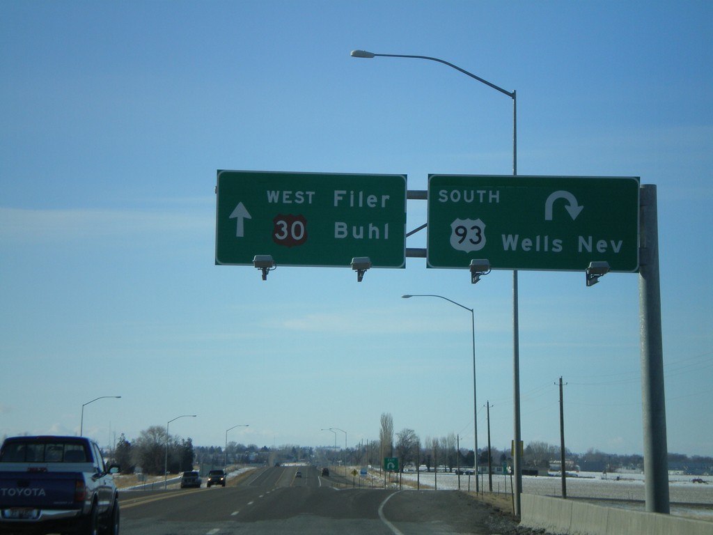
US-93 South/US-30 West at US-93 South
US-30 west to Filer and Buhl at US-93 south to Wells, Nevada.
Taken 01-16-2008
 Filer
Twin Falls County
Idaho
United States
Filer
Twin Falls County
Idaho
United States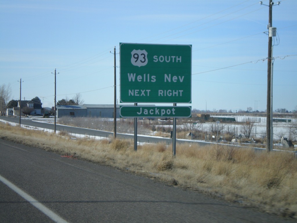
US-93 South/US-30 West Approaching US-93 South
US-30 west/US-93 south approaching US-93 south to Wells and Jackpot, NV.
Taken 01-16-2008
Curry
Twin Falls County
Idaho
United States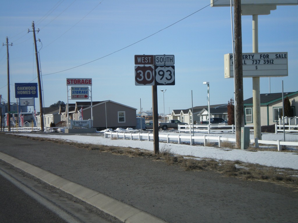
US-93 South/US-30 West
US-30 West/US-93 South on the west side of Twin Falls.
Taken 01-16-2008
Twin Falls
Twin Falls County
Idaho
United States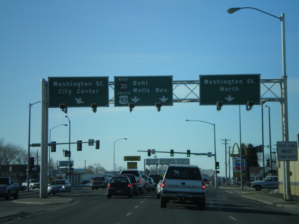
US-93 South At US-30
US-93 south at US-30 west. Use Washington St. for US-30 east.
Taken 01-16-2008
Twin Falls
Twin Falls County
Idaho
United States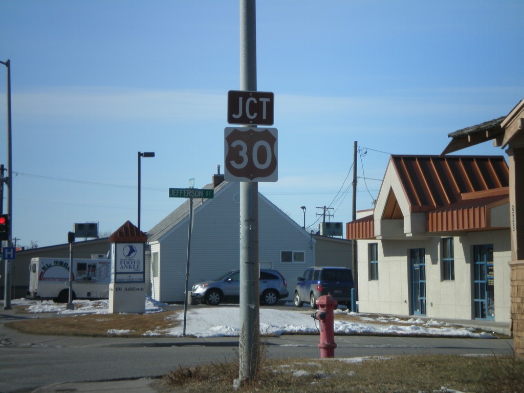
US-93 South Approaching US-30
US-93 south approaching US-30 on Addison Ave. west.
Taken 01-16-2008
Twin Falls
Twin Falls County
Idaho
United States