Signs From Idaho
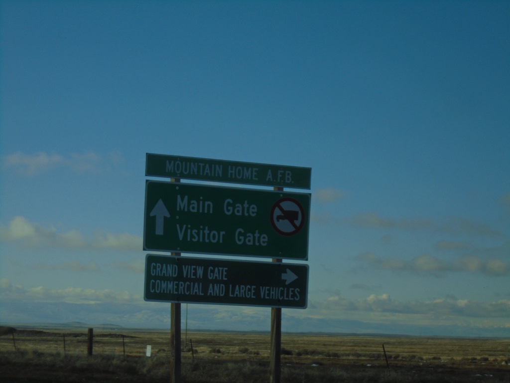
Mountain Home AFB - Gate Information
Mountain Home AFB Gate Information on ID-67 West approaching ID-167.
Taken 01-01-2023

 Mountain Home
Elmore County
Idaho
United States
Mountain Home
Elmore County
Idaho
United States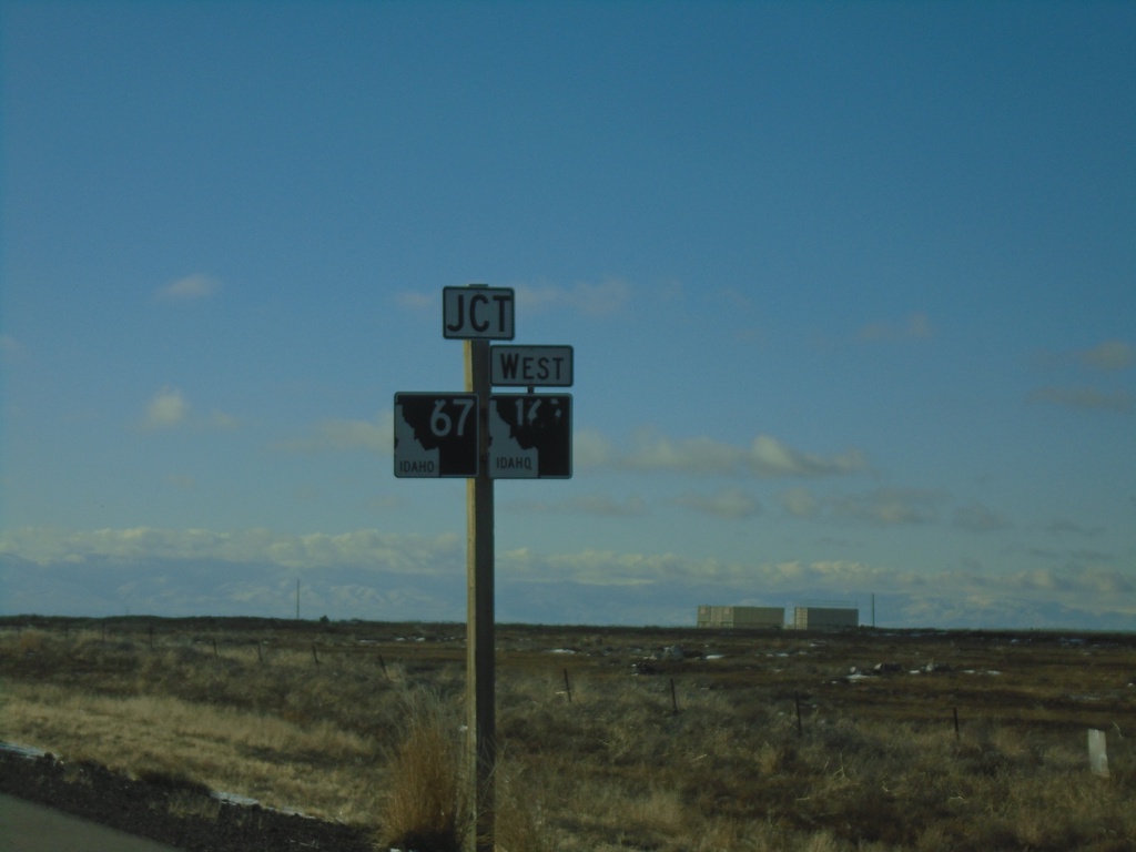
ID-67 West Approaching ID-167
ID-67 West approaching ID-167 West in Elmore County.
Taken 01-01-2023
Mountain Home
Elmore County
Idaho
United States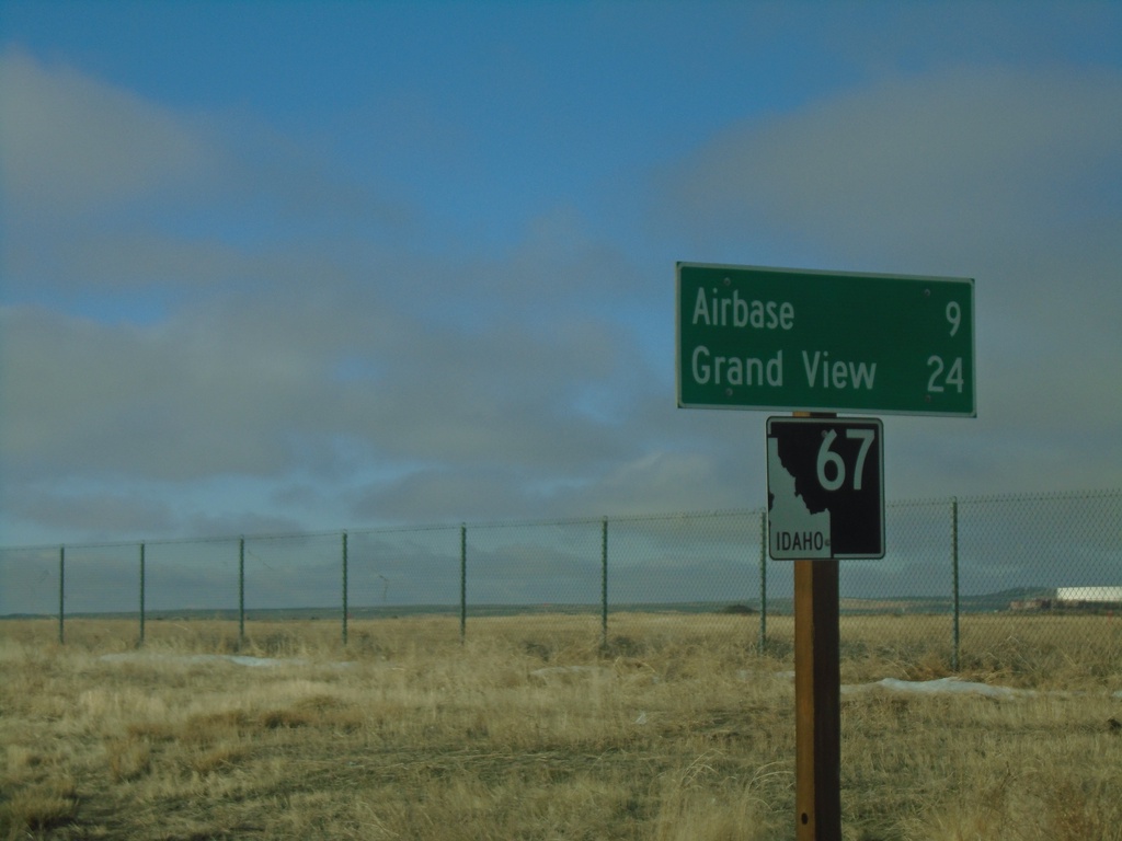
ID-67 West - Distance Marker
Distance marker on ID-67 west. Distance to Airbase (Mountain Home) and Grand View.
Taken 01-01-2023
Mountain Home
Elmore County
Idaho
United States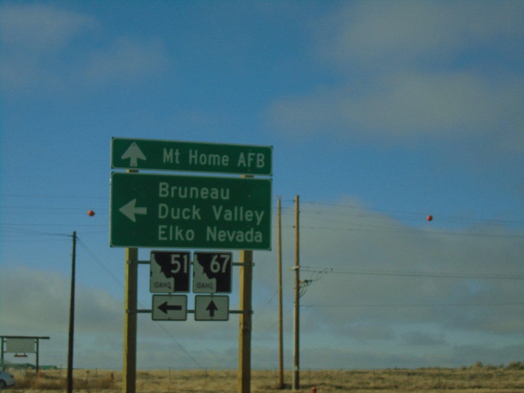
ID-51 South at ID-67 - Mountain Home
ID-51 South at ID-67 in Mountain Home. Turn left to continue on ID-51 South to Bruneau, Duck Valley, and Elko (Nevada). Continue straight for ID-67 to Mountain Home AFB.
Taken 01-01-2023
 Mountain Home
Elmore County
Idaho
United States
Mountain Home
Elmore County
Idaho
United States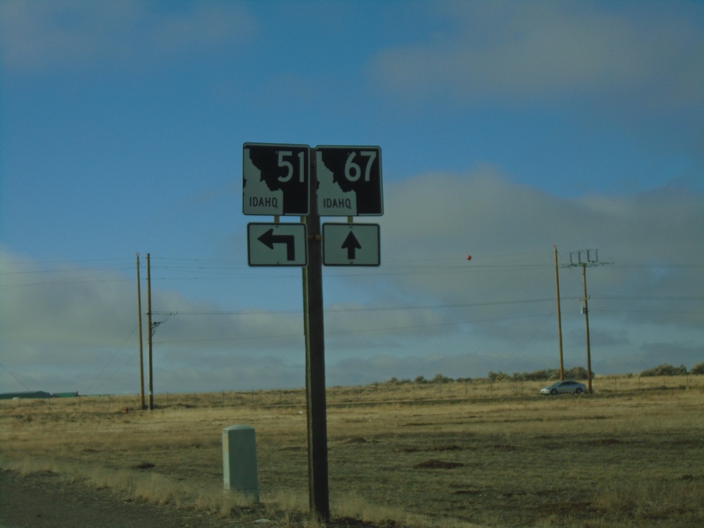
ID-51 South Approaching ID-67
ID-51 South approaching ID-67 in Mountain Home.
Taken 01-01-2023
Mountain Home
Elmore County
Idaho
United States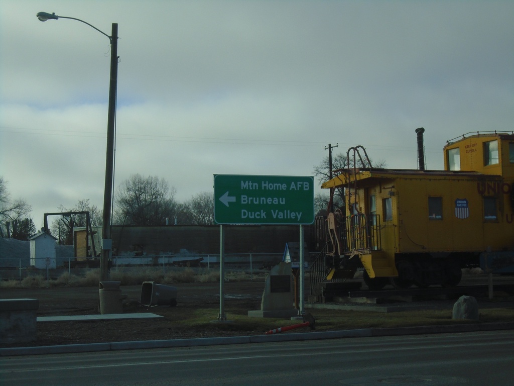
ID-51 - Mountain Home
ID-51 - American Legion Blvd at Old Oregon Trail Road. Turn left to continue on ID-51 to Mountain Home AFB, Bruneau, and Duck Valley.
Taken 01-01-2023
Mountain Home
Elmore County
Idaho
United States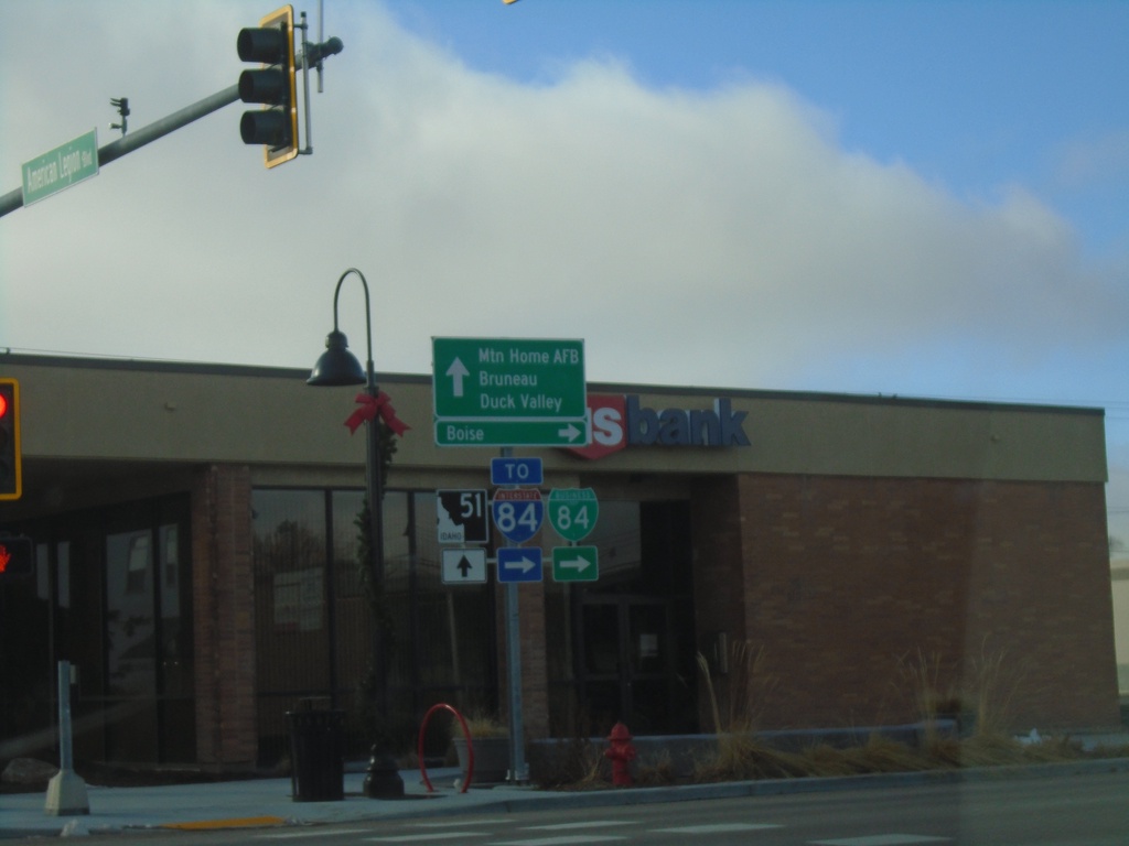
BL-84 West at ID-51 - Mountain Home
BL-84 west at ID-51 in Mountain Home (American Legion Blvd. at N 2nd E). Turn right on N 2nd E to continue west on BL-84 and for I-84 and Boise. Continue straight for ID-51 south to Mountain Home AFB, Bruneau, and Duck Valley (Indian Reservation).
Taken 01-01-2023

 Mountain Home
Elmore County
Idaho
United States
Mountain Home
Elmore County
Idaho
United States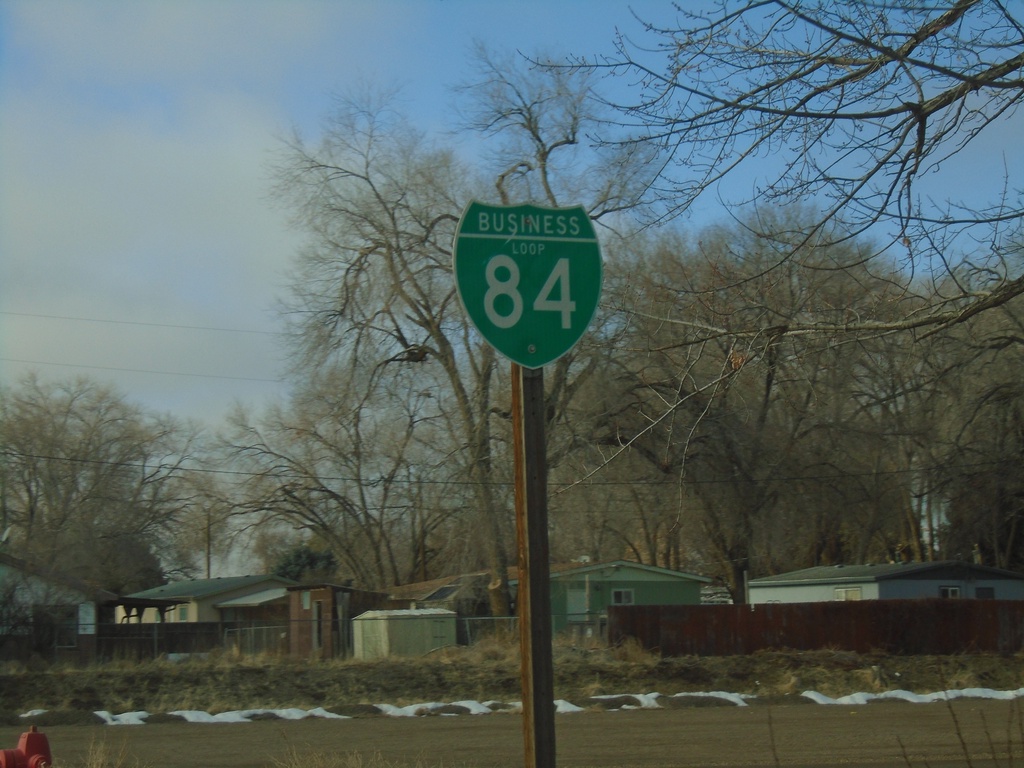
BL-84 West - Mountain Home
BL-84 West in Mountain Home
Taken 01-01-2023
Mountain Home
Elmore County
Idaho
United States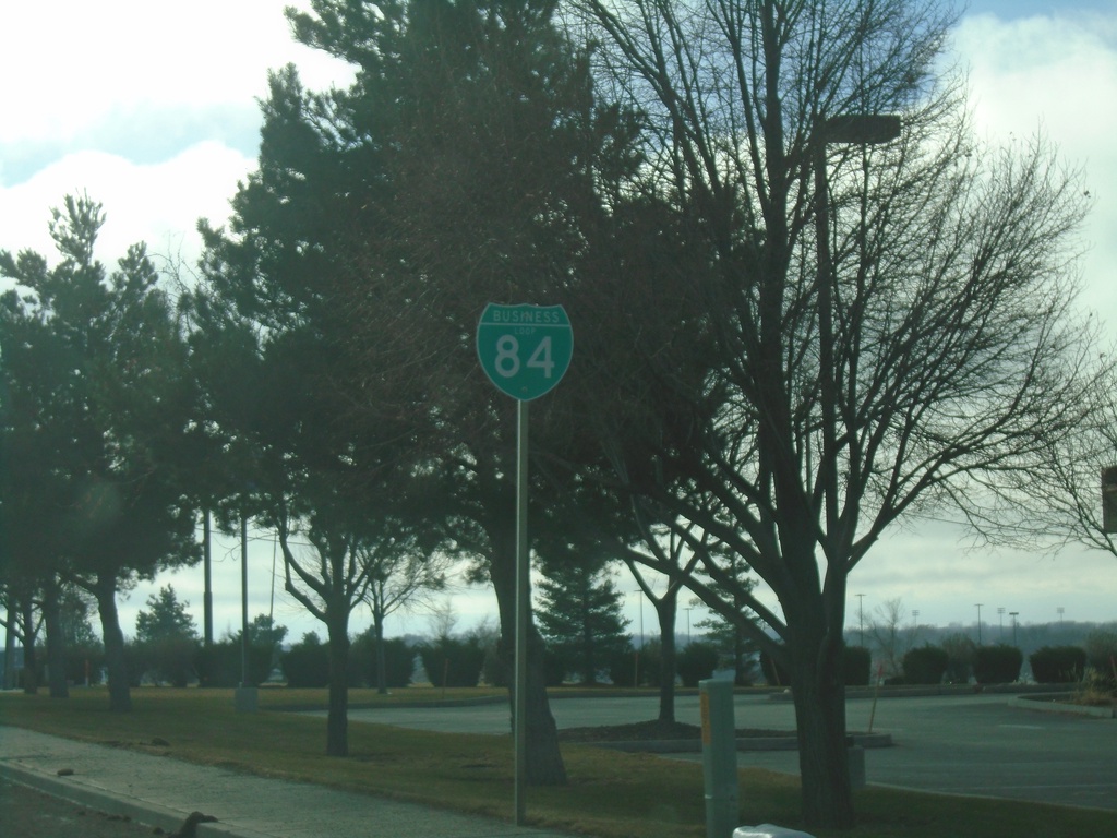
BL-84 West - Mountain Home
BL-84 West in Mountain Home
Taken 01-01-2023
Mountain Home
Elmore County
Idaho
United States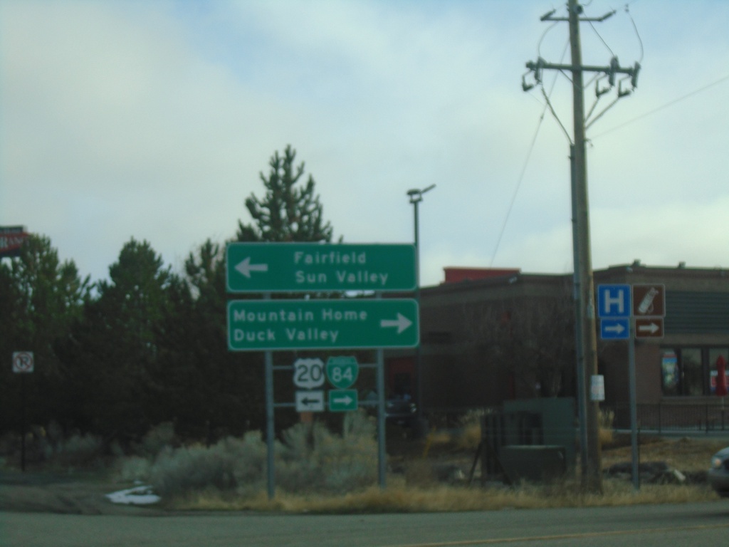
I-84 East - Exit 95 Offramp at US-20/BL-84/ID-51
I-84 East - Exit 95 Offramp at US-20/BL-84/ID-51 in Mountain Home. Turn left for US-20 East to Fairfield and Sun Valley. Turn right for BL-84/(ID-51) to Mountain Home and Duck Valley. US-20 east leaves I-84 eastbound here.
Taken 01-01-2023


 Mountain Home
Elmore County
Idaho
United States
Mountain Home
Elmore County
Idaho
United States